 English
 Spanish
 French
 Chinese
 Russian
 Portuguese
 最新宪章启动
Charter activations
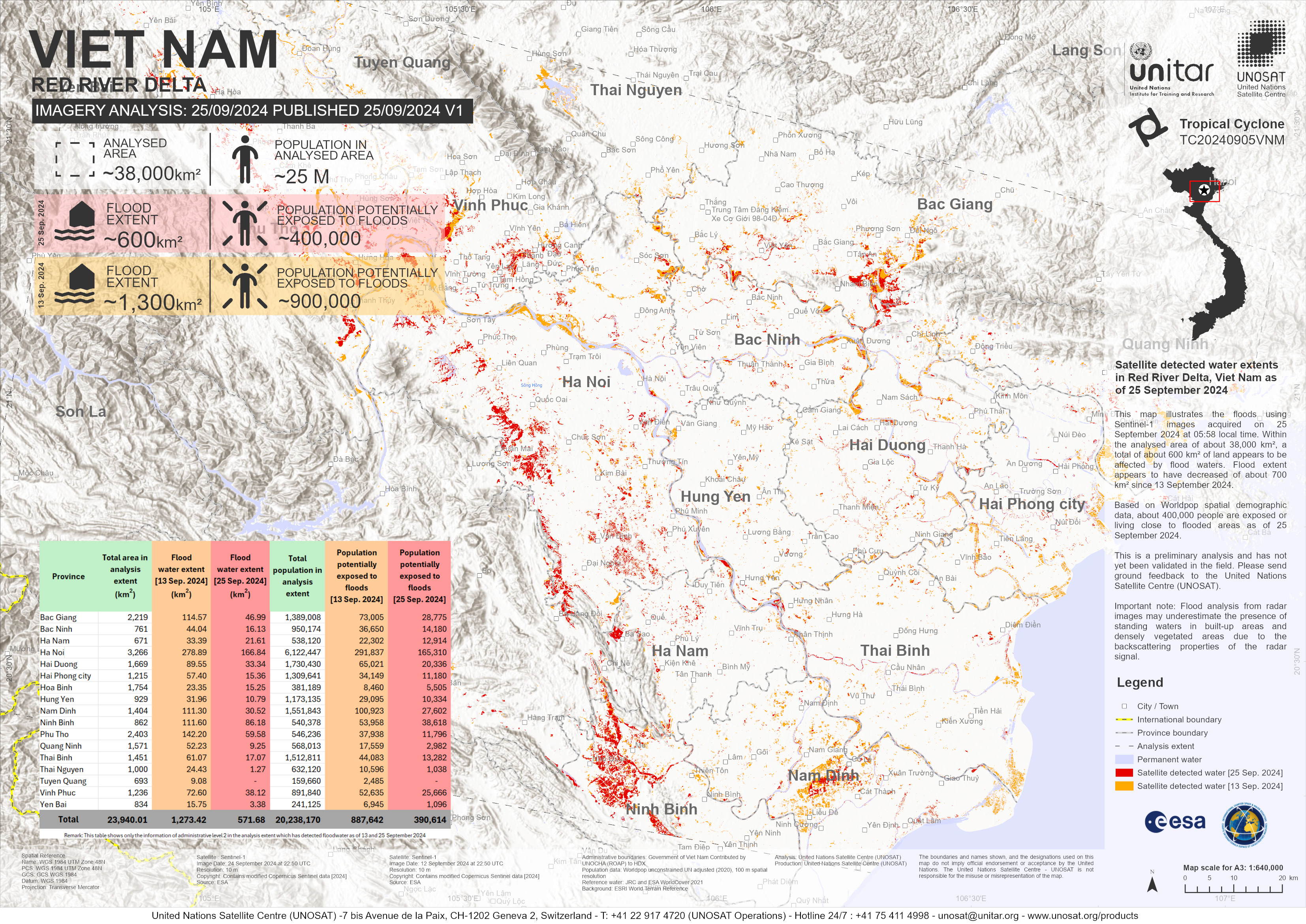
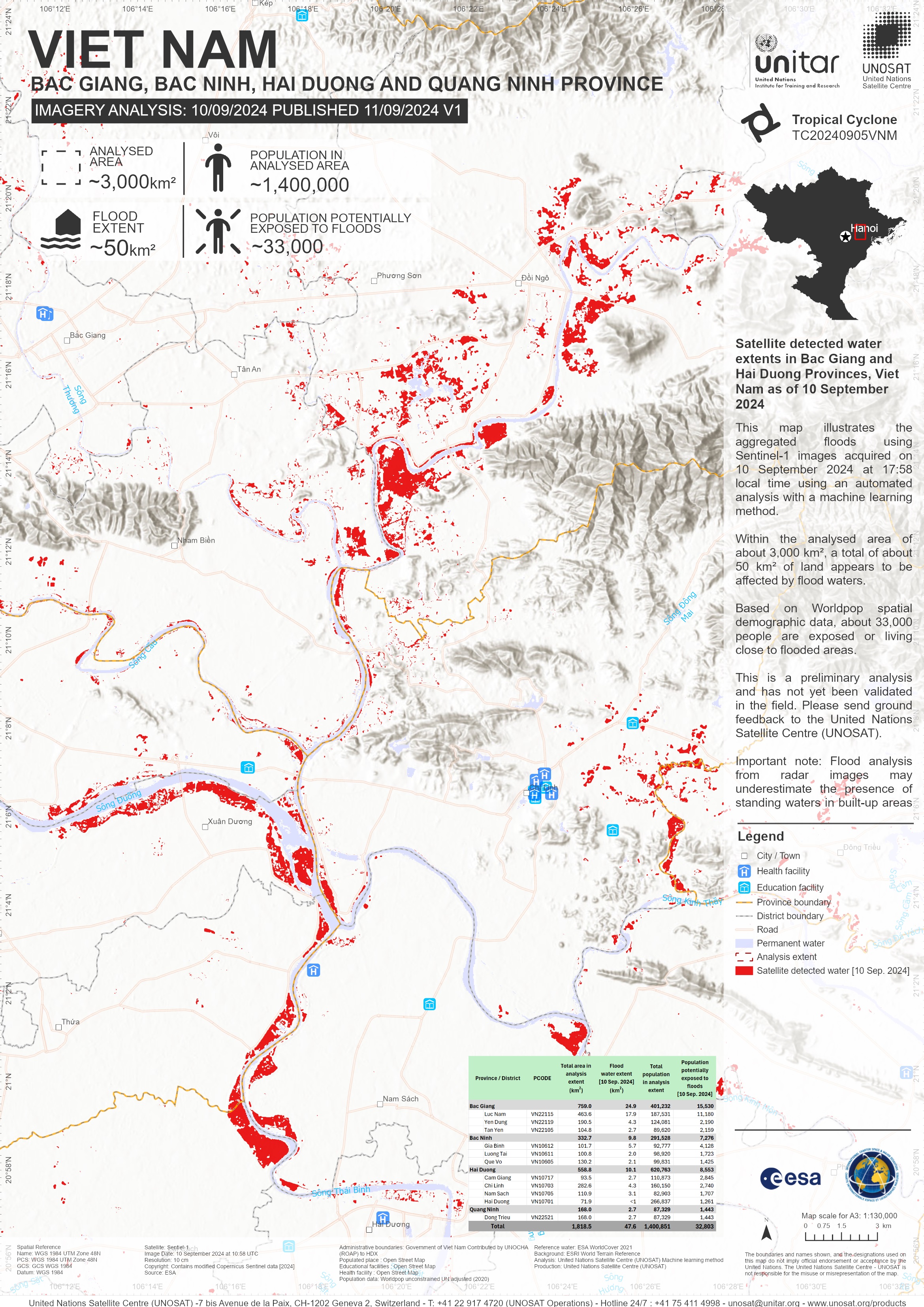
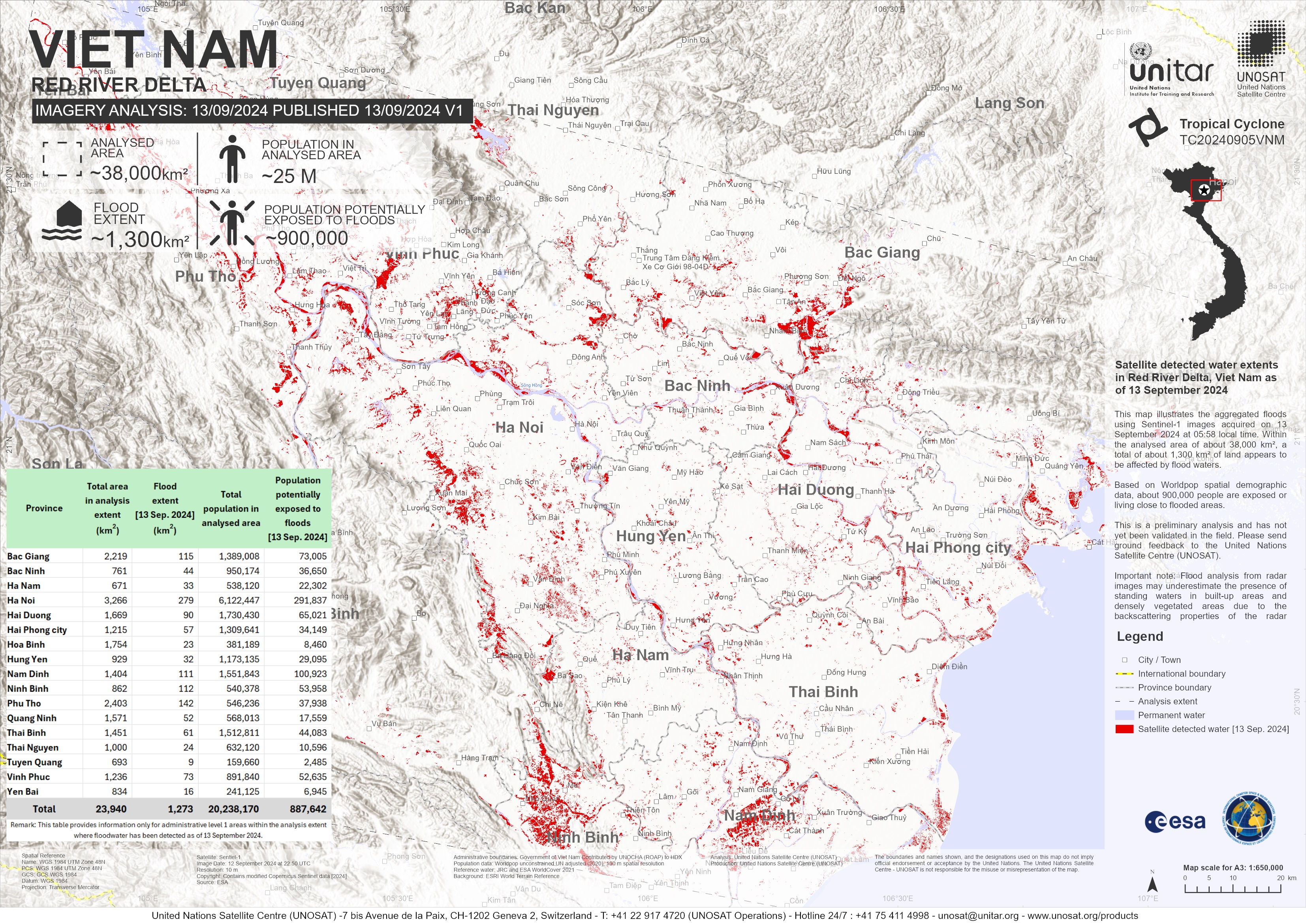
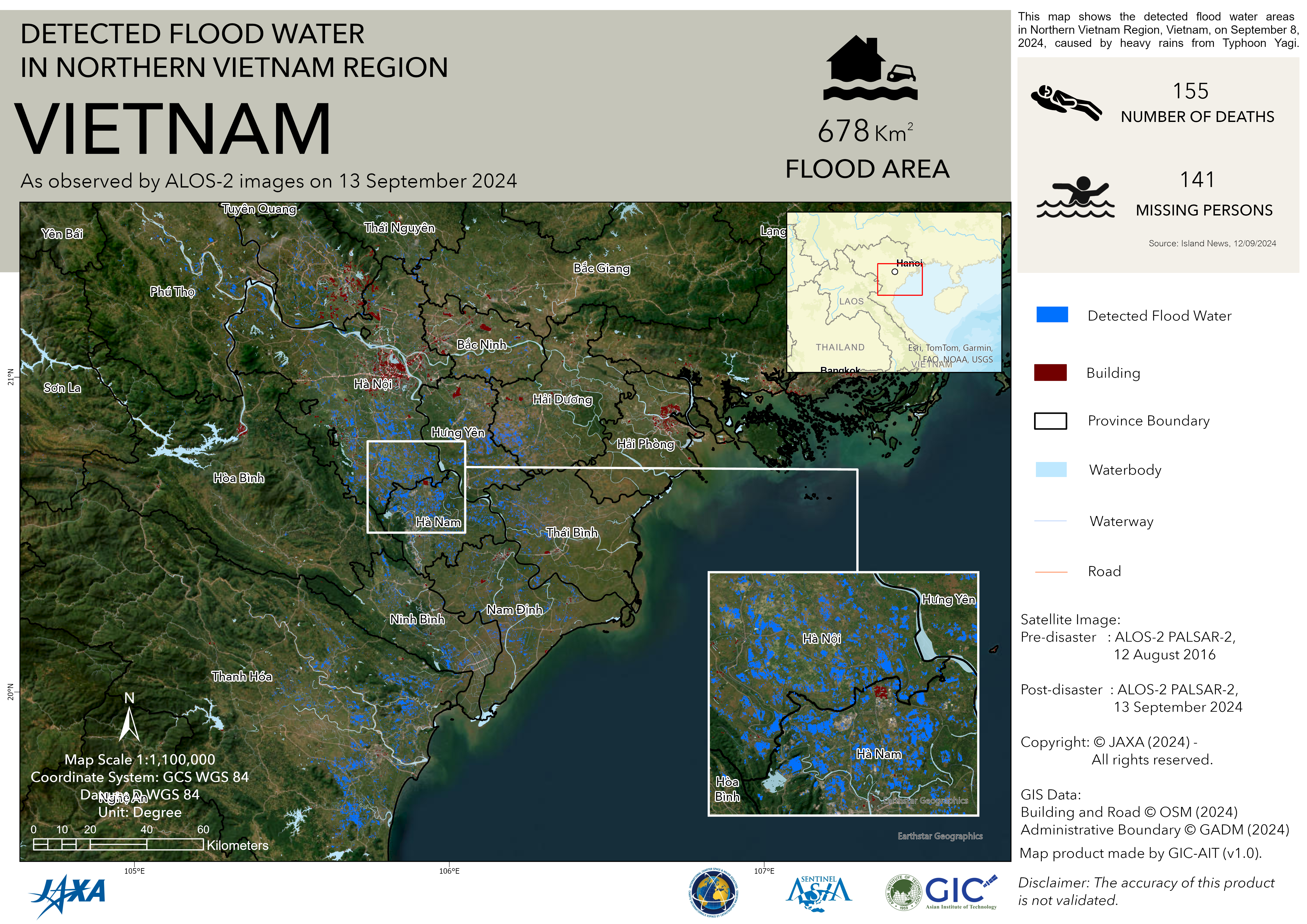
Typhoon Yagi in Vietnam
The capital city, Hanoi, and other northern provinces of Vietnam experienced landslides and severe flooding starting on Monday morning, 09 September 2024. Heavy rainfall caused by wind patterns from Typhoon Yagi produced flash floods which resulted in many towns and villages being completely immobilised.
Rivers across the impacted provinces overflowed. Residents living close to rivers and low-lying areas were evacuated as water levels rose, first floors of buildings and homes were submerged. Excessive flooding left thousands of households isolated and without electricity or phone service. The reported death toll is over 140 across northern Vietnam and 58 missing.
Schools had to close until further notice. Several roads in the city were flooded, preventing vehicles from moving through. Hundreds of soldiers, police officers, and civilians used soil-filled bags to barricade flooded areas but were unsuccessful due to the high water levels. In some areas, authorities are helping families move their belongings as homes are uninhabitable.
Related Resources:
Sentinel Asia activation for Tropical storms in Vietnam| 事件类型: | Flood |
| 事件地点: | Viet Nam |
| 启动宪章的日期: | 2024-09-10 |
| 宪章启动时间: | 08:21 |
| 宪章启动时区: | UTC+09:00 |
| 宪章要求者: | ADRC on behalf of MONRE UNOSAT on behalf of UNOCHA (ROAP) |
| 启动ID: | 909 |
| 项目经理: | Truong Son Nguyen (Ministry of Natural Resources and Environment (MONRE)) |
| act-value-adders: | Jakrapong Tawala (UNITAR) Copernicus EMS (Copernicus EMS) |
| Activation handled in collaboration with Copernicus Emergency Management Service |
Products
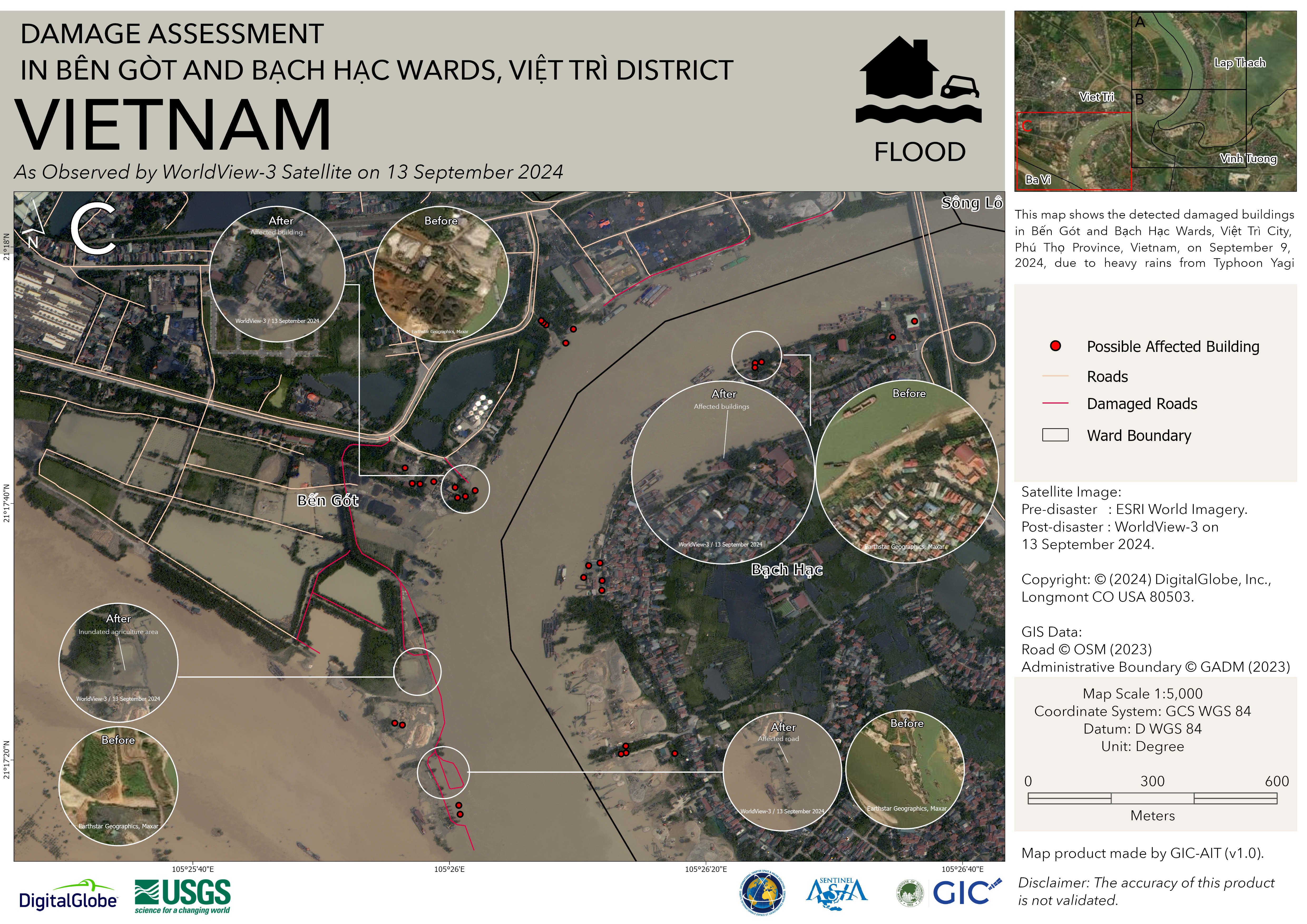
Damage assessment in Bên Gòt and Bạch Hạc wards, Việt Trì district, Vietnam
版权: © (2024) DigitalGlobe, Inc., Longmont CO USA 80503. DigitalGlobe and the DigitalGlobe logos are trademarks of DigitalGlobe, Inc. The use and/or dissemination of this data and/or of any product in any way derived there from are restricted. Unauthorized use and/or dissemination is prohibited
Map produced by GIC-AIT
Information about the Product
已获得: 13/09/2024
源: WorldView-3
类别: Delineation Map
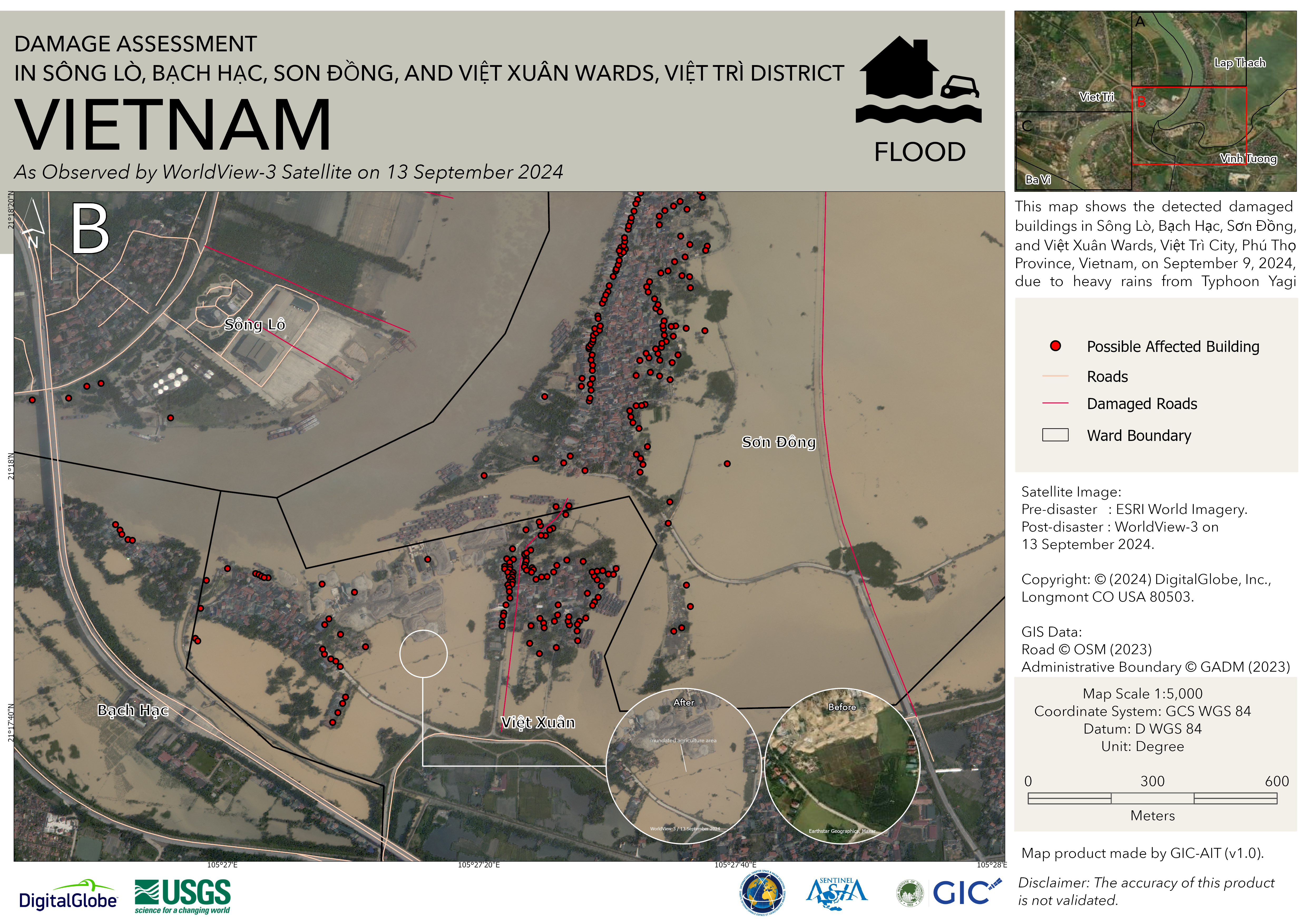
Damage assessment in Sông Lô, Bạch Hạc, Son Đồng, and Việt Xuân wards, Việt Trì district, Vietnam
版权: © (2024) DigitalGlobe, Inc., Longmont CO USA 80503. DigitalGlobe and the DigitalGlobe logos are trademarks of DigitalGlobe, Inc. The use and/or dissemination of this data and/or of any product in any way derived there from are restricted. Unauthorized use and/or dissemination is prohibited
Map produced by GIC-AIT
Information about the Product
已获得: 13/09/2024
源: WorldView-3
类别: Delineation Map
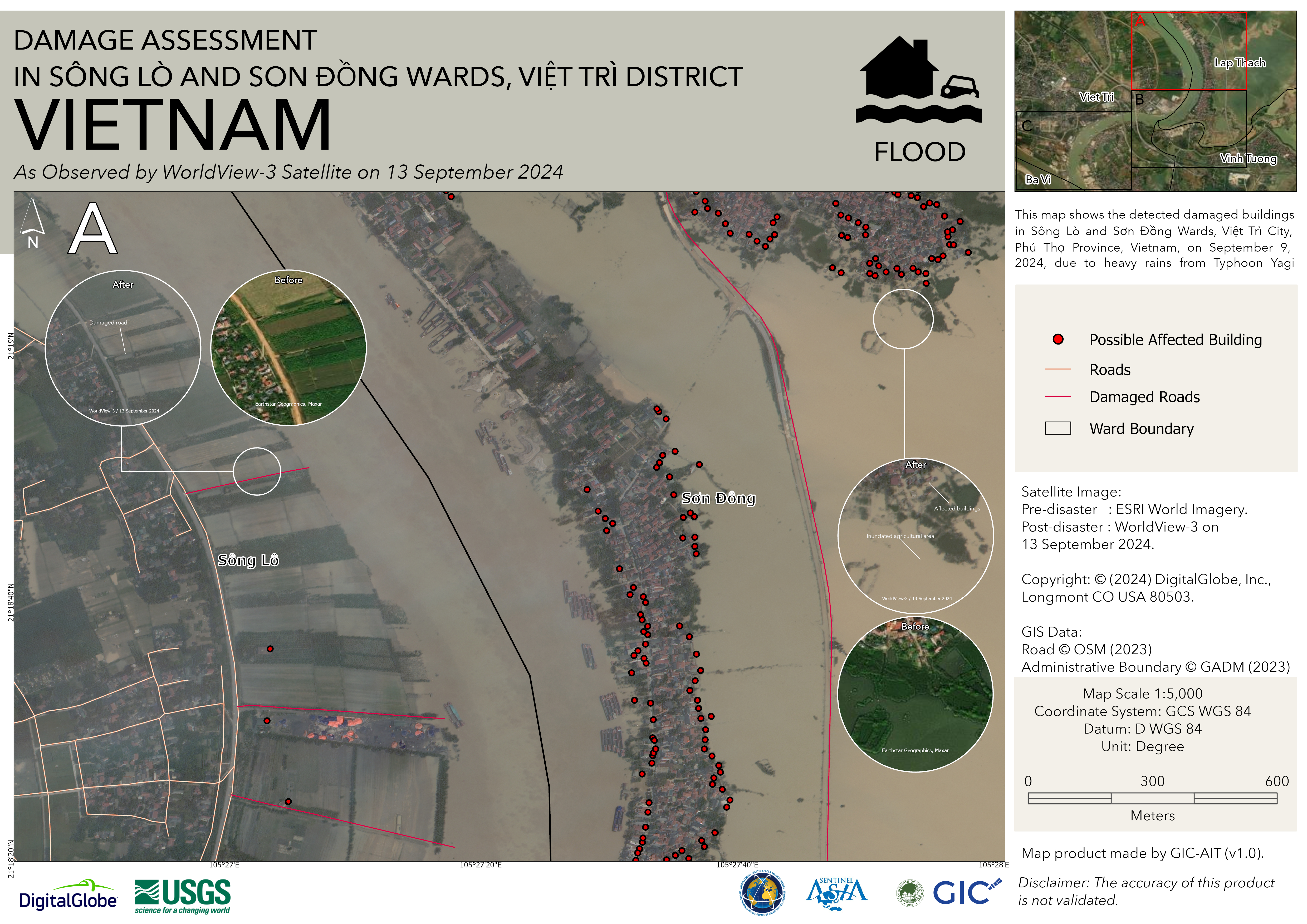
Damage assessment in Sông Lô and Son Đồng wards, Việt Trì district, Vietnam
版权: © (2024) DigitalGlobe, Inc., Longmont CO USA 80503. DigitalGlobe and the DigitalGlobe logos are trademarks of DigitalGlobe, Inc. The use and/or dissemination of this data and/or of any product in any way derived there from are restricted. Unauthorized use and/or dissemination is prohibited
Map produced by GIC-AIT
Information about the Product
已获得: 13/09/2024
源: Worldview-3
类别: Delineation Map
 返回完整的响应档案

