Charter activations
Flood in India
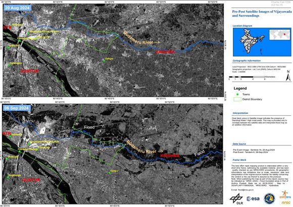
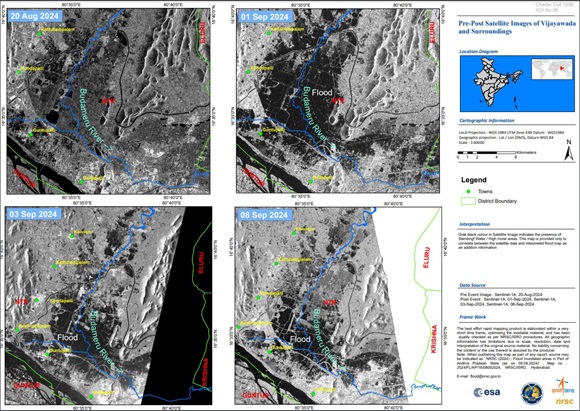
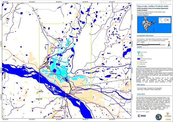
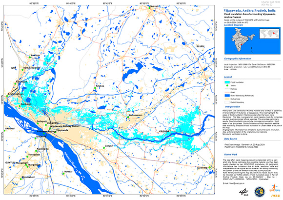
Intense monsoon rains have caused major flooding in the Krishna River floodplains affecting the two major cities of Vijayawada and Khammam and their surrounding areas. Vijayawada, the commercial capital of Andhra Pradesh, is experiencing the worst flooding in two decades with the Budameru River flooding 40% of the city and stranding nearly 275,000 people in more than a dozen residential areas.
At least 16 people have been killed in Telangana state, and nine in neighbouring Andhra Pradesh, with thousands rescued and taken to relief camps. Houses collapsed and were swept away and infrastructure such as road and rail traffic has been badly affected.
Disasters caused by landslides and floods are common in both India and Pakistan during the June-September monsoon season. Scientists and weather forecasters have blamed climate change for heavier rains in recent years.
| 事件类型: | Flood |
| 事件地点: | India |
| 启动宪章的日期: | 2024-09-03 |
| 宪章启动时间: | 11:17 |
| 宪章启动时区: | UTC+05:30 |
| 宪章要求者: | ISRO |
| 启动ID: | 907 |
| 项目经理: | AV SureshBabu (NRSC) |
| act-value-adders: | NRSC NOAA VA (NOAA) |
Products
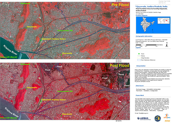
Flood Inundation Areas Surrounding Vijayawada, Andhra Pradesh, India
Download full product
版权: © KARI (2024).
Map produced by NRSC
Information about the Product
已获得: 11/09/2024
源: CAS500-1
类别: Reference Map
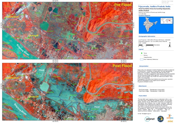
Areas affected by flooding Surrounding Vijayawada, Andhra Pradesh
Download full product
版权: © Planet Labs Inc. (2024)
Map produced by NRSC
Information about the Product
已获得: 11/09/2024
源: PlanetScope
类别: Reference Map
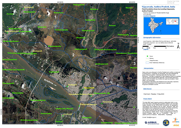
Flood Inundation Areas Surrounding Vijayawada, Andhra Pradesh, India
Download full product
版权: Includes Pleiades material © CNES (2024), Distribution Airbus DS.
Map produced by NRSC
Information about the Product
已获得: 11/09/2024
源: Pleiades
类别: Reference Map
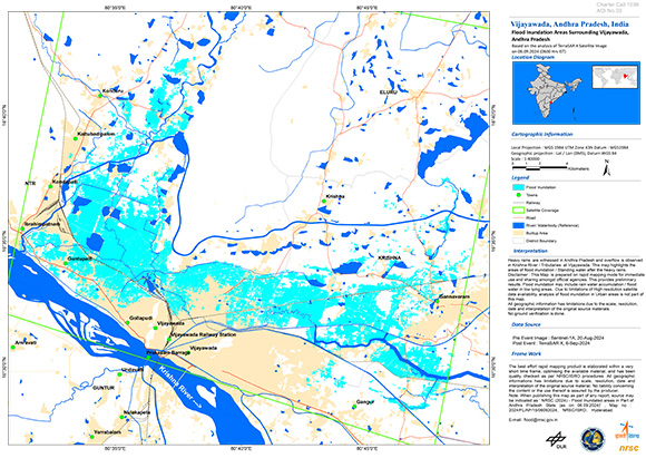
Flood Inundation Areas Surrounding Vijayawada, Andhra Pradesh
Download full product
版权: © DLR e.V. (2024), Distribution Airbus DS Geo GmbH
Map produced by NRSC
Information about the Product
已获得: 06/09/2024
源: TerraSAR-X
类别: Reference Map
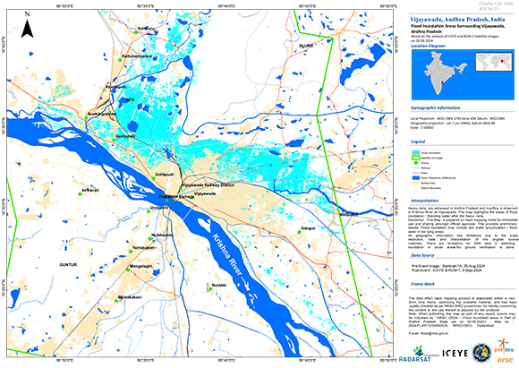
Flood Inundation in Areas Surrounding Vijayawada, Andhra Pradesh India
版权: © ICEYE (2024)
RADARSAT Constellation Mission Imagery © Government of Canada (2024) - RADARSAT is an official mark of the Canadian Space Agency
Map produced by NRSC
Information about the Product
已获得: ICEYE: 05/09/2024
RCM: 05/09/2024
源: ICEYE / RCM
类别: Delineation Map
 返回完整的响应档案

 English
 Spanish
 French
 Chinese
 Russian
 Portuguese
