Charter activations
Flood in Colombia
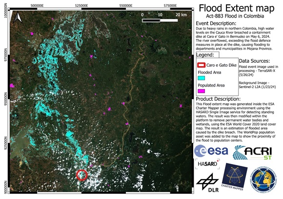
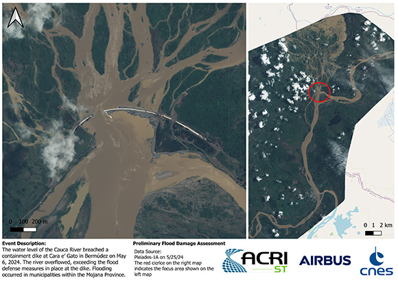
Due to heavy rains in northern Colombia, high water levels on the Cauca River breached a containment dike at Cara e' Gato in Bermúdez on May 6, 2024.
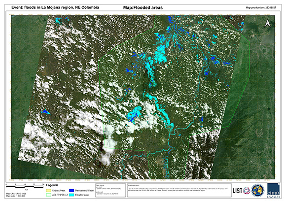
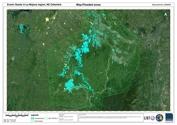
The river overflowed, exceeding the flood defence measures in place at the dike, causing flooding to departments and municipalities in Mojana Province. Extensive tracts of land were swamped with water. The flooding caused significant challenges for the affected communities; 8,268 residents had to be evacuated, a total of 895 houses were damaged, and 766 houses were destroyed.
Flooding also disrupted infrastructure; with reports of 27 affected roads, over 20 bridges, 1 health centre, and 18 schools. Agriculture in the area was affected, with 11,035 hectares of crops damaged, and 41,288 livestock harmed or missing.
| 事件类型: | Flood |
| 事件地点: | Colombia |
| 启动宪章的日期: | 2024-05-23 |
| 宪章启动时间: | 16:11 |
| 宪章启动时区: | UTC-05:00 |
| 宪章要求者: | National Unit for Disaster Risk Management (UNGRD) |
| 启动ID: | 883 |
| 项目经理: | Zachary Foltz (Argans) |
| act-value-adders: | CIMA Alessandro Masoero (CIMA) NOAA VA (NOAA) |
Products
 返回完整的响应档案

 English
 Spanish
 French
 Chinese
 Russian
 Portuguese


