最小化 最新宪章启动

Charter activations

阿富汗洪灾

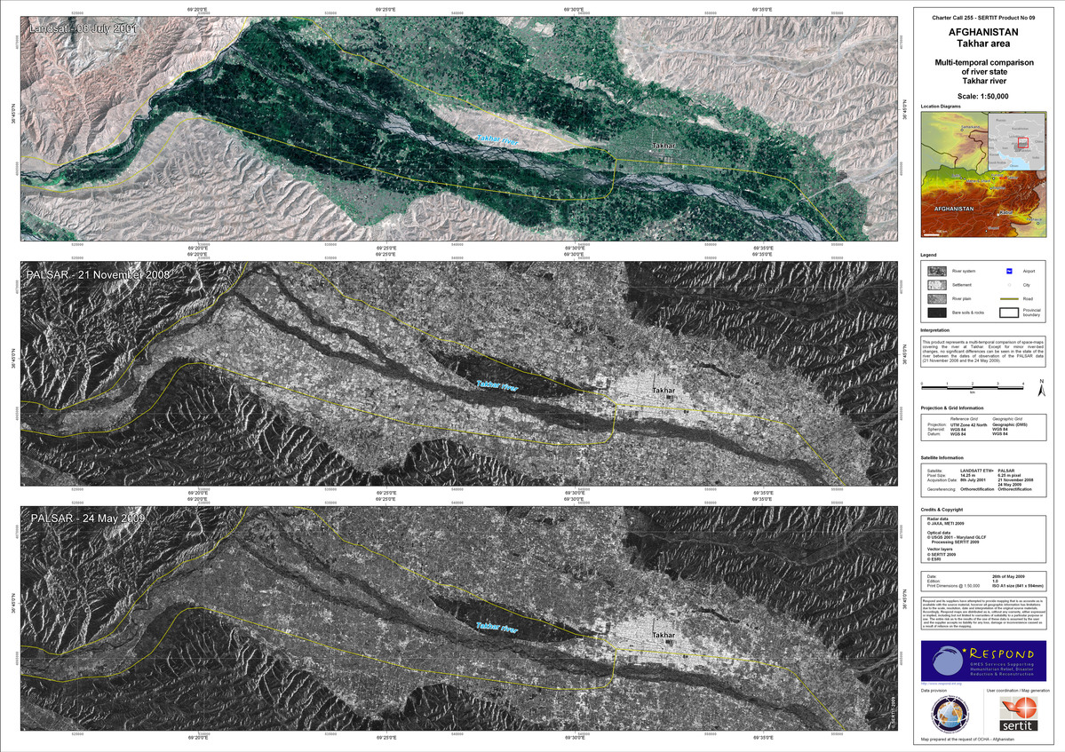
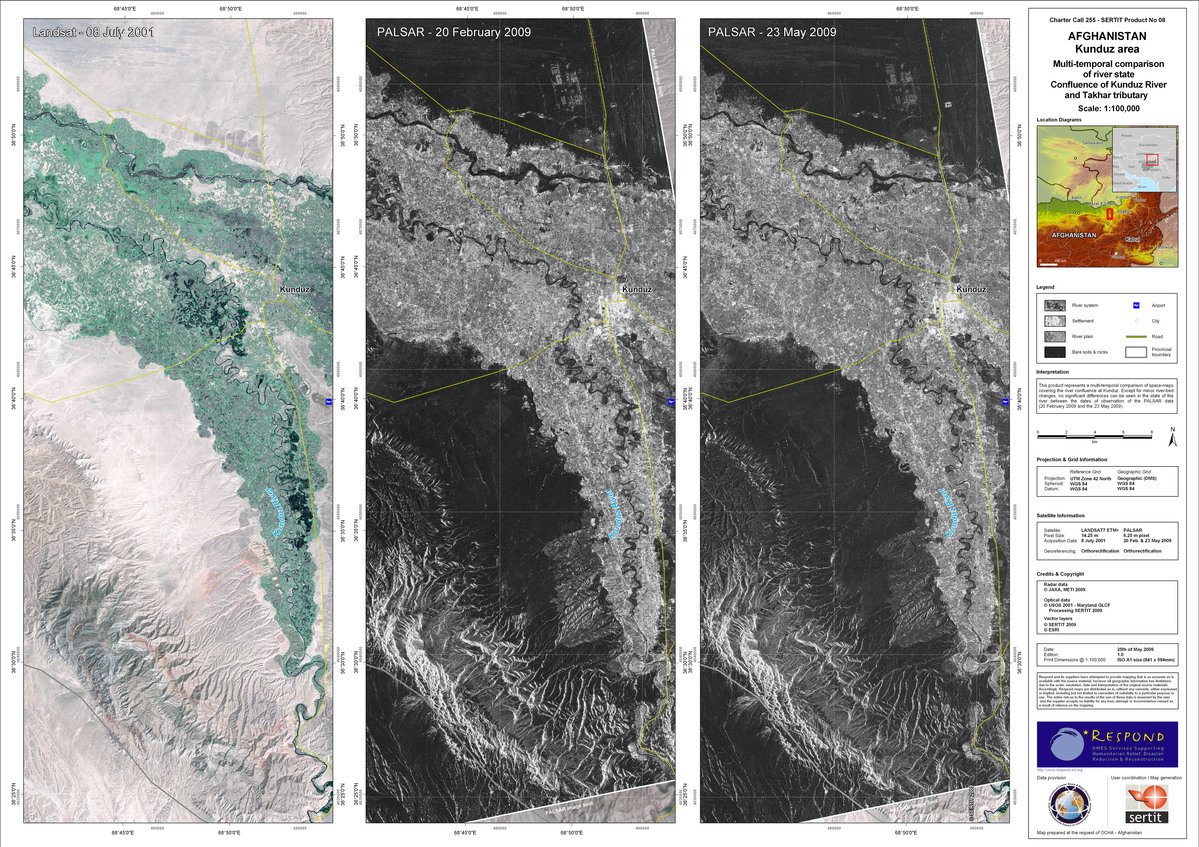
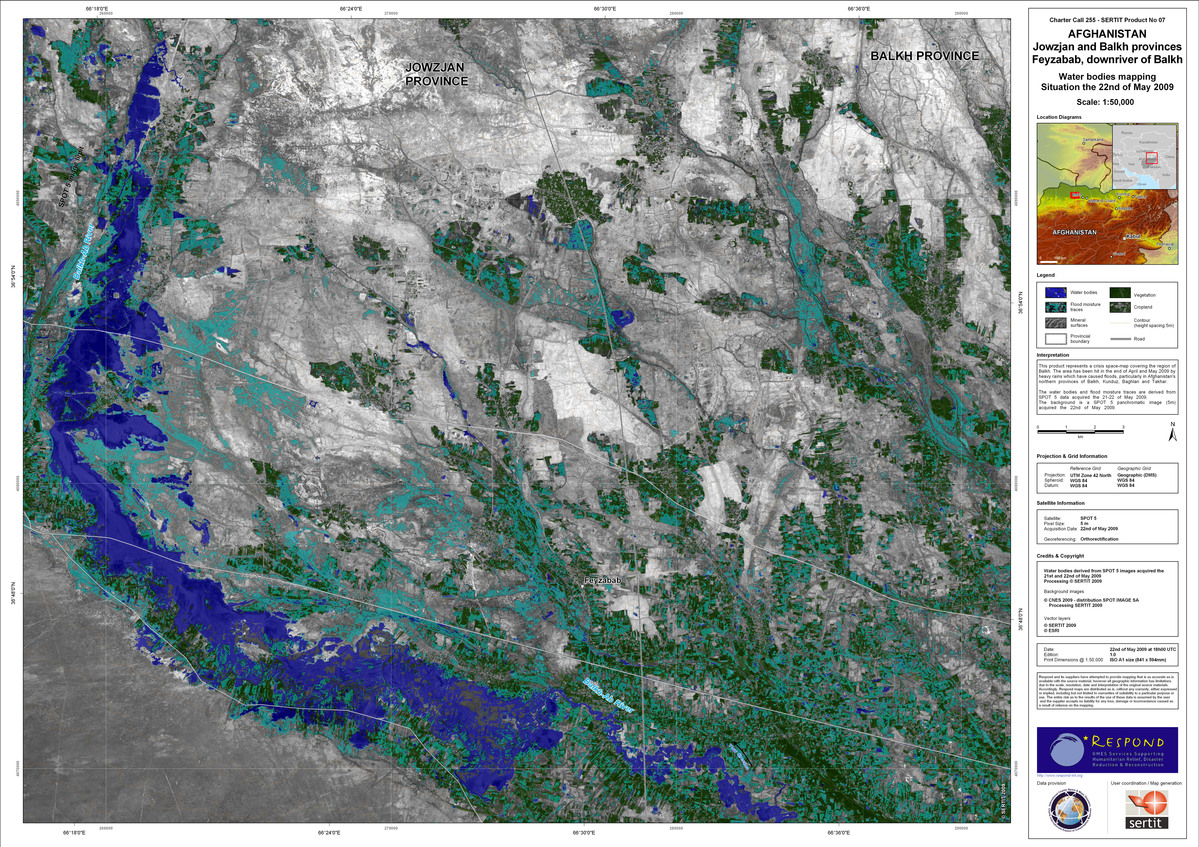
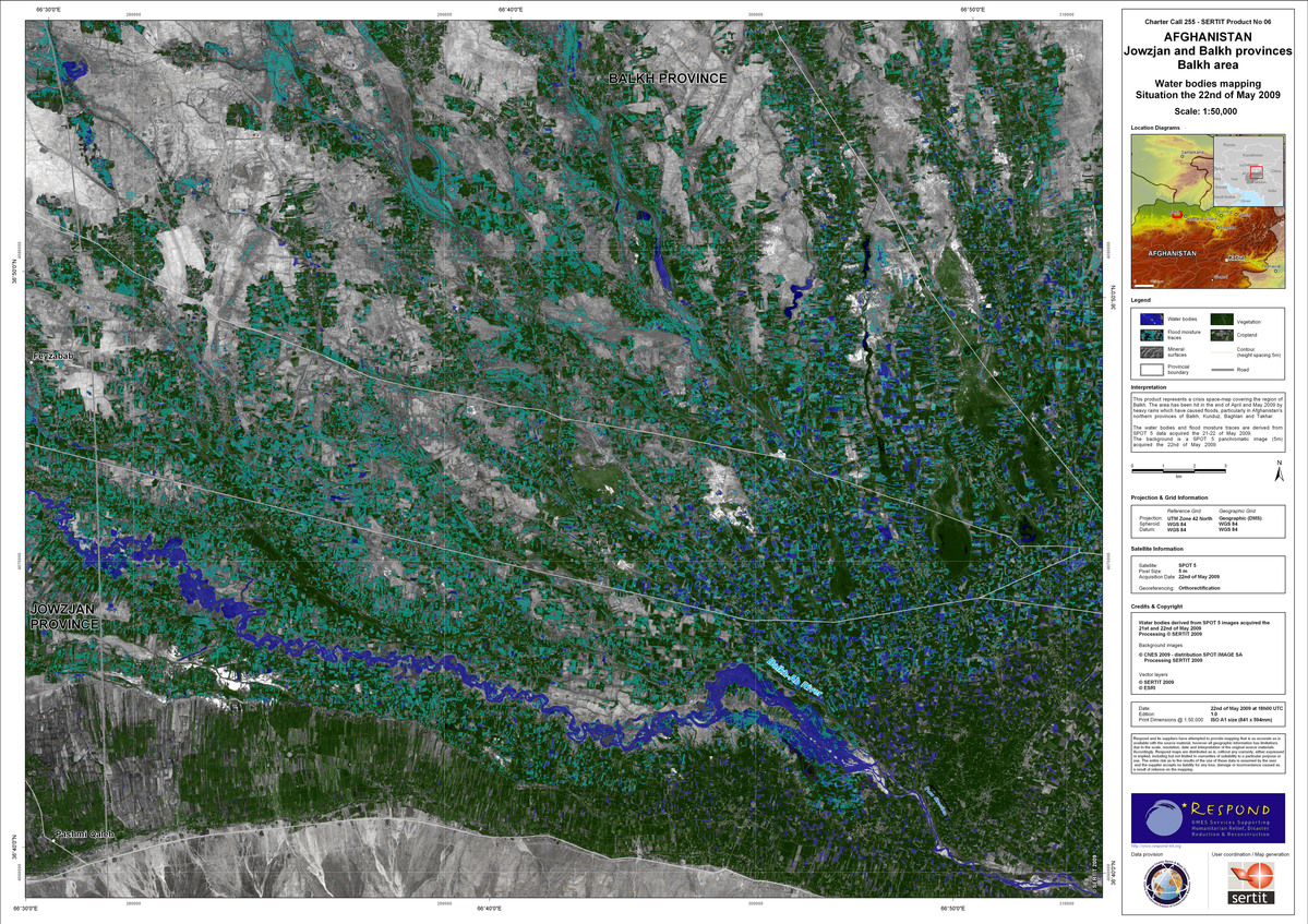
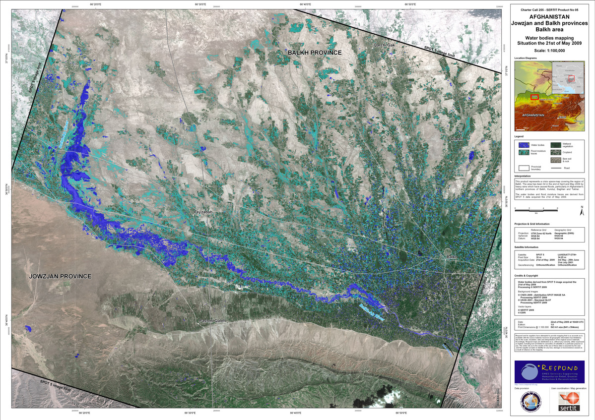
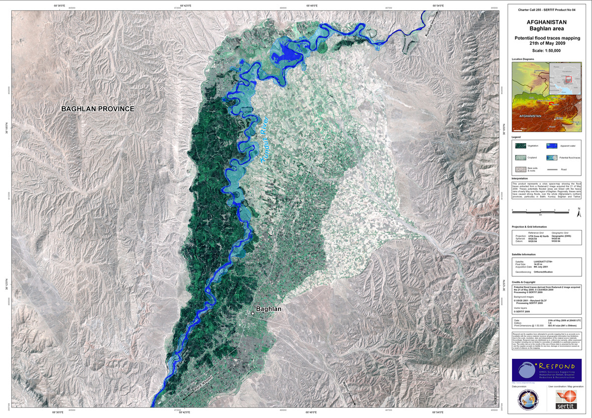
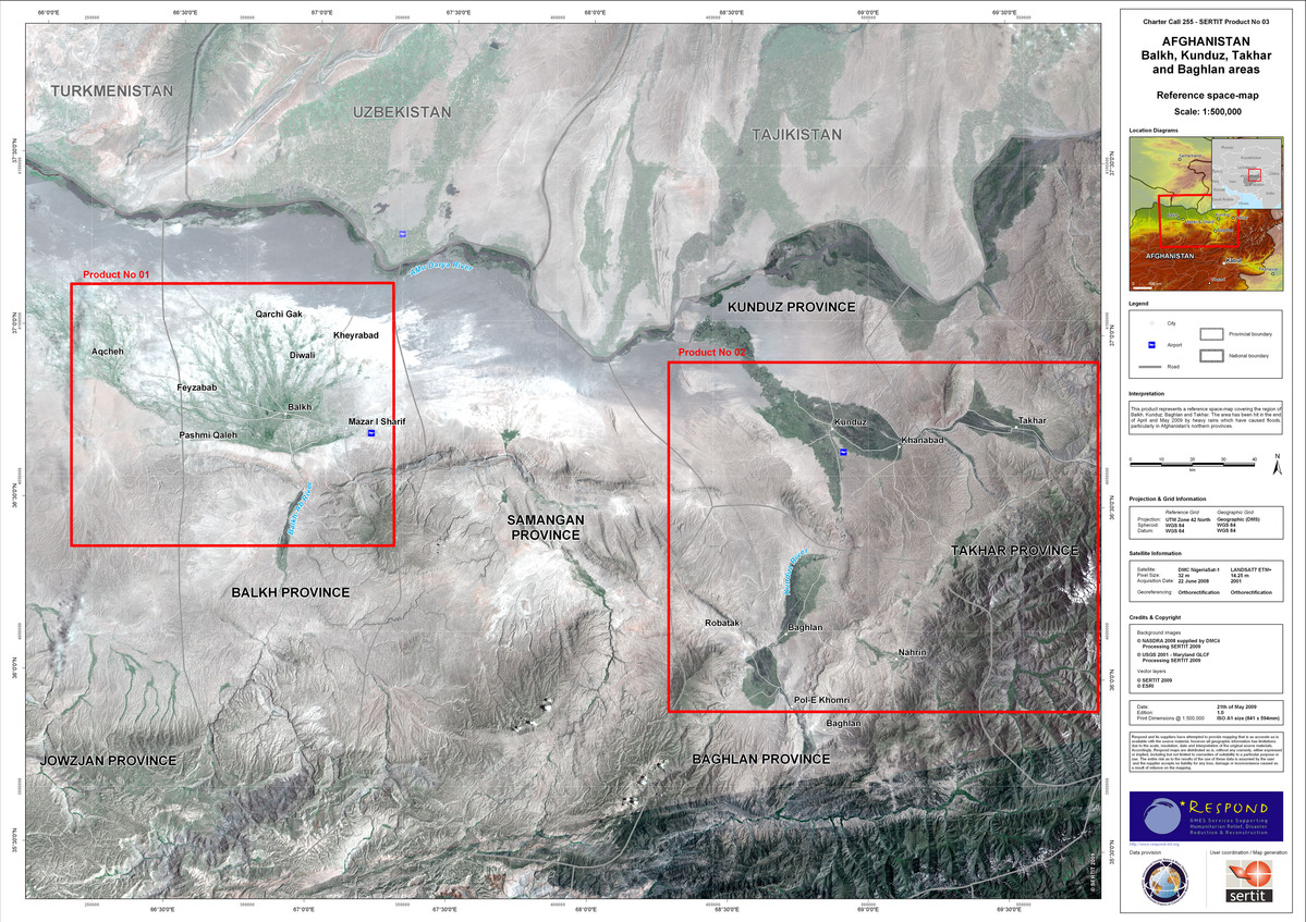
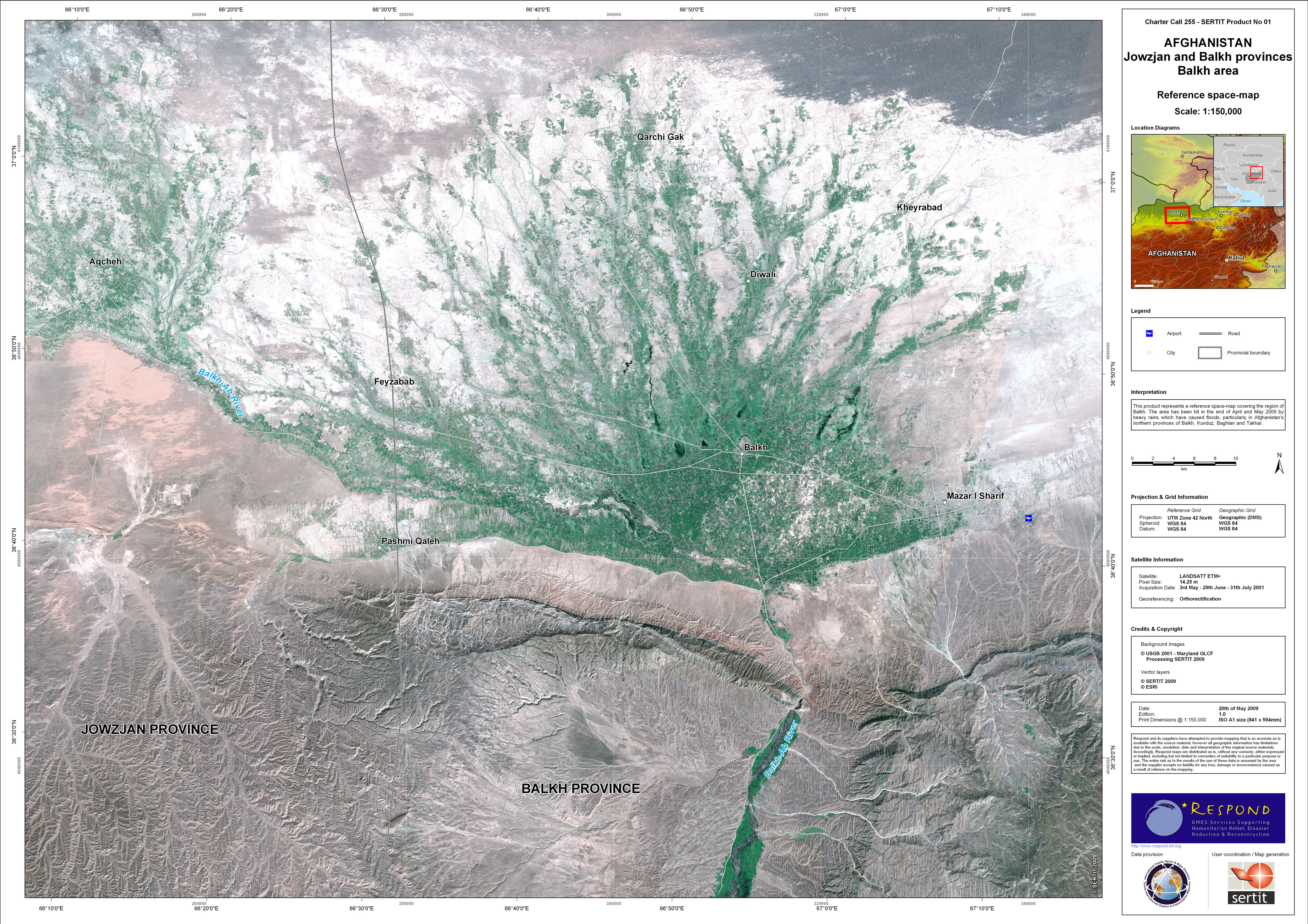
据目前估计,洪水造成北方地区五省(朱兹詹、法里亚布、巴尔赫、萨曼甘和萨尔普勒)和东北地区四省(昆都士、巴格兰、塔哈尔和巴达赫尚)约10000户居民受灾。由于强降雨和积雪融化的共同作用,北部和东北部的洪水预计将持续恶化。

事件类型:洪灾
事件地点:阿富汗
启动宪章的日期:2009年5月19日
宪章要求者:UNOOSA代表阿富汗OCHA
项目经理:SERTIT

Products

Afghanistan - Takhar river area

版权: JAXA, METI 2009, USGS 2001, SERTIT 2009, ESRI Image processing, map created 26/05/2009 by SERTIT

Information about the Product

已获得: 08/07/2001, 21/011/2008, 24/05/2009

源: LANDSAT7 ETM+, 14.25m/pixel, PALSAR 6.25m/pixel

Afghanistan - Kunduz area, confluence of Kunduz River and Takhar tributary

版权: JAXA, METI 2009, USGS 2001, SERTIT 2009, ESRI Image processing, map created 25/05/2009 by SERTIT

Information about the Product

已获得: 08/07/2001, 20/02/2009, 23/05/2009

源: LANDSAT7 ETM+, 14.25m/pixel, PALSAR 6.25m/pixel

Afghanistan - Jowzjan and Balkh provinces Feyzabab, downriver of Balkh

版权: Copyright CNES 2009, SERTIT 2009, ESRI Image processing, map created 22/05/2009 by SERTIT

Information about the Product

已获得: 22/05/2009

源: SPOT 5, 5m/pix

Afghanistan - Jowzjan and Balkh provinces Balkh area

版权: CNES 2009, SERTIT 2009, ESRI Image processing, map created 22/05/2009 by SERTIT

Information about the Product

已获得: 21/05/2009, 22/05/2009(Spot)

源: SPOT 5, 5m/pixel

Afghanistan - Jowzjan and Balkh provinces Balkh area

版权: CNES 2009, SPOT IMAGE SA, SERTIT 2009, ESRI, USGS 2001 Image processing, map created 22/05/2009 by SERTIT

Information about the Product

已获得: 31/07/2001, 03/05/2009, 21/05/2009, 29/06/2009

源: SPOT 5, 5m/pixel, LANDSAT7 ETM+, 14.25m/pixel

Afghanistan - Baghlan area

版权: SERTIT 2009, USGS 2001 Image processing, map created 21/05/2009 by SERTIT

Information about the Product

已获得: 08/07/2001

源: LANDSAT7 ETM+, 14.25m/pixel

Afghanistan - Balkh, Kunduz, Takhar and Baghlan areas

版权: NASDRA 2008, UKSA, SERTIT 2009, USGS 2001, ESRI Tratamiento de imagenes, mapa creado 21/05/2009 por SERTIT

Information about the Product

已获得: 22/06/2008, 2001

源: LANDSAT7 ETM+, 14.25m/pixel, DMC NigeriaSat-1, 32m/pixel

Reference map - Afghanistan - Kunduz, Takhar and Baghlan area

版权: USGS 2001, SERTIT 2009, ESRI Image processing, map created 20/05/2009 by SERTIT

Information about the Product

已获得: 08/07/2001

源: LANDSAT7 ETM+, 14.25 m pixel

Reference map - Afghanistan - Jowzjan and Balkh provinces, Balkh area

版权: USGS 2001, SERTIT 2009, ESRI Image processing, map created 20/05/2009 by SERTIT.

Information about the Product

已获得: 03/05/2001, 29/06/2001, 31/07/2001

源: LANDSAT7 ETM+, 14.25 m pixel

返回完整的响应档案