Charter activations
Wildfires in Chile
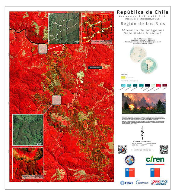
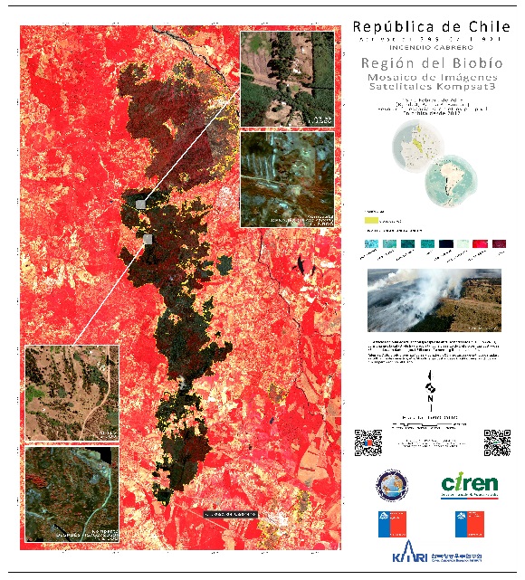
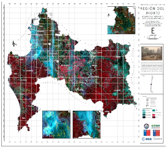
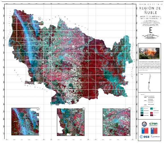
Wildfires have been raging across Chile since February 2, 2023 caused by a mix of a summer heat wave, strong winds, climate change and a Pacific Ocean weather condition called La Nina.
More than 1,000 homes have been affected or destroyed, Twenty-four people are confirmed to have died and the fires have spread across more than 294,000 hectares (1,100 square miles) several dozen of which have been classified as "red alert fires".
Chile's Interior Ministry reported so far, more than 889,000 acres of forests have been destroyed. According to official reports, Over 6,000 firefighters, many of them mainly volunteers have been trying to control more than 300 active fires, including 90 that are raging out of control.
Following a request for assistance from Chile, France, Portugal and Spain deployed more than 250 firefighters, coordination experts, and medical personnel to the most affected areas via the EU Civil Protection Mechanism.
Related News and Resources
| 事件类型: | Fires |
| 事件地点: | Chile |
| 启动宪章的日期: | 2023-02-10 |
| 宪章启动时间: | 13:17 |
| 宪章启动时区: | UTC-03:00 |
| 宪章要求者: | Ministry of Interior and Public Safety (ONEMI) |
| 启动ID: | 799 |
| 项目经理: | Marcelo Duran (Natural Resources Information Center (CIREN)) |
Products
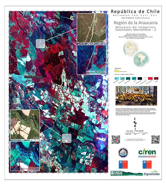
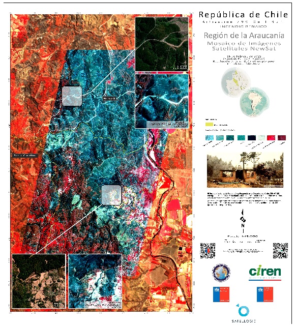
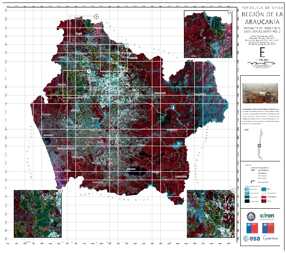
Areas Affected by Fires South of Chile. Region of Araucanía, Cities of Mulchén and Victoria.
版权: © (2023) DigitalGlobe, Inc., Longmont CO USA 80503. DigitalGlobe and the DigitalGlobe logos are trademarks of DigitalGlobe, Inc. The use and/or dissemination of this data and/or of any product in any way derived there from are restricted. Unauthorized use and/or dissemination is prohibited.
Map produced by CIREN (centro de información de recursos naturales)
Information about the Product
已获得: 21/02/2023, 23/02/2023, 24/02/2023, 26/02/2023
源: WorldView-2
类别: Delineation Map
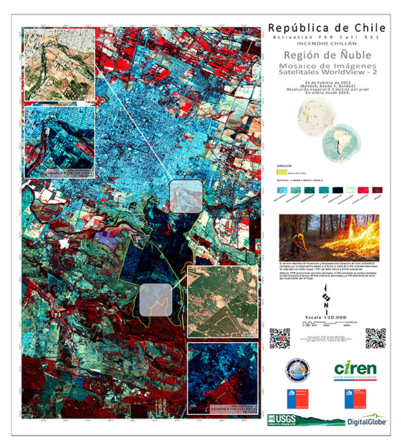
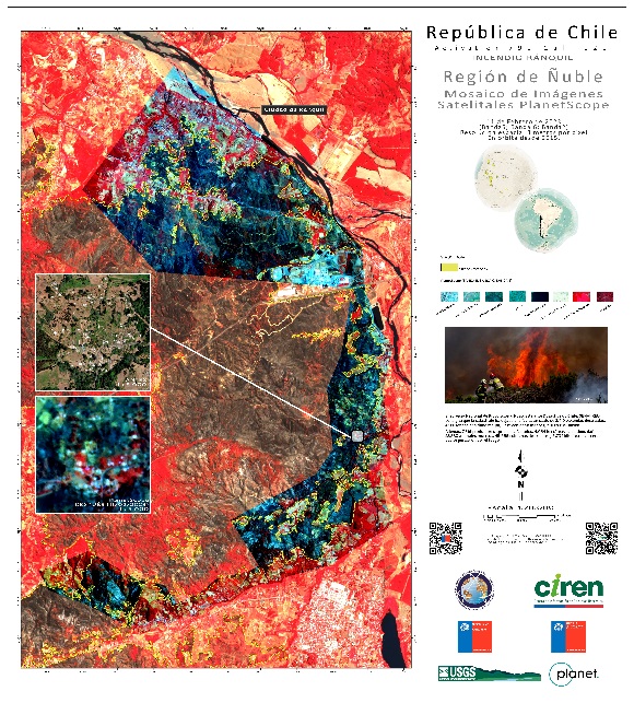
Areas Affected by Fires South of Chile. Region of the Ñuble, City of Chillán.
版权: © (2023) DigitalGlobe, Inc., Longmont CO USA 80503. DigitalGlobe and the DigitalGlobe logos are trademarks of DigitalGlobe, Inc. The use and/or dissemination of this data and/or of any product in any way derived there from are restricted. Unauthorized use and/or dissemination is prohibited.
Map produced by CIREN (centro de información de recursos naturales)
Information about the Product
已获得: 21/02/2023, 23/02/2023, 24/02/2023, 26/02/2023
源: WorldView-2
类别: Delineation Map

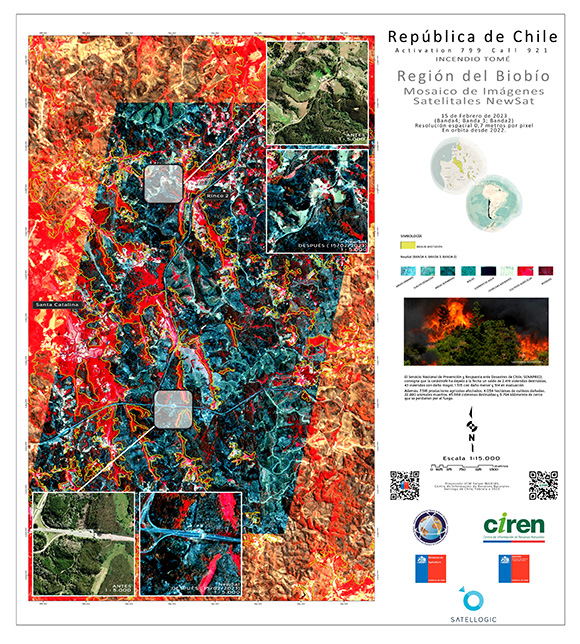
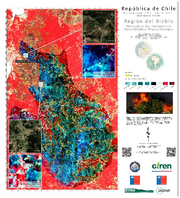
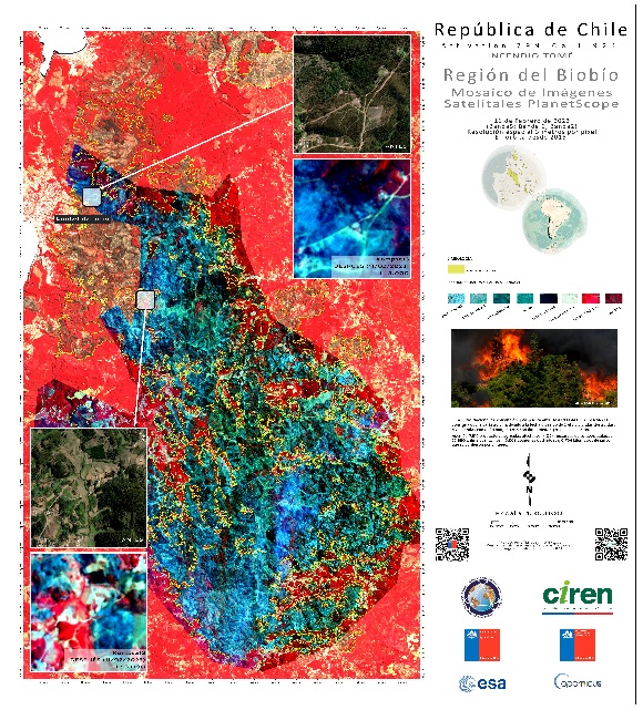
Areas Affected by Fires South of Chile. Biobío Region, Tomé City.
版权: © (2023) DigitalGlobe, Inc., Longmont CO USA 80503. DigitalGlobe and the DigitalGlobe logos are trademarks of DigitalGlobe, Inc. The use and/or dissemination of this data and/or of any product in any way derived there from are restricted. Unauthorized use and/or dissemination is prohibited.
Map produced by CIREN (centro de información de recursos naturales)
Information about the Product
已获得: 20/02/2023, 25/02/2023, 24/02/2023, 04/03/2023
源: WorldView-3
类别: Delineation Map
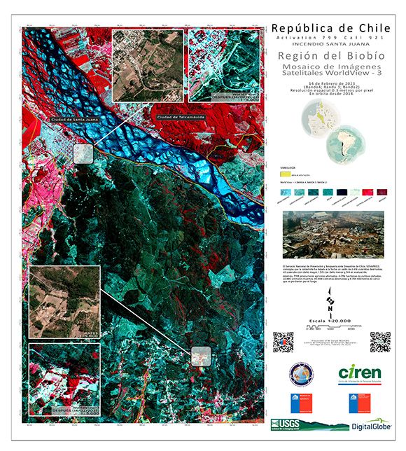
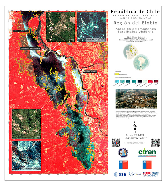
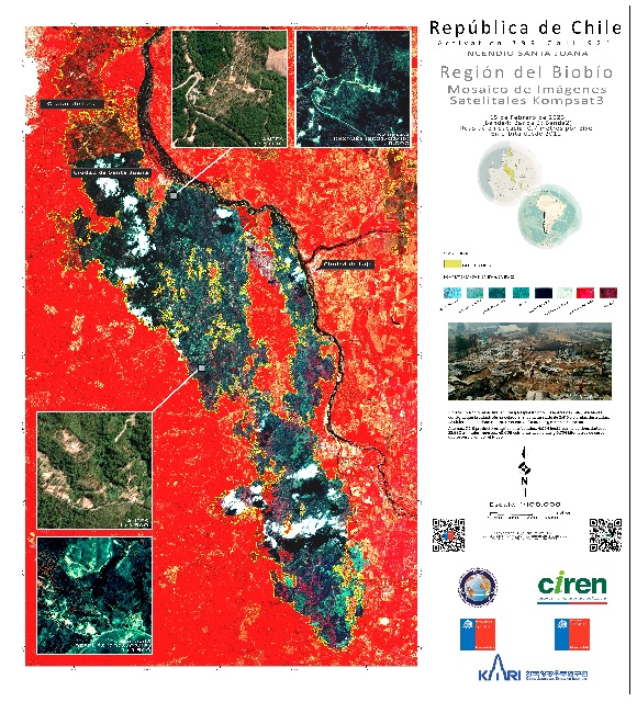
Areas Affected by Fires South of Chile. Biobio Region, Santa Juana City
版权: © (2023) DigitalGlobe, Inc., Longmont CO USA 80503. DigitalGlobe and the DigitalGlobe logos are trademarks of DigitalGlobe, Inc. The use and/or dissemination of this data and/or of any product in any way derived there from are restricted. Unauthorized use and/or dissemination is prohibited.
Map produced by CIREN (centro de información de recursos naturales)
Information about the Product
已获得: 14/02/2023
源: WorldView-3
类别: Delineation Map
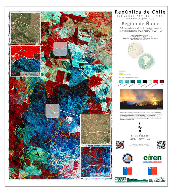
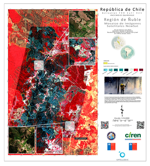
Areas Affected by Fires South of Chile. Region of Ñuble, Cities of Quirihue and Ninhue.
版权: © (2023) DigitalGlobe, Inc., Longmont CO USA 80503. DigitalGlobe and the DigitalGlobe logos are trademarks of DigitalGlobe, Inc. The use and/or dissemination of this data and/or of any product in any way derived there from are restricted. Unauthorized use and/or dissemination is prohibited.
Map produced by CIREN (centro de información de recursos naturales)
Information about the Product
已获得: 21/02/2023
源: WorldView-2
类别: Delineation Map
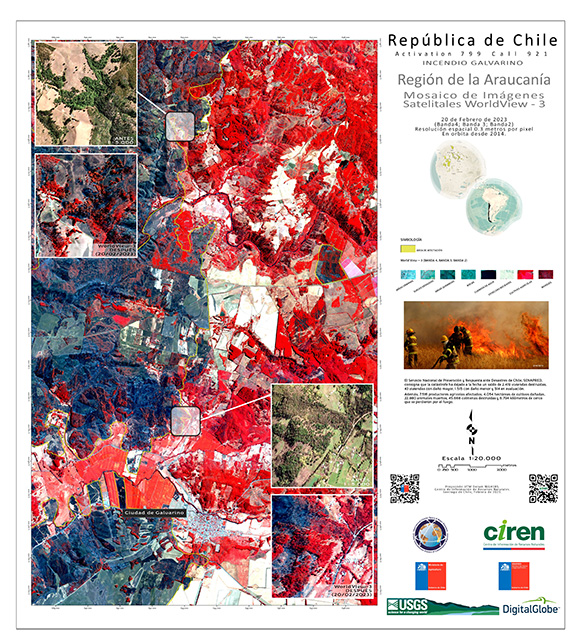
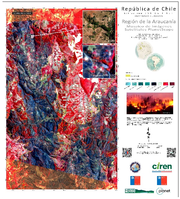
Areas Affected by Fires South of Chile. Region of Araucanía, City of Galvarino.
版权: © (2023) DigitalGlobe, Inc., Longmont CO USA 80503. DigitalGlobe and the DigitalGlobe logos are trademarks of DigitalGlobe, Inc. The use and/or dissemination of this data and/or of any product in any way derived there from are restricted. Unauthorized use and/or dissemination is prohibited.
Map produced by CIREN (centro de información de recursos naturales)
Information about the Product
已获得: 04/03/2023
源: WorldView-3
类别: Delineation Map
 返回完整的响应档案

 English
 Spanish
 French
 Chinese
 Russian
 Portuguese
