Spotlight on International Charter Data Contributors: BlackSky
News
21 一月 2025
Spotlight on International Charter Data Contributors: BlackSky
A brief introduction of BlackSky
BlackSky is a space-based intelligence company that delivers real-time imagery with global rapid revisit, analytics and high-frequency monitoring of the most critical and strategic locations, economic assets and events. The company owns and operates the industry's most advanced, purpose-built commercial, real-time intelligence system that combines the power of the BlackSky Spectra® tasking and analytics software platform and a high resolution, Low Earth Orbit (LEO) satellite constellation. The company is trusted by the most demanding U.S. and international government agencies, commercial businesses, and organizations around the world. With the confidence of secure, low-latency tasking-to-delivery of high-resolution imagery and analytics, decision makers can call on BlackSky's strategic space assets to inform live operations across the full spectrum of missions in their area of interest.
Motivation for participating in the Charter
The company joined the Charter in 2023 motivated by support for its vital mission to assist first responders in saving lives and protecting property, infrastructure and the environment in the immediate aftermath of major disasters. BlackSky's commitment to automation and low-latency operations makes it ideally suited to meet the demands of disaster response when times is of the essence. As the Earth Observation industry pivots from static mapping to dynamic monitoring, BlackSky is enabling space-based intelligence at mission speed and scale. The company achieves industry-leading speed through constellation design and a dedication to end-to-end AI-driven system automation. BlackSky Spectra delivers time-diverse imagery and analytics up to 15 times per day, dawn-to-dusk, with a typical tasking to delivery timeline of 90 minutes or less.
The specific types of data BlackSky provides
BlackSky provides both still-frame and multi-frame stereo imagery via rapid tasking and delivery for Charter activations. The BlackSky satellite constellation is optimized for agility and capacity, delivering high revisit imaging and analytic services without a dependency on an individual satellite. This approach allows the company to strategically deploy capacity to meet customer needs and tailor the capability over time to meet market demand. The satellites fly in unconventional, inclined orbits and with automated systems built in, so customers experience low-latency tasking and collection-to-delivery timelines.
BlackSky Spectra is a first-of-its-kind commercial platform providing dynamic, full-spectrum monitoring from space at industry-leading speeds, frequency and economics. The platform fuses data from BlackSky's constellation and other third-party sensors to develop the critical insights and analytics that customers require, at scale. BlackSky makes access to imagery and analytics easy, giving customers flexible, customized control, so end users do not need to be geospatial data experts. BlackSky provide the most flexible options to accommodate their customers' needs for real-time awareness in fluid mission settings.
Example of Charter activation
Kahramanmaras earthquakes in Türkiye (Activation 797)
On February 6, 2023, parts of Türkiye and Northern Syria suffered two powerful earthquakes that caused widespread damage and the loss of more than 50,000 lives. The first quake struck at 04:17 TRT (local time in Türkiye ) registering a 7.8 magnitude with an epicenter 32 km (20 miles) west–northwest of Gaziantep.
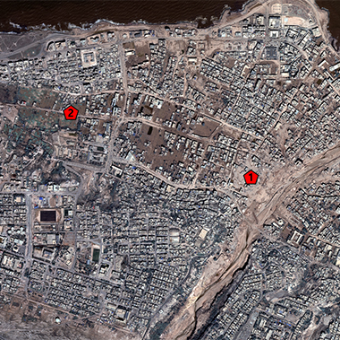
Shortly after the earthquake occurred, BlackSky collected imagery over the worst hit areas and delivered them in support of the Charter through the U.S. Geological Survey's Hazards Data Distribution System. HDDS offers imagery from multiple government agencies and commercial companies to local relief organizations. The satellite image below aided damage assessments in Kahramanmaras.
BlackSky also partnered with Esri's Disaster Response Program (DRP) to provide images for the search and rescue teams, government agencies, U.N. agencies, and several NGOs with a presence in Türkiye.
The World Health Organization (WHO) used an image of Nurdagi to aid investigation into hospital locations where informal or unofficial field observations from emergency medical technicians didn't match change-detection outputs for those areas.
List of contributions
BlackSky has contributed data for activations in the following countries:
- Landslide in India (Activation 900)
- Flood in Kyrgyzstan (Activation 898)
- Flooding in Bangladesh (Activation 888)
- Flooding in Brazil (Activation 875)
- Kahramanmaras earthquakes in Türkiye (Activation 797)

 English
 Spanish
 French
 Chinese
 Russian
 Portuguese


