 English
 Spanish
 French
 Chinese
 Russian
 Portuguese
 Latest Activation
Charter activations
Floods in Togo
Over 10,000 people are affected by the floods and six people are dead. Roads and railways are impracticable, which caused a lack of access to entire communities, isolating the north from the south of the country. In addition, some 400 houses collapsed and the telephone network was also cut in some flooded areas.
| Type of Event: | Floods |
| Location of Event: | Togo |
| Date of Charter Activation: | 31/07/2008 |
| Charter Requestor: | UNOOSA on behalf of UNOCHA-ROWA |
| Project Management: | Office of U.S. Foreign Disaster Assistance |
Products
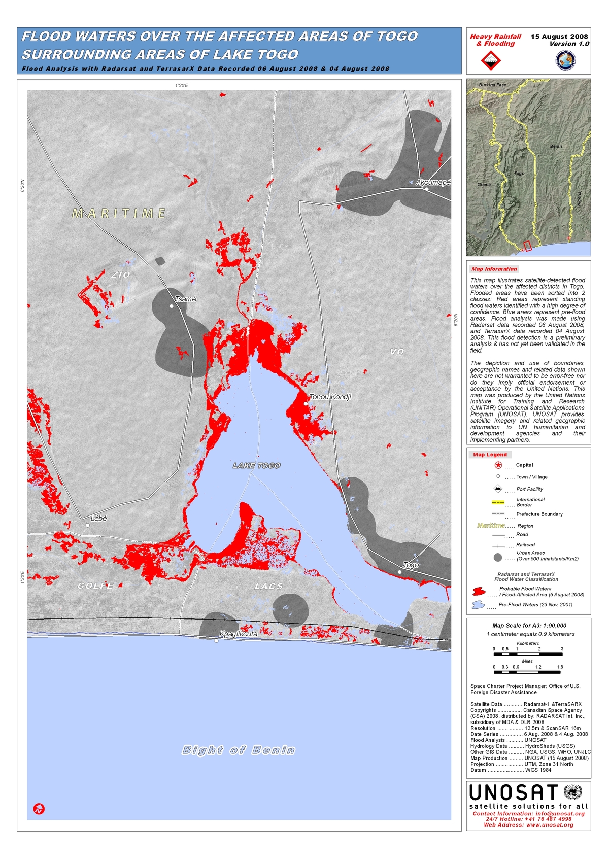
Flooded areas have been sorted into 2 classes: Red areas represent standing flood waters identified with a high degree of confidence. Blue areas represent pre-flood areas. Flood analysis was made using Radarsat data recorded 06 August 2008, and TerrasarX data recorded 04 August 2008. Preliminary analysis not yet validated in the field.
Copyright: CSA 2008, DLR 2008 Image processing, map created 15/08/2008 by UNOSAT.
Information about the Product
Acquired: 04/08/2008, 06/08/2008
Source: Radarsat-1, TerraSAR-X
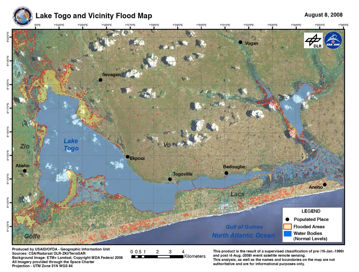
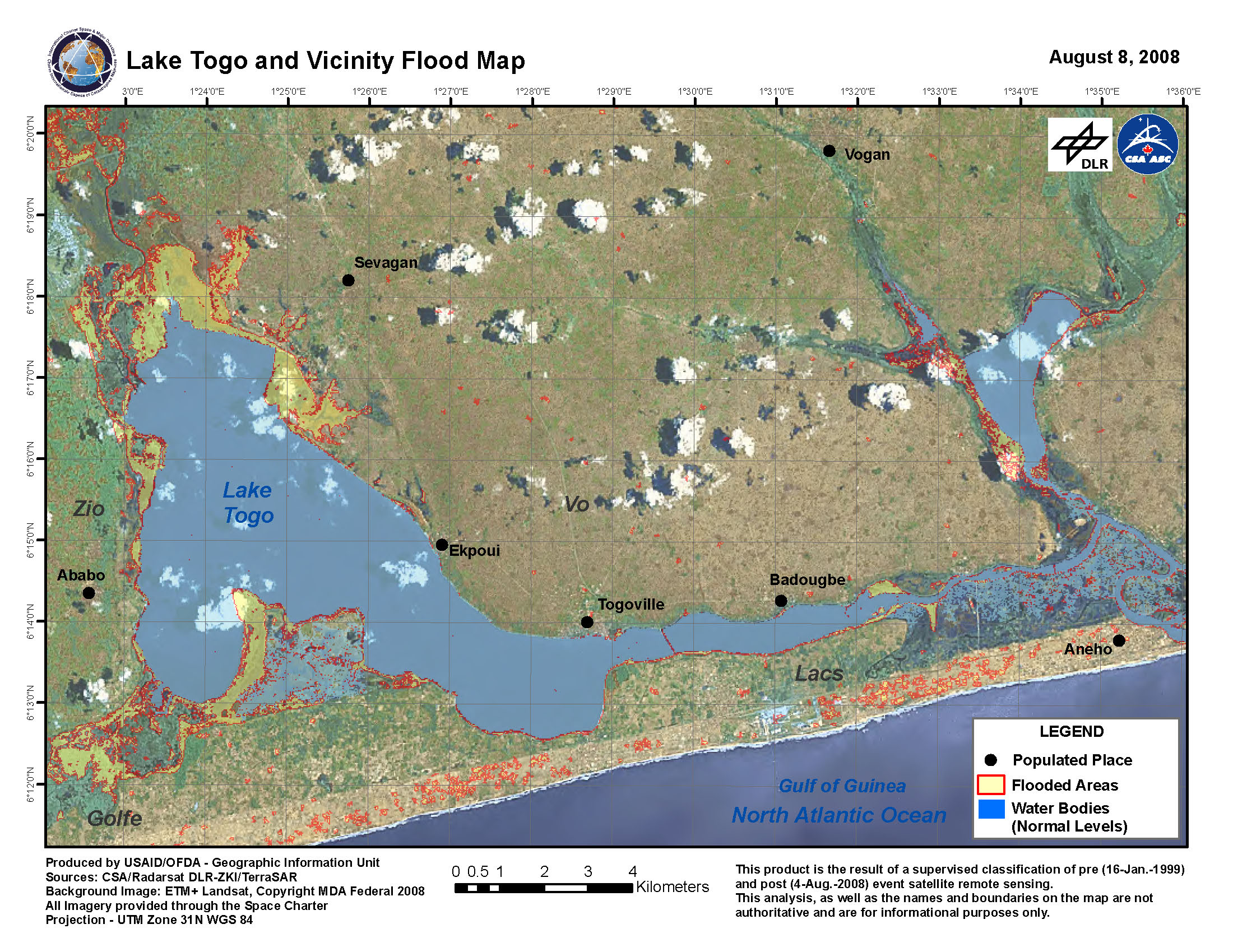
Flooded Areas around Lake Togo, Radarsat/TerraSAR-X, 04/08/2008
Copyright: CSA 2008, DLR 2008, MDA Federal 2008 Image processing, map created 05/08/2008 by USAID/OFDA.
Information about the Product
Acquired: 04/08/2008, 16/01/1999 Supervised classification of pre- (16/01/1999) and post- (04/08/2008) event satellite remote sensing. In red, flooded areas; blue, pre-flood surface water levels.
Source: Radarsat-1 and TerraSAR-X; Landsat ETM, 12.5m/pixel and 16m/pixel (ScanSAR) resolution.
 Back to the full activation archive

