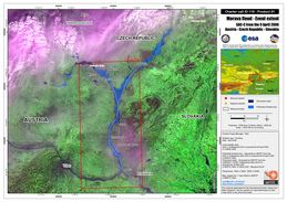
Charter activations
Flooding in Austria
Floods in western Austria killed three people and caused the evacuation of approximately 1200 homes.
| Type of Event: | Flooding |
| Location of Event: | Austria |
| Date of Charter Activation: | 07/04/2006 |
| Charter Requestor: | Regional Alarm Centre Lower Austria |
| Project Management: | ESA |
Products
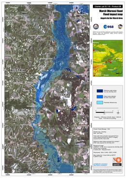
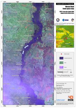
Angern Flood Impact Map Spot 4, Scale 1:100,000, with flood mapping and interpretation derived from SPOT 4 (20 m) data acquired on 09 April 2006 draped over Landsat 7 ETM+ natural colours data of 24th May 2001
Copyright: CNES 2006, USGS 2001 Image processing, map created 12/04/2006 by SERTIT in the framework of GMES RISKEOS.
Information about the Product
Acquired: 09/04/2006, 24/05/2001
Source: Spot 4, Landsat 7 ETM+
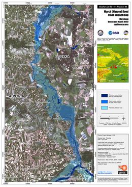
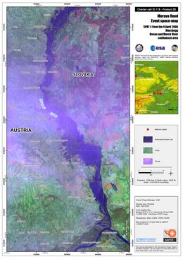
Marchegg Flood Impact Map Spot 4, Scale 1:100,000, with flood mapping and interpretation derived from SPOT 4 (20 m) data acquired on 09 April 2006 draped over Landsat 7 ETM+ natural colours data of 24th May 2001
Copyright: CNES 2006, USGS 2001 Image processing, map created 12/04/2006 by SERTIT in the framework of GMES RISKEOS.
Information about the Product
Acquired: 09/04/2006, 24/05/2001
Source: Spot 4, Landsat 7 ETM+
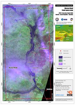
Flood Impact Map Spot 4, Scale 1:200,000, with flood mapping and interpretation derived from SPOT 4 (20 m) data acquired on 09 April 2006 draped over Landsat 7 ETM+ natural colours data of 24th May 2001
Copyright: CNES 2006, USGS 2001 Image processing, map created 12/04/2006 by SERTIT in the framework of GMES RISKEOS.
Information about the Product
Acquired: 09/04/2006, 24/05/2001
Source: Spot 4, Landsat 7 ETM+
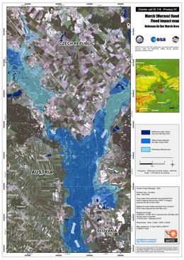
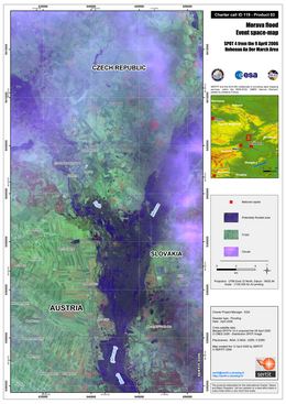
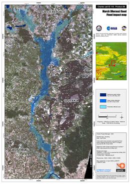
Hohenau Flood Impact Map Spot 4, Scale 1:100,000, with flood mapping and interpretation derived from SPOT 4 (20 m) data acquired on 09 April 2006 draped over Landsat 7 ETM+ natural colours data of 24th May 2001
Copyright: CNES 2006, USGS 2001 Image processing, map created 12/04/2006 by SERTIT in the framework of GMES RISKEOS.
Information about the Product
Acquired: 09/04/2006, 24/05/2001
Source: Spot 4, Landsat 7 ETM+
 Back to the full activation archive

 English
 Spanish
 French
 Chinese
 Russian
 Portuguese
