 English
 Spanish
 French
 Chinese
 Russian
 Portuguese
 Последняя Активация
Charter activations
Tropical Cyclone Lola in the Solomon Islands
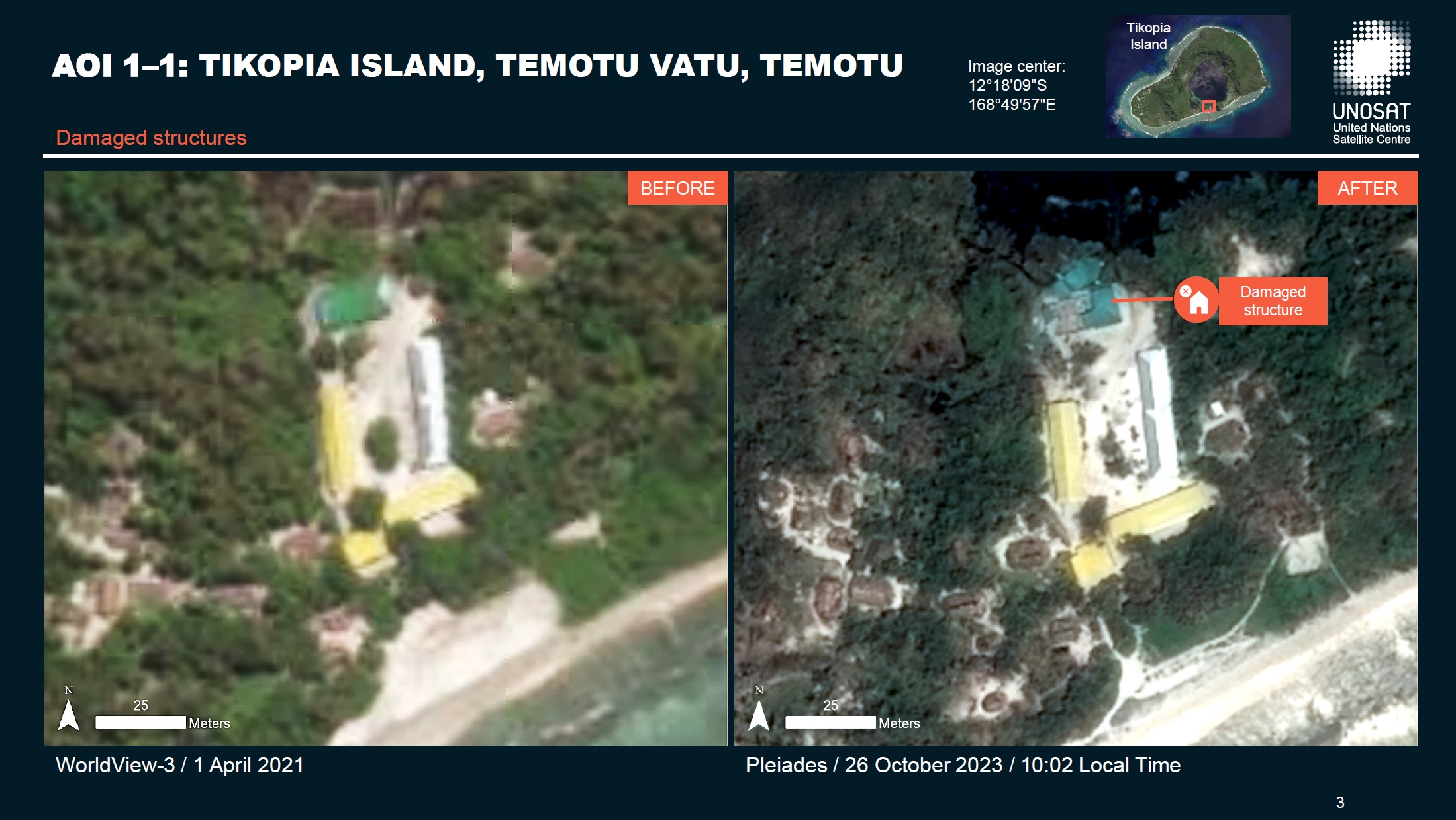
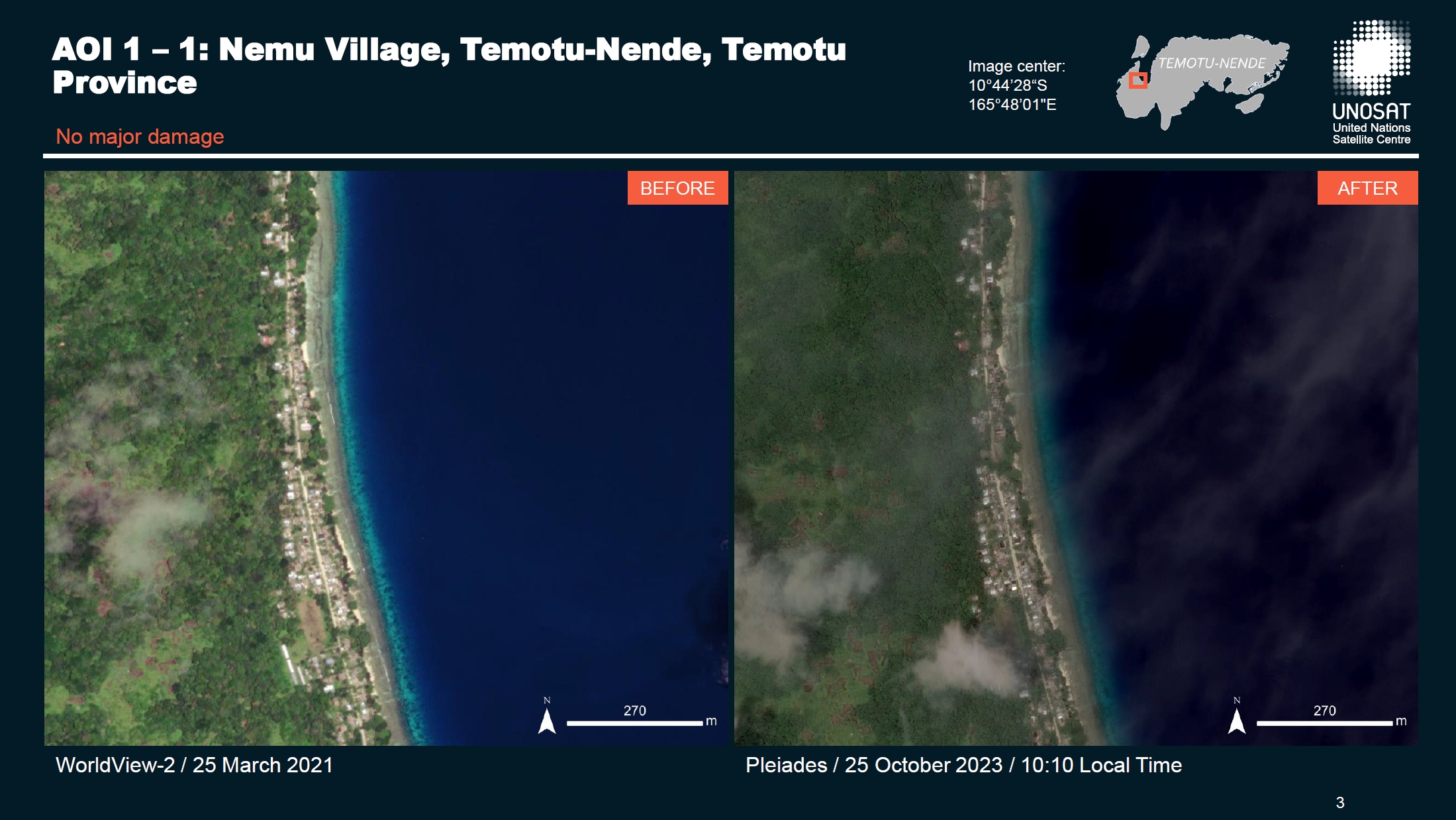
A new tropical cyclone named Lola formed over the South Pacific Ocean on 21 October and started moving south toward Vanuatu. Lola passed through the Solomon Islands on the 22 and 23 of October and the Solomon Islands National Disaster Management (NDMO) issued a situation report, confirming Tikopia Island has been significantly impacted.
Solomon Islands are currently experiencing an El Niño event. In the past, El Niño events have been associated with more tropical cyclone occurrences than average in the South Pacific region.
Related News and Resources
| Тип события: | Cyclones |
| Место события: | Solomon Islands |
| Date of Charter Activation: | 2023-10-23 |
| Время активации Хартии: | 11:42 |
| TЧасовой пояс в районе активации Хартии: | UTC+02:00 |
| Запрос на активацию поступил от: | UNITAR on behalf of United Nations Development Programme |
| Номер активации: | 846 |
| Менеждер проекта от: | Ida Svendsen (UNOSAT) |
| act-value-adders: | Copernicus EMS (Copernicus EMS) |
| Activation handled in collaboration with Copernicus Emergency Management Service |
Products
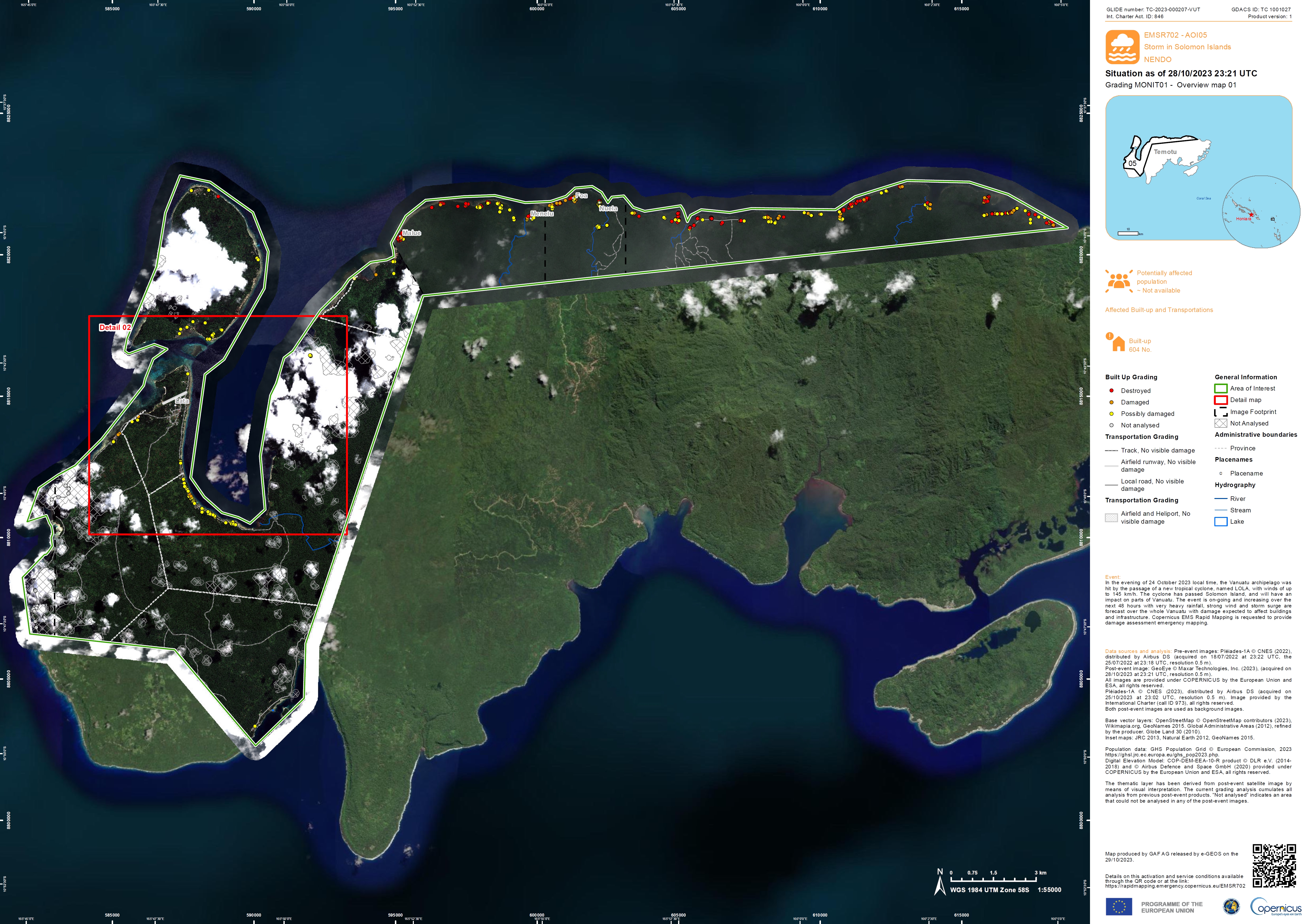
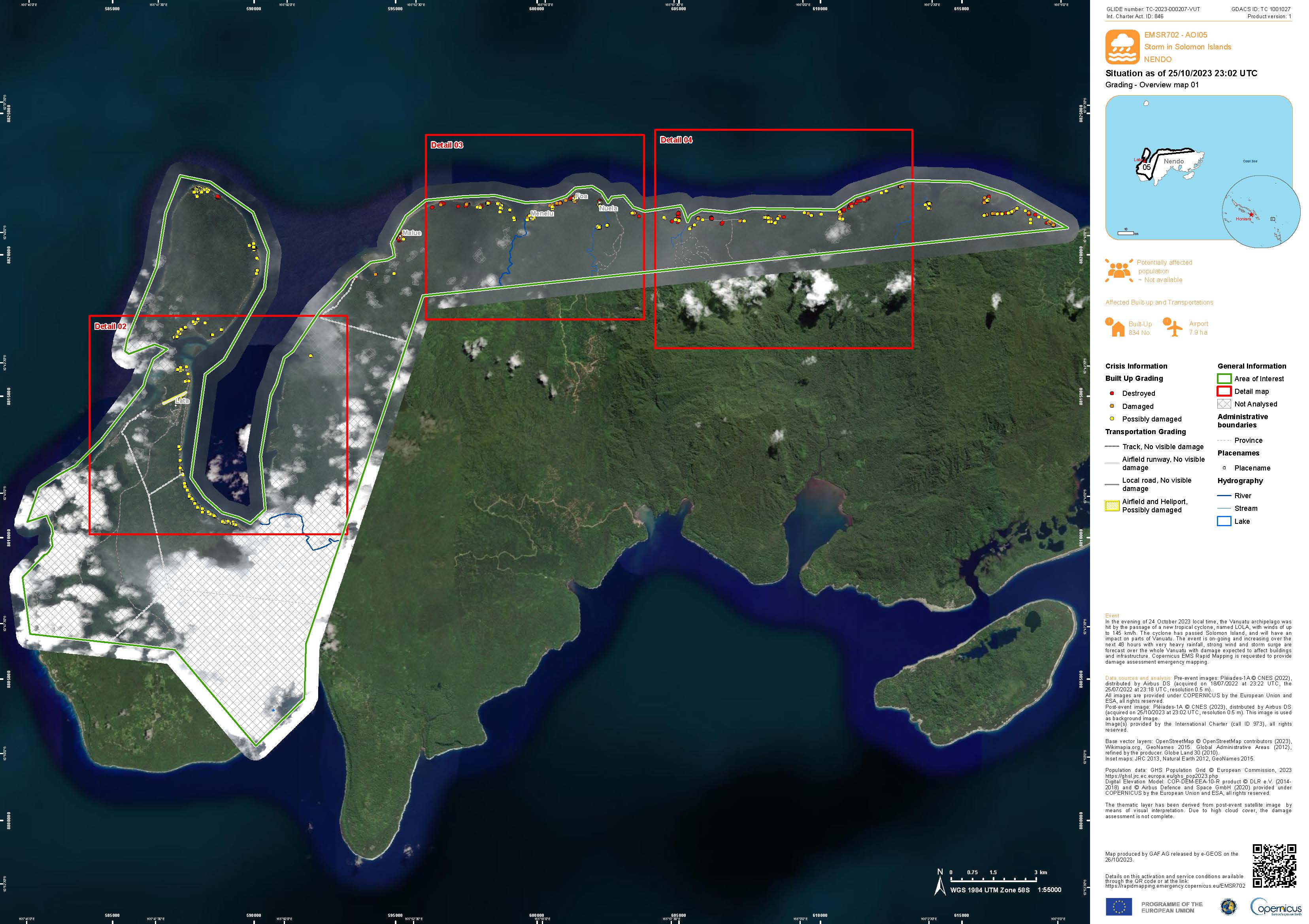
Gradient Monitoring Map showing damage on Nendö Island in the Temotu province, Solomon Islands
Авторские права: Includes Pleiades material © CNES (2023), Distribution Airbus DS.
GeoEye-1 © Maxar Technologies, Inc. (2023)
Map produced by GAF AG
Information about the Product
Получено: Pleiades: 18/07/2022, 25/07/2022 and 25/10/2023
GeoEye-1: 28/10/2023
Источник: Pleiades and GeoEye-1
Категория: Gradient Monitoring Maps
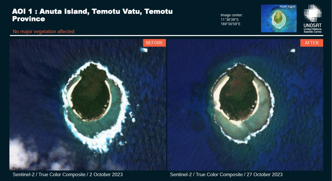
Preliminary satellite-derived agricultural and damage assessment, Anata Island, Temotu Vatu, Temotu Province, Solomon Islands.
Download the Full Report
Авторские права: Contains modified Copernicus Sentinel data (2023)
Report produced by UNITAR / UNOSAT
Information about the Product
Получено: 27/10/2023
Источник: Sentinel-2
Категория: Dossier
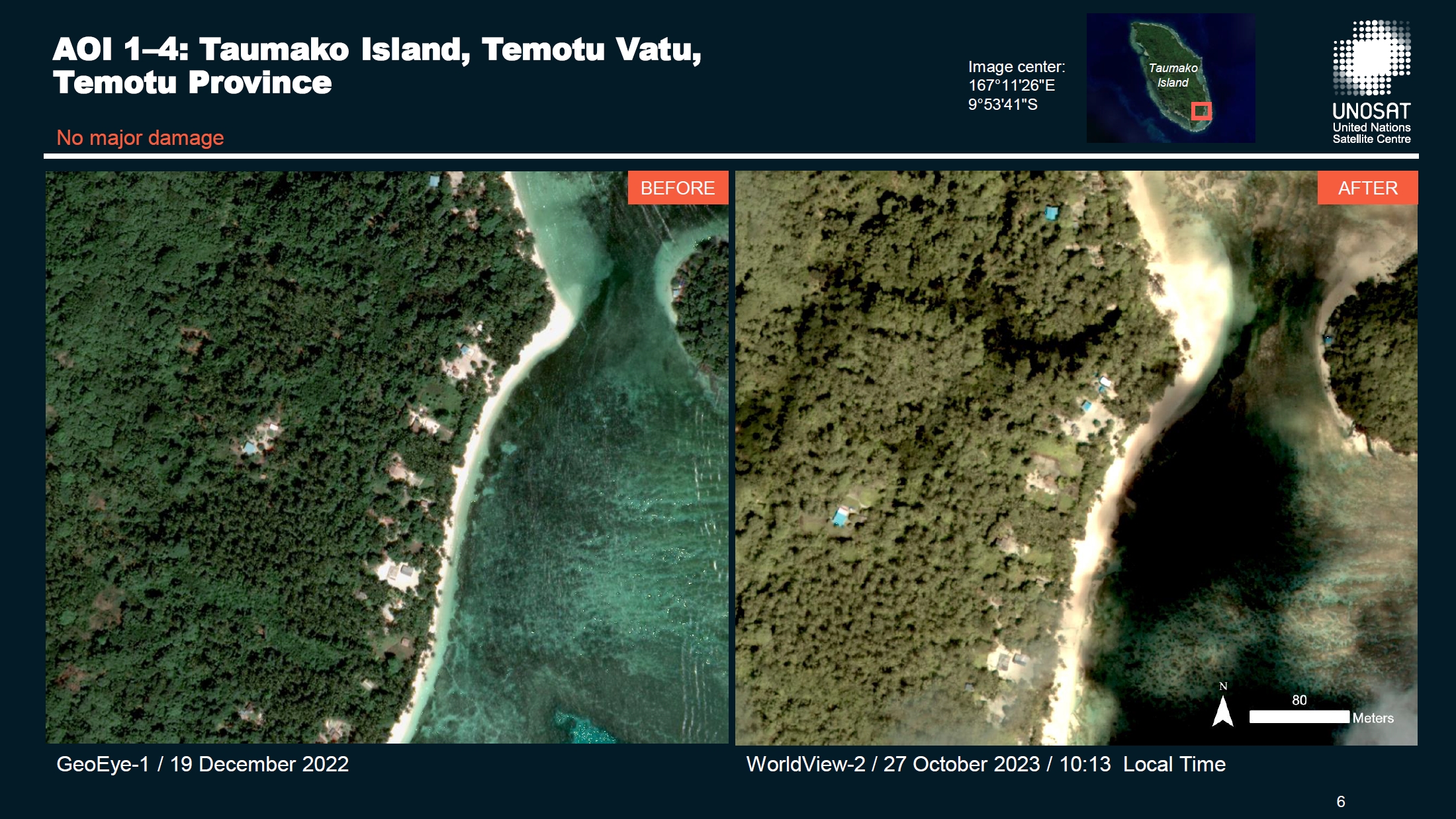
Preliminary Satellite Derived Agricultural Damage Assessment of Taumako Island, Temotu Vatu, Temotu Province, Solomon Islands
Download the Full Report
Авторские права: WorldView © (2023) DigitalGlobe, Inc., Longmont CO USA 80503. DigitalGlobe and the DigitalGlobe logos are trademarks of DigitalGlobe, Inc. The use and/or dissemination of this data and/or of any product in any way derived there from are restricted. Unauthorized use and/or dissemination is prohibited.
GeoEye-1 © 2004 GeoEye NextView License.
Map produced by UNITAR/UNOSAT
Information about the Product
Получено: WorldView-2: 27/10/2023
WorldView-3: 06/06/2022
GeoEye-1: 19/12/2022
Источник: WorldView-2, WorldView-3 and GeoEye-1
Категория: Delineation Map
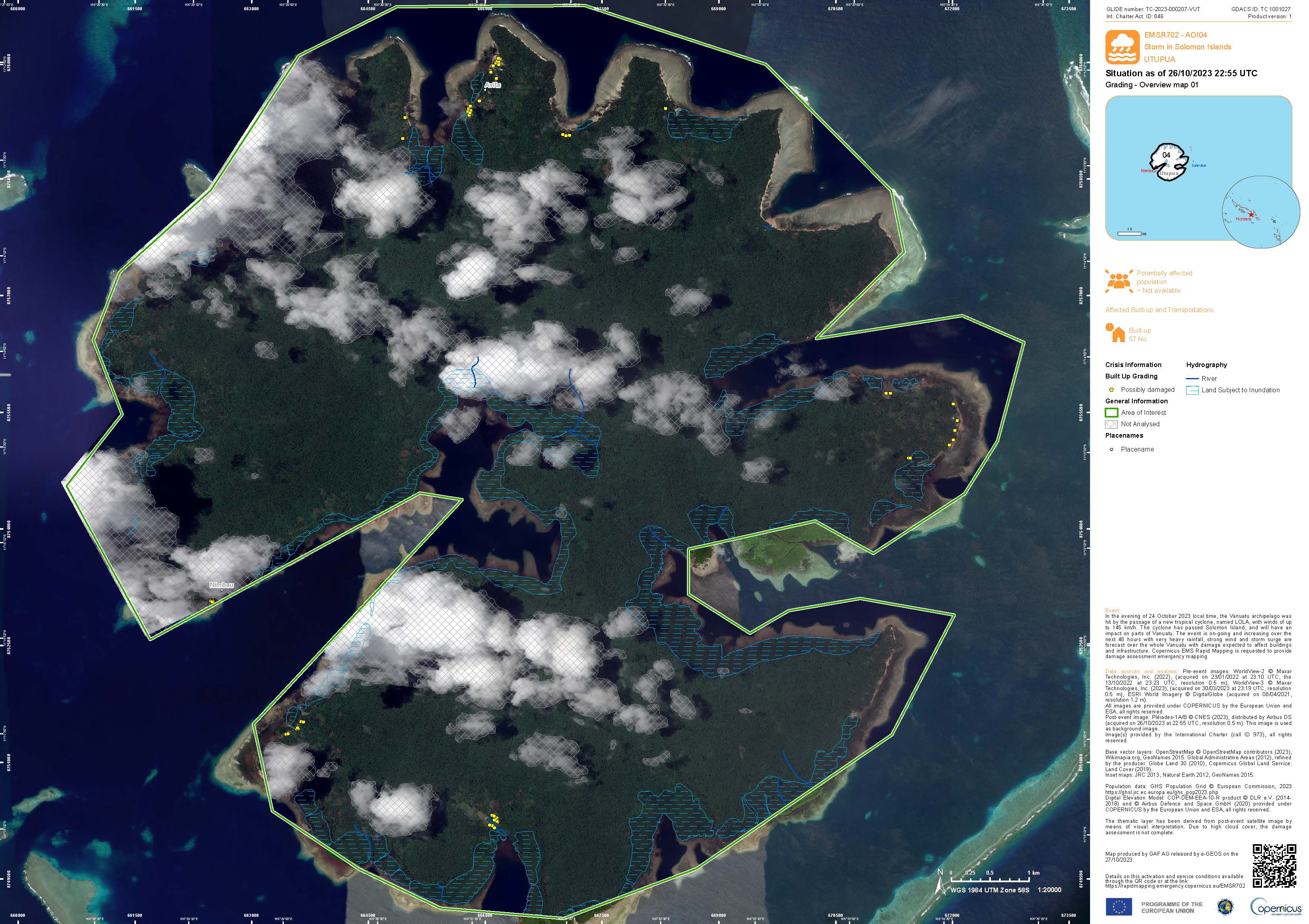
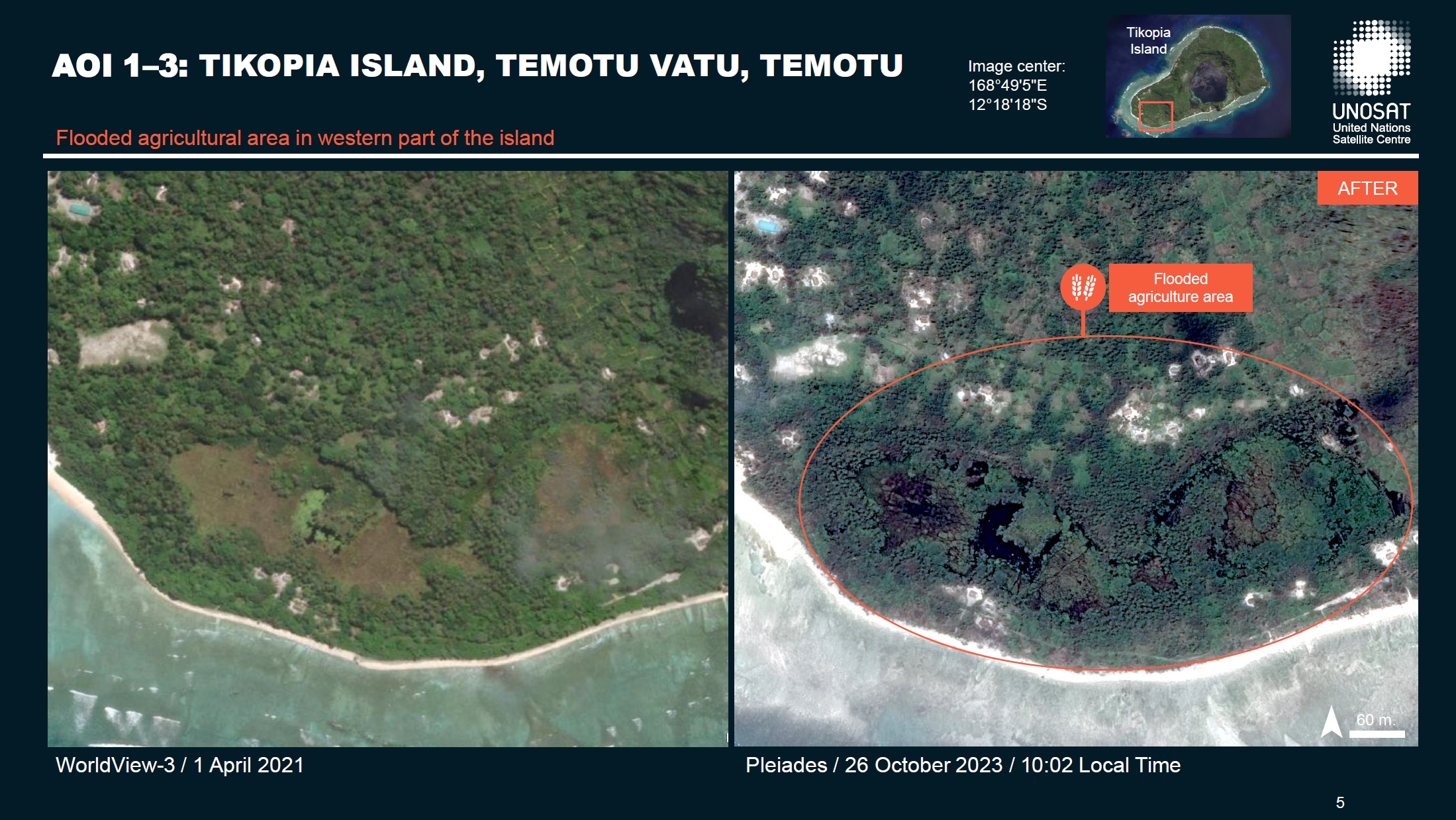
Preliminary Satellite Derived Agricultural Damage Assessment on the Islands of Tikopia, Naunonga, Utupua and Temotu-Nende, Temotu Province, Solomon Islands.
Download the Full Report
Авторские права: WorldView © (2023) DigitalGlobe, Inc., Longmont CO USA 80503.
DigitalGlobe and the DigitalGlobe logos are trademarks of DigitalGlobe, Inc. The use and/or dissemination of this data and/or of any product in any way derived there from are restricted. Unauthorized use and/or dissemination is prohibited.
Includes Pleiades material © CNES (2023), Distribution Airbus DS.
Report produced by UNITAR/UNOSAT
Information about the Product
Получено: WorldView-2: 10/12/2017, 22/05/2020, 20/02/2021, 05/08/2021 and 28/11/2021
WorldView-3: 01/04/2021 and 08/04/2021
Pleiades: 25/10/2023 and 26/10/2023
Источник: WorldView-2, WorldView-3 and Pleiades
Категория: Dossier
Preliminary Satellite Derived Damage Assessment of the Utupua and Tikopia Islands, Temotu Province, Solomon Islands
Download the Full Report
Авторские права: Includes Pleiades material © CNES (2023), Distribution Airbus DS.
Report produced by UNITAR/UNOSAT.
Information about the Product
Получено: 25/10/2023
Источник: Pleiades
Категория: Dossier
Preliminary Satellite Derived Damage Assessment of the Temotu-Nende and Temotu Vatu Islands, Temotu Province, Solomon Islands
Download the Full Report
Авторские права: Includes Pleiades material © CNES (2023), Distribution Airbus DS.
Report produced by UNITAR/UNOSAT.
Information about the Product
Получено: 24/10/2023
Источник: Pleiades
Категория: Reference Map
 Вернуться к полному архиву активаций

