 English
 Spanish
 French
 Chinese
 Russian
 Portuguese
 Последняя Активация
Charter activations
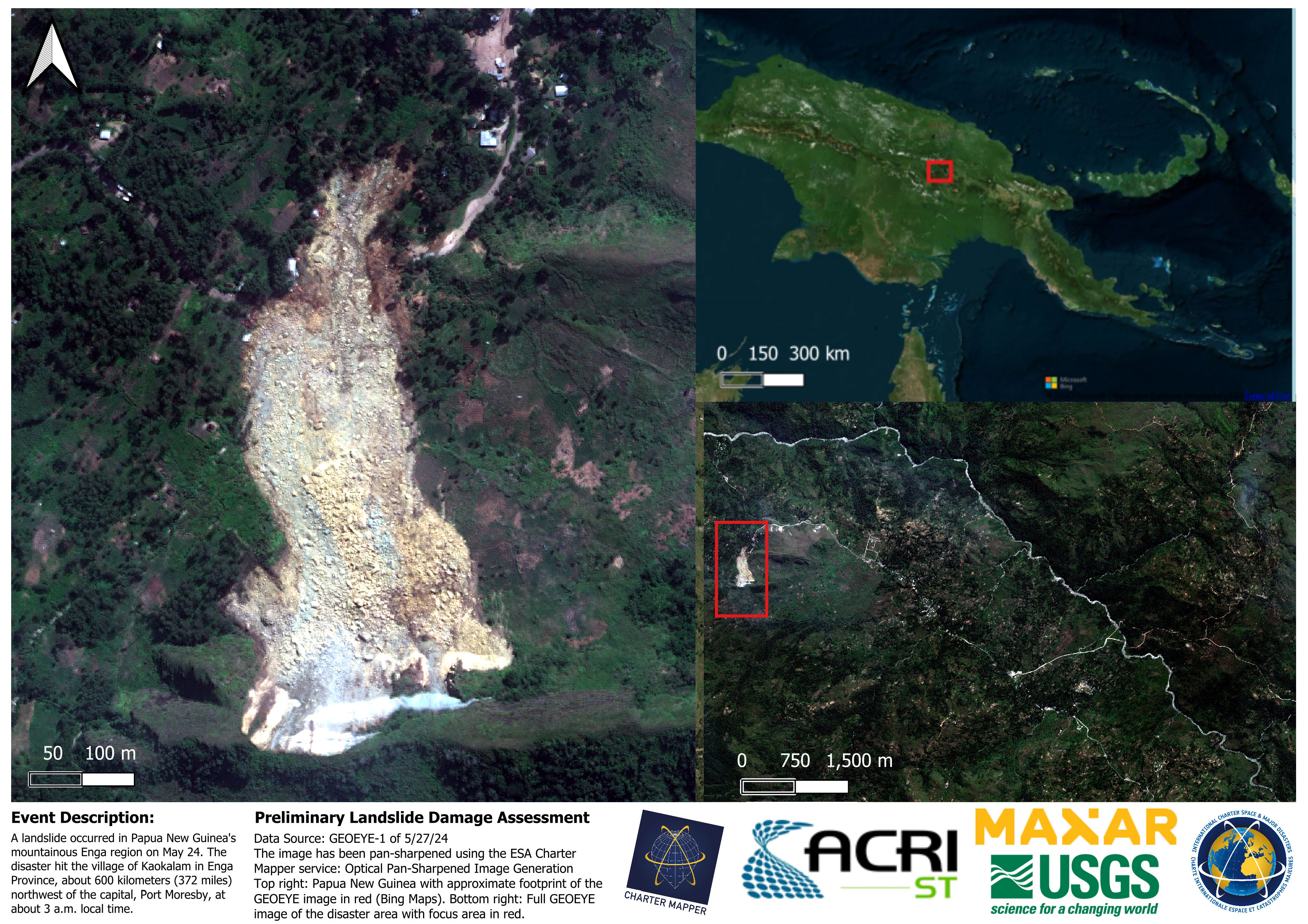
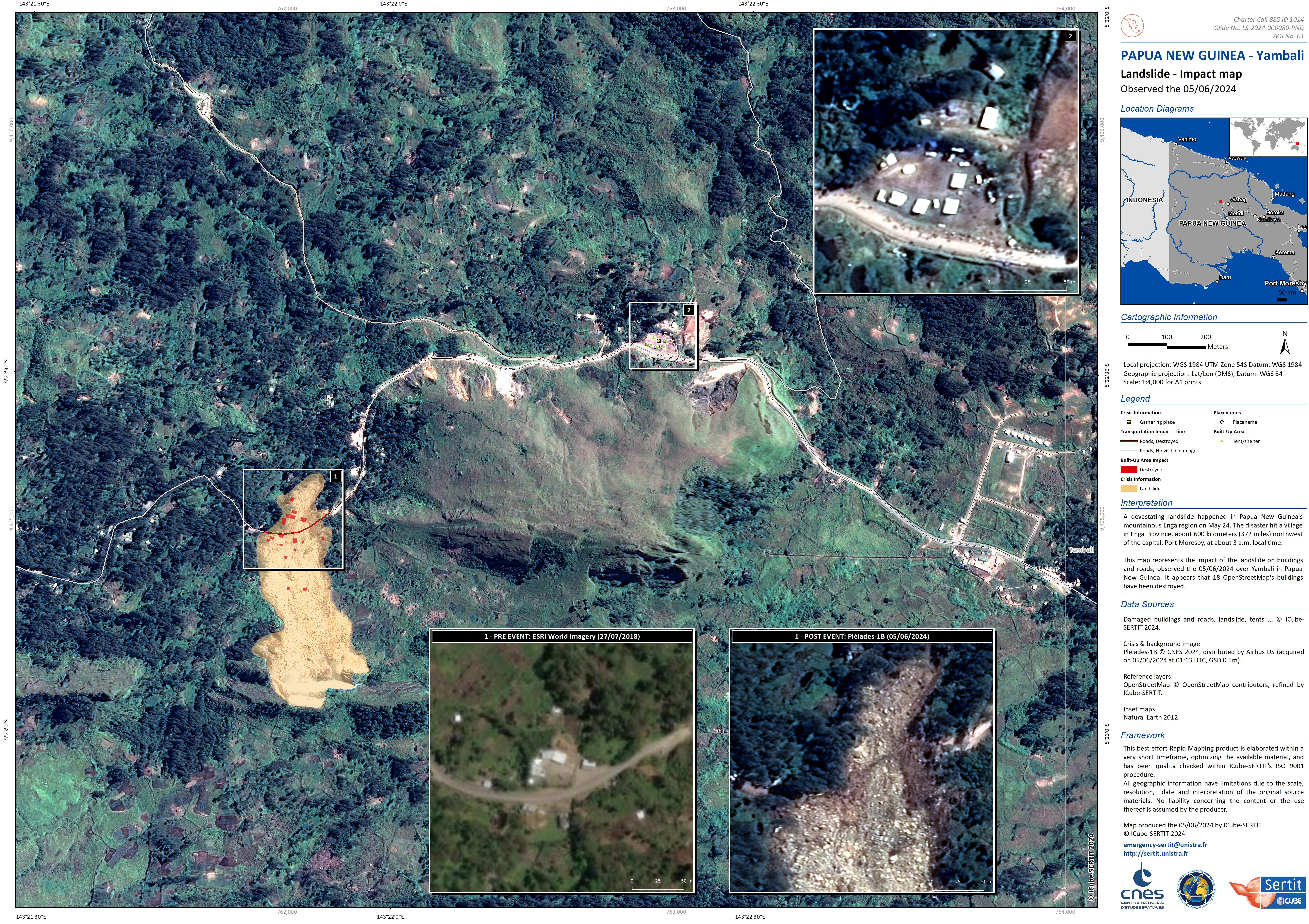
Landslide in Papua New Guinea
A devastating landslide happened in Papua New Guinea's mountainous Enga region on May 24. The disaster hit the village of Kaokalam in Enga Province, about 600 kilometers (372 miles) northwest of the capital, Port Moresby, at about 3 a.m. local time.
More than 100 people are feared dead and as many as 2,000 people are feared to have been buried after the landslide flattened homes and buried people alive while they were sleeping.
Rescue teams have been slow to reach the site because of the treacherous terrain and tribal unrest forcing the military to escort convoys of relief teams. The remoteness of the affected village, home to nearly 4,000, is also a factor that is hindering search and rescue efforts.
Related Resources:
| Тип события: | landslide |
| Место события: | Papua New Guinea |
| Date of Charter Activation: | 2024-05-30 |
| Время активации Хартии: | 07:43 |
| TЧасовой пояс в районе активации Хартии: | UTC+12:00 |
| Запрос на активацию поступил от: | NEMA on behalf of Ministry of Foreign Affairs and Trade (NZ) |
| Номер активации: | 885 |
| Менеждер проекта от: | Kate Burns (NEMA) |
| act-value-adders: | Zachary Foltz (ACRI-ST) Alessandro Novellino (British Geological Survey) SERTIT Rapid Mapping Service (SERTIT Rapid Mapping Service) Ian Hamling (GNS Science) Salman Ashraf (GNS Science) |
Products
Quickviews
Quickviews are produced for illustration purposes only and do not contain any verified analysis of the disaster.


The landslide in Papua New Guinea's mountainous Enga region can be seen in the GeoEye-1 post-event image on 27 May 2024. The pre-event image is from the Gaofen-2 satellite on 28 November 2022
Copyrights: © 2024 GeoEye NextView License
© CNSA/CRESDA (2022)
Information about the Quickview
Acquired: 28-11-2022 / 27-05-2024
Source(s): Gaofen-2 / GeoEye-1
 Вернуться к полному архиву активаций

