Последняя Активация
Charter activations
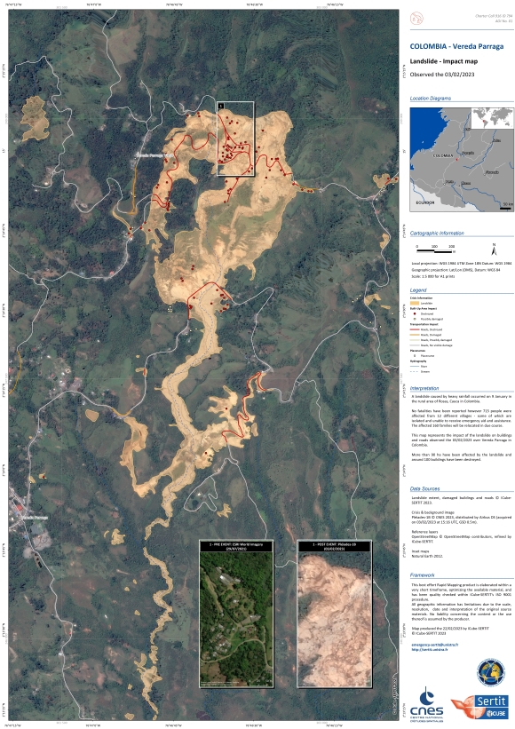
Landslide in Colombia
A landslide caused by heavy rainfall occurred on 9 January in the rural area of Rosas, Cauca in Colombia.
No fatalities have been reported however 715 people were affected from 12 different villages - some of which are isolated and unable to receive emergency aid and assistance. The affected 160 families will be relocated in due course.
In addition, the Pan-American Highway, between Popayan (Cauca) and Pasto (Narino), was blocked by the landslide hence inhibiting the movement of food and other essential supplies.
| Тип события: | Landslide |
| Место события: | Colombia |
| Date of Charter Activation: | 2023-01-16 |
| Время активации Хартии: | 08:51 |
| TЧасовой пояс в районе активации Хартии: | UTC-05:00 |
| Запрос на активацию поступил от: | National Unit for Disaster Risk Management (UNGRD) |
| Номер активации: | 794 |
| Менеждер проекта от: | Carlos Laverde (Servicio Geologico Colombiano) |
 Вернуться к полному архиву активаций

 English
 Spanish
 French
 Chinese
 Russian
 Portuguese


