 English
 Spanish
 French
 Chinese
 Russian
 Portuguese
 Последняя Активация
Charter activations
Floods in Chanthaburi Province, Thailand
Heavy rains, which began on 21 July 2013, have resulted in flooding across Chanthaburi Province, Thailand. Two people have been reported killed in the flooding, and it is estimated that more than 10,000 people have been affected.
By 25 July, the floodwaters have reached as high as one metre in some areas, and there are concerns that water run-off from neighbouring provinces will lead to more flooding. The province is also on high-alert due to the increasing water level of the Chanthaburi River.
Due to the flooding, the worst-affected districts have been evacuated and some roads have been closed. The governor of the province has ordered the reinforcement of flood prevention measures in an attempt to stem further flooding, and the army has been mobilised to conduct rescue operations.
| Тип события: | Flood |
| Место события: | Chanthaburi Province, Thailand |
| Date of Charter Activation: | 25 July 2013 |
| Запрос на активацию поступил от: | Asia Disaster Reduction Center (ADRC) on behalf of GISTDA |
| Менеждер проекта от: | Asian Institute of Technology(AIT) |
Products
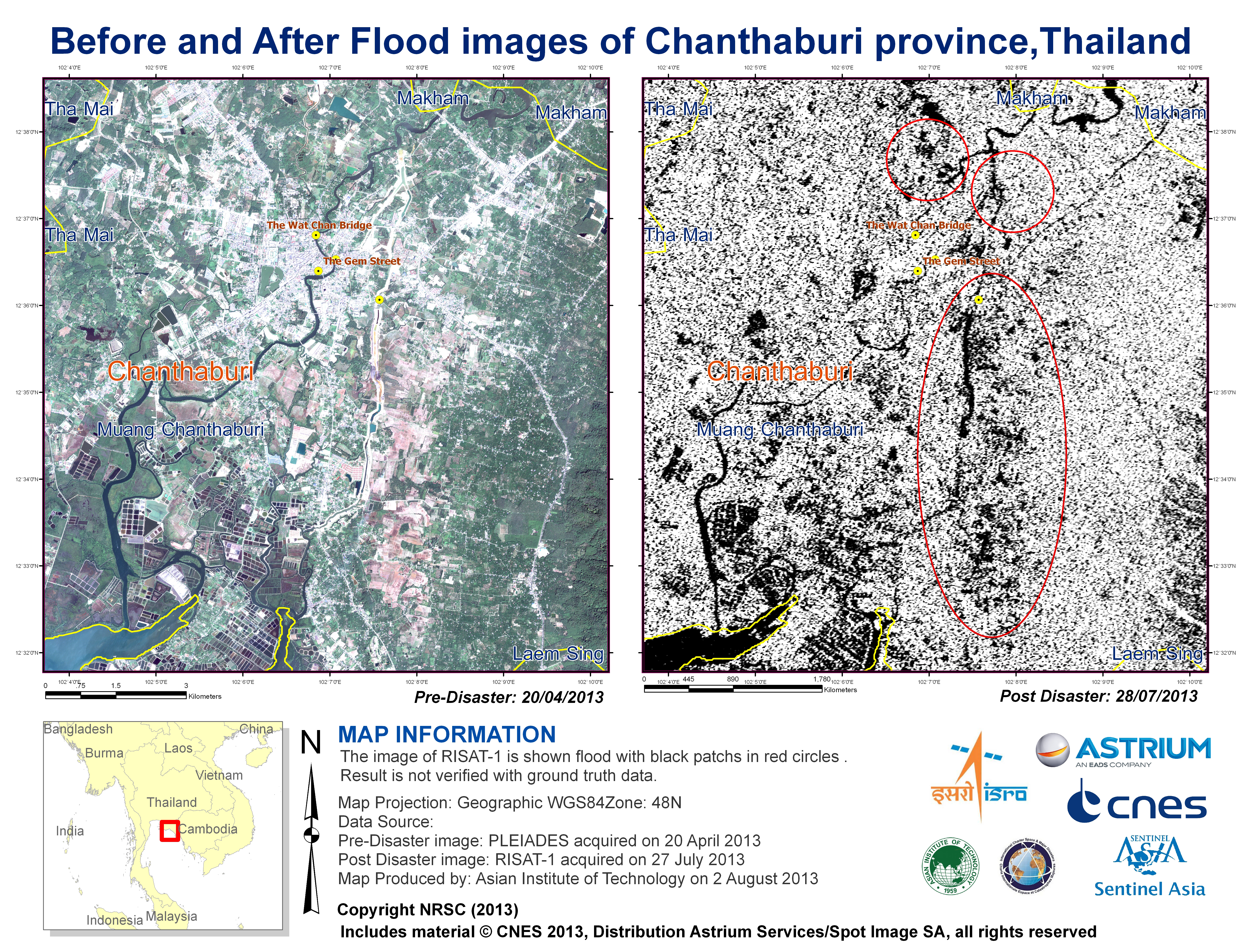
Before and after flood images of Chanthaburi province, Thailand
Авторские права: © CNES 2013, Distribution Astrium Services / Spot Image SA, all rights reserved
NRSC / ISRO (2013)
Map produced by Asian Institute of Technology (AIT)
Information about the Product
Получено: Pre-disaster: 20/04/2013
Post-disaster: 27/07/2013
Источник: Pleiades
RISAT-1
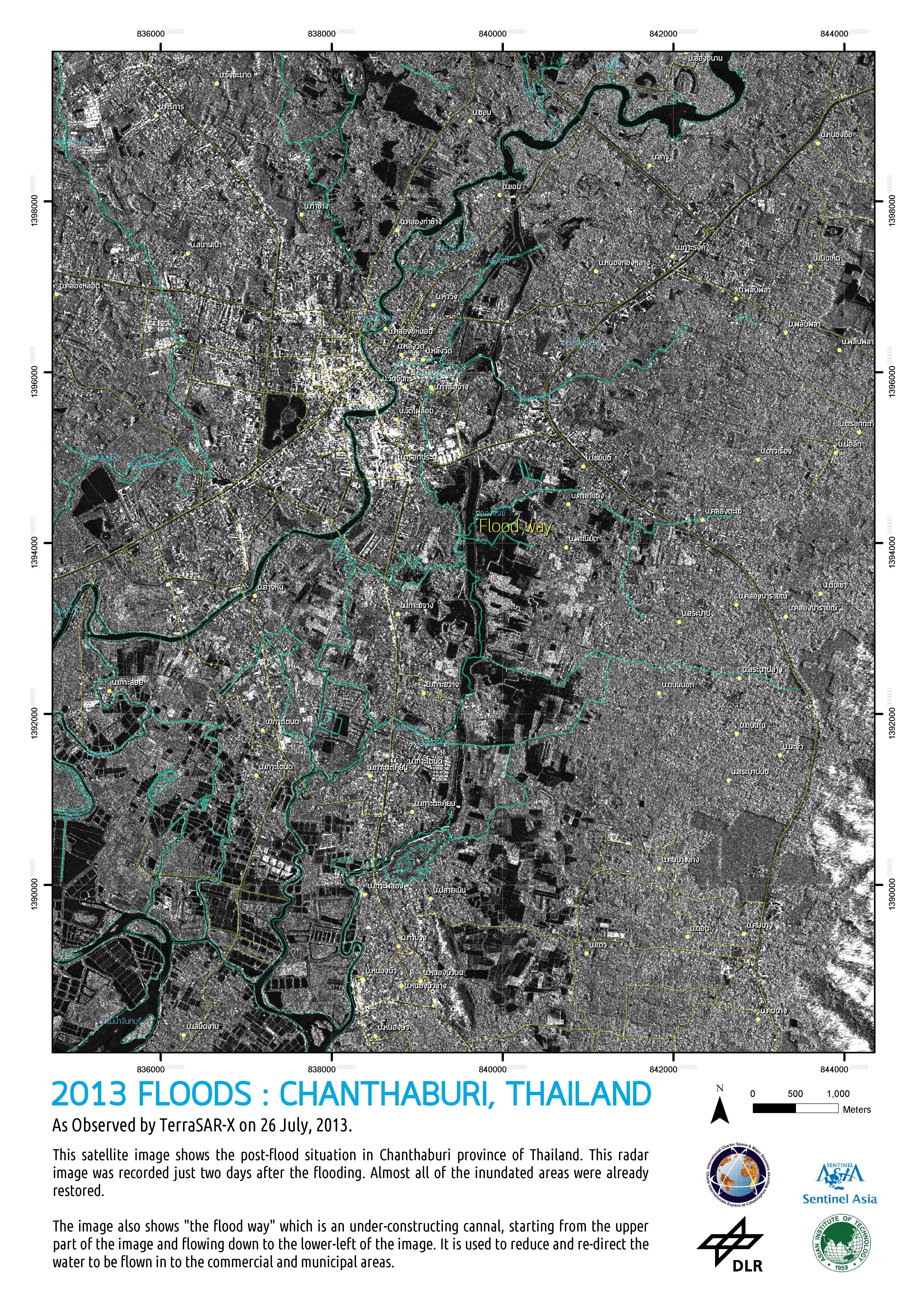
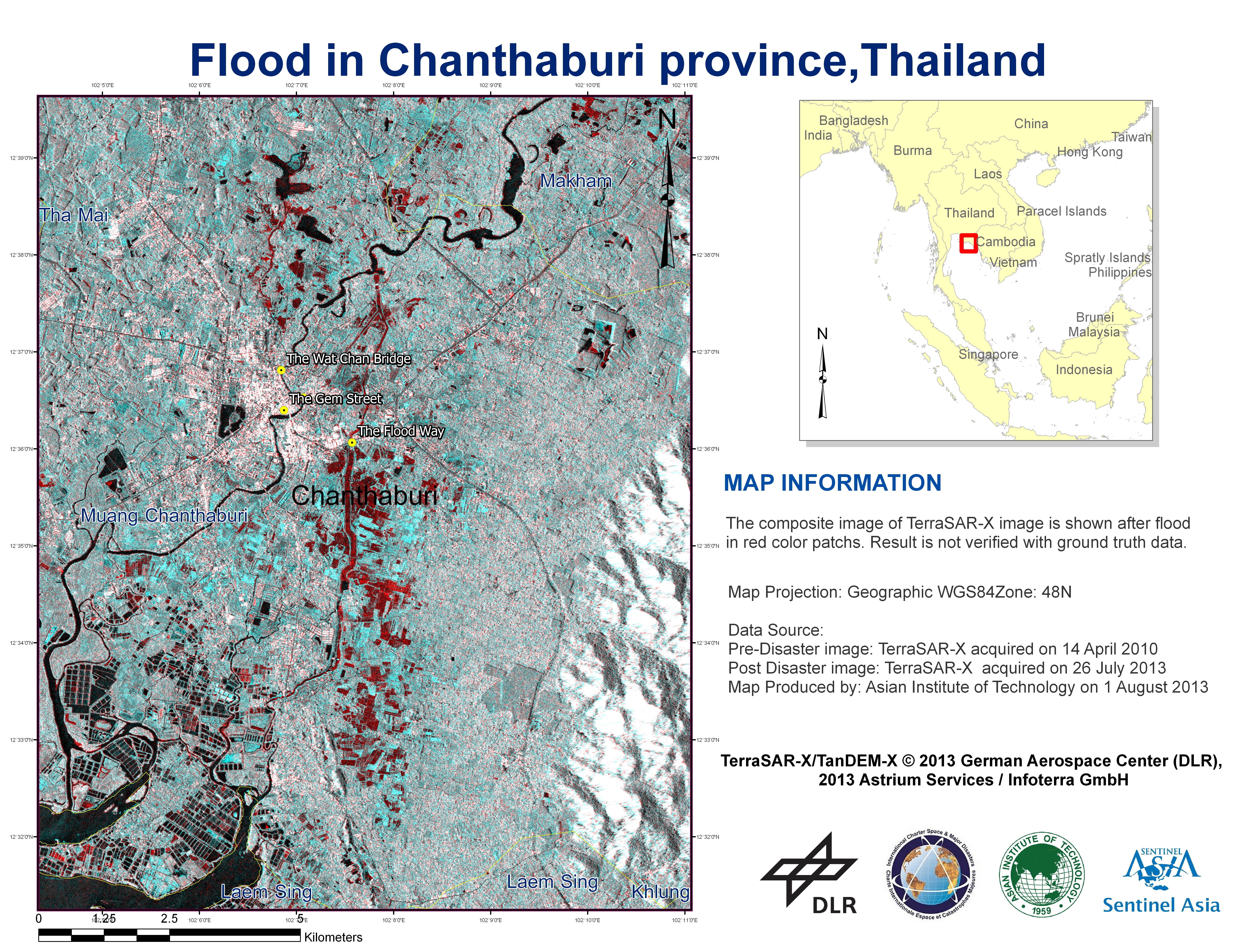
Floods in Chanthaburi Province, Thailand
Авторские права: TerraSAR-X/TanDEM-X © 2013 German Aerospace Center (DLR), 2013 Astrium Services / Infoterra GmbH
Map produced by Asian Institute of Technology
Information about the Product
Получено: Pre-disaster: 14/04/2010
Post-disaster: 26/07/2013
Источник: TerraSAR-X
 Вернуться к полному архиву активаций

