Charter activations
Flooding in Chile
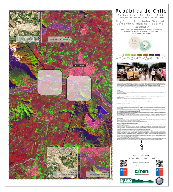
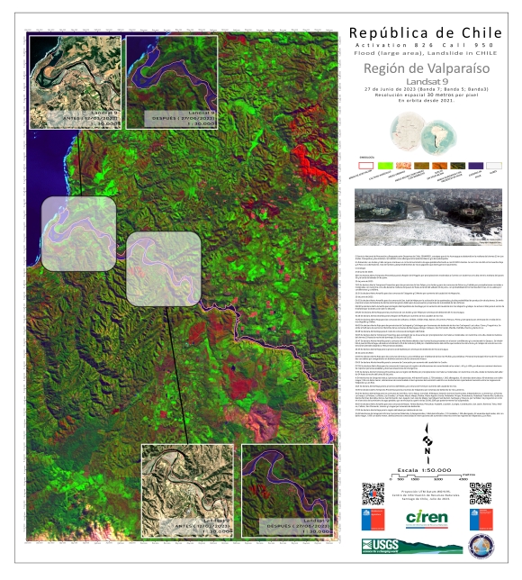
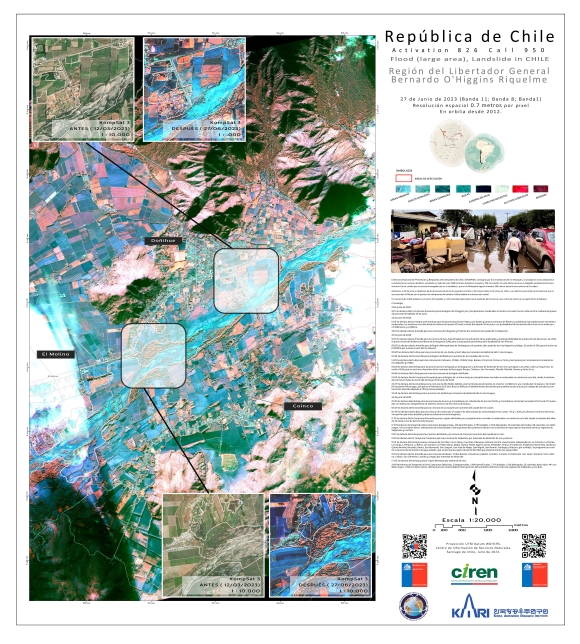
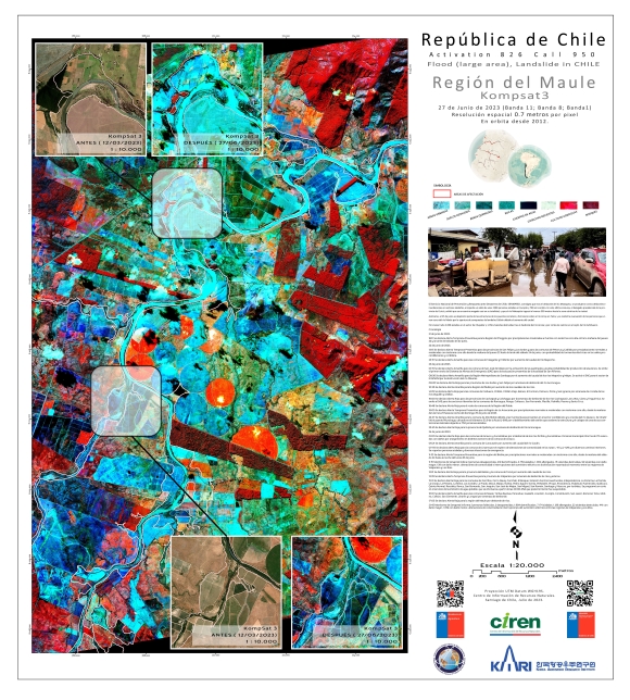
Days of heavy rainfall swelled Chile's rivers, causing deadly widespread floods as the country sees the worst weather front in a decade.
The deluge blocked roads, prompted an evacuation in the centre of the country and a red alert has been issued by The Meteorological Directorate of Chile in some regions, warning of further heavy rains and the possibility of landslides.
The rains come just a few months after a period of wildfires amid a severe drought that destroyed hundreds of homes and left dozens of people dead.
| Тип события: | Floods |
| Место события: | Chile |
| Date of Charter Activation: | 2023-06-28 |
| Время активации Хартии: | 15:21 |
| TЧасовой пояс в районе активации Хартии: | UTC-04:00 |
| Запрос на активацию поступил от: | Ministry of Interior and Public Safety (ONEMI) |
| Номер активации: | 826 |
| Менеждер проекта от: | Marcelo Duran (Natural Resources Information Center (CIREN)) |
Products
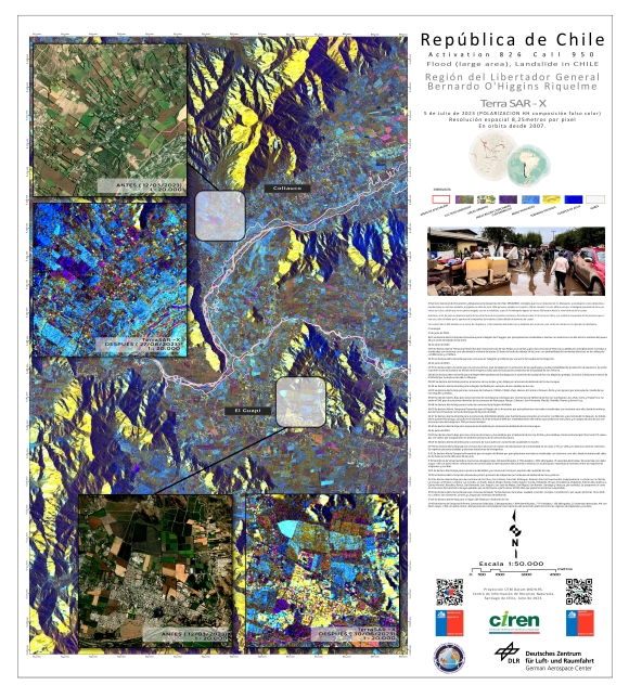
Areas affected by Flooding and Landslides in the O'Higgins Region, El Guapi, Chile
Авторские права: © DLR e.V. (2010), Distribution Airbus DS Geo GmbH.
Map produced by the Natural Resources Information Centre (CIREN).
Information about the Product
Получено: 12/03/2023, 27/06/2023, 30/06/2023, 05/07/2023
Источник: TerraSAR-X
Категория: Delineation Map
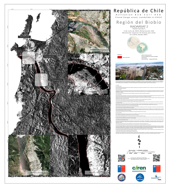
Areas affected by Flooding and Landslides in the BioBio Region, Concepcion, Chile
Авторские права: RADARSAT-2 Data and Products © Maxar Technologies Ltd. (2023) – All Rights Reserved.
RADARSAT is an official mark of the Canadian Space Agency.
Map produced by the Natural Resources Information Centre (CIREN).
Information about the Product
Получено: 22/07/2023
Источник: RADARSAT-2
Категория: Delineation Map
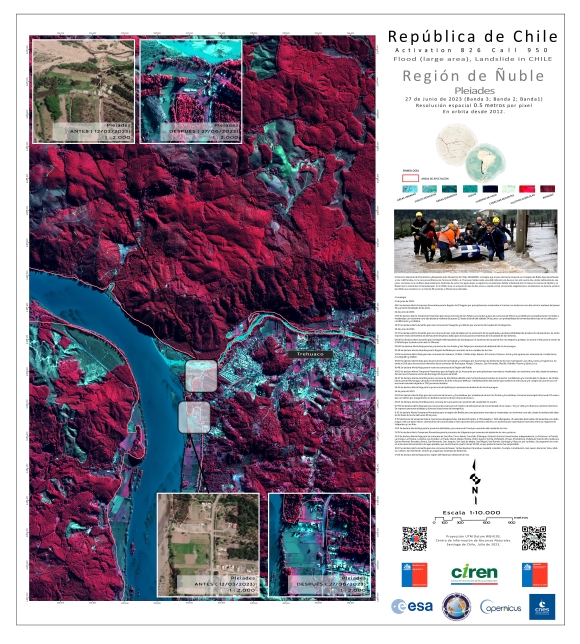
Areas affected by Flooding and Landslides in the Ñuble Region, Treguaco, Chile
Авторские права: Includes Pleiades material © CNES (2023), Distribution Airbus DS.
Map produced by the Natural Resources Information Centre (CIREN).
Information about the Product
Получено: 08/07/2023
Источник: Pleiades
Категория: Delineation Map
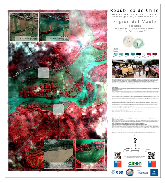
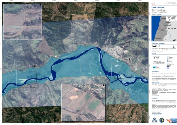
Areas affected by Flooding and Landslides in the Maule Region, Hualane, Chile
Авторские права: Includes Pleiades material © CNES (2023), Distribution Airbus DS.
Map produced by the Natural Resources Information Centre (CIREN).
Information about the Product
Получено: 06/07/2023
Источник: Pleiades
Категория: Delineation Map
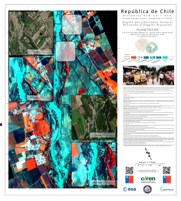
Areas affected by Flooding and Landslides in the city of Las Cabras in the O'Higgins Region, Chile
Авторские права: © Planet Labs Inc. (2023)
Map produced by the Natural Resources Information Centre (CIREN).
Information about the Product
Получено: 05/07/2023
Источник: PlanetScope
Категория: Delineation Map
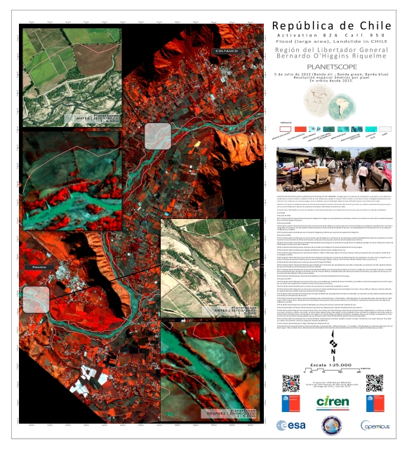
Areas affected by Flooding and Landslides in the city of Doñihue in the O'Higgins Region, Chile
Авторские права: © Planet Labs Inc. (2023)
Map produced by the Natural Resources Information Centre (CIREN).
Information about the Product
Получено: 05/07/2023
Источник: PlanetScope
Категория: Delineation Map
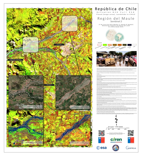
Areas affected by Flooding and Landslides in the Talhuenes area of the Maule Region, Chile
Авторские права: Contains modified Copernicus Sentinel data (2023)
Map produced by the Natural Resources Information Centre (CIREN).
Information about the Product
Получено: 29/06/2023
Источник: Sentinel-2
Категория: Delineation Map
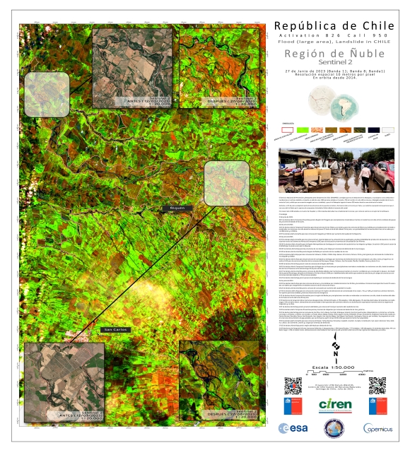
Areas affected by Flooding and Landslides in the Ñuble Region, Ñiquen, Chile
Авторские права: Contains modified Copernicus Sentinel data (2023)
Map produced by the Natural Resources Information Centre (CIREN).
Information about the Product
Получено: 29/06/2023
Источник: Sentinel-2
Категория: Delineation Map
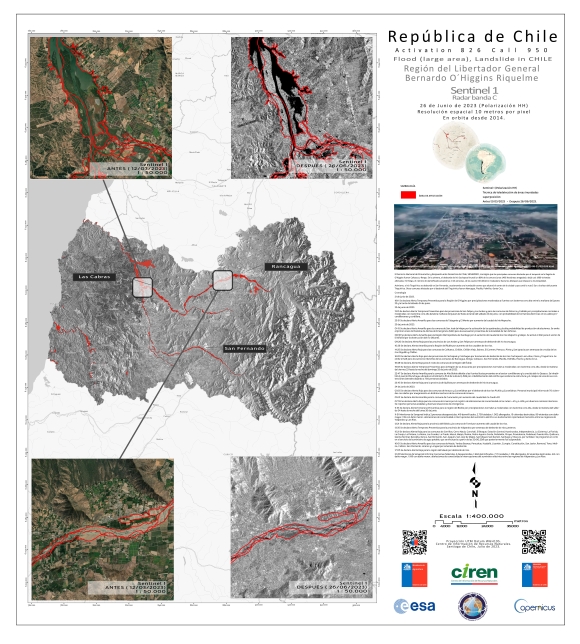
Areas affected by Flooding and Landslides in the O'Higgins Region of Chile
Авторские права: Contains modified Copernicus Sentinel data (2023)
Map produced by the Natural Resources Information Centre (CIREN).
Information about the Product
Получено: 26/06/2023
Источник: Sentinel-1
Категория: Delineation Map
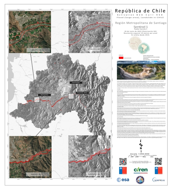
Areas affected by Flooding and Landslides in the Metropolitana Region of Chile
Авторские права: Contains modified Copernicus Sentinel data (2023)
Map produced by the Natural Resources Information Centre (CIREN).
Information about the Product
Получено: 26/06/2023
Источник: Sentinel-1
Категория: Delineation Map
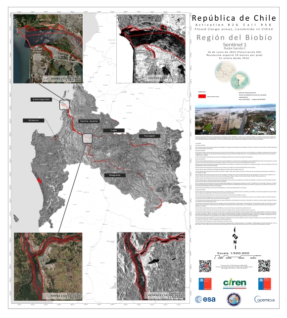
Areas affected by Flooding and Landslides in the BioBio Region, Chile
Авторские права: Contains modified Copernicus Sentinel data (2023)
Map produced by the Natural Resources Information Centre (CIREN).
Information about the Product
Получено: 26/06/2023
Источник: Sentinel-1
Категория: Delineation Map
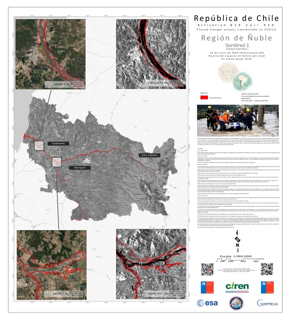
Areas affected by Flooding and Landslides in the Ñuble Region of Chile
Авторские права: Contains modified Copernicus Sentinel data (2023)
Map produced by the Natural Resources Information Centre (CIREN).
Information about the Product
Получено: 26/06/2023
Источник: Sentinel-1
Категория: Delineation Map
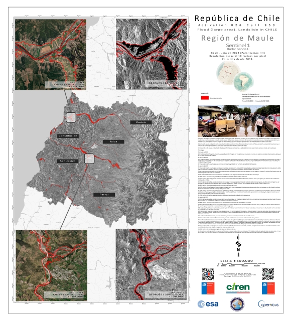
Areas affected by Flooding and Landslides in the Maule Region, Chile
Авторские права: Contains modified Copernicus Sentinel data (2023)
Map produced by the Natural Resources Information Centre (CIREN).
Information about the Product
Получено: 26/06/2023
Источник: Sentinel-1
Категория: Delineation Map
 Вернуться к полному архиву активаций

 English
 Spanish
 French
 Chinese
 Russian
 Portuguese
