Charter activations
Hurricane John in Mexico
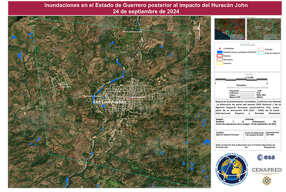
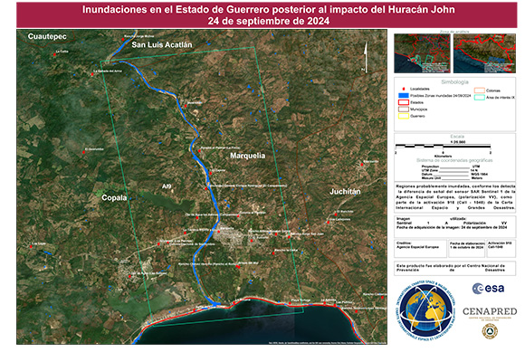
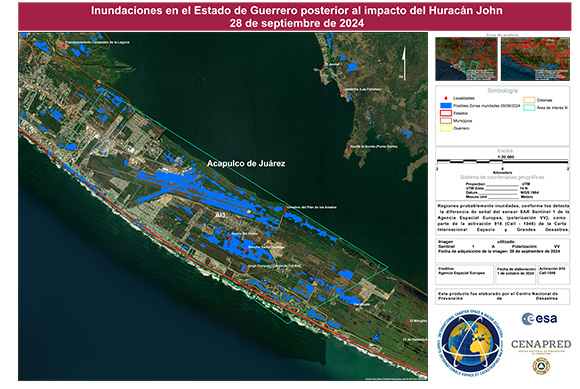
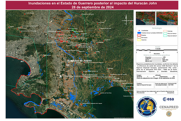
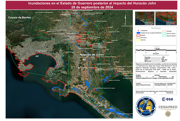
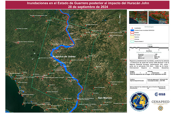
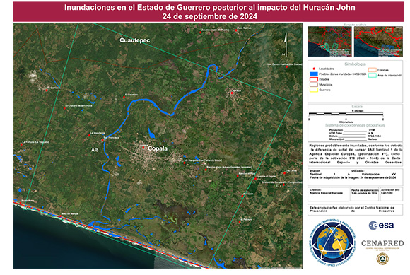
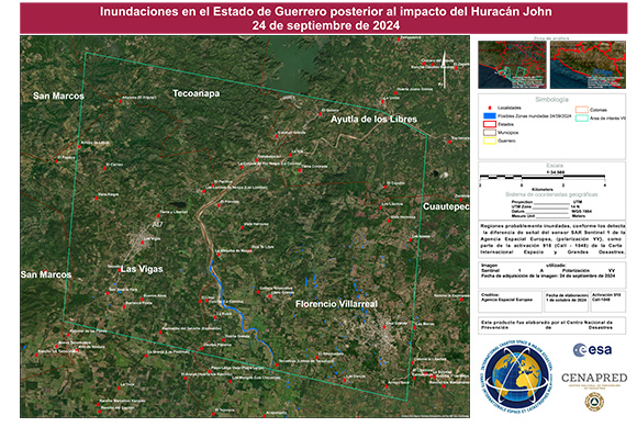
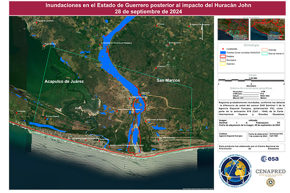
On the evening of 23 September, Hurricane John hit the southern coast state of Guerrero, Mexico. The category 3 hurricane then continued along the coast, causing flooding in different towns, including the tourist city of Acapulco.
Hurricane John brought four days of rain, the National Water Commission recorded rainfall of 1000 mm over 3 days, which caused flooding with water levels as high as 2 metres in neighbourhoods near rivers and streams. Many people were trapped in their homes due to flooding.
Emergency response teams in the resort city of Acapulco carried out rescue operations by boat, jet ski and helicopter, and residents waded through roads flooded up to waist height. At least 22 people have died, many due to mudslides that crushed houses.
| Тип события: | Flood |
| Место события: | Mexico |
| Date of Charter Activation: | 2024-09-28 |
| Время активации Хартии: | 12:02 |
| TЧасовой пояс в районе активации Хартии: | UTC-06:00 |
| Запрос на активацию поступил от: | CENAPRED |
| Номер активации: | 918 |
| Менеждер проекта от: | Miguel Angel Cruz Pliego (CENAPRED) |
| act-value-adders: | Fernando Silva López (CENAPRED) Gustavo Domínguez Posadas (CENAPRED) Némiga Xanat Antonio (Autonomous University of Mexico State) |
Products
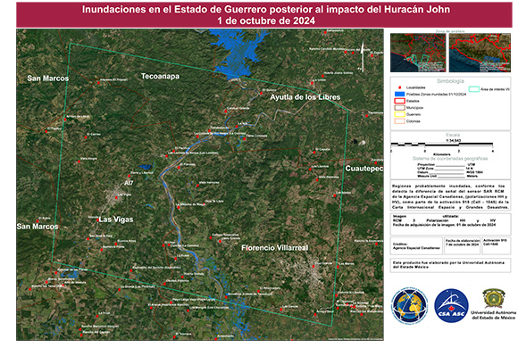
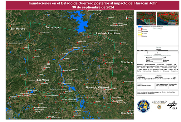
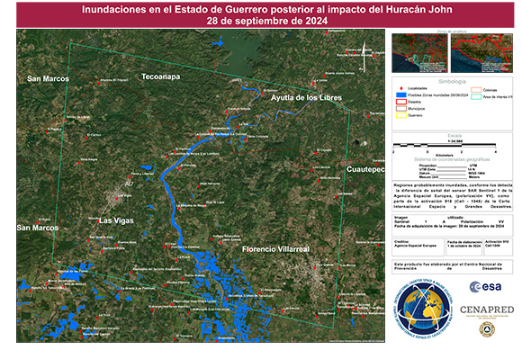
Areas flooded by Hurricane John in Florencio Villareal, Guerrero, Mexico
Авторские права: RADARSAT Constellation Mission Imagery © Government of Canada (2024) - RADARSAT is an official mark of the Canadian Space Agency
Map produced by Autonomous University of the State of Mexico
Information about the Product
Получено: 01/10/2024
Источник: RCM
Категория: Delineation Map
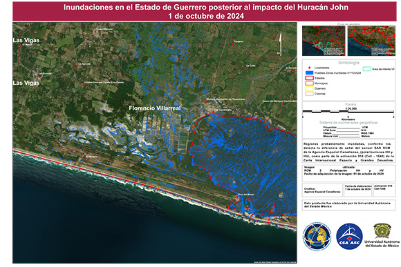
Areas affected by Hurricane John in Florencio Villareal, Guerrero, Mexico
Авторские права: RADARSAT Constellation Mission Imagery © Government of Canada (2024) - RADARSAT is an official mark of the Canadian Space Agency
Map produced by Autonomous University of the State of Mexico
Information about the Product
Получено: 01/10/2024
Источник: RCM
Категория: Delineation Map
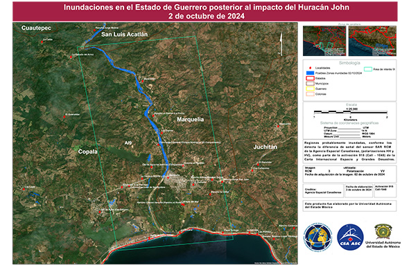
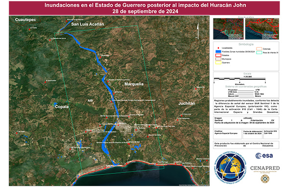
Areas flooded by Hurricane John in Marquelia, Guerrero, Mexico
Авторские права: RADARSAT Constellation Mission Imagery © Government of Canada (2024) - RADARSAT is an official mark of the Canadian Space Agency
Autonomous University of the State of Mexico
Information about the Product
Получено: 02/10/2024
Источник: RCM
Категория: Delineation Map
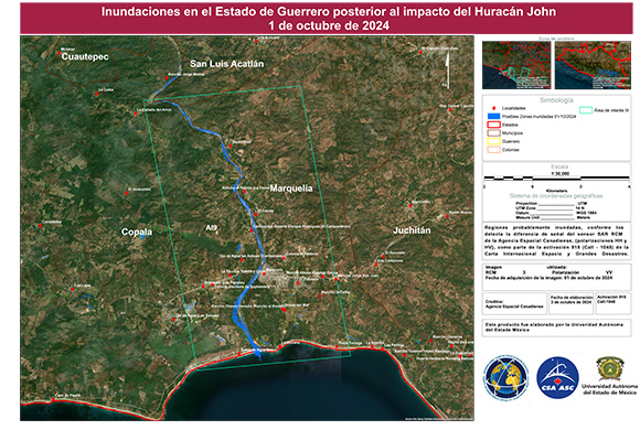
Areas affected by Hurricane John in Marquelia, Guerrero, Mexico
Авторские права: RADARSAT Constellation Mission Imagery © Government of Canada (2024) - RADARSAT is an official mark of the Canadian Space Agency
Map produced by Autonomous University of the State of Mexico
Information about the Product
Получено: 01/10/2024
Источник: RCM
Категория: Delineation Map
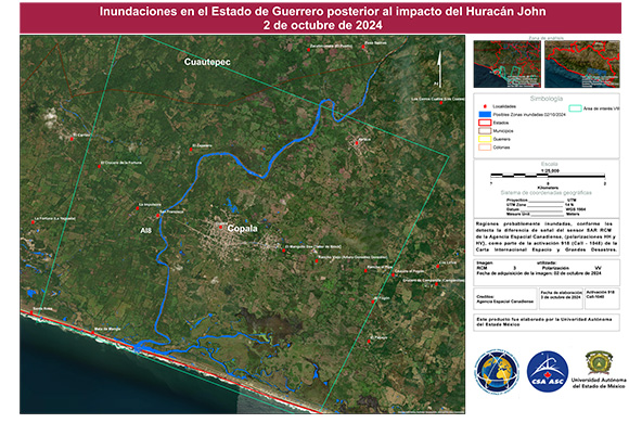
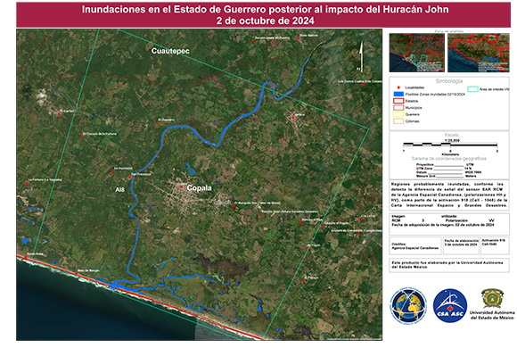
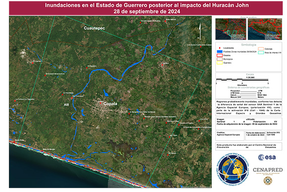
Areas affected by Hurricane John in Copala, Guerrero, Mexico
Авторские права: RADARSAT Constellation Mission Imagery © Government of Canada (2024) - RADARSAT is an official mark of the Canadian Space Agency
Map produced by Autonomous University of the State of Mexico
Information about the Product
Получено: 02/10/2024
Источник: RCM
Категория: Delineation Map
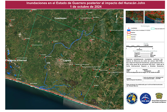
Result of Hurricane John, Flooded area near Copala, Guerrero, Mexico
Авторские права: RADARSAT Constellation Mission Imagery © Government of Canada (2024) - RADARSAT is an official mark of the Canadian Space Agency
Map produced by Autonomous University of the State of Mexico
Information about the Product
Получено: 01/10/2024
Источник: RCM
Категория: Delineation Map
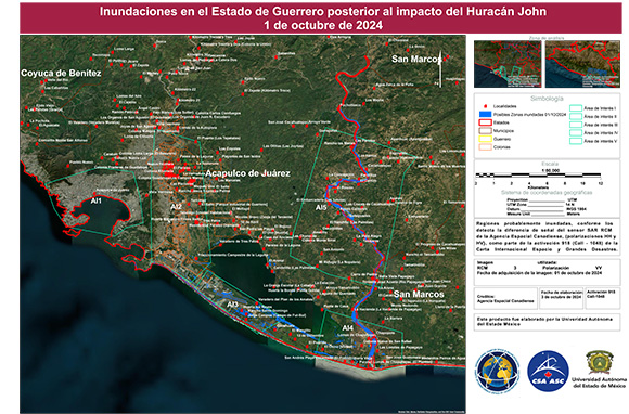
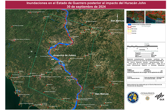
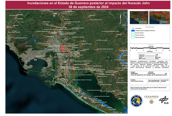
Areas affected by Hurricane John in Acapulco, Guerrero, Mexico
Авторские права: RADARSAT Constellation Mission Imagery © Government of Canada (2024) - RADARSAT is an official mark of the Canadian Space Agency
Map produced by Autonomous University of the State of Mexico
Information about the Product
Получено: 01/10/2024
Источник: RCM
Категория: Delineation Map
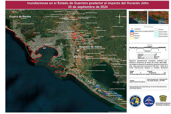
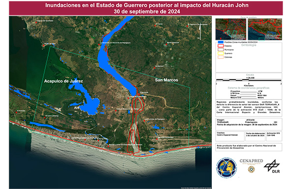
Areas flooded by Hurricane John in Acapulco, Guerrero, Mexico
Авторские права: RADARSAT Constellation Mission Imagery © Government of Canada (2024) - RADARSAT is an official mark of the Canadian Space Agency
Map produced by Autonomous University of the State of Mexico
Information about the Product
Получено: 30/09/2024
Источник: RCM
Категория: Delineation Map
 Вернуться к полному архиву активаций

 English
 Spanish
 French
 Chinese
 Russian
 Portuguese
