 English
 Spanish
 French
 Chinese
 Russian
 Portuguese
 Последняя Активация
Charter activations
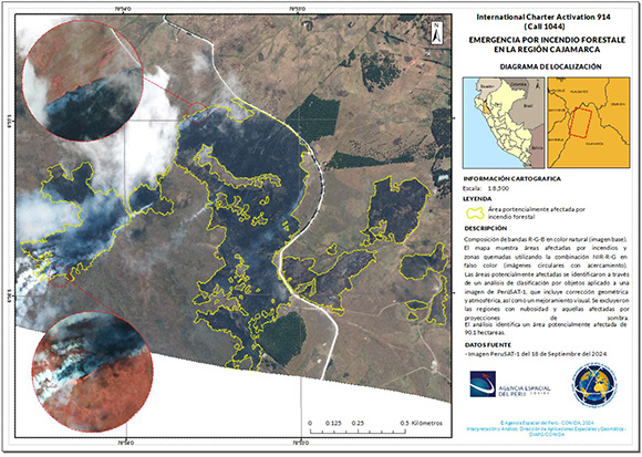
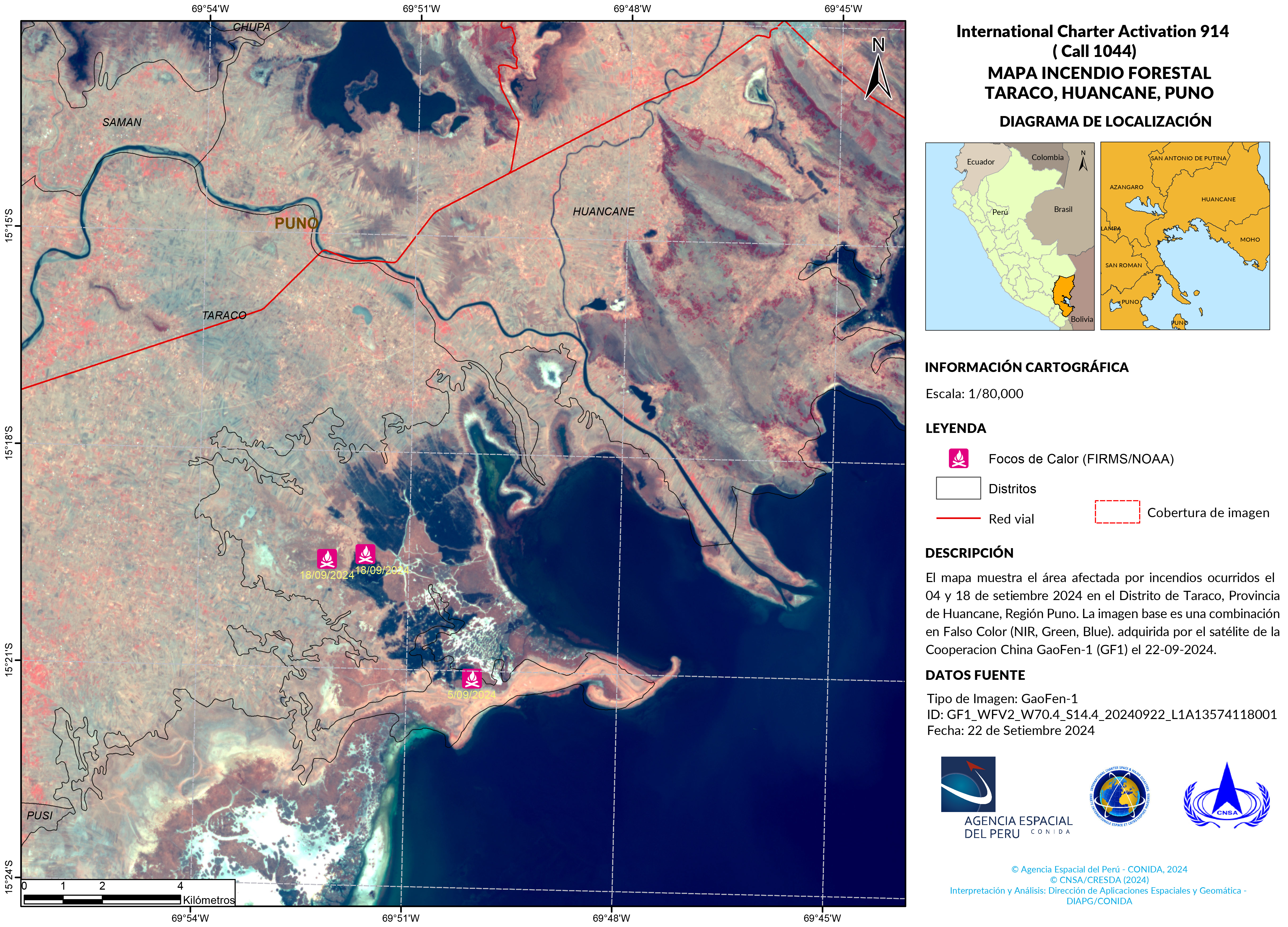
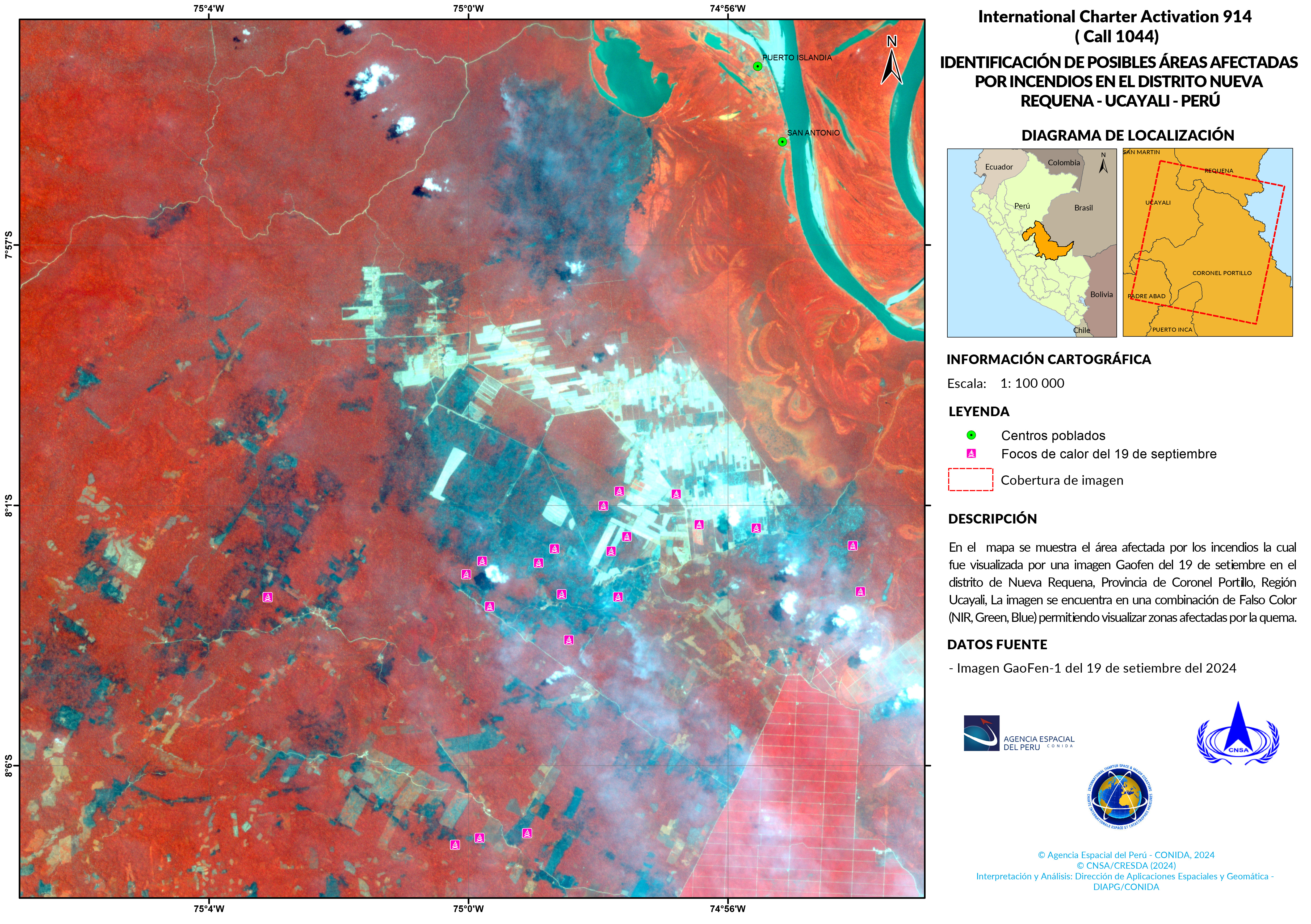
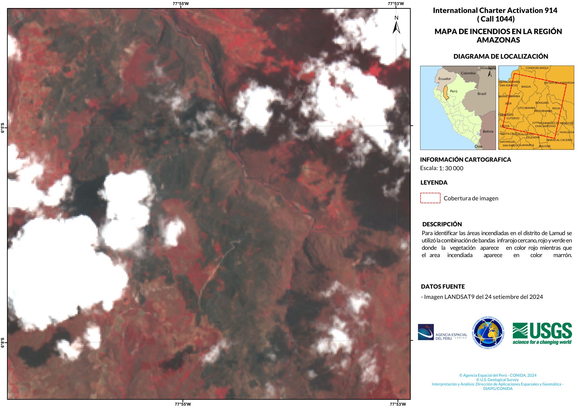
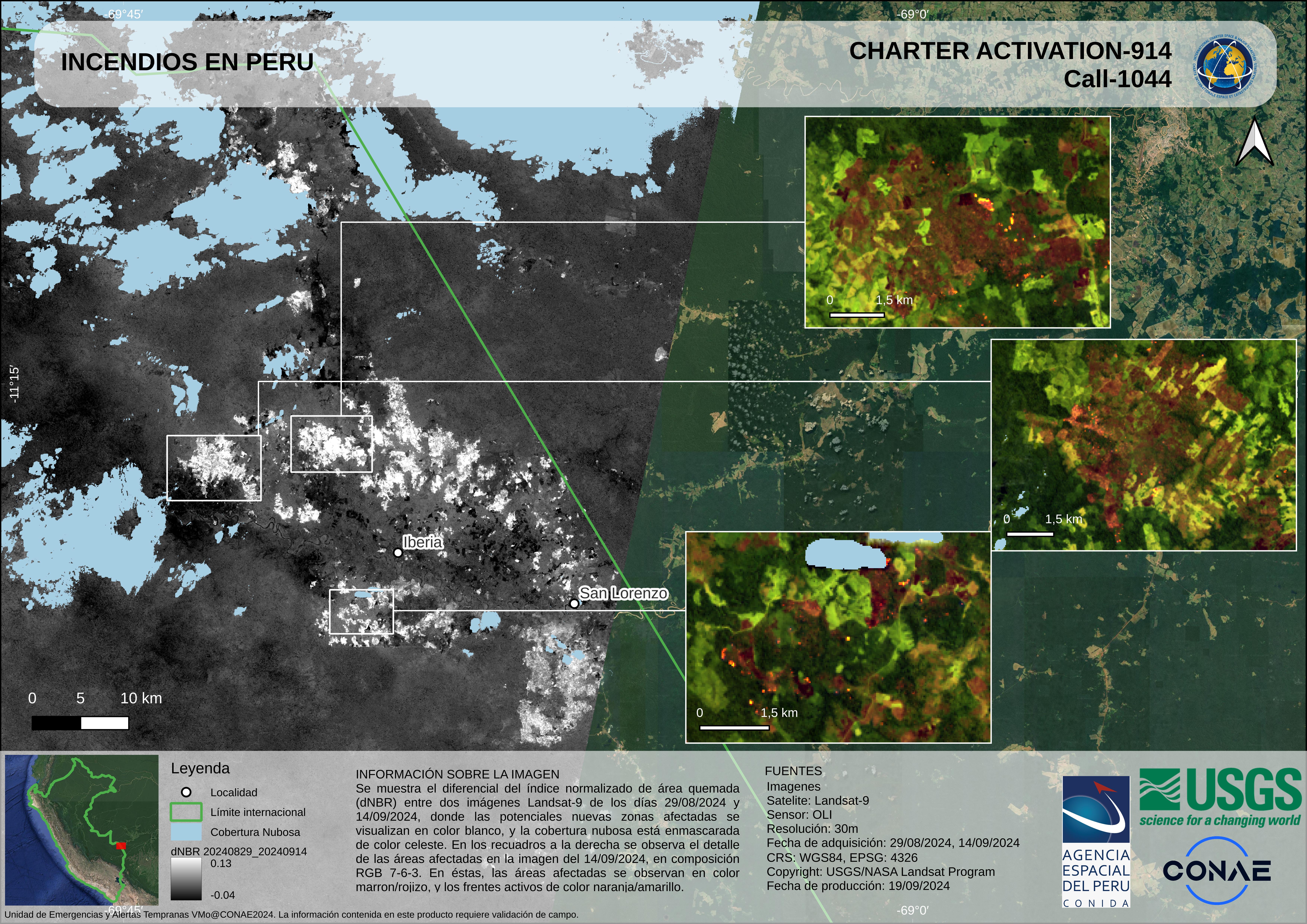
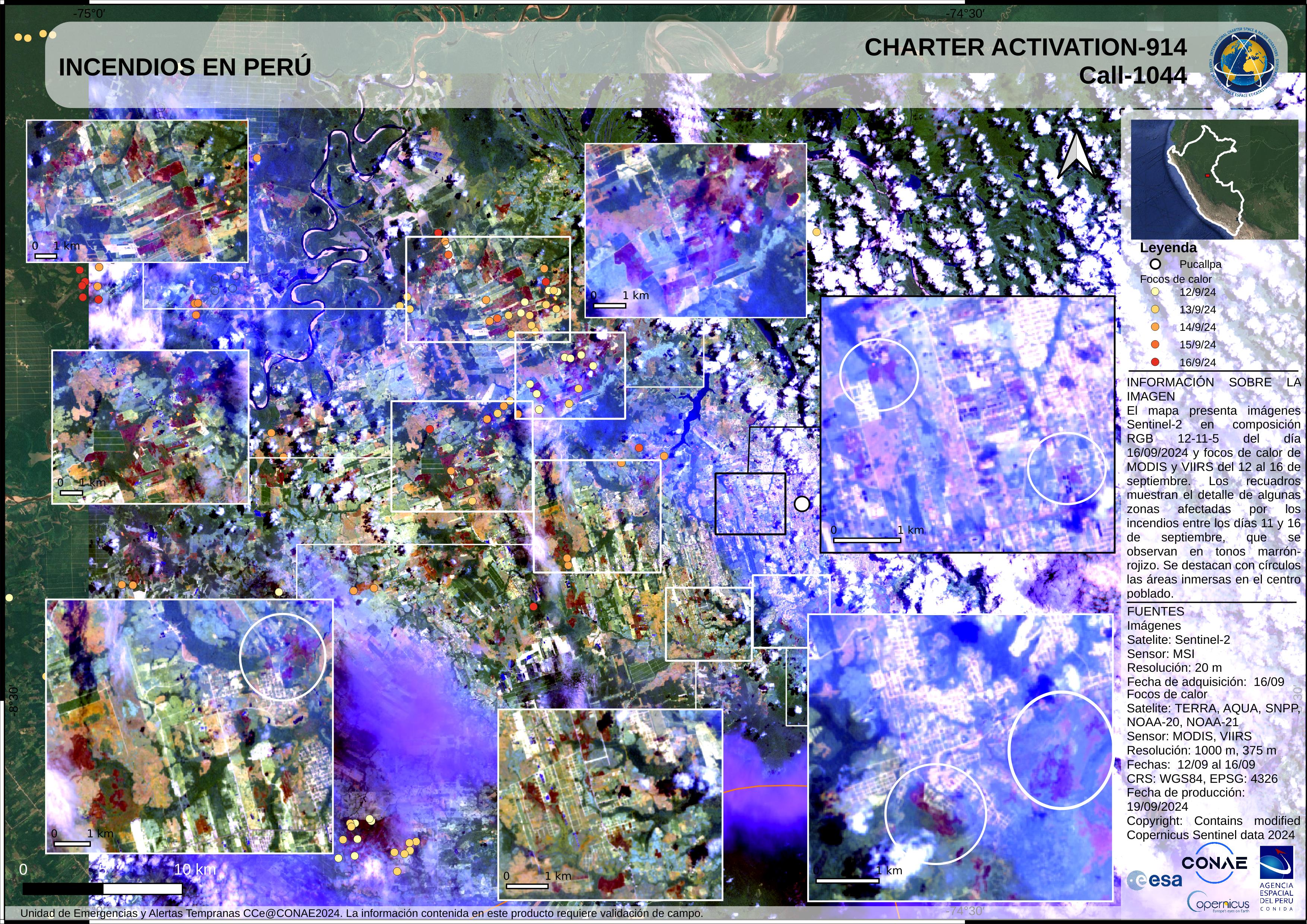
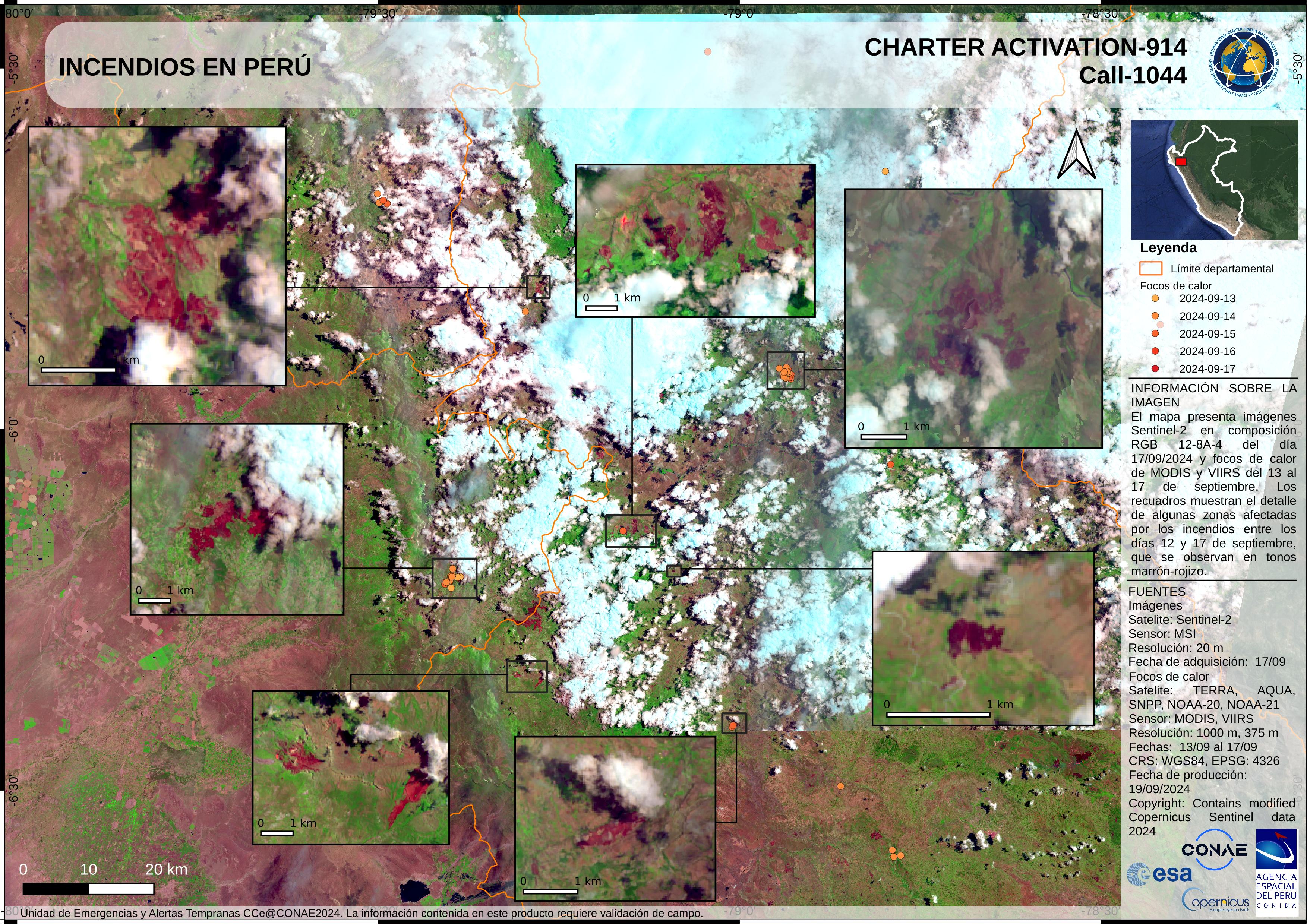
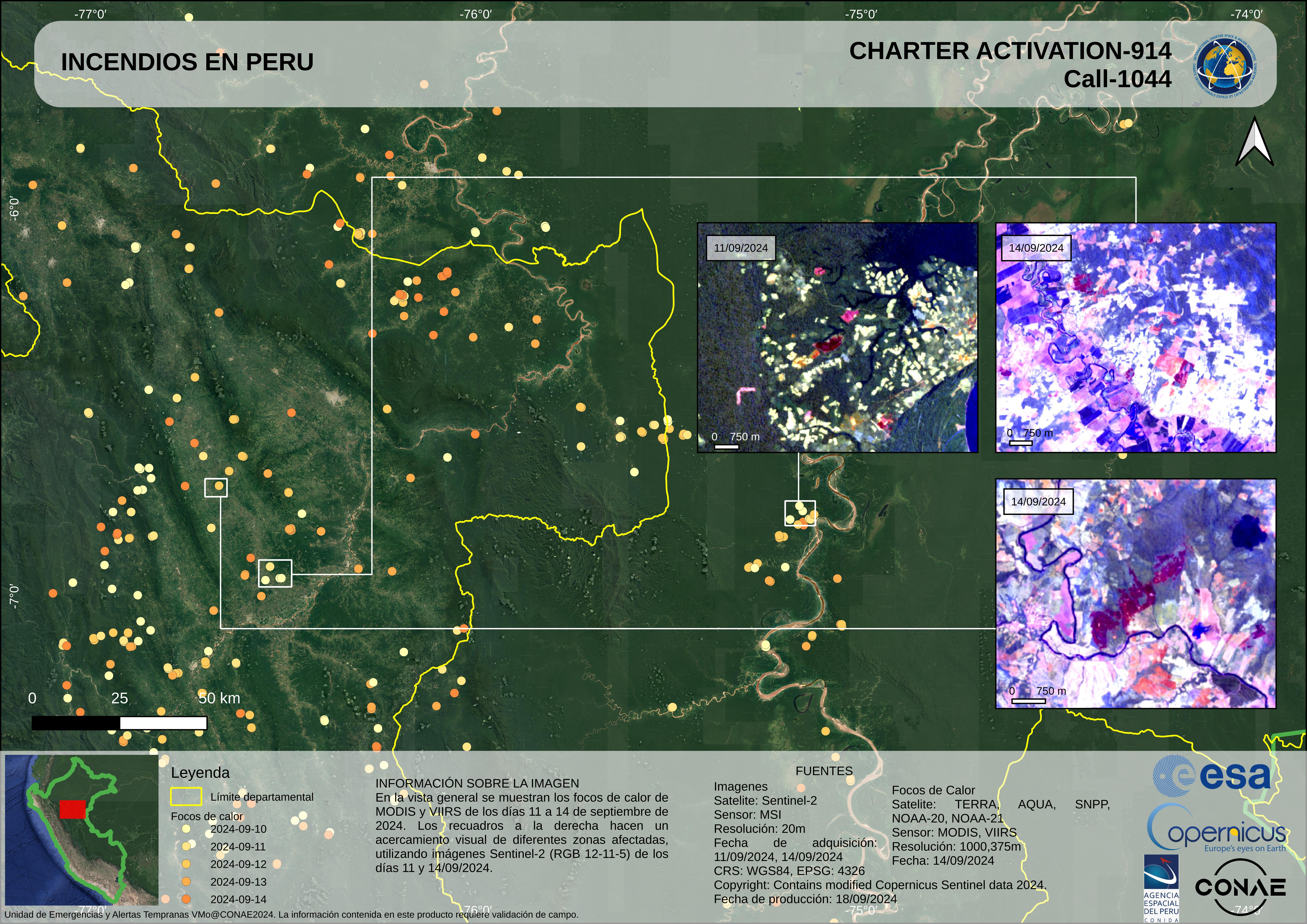
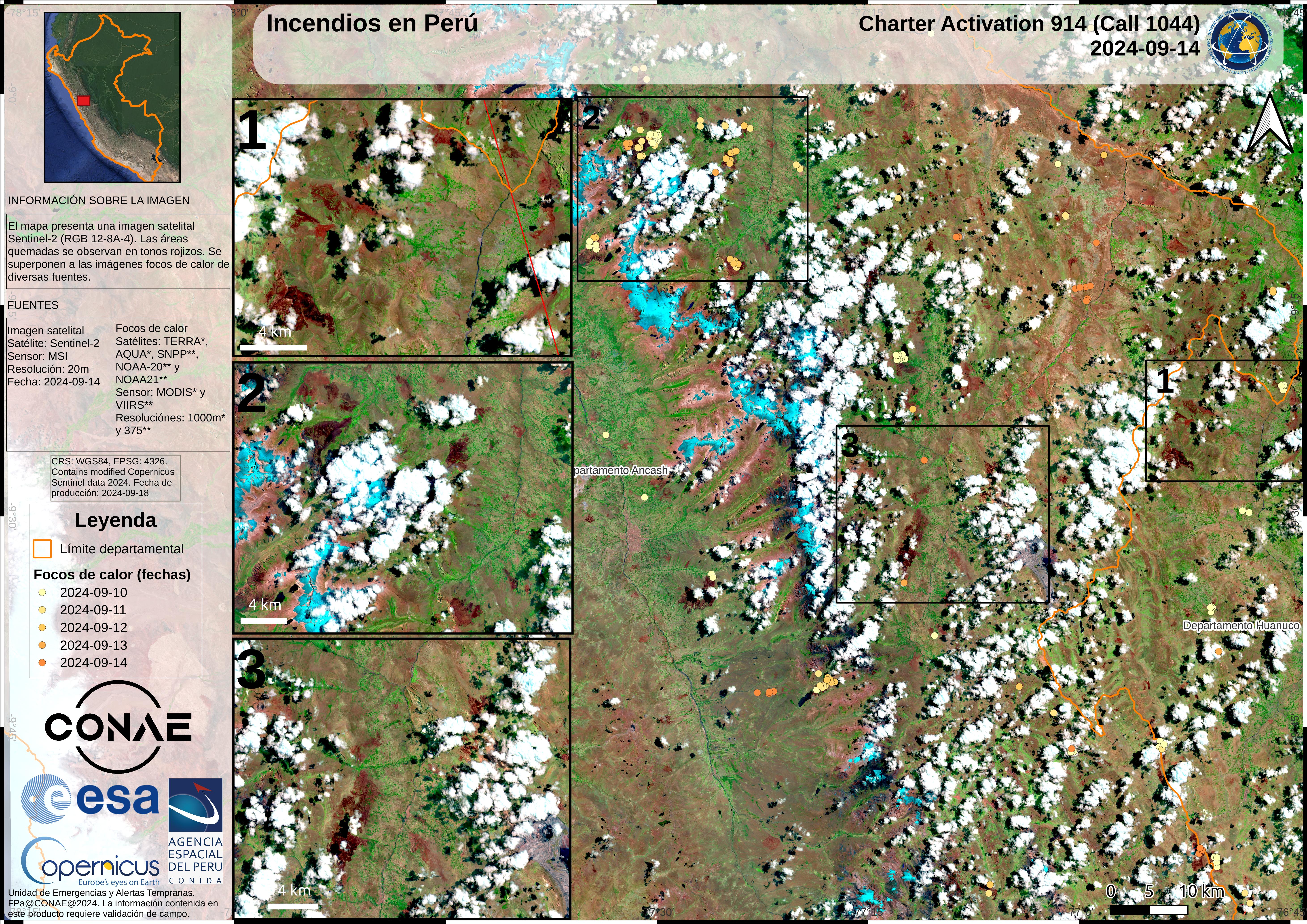
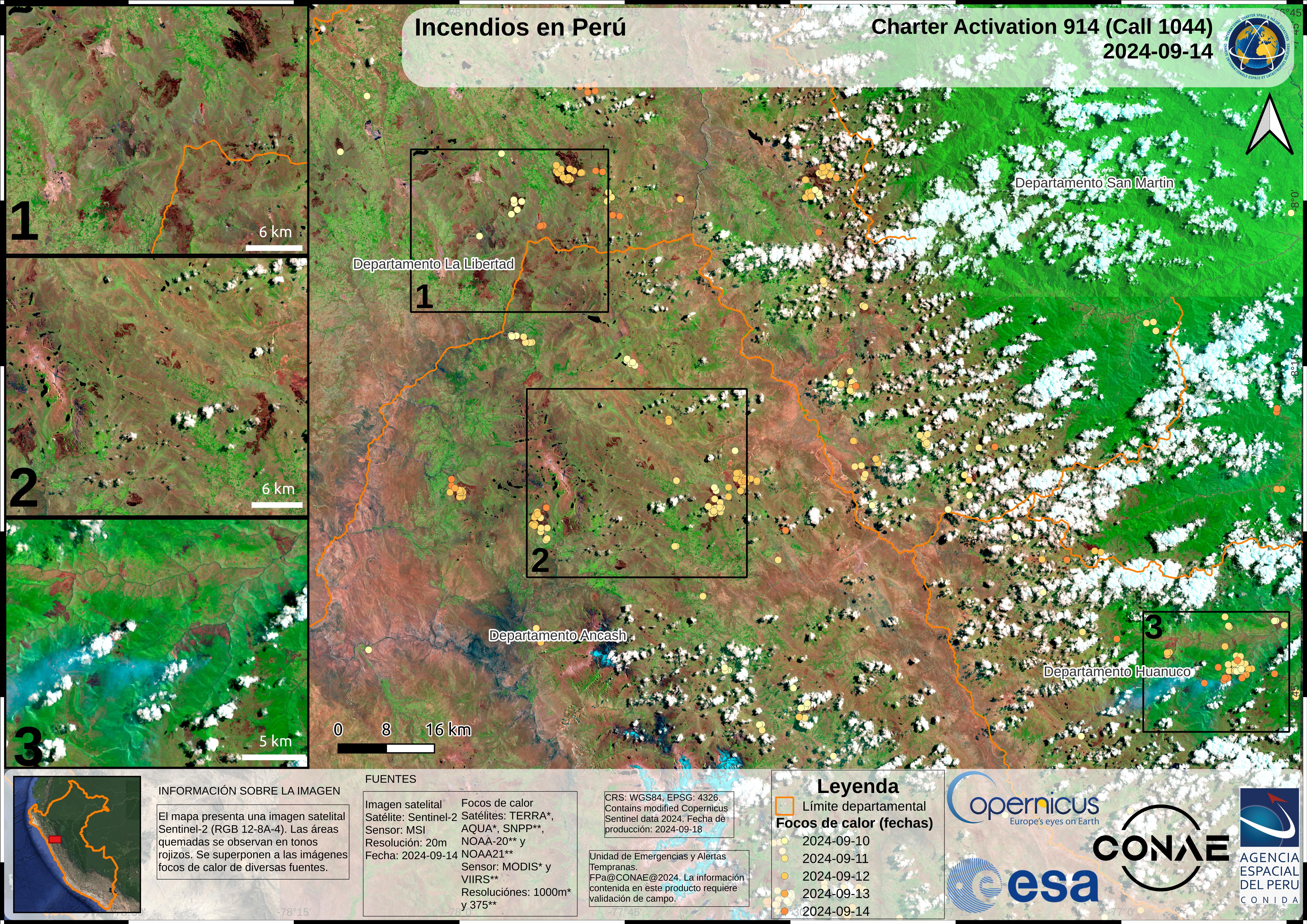
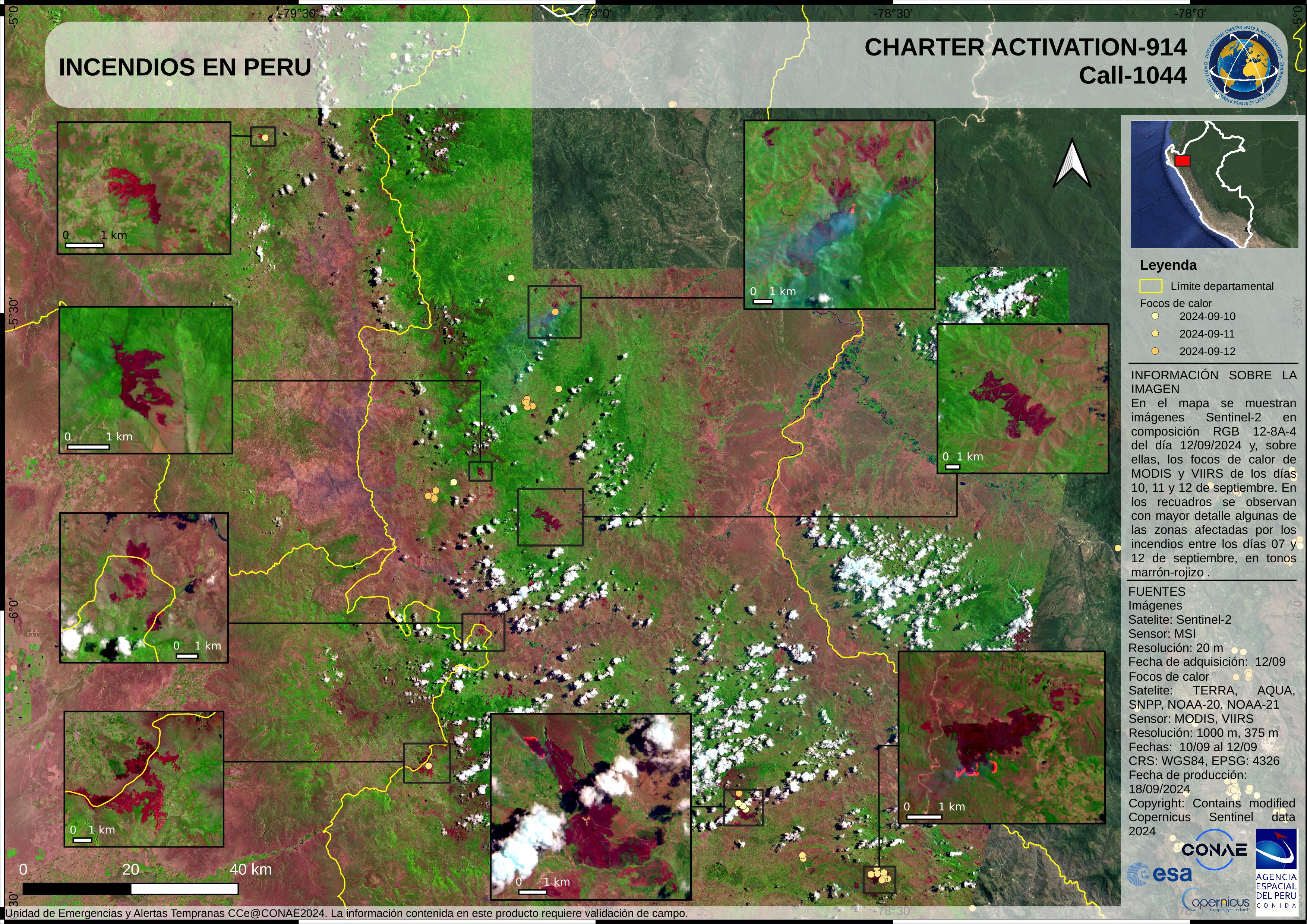
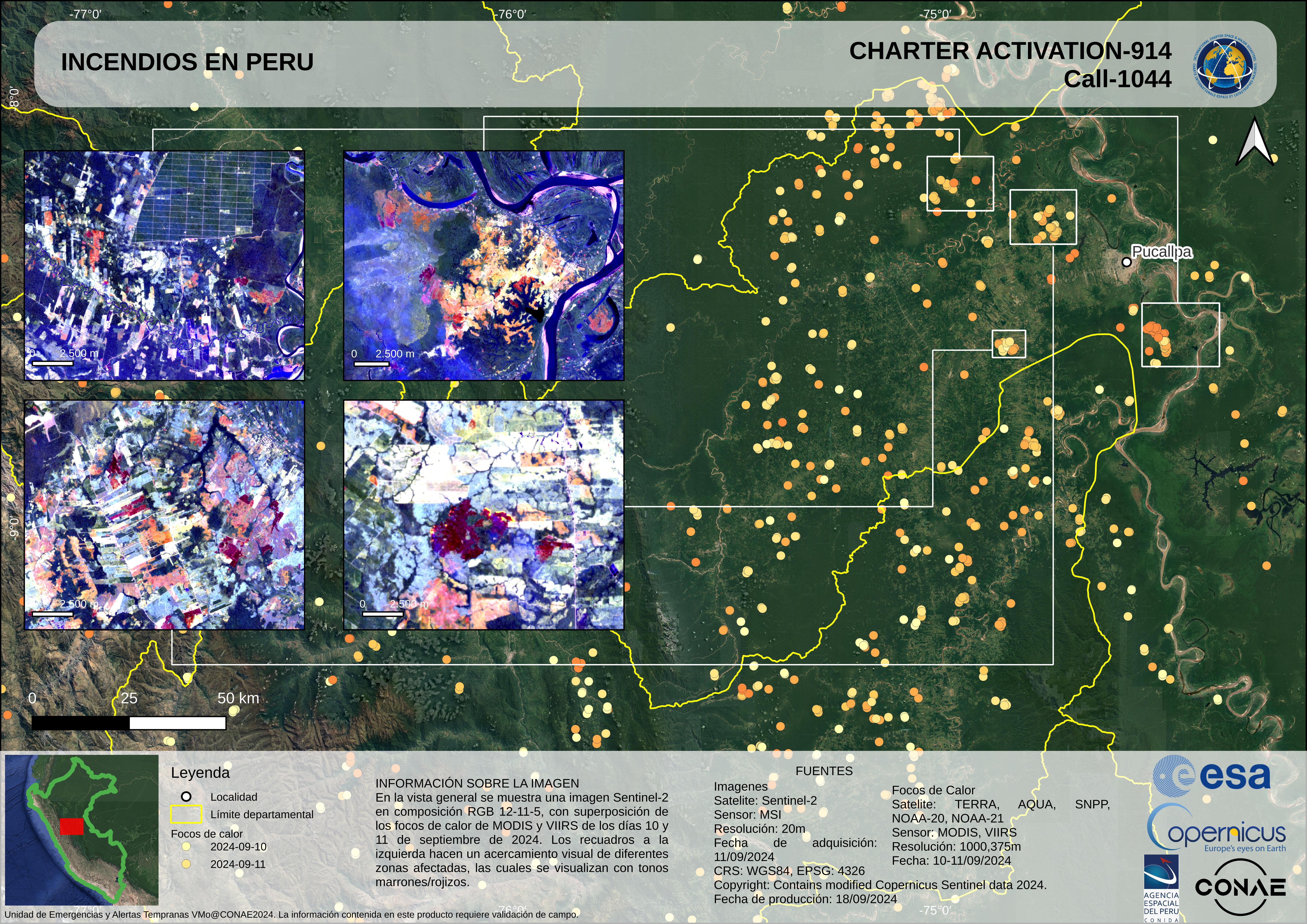
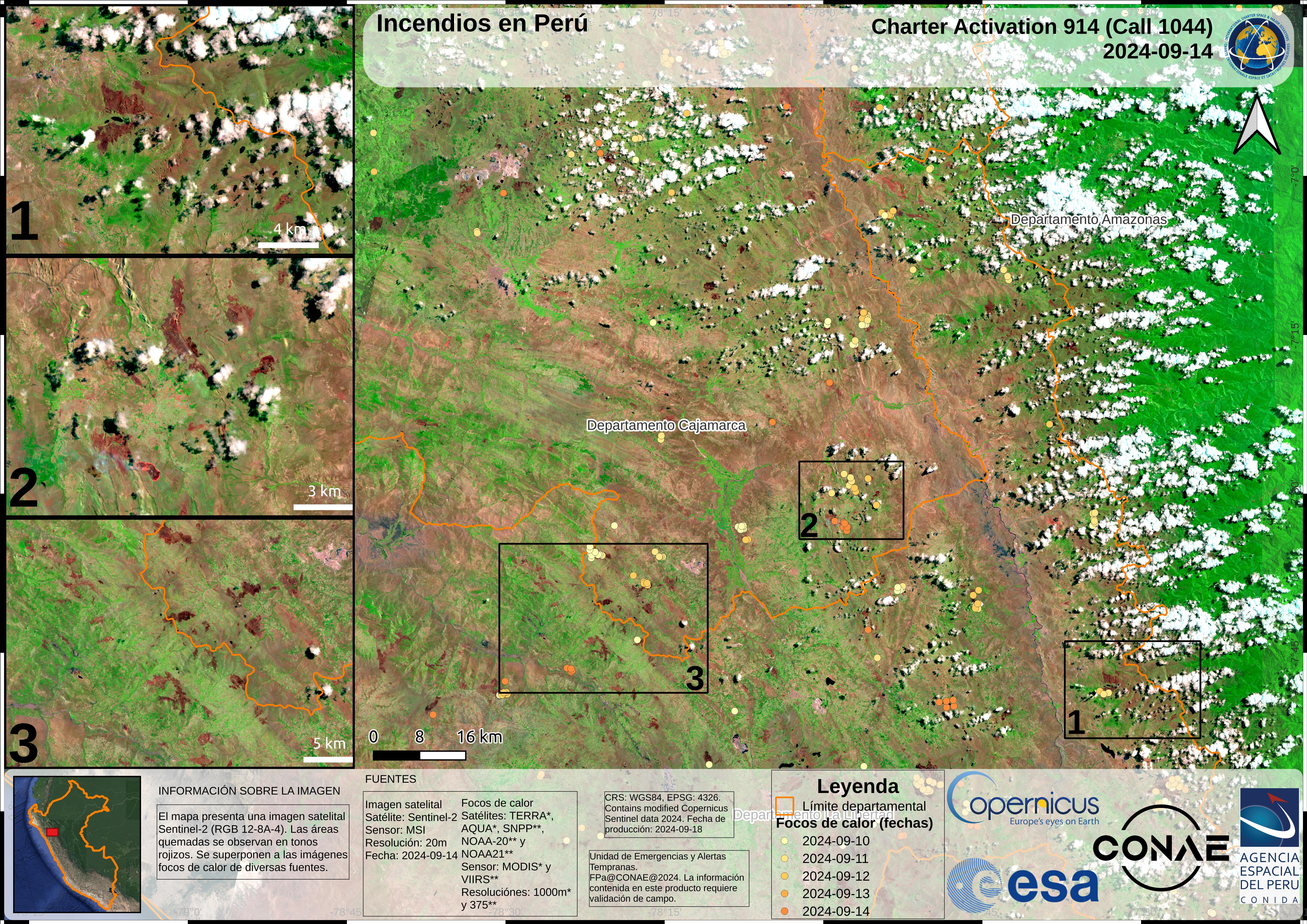
Fire in Peru
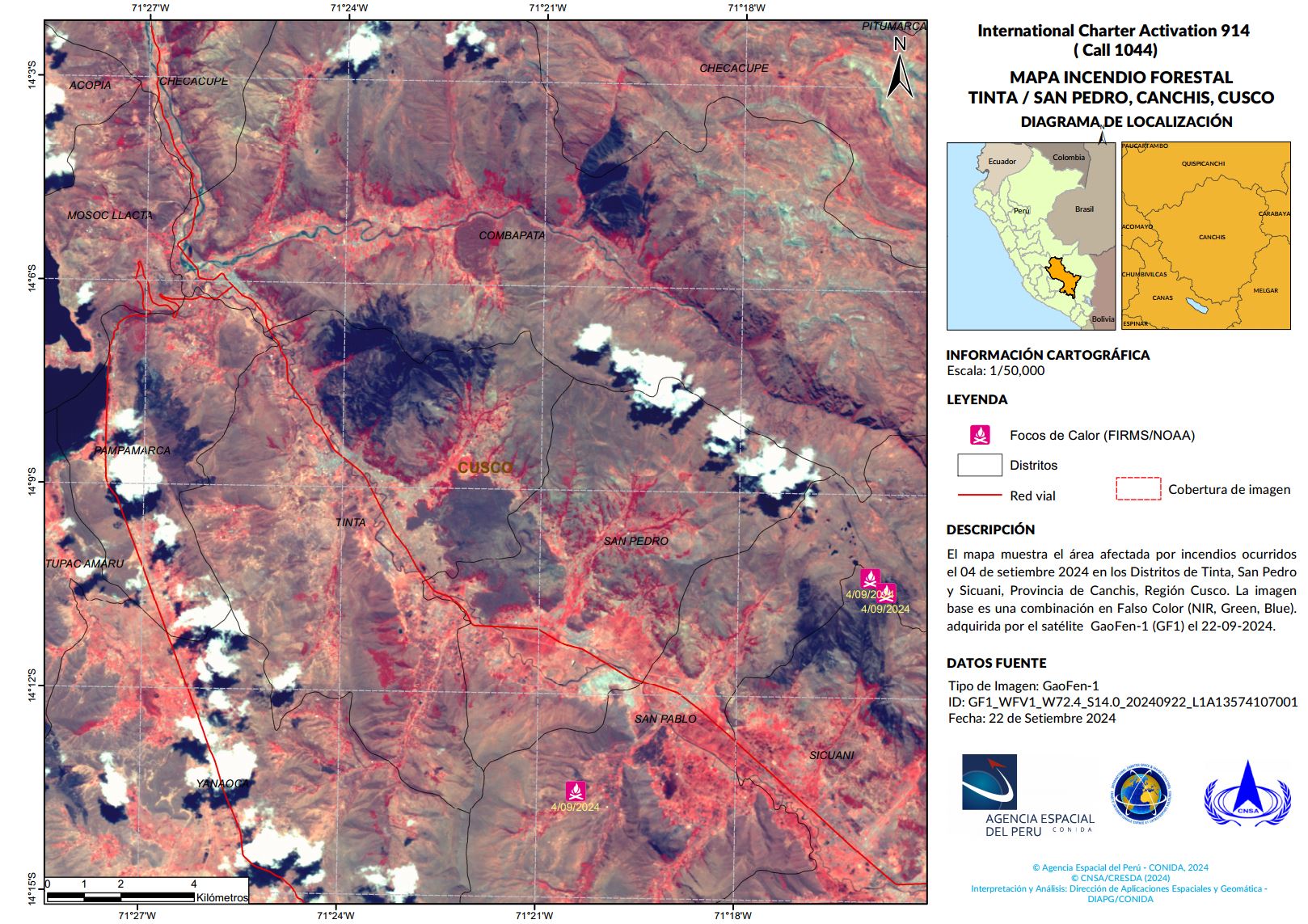
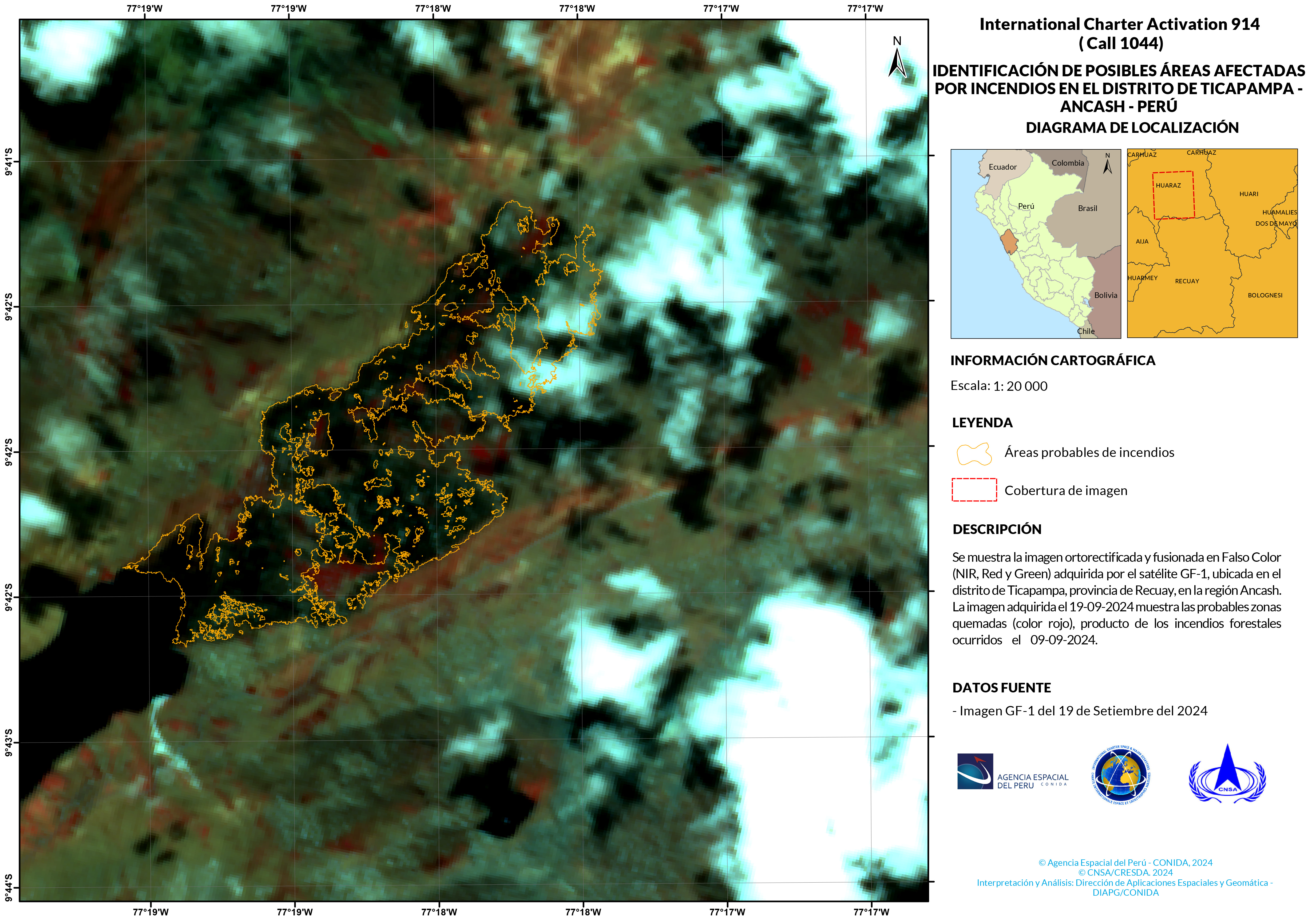
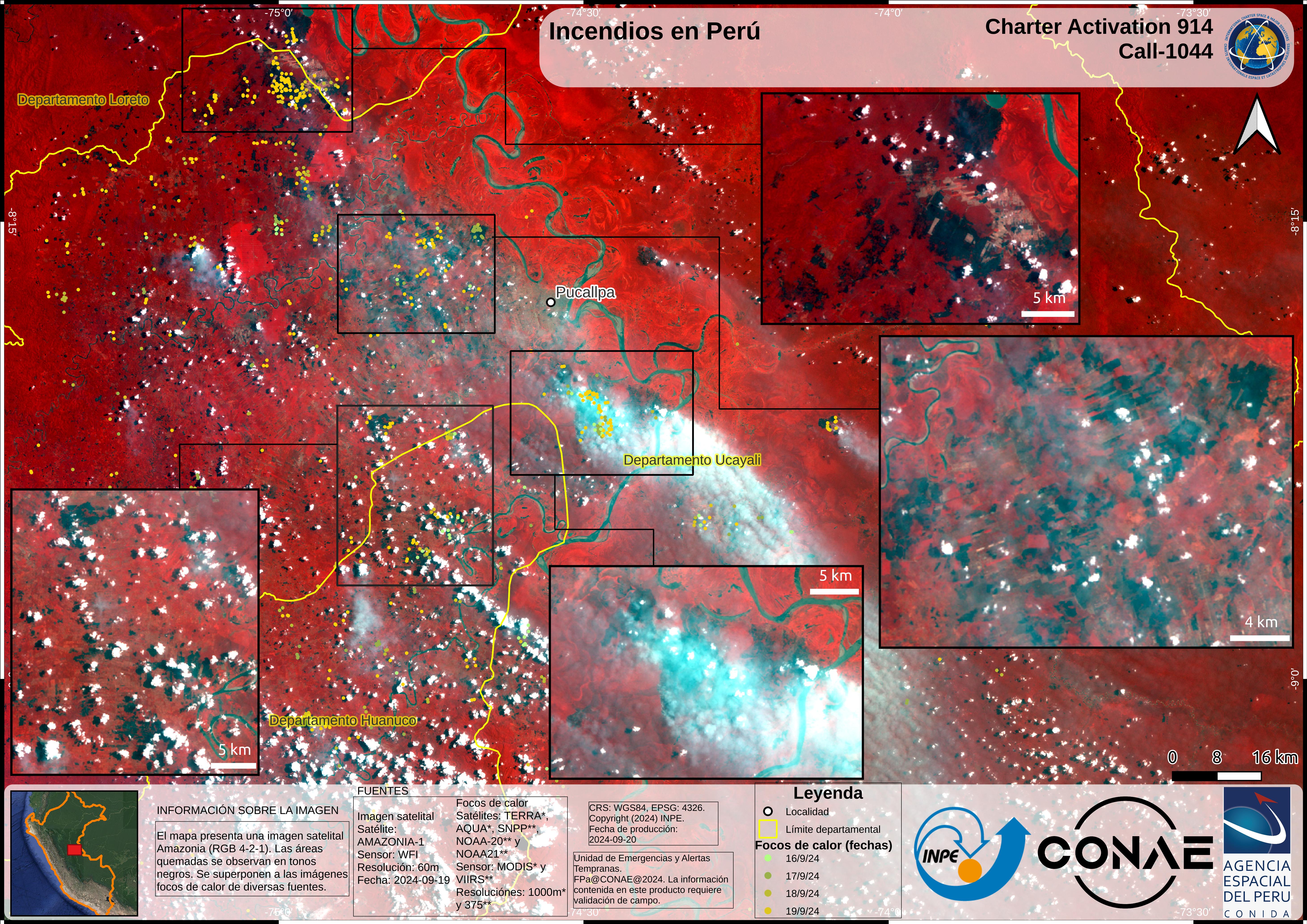
Forest fires have broken out in Peru, burning more than 3,000 hectares (11.58 square miles) of cultivated land and natural areas.
22 of Peru's 24 regions have been impacted, with Cuzco, Cajamarca, Huancavelica, and Huánuco being the worst affected areas. Reports say that the fires were caused by human activity. However, weather conditions such as clouds, smoke, and winds have helped spread the fires and also obstructed aircraft operations needed to fight the fires.
Numerous wildfires have started in Peru since July 2024, resulting in 15 fatalities, 98 injuries, and affecting more than 1,800 people.
| Тип события: | Fire |
| Место события: | Peru |
| Date of Charter Activation: | 2024-09-16 |
| Время активации Хартии: | 20:24 |
| TЧасовой пояс в районе активации Хартии: | UTC-03:00 |
| Запрос на активацию поступил от: | INDECI |
| Номер активации: | 914 |
| Менеждер проекта от: | José Pasapera (CONIDA) |
| act-value-adders: | Franco Pascualone (CONAE) Carla Celleri (CONAE) |
Products
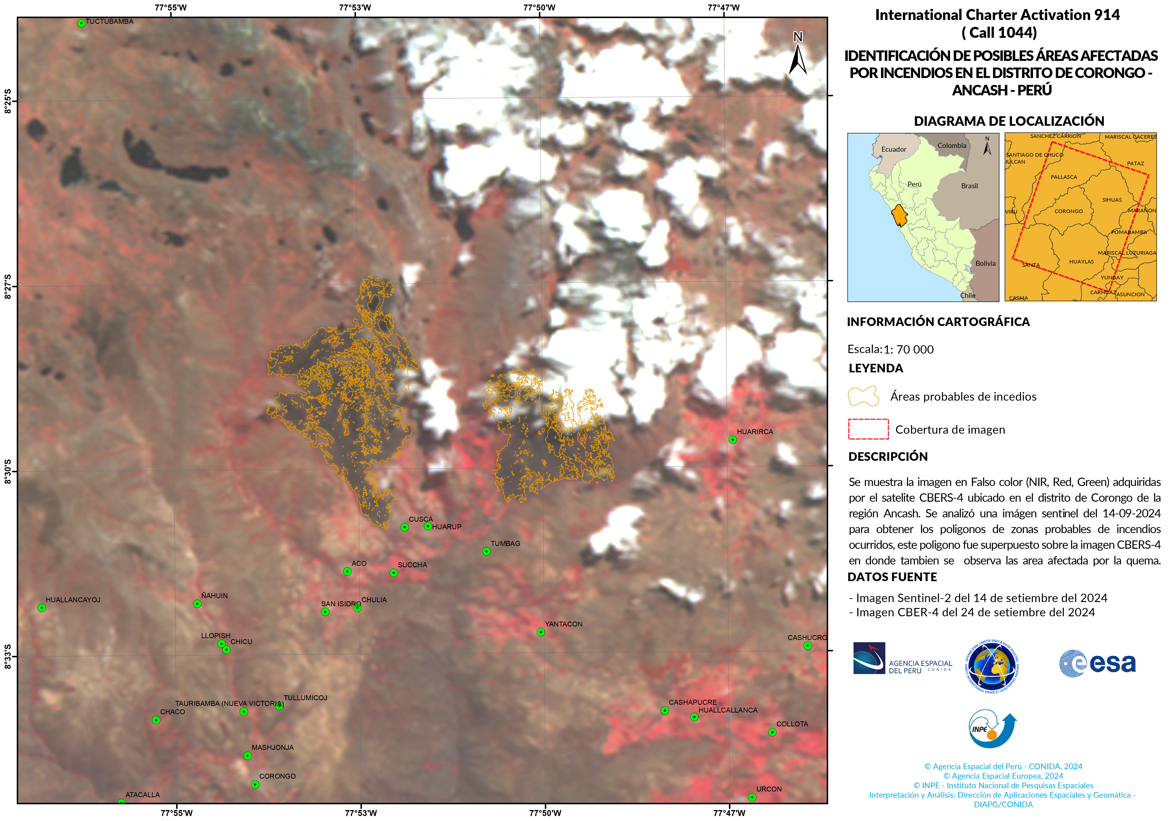
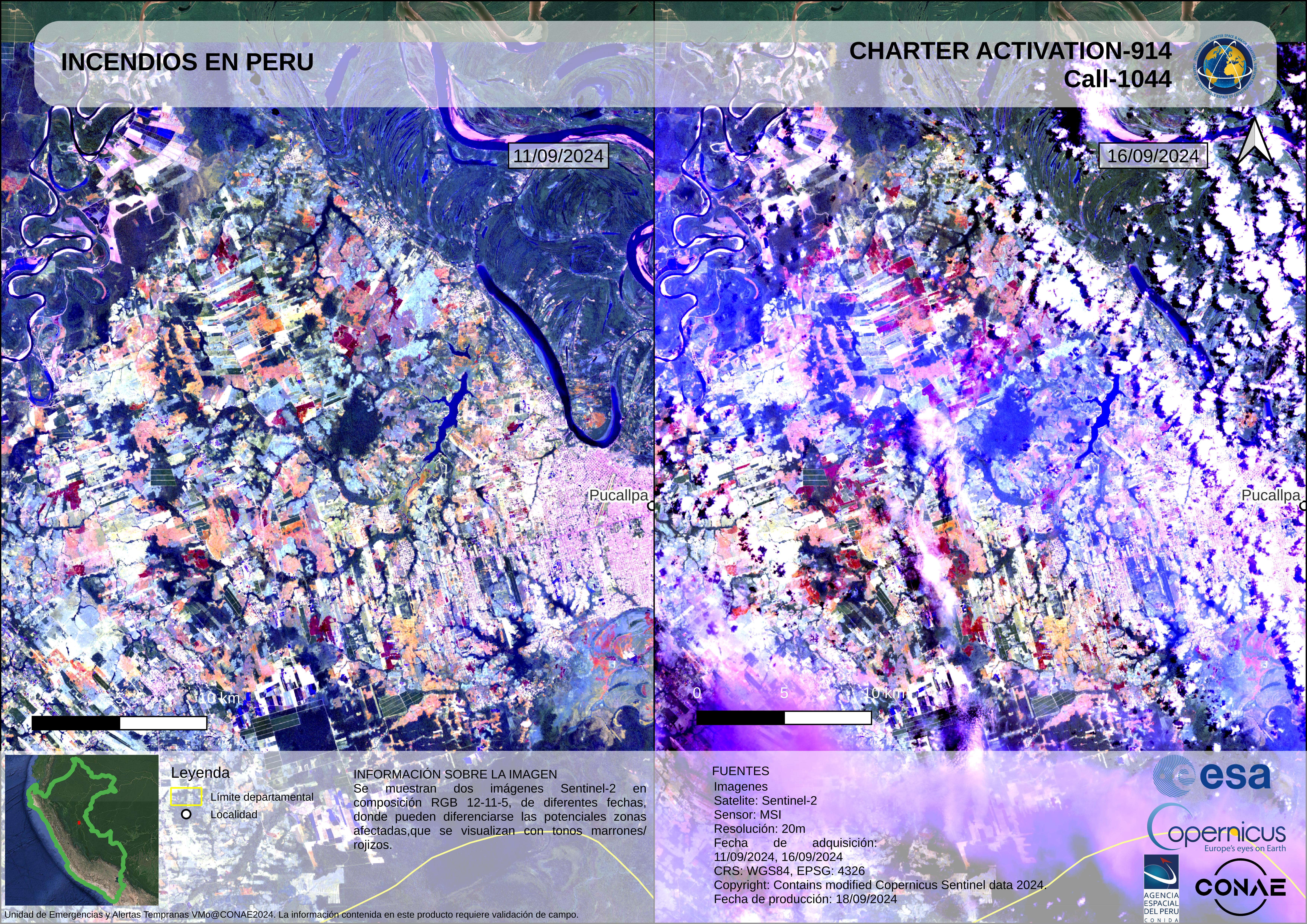
Identification of possible areas affected by fires in the Corongo district - Ancash - Perú
Авторские права: Contains modified Copernicus Sentinel data (2024)
copyright (2024) INPE
Map produced by Special Agency of Peru
Information about the Product
Получено: Sentinel -2: 14/09/2024
CBERS-4: 24/09/2024
Источник: Sentinel -2 / CBERS-4
Категория: Delineation Map
 Вернуться к полному архиву активаций

