 English
 Spanish
 French
 Chinese
 Russian
 Portuguese
 Последняя Активация
Charter activations
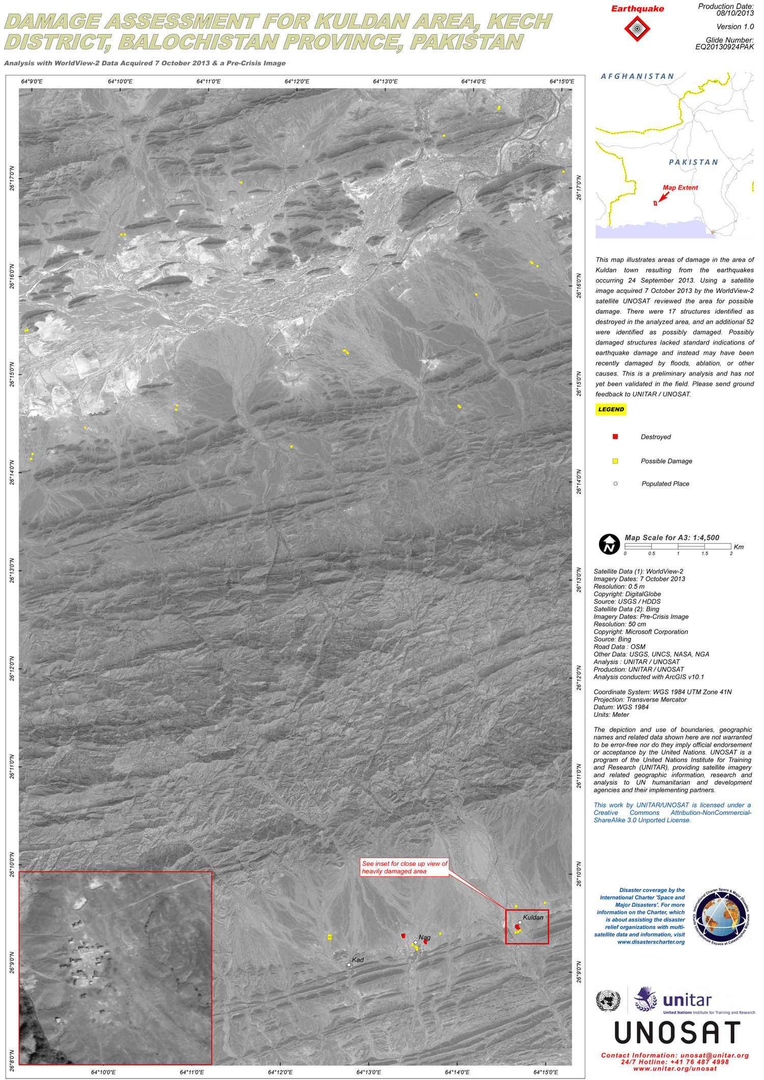
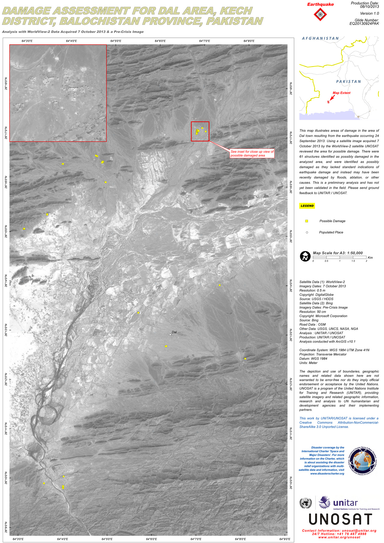
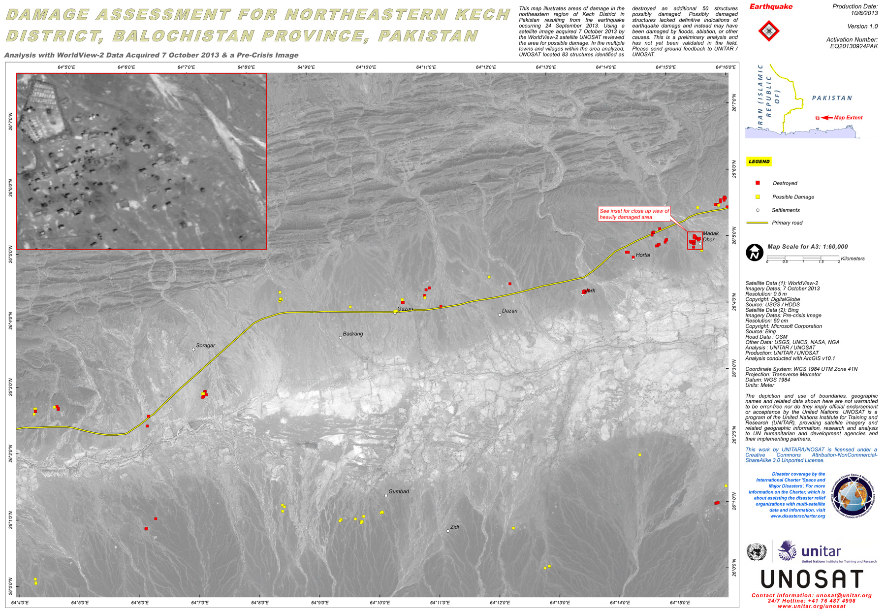
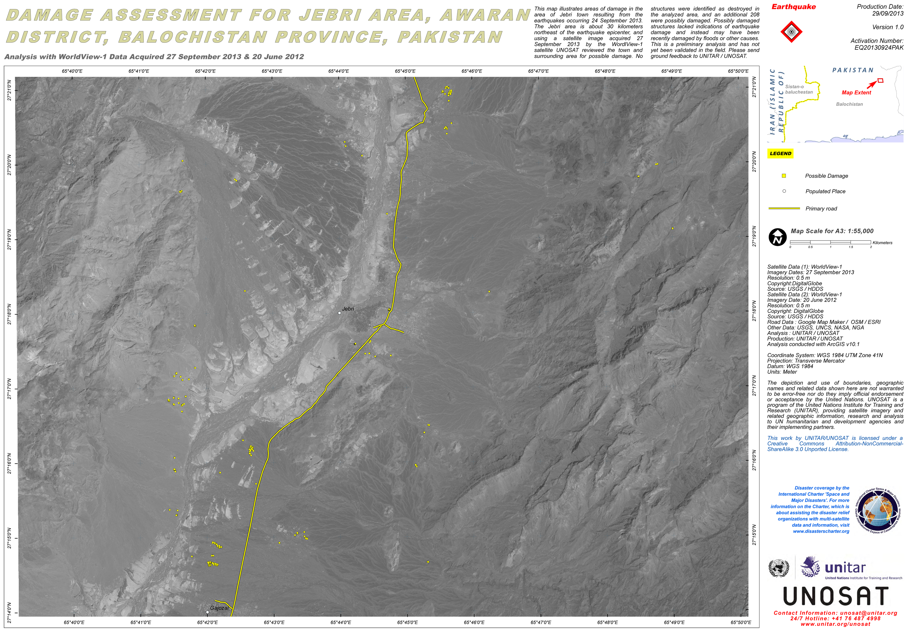
Earthquake in Pakistan
A large and powerful earthquake struck the province of Balochistan, a remote, mountainous region of Pakistan, on the evening of 24 September 2013. The region is Pakistan's largest, but least populated province. Officials in the area report that major damage and loss of life has been averted due to the earthquake's location in a remote area.
The earthquake measured 7.8 on the Richter Scale and tremors were felt as far away as New Delhi. Aftershocks of up to 5 magnitude are expected following the earthquake.
Reports suggest that over 200 people have been killed and almost 400 people are injured. A red alert has been issued for the area, which means that there are estimated fatalities of more than 1000 and damages exceeding $1 billion.
In the Awaran district, it has been reported that entire villages were destroyed in the earthquake. The houses in these locations were mostly constructed from mud, which offered little resistance to the earthquake.
Local media have reported that a new island has been created off Pakistan's Gwadar coastline, following the earthquake, approximately 1 kilometre out to sea.
| Тип события: | Earthquake |
| Место события: | Balochistan, Pakistan |
| Date of Charter Activation: | 24 September 2013 |
| Запрос на активацию поступил от: | UNITAR/UNOSAT on behalf of UNICEF |
| Менеждер проекта от: | UNOSAT |
Products
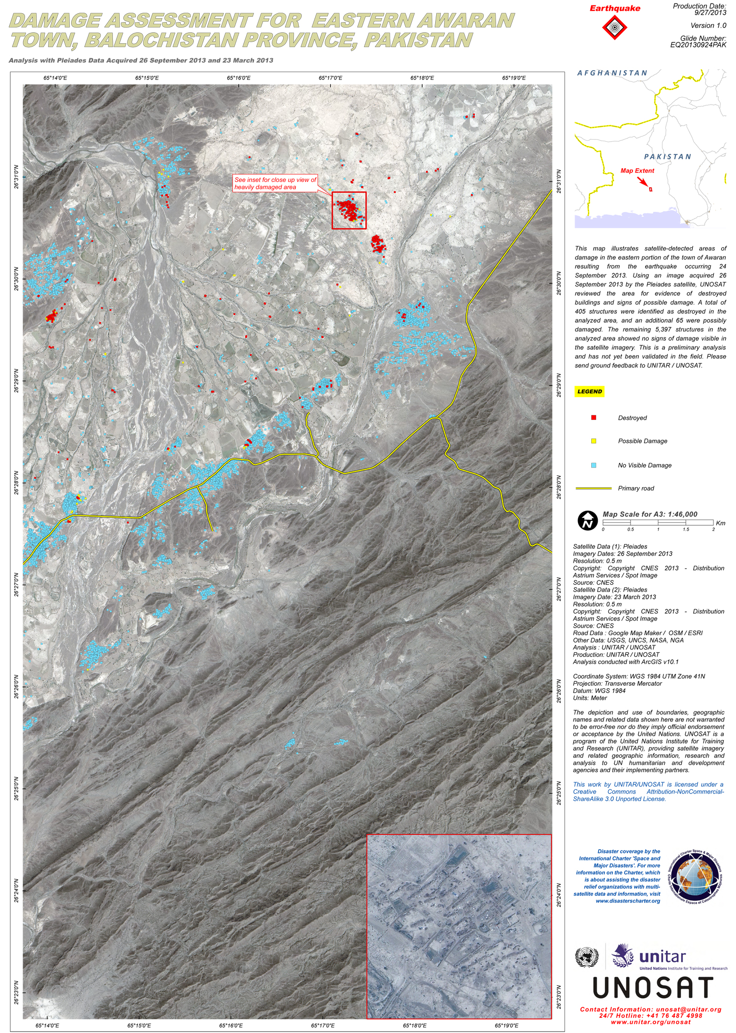
Damage assessment for Eastern Awaran Town, Balochistan Province, Pakistan
Авторские права: CNES 2013 - Distribution: Astrium Services / Spot Image S.A., all rights reserved
Map produced by UNITAR/UNOSAT
Information about the Product
Получено: Pre-crisis: 23/03/2013
Post-crisis: 26/09/2013
Источник: Pléiades-HR 1A
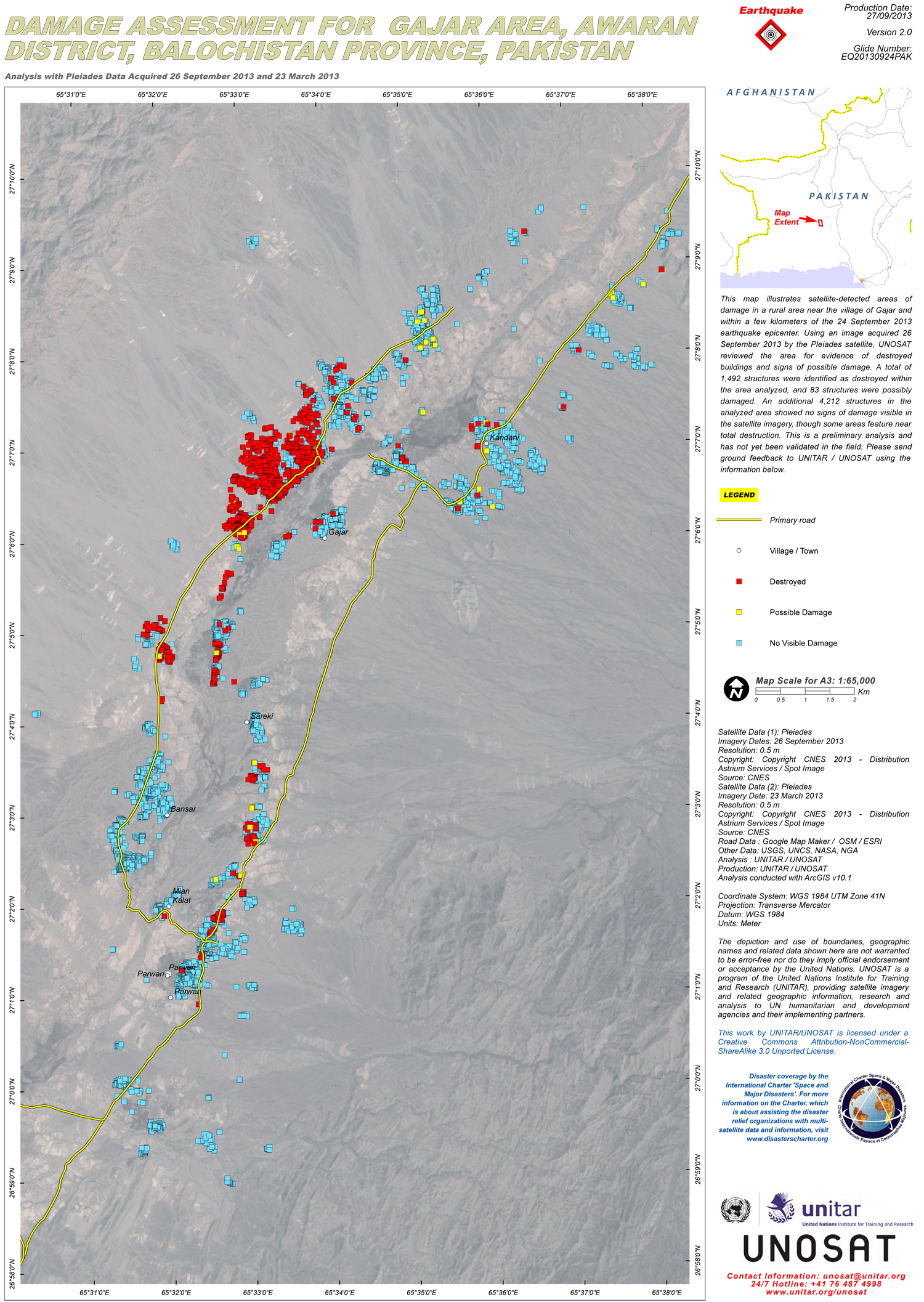
Damage assessment for Gajar Area, Awaran District, Balochistan Province, Pakistan
Авторские права: CNES 2013 - Distribution: Astrium Services / Spot Image S.A., all rights reserved
Map produced by UNITAR/UNOSAT
Information about the Product
Получено: Pre-crisis: 23/03/2013
Post-crisis: 26/09/2013
Источник: Pléiades-HR 1A
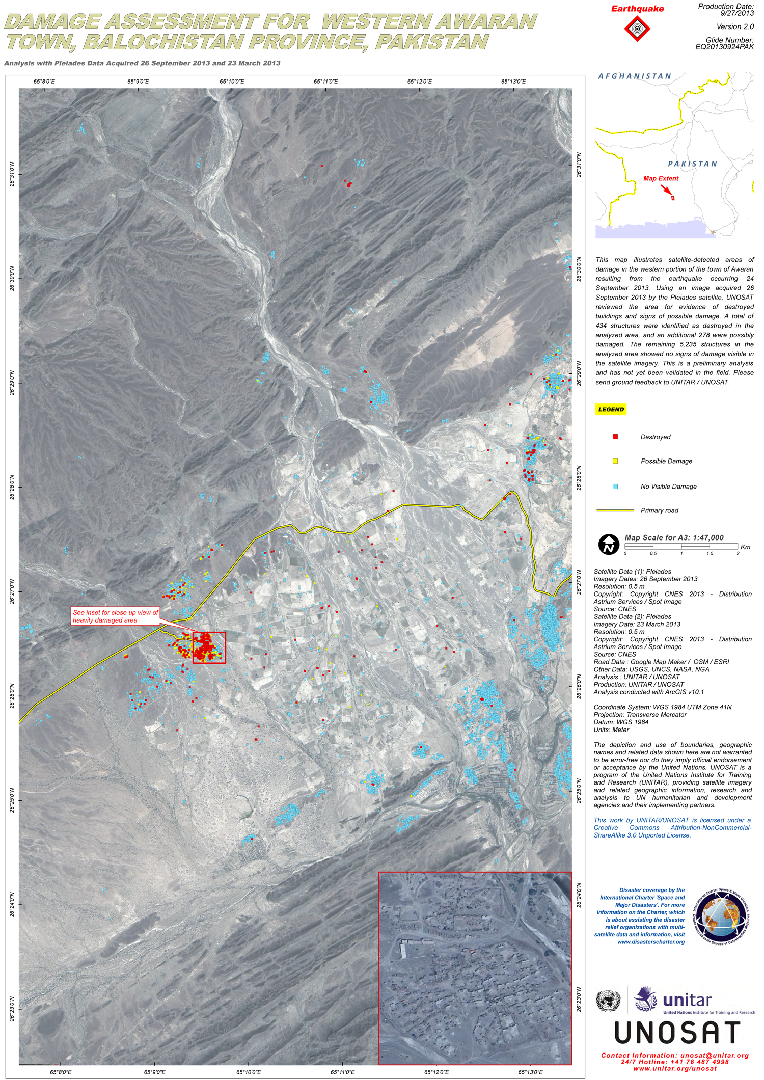
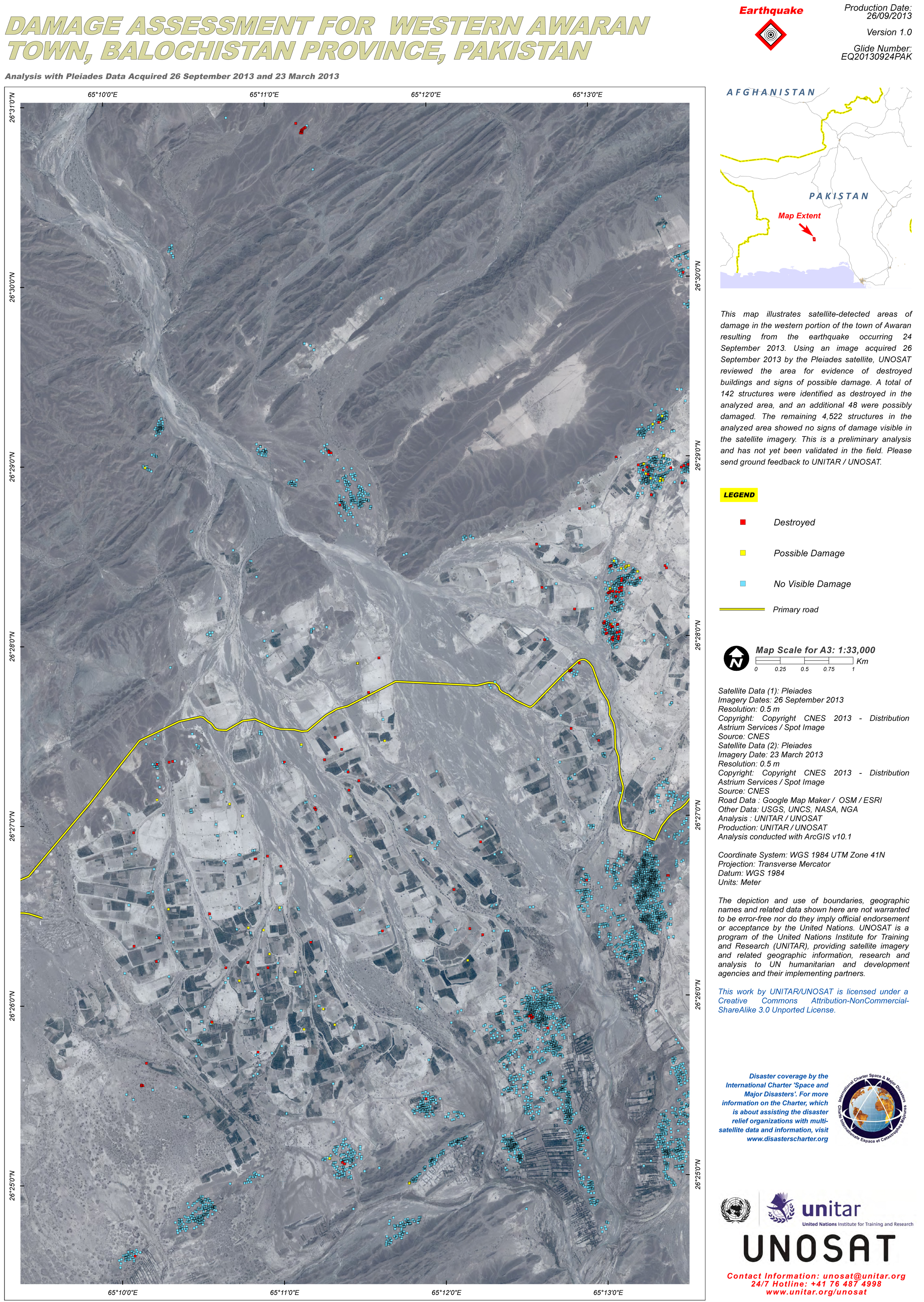
Damage assessment for Western Awaran Town, Balochistan Province, Pakistan
Авторские права: CNES 2013 - Distribution: Astrium Services / Spot Image S.A., all rights reserved
Map produced by UNITAR/UNOSAT
Information about the Product
Получено: Pre-crisis: 23/03/2013
Post-crisis: 26/09/2013
Источник: Pléiades-HR 1A
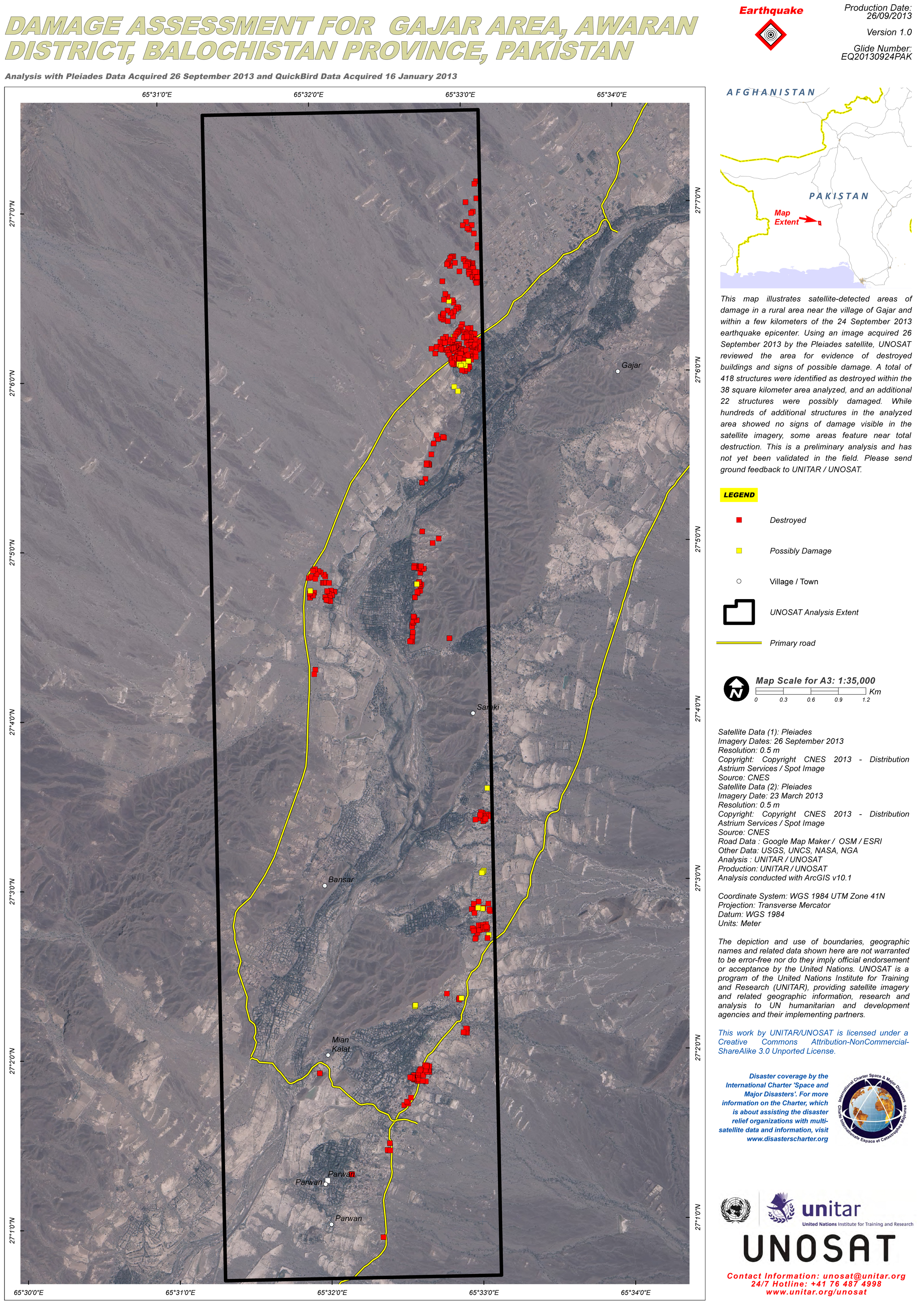
Damage assessment for Gajar Area, Awaran District, Balochistan Province, Pakistan
Авторские права: CNES 2013 - Distribution: Astrium Services / Spot Image S.A., all rights reserved
Map produced by UNITAR/UNOSAT
Information about the Product
Получено: Pre-crisis: 23/03/2013
Post-crisis: 26/09/2013
Источник: Pléiades-HR 1A
Damage assessment for Western Awaran Town, Balochistan Province, Pakistan
Авторские права: CNES 2013 - Distribution: Astrium Services / Spot Image S.A., all rights reserved
Map produced by UNITAR/UNOSAT
Information about the Product
Получено: Pre-crisis: 23/03/2013
Post-crisis: 26/09/2013
Источник: Pléiades-HR 1A
 Вернуться к полному архиву активаций

