 English
 Spanish
 French
 Chinese
 Russian
 Portuguese
 Latest Activation
Charter activations
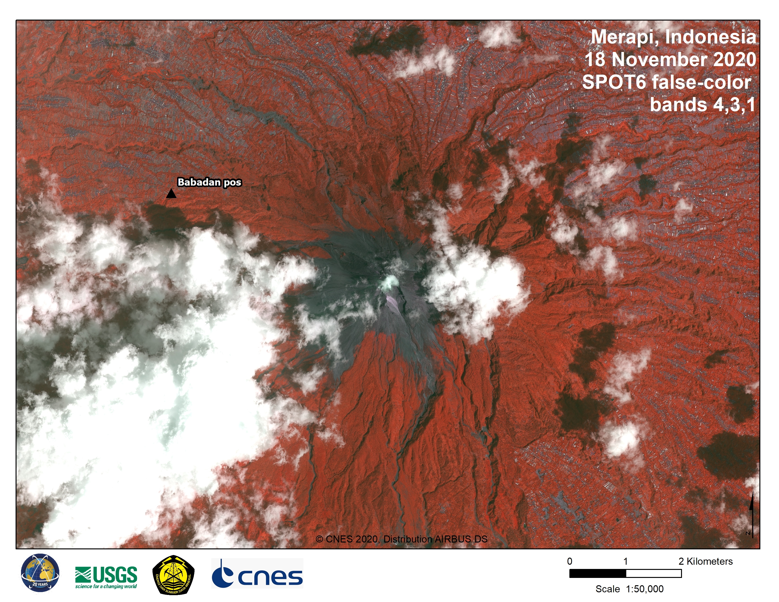
Volcano in Indonesia
500 people living on Indonesia's Mount Merapi have been evacuated following increased volcanic activity. Authorities warned the volcano could erupt at any moment.
Merapi lies only 18 miles Yogyakarta city centre, and 250,000 people live within 6 miles of the volcano, putting them at high risk should activity increase. Merapi sent ash and gas clouds as high as 3.7 miles into the air in June, although no casualties were reported at that time.
Indonesia's geological agency have raised Merapi's alert level to the second-highest level and local administrations are monitoring the situation closely.
| Local do evento: | Indonesia |
| Data da Ativação da Carta: | 2020-11-10 |
| Tempo de Ativação da Carta: | 12:26 |
| Zona de Tempo da Ativação da Carta: | UTC-06:00 |
| Requisitante da Carta: | USGS on behalf of Merapi Volcano Observatory |
| ID da Ativação: | 685 |
Products
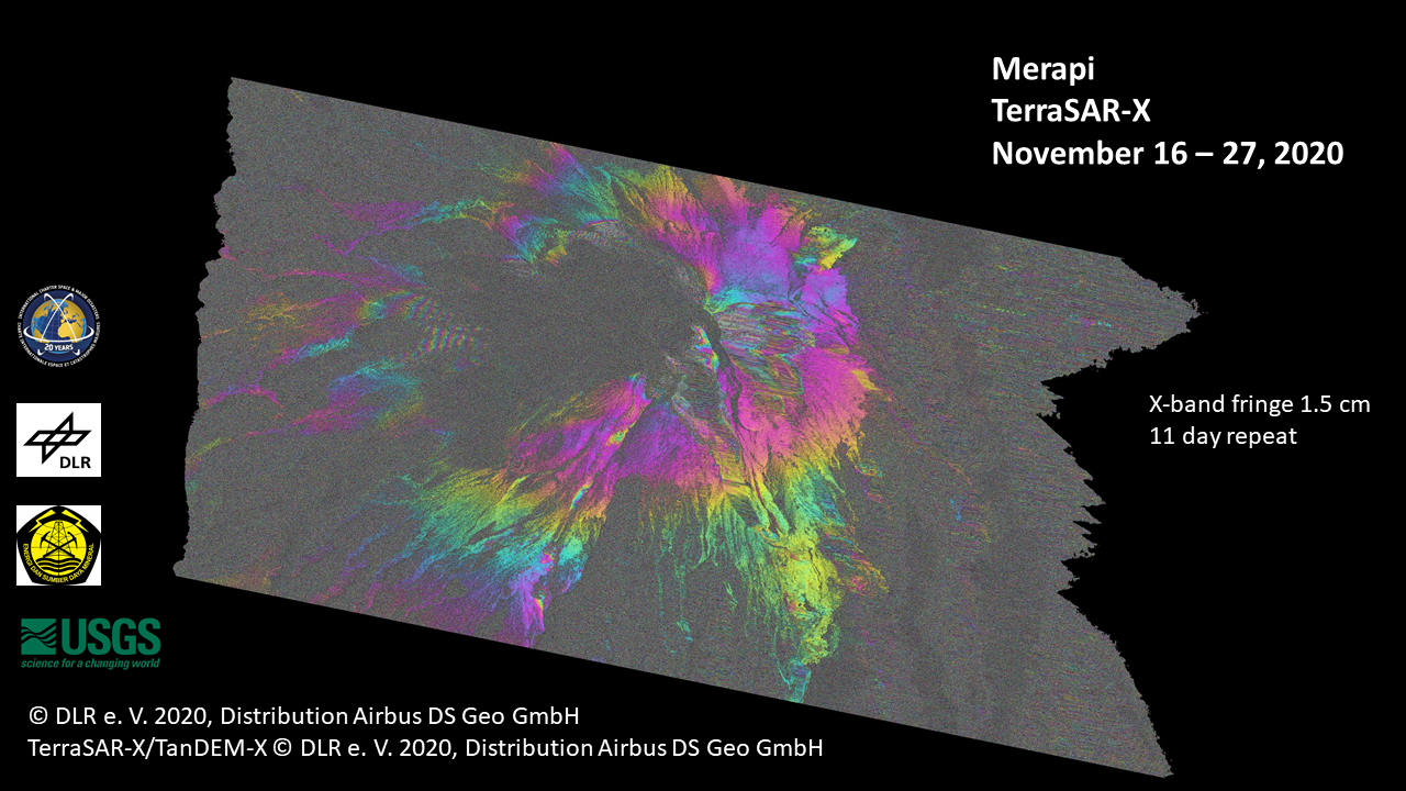
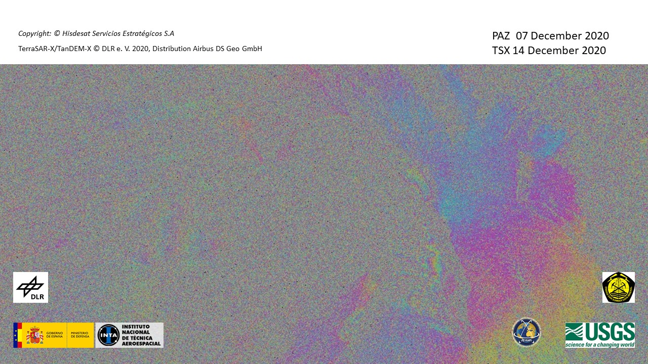
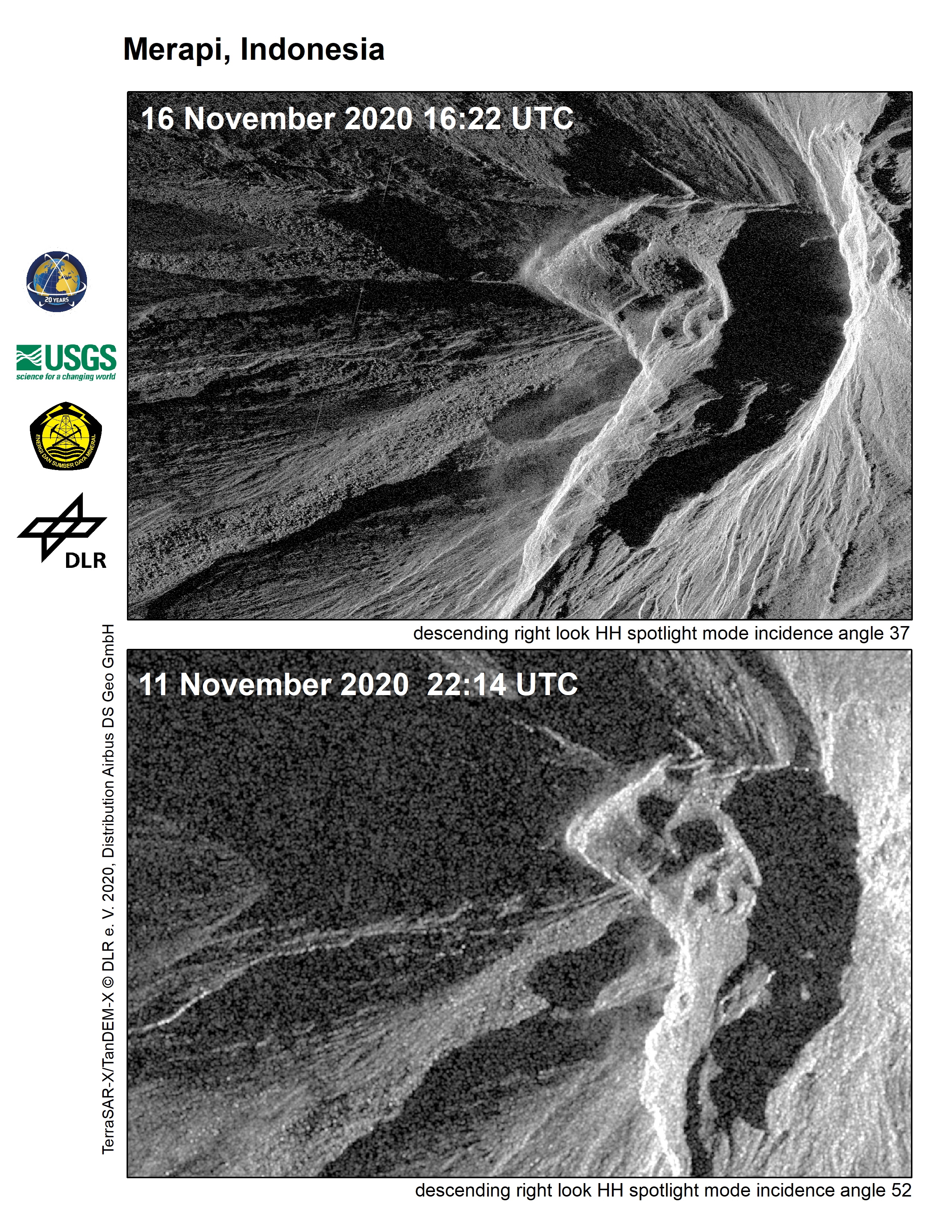
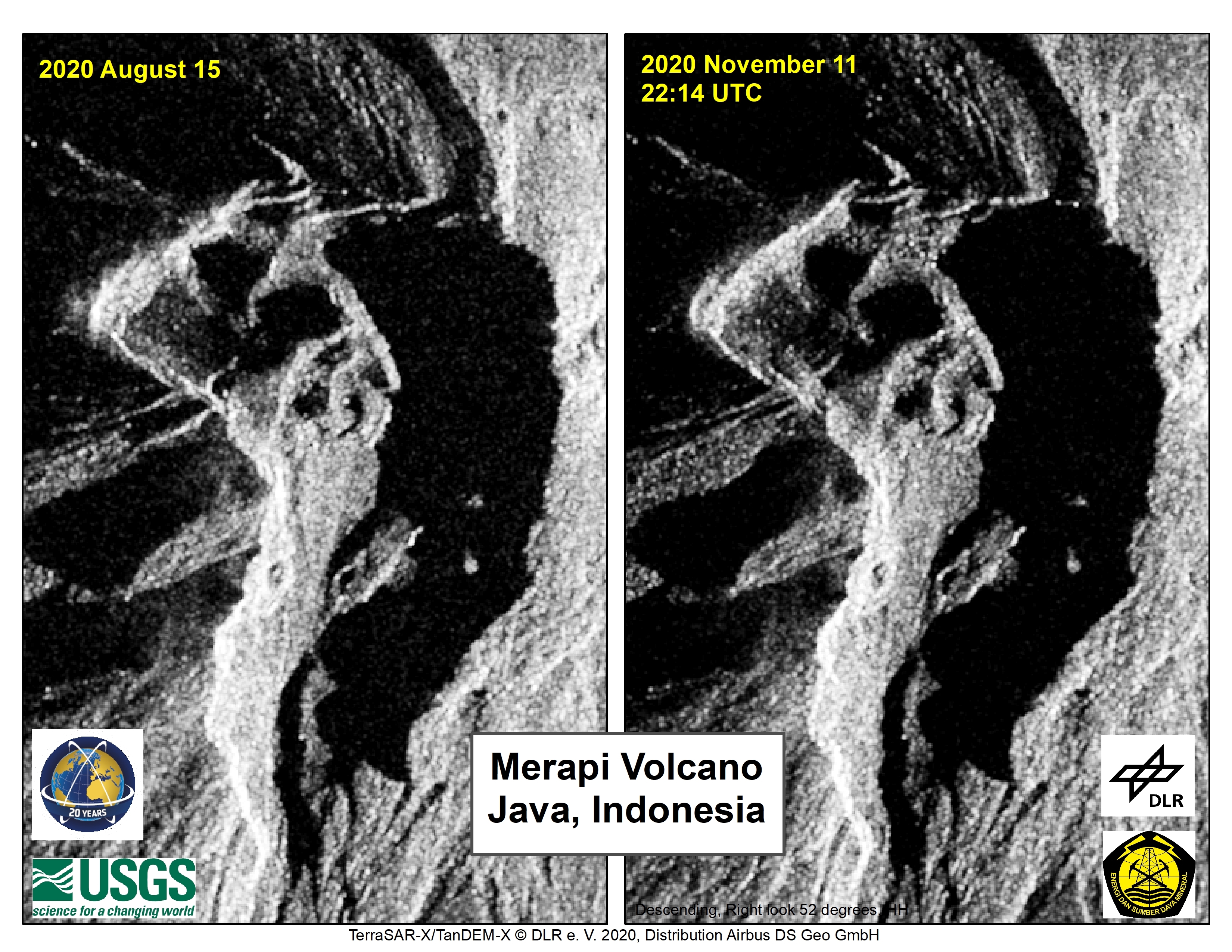
InSAR fringes show deformation of the Merapi summit continues
Direitos autorais: PAZ © Hisdesat Servicios Estratégicos S.A
TerraSAR-X © DLR e.V. (2020), Distribution Airbus DS Geo GmbH
Map produced by USGS
Information about the Product
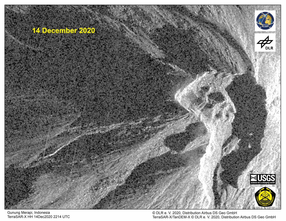
Adquirida: PAZ: 07/12/2020
TerraSAR-X: 14/12/2020
Fonte: TerraSAR-X / PAZ
RCM-derived filtered interferogram showing phase change, Merapi volcano, Indonesia.
Direitos autorais: RADARSAT Constellation Mission Imagery © Government of Canada (2020) - RADARSAT is an official mark of the Canadian Space Agency
Map produced by the Department of Natural Resources Canada
Information about the Product
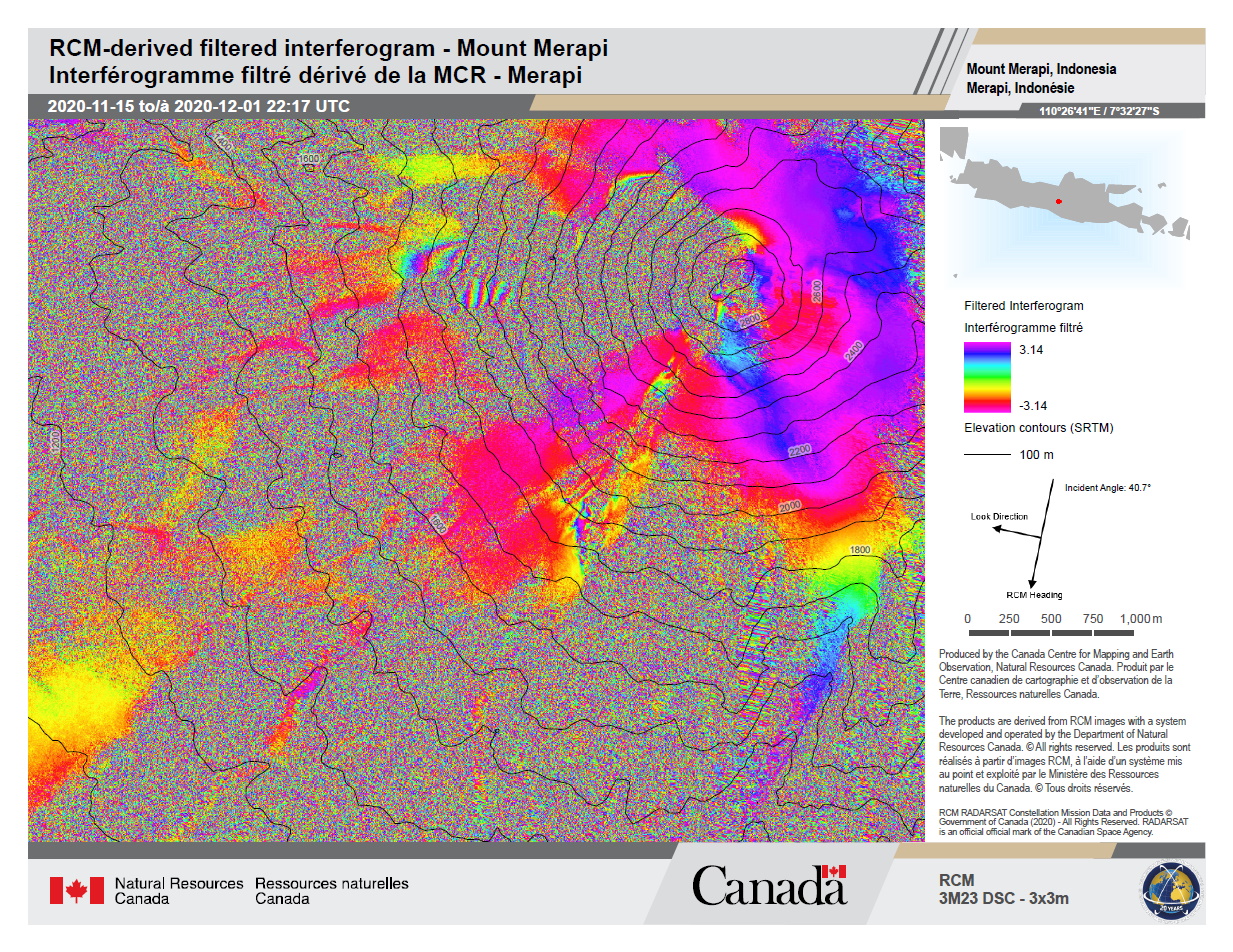
Adquirida: RCM: 15/11/2020 & 01/12/2020
Fonte: RCM
RCM-derived filtered interferogram showing phase change Merapi volcano, Indonesia.
Direitos autorais: RADARSAT Constellation Mission Imagery © Government of Canada (2020) - RADARSAT is an official mark of the Canadian Space Agency
Map produced by the Department of Natural Resources Canada
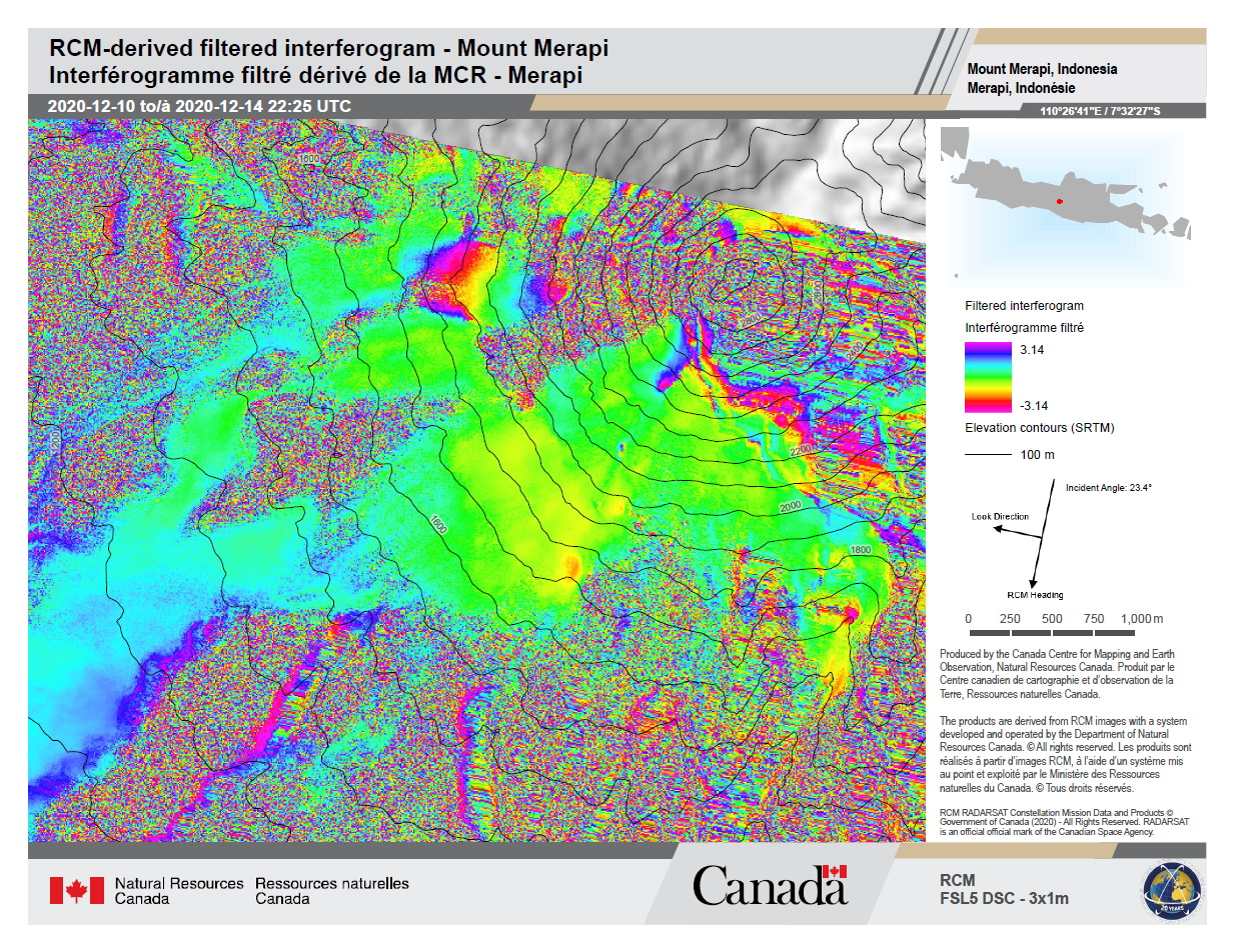
Information about the Product
Adquirida: RCM-3: 10/12/2020 & 14/12/2020
Fonte: RCM
Derived filtered interferogram Mount Merapi, Indonesia
Direitos autorais: RADARSAT Constellation Mission Imagery © Government of Canada (2020) - RADARSAT is an official mark of the Canadian Space Agency
Map produced by the Canada Center for Mapping and Earth Observation and Natural Resources.
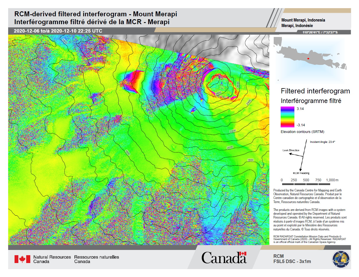
Information about the Product
Adquirida: RCM-2: 06/12/2020
RCM-3: 10/12/2020
Fonte: RCM
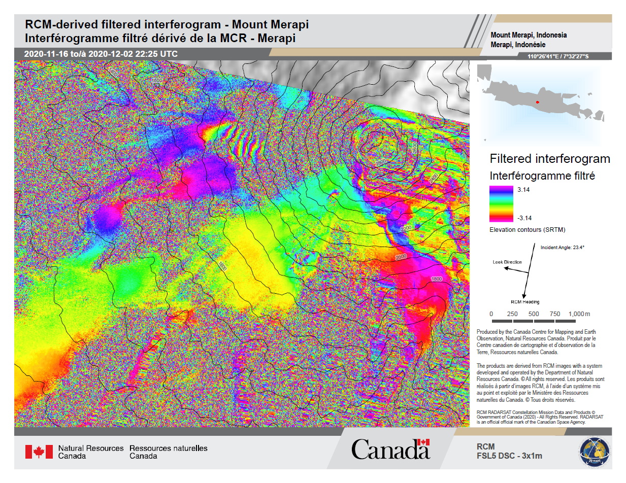
Derived filtered interferogram Mount Merapi, Indonesia
Direitos autorais: RADARSAT Constellation Mission Imagery © Government of Canada (2020) - RADARSAT is an official mark of the Canadian Space Agency
Map produced by the Canada Center for Mapping and Earth Observation and Natural Resources.- RADARSAT is an official mark of the Canadian Space Agency
Information about the Product
Adquirida: RCM-1: 02/12/2020
RCM-2: 06/12/2020
Fonte: RCM
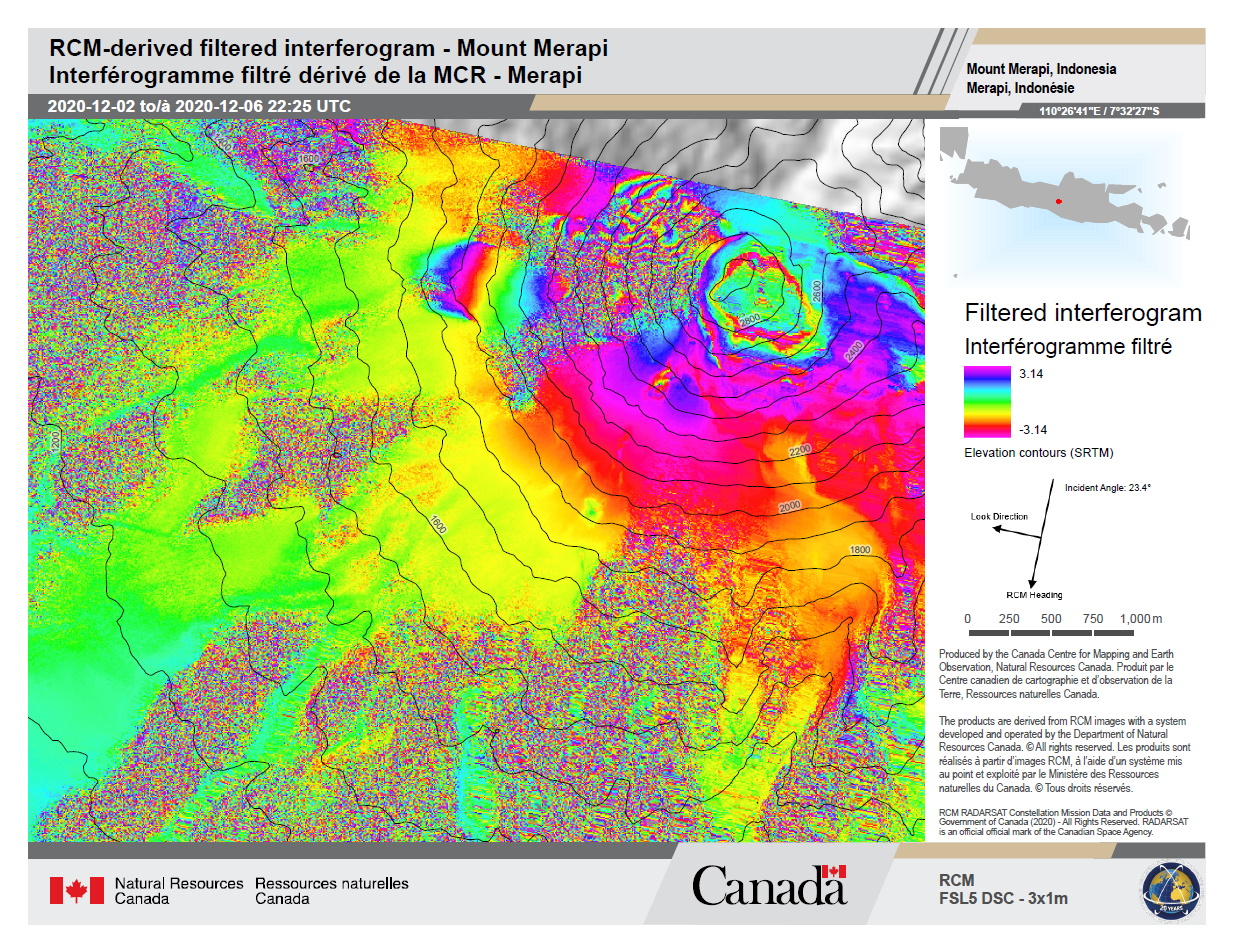
Derived filtered interferogram Mount Merapi, Indonesia
Direitos autorais: RADARSAT Constellation Mission Imagery © Government of Canada (2020) - RADARSAT is an official mark of the Canadian Space Agency
Map produced by the Canada Center for Mapping and Earth Observation and Natural Resources.
Information about the Product
Adquirida: RCM-3: 16/11/2020
RCM-1: 02/12/2020
Fonte: RCM
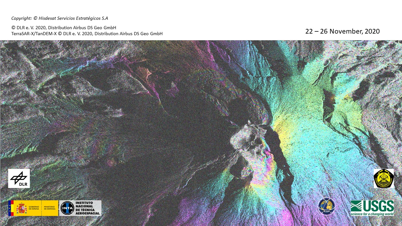
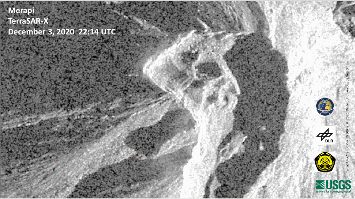
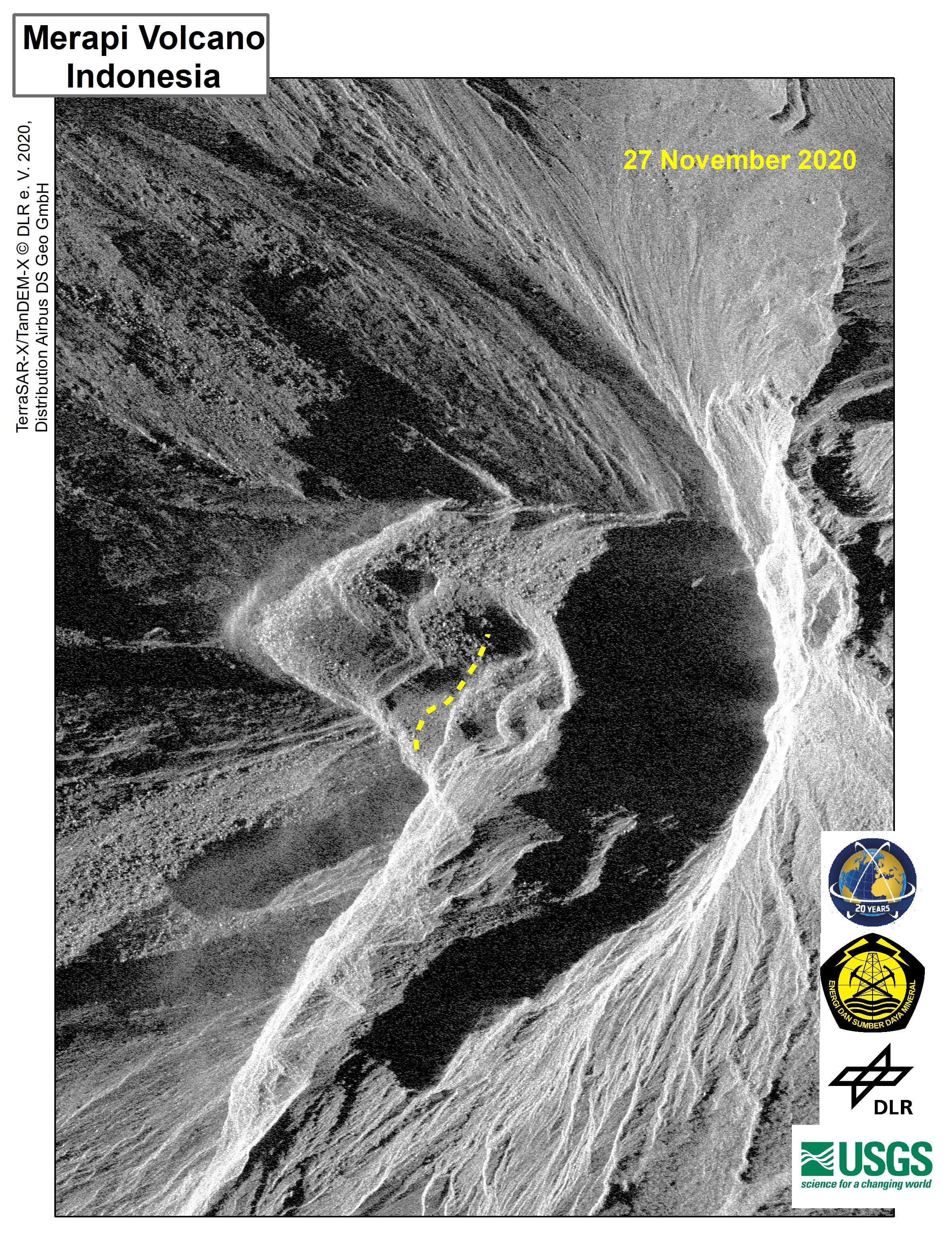
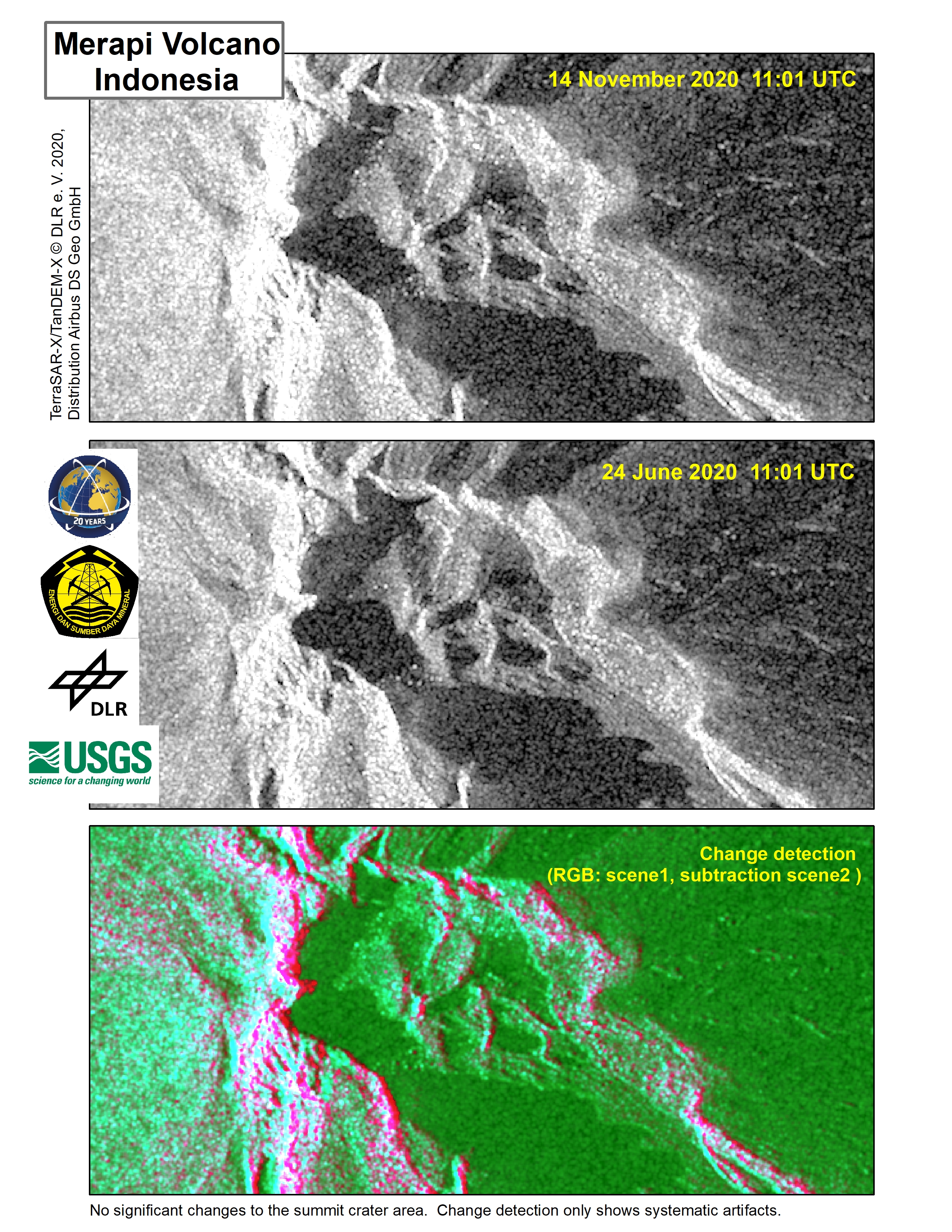
Interferogram shows extensive deformation of the summit area and west flank continues. Image 4 of 4, upper edifice with topography displayed
Direitos autorais: © DLR e.V. (2020), Distribution Airbus DS Geo GmbH
© Hisdesat Servicios Estratégicos S.A
Map produced by USGS
Information about the Product
Adquirida: 22/11/2020 - 26/11/2020
Fonte: TerraSAR-X
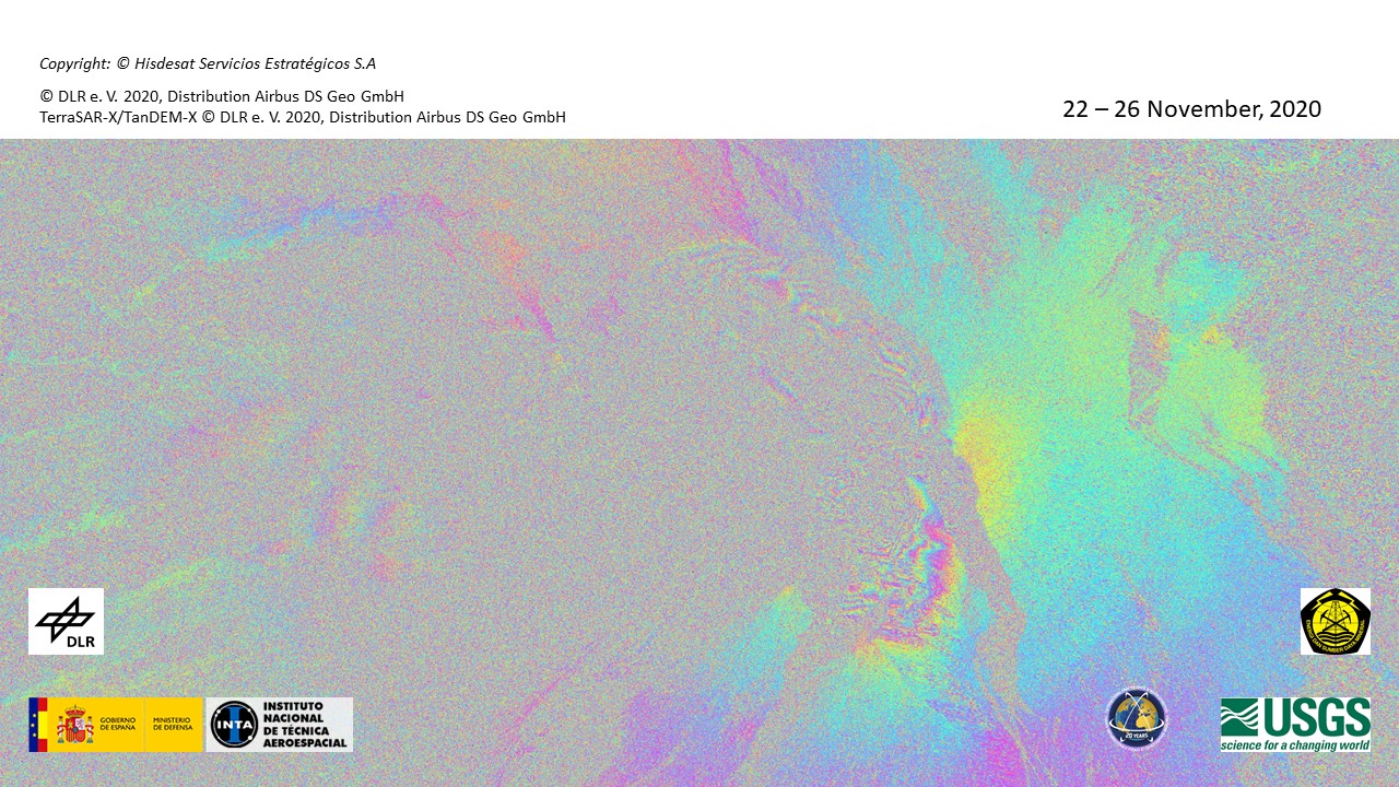
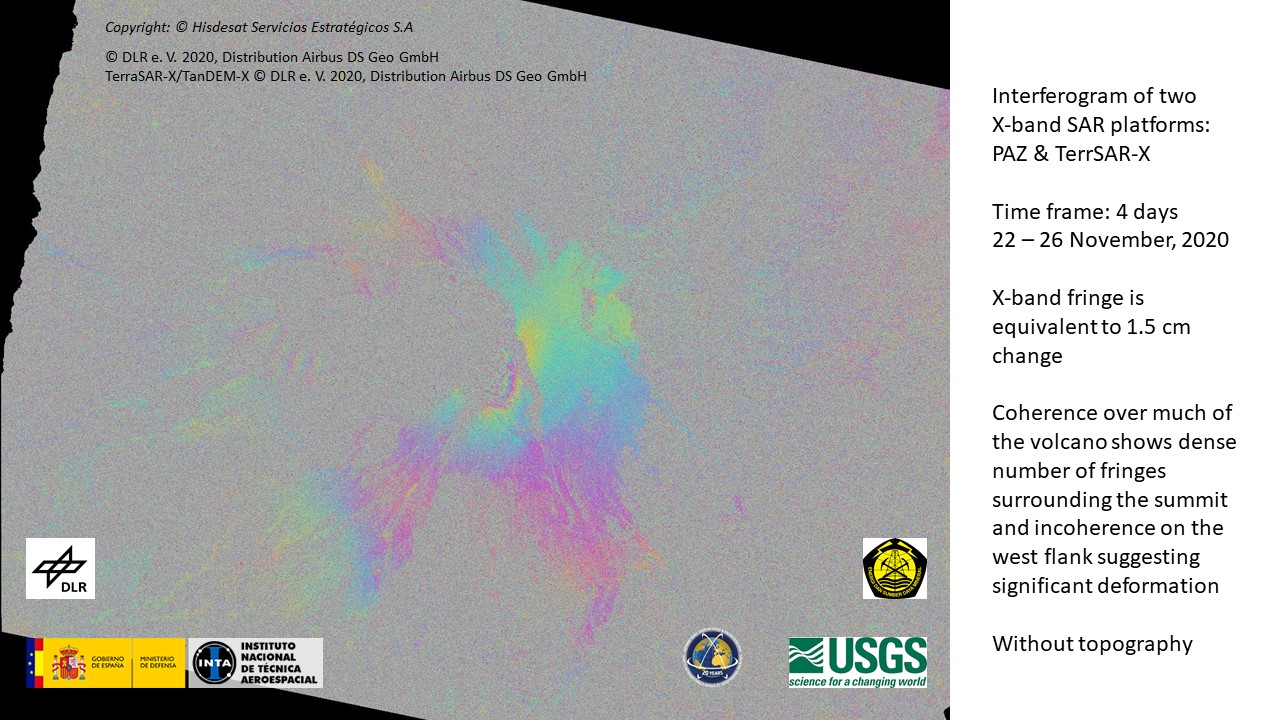
Interferogram shows extensive deformation of the summit area and west flank continues. Image 3 of 4, upper edifice without topography displayed
Direitos autorais: © DLR e.V. (2020), Distribution Airbus DS Geo GmbH
Map produced by USGS
Information about the Product
Adquirida: 22/11/2020 - 26/11/2020
Fonte: TerraSAR-X / TanDEM-X
Interferogram shows extensive deformation of the summit area and west flank continues. Image 2 of 4, whole edifice with topography displayed
Direitos autorais: © DLR e.V. (2020), Distribution Airbus DS Geo GmbH
© Hisdesat Servicios Estratégicos S.A
Map produced by USGS
Information about the Product
Adquirida: TerraSAR-X: 22/11/2020
PAZ: 26/11/2020
Fonte: TerraSAR-X / PAZ
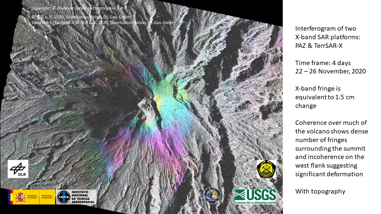
Interferogram shows extensive deformation of the summit area and west flank continues. Image 1 of 4, whole edifice without topography displayed
Direitos autorais: © DLR e.V. (2020), Distribution Airbus DS Geo GmbH
© Hisdesat Servicios Estratégicos S.A
Map produced by USGS
Information about the Product
Adquirida: TerraSAR-X: 22/11/2020
PAZ: 26/11/2020
Fonte: TerraSAR-X / PAZ
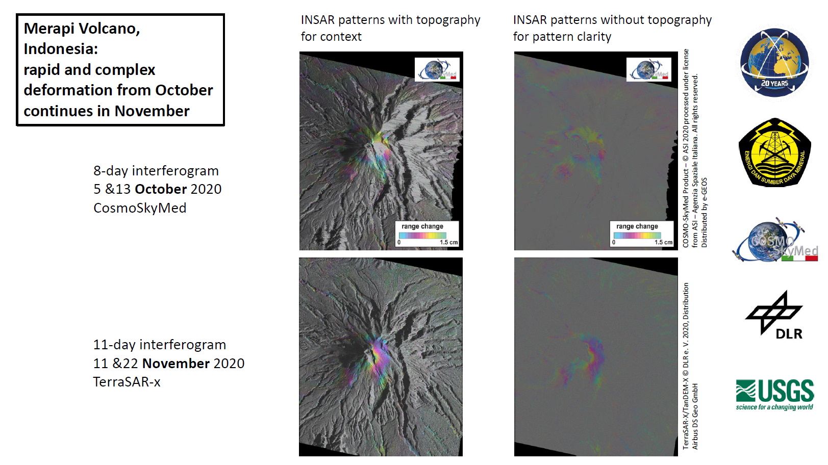
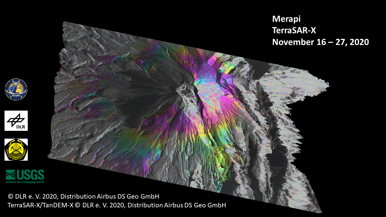
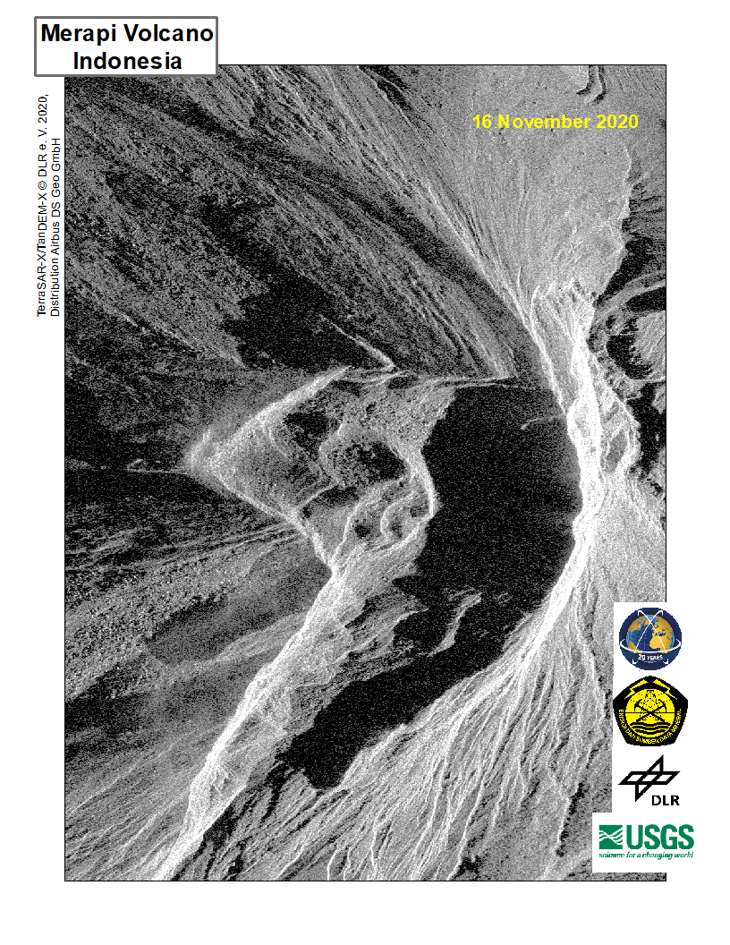
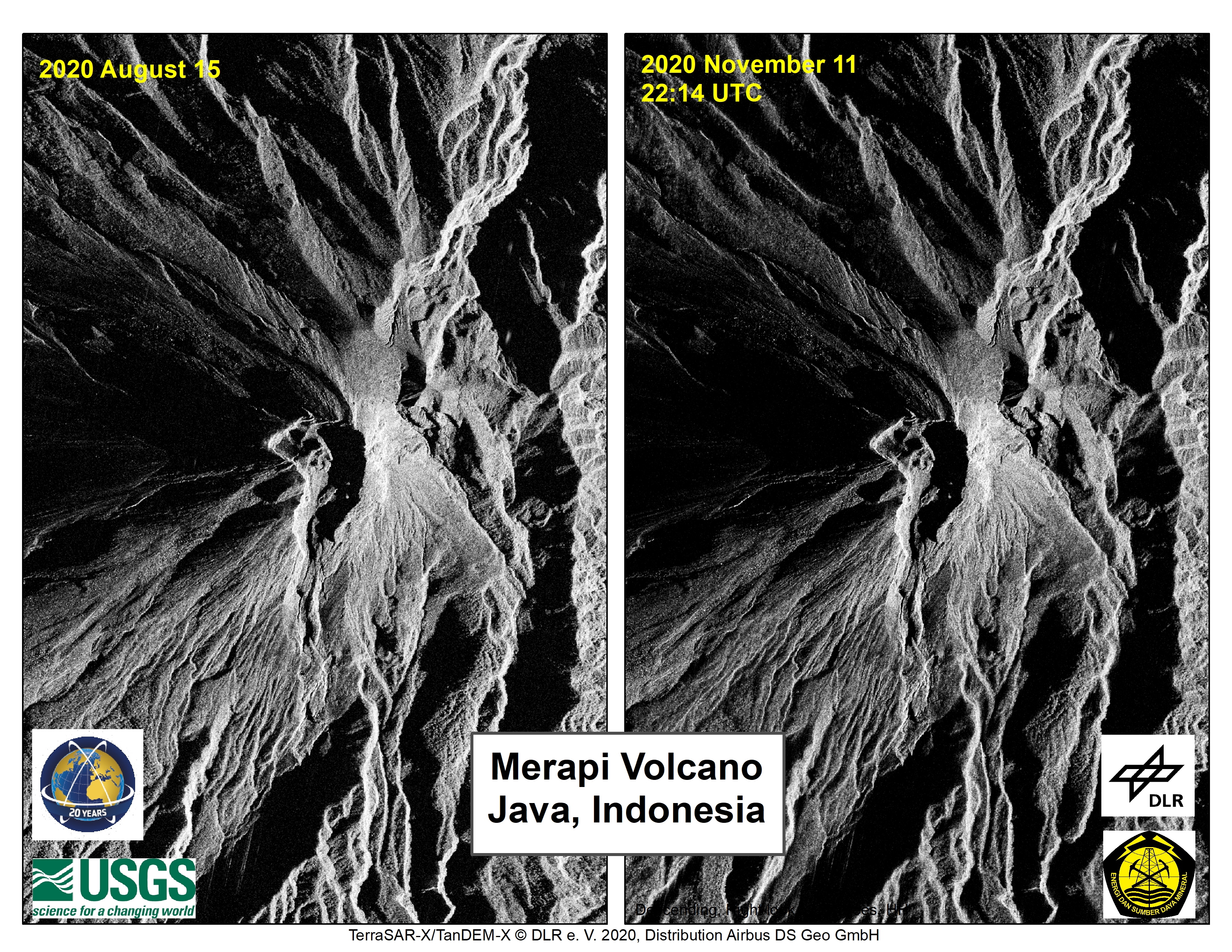
Deformation of the summit of Merapi volcano seen from mid-October into mid-November, 2020
Direitos autorais: © DLR e.V. (2020), Distribution Airbus DS Geo GmbH
COSMO-SkyMed Product – © ASI 2020 processed under license from ASI – Agenzia Spaziale Italiana. All rights reserved. Distributed by e-GEOS
Map produced by USGS
Information about the Product
Adquirida: COSMO-SkyMed: 05/10/2020 - 13/10/2020
TerraSAR-X : 11/10/2020 - 22/10/2020
Fonte: TerraSAR-X / COSMO-SkyMed
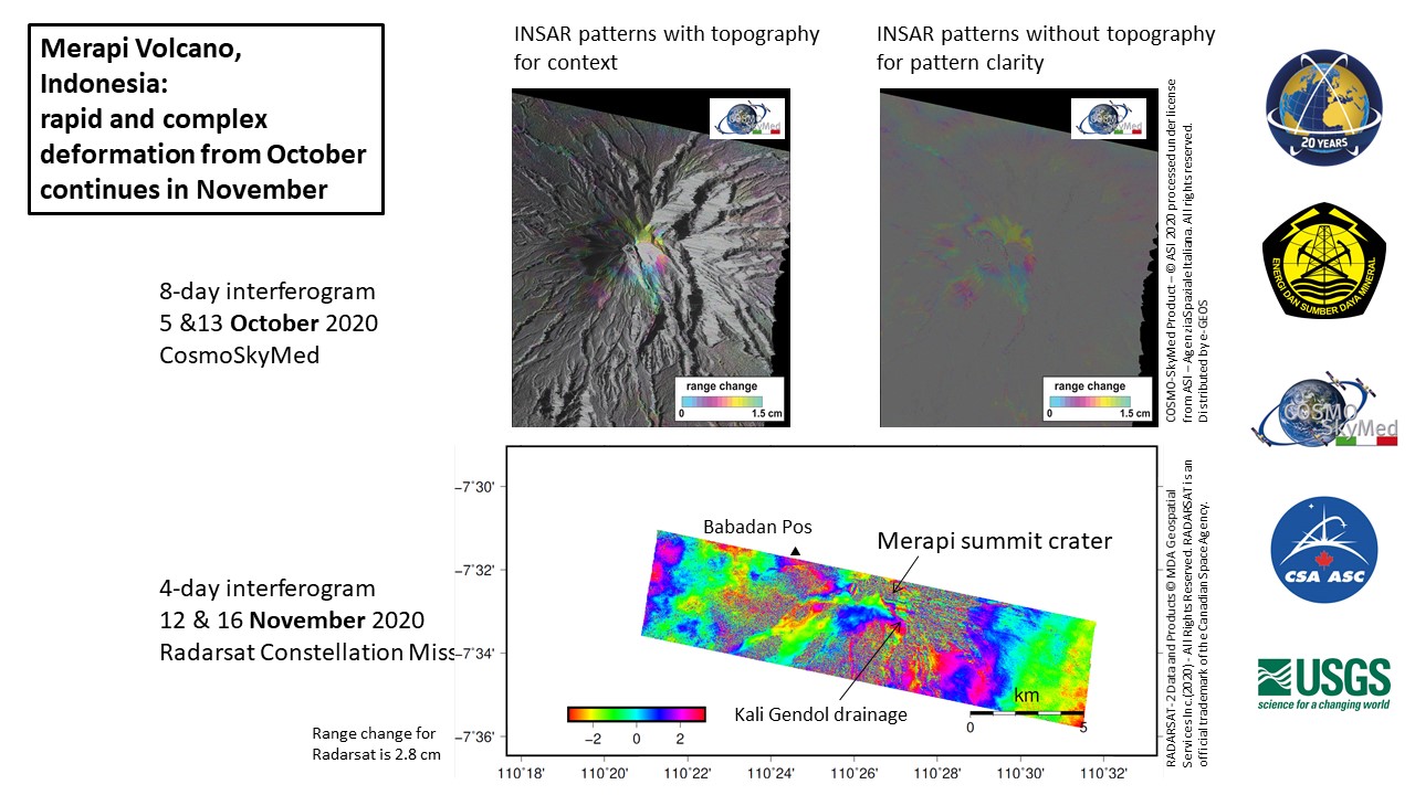
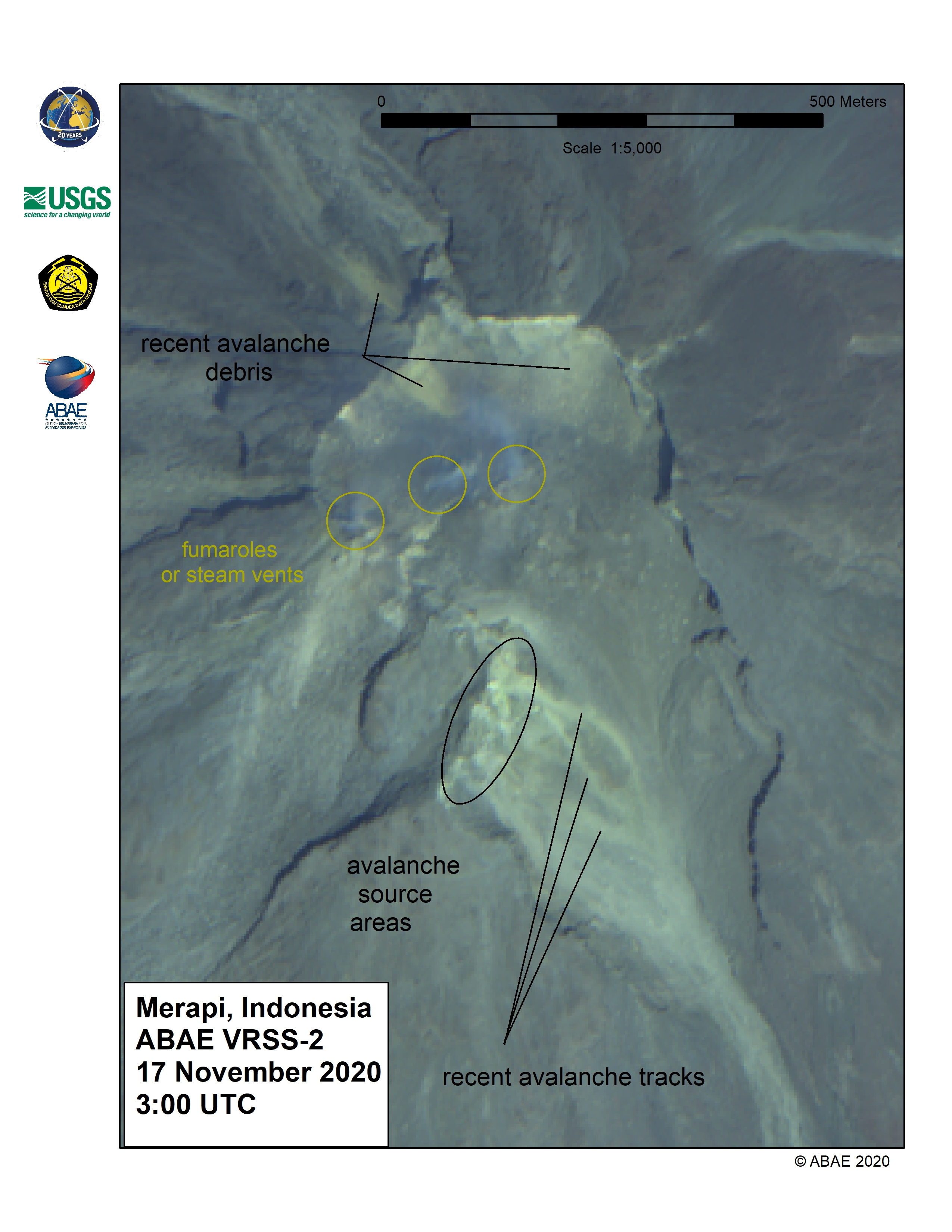
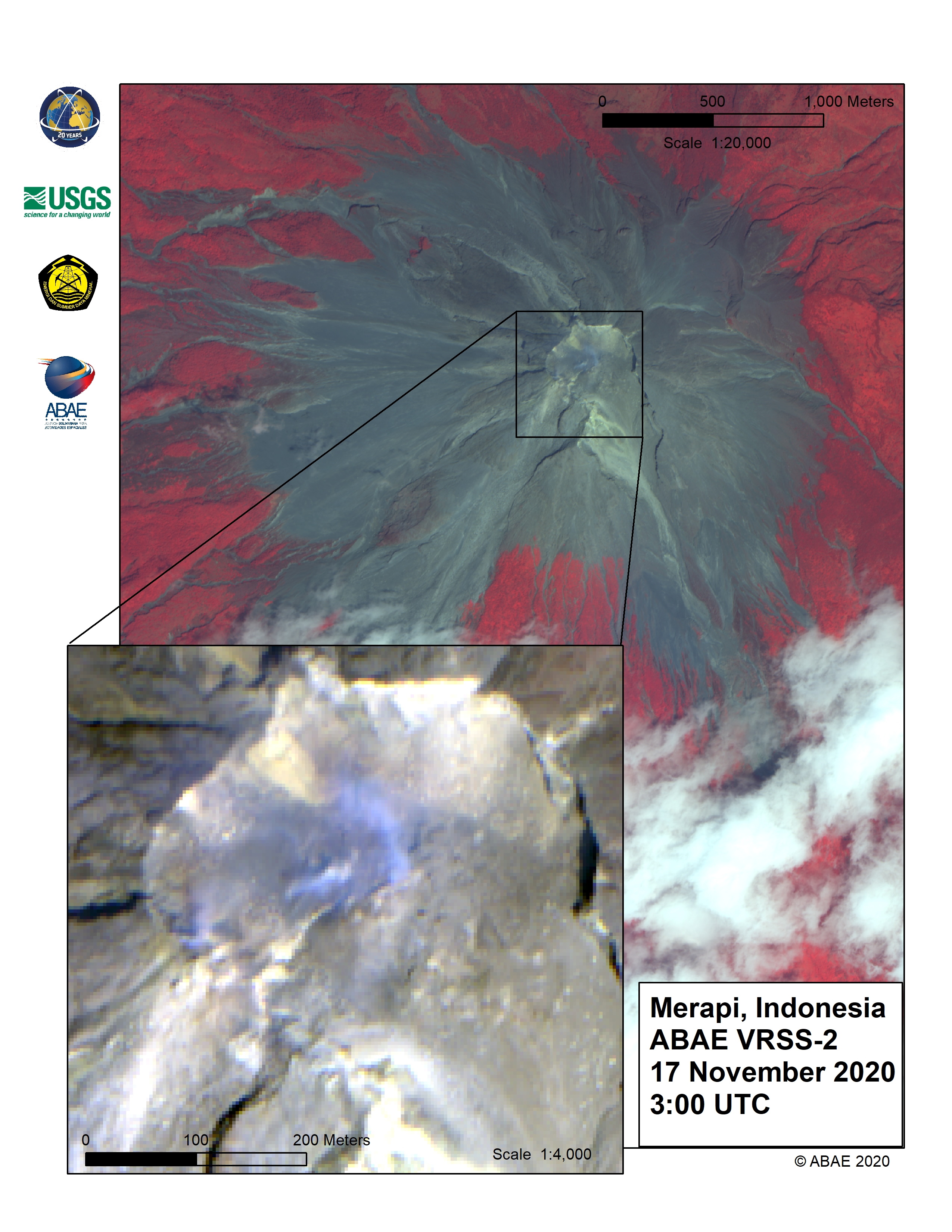
Localized deformation of the summit and west edifice of Merapi observed in mid-October continues into mid-November, 2020
Direitos autorais: RADARSAT Constellation Mission Imagery © Government of Canada (2020) - RADARSAT is an official mark of the Canadian Space Agency
COSMO-SkyMed Product – © ASI 2020 processed under license from ASI – Agenzia Spaziale Italiana. All rights reserved. Distributed by e-GEOS
Map produced by USGS
Information about the Product
Adquirida: COSMO-SkyMed: 05/10/2020 - 13/10/2020
RCM: 12/10/2020 - 16/10/2020
Fonte: RCM / COSMO-SkyMed
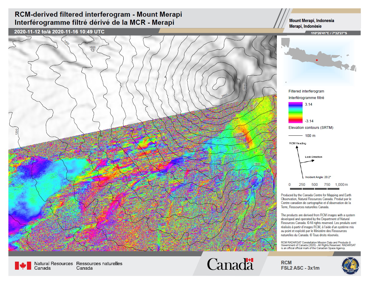
RCM-derived filtered interferogram showing phase change between 2020-11-12 and 2020-11-16, ascending pass, Merapi volcano, Indonesia
Direitos autorais: RADARSAT Constellation Mission Imagery © Government of Canada (2020) - RADARSAT is an official mark of the Canadian Space Agency.
Map produced by the Canada Center for Mapping and Earth Observation
Information about the Product
Adquirida: 16/12/2020
Fonte: RCM
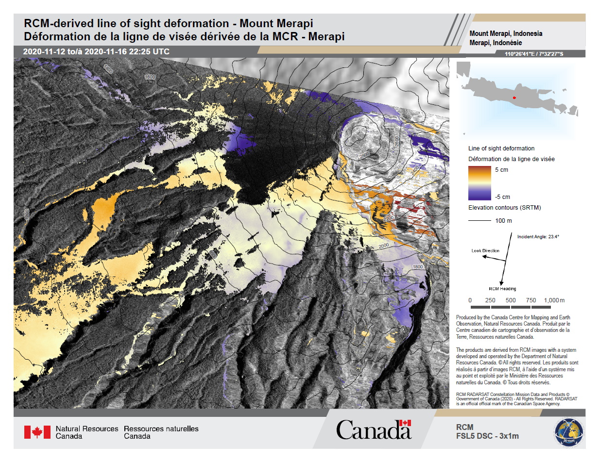
RCM-derived line of sight ground movement between 2020-11-12 and 2020-11-16, descending pass, Merapi volcano, Indonesia
Direitos autorais: RADARSAT Constellation Mission Imagery © Government of Canada (2020) - RADARSAT is an official mark of the Canadian Space Agency.
Map produced by the Canada Center for Mapping and Earth Observation
Information about the Product
Adquirida: 16/11/2020
Fonte: RCM
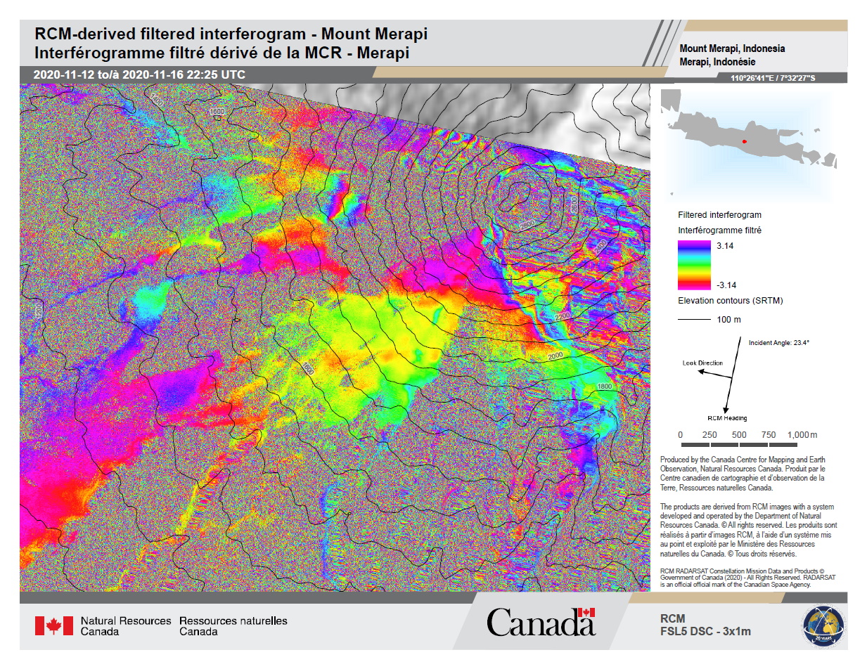
RCM-derived filtered interferogram showing phase change between 2020-11-12 and 2020-11-16, descending pass, Merapi volcano, Indonesia
Direitos autorais: RADARSAT Constellation Mission Imagery © Government of Canada (2020) - RADARSAT is an official mark of the Canadian Space Agency.
Map produced by the Canada Center for Mapping and Earth Observation
Information about the Product
Adquirida: 16/11/2020
Fonte: RCM
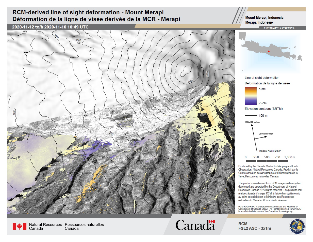
RCM-derived line of sight ground movement between 2020-11-12 and 2020-11-16, ascending pass, Merapi volcano, Indonesia
Direitos autorais: RADARSAT Constellation Mission Imagery © Government of Canada (2020) - RADARSAT is an official mark of the Canadian Space Agency.
Map produced by the Canada Center for Mapping and Earth Observation
Information about the Product
Adquirida: 16/11/2020
Fonte: RCM
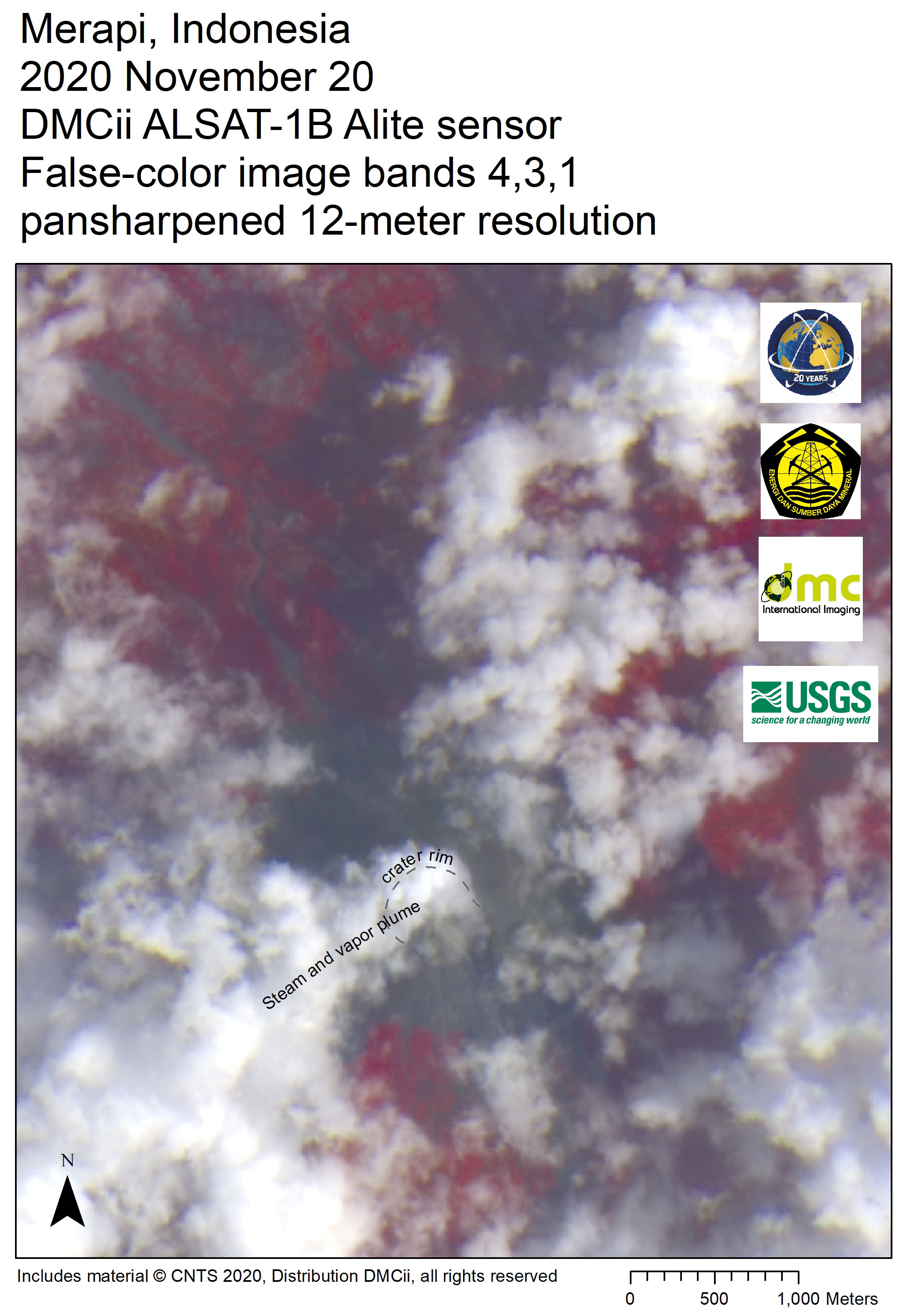
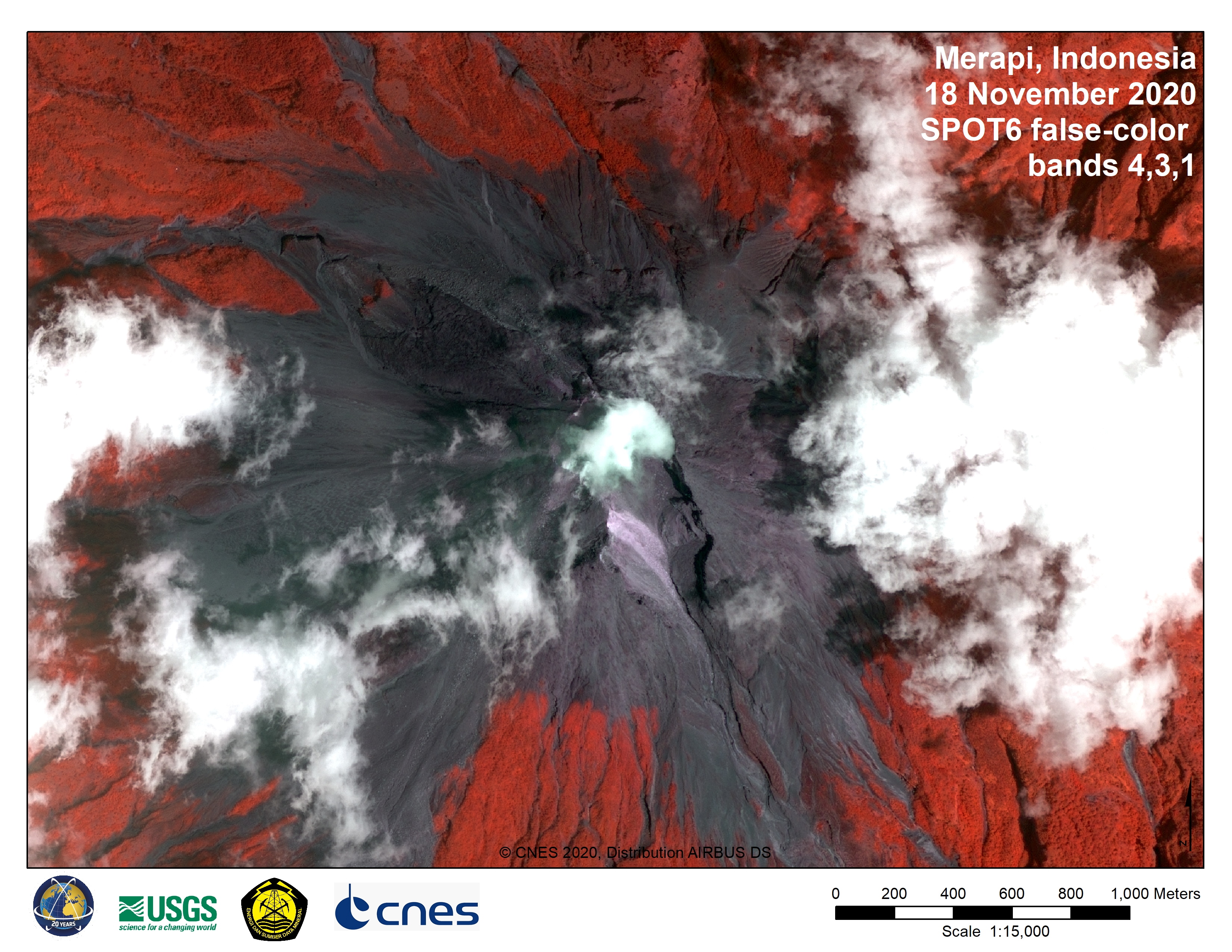
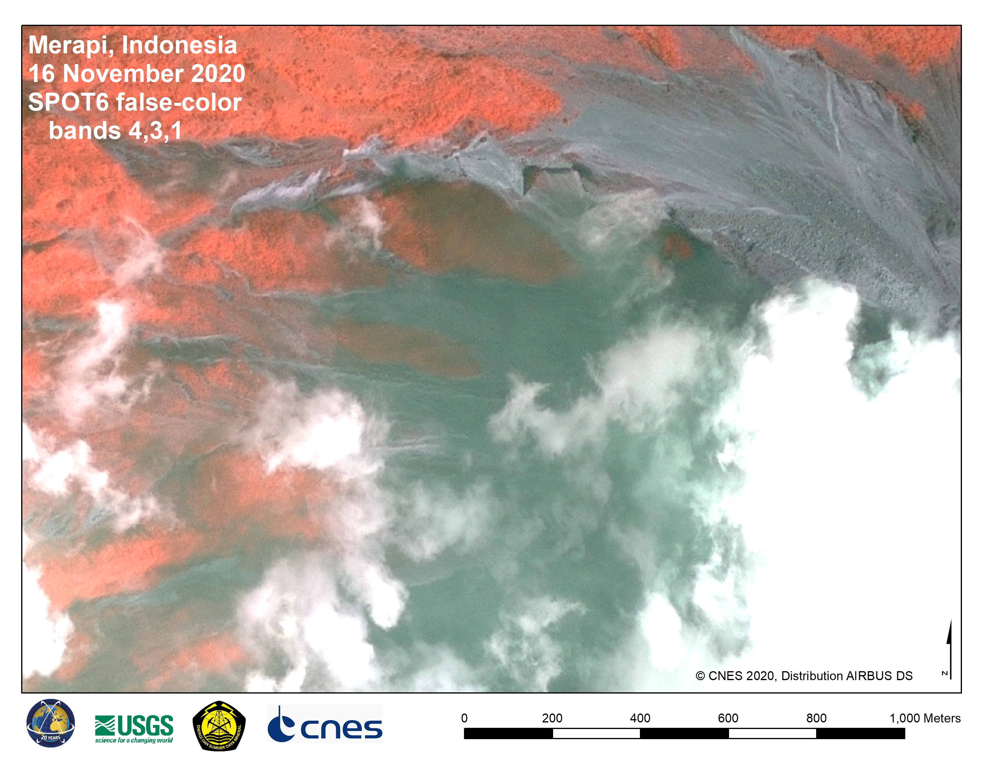
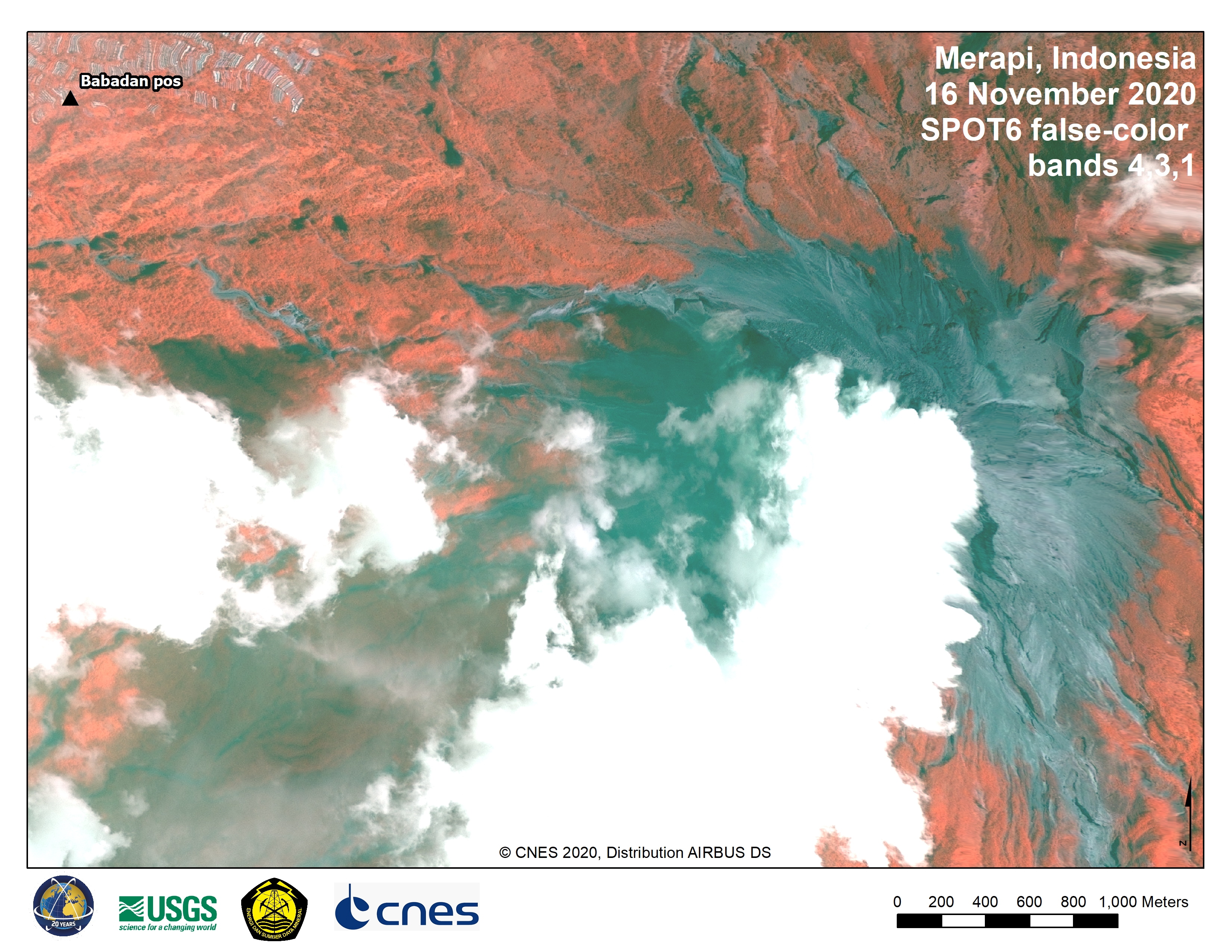
False-color image shows the approximate crater area and visible steam and vapor plume rising from the crater
Direitos autorais: DMC Constellation, ALSAT-1B image © (2020) ASAL, Distribution Airbus DS, all rights reserved
Map produced by USGS
Information about the Product
Adquirida: ALSAT-1B: 20/11/2020
Fonte: ALSAT-1B

 Voltar ao arquivo completo da Ativação

