 English
 Spanish
 French
 Chinese
 Russian
 Portuguese
 Latest Activation
Charter activations
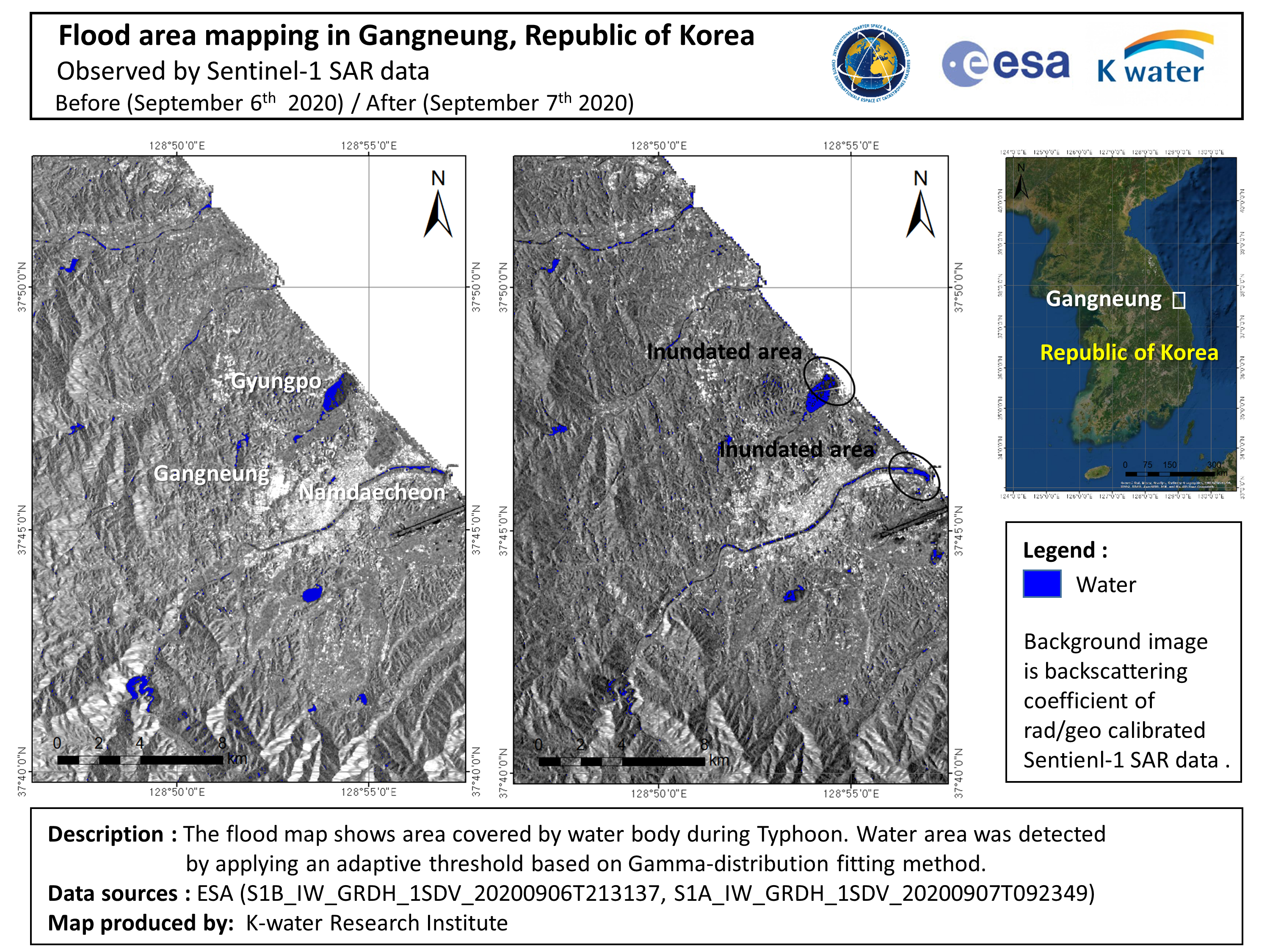
Typhoon Maysak in South Korea
Typhoon Maysak tracked past Okinawa, Japan with wind speeds of over 100mph and is now headed towards South Korea where it is expected to make landfall on 2 September.
Maysak is currently as powerful as a Category 3 hurricane but is expected to intensify and has the potential to become a super typhoon. The storm is predicted to pass to the east of Seoul, but Busan, the nation's second largest city and the world's fifth largest port is expected to be affected by storm surges and strong winds.
Maysak is expected to bring torrential rains and wind speeds of up to 140mph to South and North Korea, before moving into northeastern China. Some areas of South Korea are bracing for more flooding as Typhoon Bavi had already passed by saturating the area only one week ago.
| Tipo de evento: | Cyclone |
| Local do evento: | South Korea |
| Data da Ativação da Carta: | 2020-08-31 |
| Tempo de Ativação da Carta: | 00:38 |
| Zona de Tempo da Ativação da Carta: | UTC+02:00 |
| Requisitante da Carta: | National Disaster Management Institute (NDMI) |
| ID da Ativação: | 673 |
| Gerenciamento de projeto: | KARI |
 Voltar ao arquivo completo da Ativação

