Charter activations
Landslide in Mexico
Seasonal cold fronts have brought more rain to several municipalities of Chiapas, in Mexico, which are suffering from the aftermath of Hurricane's Eta and Iota. This has caused flooding and landslides in Ixhuatan, Matzam, Tacuba and Juan de Grijalva.
The extent of the landslides are not yet known, as access to some rural communities by road has been cut off.
| Tipo de evento: | Landslide |
| Local do evento: | Mexico |
| Data da Ativação da Carta: | 2020-12-01 |
| Tempo de Ativação da Carta: | 10:30 |
| Zona de Tempo da Ativação da Carta: | UTC+01:00 |
| Requisitante da Carta: | UNOOSA/UN-SPIDER on behalf of National Disaster Prevention Centre of Mexico (CENAPRED) |
| ID da Ativação: | 689 |
| Gerenciamento de projeto: | National Autonomous University of Mexico (UNAM) |
Products
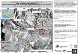
Landslides map of Tiontiepa-Benito Juarez using 1 m resolution data
Direitos autorais: © DLR e.V. (2020), Distribution Airbus DS Geo GmbH
Map produced by National Autonomous University of México (UNAM), Maritime Authority of Colombia (DIMAR) and National Center of Disaster prevention (CENAPRED).
Information about the Product
Adquirida: 11/12/2020
Fonte: TerraSAR-X
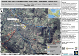
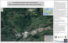
Landslides map in Ignacio Zaragoza and Chapayal Grande, Chiapas, Mexico
Direitos autorais: Pleiades © CNES (2020) - Distribution: Airbus Defence and Space, all rights reserved
Map produced by National Center of Disaster prevention (CENAPRED).
Information about the Product
Adquirida: 02/12/2020
Fonte: Pleiades
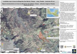
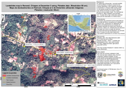
Landslides map in Anexo las Margaritas (San Martín), Chiapas, Mexico
Direitos autorais: Pleiades © CNES (2020) - Distribution: Airbus Defence and Space, all rights reserved
Map produced by National Center of Disaster prevention (CENAPRED).
Information about the Product
Adquirida: 02/12/2020
Fonte: Pleiades
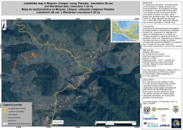
Landslides map in Muquén, Chiapas, Mexico
Direitos autorais: Pleiades © CNES (2020) - Distribution: Airbus Defence and Space, all rights reserved
WorldView © (2020) DigitalGlobe, Inc., Longmont CO USA 80503. DigitalGlobe and the DigitalGlobe logos are trademarks of DigitalGlobe, Inc. The use and/or dissemination of this data and/or of any product in any way derived there from are restricted. Unauthorized use and/or dissemination is prohibited.
Map produced by National Center of Disaster prevention (CENAPRED).
Information about the Product
Adquirida: Pleiades: 02/12/2020
WorldView: 02/12/2020
Fonte: Pleiades / WorldView
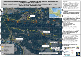
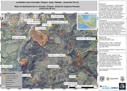
Landslides map in the transect Tzomtehuitz-La Cañada, Chiapas Mexico
Direitos autorais: Pleiades © CNES (2020) - Distribution: Airbus Defence and Space, all rights reserved
Map produced by National Center of Disaster prevention (CENAPRED).
Information about the Product
Adquirida: 02/12/2020
Fonte: Pleiades
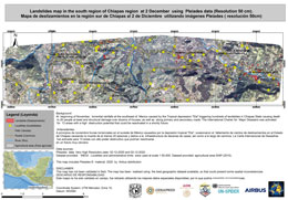
Map of landslides in the south of Chiapas region using 50 cm resolution data
Direitos autorais: Pleiades © CNES (2020) - Distribution: Airbus Defence and Space, all rights reserved
Map produced by National Autonomous University of México (UNAM), Maritime Authority of Colombia (DIMAR) and National Center of Disaster prevention (CENAPRED).
Information about the Product
Adquirida: 02/12/2020
Fonte: Pleiades
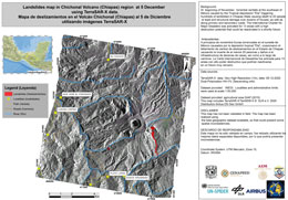
Map of landslides at Chichonal Volcano, in the Chiapas region of Mexico
Direitos autorais: © DLR e.V. (2020), Distribution Airbus DS Geo GmbH
Map produced by National Autonomous University of México (UNAM), Maritime Authority of Colombia (DIMAR) and National Center of Disaster prevention (CENAPRED).
Information about the Product
Adquirida: 05/12/2020
Fonte: TerraSAR-X
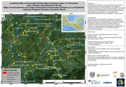
Map of landslides at Ixtacomitan-Solosuchiapa (Chiapas) region using 50 cm resolution data
Direitos autorais: Pleiades © CNES (2020) - Distribution: Airbus Defence and Space, all rights reserved
Map produced by National Autonomous University of México (UNAM), Maritime Authority of Colombia (DIMAR) and National Center of Disaster prevention (CENAPRED).
Information about the Product
Adquirida: 02/12/2020
Fonte: Pleiades
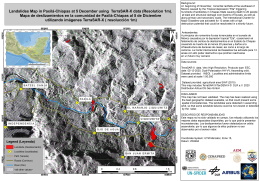
Map of landslides at Paxilá-Chiapas in Mexico using 1 m resolution data
Direitos autorais: © DLR e.V. (2020), Distribution Airbus DS Geo GmbH
Map produced by National Autonomous University of México (UNAM), Maritime Authority of Colombia (DIMAR) and National Center of Disaster prevention (CENAPRED).
Information about the Product
Adquirida: 05/12/2020
Fonte: TerraSAR-X
 Voltar ao arquivo completo da Ativação

 English
 Spanish
 French
 Chinese
 Russian
 Portuguese
