Minimizar Latest Activation

Charter activations

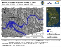
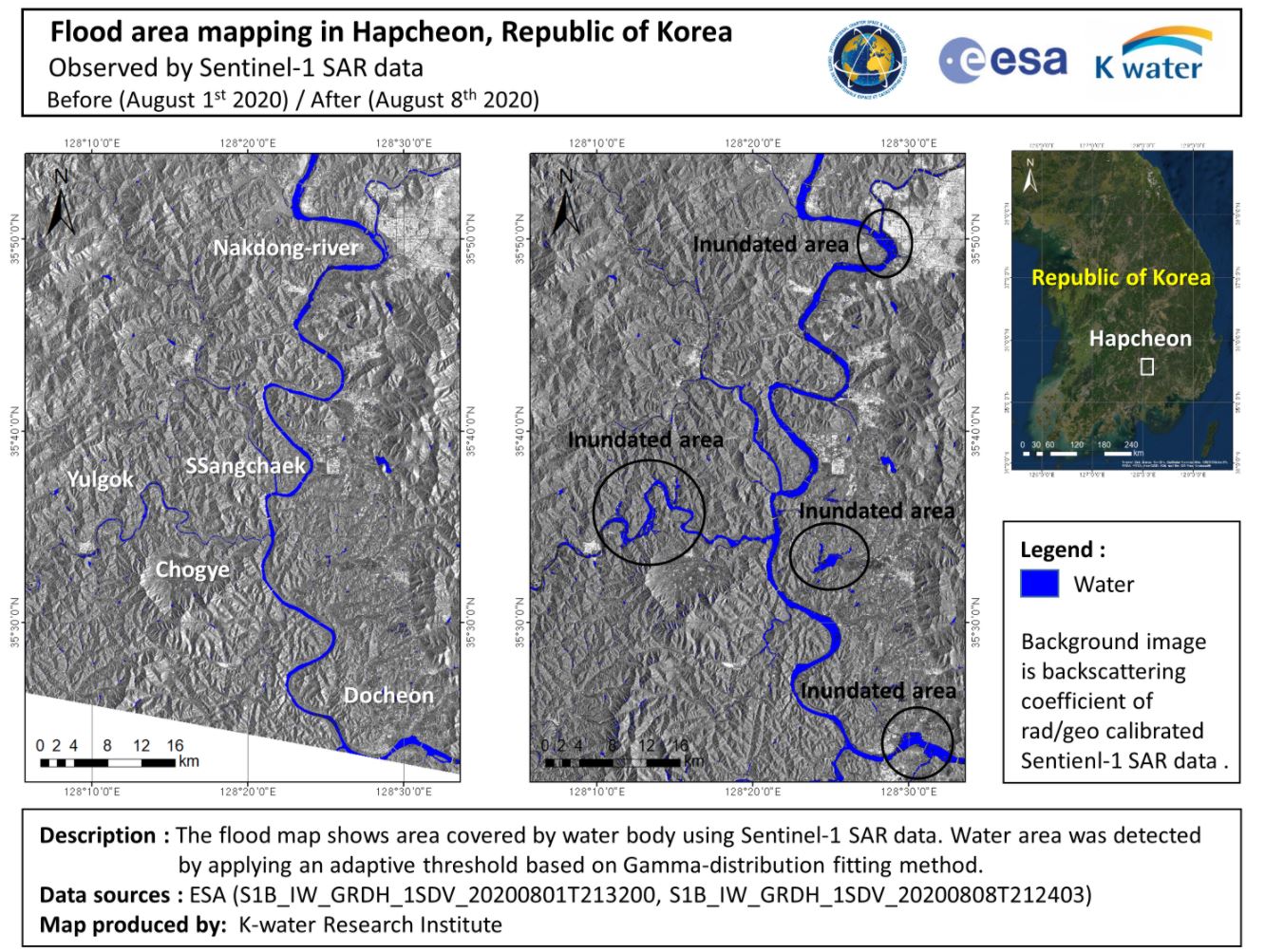
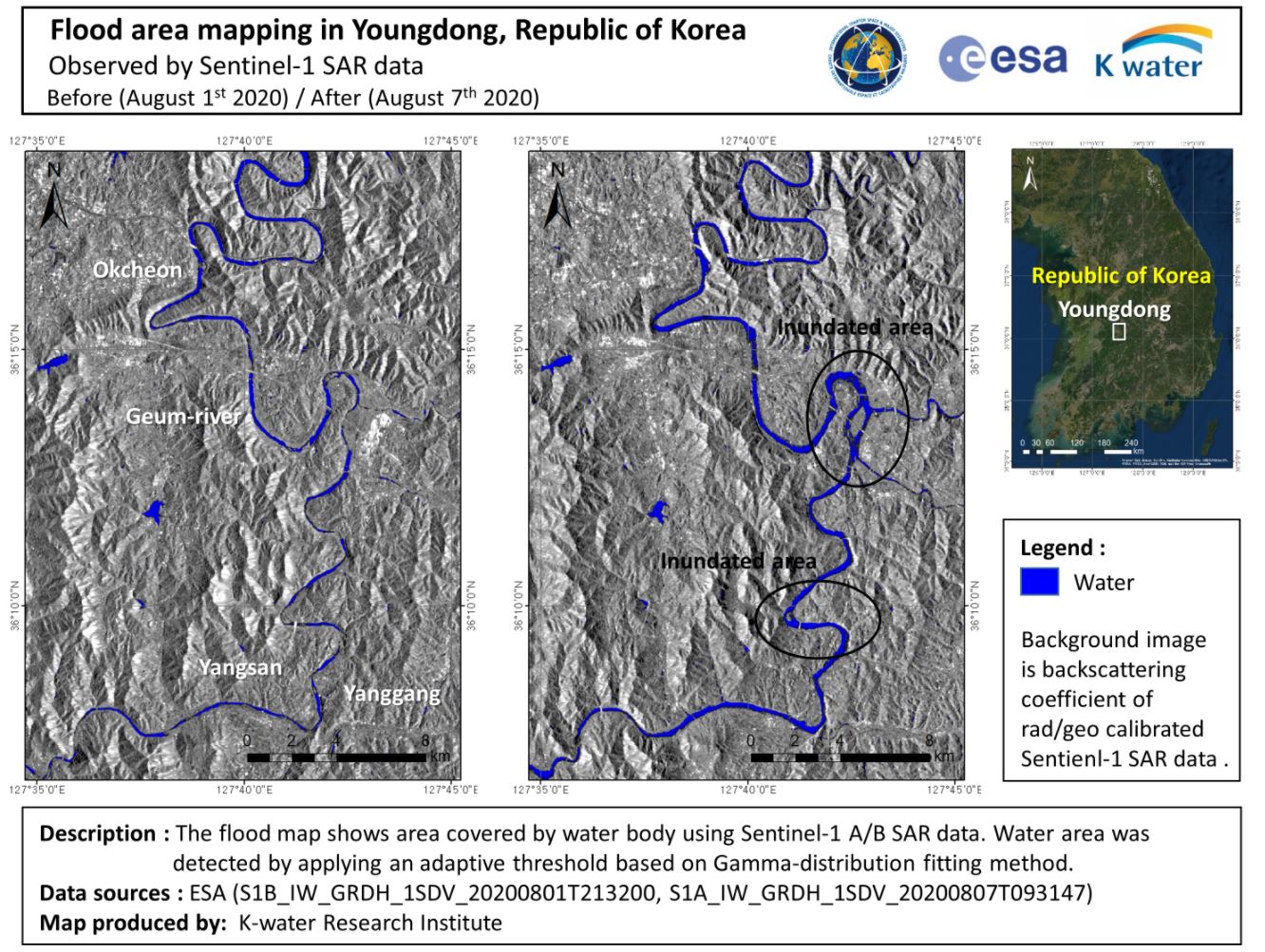
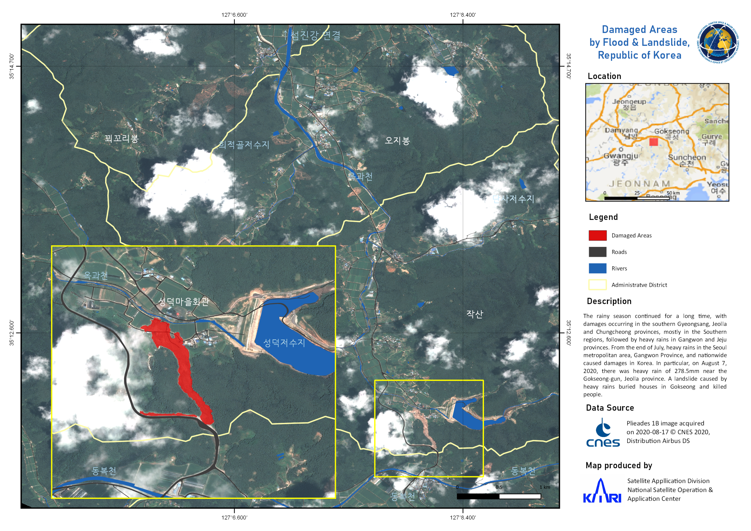
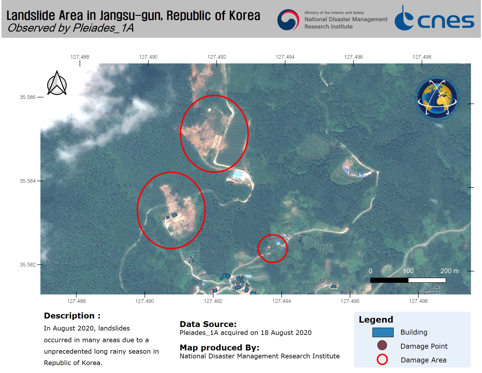
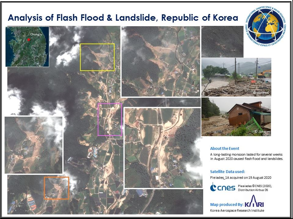
Flooding and Landslides in South Korea

At least 30 people are dead and a dozen are missing after more than a week of devastating torrential rain caused landslides in South Korea as it battles the longest monsoon since 2013. Current weather forecasts predict that this year's monsoon may last longer.

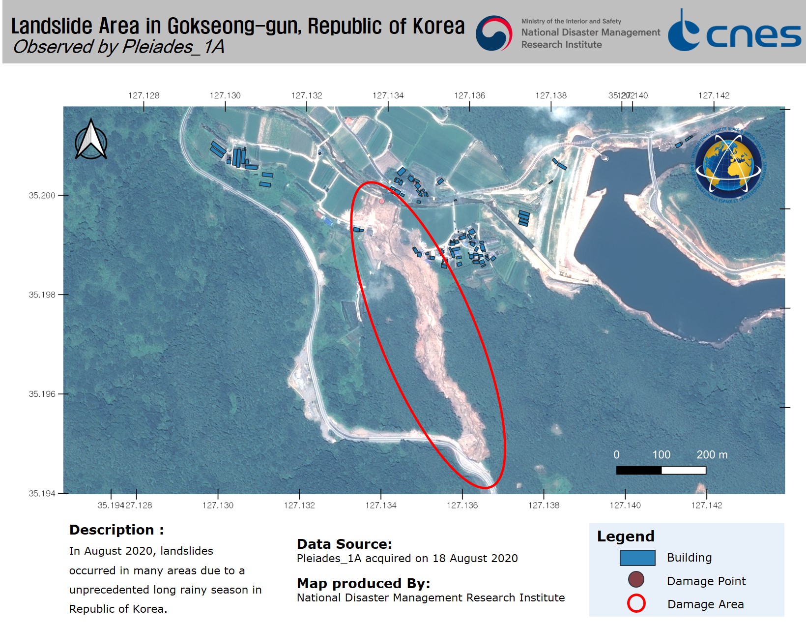
About 100 metres of levee collapsed at the Seomjin River on the southern edge of the Korean peninsula forcing about 1,900 people to be evacuated from the local area and Five homes were buried in a landslide from a mountain behind a village in Gokseong, South Jeolla province, killing five people and requiring more to be rescued

The country's forestry agency has raised landslide warnings to its highest level in every region except the holiday island of Jeju.

Tipo de evento:Flood, Landslide
Local do evento:South Korea
Data da Ativação da Carta:2020-08-14
Tempo de Ativação da Carta:11:06
Zona de Tempo da Ativação da Carta:UTC+09:00
Requisitante da Carta:National Disaster Management Institute (NDMI)
ID da Ativação:668
Gerenciamento de projeto:KARI

Products

Flood area mapping in Geumsan, South Korea

Direitos autorais: © KARI (2020).
Map produced by KARI

Information about the Product

Adquirida: 08/08/2020

Fonte: KOMPSAT-5

Flood area mapping in Hapcheon, South Korea

Direitos autorais: Contains modified Copernicus Sentinel data (2020)
Map produced by KARI

Information about the Product

Adquirida: 08/08/2020 and 01/09/2020

Fonte: Sentinel-1

Flood area mapping in Youngdong, South Korea

Direitos autorais: Contains modified Copernicus Sentinel data (2020)
Map produced by KARI

Information about the Product

Adquirida: 01/08/2020, 07/08/2020

Fonte: Sentinel-1

Damaged Areas by Flood & Landslide in Gokseong-gun, Republic of Korea

Direitos autorais: Includes Pleiades material © CNES (2020), Distribution Airbus DS.
Map produced by National Disaster Management Research Institute

Information about the Product

Adquirida: 17/08/2020

Fonte: Pleaides

Landslide Area in Jangsu-gun, Republic of Korea

Direitos autorais: Includes Pleiades material © CNES (2020), Distribution Airbus DS.
Map produced by National Disaster Management Research Institute

Information about the Product

Adquirida: 18/08/2020

Fonte: Pleiades

Landslide Area in Gokseong-gun, Republic of Korea

Direitos autorais: Includes Pleiades material © CNES (2020), Distribution Airbus DS.
Map produced by National Disaster Management Research Institute

Information about the Product

Adquirida: 18/08/2020

Fonte: Pleiades

Landslide Area in Gapyeong-gun, Republic of Korea

Direitos autorais: Includes Pleiades material © CNES (2020), Distribution Airbus DS.
Map produced by National Disaster Management Research Institute

Information about the Product

Adquirida: 19/08/2020

Fonte: Pleiades

Landslide Area in Anseong-si, Republic of Korea

Direitos autorais: Includes Pleiades material © CNES (2020), Distribution Airbus DS.
Map produced by National Disaster Management Research Institute

Information about the Product

Adquirida: 24/08/2020

Fonte: Pleiades

Analysis of flash flood and landslide, Rep. of South Korea

Direitos autorais: Includes Pleiades material © CNES (2020), Distribution Airbus DS.
Map produced by KARI

Information about the Product

Adquirida: 19/08/2020

Fonte: Pleiades

Voltar ao arquivo completo da Ativação