 English
 Spanish
 French
 Chinese
 Russian
 Portuguese
 Latest Activation
Charter activations
Landslide in Ethiopia
Heavy rains on 21 and 22 July caused three sequential landslide incidents in a mountainous area in Gezei Gofa District in the Gofa Zone, South Ethiopia.
People who were trying to rescue individuals from the first landslide were trapped by the second landslide. 257 people have reportedly died and more than 15,000 people have been affected, including 6,750 people in Koncho Gozji Kebele and 7,765 people in Koncho Wiza Kebele as of the morning hours of 23 July.
The muddy landslides engulfed all in it's path damaging homes and impacting people's livelihoods.
Search and rescue operations continue; however, the federal government fears that there is a higher risk of more landslides to come.
Related Resources:
Live Web Map showing analysis related to Landlides in Ethiopia
| Tipo de evento: | Landslide |
| Local do evento: | Ethiopia |
| Data da Ativação da Carta: | 2024-07-29 |
| Tempo de Ativação da Carta: | 15:20 |
| Zona de Tempo da Ativação da Carta: | UTC+02:00 |
| Requisitante da Carta: | UNOSAT on behalf of Joint Environment Unit of UNEP/OCHA |
| ID da Ativação: | 899 |
| Gerenciamento de projeto: | Teodoro Hunger (UNITAR/UNOSAT) |
| act-value-adders: | Alia Mohammad Al Mekhyat (Mohammed Bin Rashid Space Centre) Copernicus EMS (Copernicus EMS) |
| Activation handled in collaboration with Copernicus Emergency Management Service |
Products
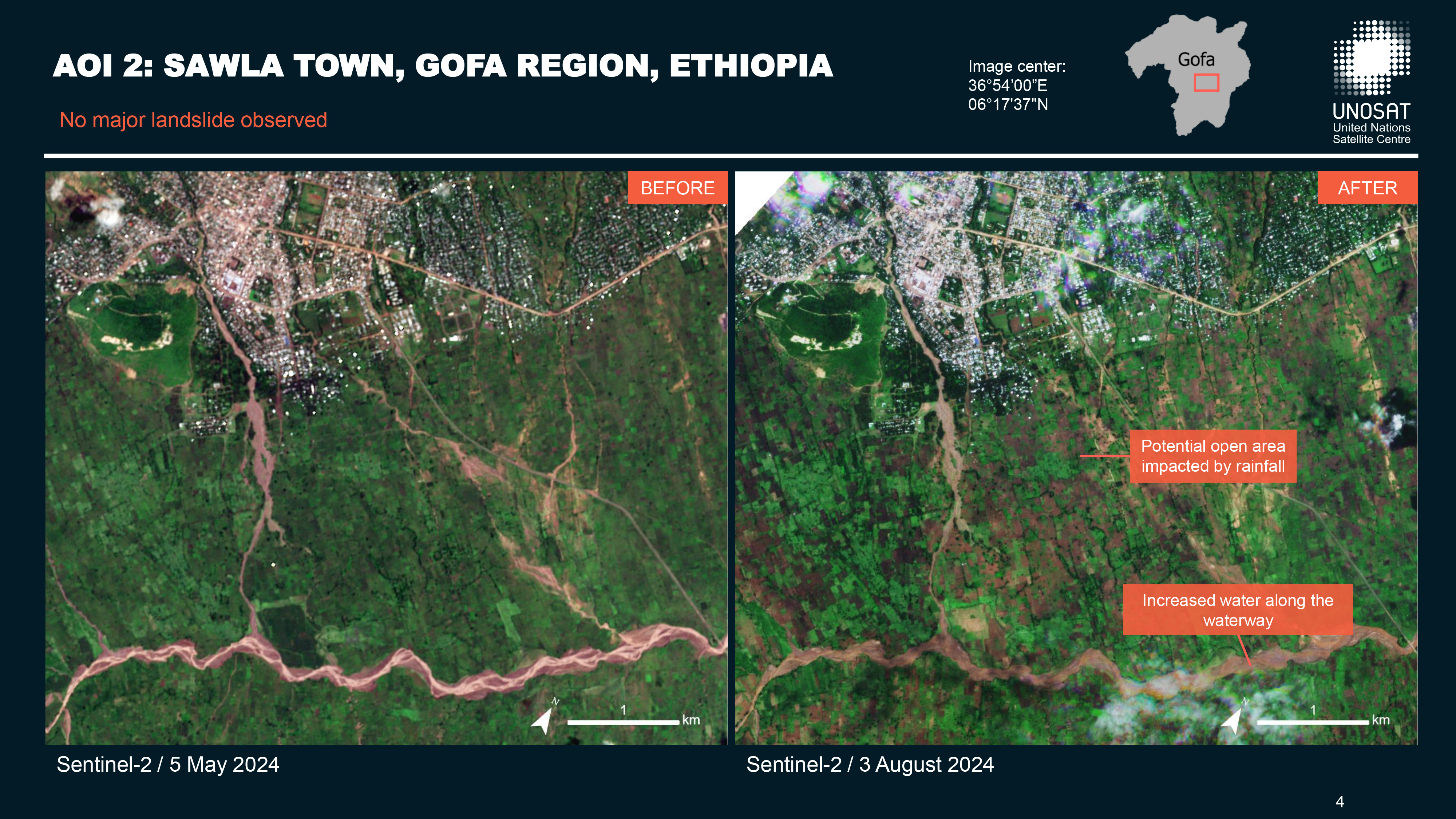
Preliminary satellite-derived landslide impact assessment, Gezei Gofa Zone, Gofa Region, Ethiopia
Download full report
Direitos autorais: Contains modified Copernicus Sentinel data (2024)
© Planet Labs Inc. (2024)
Map produced by UNOSAT / UNITAR
Information about the Product
Adquirida: Sentinel-2: 05/05/2024 / 03/08/2024
PlanetScope: 11/08/2024
Fonte: Sentinel-2/ PlanetScope
Categoria: Reference Map
 Voltar ao arquivo completo da Ativação

