Minimizar Latest Activation

Charter activations

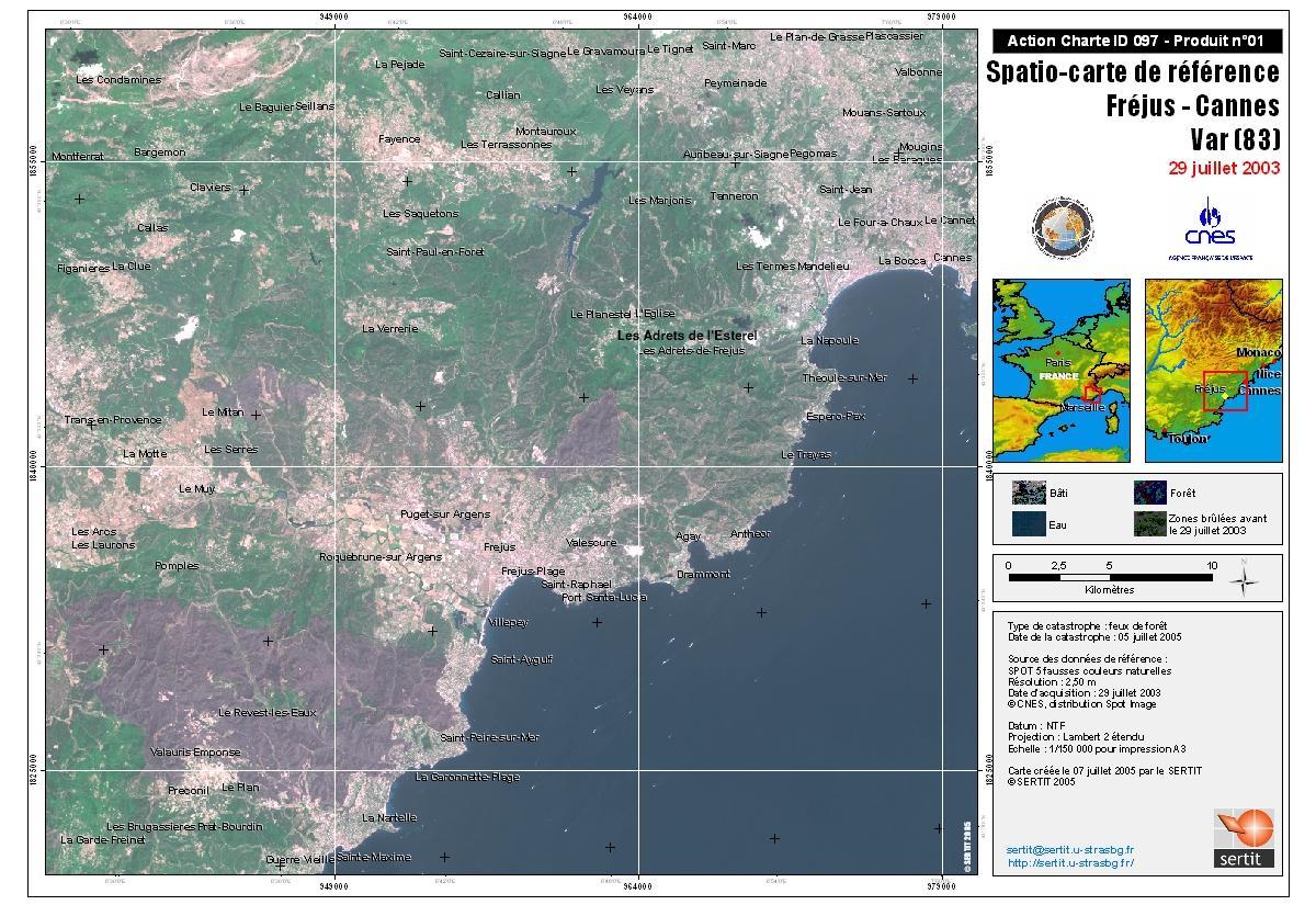
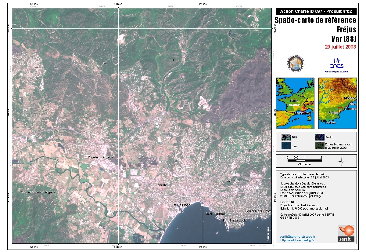
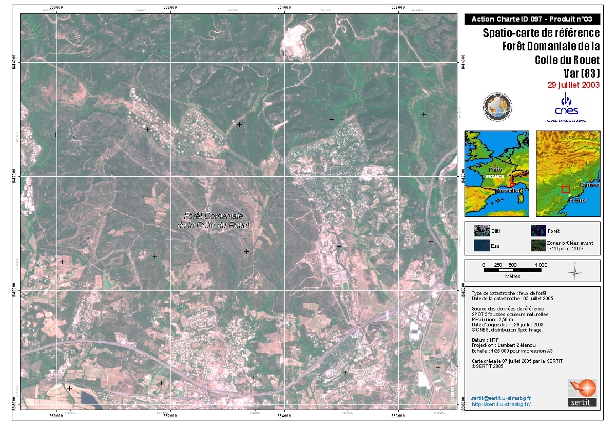
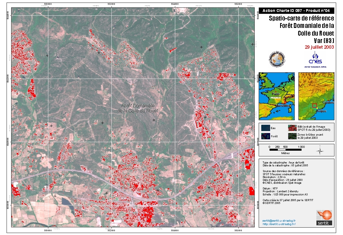
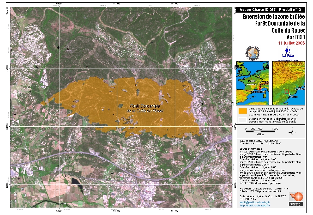
Forest Fires in Southern France

Forest fires started at the northeastern edge of the Massif des Maures, near the populated areas of Vidauban, Le Muy, and Revest, northeast of Hyères in the Provence région of France, and continued to spread, fanned by strong winds.

Tipo de evento:Forest fires
Local do evento:Var region of Southern France
Data da Ativação da Carta:05/07/2005
Requisitante da Carta:French Civil Protection Agency
Gerenciamento de projeto:NRSA

Products

Frejus-Cannes

Direitos autorais: CNES 2005, distribution Spotimage
Map created 07/07/2005 by SERTIT

Information about the Product

Adquirida: 29/07/2003

Fonte: Spot 5, resolution 2.5 m

Frejus

Direitos autorais: CNES 2005, distribution Spotimage
Map created 05/07/2005 by SERTIT

Information about the Product

Adquirida: 29/07/2003

Fonte: Spot 5, resolution 2.5 m

Rouet Forest

Direitos autorais: CNES 2005, distribution Spotimage
Map created 07/07/2005 by SERTIT

Information about the Product

Adquirida: 29/07/2003

Fonte: Spot 5, resolution 2.5 m

Rouet Forest

Direitos autorais: CNES 2005, distribution Spotimage
Map created 07/07/2005 by SERTIT

Information about the Product

Adquirida: 29/07/2003

Fonte: Spot 5, resolution 2.5 m

Rouet Forest Burnt Areas

Direitos autorais: CNES 2005, distribution Spotimage
Map created 13/07/2005 by SERTIT

Information about the Product

Adquirida: 11/07/2005

Fonte: Spot 5, resolution 2.5 m

Rouet Forest Burnt Areas

Direitos autorais: CNES 2005, distribution Spotimage
Map created 13/07/2005 by SERTIT

Information about the Product

Adquirida: 11/07/2005

Fonte: Spot 5, resolution 2.5 m

Voltar ao arquivo completo da Ativação