 English
 Spanish
 French
 Chinese
 Russian
 Portuguese
 Latest Activation
Charter activations
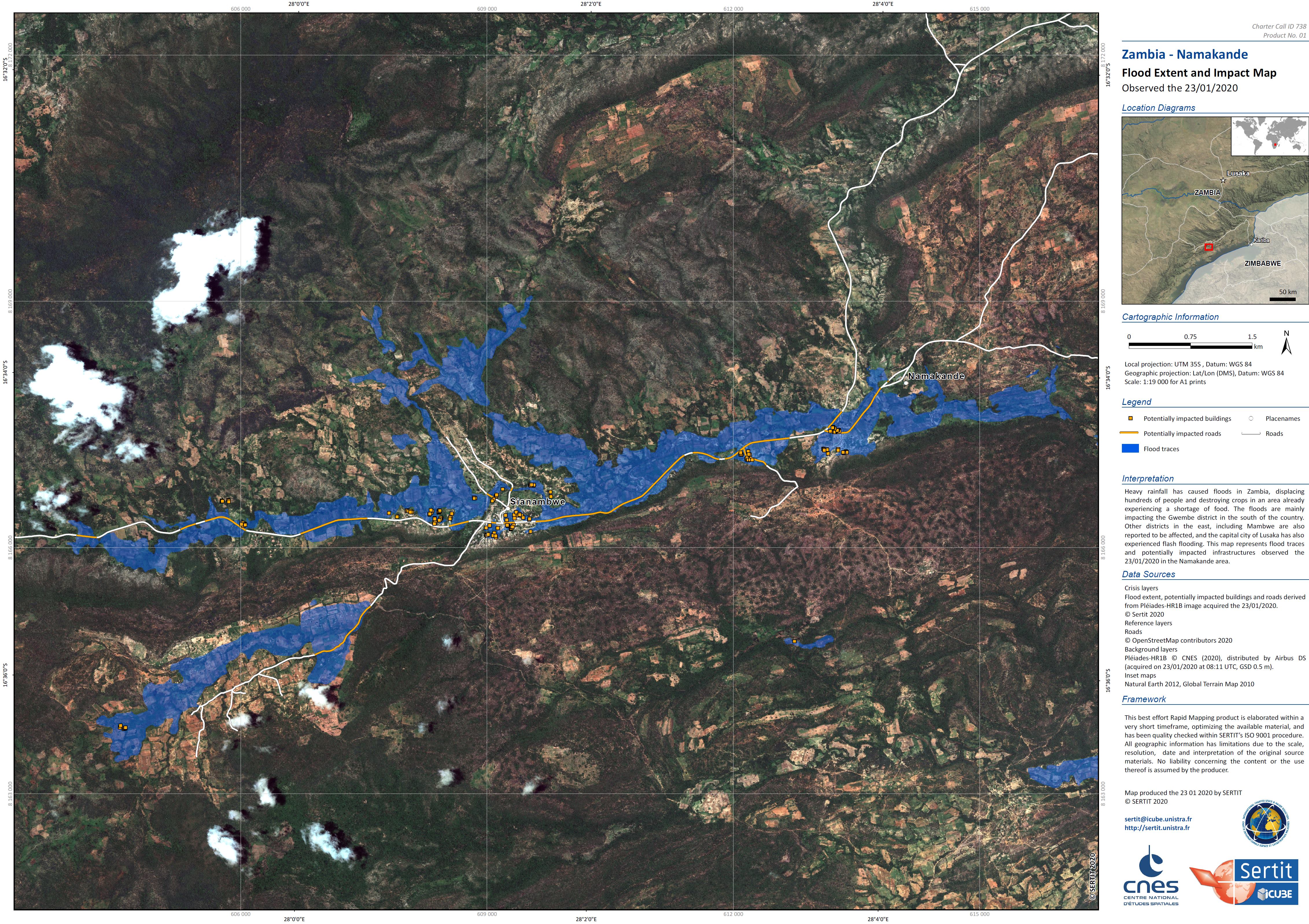
Flood in Zambia
Heavy rainfall has caused floods in Zambia, displacing hundreds of people and destroying crops in an area already experiencing a shortage of food.
The floods are mainly impacting the Gwembe district in the south of the country. Other districts in the east, including Mambwe are also reported to be affected, and the capital city of Lusaka has also experienced flash flooding.
Transportation has been affected by the situation, and eight bridges have been damaged or are currently impassable. The flood waters also pose a risk of breeding waterborne diseases.
Food shortages have been further impacted by the floods, as the area had been experiencing a drought before the floods began. There are reports that more than 2 million people may be affected by the damage to agriculture.
Relief is being provided to people evacuated from the affected areas.
| Tipo de evento: | Flood |
| Local do evento: | Zambia |
| Data da Ativação da Carta: | 2020-01-22 |
| Tempo de Ativação da Carta: | 14:16 |
| Zona de Tempo da Ativação da Carta: | UTC+01:00 |
| Requisitante da Carta: | UNITAR on behalf of UNOCHA Regional Office for Southern and Eastern Africa and the UN Resident Coordinator office in Zambia. |
| ID da Ativação: | 640 |
| Gerenciamento de projeto: | UNITAR/UNOSAT |
Products
Preliminary flood assessment of Gwembe District in the Southern Province of Zambia
Download the full report
Direitos autorais: Report produced by UNITAR/UNOSAT
 Voltar ao arquivo completo da Ativação

