 English
 Spanish
 French
 Chinese
 Russian
 Portuguese
 Latest Activation
Charter activations
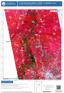
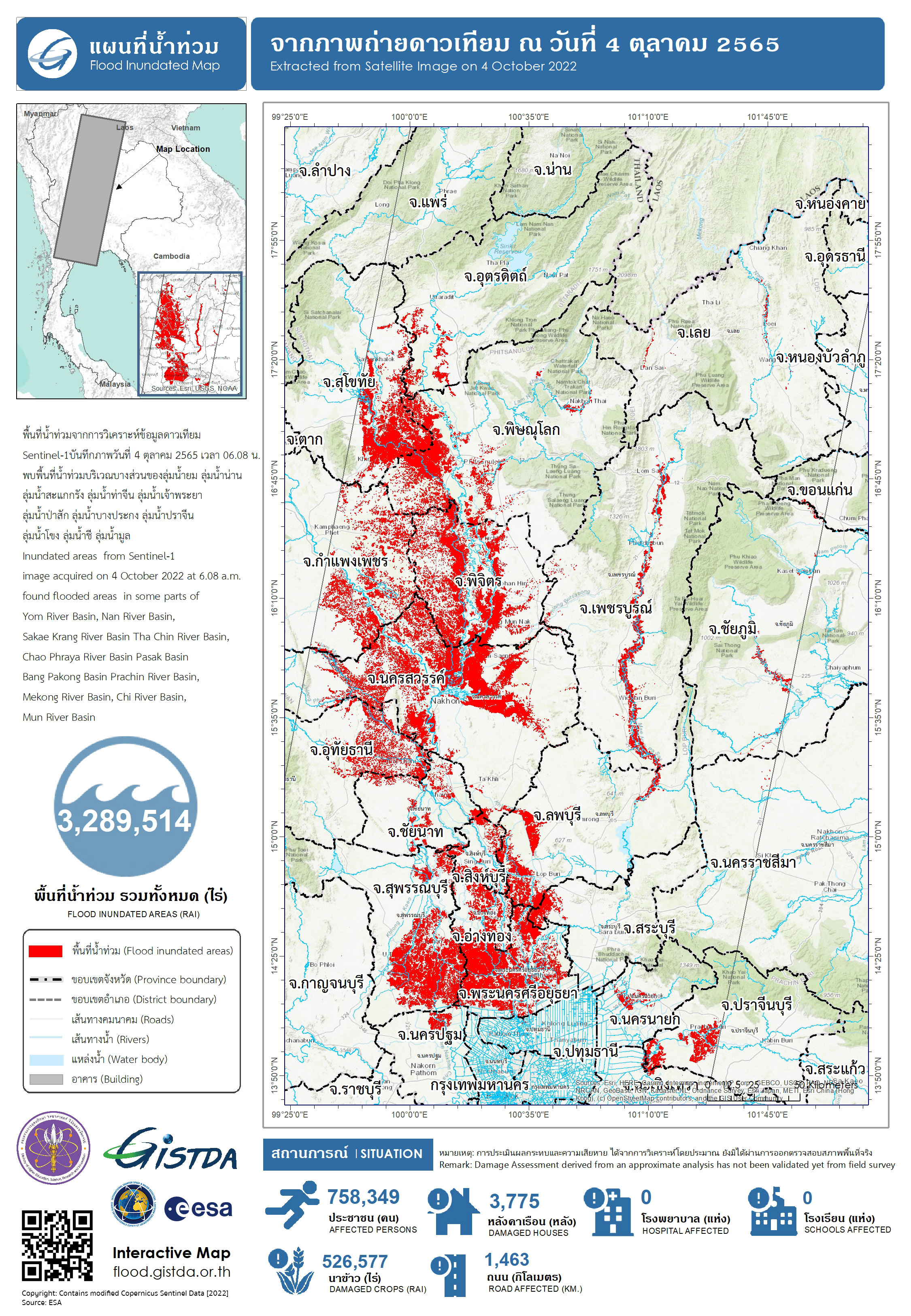
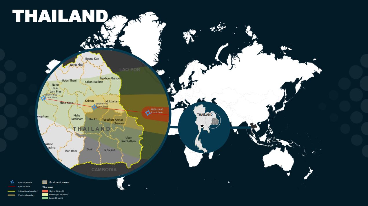
Typhoon Noru in Thailand
Typhoon Noru, known in the Philippines as Super Typhoon Karding, was an intense tropical cyclone that affected Vietnam, Thailand, and the Philippines — where it caused widespread damage.
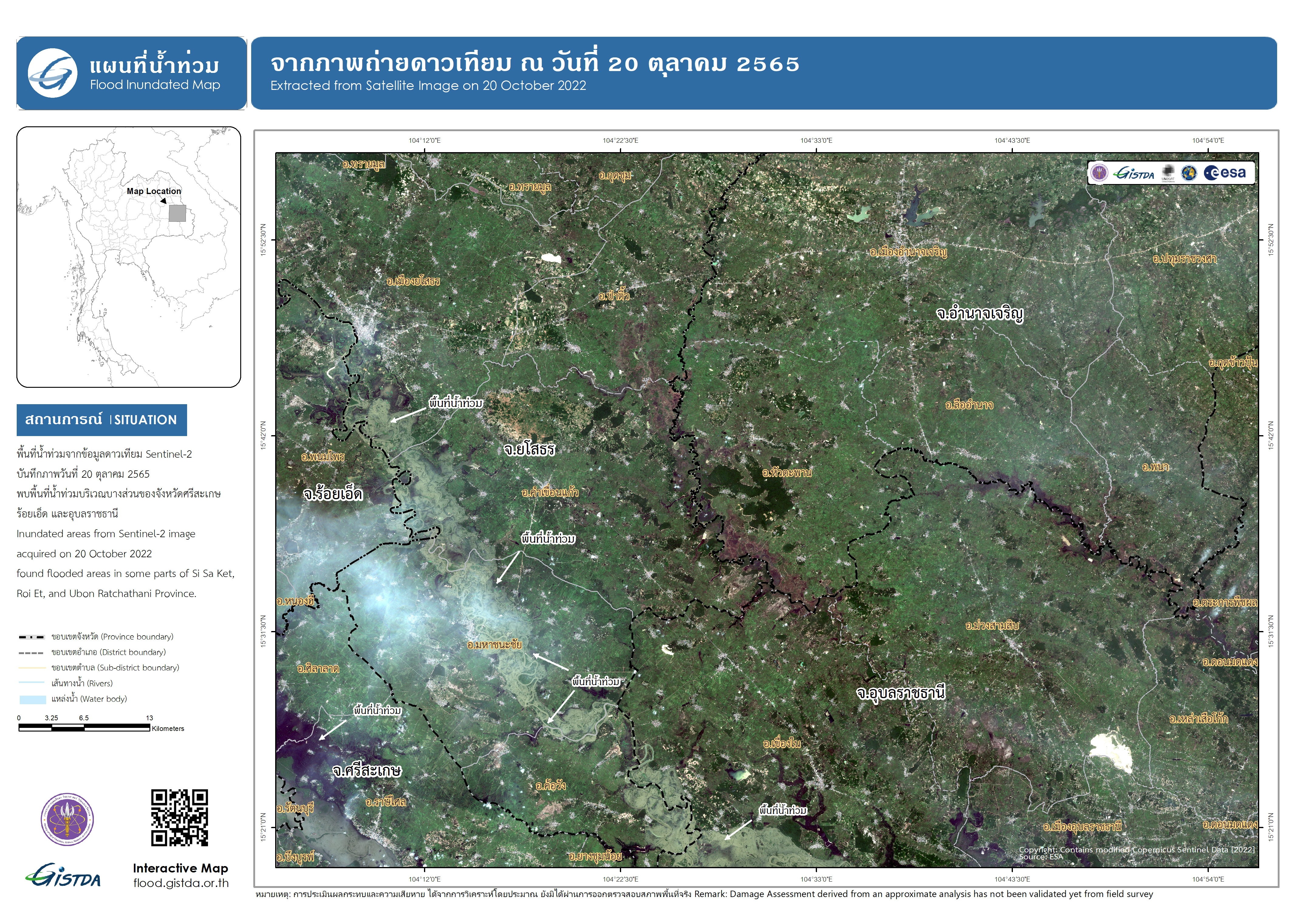
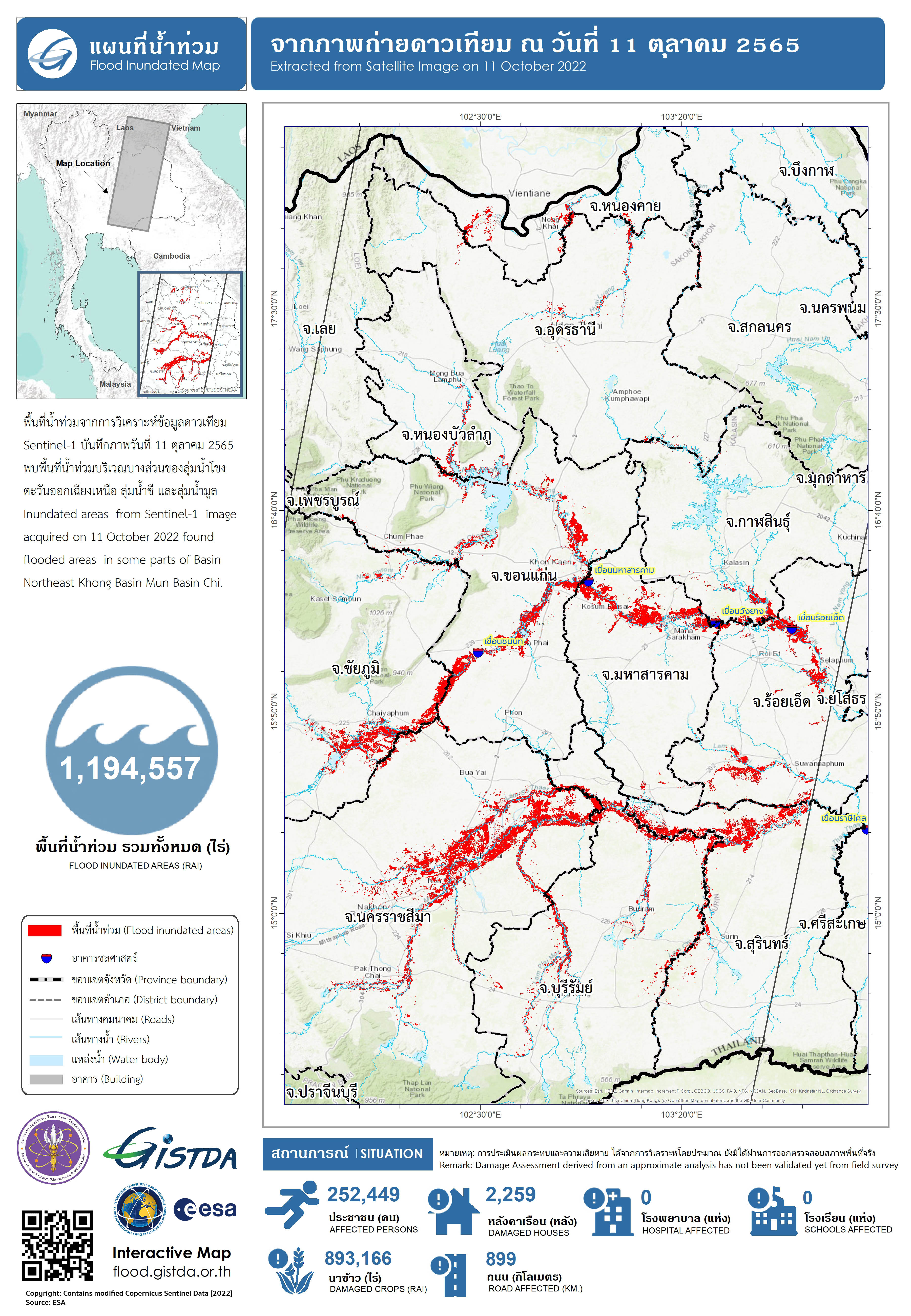
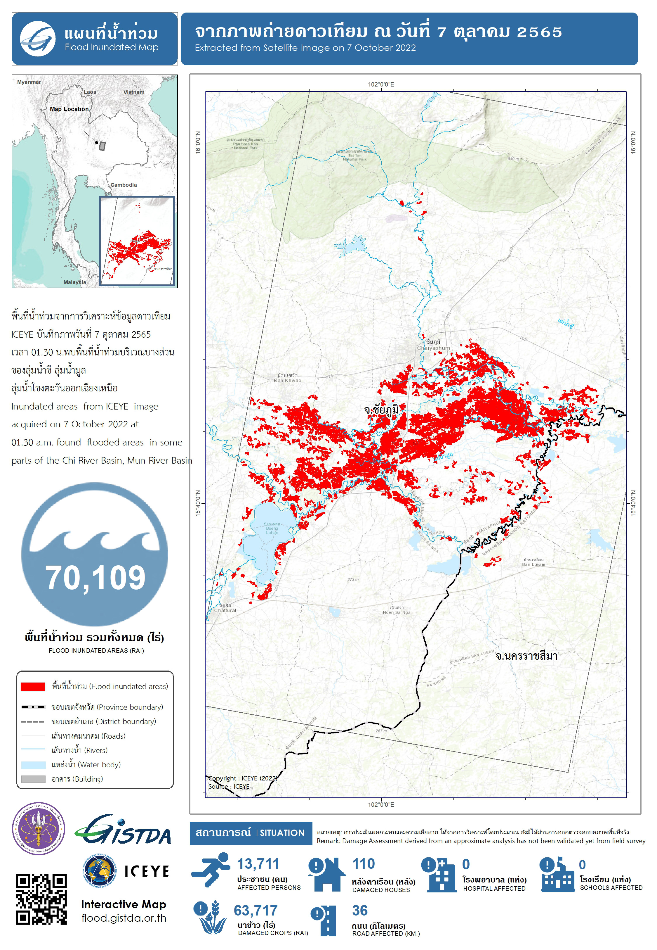
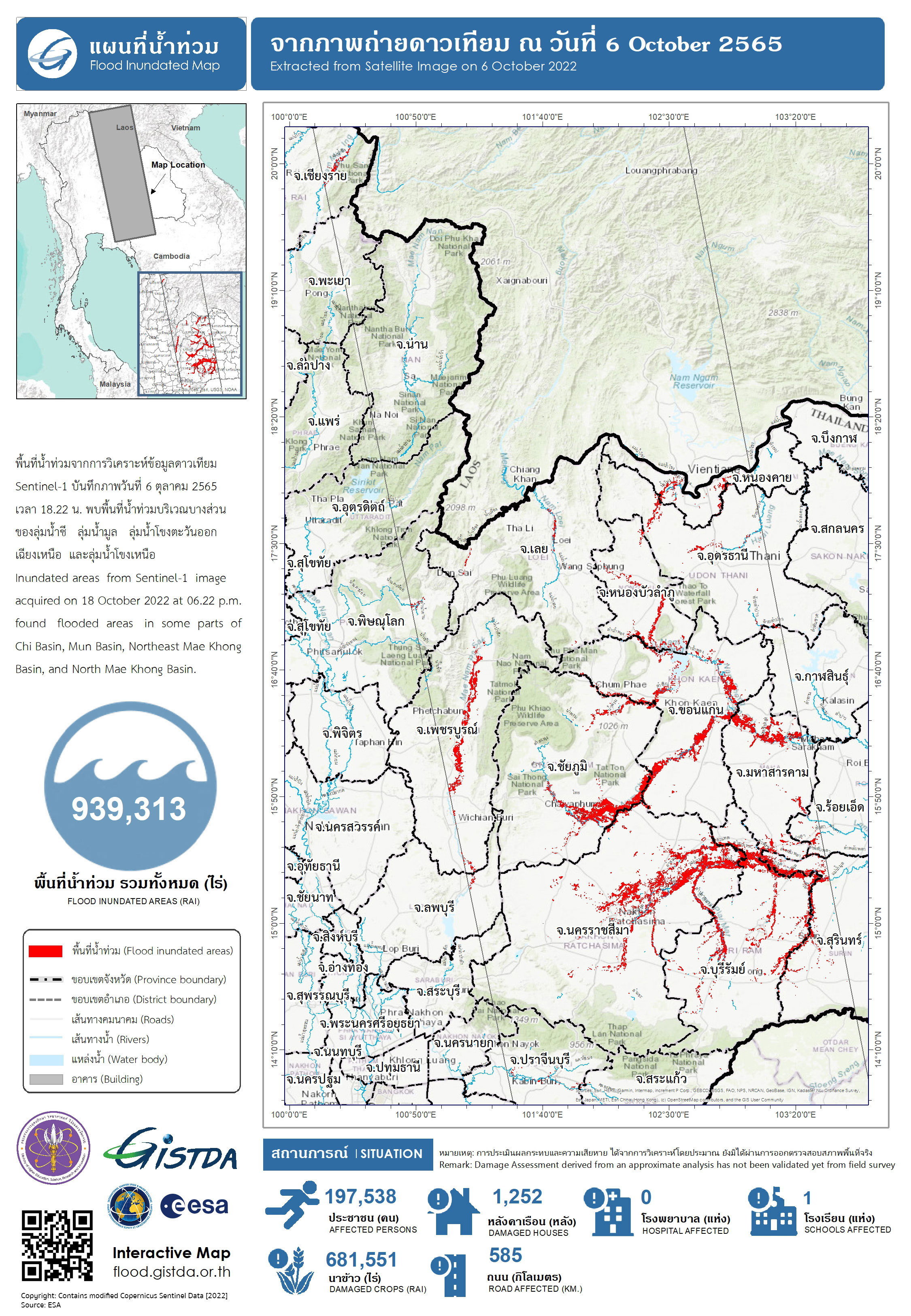
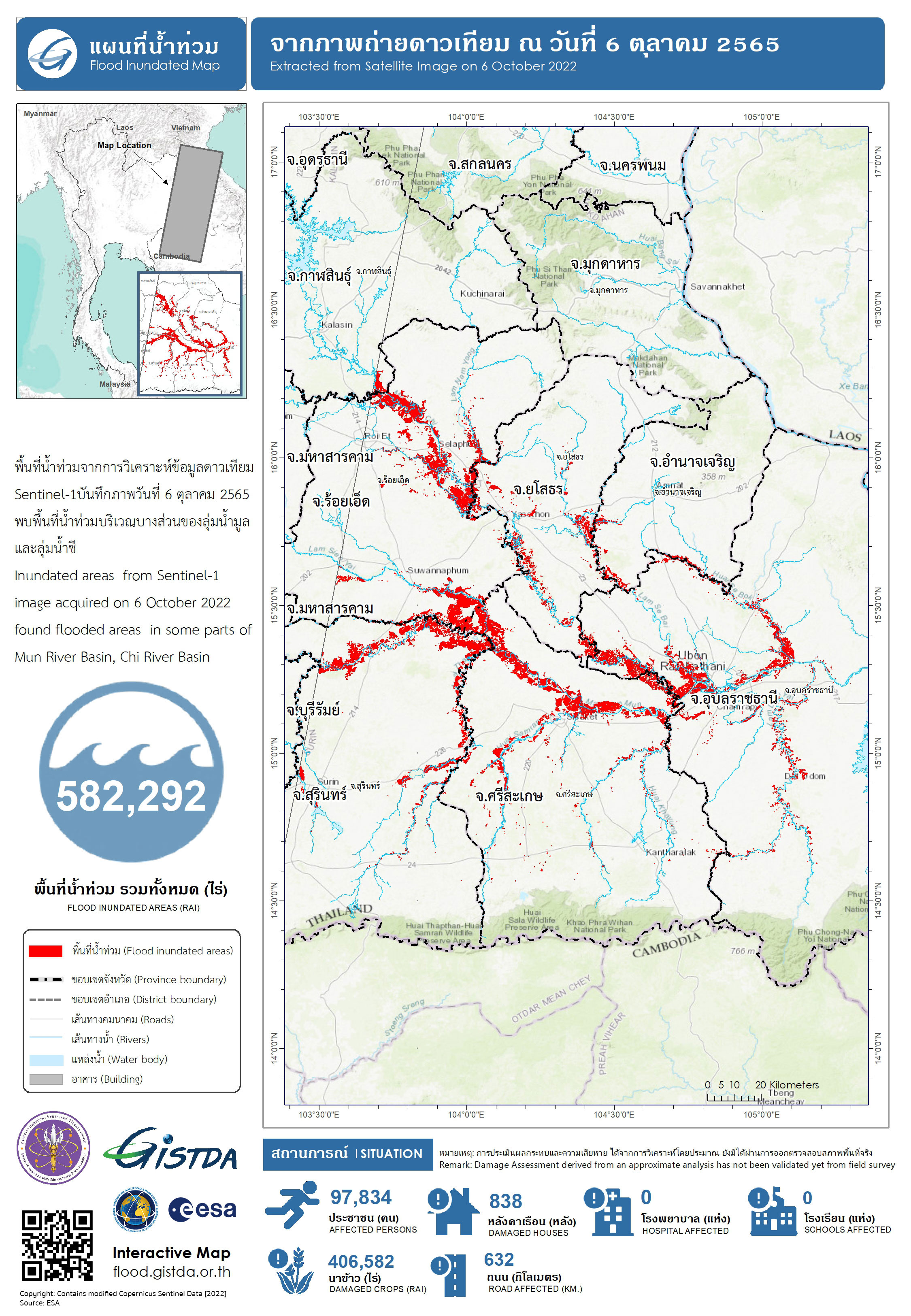
Authorities in South East Asia reported that heavy rain from the storm caused severe flooding and landslides across parts of Vietnam and Thailand after previously causing widespread damage and flooding in the Philippines when it made landfall in Khong Chiam District of Ubon Ratchathani Province during the on 28 September 2022.
The city of Ratchathani recorded 200.3 mm of rain in 24 hours, according to figures from the Thai Meteorological Department. The Department of Disaster Prevention and Mitigation (DDPM) reported that, as of 30 September, 3,121 households were affected by strong winds and flooding across 35 districts of the provinces of Phetchabun, Amnat Charoen, Sisaket, Yasothon, Ubon Ratchathani, Khon Kaen, Chaiyaphum, Mukdahan, Saraburi, Chainat and Sa Kaeo.
| Local do evento: | Thailand |
| Data da Ativação da Carta: | 2022-10-02 |
| Tempo de Ativação da Carta: | 17:23 |
| Zona de Tempo da Ativação da Carta: | UTC+07:00 |
| Requisitante da Carta: | UNITAR on behalf of UNRCO Thailand |
| ID da Ativação: | 784 |
| Gerenciamento de projeto: | Jakrapong Tawala (UNITAR) |
| act-value-adders: | Surassawadee Phoompanich (GISTDA) |
Products
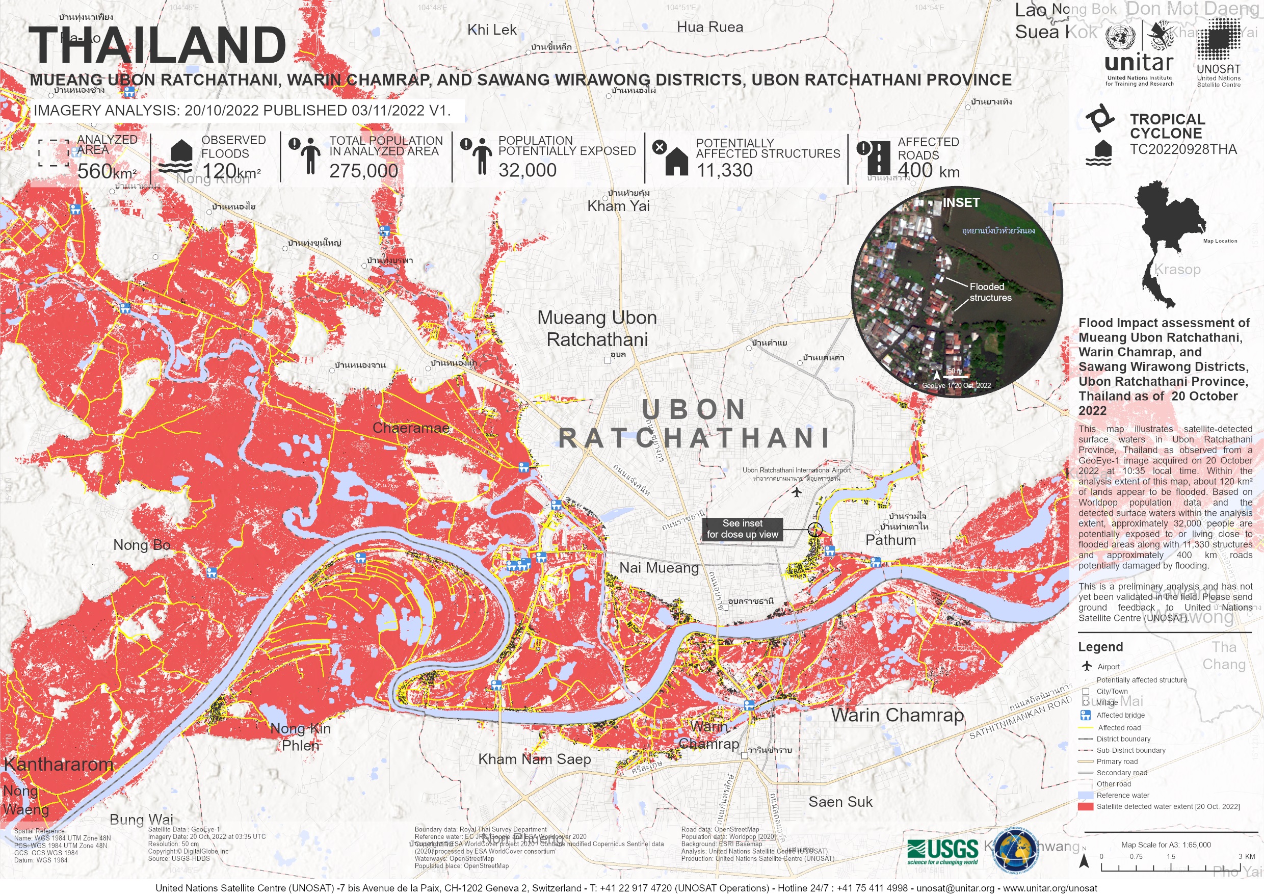
Flood Impact assessment of Mueang Ubon Ratchathani, Warin Chamrap, and Sawang Wirawong Districts, Ubon Ratchathani Province, Thailand
Direitos autorais: © 2004 GeoEye, NextView License
Map produced by UNITAR / UNOSAT
Information about the Product
Adquirida: 20/10/2022
Fonte: GeoEye-1
Categoria: Grading Map
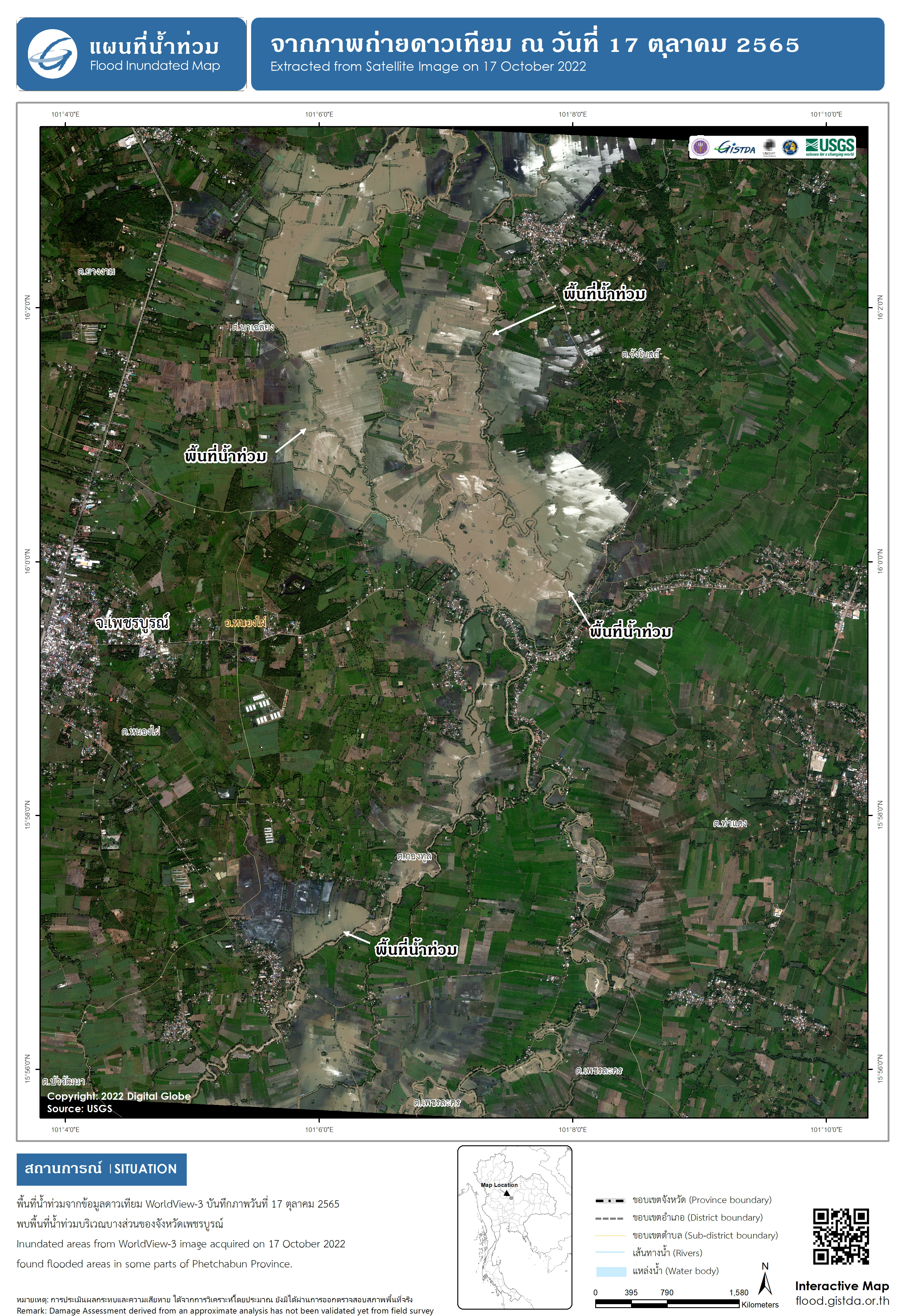
Inundated area in some part of Phetchabun Province, Thailand
Direitos autorais: © (2022) DigitalGlobe, Inc., Longmont CO USA 80503. DigitalGlobe and the DigitalGlobe logos are trademarks of DigitalGlobe, Inc. The use and/or dissemination of this data and/or of any product in any way derived there from are restricted. Unauthorized use and/or dissemination is prohibited.
Map produced by GISTDA
Information about the Product
Adquirida: 17/10/2022
Fonte: WorldView-3
Categoria: Grading Map
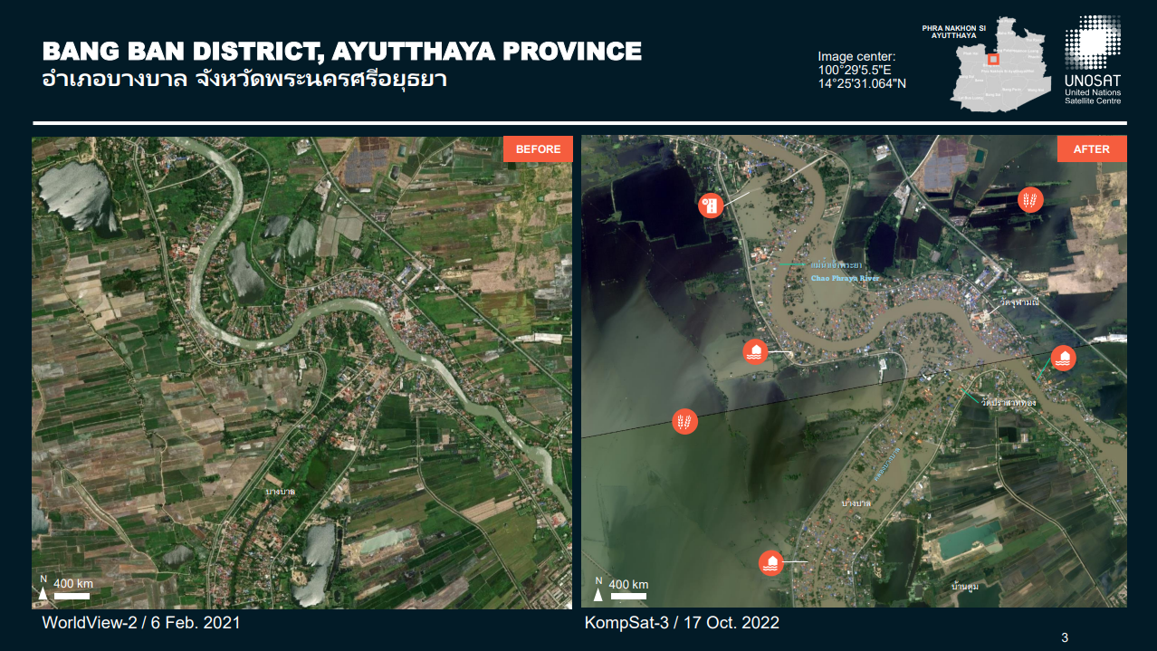
Preliminary Satellite-derived Flood Assessment in Phra Nakhon Si Ayutthaya Provinces of Thailand
Download full report
Direitos autorais: © KARI (2022)
Report prepared by UNITAR / UNOSAT
Information about the Product
Adquirida: 17/10/2022
Fonte: KOMPSAT-3
Categoria: Dossier
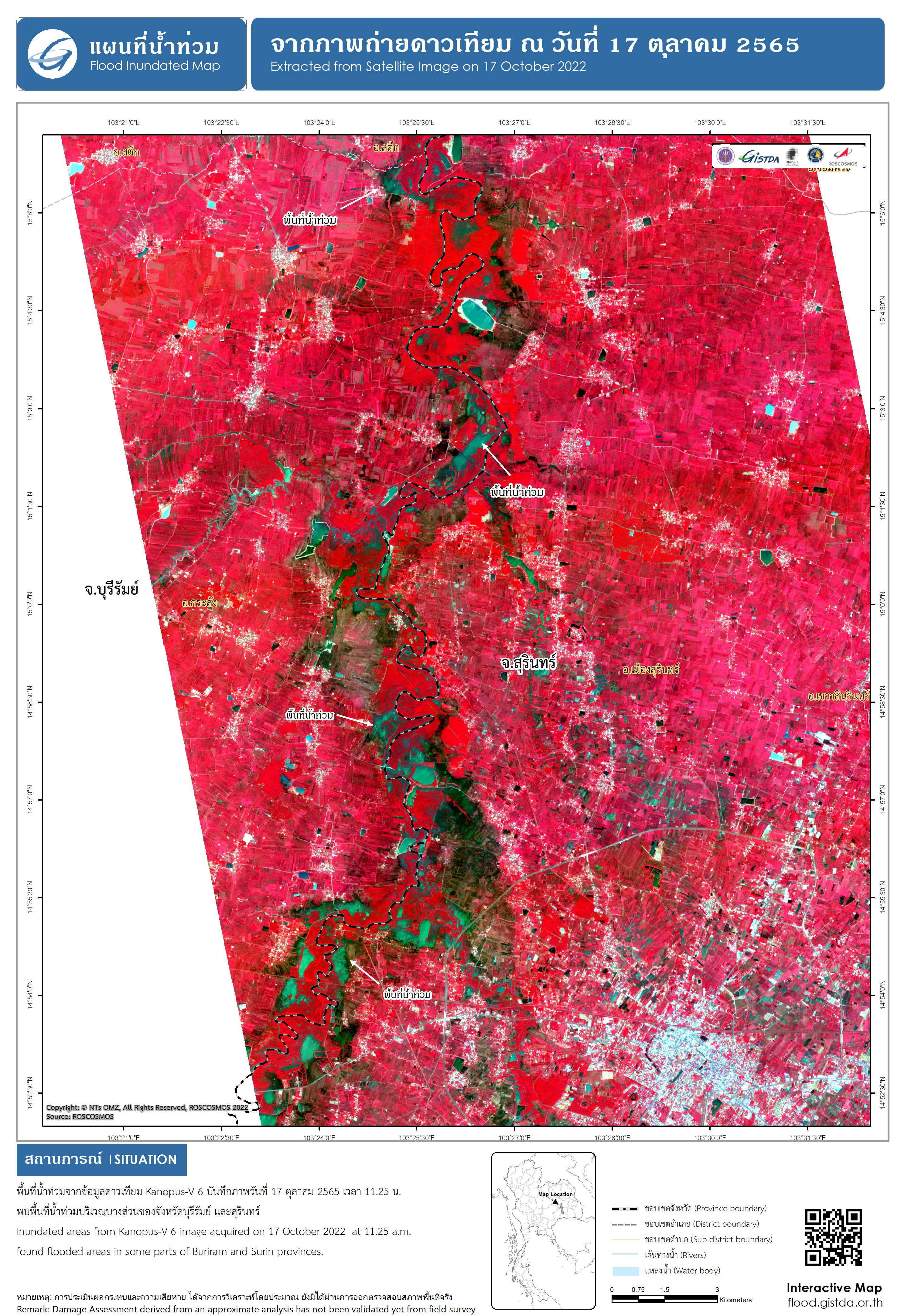
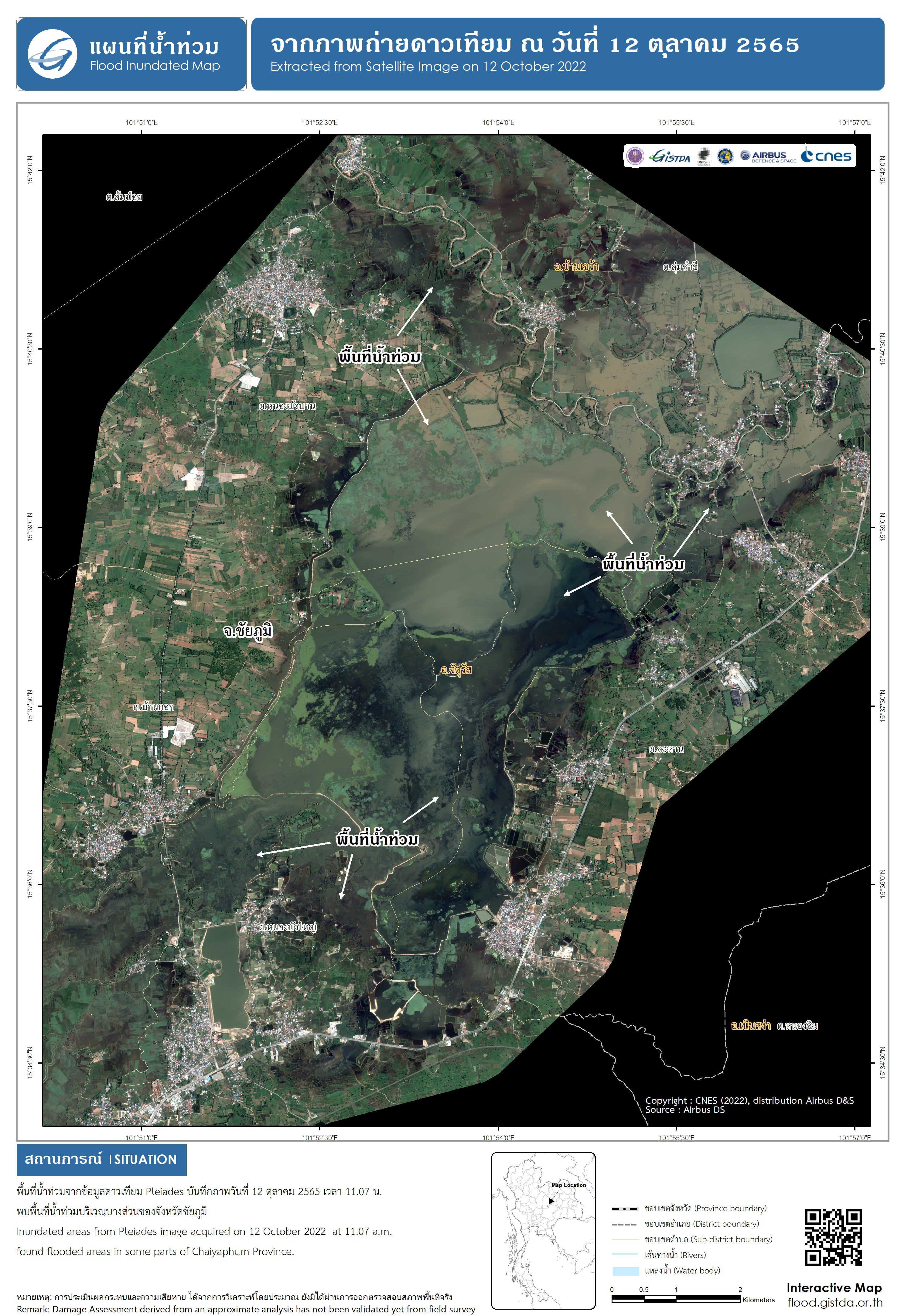
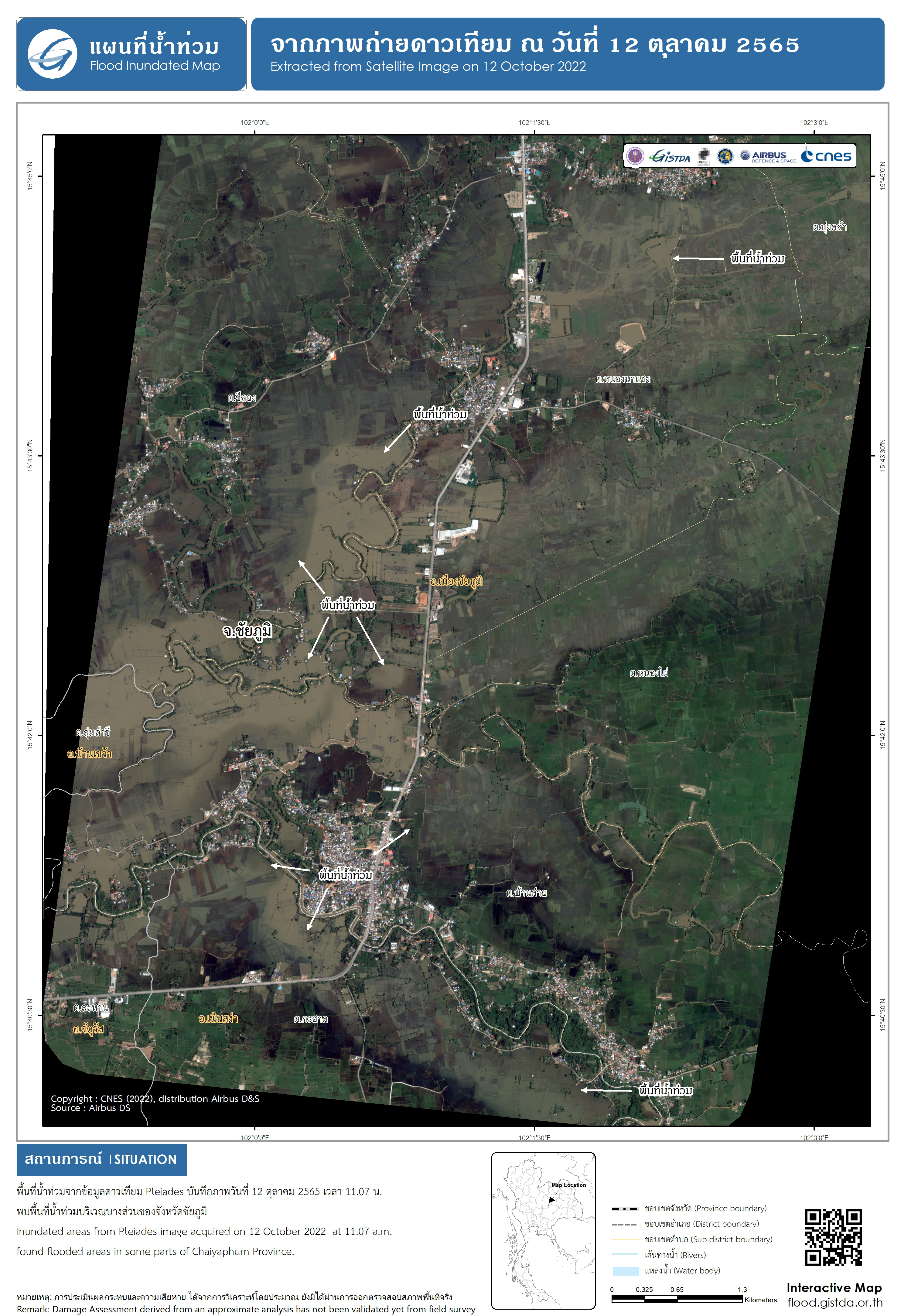
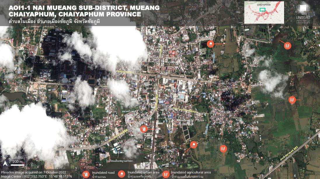
Preliminary Satellite-derived Flood Assessment in Chaiyaphum Province, Thailand
Download full report
Direitos autorais: Contains modified Copernicus Sentinel data (2022)
Includes Pleiades material © CNES (2022), Distribution Airbus DS.
Report prepared by UNITAR / UNOSAT
Information about the Product
Adquirida: Sentinel-1:24/09/2022, 06/10/2022, 28/09/2022
Pleiades: 07/10/2022
Fonte: Sentinel-1, Pleiades
Categoria: Dossier
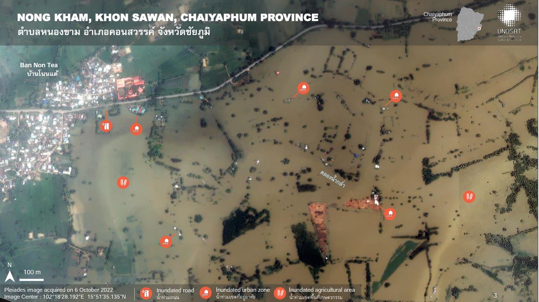
Preliminary satellite-derived flood assessment in Khon Sawan District, Chaiyaphum Provinces, Thailand
Download full report
Direitos autorais: Includes Pleiades material © CNES (2022), Distribution Airbus DS.
Report produced by UNITAR / UNOSAT
Information about the Product
Adquirida: 06/10/2022
Fonte: Pleiades
Categoria: Dossier
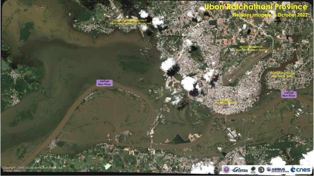
Flood Monitoring in Ubon Ratchathani Province, Thailand, following Typhoon Noru
Download full report
Direitos autorais: Includes Pleiades material © CNES (2022), Distribution Airbus DS.
Report produced by UNITAR / UNOSAT
Information about the Product
Adquirida: 05/10/2022
Fonte: Pleiades
Categoria: Delineation Map
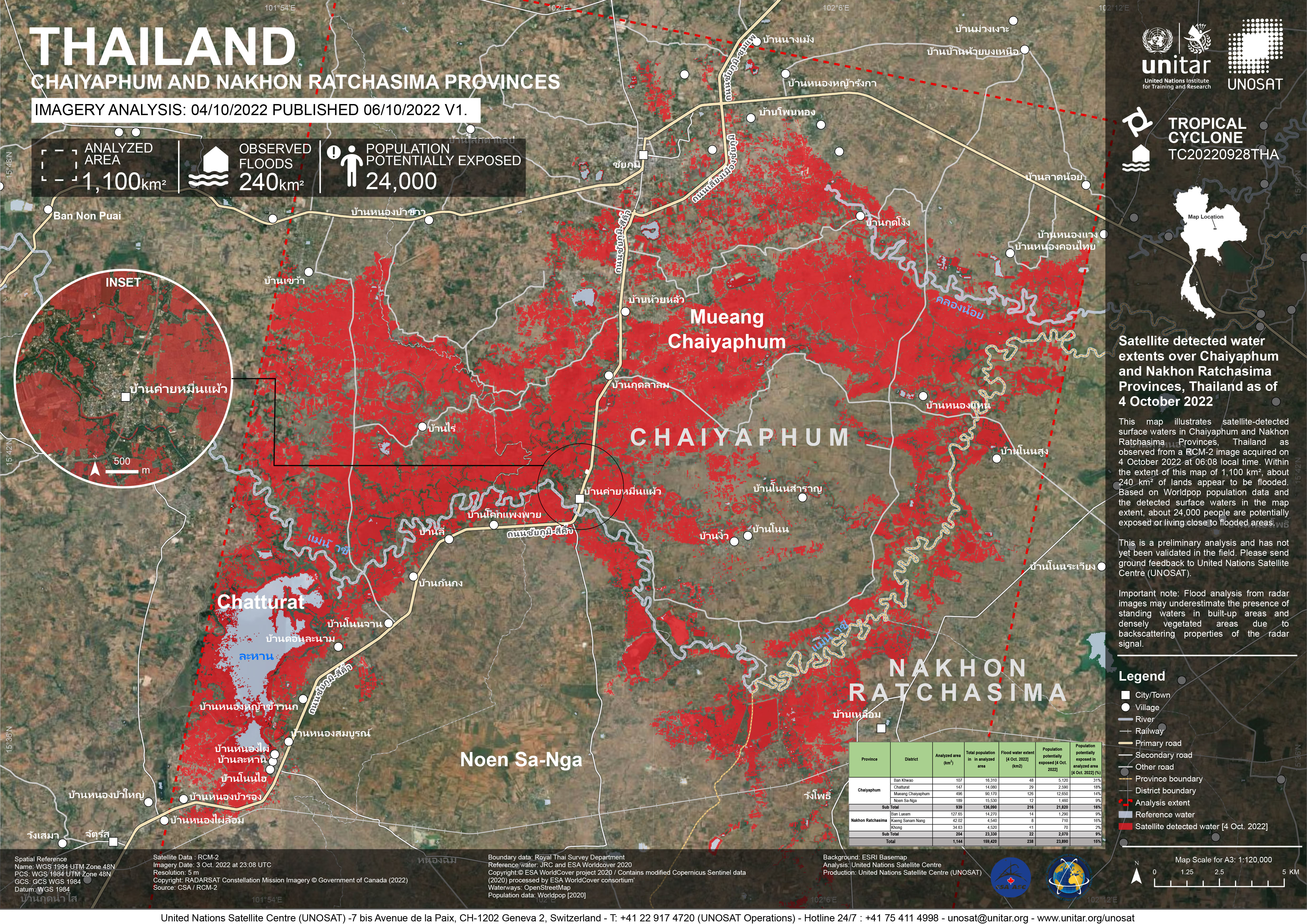
Satellite detected water extents over Chaiyaphum and Nakhon Ratchasima Provinces, Thailand
Direitos autorais: RADARSAT Constellation Mission Imagery © Government of Canada (2022) - RADARSAT is an official mark of the Canadian Space Agency.
Map produced by UNITAR
Information about the Product
Adquirida: 04/10/2022
Fonte: RCM
Categoria: Grading Map
Preliminary Satellite-derived Flood Assessment in North Eastern part of Thailand
Download full report
Direitos autorais: Contains modified Copernicus Sentinel data (2022)
Map produced by UNITAR / UNOSAT
Information about the Product
Adquirida: 23/09/2022, 01/10/2022
Fonte: Sentinel-1
Categoria: Dossier
 Voltar ao arquivo completo da Ativação

