 English
 Spanish
 French
 Chinese
 Russian
 Portuguese
 Latest Activation
Charter activations
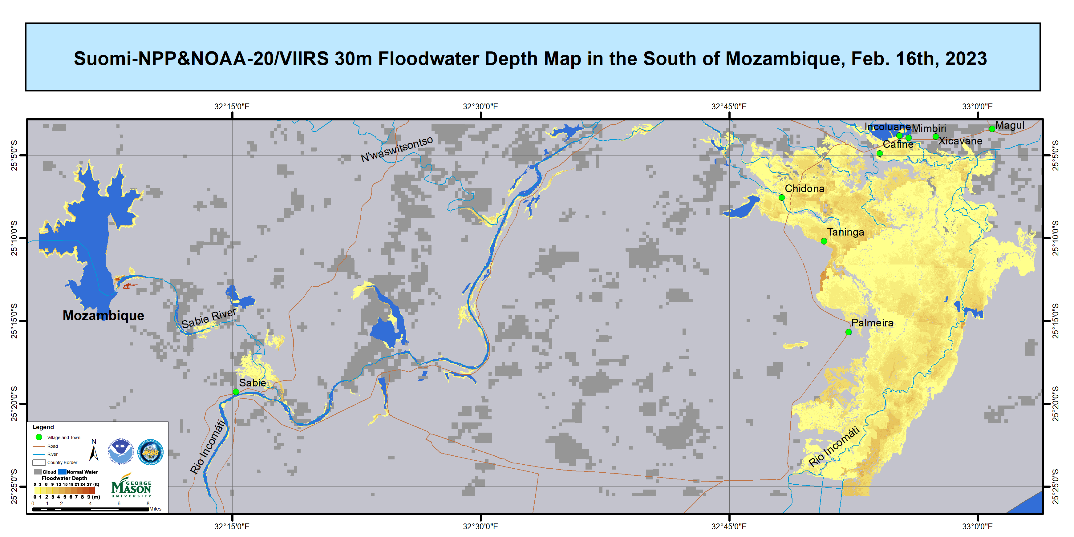
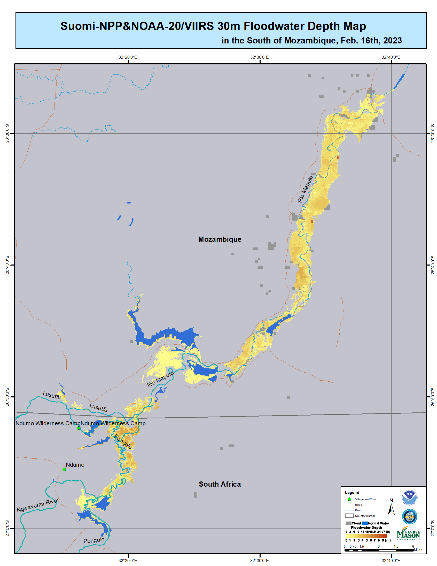
Flooding in Mozambique
Heavy rainfall in the Maputo Province in Mozambique has caused extensive floods, particularly in the capital city of Maputo.
The National Institute for Management and Reduction of Disaster Risk (INGD) has reported 6 fatalities, 2 injured and a further 3 people missing. A total of 36,700 people have been affected by the flooding and around 7,300 homes, 15 schools and 15 health centres have been damaged.
The World Health Organisation recorded over 400 mm of rain in a 24 hour period at a weather station in Mavalane, Maputo. Consequently, substantial rainfall increased discharge in the river systems of Maputo, Incomati and Umbeluzi, as well as further river systems upstream, which elevated flooding in the region considerably.
10 emergency accommodation centres have been opened and INGD is providing assistance to victims by offering food, medical services and other essential aid.
| Tipo de evento: | Floods |
| Local do evento: | Mozambique |
| Data da Ativação da Carta: | 2023-02-16 |
| Tempo de Ativação da Carta: | 14:29 |
| Zona de Tempo da Ativação da Carta: | UTC+01:00 |
| Requisitante da Carta: | UNOOSA/UN-SPIDER on behalf of National Disaster Risk Management Institute of Mozambique (INGD) |
| ID da Ativação: | 801 |
| Gerenciamento de projeto: | Giriraj Amarnath (International Water Management Institute) |
| act-value-adders: | Gigo Sumbane (National Disasters Management Institute(INGD)) Jakrapong Tawala (UNITAR) |
Products

Flood situation in the Mapout Province, Mozambique: Comparing Pre- and Post-Flood Images
Direitos autorais: Contains modified Copernicus Sentinel data (2023)
Map produced by the International Water Management Institute, INGC, CGIAR and AICCRA.
Information about the Product
Adquirida: 09/02/2023, 13/02/2023 and 21/02/2023
Fonte: Sentinel-1
Categoria: Reference Map
Flood progression in the Mapout Province, Mozambique
Direitos autorais: Contains modified Copernicus Sentinel data (2023)
Map produced by the International Water Management Institute, INGC, CGIAR and AICCRA.
Information about the Product
Adquirida: 13/02/2023 and 21/02/2023
Fonte: Sentinel-1
Categoria: Reference Map
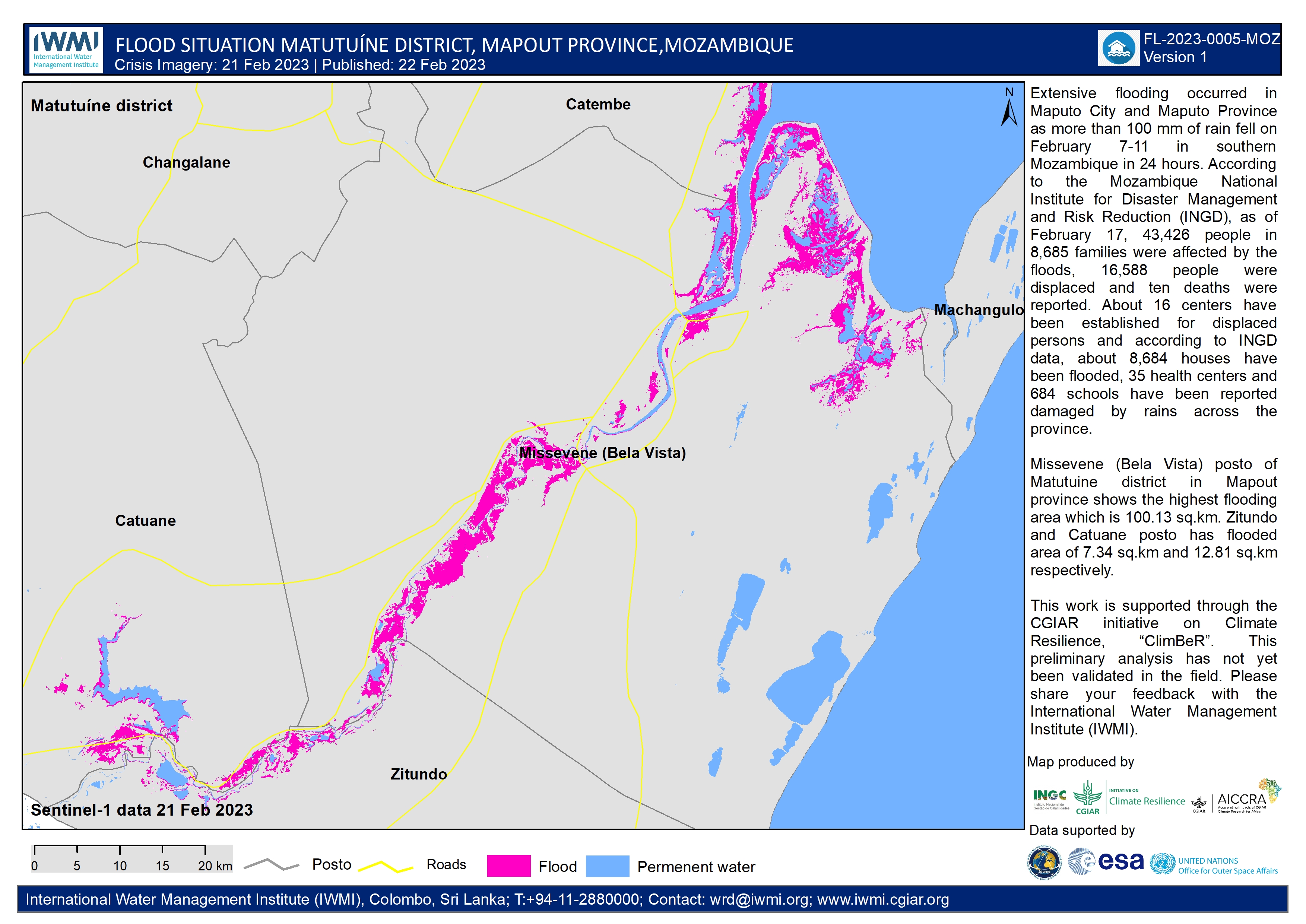
Flood situation in the Matutuine district, Mozambique on 21st February 2023
Direitos autorais: Contains modified Copernicus Sentinel data (2023)
Map produced by the International Water Management Institute, INGC, CGIAR and AICCRA.
Information about the Product
Adquirida: 21/02/2023
Fonte: Sentinel-1
Categoria: Reference Map
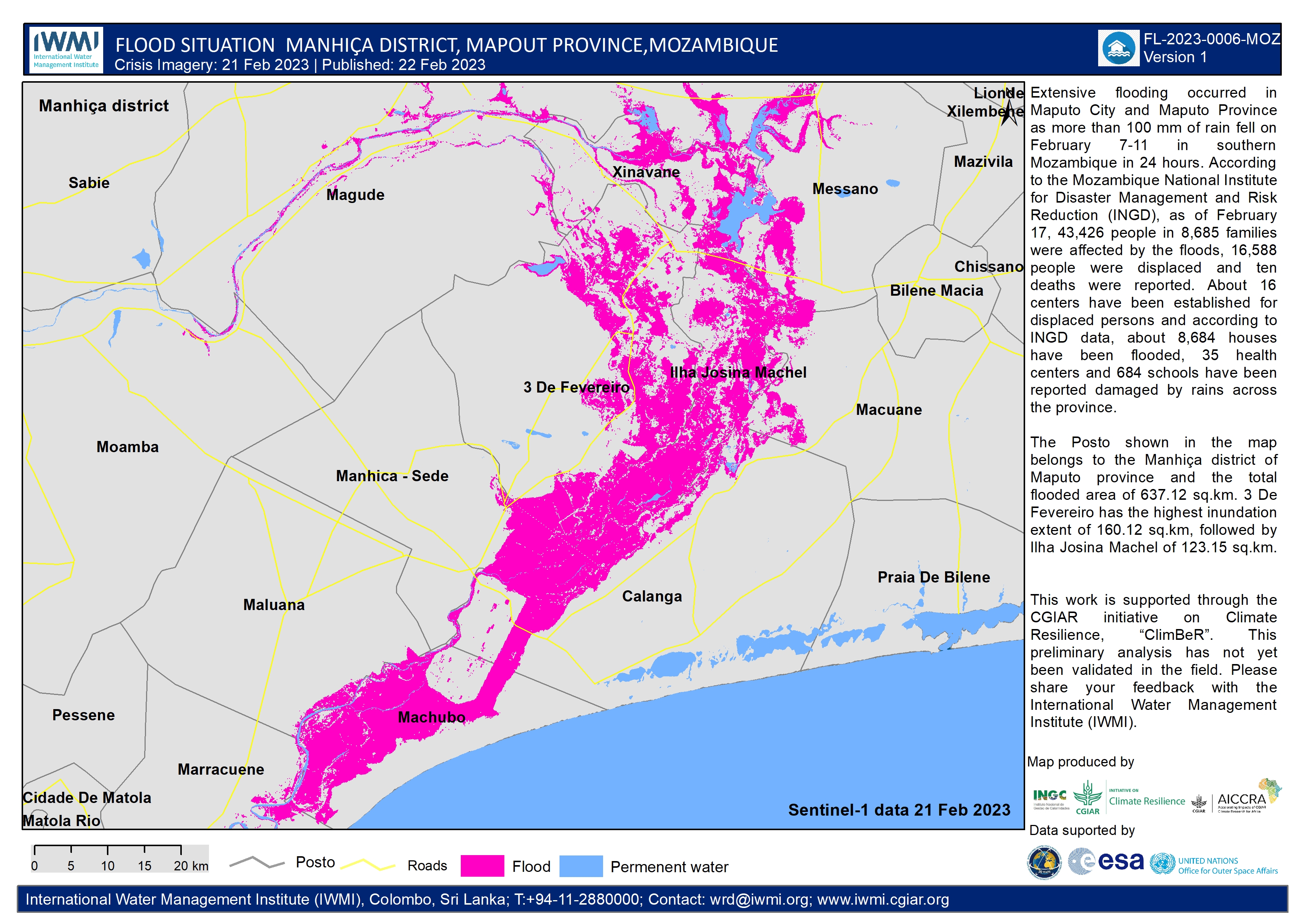
Flood situation in the Mapout Province, Mozambique on 21 February 2023
Direitos autorais: Contains modified Copernicus Sentinel data (2023)
Map produced by the International Water Management Institute, INGC, CGIAR and AICCRA.
Information about the Product
Adquirida: 21/02/2023
Fonte: Sentinel-1
Categoria: Delineation Monitoring Maps
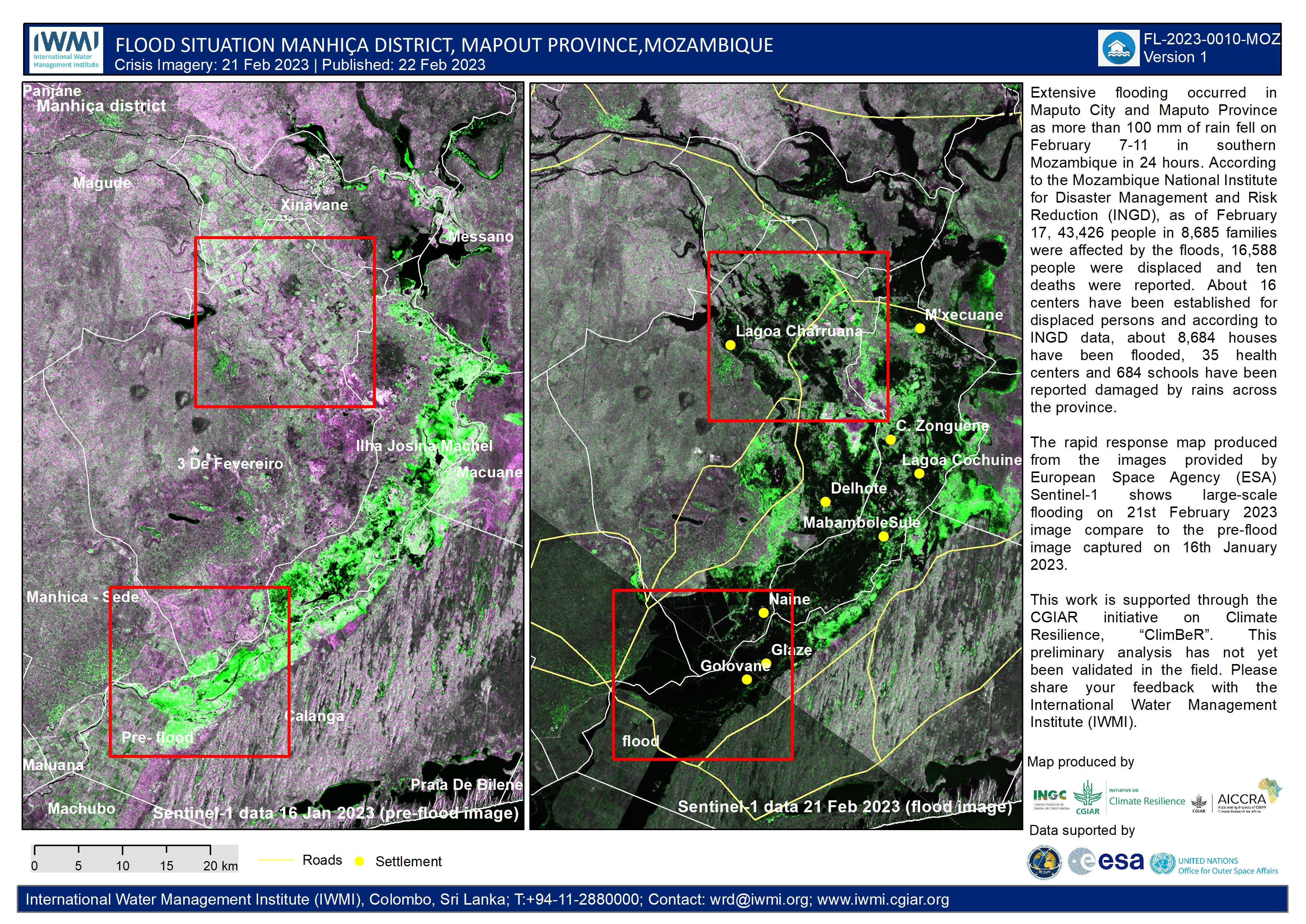
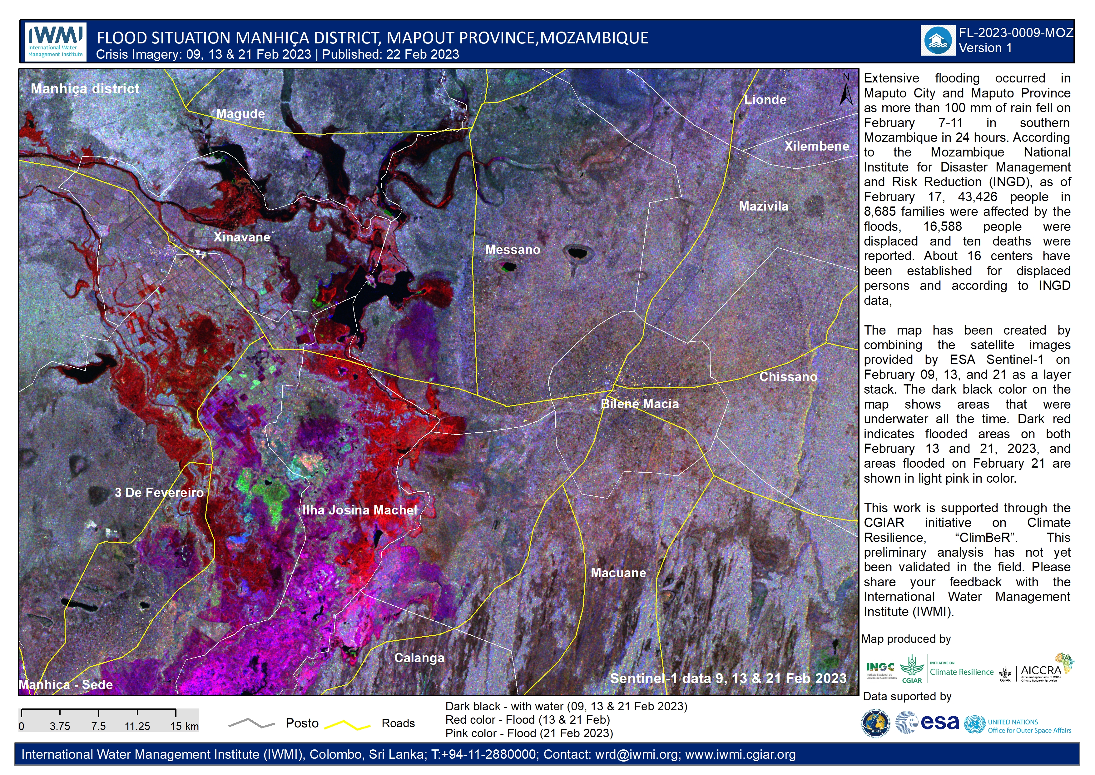
Flood progression in the Manchica district, Mozambique: Comparing Pre- and Post-Flood Images
Direitos autorais: Contains modified Copernicus Sentinel data (2023)
Map produced by the International Water Management Institute, INGC, CGIAR and AICCRA.
Information about the Product
Adquirida: 16/01/2023 and 21/02/2023
Fonte: Sentinel-1
Categoria: Reference Map
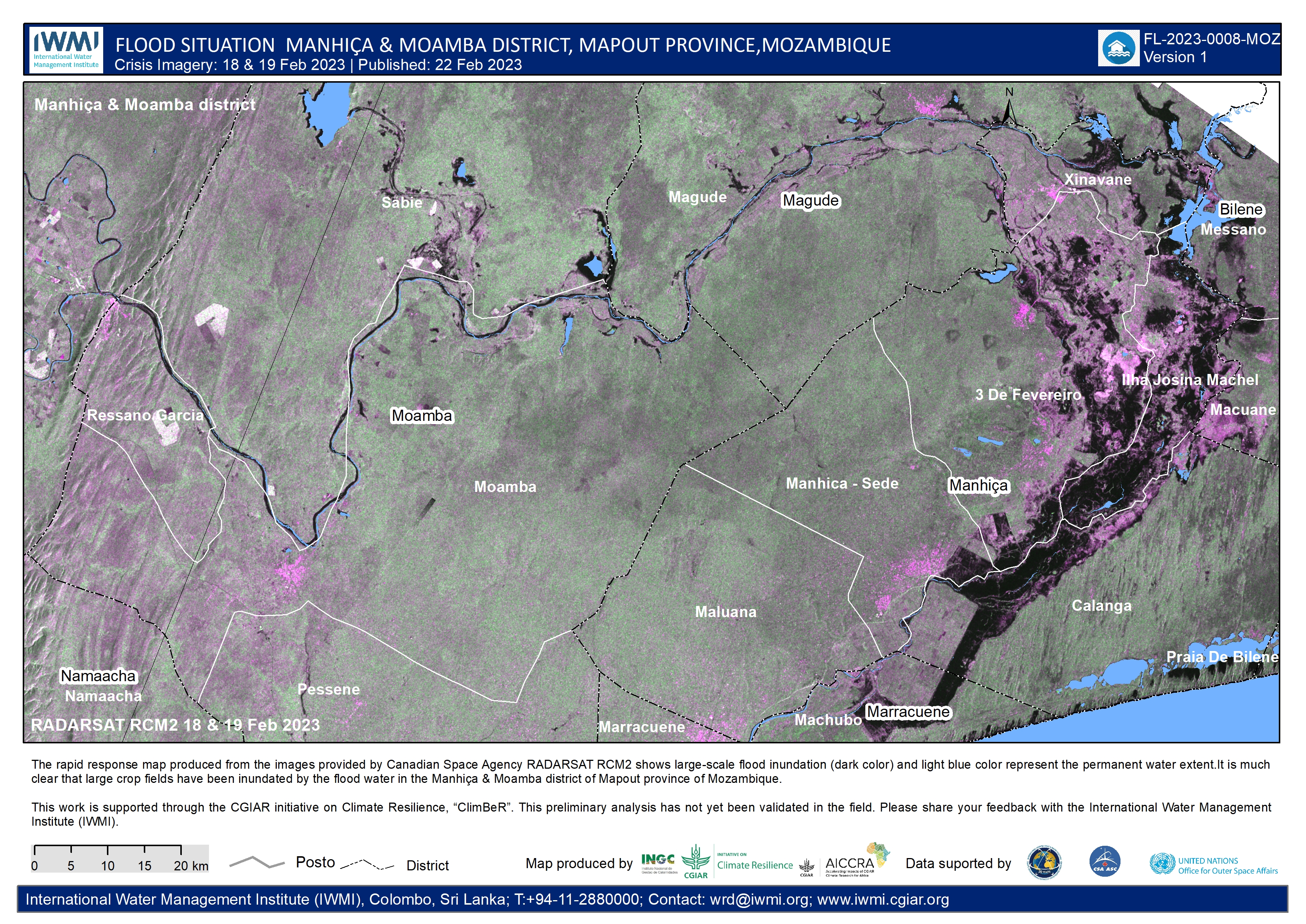
Flood situation recorded in the Mapout Province, Mozambique on 18th and 19th February
Direitos autorais: RADARSAT Constellation Mission Imagery © Government of Canada (2023) - RADARSAT is an official mark of the Canadian Space Agency
Map produced by the International Water Management Institute, INGC, CGIAR and AICCRA.
Information about the Product
Adquirida: 18/02/2023 and 19/02/2023
Fonte: RCM
Categoria: Delineation Monitoring Maps
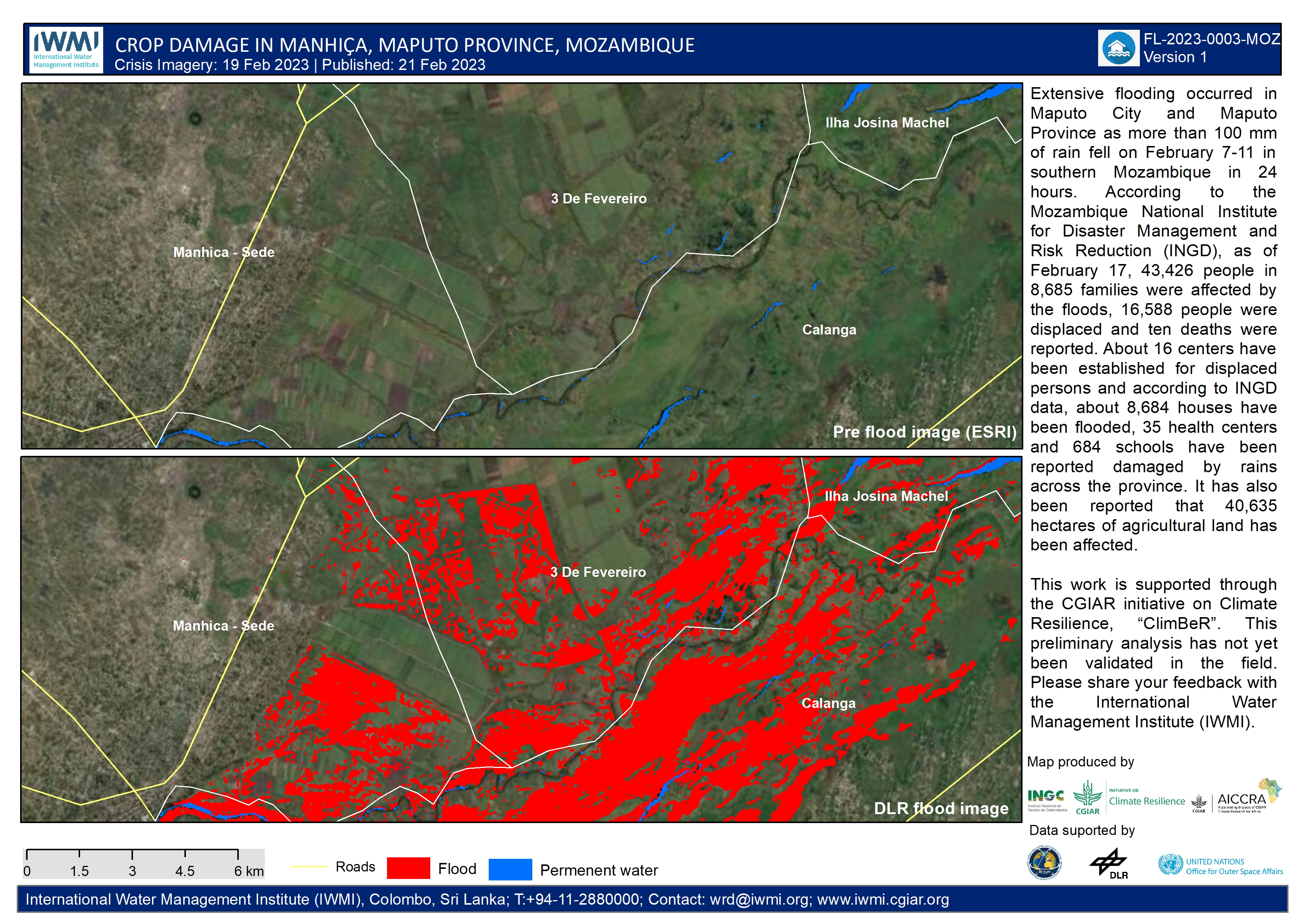
Crop damage in the Manhiça district, Mapout Province, Mozambique
Direitos autorais: © DLR e.V. (2023), Distribution Airbus DS Geo GmbH
Map produced by the International Water Management Institute, INGC, CGIAR and AICCRA.
Information about the Product
Adquirida: 19/02/2023
Fonte: TerraSAR-X
Categoria: Reference Map
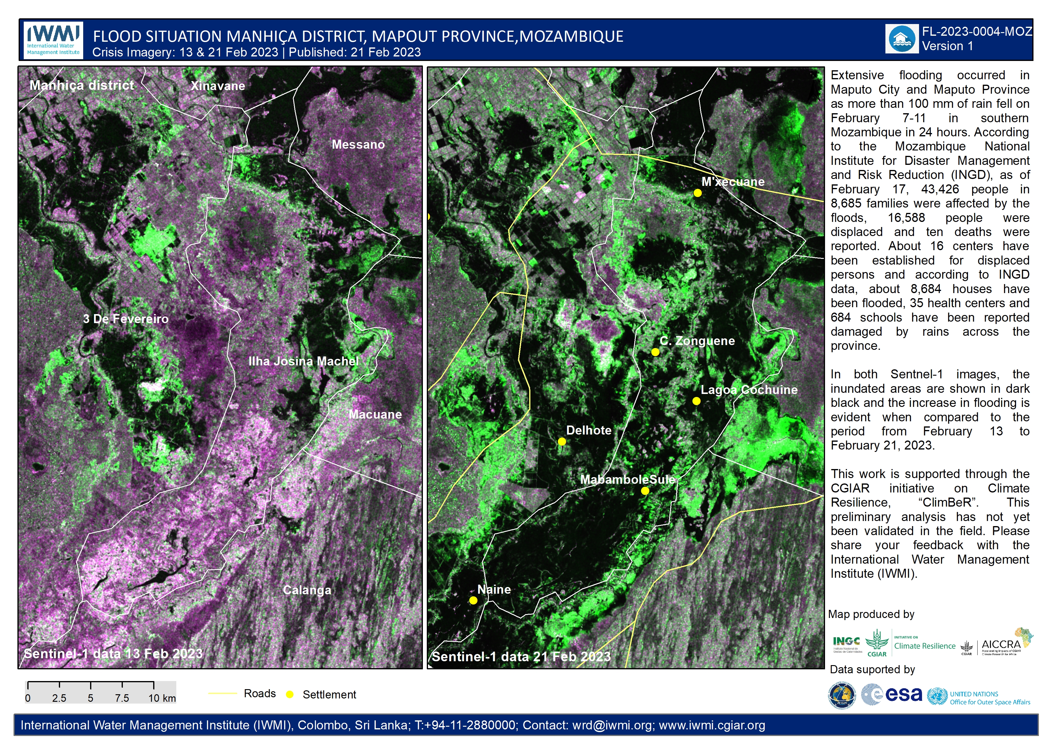
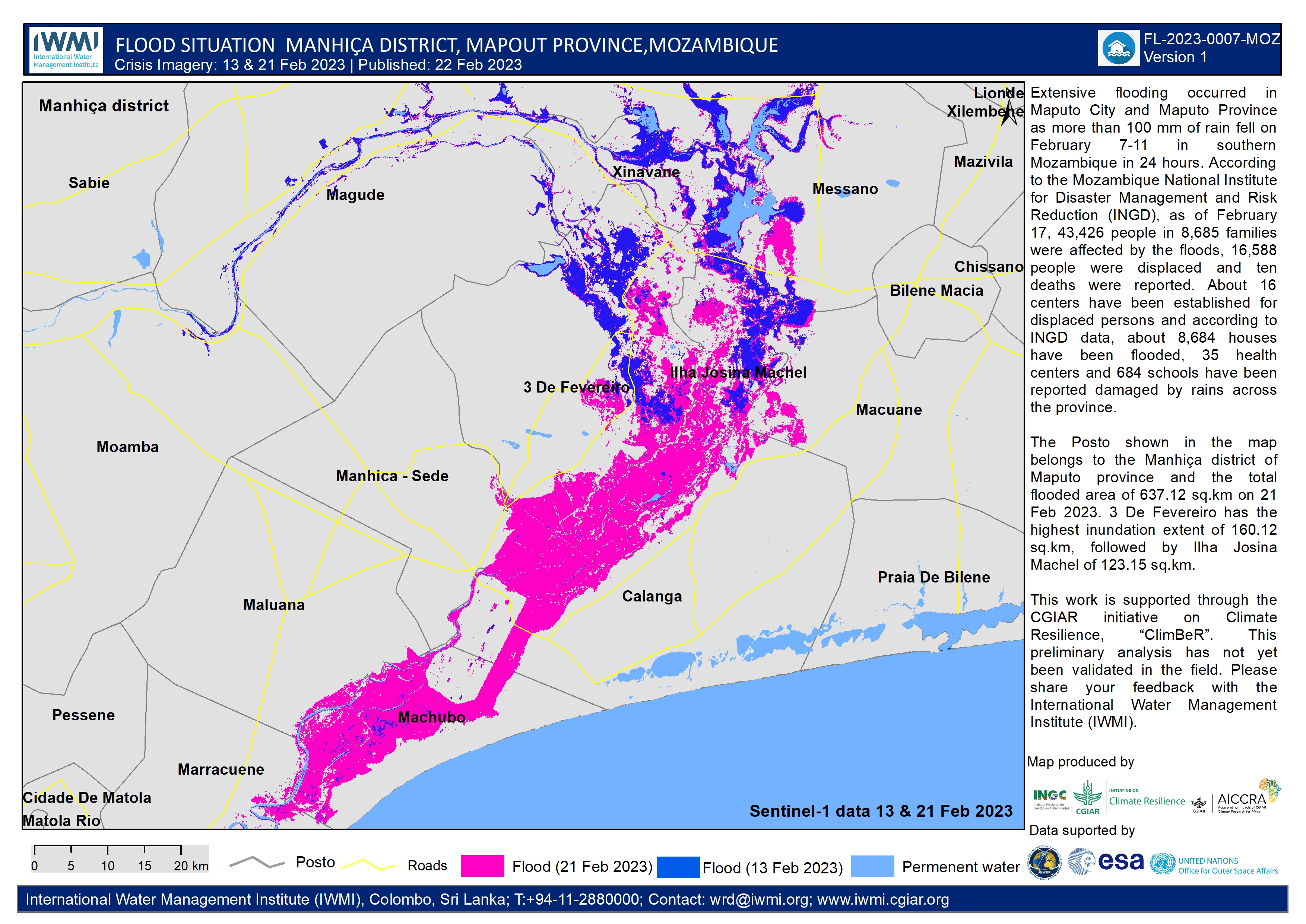
Flood situation in the Manhiça district, Mapout Province, Mozambique
Direitos autorais: Contains modified Copernicus Sentinel data (2023)
Map produced by the International Water Management Institute, INGC, CGIAR and AICCRA.
Information about the Product
Adquirida: 13/02/2023 and 21/02/2023
Fonte: Sentinel-1
Categoria: Grading Map
 Voltar ao arquivo completo da Ativação

