 English
 Spanish
 French
 Chinese
 Russian
 Portuguese
 Latest Activation
Charter activations
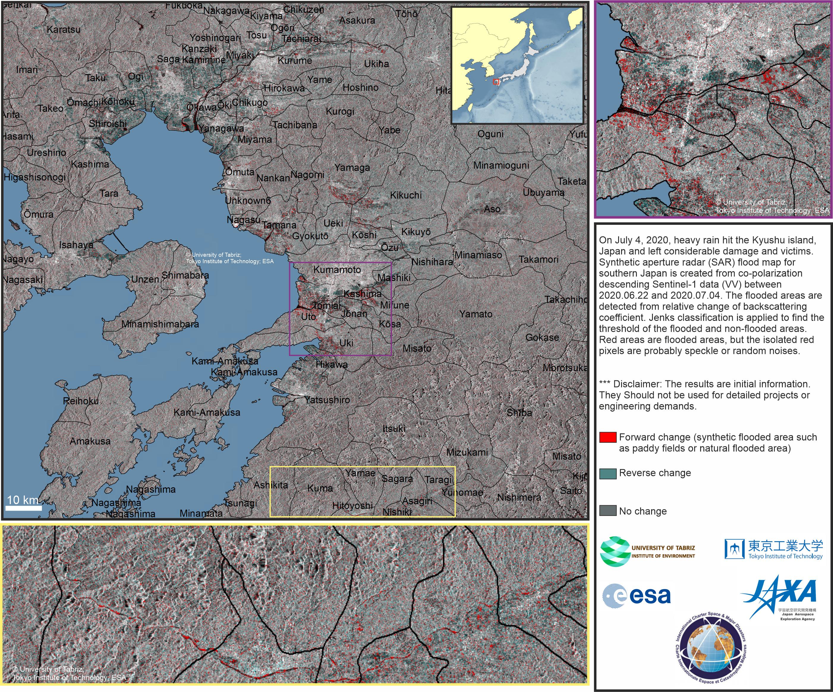
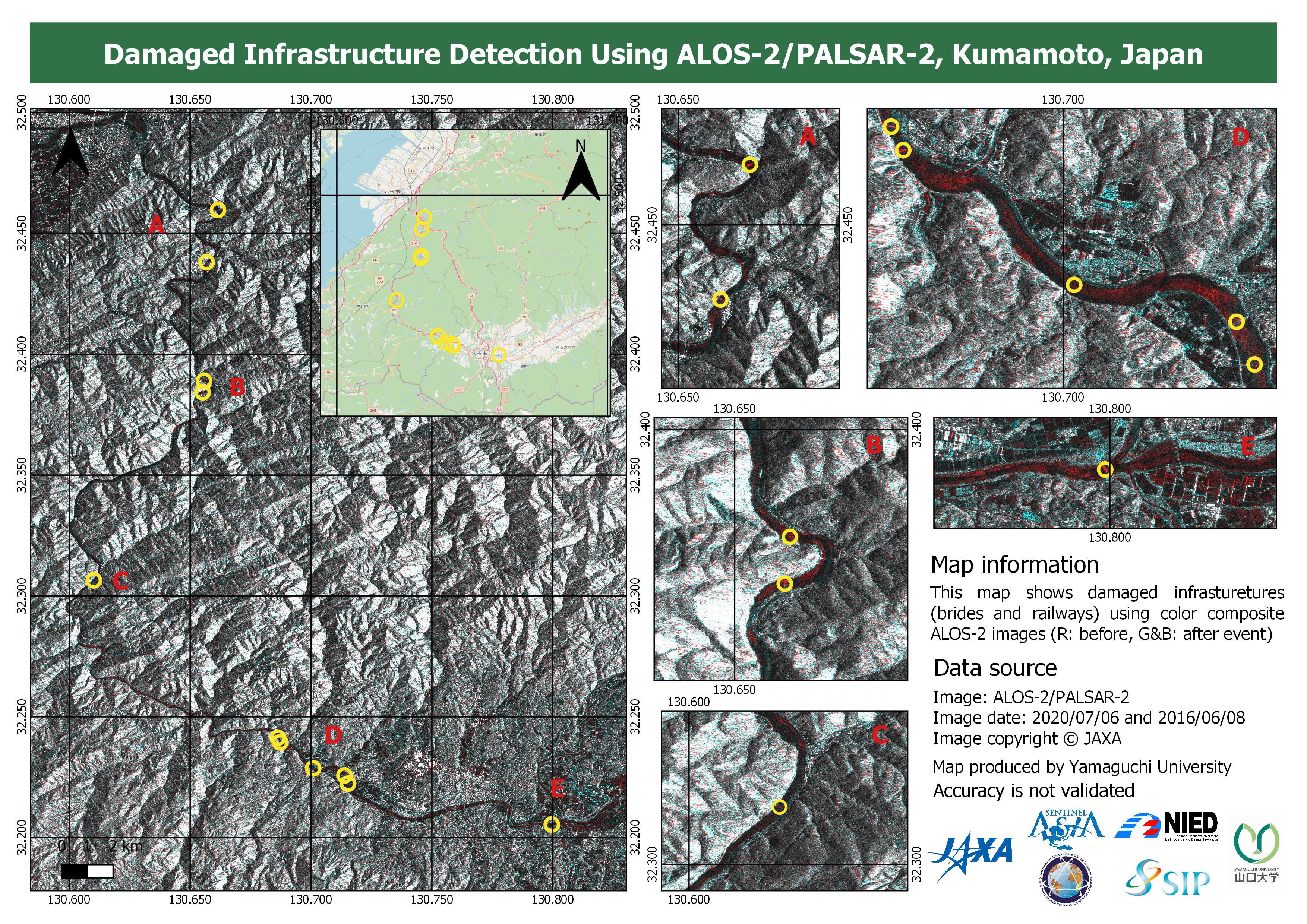
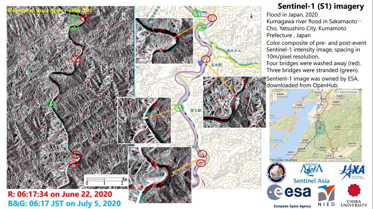
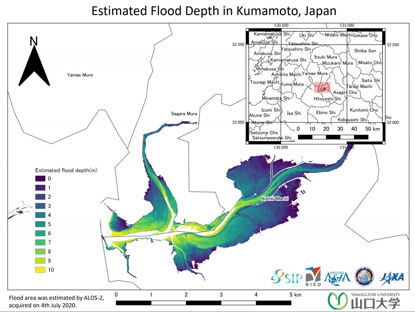
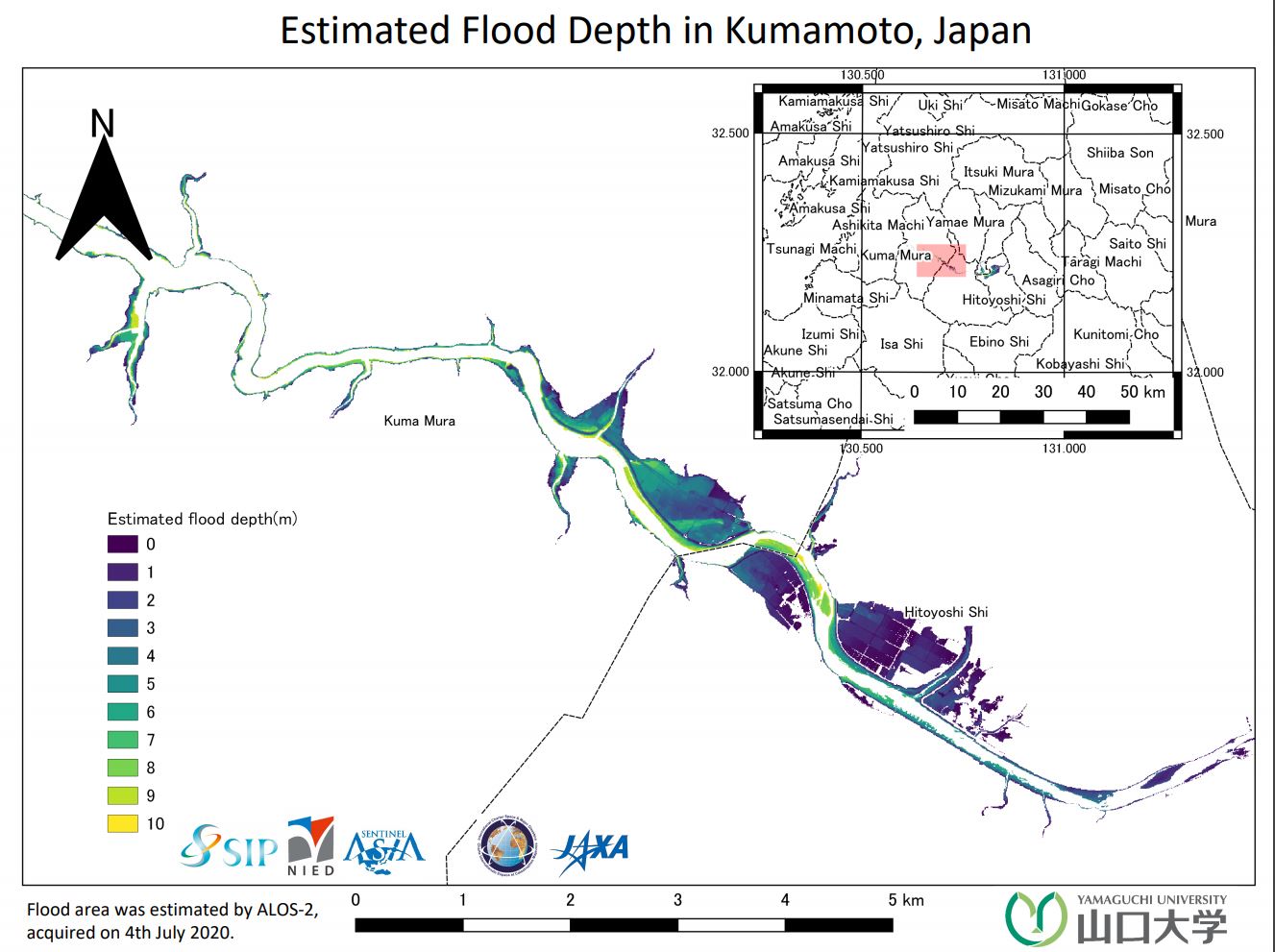
Flood in Japan
Heavy rainfall has caused flooding and landslides on the Island oy Kyushu, Japan. At least 16 people are reported to have been killed and 12 reported missing.
The prefectures of Kumamoto and Kagoshima have been worst hit, with rivers breaking their banks and washing away homes, bridges, cars and trees.
Local authorities evacuated 200,000 people from their homes and deployed 10,000 soldiers to assist in relief efforts.
Japan's Meteorological Agency said such rainfall had never been seen before in the region. The rains are forecast to ease in the coming hours and days.
Related News and Resources
| Tipo de evento: | Floods |
| Local do evento: | Japan |
| Data da Ativação da Carta: | 2020-07-06 |
| Tempo de Ativação da Carta: | 20:00 |
| Zona de Tempo da Ativação da Carta: | UTC+09:00 |
| Requisitante da Carta: | ADRC |
| ID da Ativação: | 657 |
| Gerenciamento de projeto: | Yamaguchi University |
Products
Preliminary flood mapping in Kumamoto, Japan
Direitos autorais: © JAXA
Information about the Product
Adquirida: 04/07/2020
Fonte: ALOS-2

 Voltar ao arquivo completo da Ativação

