Charter activations
Typhoon Doksuri in China
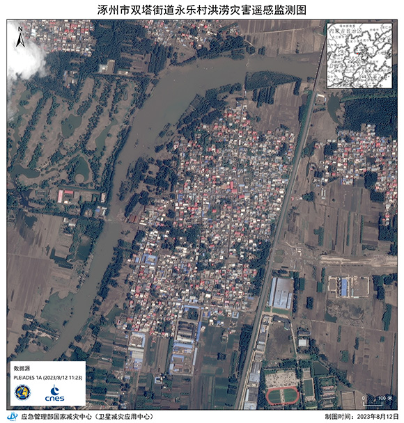
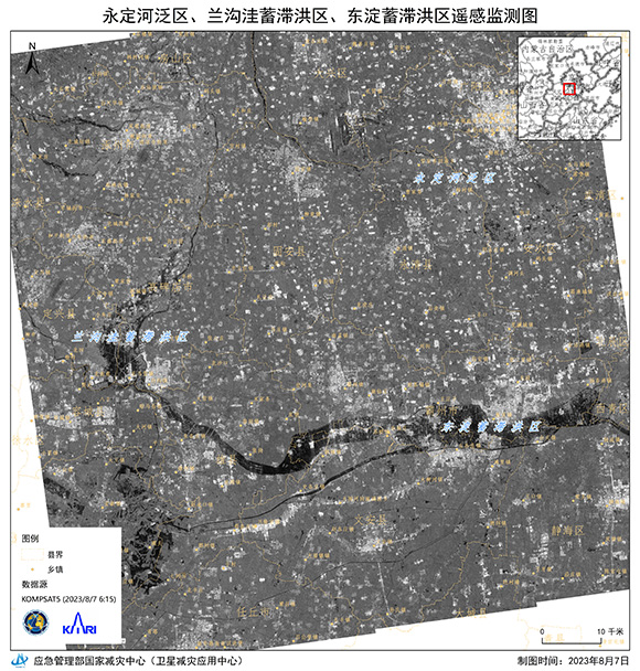
Typhoon Doksuri made landfall in the Fujian province of south-east China on the 28 July. The second of two severe typhoons in recent weeks, Typhoon Doksuri brought gusts of wind over 100 mph and caused widespread flooding and subsequent landslides.
As Doksuri moved north and deeper inland on 29 July, red alerts for severe flooding in parts of Northern China were triggered. In Beijing, 30,000 people were evacuated from the highest risk areas where more than 100 mm of rainfall was recorded with certain areas (notably Mentougou) closer to 500 mm.
All modes of transportation were suspended, businesses and schools were closed due to flooding and agriculture was severely damaged. The strong winds left a trail of debris and devastation. Two fatalities were reported and a total of around 880,000 people were affected.
Typhoon Doksuri is the second strongest storm to hit China in years; after Typhoon Meranti in 2016 which killed 11 people.
| Tipo de evento: | Cyclones |
| Local do evento: | China |
| Data da Ativação da Carta: | 2023-07-31 |
| Tempo de Ativação da Carta: | 19:24 |
| Zona de Tempo da Ativação da Carta: | UTC+08:00 |
| Requisitante da Carta: | National Disaster Reduction Center of China (NDRCC) |
| ID da Ativação: | 825 |
| Gerenciamento de projeto: | Mingbo Liu (National Disaster Reduction Center of China) |
Products
 Voltar ao arquivo completo da Ativação

 English
 Spanish
 French
 Chinese
 Russian
 Portuguese


