 English
 Spanish
 French
 Chinese
 Russian
 Portuguese
 Latest Activation
Charter activations
Flood in Morocco
Heavy rains since 2 February have claimed 24 lives and forced 2,000 to be evacuated over the past week. Rivers rose and houses were swept away in landslides, causing over 2,000 homes to be lost.
According to the authorities in Rabat, 2,252 houses have been lost and another 328 damaged, with 80,000 hectares (300 square miles) of agricultural land submerged.
| Tipo de evento: | Flood |
| Local do evento: | Morocco |
| Data da Ativação da Carta: | 09/02/2009 |
| Requisitante da Carta: | UNOOSA on behalf of Economic Commission for Africa (ECA) |
| Gerenciamento de projeto: | ESA |
Products
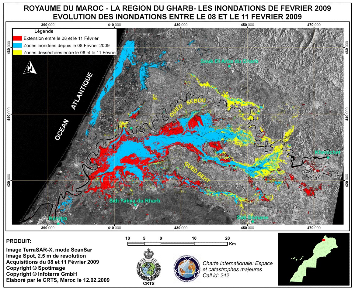
Crisis image map presenting the evolution of the flood event from 8th (blue areas) to 11th of February (red areas). Areas in yellow are flooded in both dates.
Direitos autorais: CNES 2009
DLR 2009
Image processing, map created 12/02/2009 by CRTS.
Information about the Product
Adquirida: SPOT: 08/02/2009
TerraSAR-X: 11/02/2009
Fonte: SPOT-5 and TerraSAR-X

Image map using the intensity image of TerraSAR-X acquisition. Inland dark areas represent flood-affected areas during 11th of February 2009 over the area of Gharb.
Direitos autorais: DLR 2009
Image processing, map created 12/02/2009 by CRTS.
Information about the Product
Adquirida: 11/02/2009
Fonte: TerraSAR-X
 Voltar ao arquivo completo da Ativação

