 English
 Spanish
 French
 Chinese
 Russian
 Portuguese
 Latest Activation
Charter activations
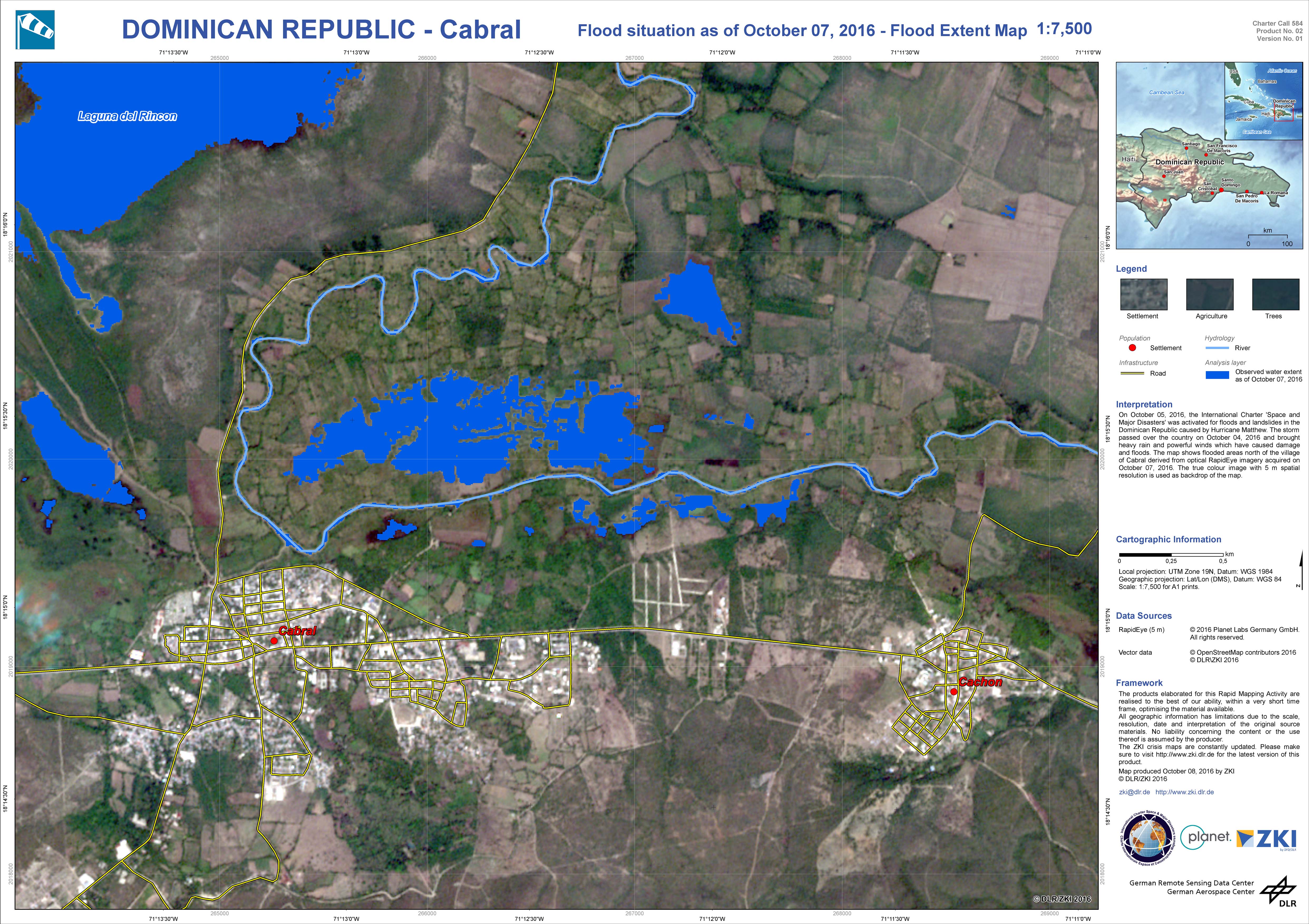
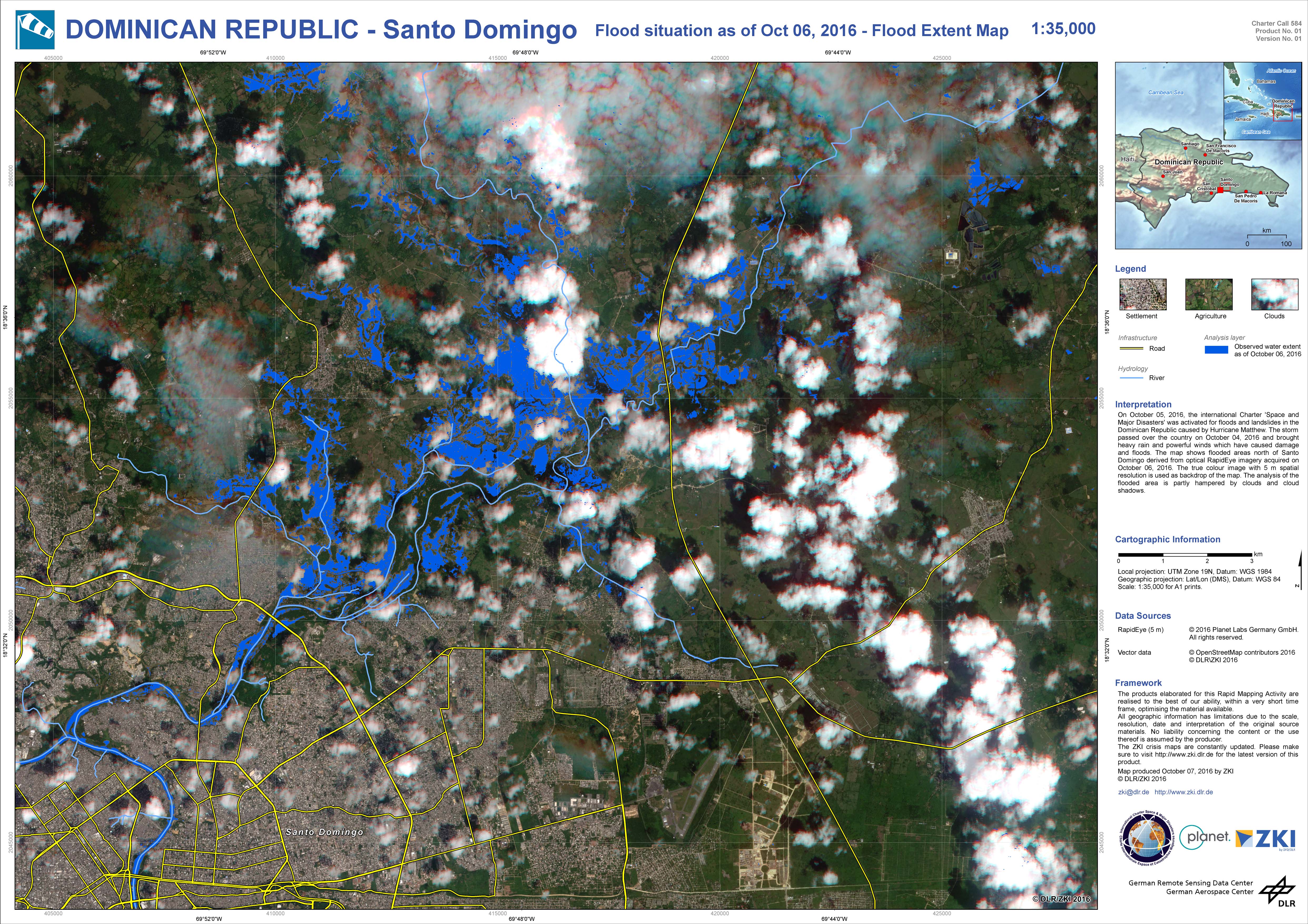
Hurricane Matthew in the Dominican Republic
Four people have died in the Dominican Republic after Hurricane Matthew passed over the country on 4 October.
The powerful storm has affected thousands of people, and a red alert is in place across 19 provinces.
Hurricane Matthew brought heavy rain and powerful winds, which have caused damage and floods. 800 people were evacuated after the storm, and it is estimated that as many as 16,000 are currently taking shelter.
A Category Four storm is on the higher end of the Saffir-Simpson scale, and is used to classify storms that may cause "catastrophic" damage. Matthew has affected 16 countries in the Caribbean so far, and caused major damage in neighbouring Haiti. After leaving the Dominican Republic, the storm moved north where it also affected part of Cuba's eastern coast.
| Tipo de evento: | Ocean Storm - Hurricane |
| Local do evento: | Dominican Republic |
| Data da Ativação da Carta: | 5 October 2016 |
| Tempo de Ativação da Carta: | 04:20:54 |
| Zona de Tempo da Ativação da Carta: | UTC+02:00 |
| Requisitante da Carta: | Comisión Nacional de Emergencias |
| Gerenciamento de projeto: | DLR |
Products
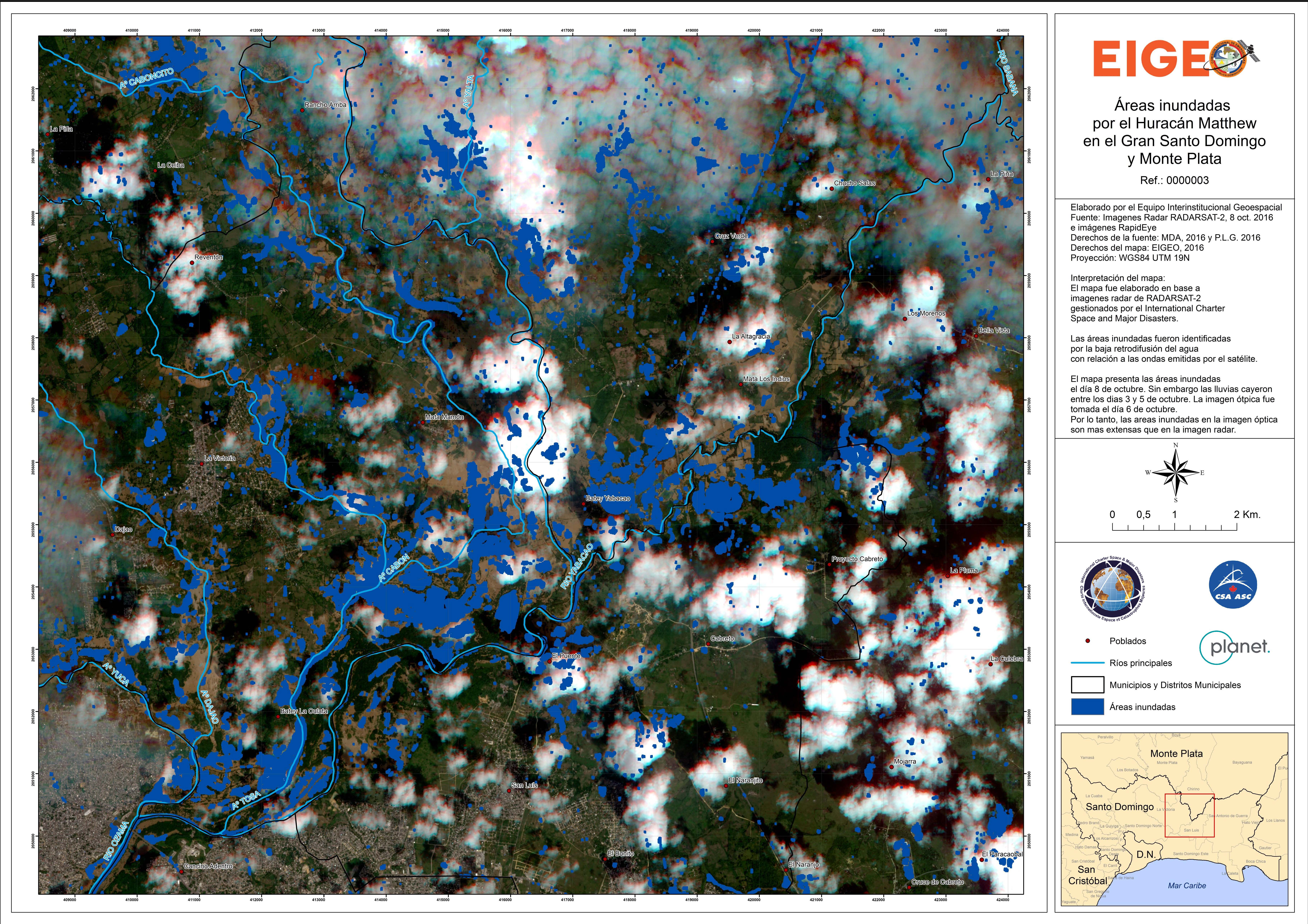
Areas flooded by Hurricane Matthew in Gran Santo Domingo and Monte Plata
Direitos autorais: RADARSAT-2 Data and Products © MacDonald, Dettwiler and Associates Ltd. (2016) - All Rights Reserved. RADARSAT is an official trademark of the Canadian Space Agency.
RapidEye © Planet (2016) - All rights reserved
Map produced by EIGEO
Information about the Product
Adquirida: 08/10/2016
Fonte: RADARSAT-2 / RapidEye
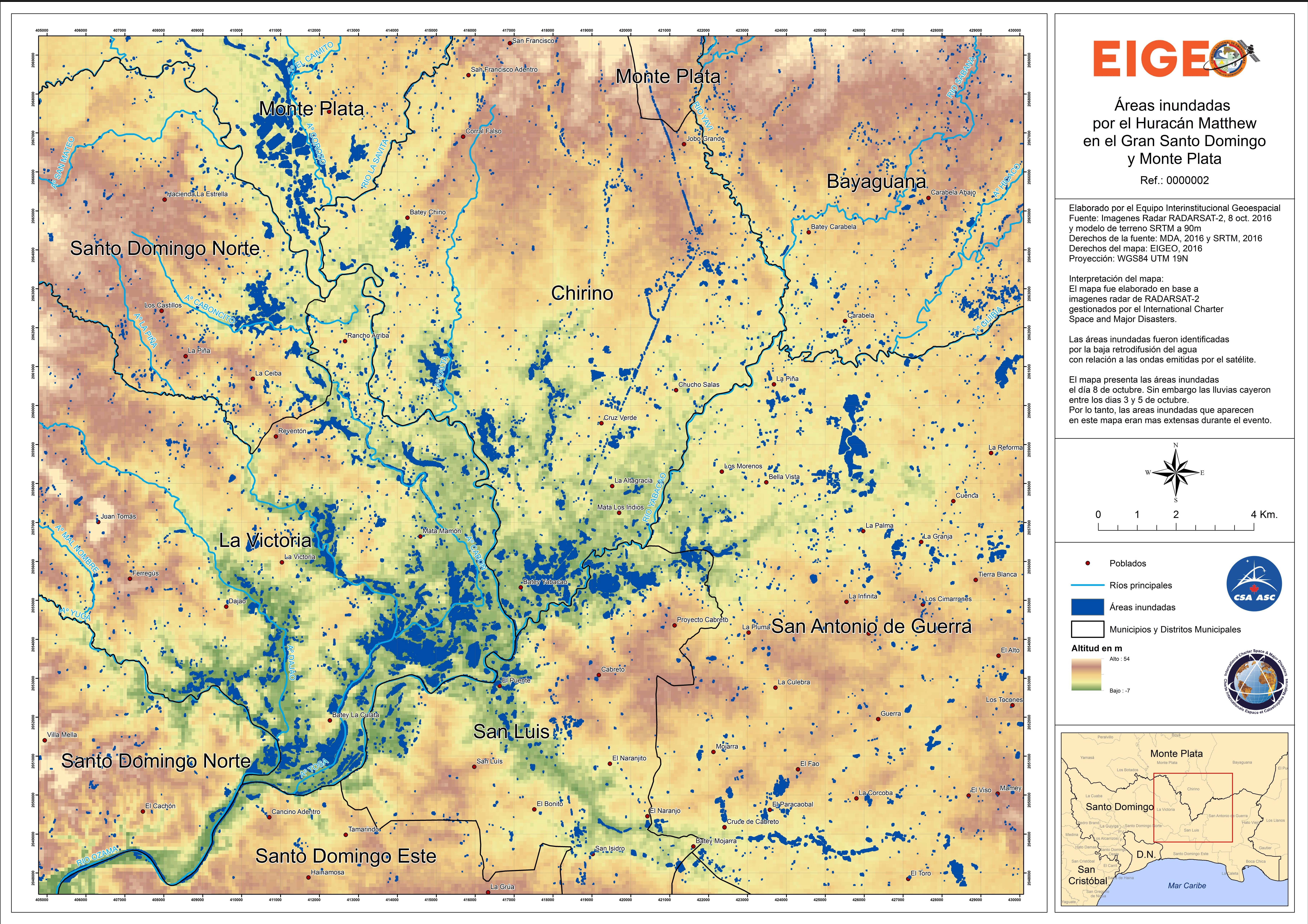
Areas flooded by Hurricane Matthew in Gran Santo Domingo and Monte Plata
Direitos autorais: RADARSAT-2 Data and Products © MacDonald, Dettwiler and Associates Ltd. (2016) - All Rights Reserved. RADARSAT is an official trademark of the Canadian Space Agency.
Map produced by EIGEO
Information about the Product
Adquirida: 08/10/2016
Fonte: RADARSAT-2
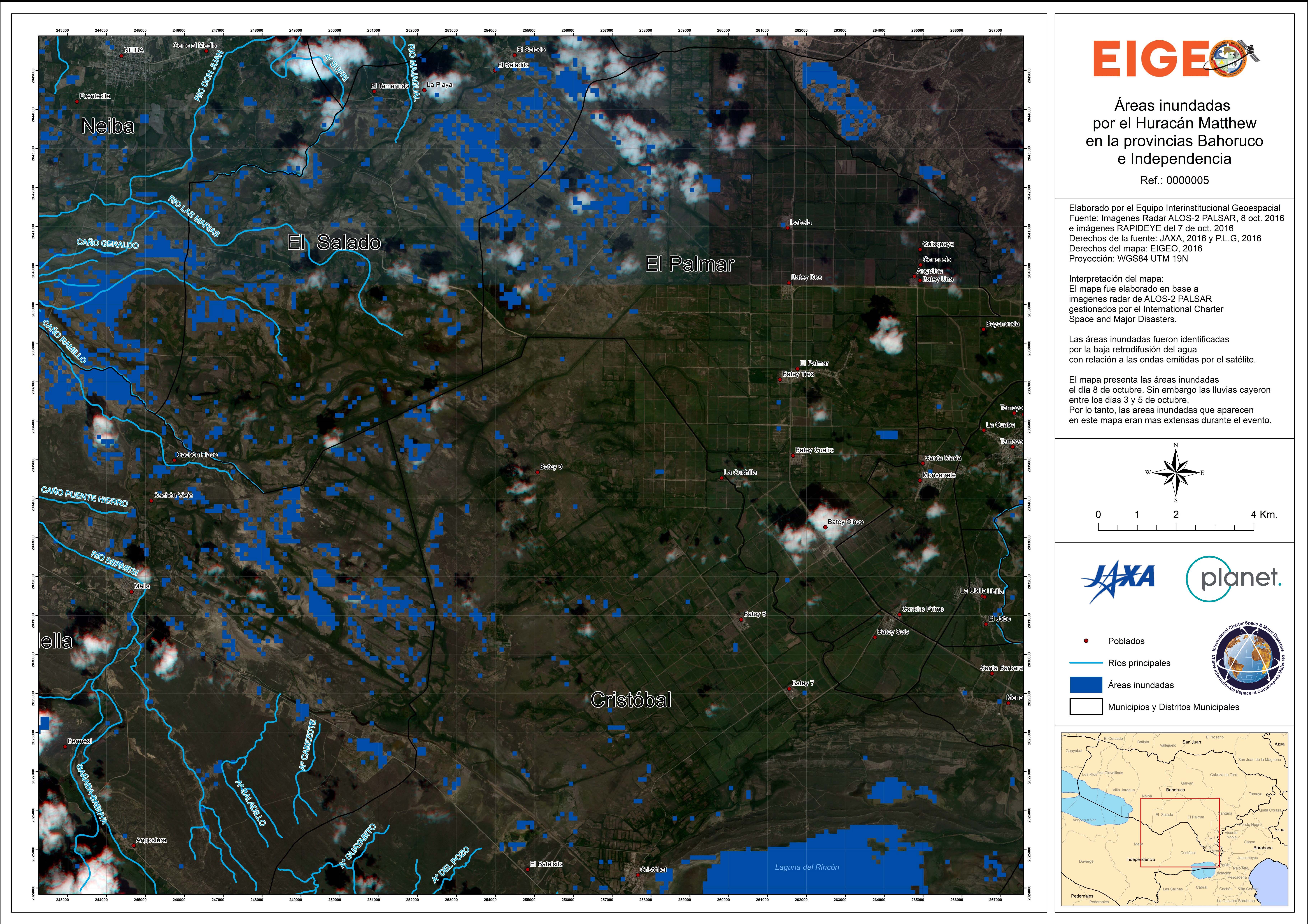
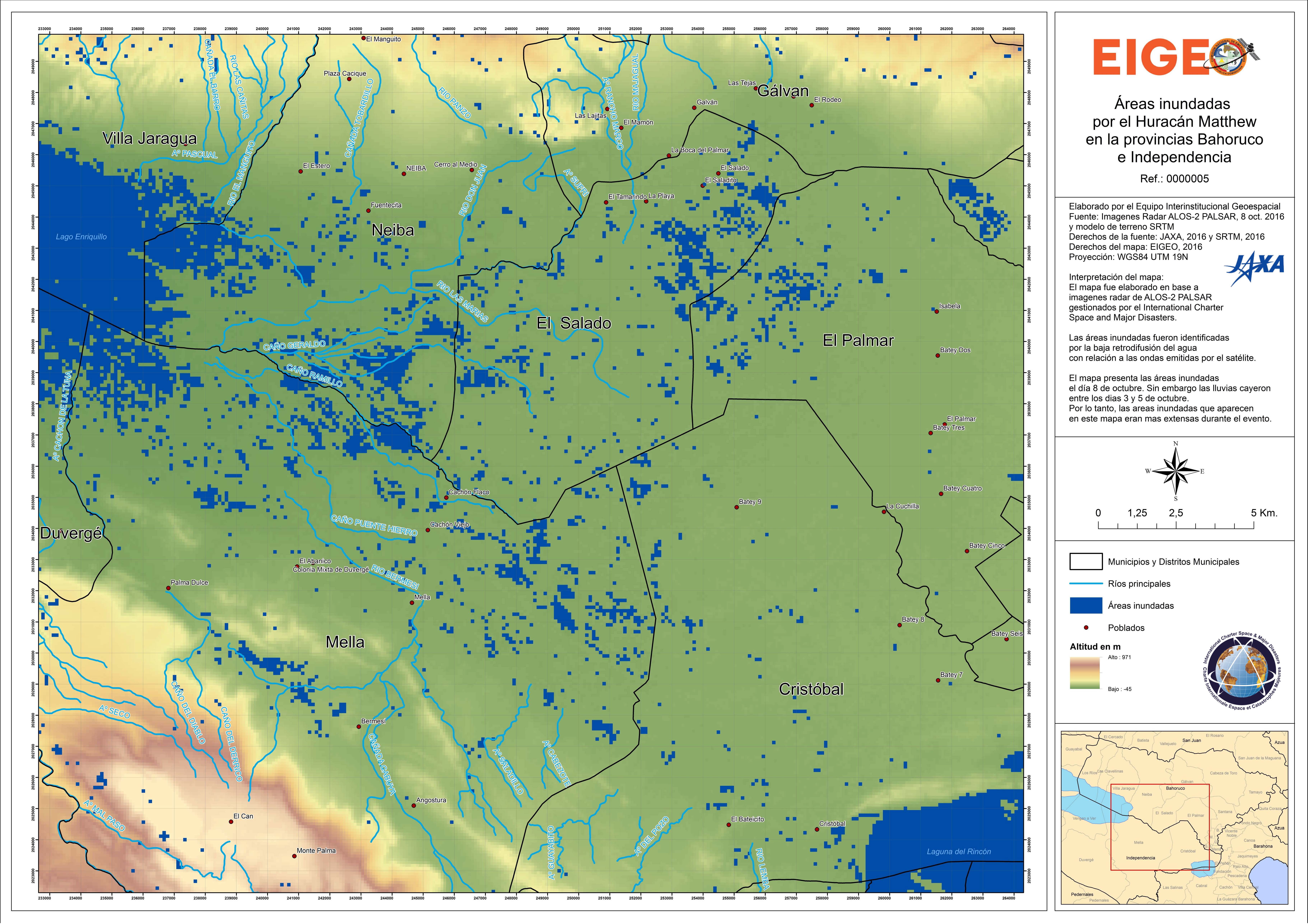
Areas flooded by Hurricane Matthew in Bahoruco and Independencia Provinces
Direitos autorais: ALOS-2 © JAXA (2016) - All rights reserved
RapidEye © Planet (2016) - All rights reserved
Map produced by EIGEO
Information about the Product
Adquirida: ALOS-2: 08/10/2016
RapidEye: 07/10/2016
Fonte: ALOS-2 / RapidEye
 Voltar ao arquivo completo da Ativação

