Charter activations
Flood in Costa Rica
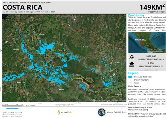
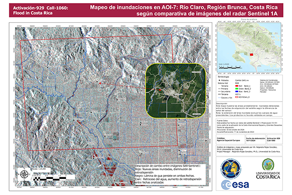
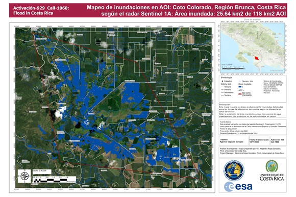
Continuous torrential rainfall has hit Costa Rica between 1 – 12 November. According to the National Meteorological Institute this is related to the indirect influence of Hurricane Rafael. Heavy rainfall is the result of a mix of meteorological factors, including tropical depressions over the Caribbean and the Madden-Julian Oscillation. These conditions were caused by an increase in the flow of the western trade wind associated with the influence of a trough in the troposphere. Which then generated a series of incidents related to flooding and devastation in different locations along the North, Central, and South Pacific slopes.
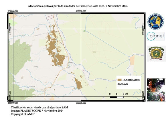
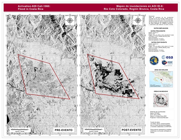
As of November 13, more than 1,100 incidents related to floods, landslides, mudflows, sinkholes, among others, have been recorded, which have affected 41 districts and more than 467 communities reported by the Municipal Emergency Committees. 3 deaths and 5 disappearances have been reported and nearly 1,450 people have been displaced to 35 temporary shelters. In addition, soil saturation and overflowing rivers have blocked essential routes and affected access to several communities, increasing the risk of additional disasters.
Costa Rica's government and emergency teams are actively working to minimize the impact of this storm, the public were warned to remain vigilant, stay informed and prepare their homes for potential flooding.
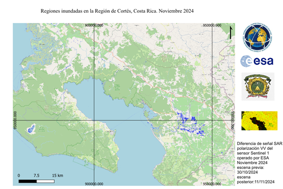
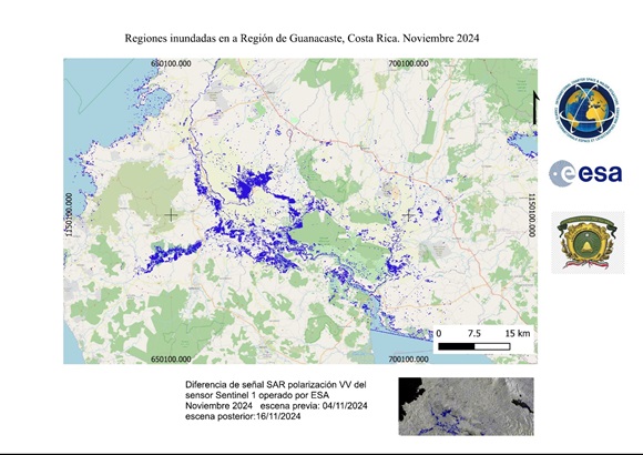
On 16 November, storm Sara brought more rainfall over Costa Rica. The province of Guanacaste was affected the most, with flooding of crops and homes. Roads and local airports were closed. In southern Costa Rica, near the Panamanian border, overflowed rivers left entire communities isolated. Three major routes in the country have been impacted by landslides.
| Tipo de evento: | Flood |
| Local do evento: | Costa Rica |
| Data da Ativação da Carta: | 2024-11-14 |
| Tempo de Ativação da Carta: | 11:43 |
| Zona de Tempo da Ativação da Carta: | UTC-06:00 |
| Requisitante da Carta: | National Comission for Risk Prevention and Emergency Response (CNE) on behalf of Comisión Nacional de Prevención de Riesgos y Atención de Emergencias |
| ID da Ativação: | 929 |
| Gerenciamento de projeto: | Alejandra Rojas (Universidad de Costa Rica) |
| act-value-adders: | Némiga Xanat Antonio (Autonomous University of Mexico State) Yennybel Mirabal (ABAE) Shaikha Ahmed Albesher (Mohammed Bin Rashid Space Centre) |
Products
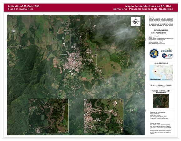
Areas affected by flooding in Santa Cruz, Guanacaste Province, Costa Rica
Direitos autorais: © (2024) DigitalGlobe, Inc., Longmont CO USA 80503. DigitalGlobe and the DigitalGlobe logos are trademarks of DigitalGlobe, Inc. The use and/or dissemination of this data and/or of any product in any way derived there from are restricted. Unauthorized use and/or dissemination is prohibited
Map produced by the University of Costa Rica
Information about the Product
Adquirida: 23/11/2024
Fonte: WorldView-3
Categoria: Delineation Map
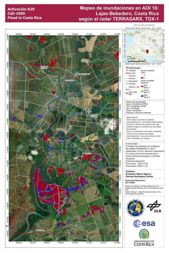
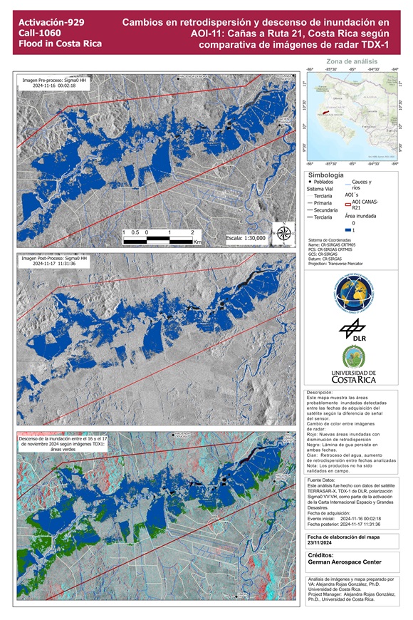
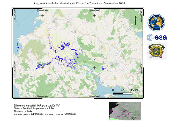
Areas affected by flood in Lajas Bebedero
Direitos autorais: Contains modified Copernicus Sentinel data (2024)
© DLR e.V. (2024), Distribution Airbus DS Geo GmbH
Contains modified Copernicus Sentinel data (2024)
Map produced by the University of Costa Rica
Information about the Product
Adquirida: Sentinel-1: 04/11/2024, 16/11/2024
Tandem-X: 16/11/2024
Fonte: Sentinel-1, Tandem-X
Categoria: Delineation Map
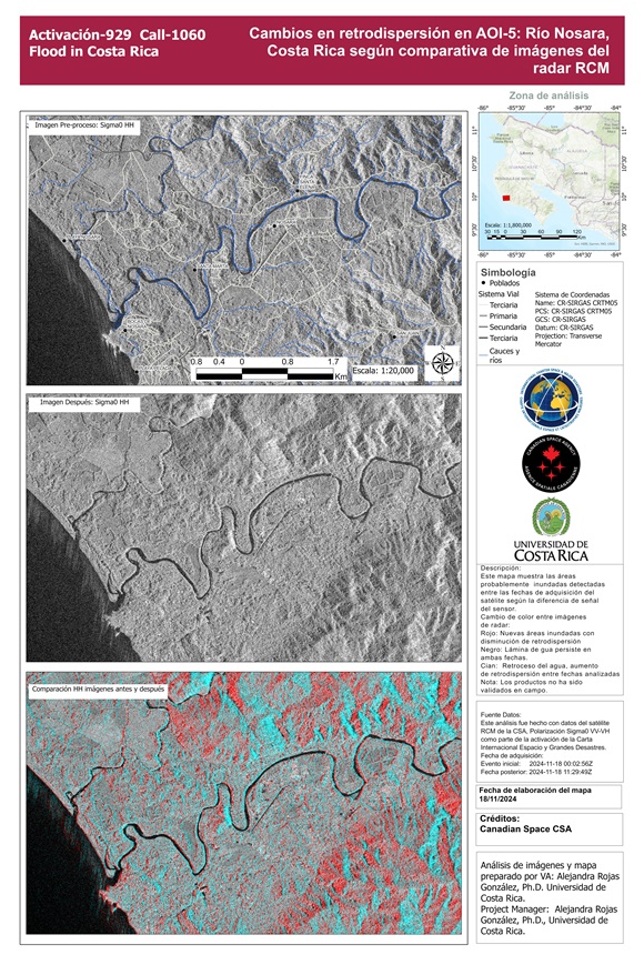
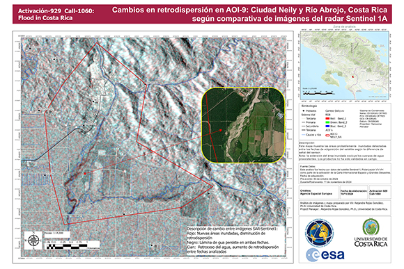
Areas affected by flooding in Rio Nosara, Costa Rica
Direitos autorais: RADARSAT Constellation Mission Imagery © Government of Canada (2024) - RADARSAT is an official mark of the Canadian Space
Map produced by the University of Costa Rica
Information about the Product
Adquirida: 18/11/2024
Fonte: RCM
Categoria: Reference Map
 Voltar ao arquivo completo da Ativação

 English
 Spanish
 French
 Chinese
 Russian
 Portuguese
