Charter activations
Flood in Cambodia
Heavy rainfall in October has resulted in flash floods in Cambodia which have taken 152 lives and affected over half a million people.
16 of Cambodia's 24 provinces have been affected by the flooding and the Mekong River was particularly affected, as its water levels rose with the rainfall.
28,000 people have been evacuated to higher ground and it is estimated that 200,000 homes and over a thousand schools have been inundated. 300,000 hectares of rice are also believed to have been lost and 241 km of roads in the country are estimated to be affected by the flooding and debris washed onto the roads.
While the floodwaters have been receding, Typhoon Nari, which passed through neighbouring Vietnam and Laos last week, may have exacerbated the flooding; further prolonging the situation in Cambodia.
| Tipo de evento: | Flood |
| Local do evento: | Cambodia |
| Data da Ativação da Carta: | 21 October 2013 |
| Requisitante da Carta: | UNITAR/UNOSAT on behalf of UNICEF WFP |
| Gerenciamento de projeto: | UNITAR/UNOSAT |
Products

Update 3: Flood waters over Phnom Penh, Cambodia
Direitos autorais: RADARSAT-2 Data and Products © MacDonald, Dettwiler and Associates Ltd. (2013) - All Rights Reserved. RADARSAT is an official trademark of the Canadian Space Agency.
DMC International Imaging (UKSA)
Map produced by UNITAR/UNOSAT
Information about the Product
Adquirida: RADARSAT-2: 28/10/2013
DMC: 01/02/2013
Fonte: RADARSAT-2 / DMC
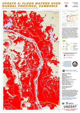
Update 2: Flood waters over Kandal Province, Cambodia
Direitos autorais: RADARSAT-2 Data and Products © MacDonald, Dettwiler and Associates Ltd. (2013) - All Rights Reserved. RADARSAT is an official trademark of the Canadian Space Agency.
DMC International Imaging (UKSA)
Map produced by UNITAR/UNOSAT
Information about the Product
Adquirida: RADARSAT-2: 25/10/2013
DMC: 01/02/2013
Fonte: RADARSAT-2 / DMC
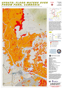
Update: Flood waters over Phnom Penh, Cambodia
Direitos autorais: Landsat-8 data and products © USGS (2013) - All rights reserved
TerraSAR-X © German Aerospace Center (DLR), 2013 Astrium Services / Infoterra GmbH
DMC International Imaging (UKSA)
Map produced by UNITAR/UNOSAT
Information about the Product
Adquirida: Landsat-8: 24/10/2013
TerraSAR-X: 23/10/2013
DMC: 01/02/2013
Fonte: Landsat-8 / TerraSAR-X / DMC
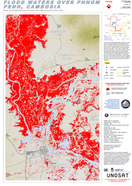
Flood Waters Over Phnom Penh, Cambodia
Direitos autorais: DMC: International Imaging Ltd. (UKSA)
TerraSAR-X: © German Aerospace Center (DLR), 2013 Astrium Services / Infoterra GmbH
Map produced by UNITAR/UNOSAT
Information about the Product
Adquirida: TerraSAR-X: 23/10/2013
DMC: 01/02/2013
Fonte: TerraSAR-X and DMC
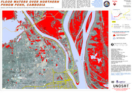
Flood Waters Over Northern Phnom Penh, Cambodia
Direitos autorais: DMC: International Imaging Ltd. (UKSA)
Pleiades: © CNES 2012, Distribution Astrium Services/Spot Image SA, all rights reserved
Map produced by UNITAR/UNOSAT
Information about the Product
Adquirida: Pleiades: 22/10/2013
DMC: 01/02/2013
Fonte: Pleiades and DMC
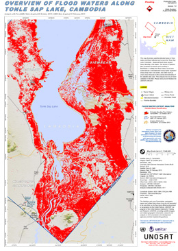
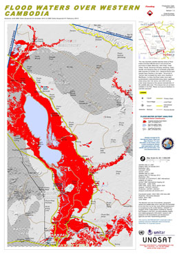
Overview of Flood Waters Along Tonle Sap Lake, Cambodia
Direitos autorais: DMC: International Imaging Ltd. (UKSA)
TerraSAR-X: German Aerospace Center (DLR), 2013 Astrium Services/Infoterra GmbH
Map produced by UNITAR/UNOSAT
Information about the Product
Adquirida: DMC: 01/02/2013
TerraSAR-X: 22/10/2013
Fonte: TerraSAR-X and DMC
 Voltar ao arquivo completo da Ativação

 English
 Spanish
 French
 Chinese
 Russian
 Portuguese
