 English
 Spanish
 French
 Chinese
 Russian
 Portuguese
 Latest Activation
Charter activations
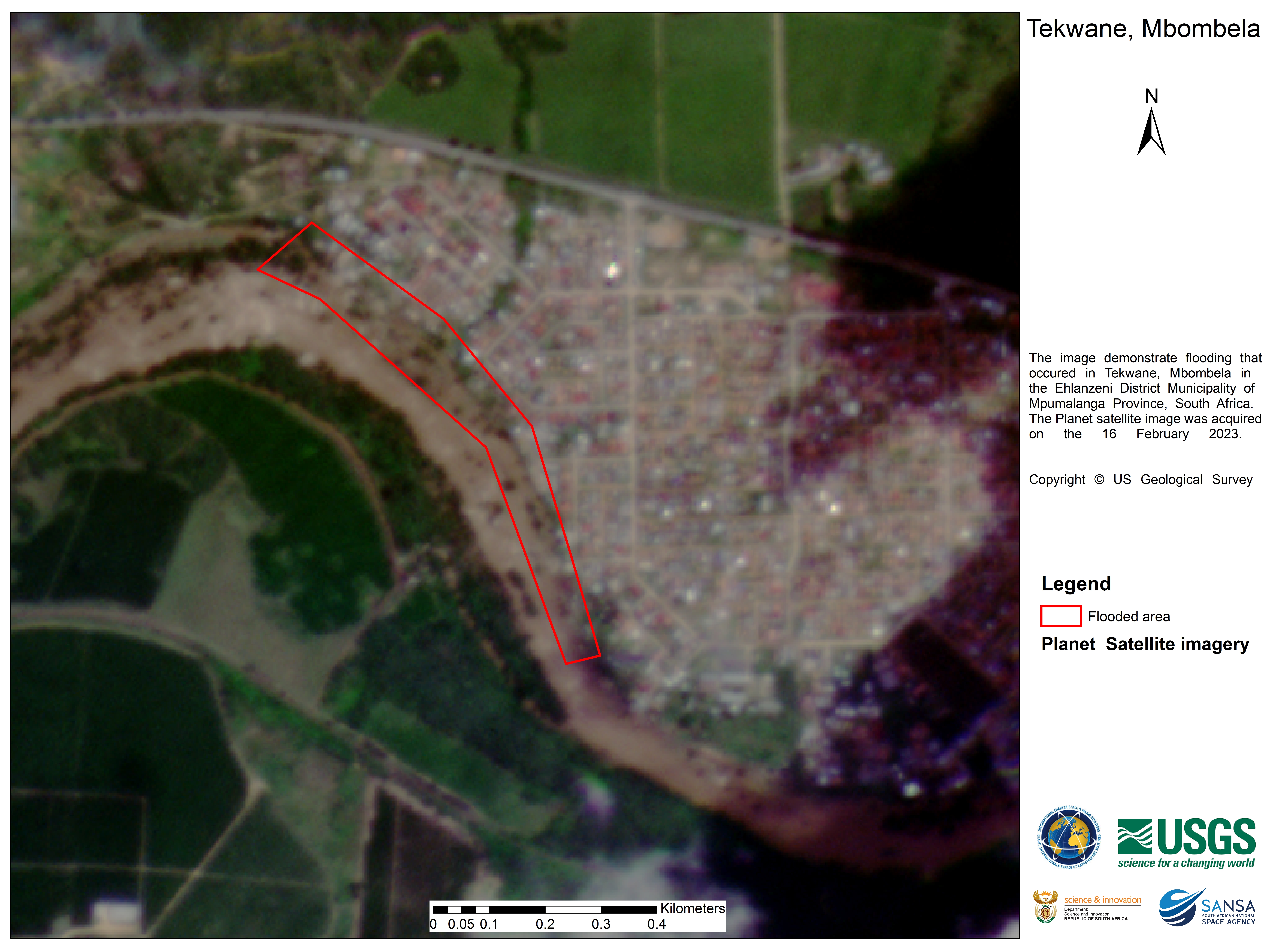
Flooding in Eswatini
Storms and heavy rains have caused flooding Eswatini. Overall, the country has received 2, 868.3mm of rainfall caused by an upper level trough which is a trough of low pressure that forms in the upper levels of the atmosphere, similar to a cold front.
The National Disaster Management Agency (NDMA), urged members of the public to take extra precautions as a number of rivers in the country were flooded due to the torrential rains.
| Tipo de evento: | Floods |
| Local do evento: | Eswatini |
| Data da Ativação da Carta: | 2023-02-11 |
| Tempo de Ativação da Carta: | 00:15 |
| Zona de Tempo da Ativação da Carta: | UTC+01:00 |
| Requisitante da Carta: | NDMA |
| ID da Ativação: | 800 |
| Gerenciamento de projeto: | Sibusiso Ginindza (National Disaster Management Agency) |
| act-value-adders: | Morwapula Mashalane (SANSA) |
 Voltar ao arquivo completo da Ativação

