 English
 Spanish
 French
 Chinese
 Russian
 Portuguese
 Latest Activation
Charter activations
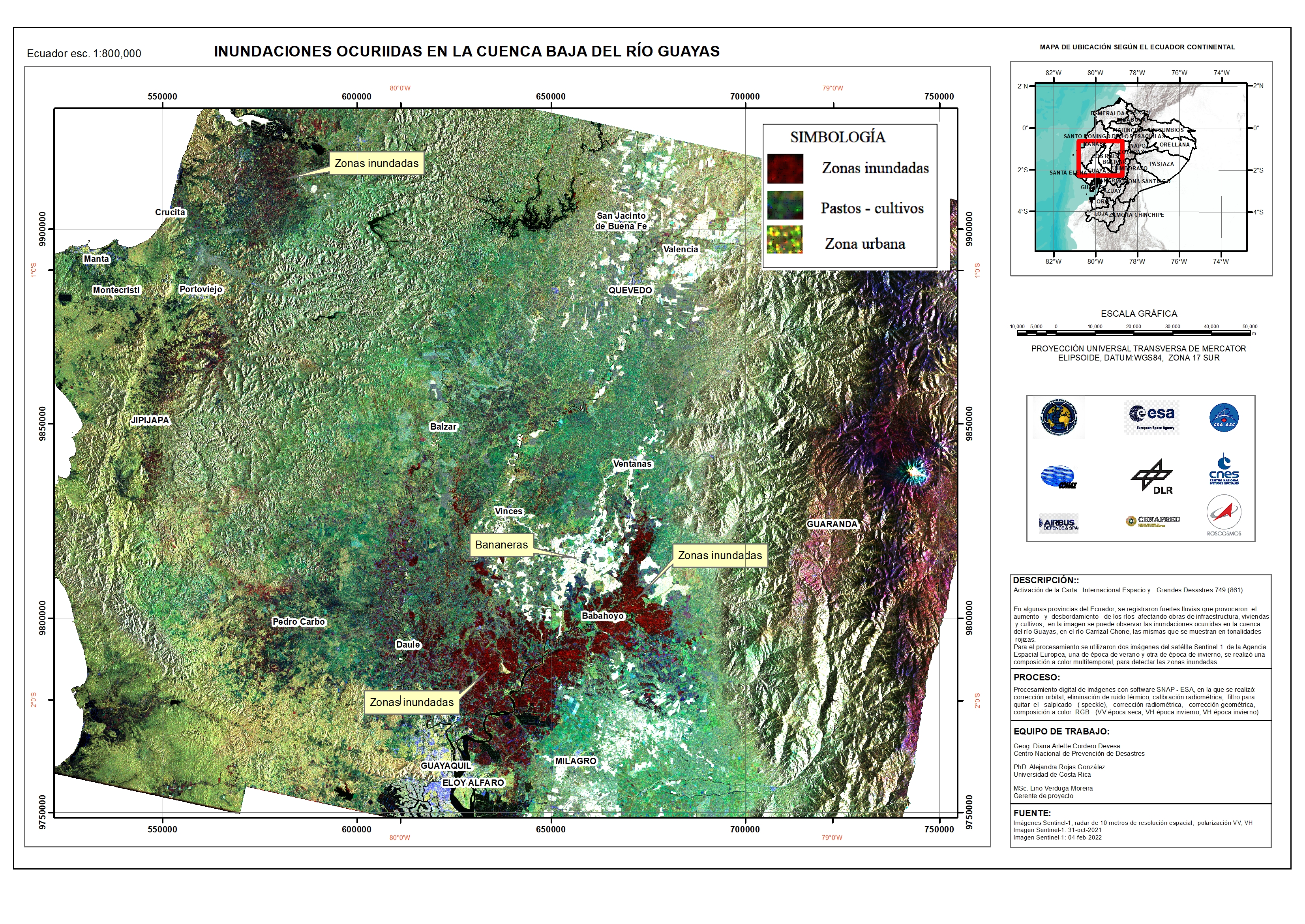
Flooding in Ecuador
Massive flooding in Ecuador's capital Quito and a resulting landslide on the Pichincha volcano which overlooks the city, has killed at least 22 people it has been reported. The floods on 31 January were caused by heavy rainfall, the heaviest in Ecuador for almost 20 years.
Rescue crews are searching homes and streets covered by mud and officials say there are many people missing. The National Police of Ecuador have dispatched both Special Operations Group and an Intervention and Rescue Group to assist with recovery efforts.
| Tipo de evento: | Floods, landslides |
| Local do evento: | Ecuador |
| Data da Ativação da Carta: | 2022-01-31 |
| Tempo de Ativação da Carta: | 20:27 |
| Zona de Tempo da Ativação da Carta: | UTC-05:00 |
| Requisitante da Carta: | SERVICIO NACIONAL DE GESTIÓN DE RIESGOS Y EMERGENCIAS (SNGRE) |
| ID da Ativação: | 749 |
| Gerenciamento de projeto: | SNGRE |
Products
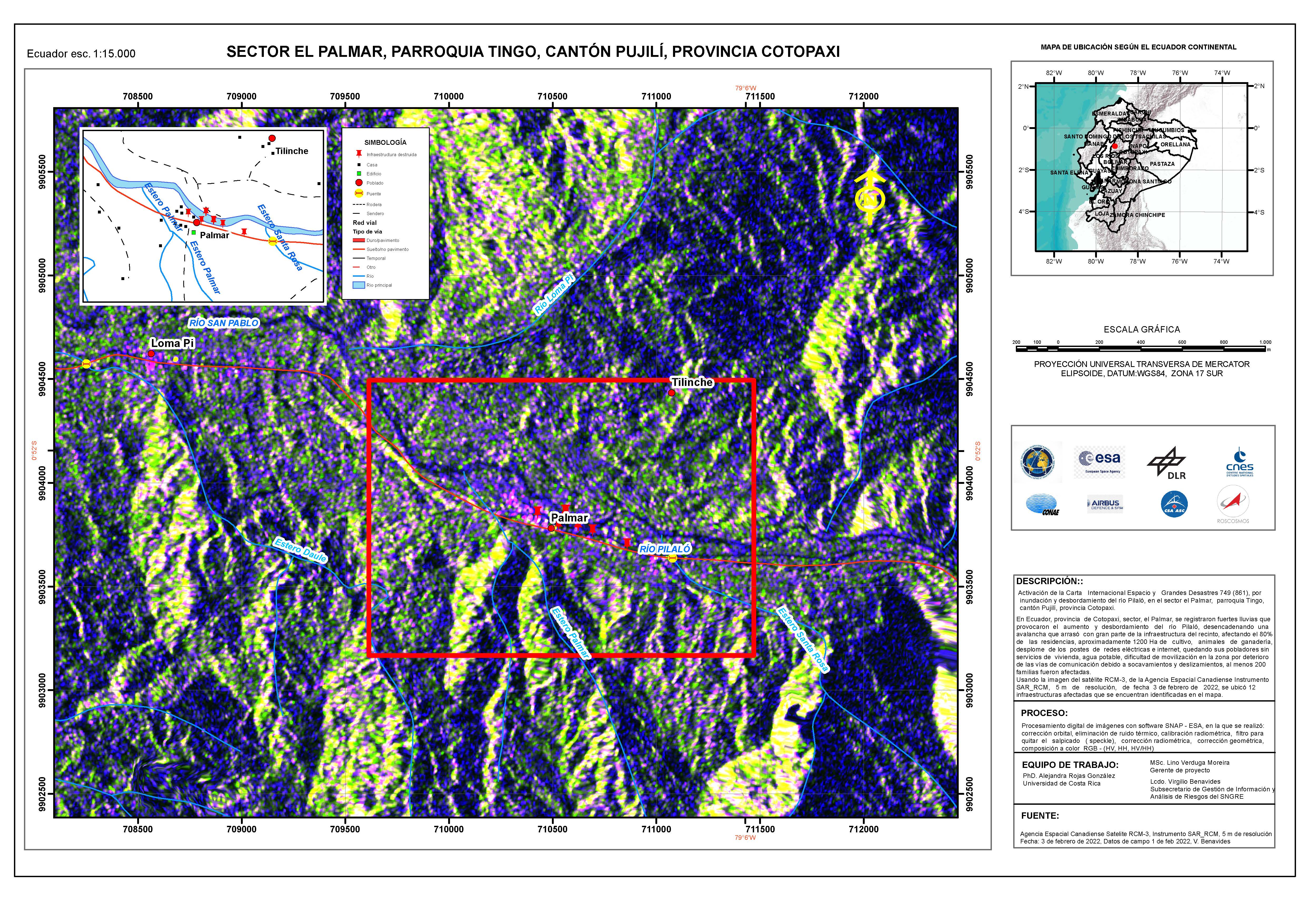
Areas affected by flooding and overflow of the Pilaló River, in the El Palmar sector, Tingo parish, Pujilí canton, Cotopaxi province Ecuador
Direitos autorais: RADARSAT Constellation Mission Imagery © Government of Canada (2022) - RADARSAT is an official mark of the Canadian Space Agency
Map produced by University of Costa Rica
Information about the Product
Adquirida: 03/02/2022
Fonte: RCM
Categoria: Delineation Map
 Voltar ao arquivo completo da Ativação

