 English
 Spanish
 French
 Chinese
 Russian
 Portuguese
 Latest Activation
Charter activations
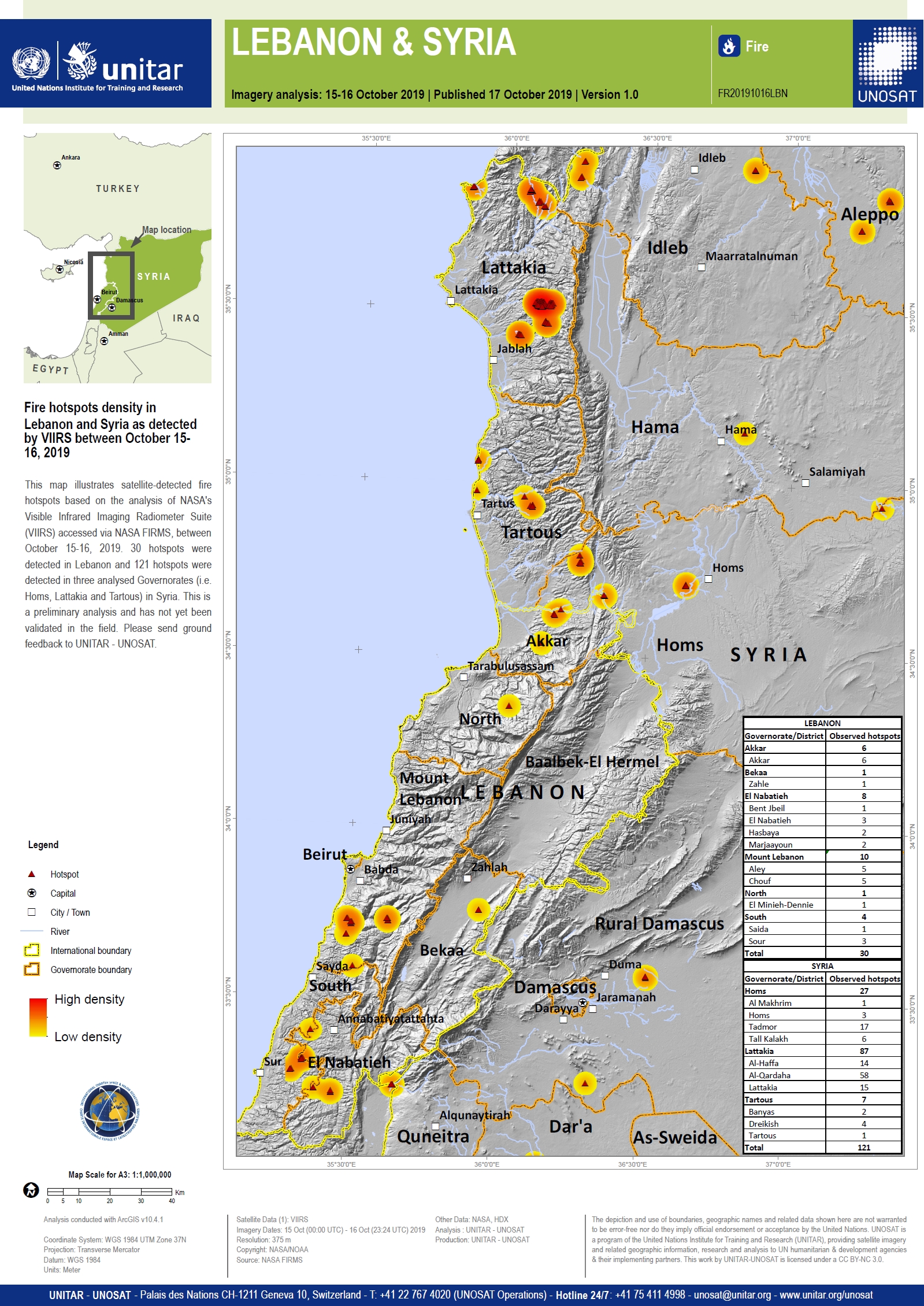
Fires in Lebanon and Syria
Wildfires burning across Lebanon and into Syria are being described as the worst in decades. The fires started in Lebanon's western mountains during a heatwave and have been spread by strong winds.
Reports suggest one firefighter and two forestry workers have lost their lives, with at least eight more people being injured. The Lebanese Red Cross announced they have treated more than 70 people at a field hospital in Damour, Lebanon.
Lebanon's Interior Minister Raya El Hassan said the government had contacted several countries for help to battle hundreds of forest fires. Army and air force units have already been deployed with water cannons to supress the flames which spread into three provinces in neighboring Syria.
Rainfall helped to subdue fires, but the risk of fires igniting again remains high as strong winds and rising temperatures are forecast over the coming days.
| Tipo de evento: | Fire |
| Local do evento: | Lebanon and Syria |
| Data da Ativação da Carta: | 2019-10-16 |
| Tempo de Ativação da Carta: | 22:43 |
| Zona de Tempo da Ativação da Carta: | UTC+02:00 |
| Requisitante da Carta: | UNITAR/UNOSAT on behalf of ICRC |
| ID da Ativação: | 626 |
| Gerenciamento de projeto: | UNITAR/UNOSAT |
Products
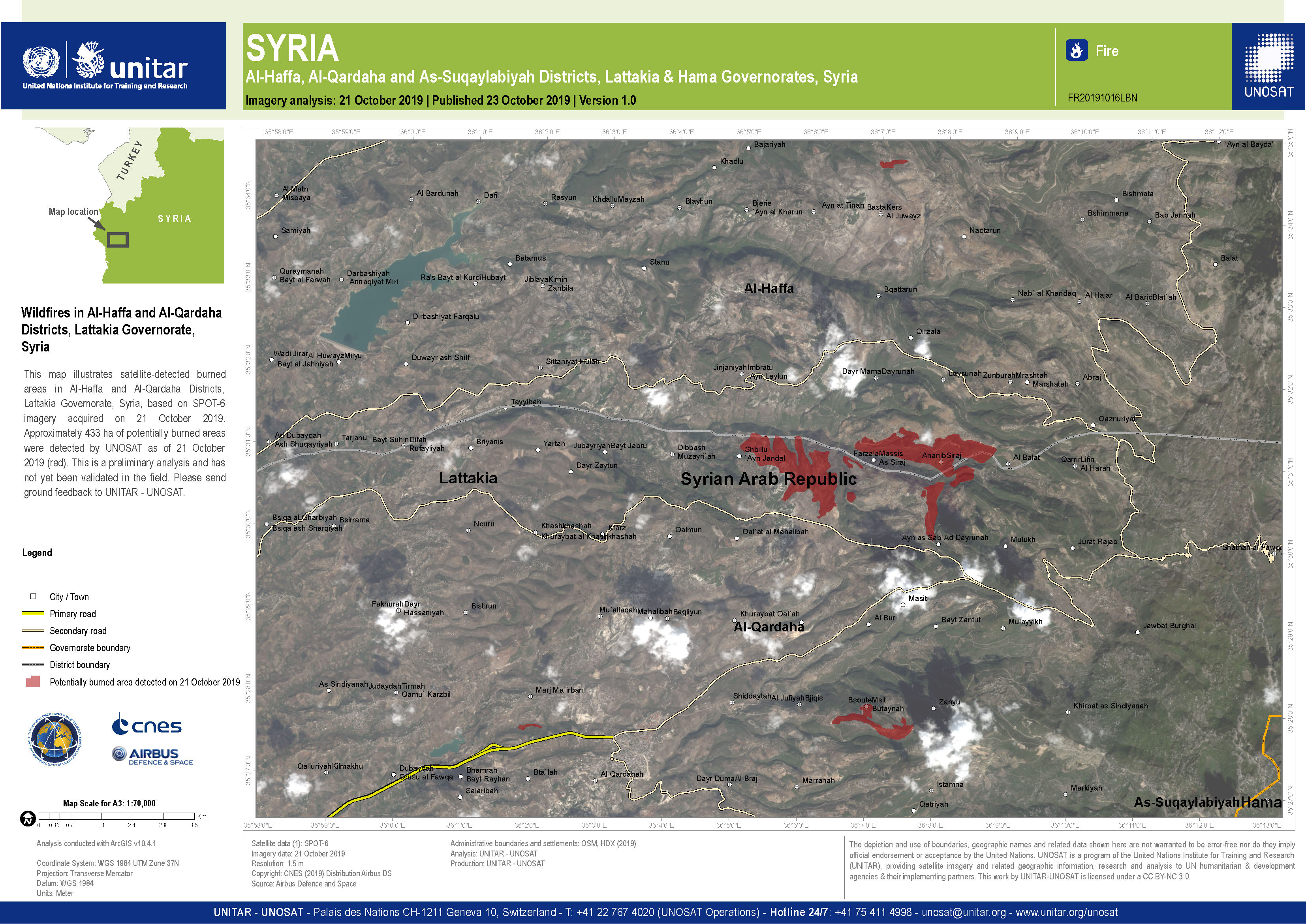
Wildfires in Al-Haffa and Al-Qardaha Districts of Lattakia Governorate, Syria
Direitos autorais: SPOT-6 © Airbus DS (2019)
Map produced by UNITAR/UNOSAT
Information about the Product
Adquirida: 21/10/2019
Fonte: SPOT-6

Wildfires in Akkar Governorate of Lebanon and Tartous and Homs Governorates in Syria
Direitos autorais: Includes material © Airbus DS (2019)
Map produced by UNITAR/UNOSAT
Information about the Product
Adquirida: 21/10/2019
Fonte: SPOT-6
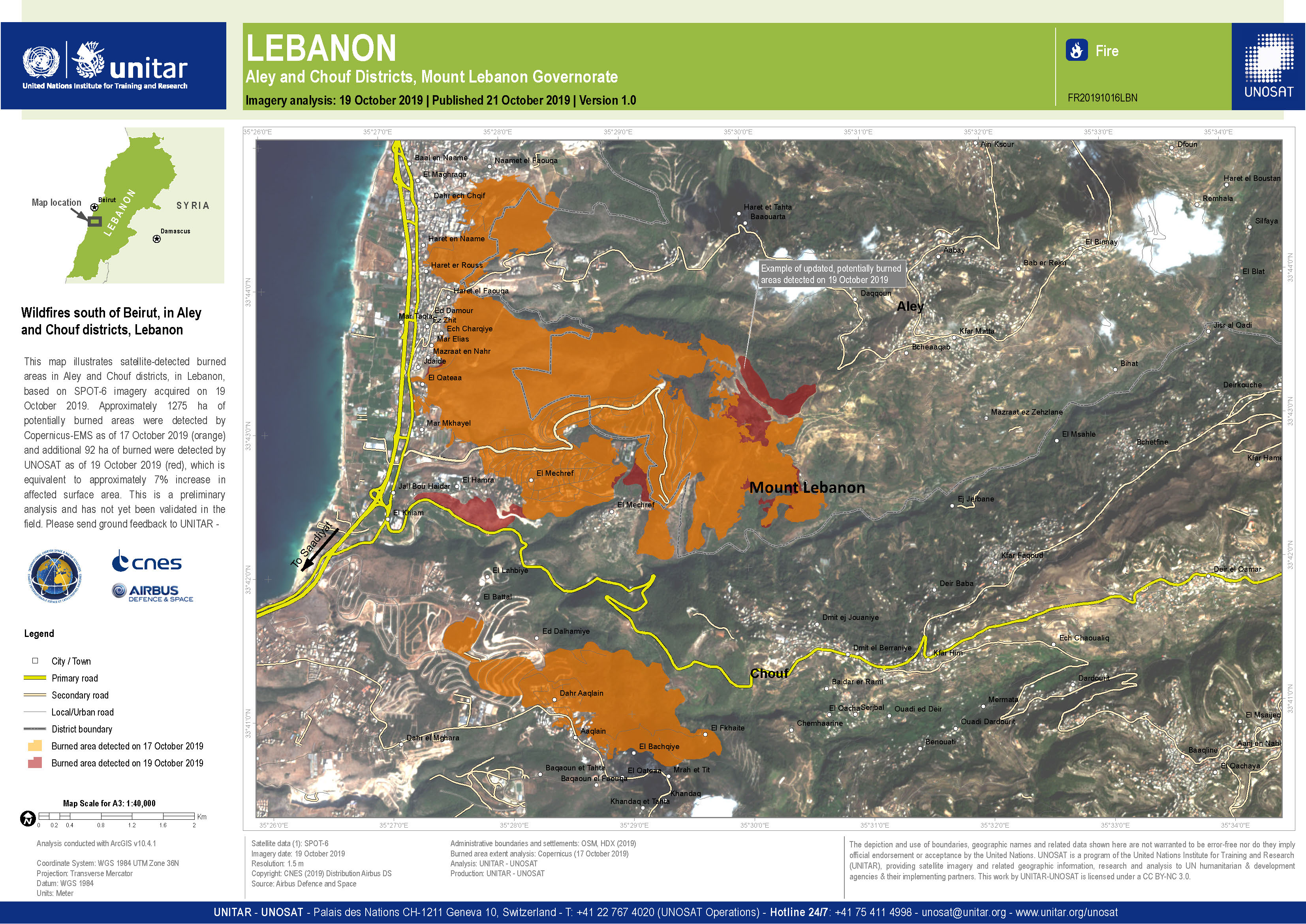
Wildfires south of Beirut in Aley and Chouf districts of Lebanon
Direitos autorais: SPOT-6 © Airbus DS (2019)
Map produced by UNITAR/UNOSAT
Information about the Product
Adquirida: 19/10/2019
Fonte: SPOT-6
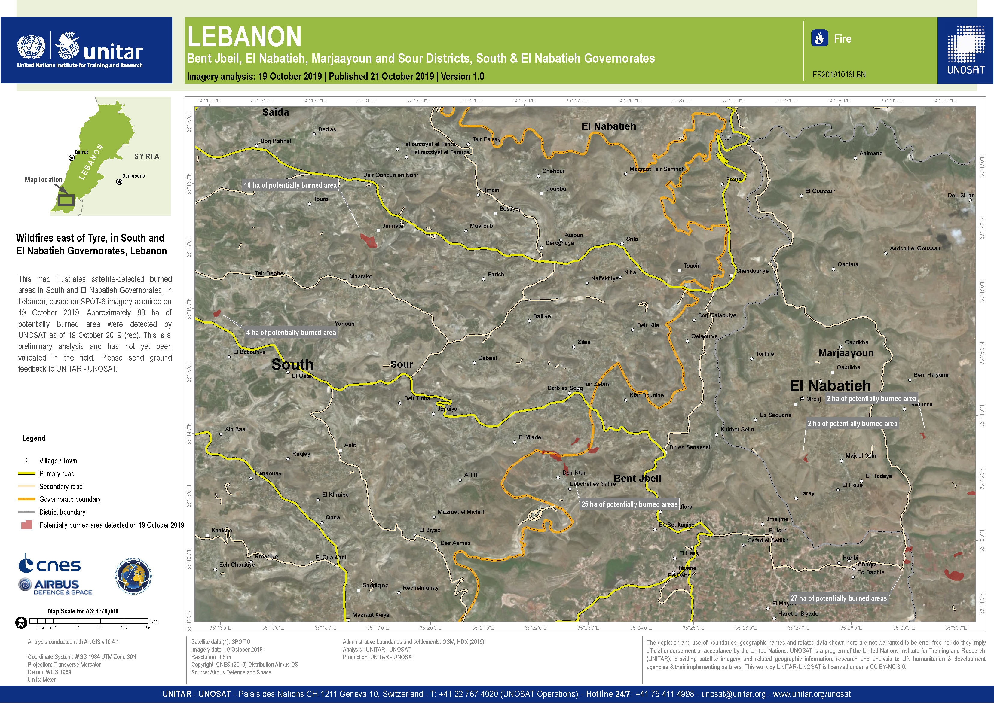
Wildfires east of Tyre in South and El Nabatieh Governorates in Lebanon
Direitos autorais: SPOT-6 © Airbus DS (2019)
Map produced by UNITAR/UNOSAT
Information about the Product
Adquirida: 19/10/2019
Fonte: SPOT-6
 Voltar ao arquivo completo da Ativação

