 English
 Spanish
 French
 Chinese
 Russian
 Portuguese
 Latest Activation
Charter activations
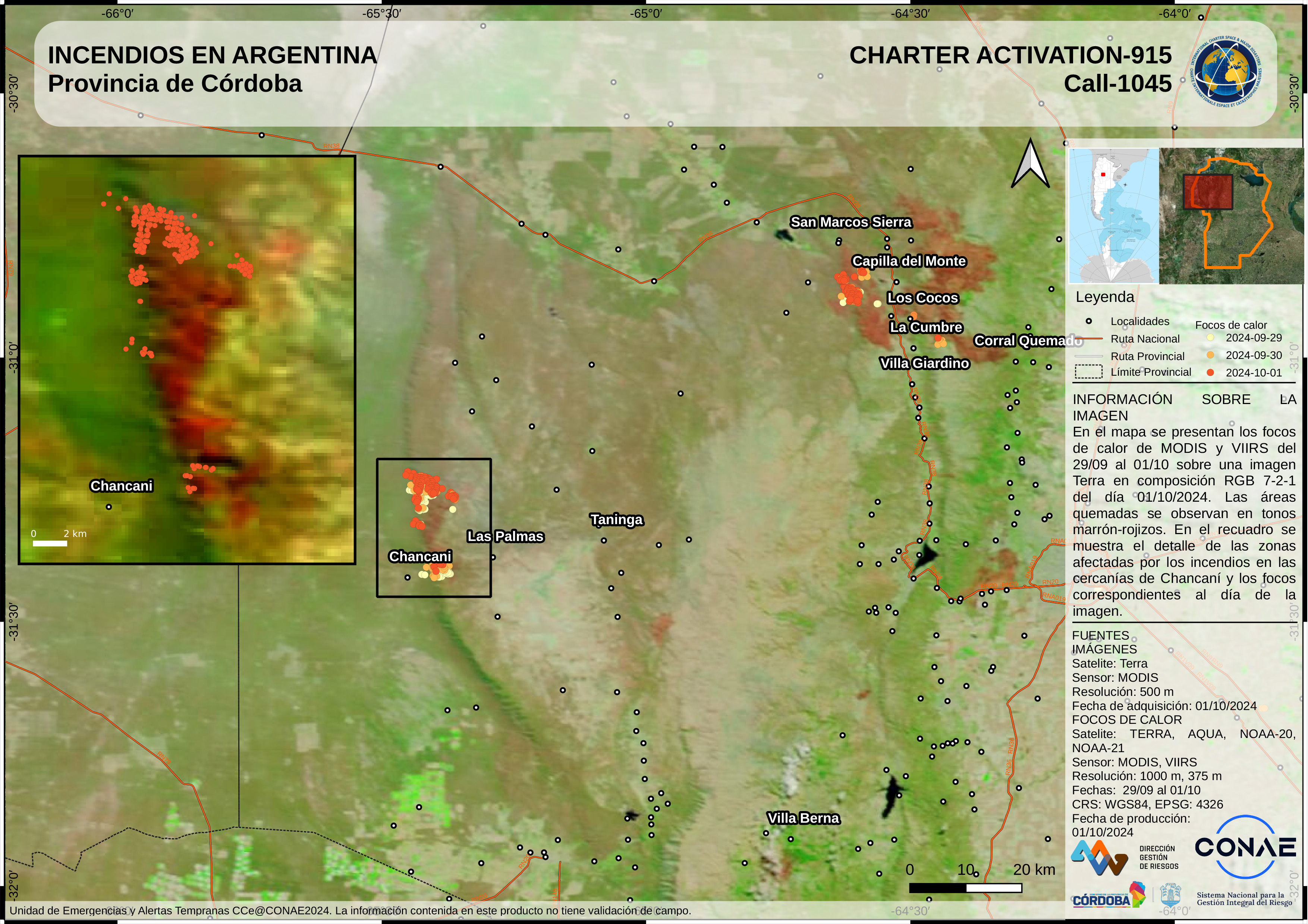
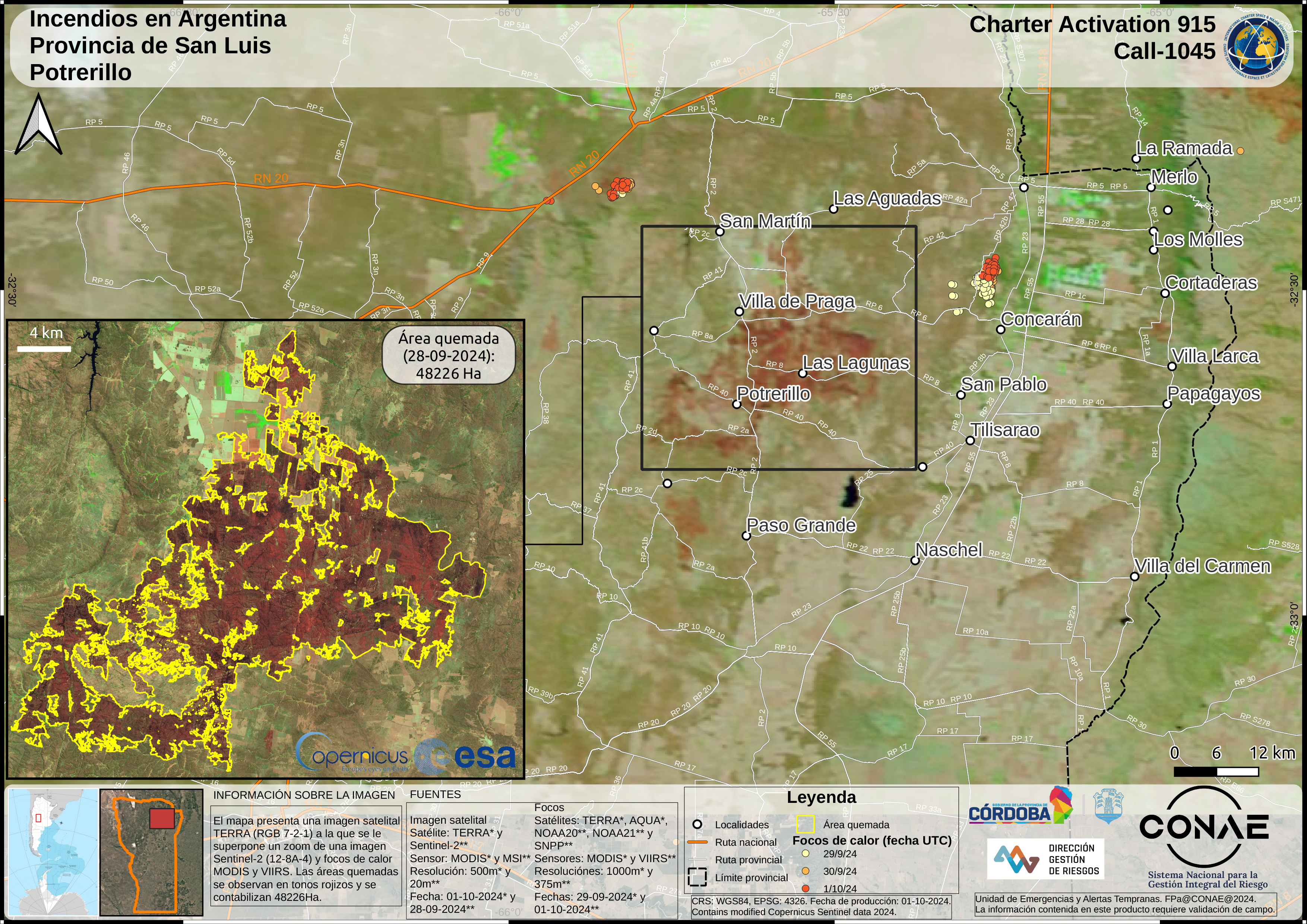
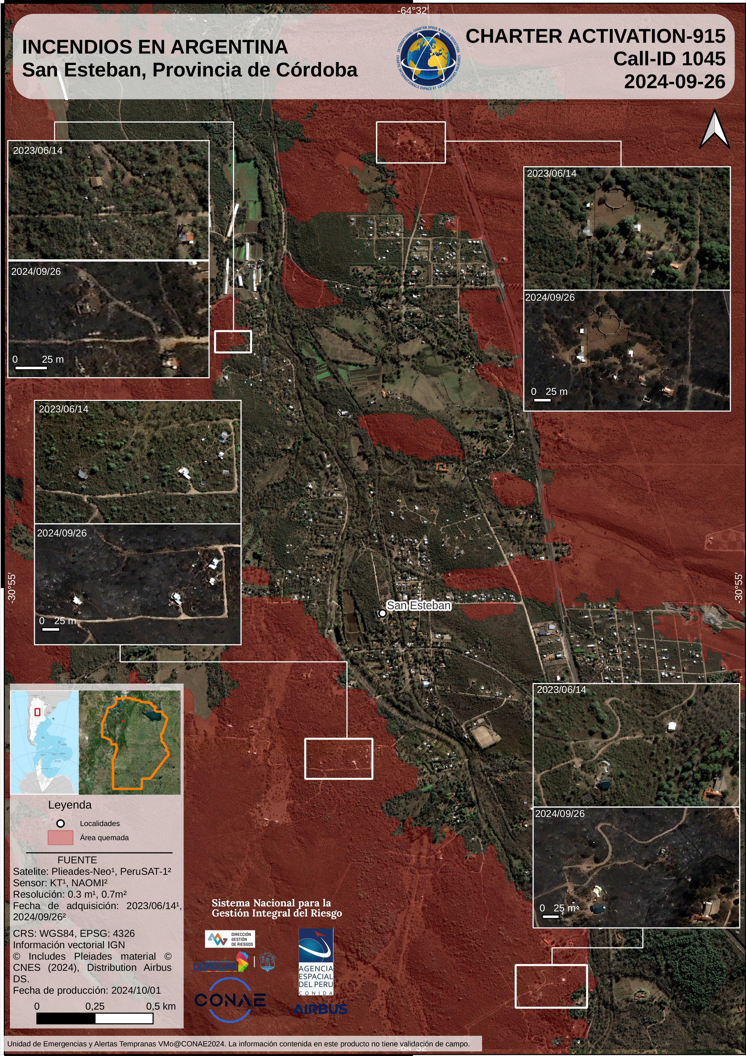
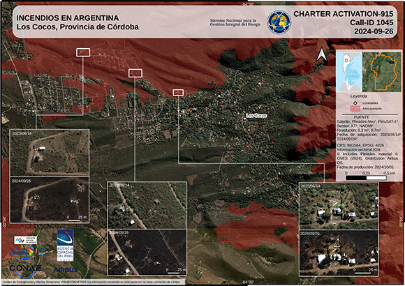
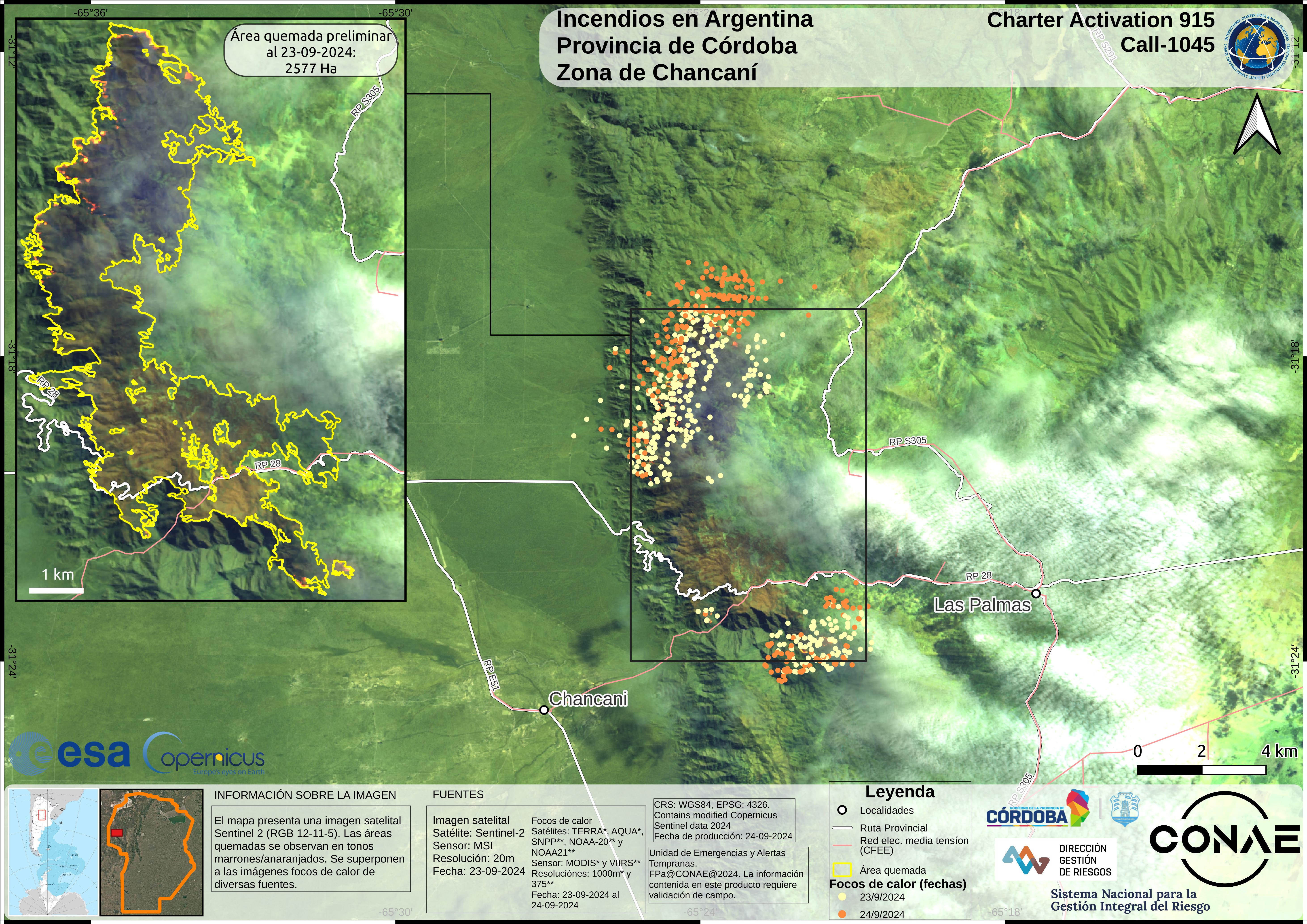
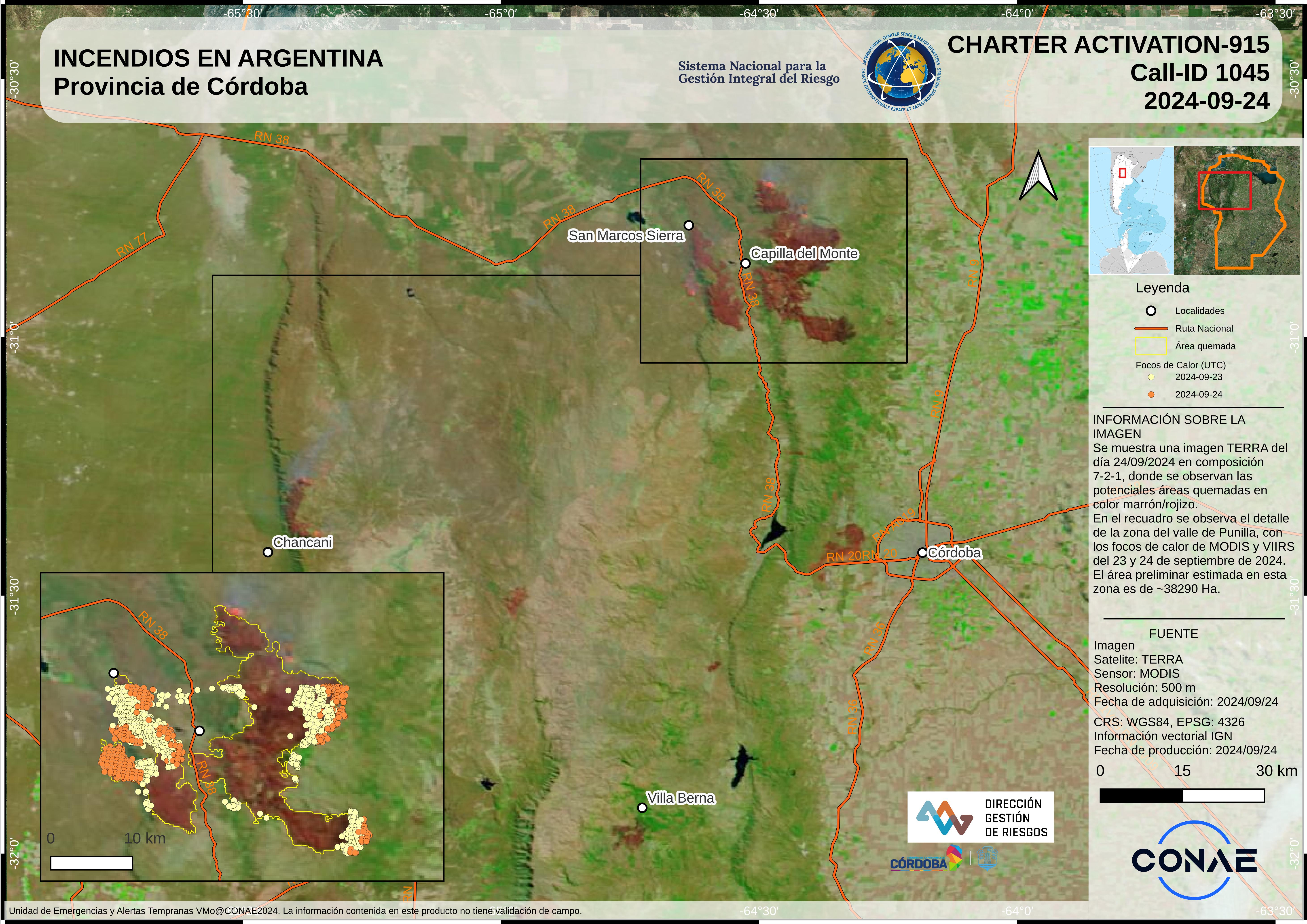
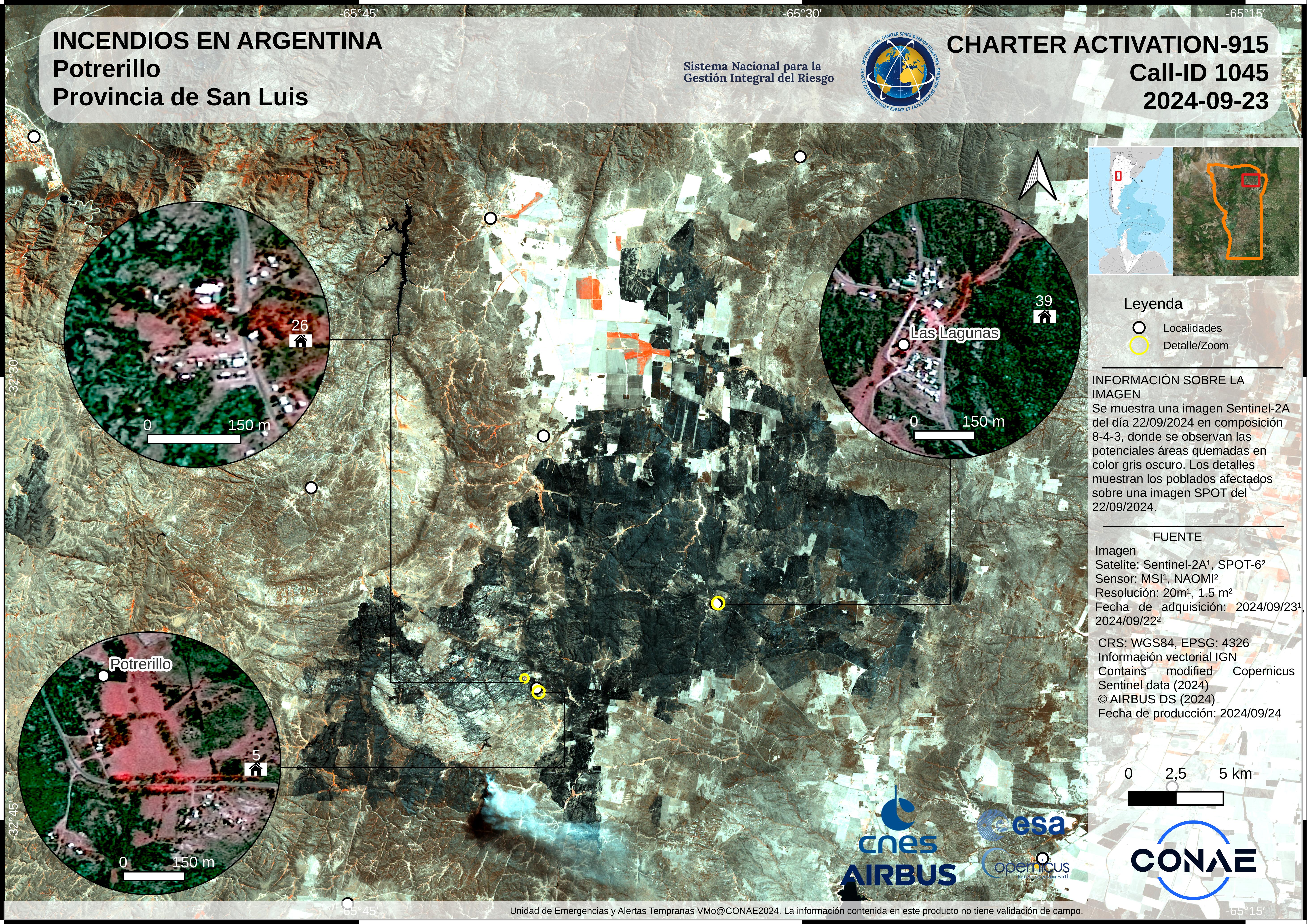
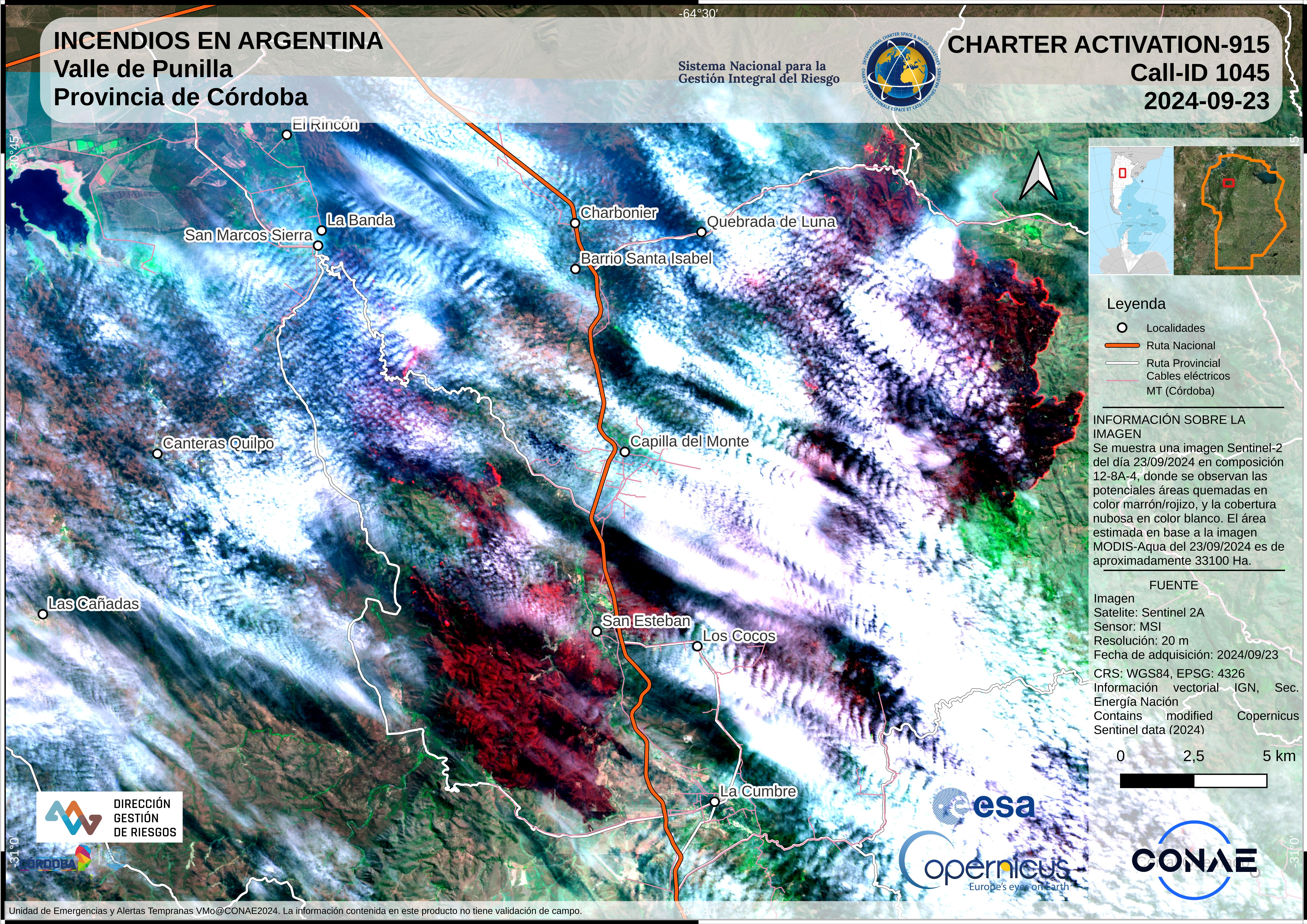
Fire in Argentina
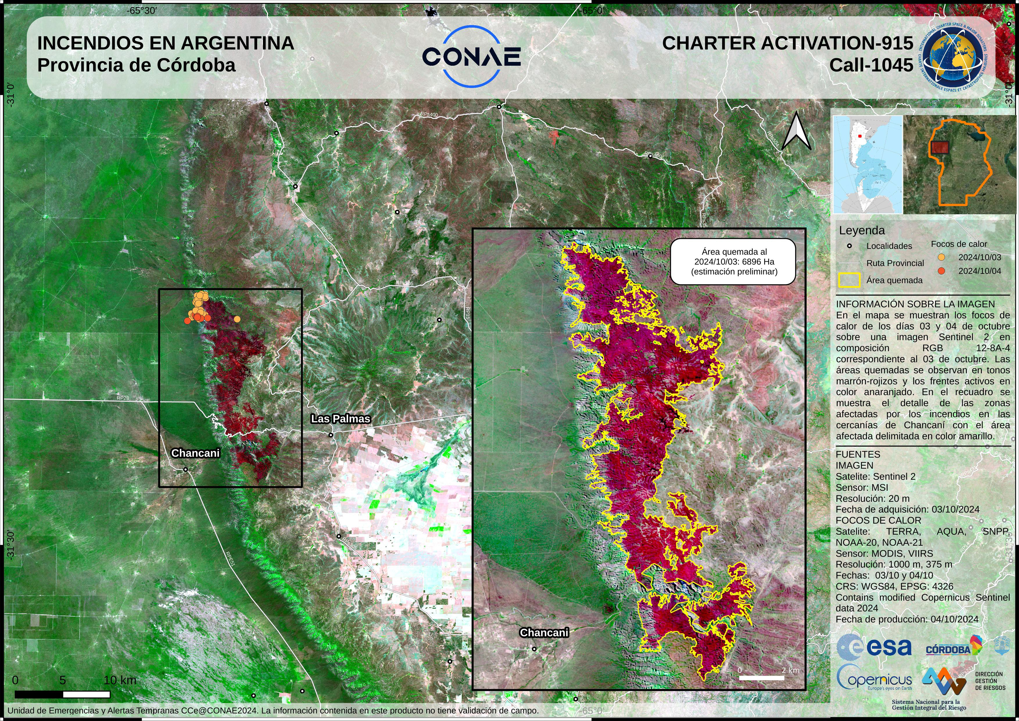
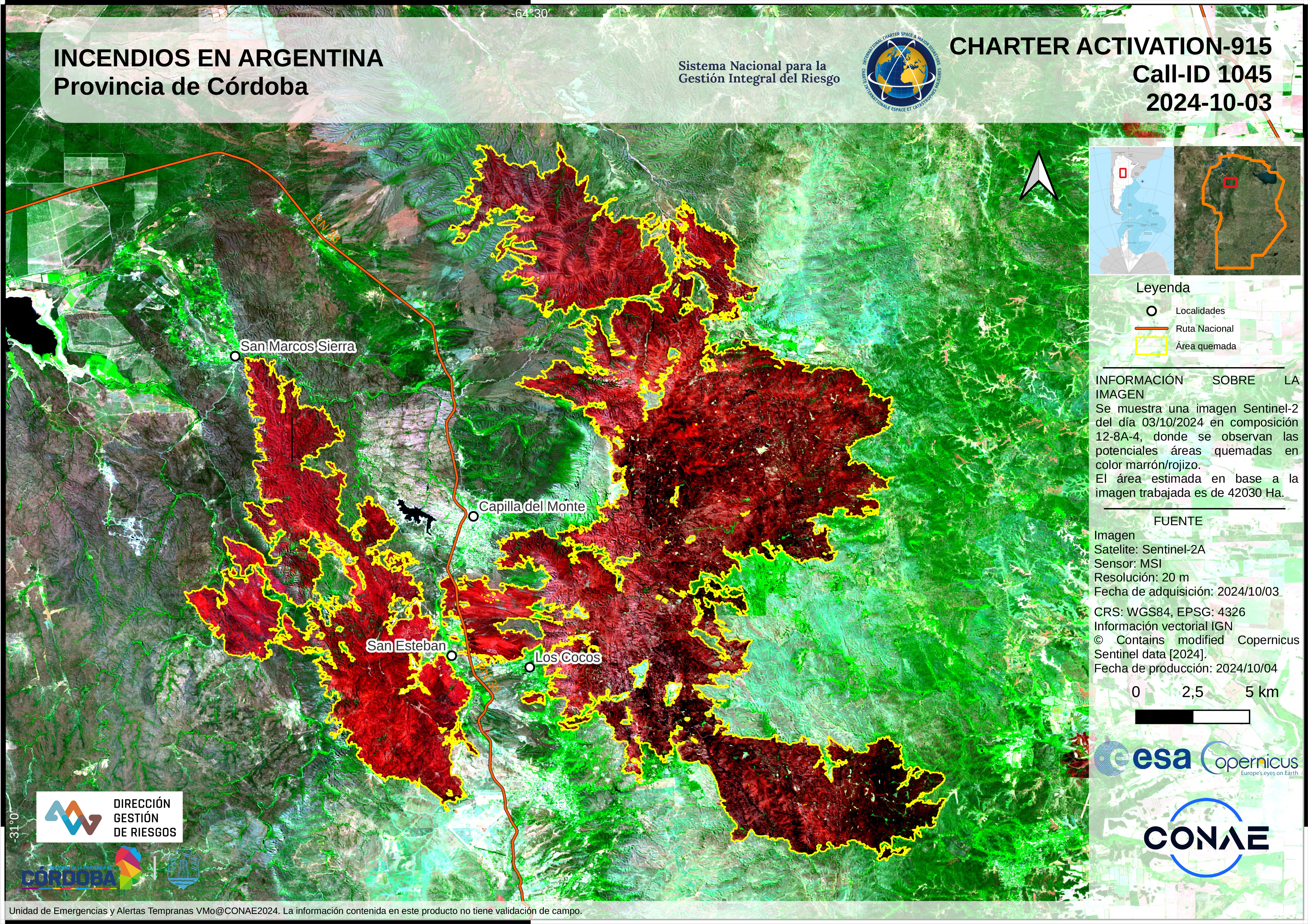
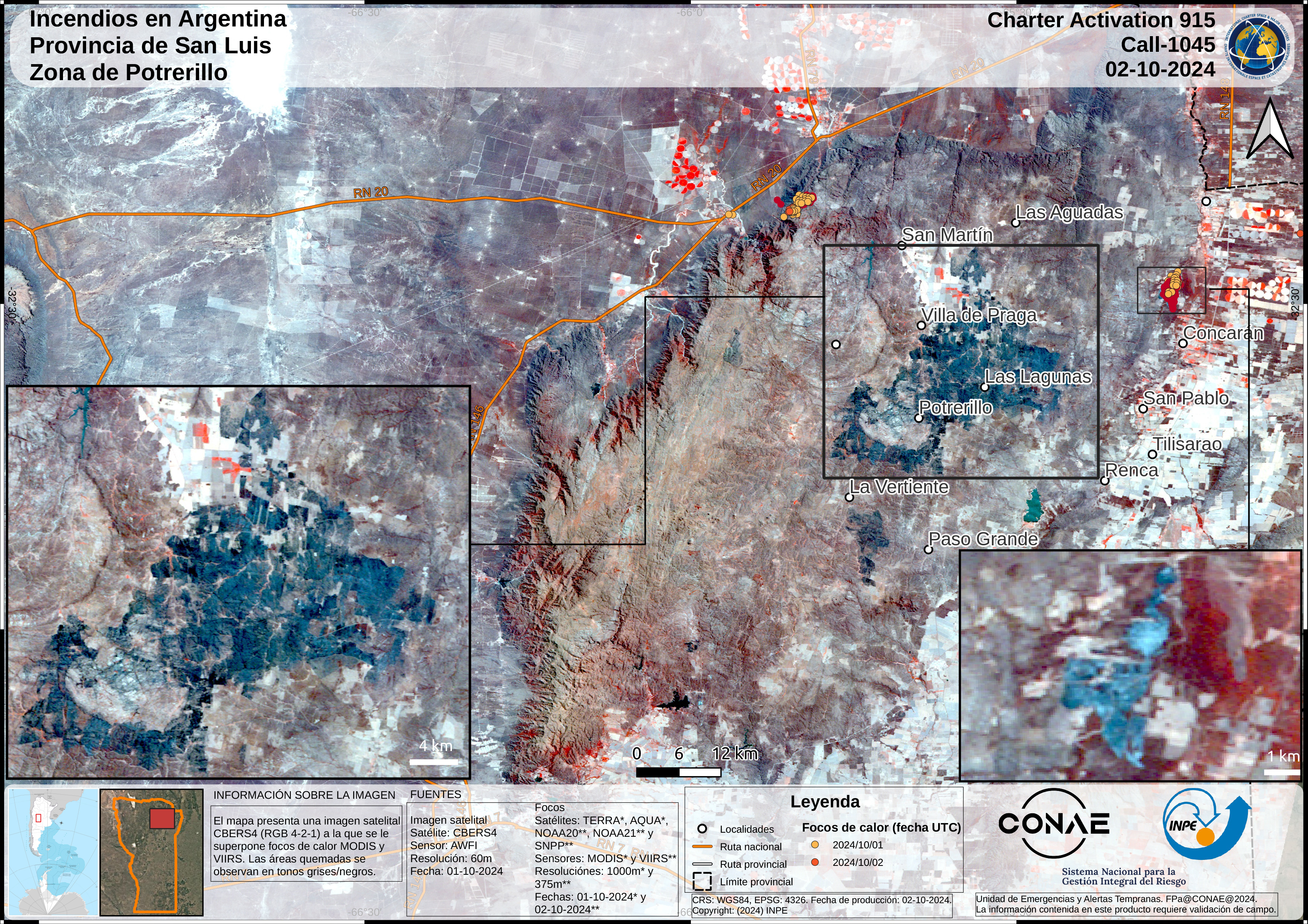
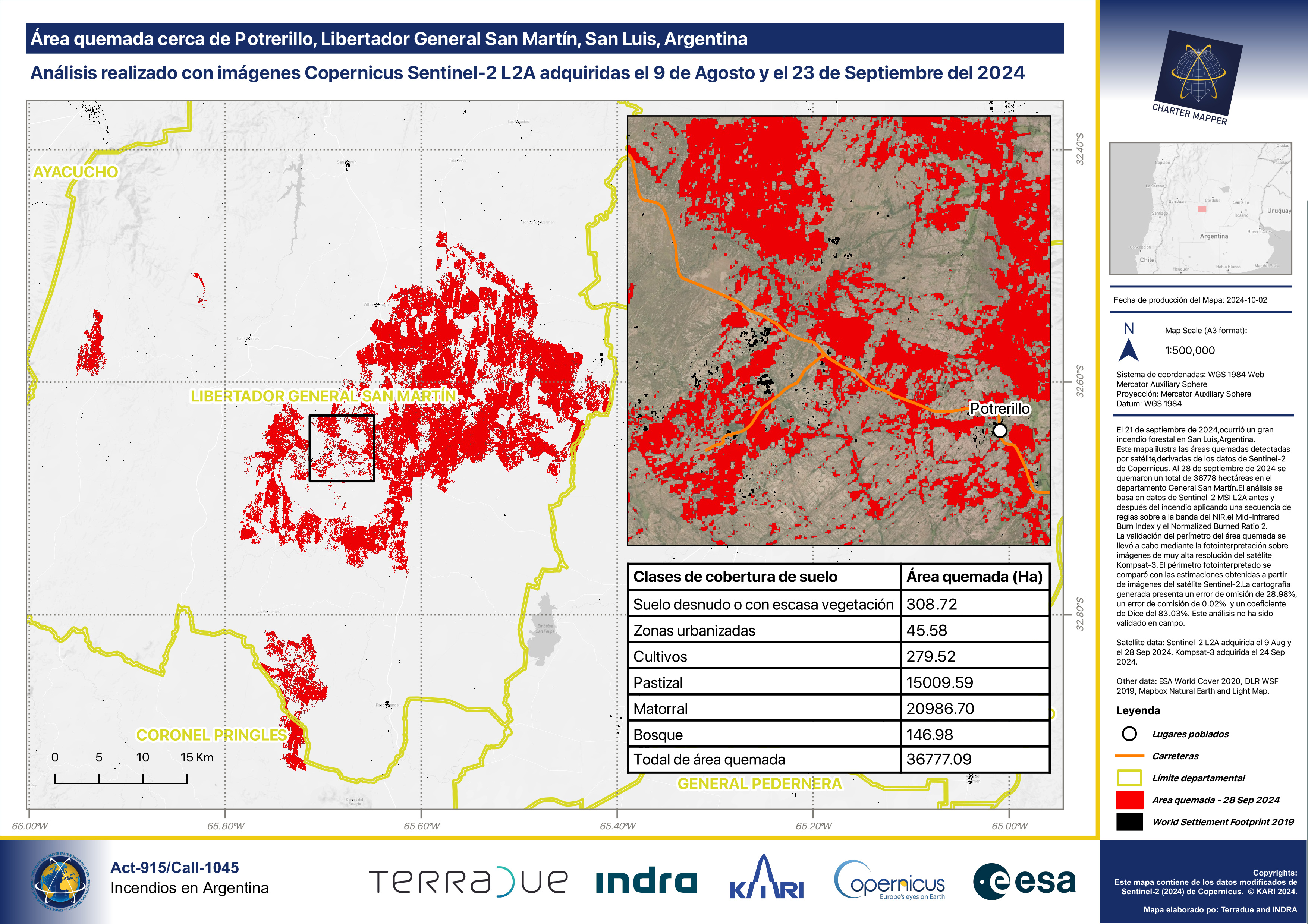
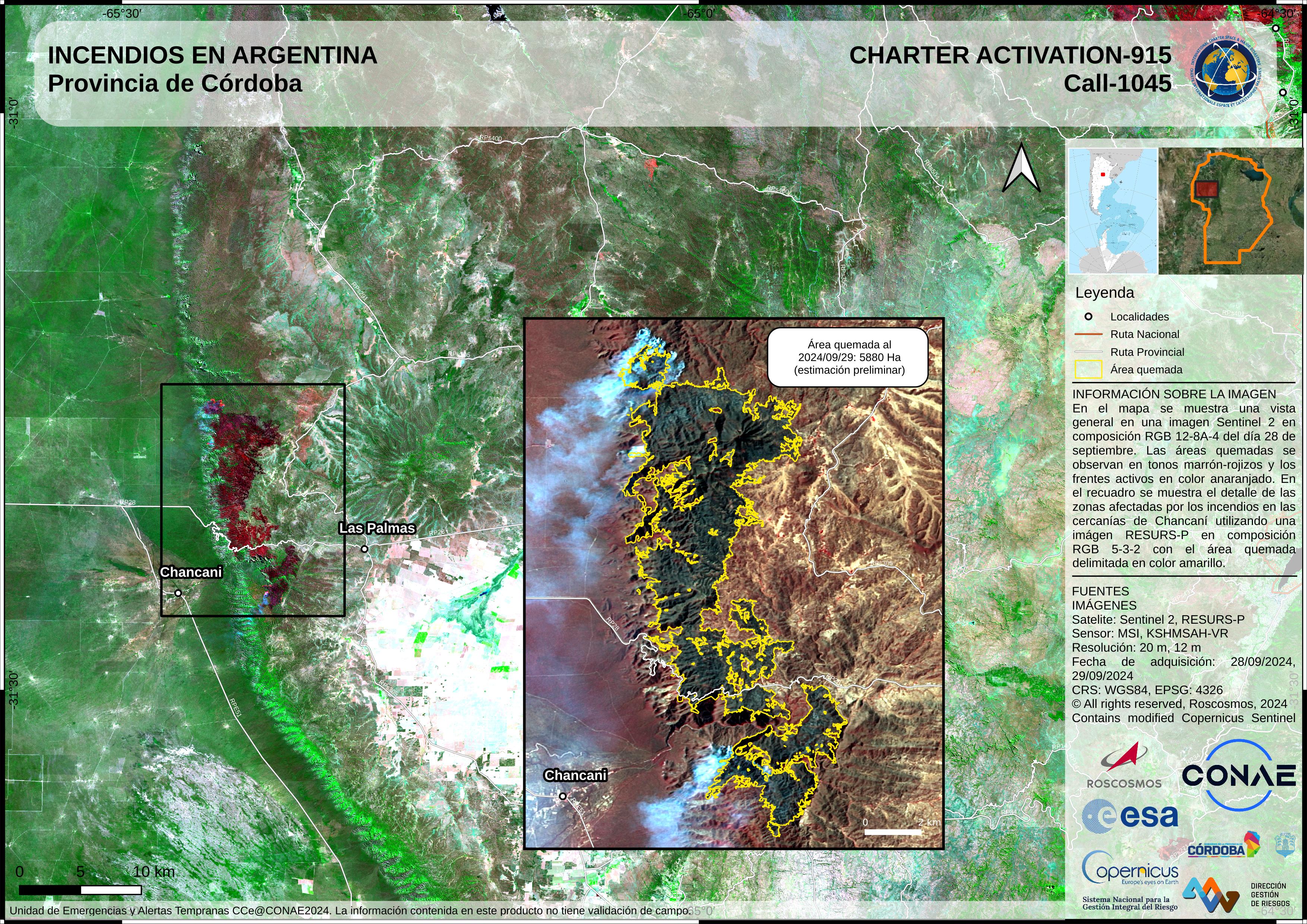
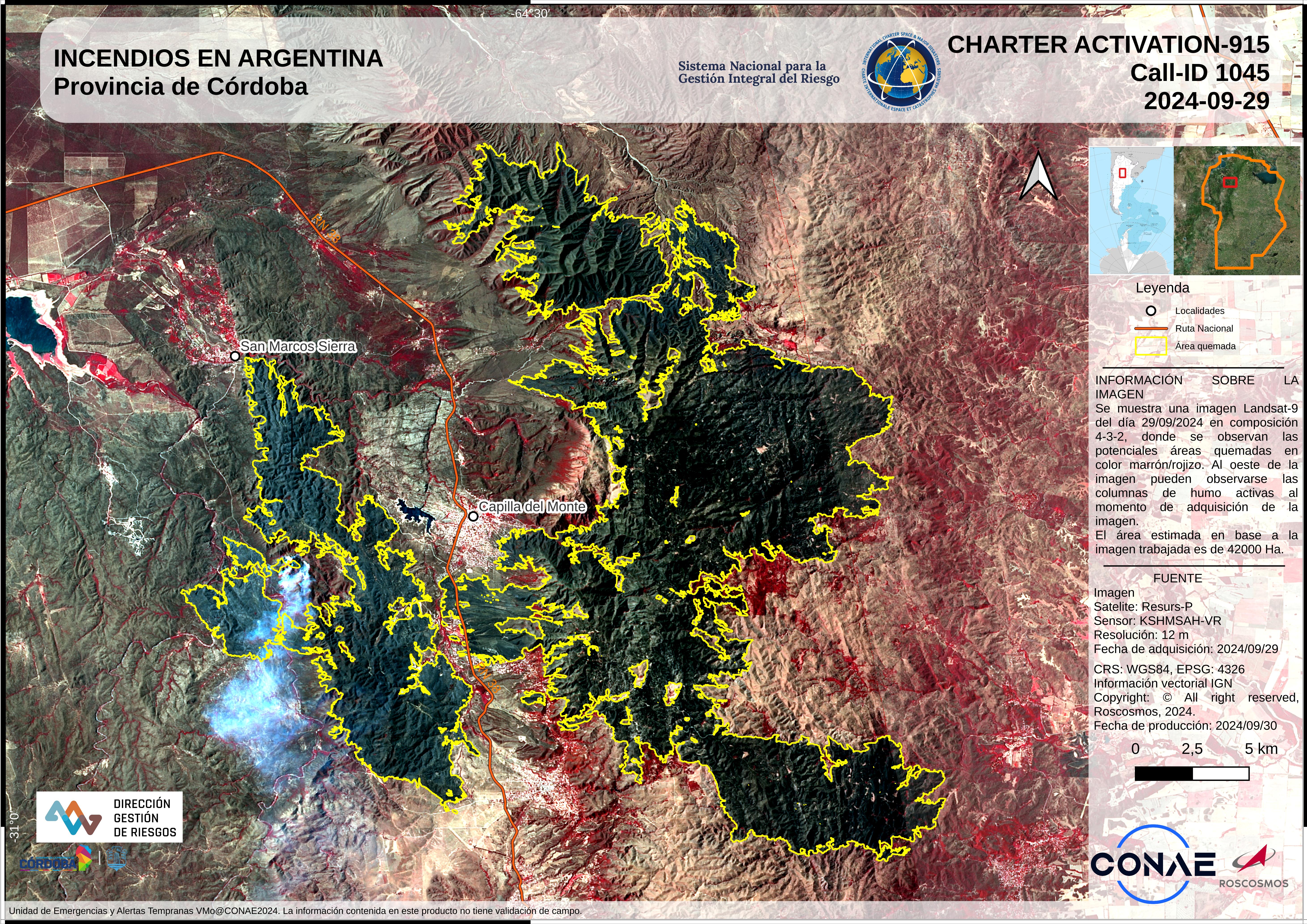
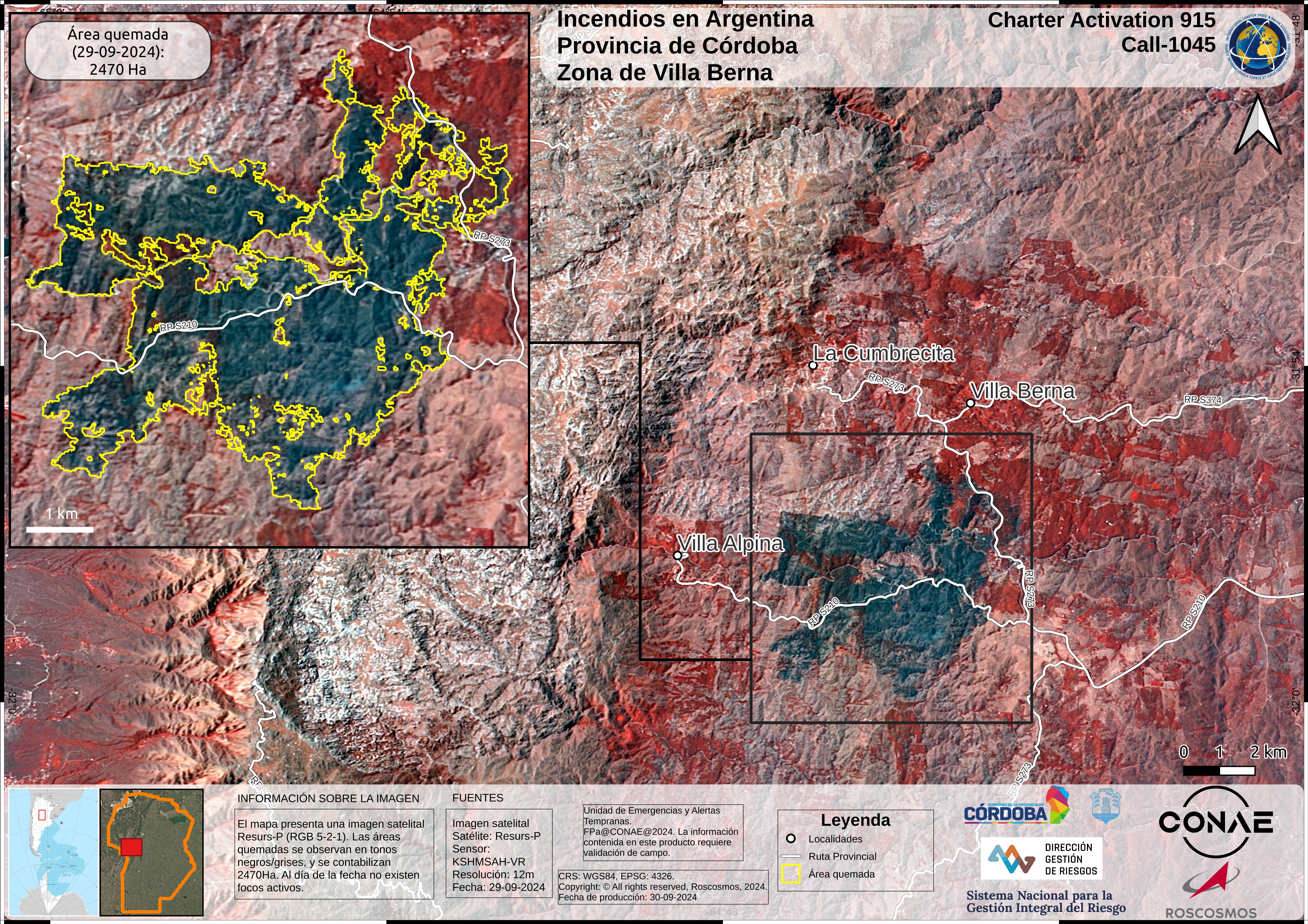
Two big wildfires have occurred in Argentina, one in Córdoba and the other in San Luis.
The fire in Córdoba has burned through 40,000 hectares (400 square kilometers) leaving charred livestock, forests and fields in it's wake. homes have been destroyed, and many people have had to evacuate.
The fire in San Luis is large, and the local rescue services are struggling with limited resources to tackle the situation.
The National Fire Management Service has warned that the region will face high temperatures and strong northern winds in the next few days, which could make things worse. It has also been reported that the fuel availability is at a concerning level.
| Tipo de evento: | Fire |
| Local do evento: | Argentina |
| Data da Ativação da Carta: | 2024-09-21 |
| Tempo de Ativação da Carta: | 15:23 |
| Zona de Tempo da Ativação da Carta: | UTC-03:00 |
| Requisitante da Carta: | SINAGIR |
| ID da Ativação: | 915 |
| Gerenciamento de projeto: | Andres Lighezzolo (CONAE) |
| act-value-adders: | Mauro Arcorace (Terradue) |
Products

Área quemada cerca de Potrerillo, Libertador General San Martín, San Luis, Argentina
Direitos autorais: Contains modified Copernicus Sentinel data (2024)
© KARI (2024).
Map produced by Terradue and INDRA
Information about the Product
Adquirida: Sentinel-2: 28/09/2024
KOMPSAT-3: 24/09/2024
Fonte: Sentinel-2 / KOMPSAT-3
Categoria: Reference Map
Burned Areas near Potrerillo, Libertador General San Martín, San Luis, Argentina
Direitos autorais: Contains modified Copernicus Sentinel data (2024)
© KARI (2024).
Information about the Product
Adquirida: Sentinel-2: 28/10/2024
KOMPSAT-3: 24/09/2024
Fonte: Sentinel-2 / KOMPSAT-3
Categoria: Delineation Map
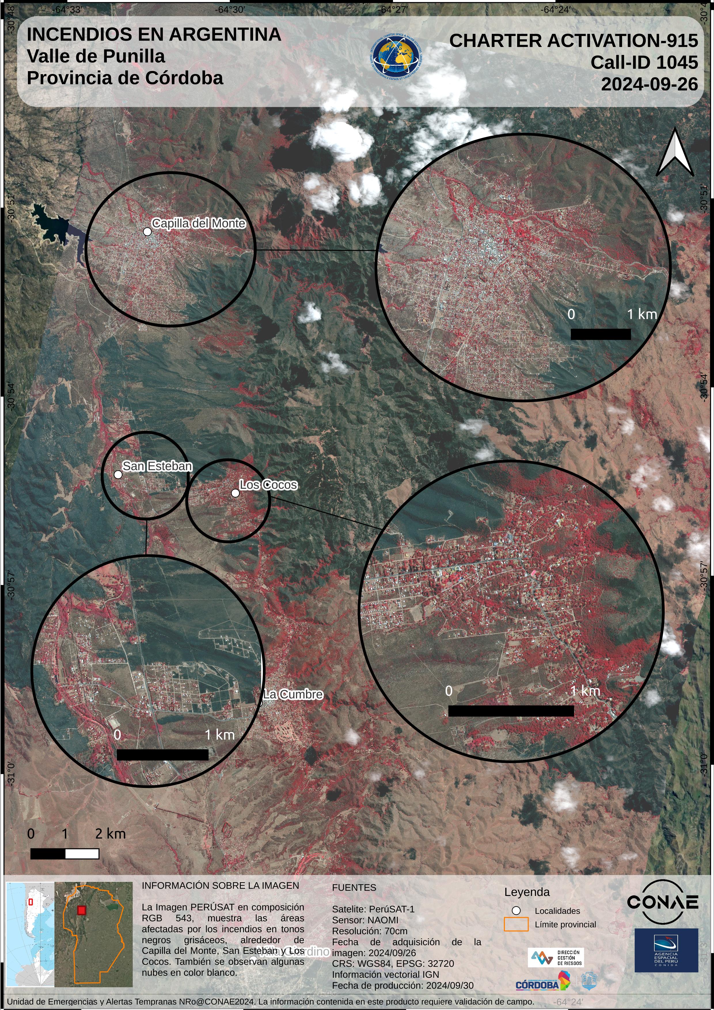
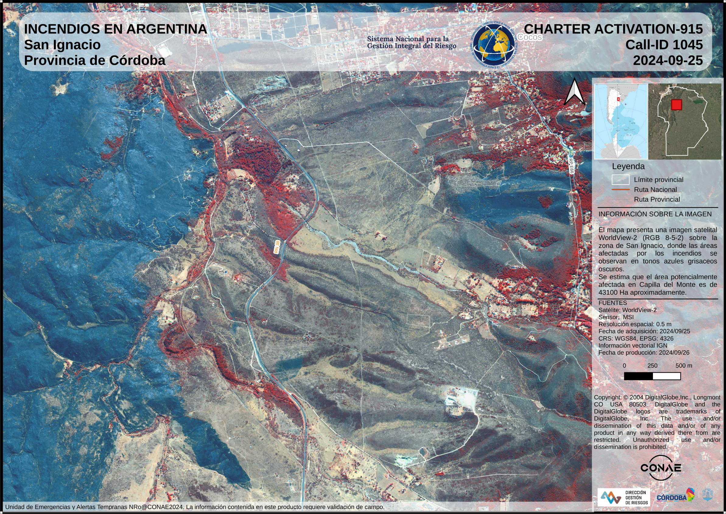
Areas affected by fires in the Province of Córdoba (San Ignacio) - Argentina
Direitos autorais: © (2024) DigitalGlobe, Inc., Longmont CO USA 80503. DigitalGlobe and the DigitalGlobe logos are trademarks of DigitalGlobe, Inc. The use and/or dissemination of this data and/or of any product in any way derived there from are restricted. Unauthorized use and/or dissemination is prohibited
Information about the Product
Adquirida: 25/09/2024
Fonte: WorldView-2
Categoria: Grading Map
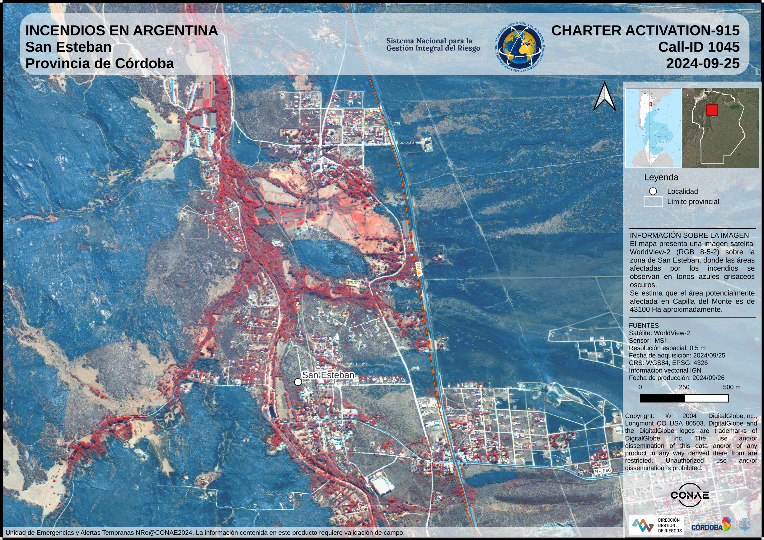
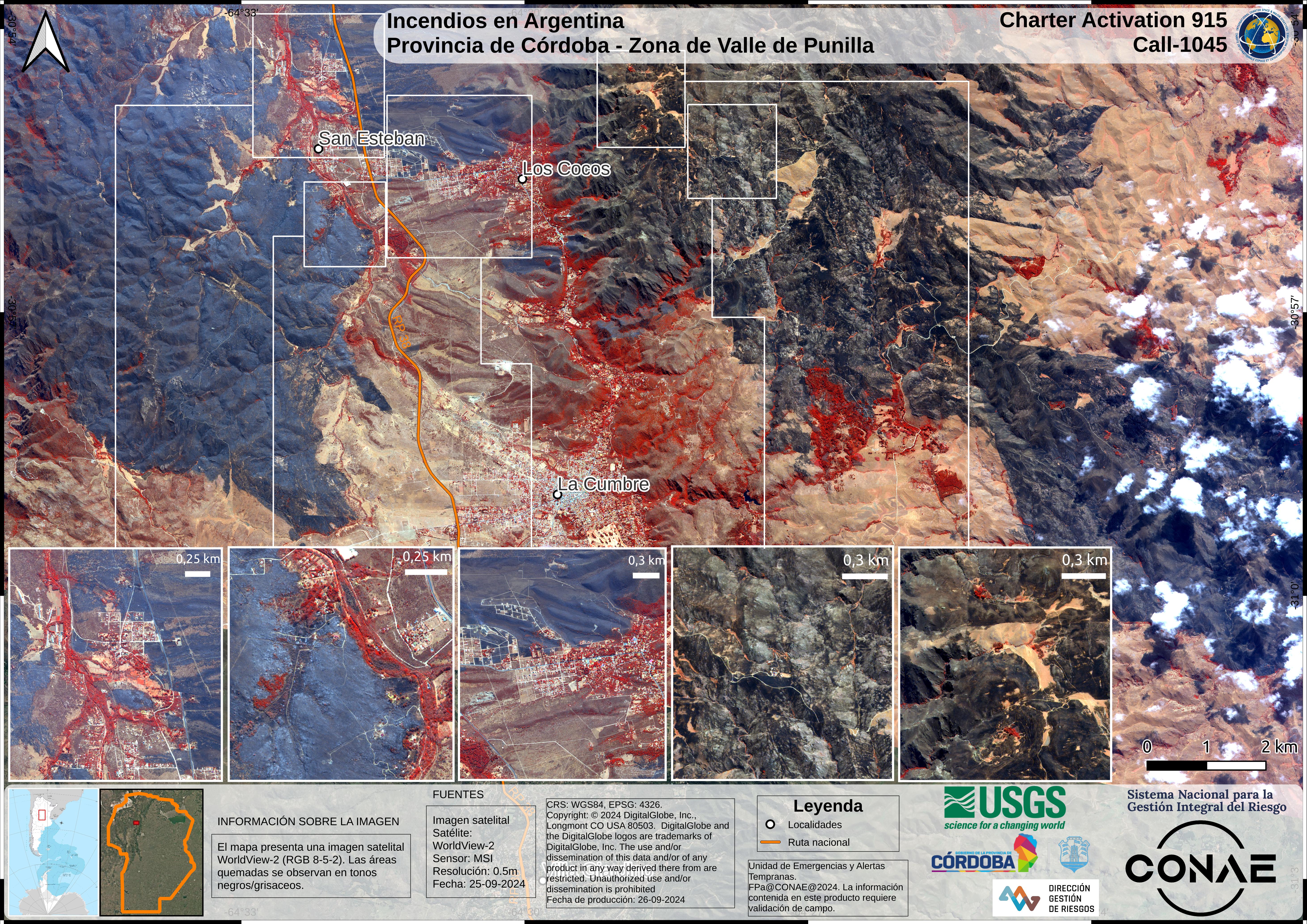
Areas affected by fires in the Province of Córdoba (San Esteban) - Argentina
Direitos autorais: © (2024) DigitalGlobe, Inc., Longmont CO USA 80503. DigitalGlobe and the DigitalGlobe logos are trademarks of DigitalGlobe, Inc. The use and/or dissemination of this data and/or of any product in any way derived there from are restricted. Unauthorized use and/or dissemination is prohibited
Map produced by CONAE
Information about the Product
Adquirida: 25/09/2024
Fonte: WorldView-2
Categoria: Grading Map
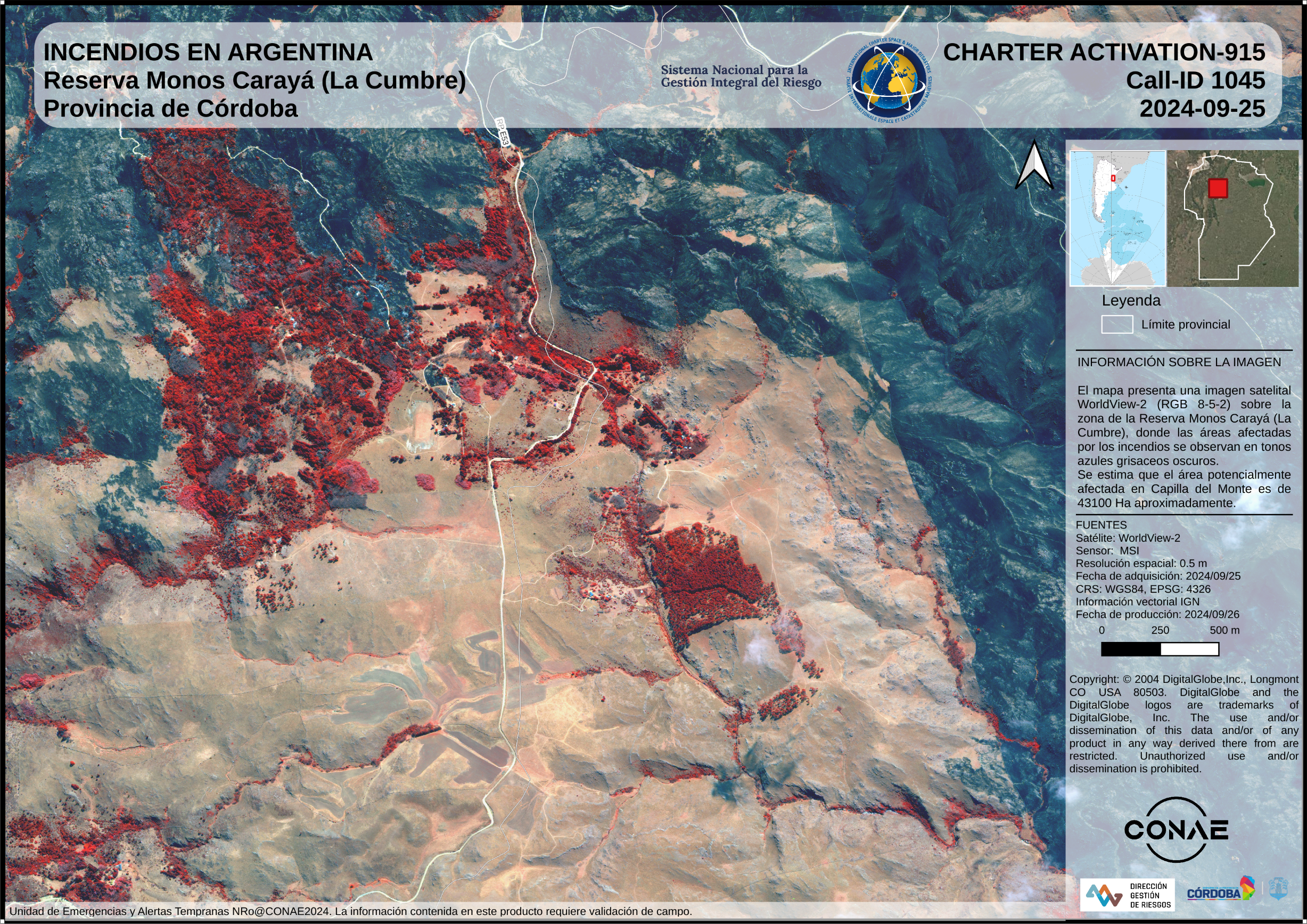
Areas affected by fires in the Province of Córdoba (Reserva Monos Carayá) - Argentina
Direitos autorais: © (2024) DigitalGlobe, Inc., Longmont CO USA 80503. DigitalGlobe and the DigitalGlobe logos are trademarks of DigitalGlobe, Inc. The use and/or dissemination of this data and/or of any product in any way derived there from are restricted. Unauthorized use and/or dissemination is prohibited
Map produced by CONAE
Information about the Product
Adquirida: 25/09/2024
Fonte: WorldView-2
Categoria: Grading Map
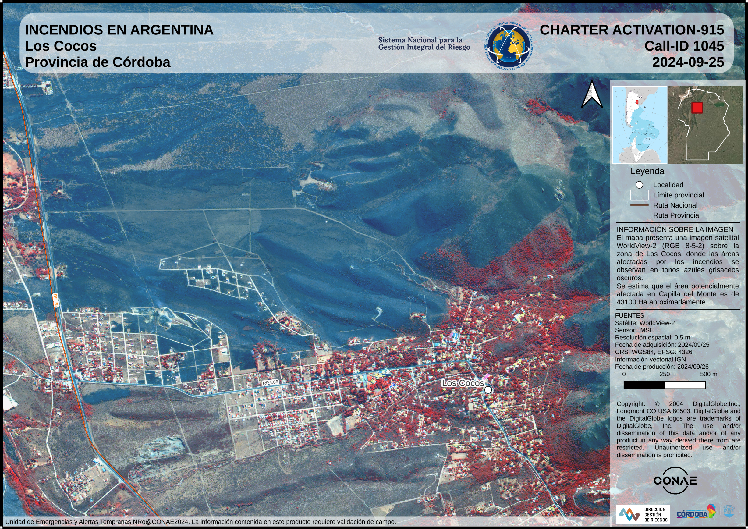
Areas affected by fires in the Province of Córdoba (Los Cocos) - Argentina
Direitos autorais: © (2024) DigitalGlobe, Inc., Longmont CO USA 80503. DigitalGlobe and the DigitalGlobe logos are trademarks of DigitalGlobe, Inc. The use and/or dissemination of this data and/or of any product in any way derived there from are restricted. Unauthorized use and/or dissemination is prohibited
Map produced by CONAE
Information about the Product
Adquirida: 25/09/2024
Fonte: WorldView-2
Categoria: Grading Map
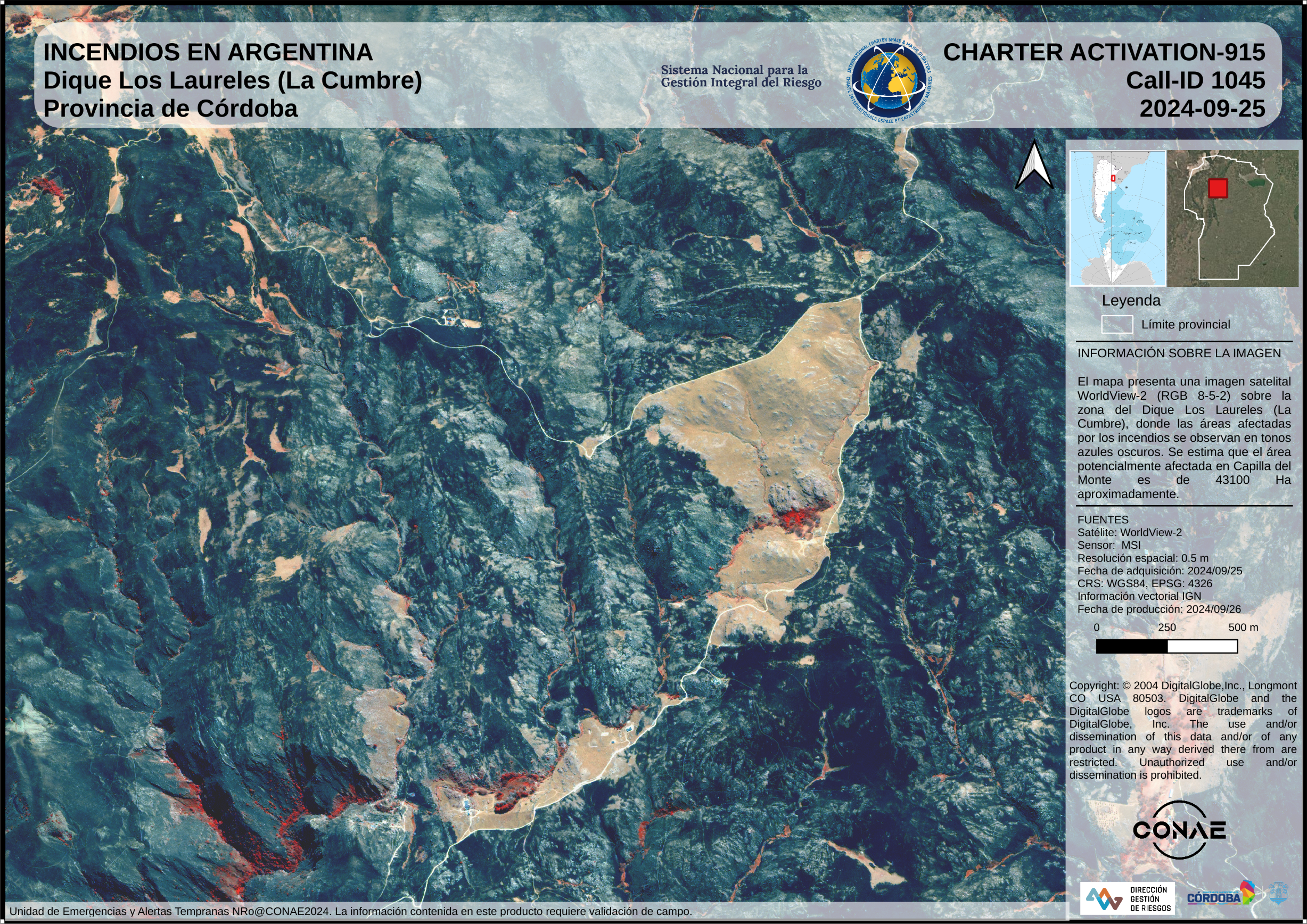
Areas affected by fires in the Province of Córdoba (Dique Los Laureles) - Argentina
Direitos autorais: © (2024) DigitalGlobe, Inc., Longmont CO USA 80503. DigitalGlobe and the DigitalGlobe logos are trademarks of DigitalGlobe, Inc. The use and/or dissemination of this data and/or of any product in any way derived there from are restricted. Unauthorized use and/or dissemination is prohibited
Map produced by CONAE
Information about the Product
Adquirida: 25/09/2024
Fonte: WorldView-2
Categoria: Grading Map
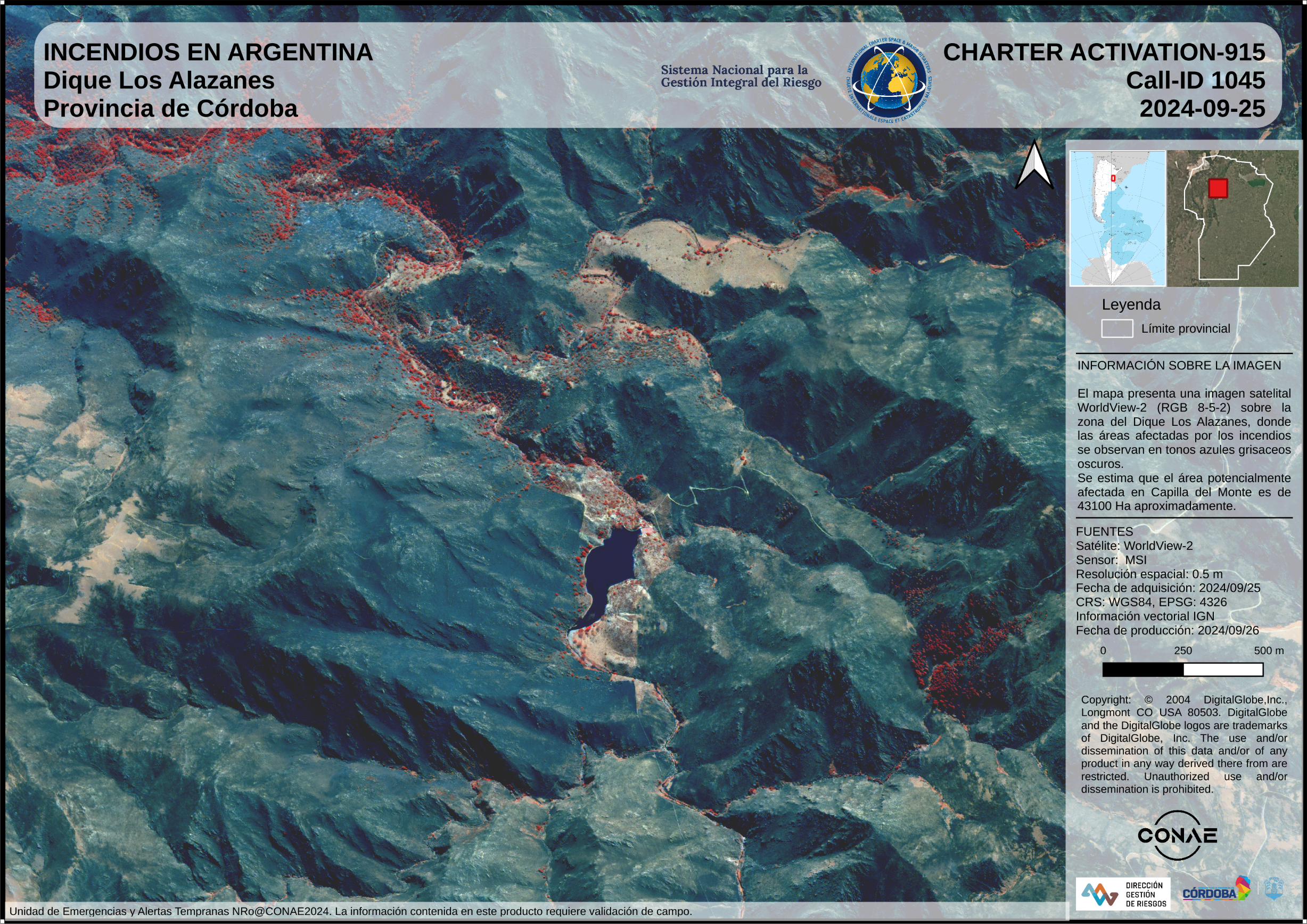
Areas affected by fires in the Province of Córdoba (Dique Los Alazanes) - Argentina
Direitos autorais: © (2024) DigitalGlobe, Inc., Longmont CO USA 80503. DigitalGlobe and the DigitalGlobe logos are trademarks of DigitalGlobe, Inc. The use and/or dissemination of this data and/or of any product in any way derived there from are restricted. Unauthorized use and/or dissemination is prohibited
MAp produced by CONAE
Information about the Product
Adquirida: 25/09/2024
Fonte: WorldView-2
Categoria: Grading Map
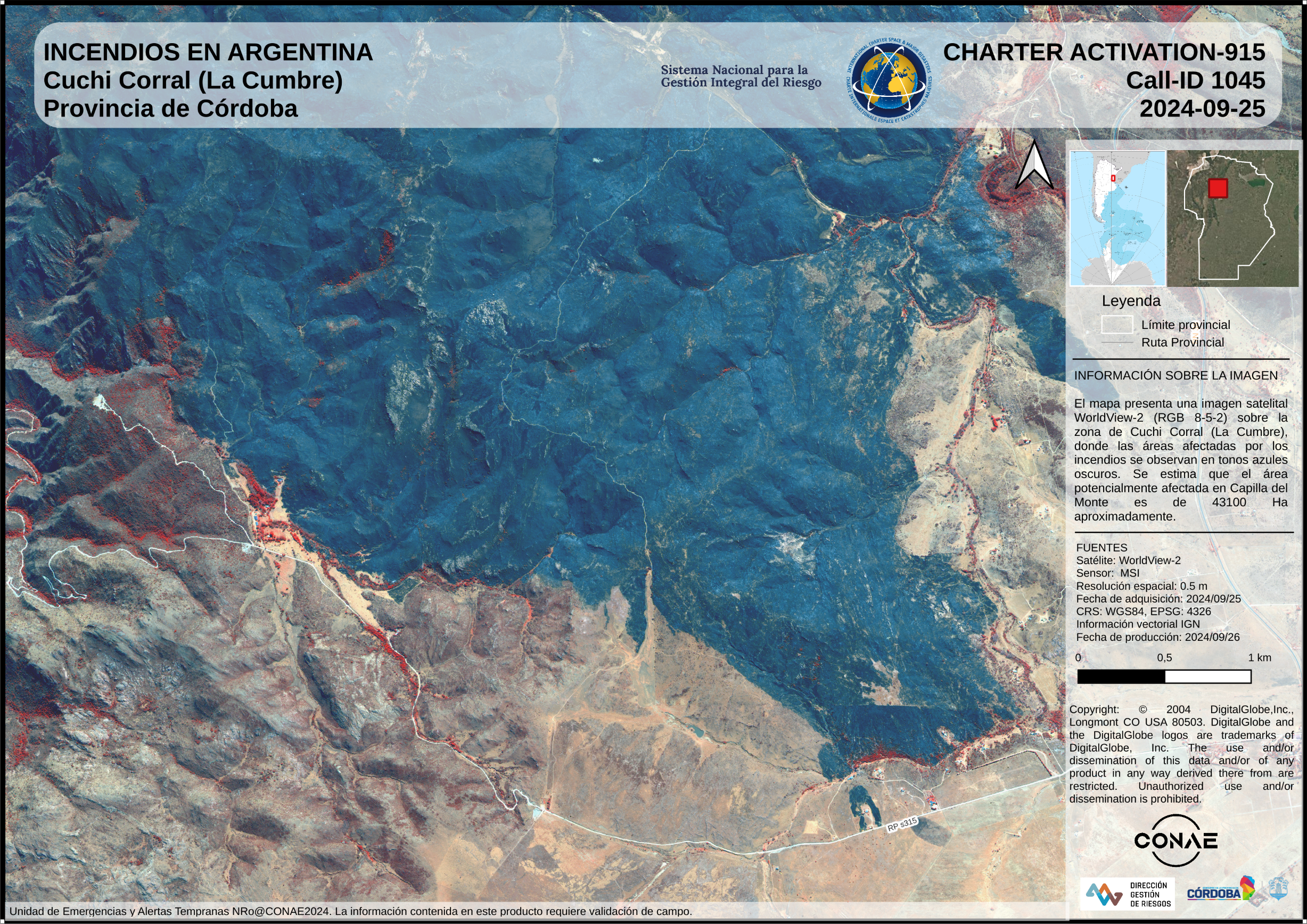
Areas affected by fires in the Province of Córdoba (Cuchi Corral - La Cumbre) - Argentina
Direitos autorais: © (2024) DigitalGlobe, Inc., Longmont CO USA 80503. DigitalGlobe and the DigitalGlobe logos are trademarks of DigitalGlobe, Inc. The use and/or dissemination of this data and/or of any product in any way derived there from are restricted. Unauthorized use and/or dissemination is prohibited
Map produced by CONAE
Information about the Product
Adquirida: 28/09/2024
Fonte: WorldView-2
Categoria: Grading Map
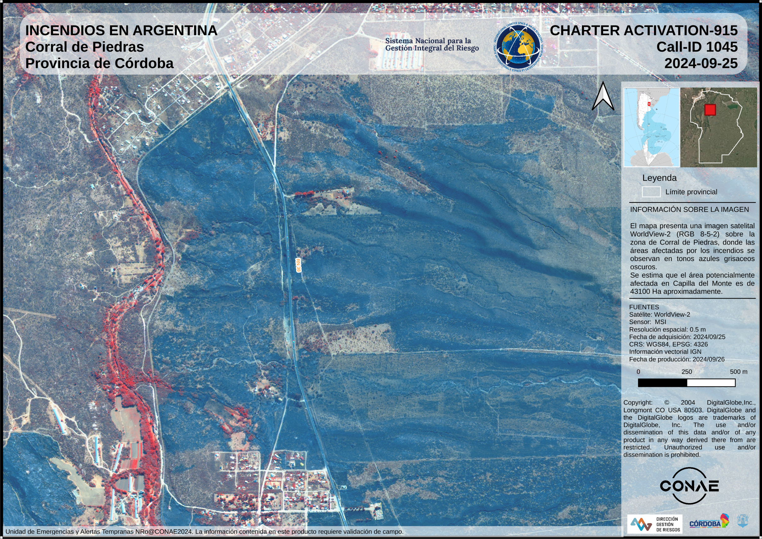
Areas affected by fires in the Province of Córdoba (Corral de Piedra) - Argentina
Direitos autorais: © (2024) DigitalGlobe, Inc., Longmont CO USA 80503. DigitalGlobe and the DigitalGlobe logos are trademarks of DigitalGlobe, Inc. The use and/or dissemination of this data and/or of any product in any way derived there from are restricted. Unauthorized use and/or dissemination is prohibited
Map produced by CONAE
Information about the Product
Adquirida: 28/09/2024
Fonte: WorldView-2
Categoria: Grading Map
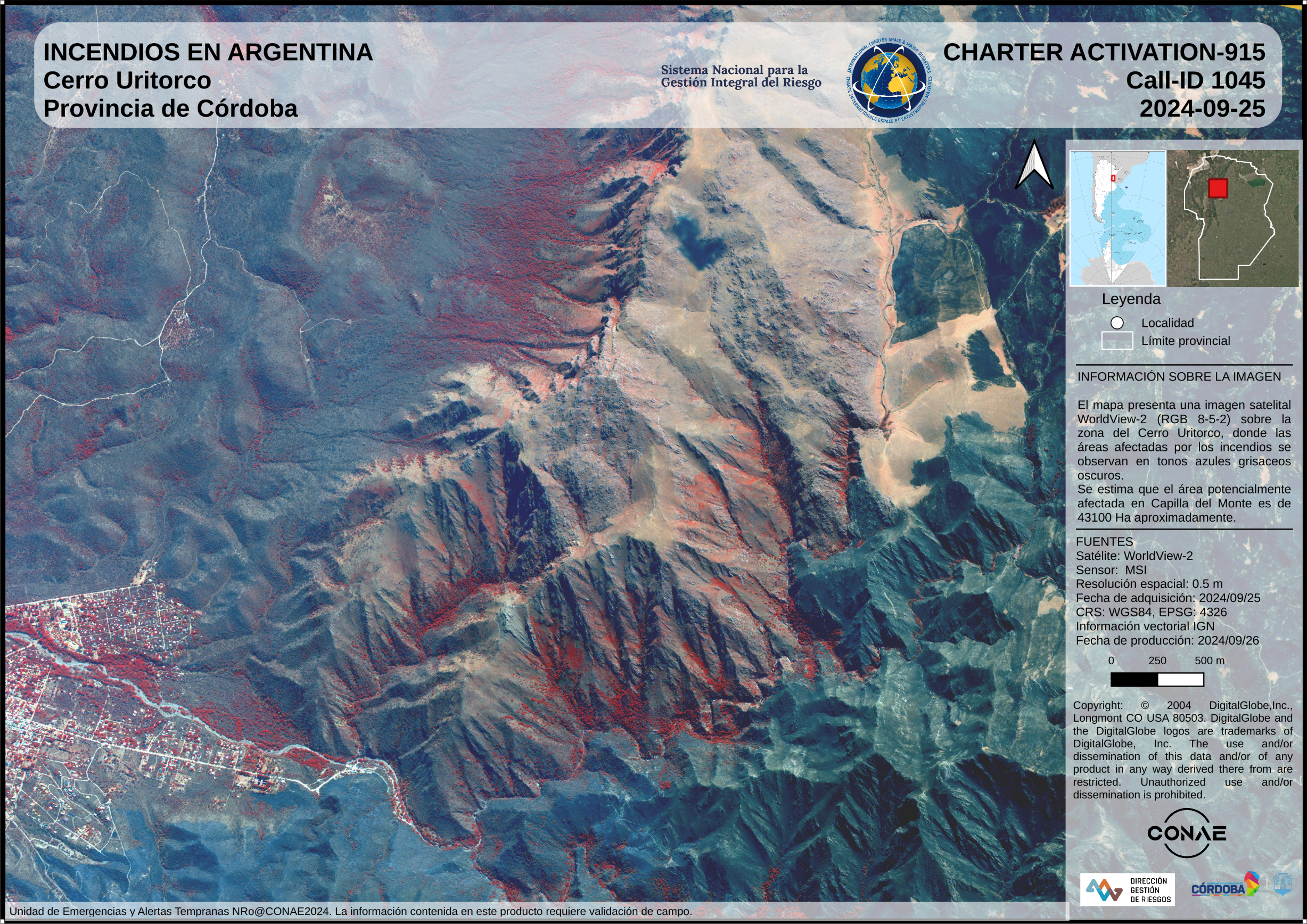
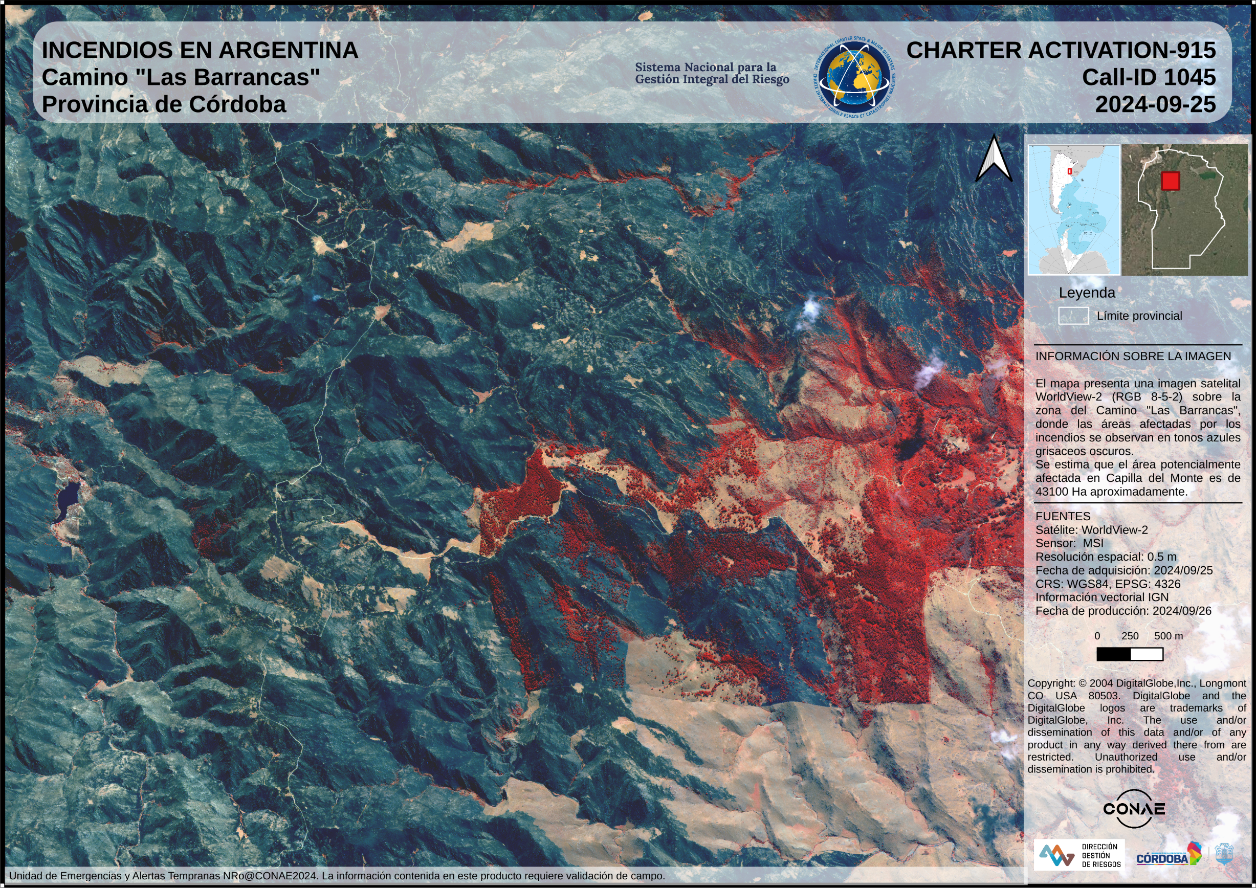
Areas affected by fires in the Province of Córdoba (Cerro Uritorco) - Argentina
Direitos autorais: © (2024) DigitalGlobe, Inc., Longmont CO USA 80503. DigitalGlobe and the DigitalGlobe logos are trademarks of DigitalGlobe, Inc. The use and/or dissemination of this data and/or of any product in any way derived there from are restricted. Unauthorized use and/or dissemination is prohibited
Map produced by CONAE
Information about the Product
Adquirida: 28/09/2024
Fonte: WorldView-2
Categoria: Delineation Map
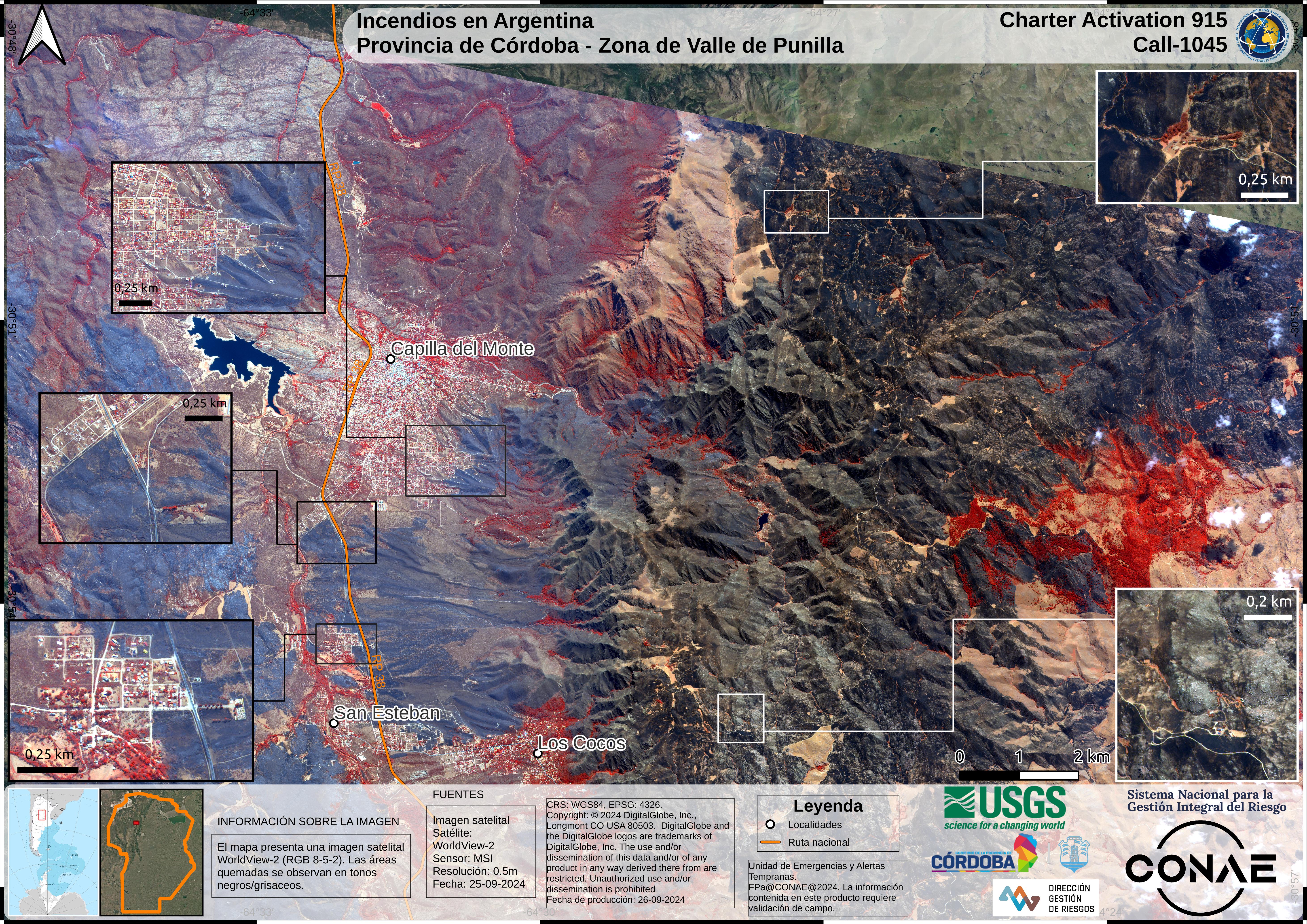
Areas affected by fires in the Province of Córdoba (Capilla del Monte) - Argentina
Direitos autorais: © (2024) DigitalGlobe, Inc., Longmont CO USA 80503. DigitalGlobe and the DigitalGlobe logos are trademarks of DigitalGlobe, Inc. The use and/or dissemination of this data and/or of any product in any way derived there from are restricted. Unauthorized use and/or dissemination is prohibited
Map produced by CONAE
Information about the Product
Adquirida: 28/09/2024
Fonte: WorldView-2
Categoria: Delineation Map
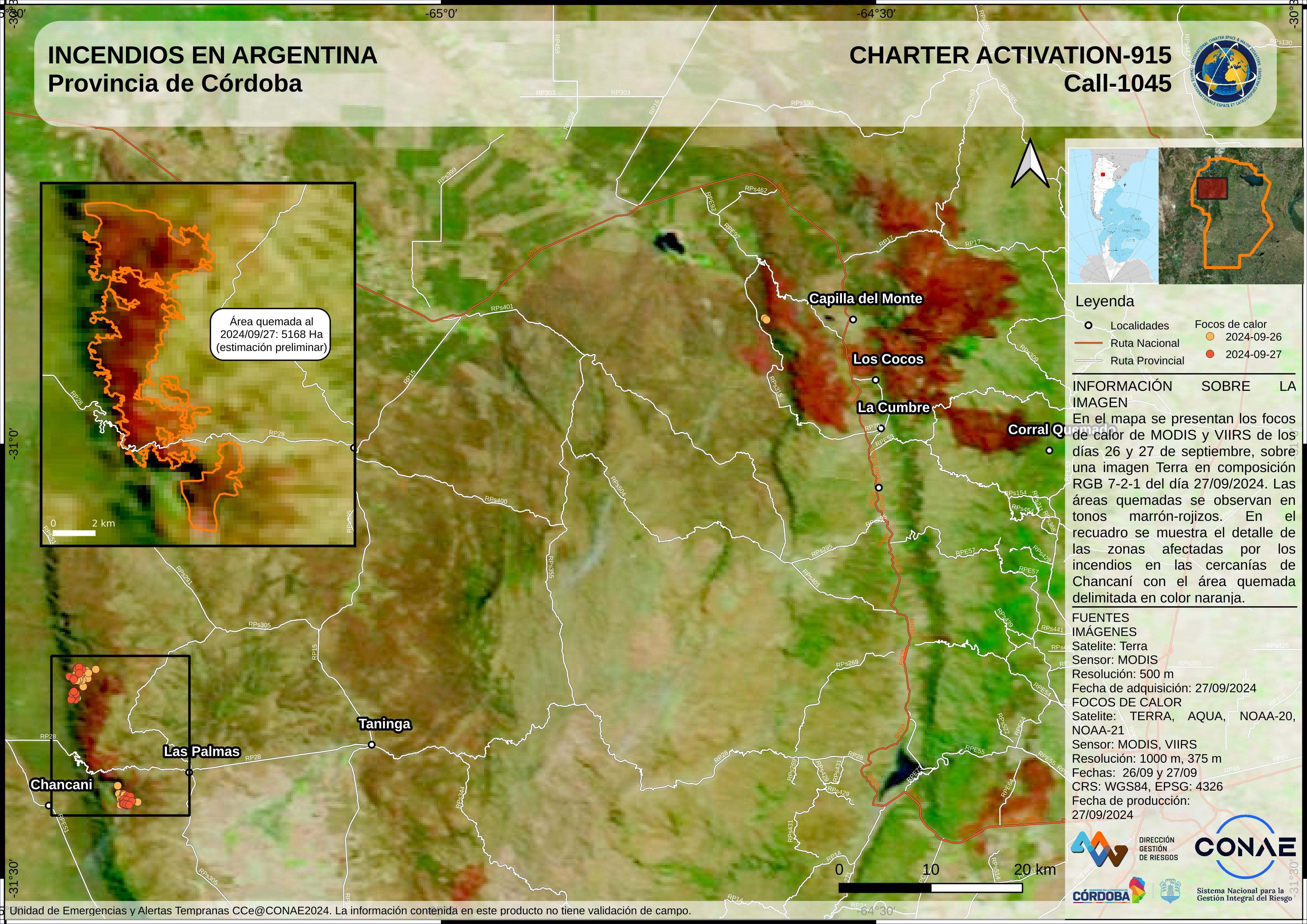
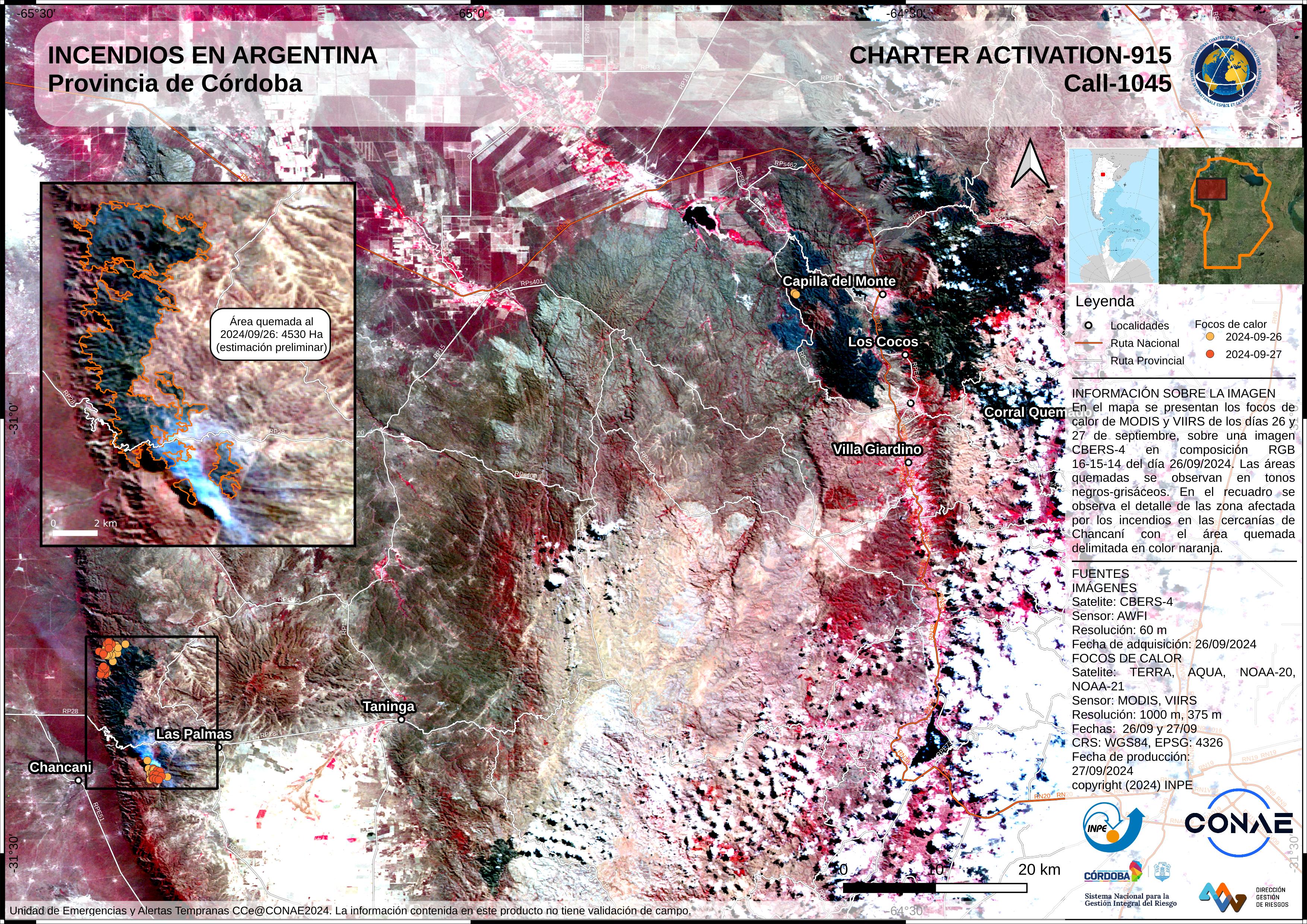
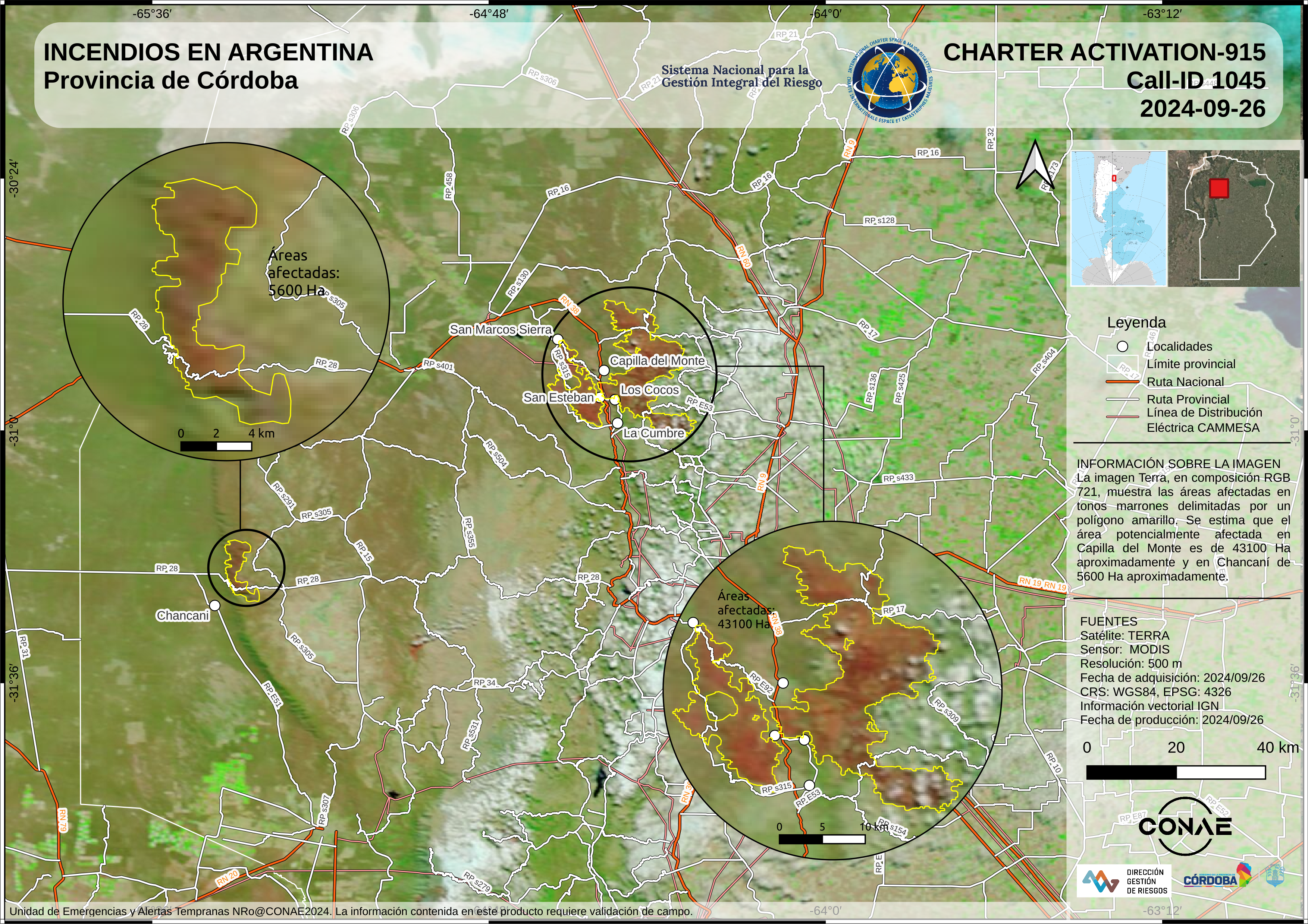
Areas affected by fires in the Province of Córdoba - Argentina
Direitos autorais: © (2024) DigitalGlobe, Inc., Longmont CO USA 80503. DigitalGlobe and the DigitalGlobe logos are trademarks of DigitalGlobe, Inc. The use and/or dissemination of this data and/or of any product in any way derived there from are restricted. Unauthorized use and/or dissemination is prohibited
Map produced by CONAE
Information about the Product
Adquirida: 25/09/2024
Fonte: WorldView-2
Categoria: Delineation Map
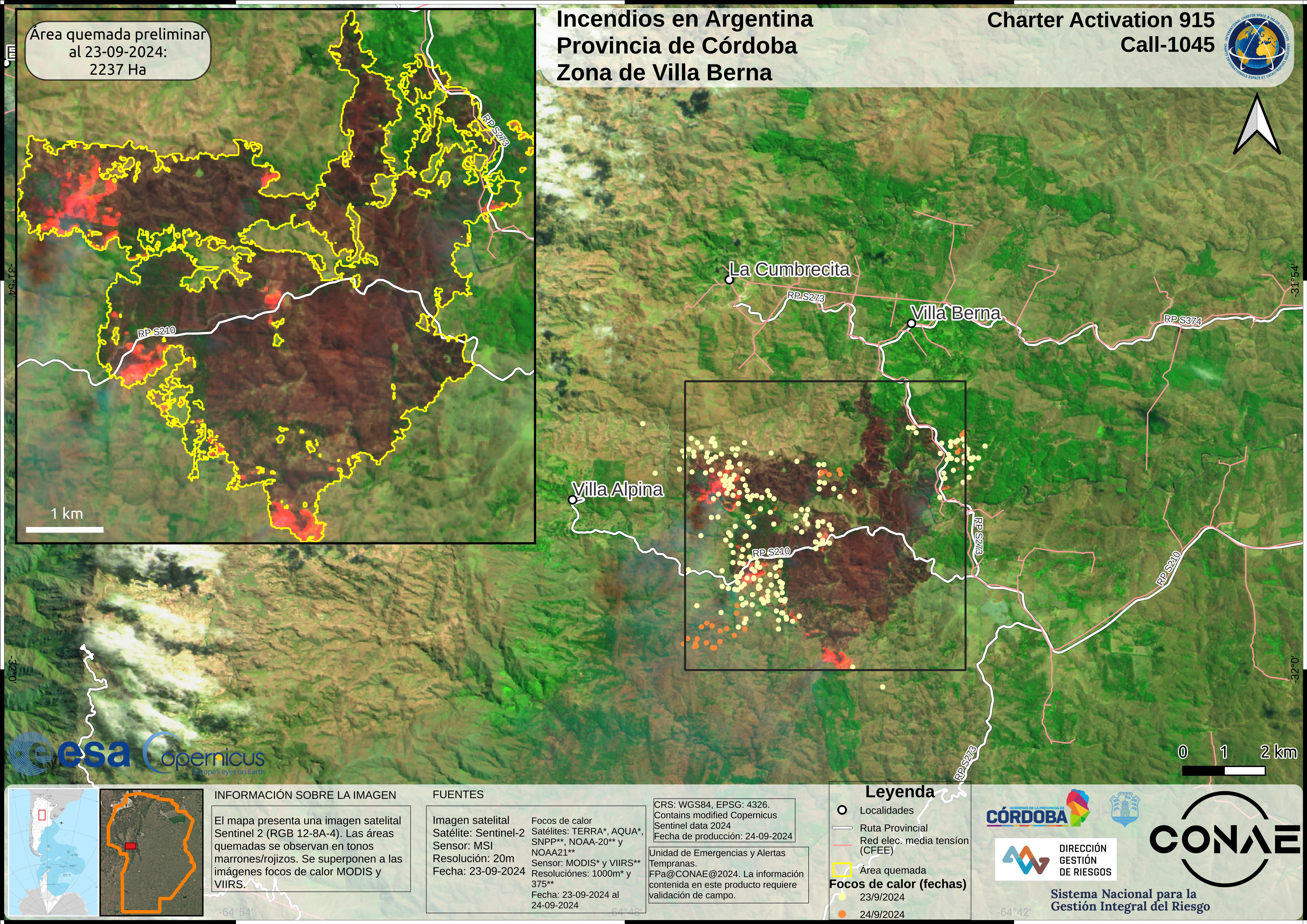

 Voltar ao arquivo completo da Ativação

