 English
 Spanish
 French
 Chinese
 Russian
 Portuguese
 Latest Activation
Charter activations
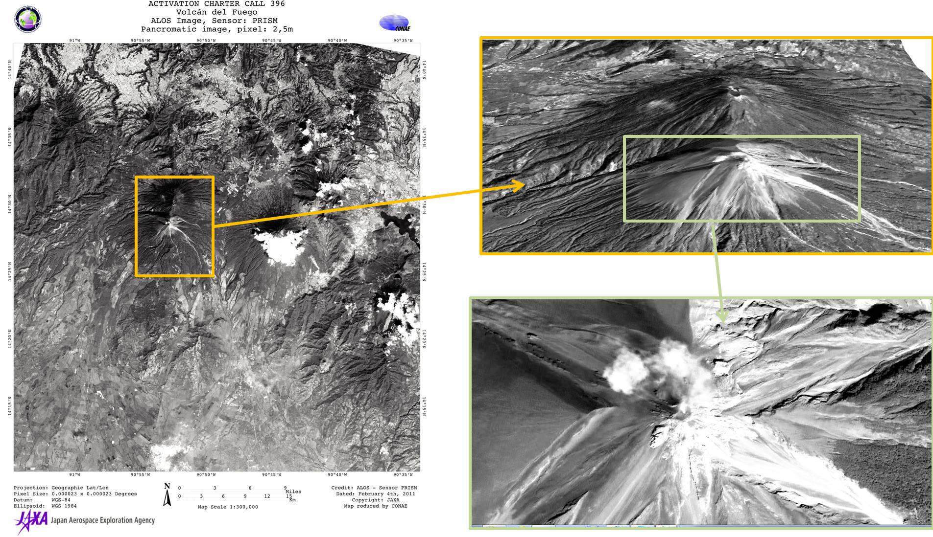
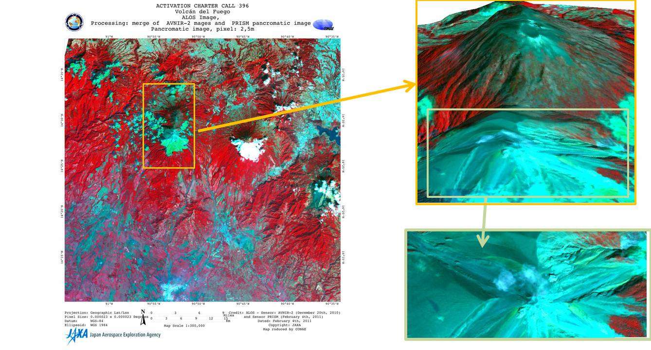
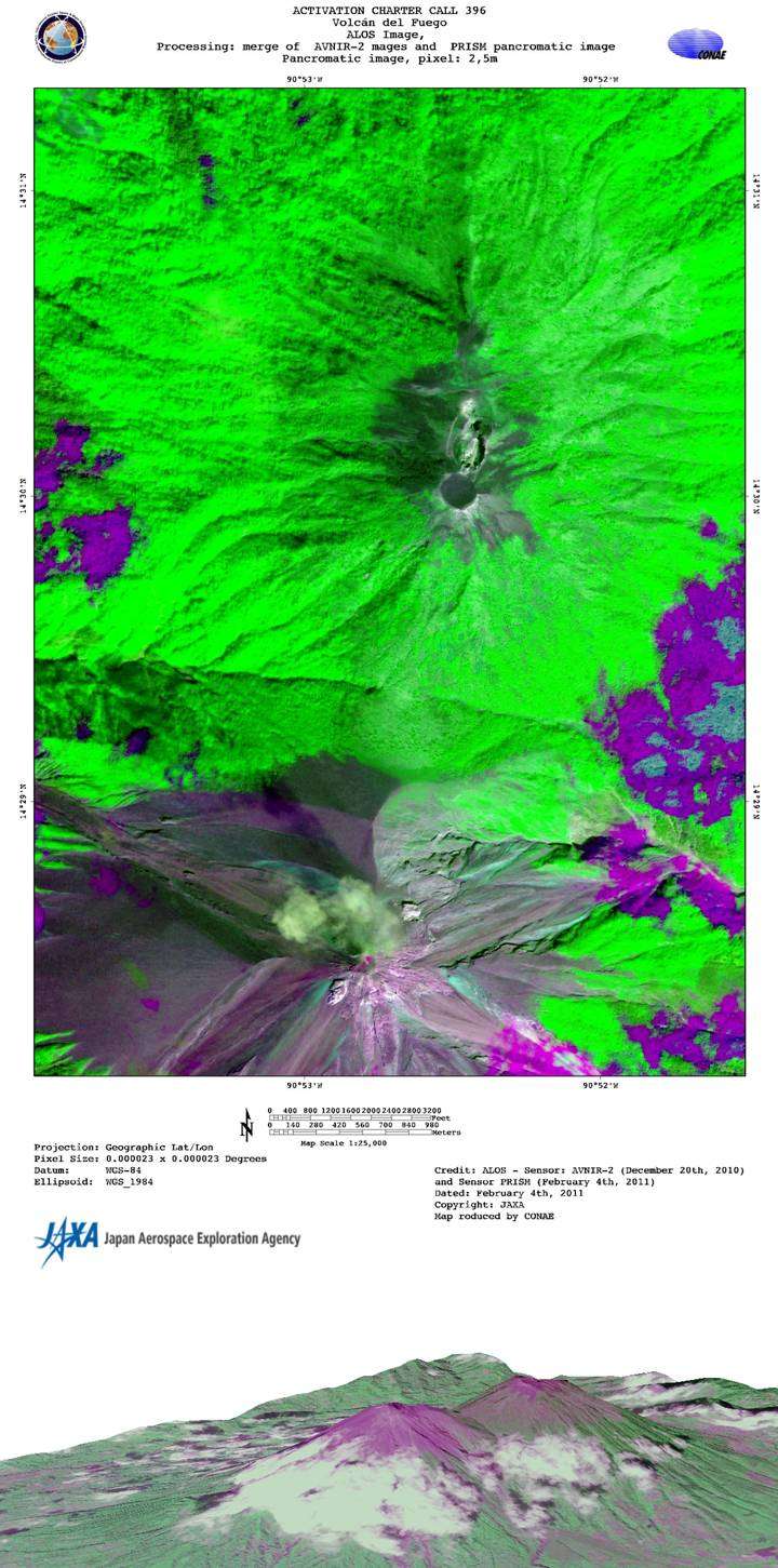
Eruption of lava from Fuego volcano in Guatemala
On Saturday, Feugo Volcano in Guatemala began to spew ash and emit lava in the capital of Antigua. Authorities issued an "orange" alert, and restricted flights from flying within a 25-mile (40 kilometer) radius of the volcano.
The volcano entered the phase of effusive eruption, throwing lava over 1,300 feet high, and ash plumed up to 5,000 meters which continued to fall over the weekend.
The National Disasters Agency cautioned nearby villagers to move quickly, however, no evacuations were ordered.
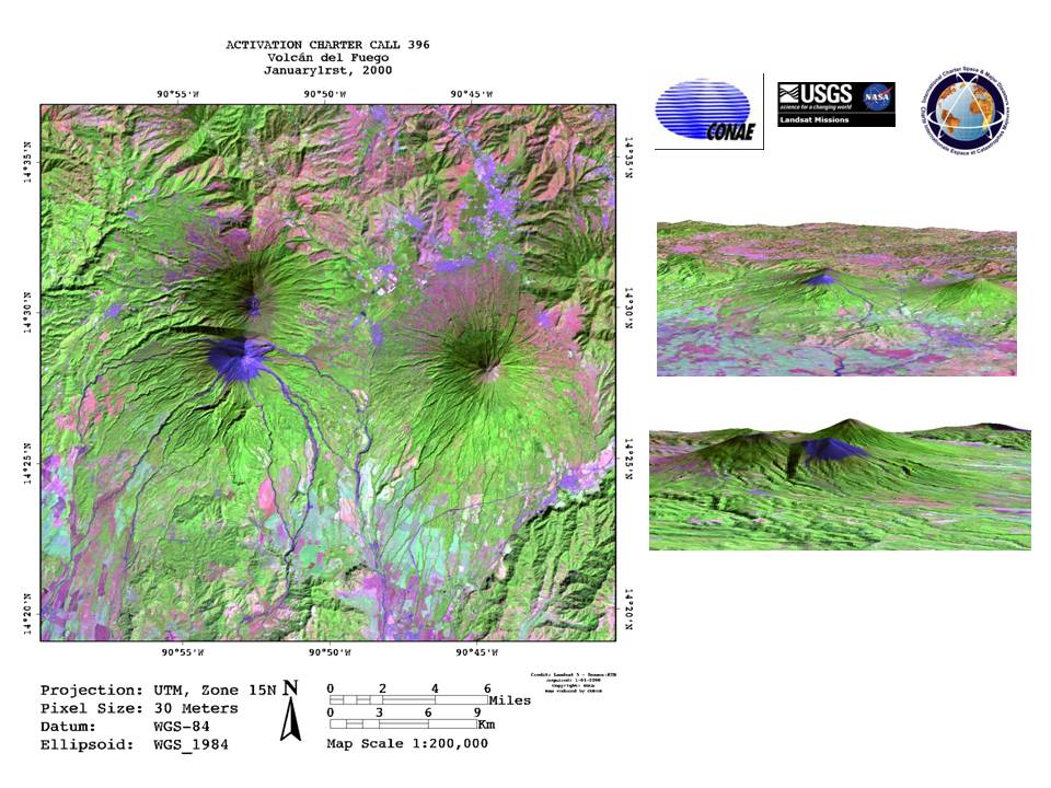
This is the largest eruption of the Fuego Volcano in recent times, and is part of activity that began in 2002 including intermittent explosive eruptions and lava flows.
| Tipo de evento: | Volcán |
| Local do evento: | Alotenango, Guatemala |
| Data da Ativação da Carta: | 21/05/2012 |
| Requisitante da Carta: | SIFEM on behalf of SECONRED |
| Gerenciamento de projeto: | CONAE |
Products
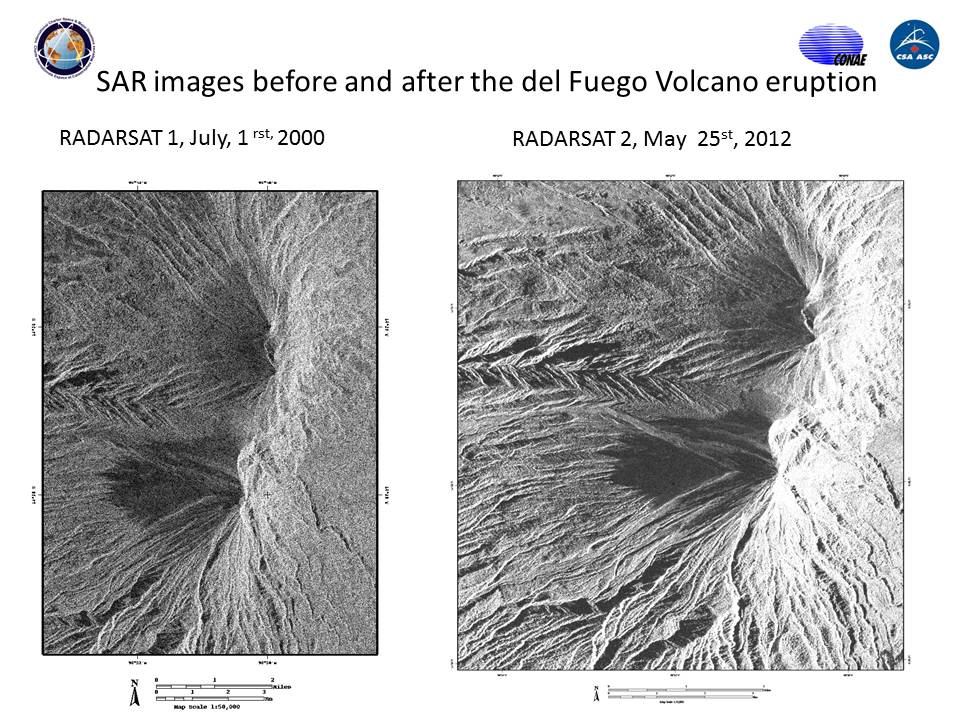
SAR images before and after the del Fuego Volcano eruption
Geofered system: UTM, Zone 15N
Direitos autorais: RADARSAT Data and Products © MacDonald, Dettwiler and Associates Ltd. (2011) - All Rights Reserved. RADARSAT is an official trademark of the Canadian Space Agency.
Map produced by CONAE
Information about the Product
Adquirida: 01/07/2000 and 25/05/2012
Fonte: RADARSAT-1 and RADARSAT-2
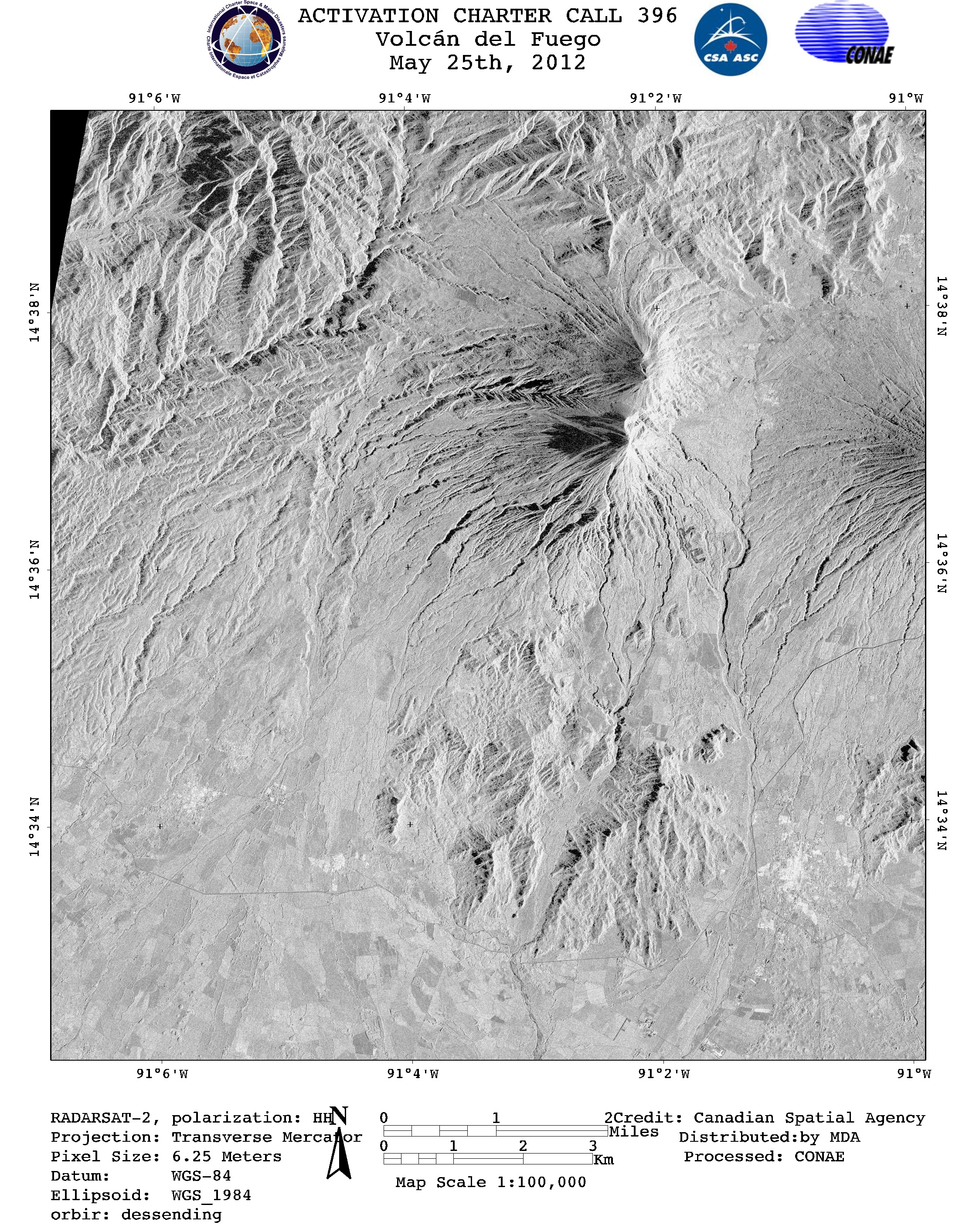
Post-disaster image of Fuego Volcano
Geofered system: UTM, Zone 15N
Direitos autorais: RADARSAT-2 Data and Products © MacDonald, Dettwiler and Associates Ltd. (2011) - All Rights Reserved. RADARSAT is an official trademark of the Canadian Space Agency.
Map produced by CONAE
Information about the Product
Adquirida: 25/05/2012
Fonte: RADARSAT-2

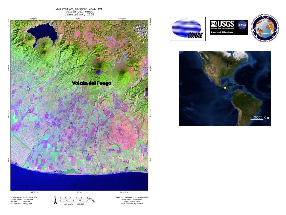
Historic image of Fuego Volcano
Geofered system: UTM, Zone 15N
Direitos autorais: RADARSAT Data and Products © MacDonald, Dettwiler and Associates Ltd. (2011) - All Rights Reserved. RADARSAT is an official trademark of the Canadian Space Agency.
Map produced by CONAE
Information about the Product
Adquirida: 01/07/2000
Fonte: RADARSAT-1
 Voltar ao arquivo completo da Ativação

