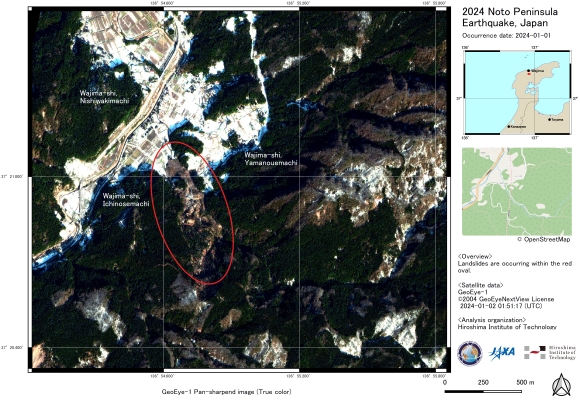
Charter activations
Earthquake in Japan
A magnitude 7.6 earthquake struck Japan on 1 January, leaving 48 dead and destroying hundreds of buildings.
7.6 is a major earthquake on the Richter scale, and the initial earthquake was followed by many smaller tremors, reaching as high as 4.9 magnitude.
The earthquake occurred at 07:10 UTC, in the Noto Peninsula of Ishikawa Prefecture. Hundreds of buildings were destroyed by the earthquake or by fires that followed. Roads and power infrastructure were also damaged, leaving over 30,000 people without power and affecting rescue efforts.
Rescue operations continued since the earthquake, and over 57,000 people were evacuated. The death toll risked to rise in the aftermath as the search continued, but thousands of emergency responders worked through the debris to find any survivors.
The area was put on alert for the impact of further tremors and tsunami warnings were in place following the earthquake, but were later lifted.
| Tipo de evento: | Earthquake |
| Local do evento: | Japan |
| Data da Ativação da Carta: | 2024-01-02 |
| Tempo de Ativação da Carta: | 13:25 |
| Zona de Tempo da Ativação da Carta: | UTC+09:00 |
| Requisitante da Carta: | ADRC |
| ID da Ativação: | 857 |
| Gerenciamento de projeto: | Masahiko Nagai (Yamaguchi University) |
| act-value-adders: | University of Tokyo Fumio YAMAZAKI (Chiba University) Tokyo Denki University Kohki ITOH (JAXA) Hitoshi Taguchi (National Research Institute for Earth Science and Disaster Resilience (NIED)) Hiromichi FUKUI (Chubu University) Yuzo SUGA (Hiroshima Institute of Technology) Shiro KAWAKITA (JAXA) Tsuyoshi Eguchi (Yamaguchi University) Atsuko NONOMURA (Kagawa University) |
Products
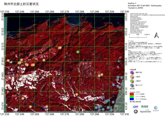
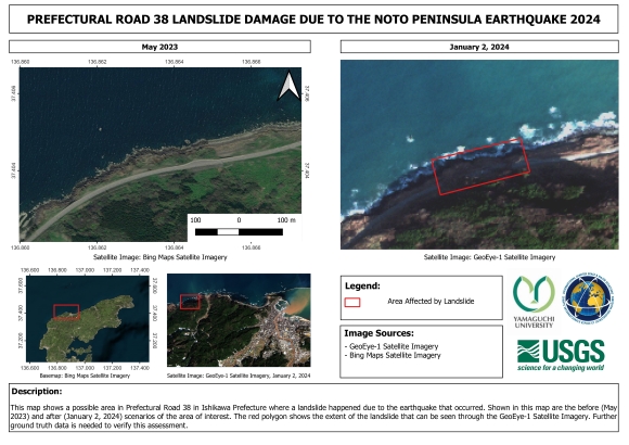
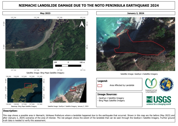
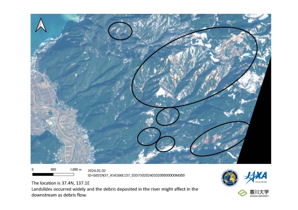
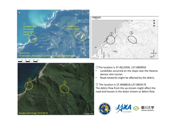
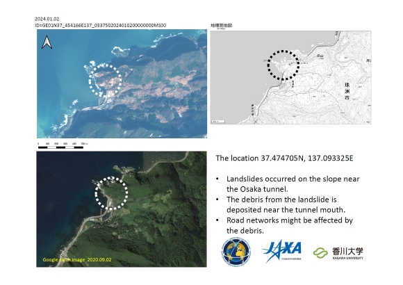
Landslides after the Noto Peninsula Earthquake in the Northern City of Suzu, Japan
Direitos autorais: © 2004 GeoEye NextView License
Map produced by IDEAS (International Digital Applied Services Research Group).
Information about the Product
Adquirida: 02/01/2024
Fonte: GeoEye-1
Categoria: Delineation Map
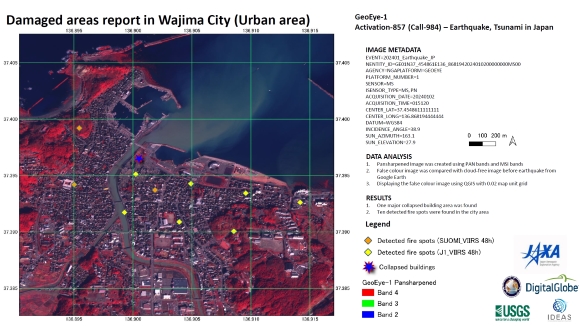
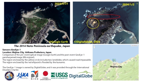
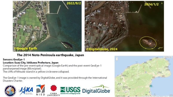
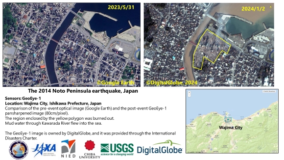
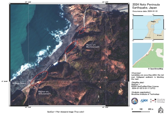
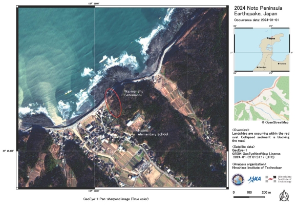
Post-Earthquake Damage, including Landslides and Fires, detected in Wajima city, Japan
Download the Full Report
Direitos autorais: © 2004 GeoEye NextView License
Report produced by JAXA.
Information about the Product
Adquirida: 02/01/2024
Fonte: GeoEye-1
Categoria: Delineation Map
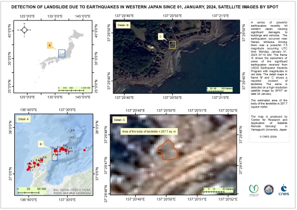
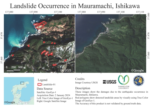
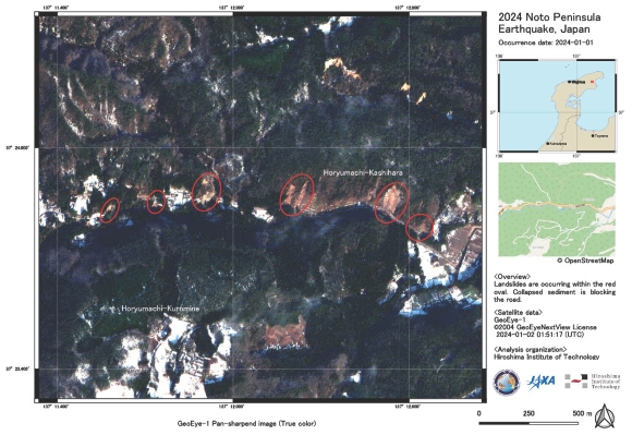
Detection of Landslides due to earthquakes in Noto, Japan
Direitos autorais: Includes material © AIRBUS DS (2024)
Map produced by The "Center for Research and Application of Satellite Remote Sensing" in Yamaguchi University, Japan.
Information about the Product
Adquirida: 04/01/2024
Fonte: SPOT-6
Categoria: Reference Map
 Voltar ao arquivo completo da Ativação

 English
 Spanish
 French
 Chinese
 Russian
 Portuguese
