 English
 Spanish
 French
 Chinese
 Russian
 Portuguese
 Latest Activation
Charter activations
Typhoon Damrey in Vietnam
Typhoon Damrey battered Vietnam on 04 November. This devastating storm left 27 people dead and 22 missing. Vietnam is susceptible to storms but Accuweather has reported that this was the worst in the area in 16 years.
Damrey made landfall near Nha Trang area at Category 2 strength. Quang Ngai is believed to have been affected the most with an outstanding 580mm of rain since Damrey made landfall.
Heavy rainfall with strong winds of 140 kph flooded the local communities; resulting in damage to buildings and houses, the destruction of 40,000 hectares of crops, and trees and electricity poles were also knocked down. Local authorities have reported that there was an electricity cut and more than 36,000 people in the coastal Can Gio district of Ho Chi Min city were evacuated as a result.
| Tipo de evento: | Ocean Storm - Typhoon |
| Local do evento: | Vietnam |
| Data da Ativação da Carta: | 2017-11-06 |
| Tempo de Ativação da Carta: | 16:35 |
| Zona de Tempo da Ativação da Carta: | UTC+05:30 |
| Requisitante da Carta: | UNITAR-UNOSAT on behalf of UNOCHA |
| ID da Ativação: | 557 |
| Gerenciamento de projeto: | UNITAR / UNOSAT |
Products
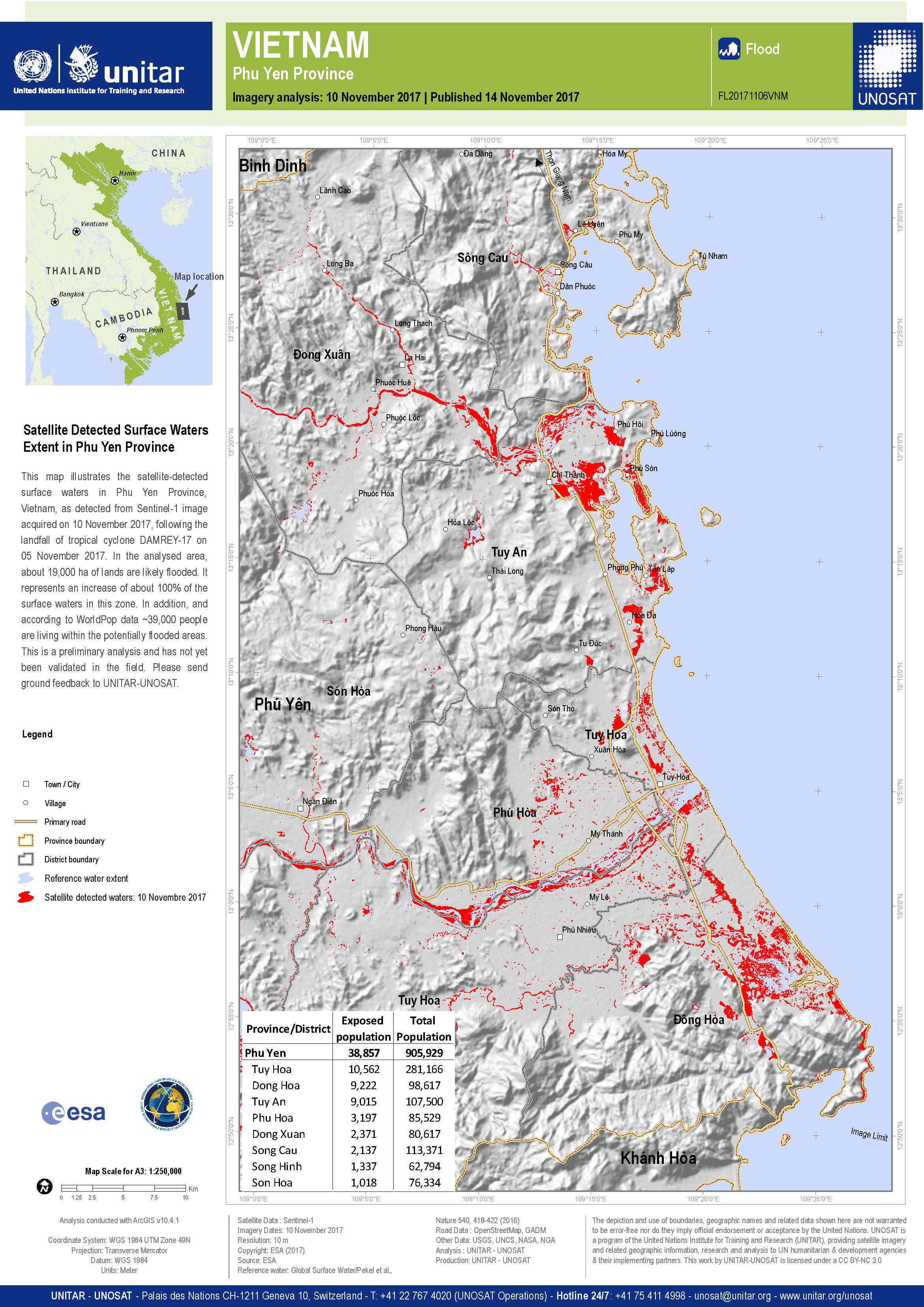
Flood detection in Phu Yen Province, Vietnam
Direitos autorais: Sentinel-1© Contains modified Copernicus Sentinel data (2017)
Map produced by UNITAR / UNOSAT
Information about the Product
Adquirida: 10/11/2017
Fonte: Sentinel-1
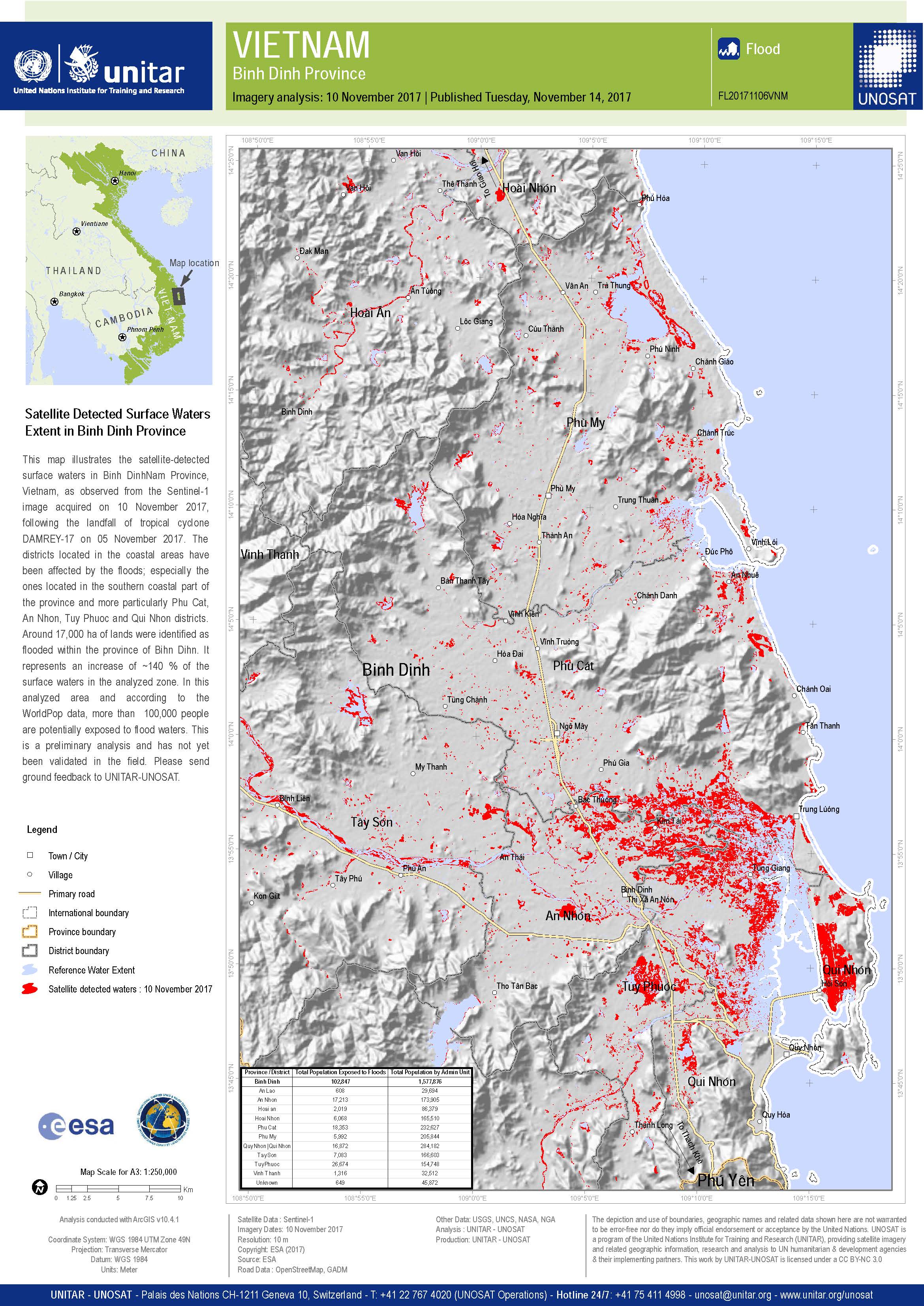
Flood detection in Binh Dinh Province, Vietnam
Direitos autorais: Sentinel-1© Contains modified Copernicus Sentinel data (2017)
Map produced by UNITAR / UNOSAT
Information about the Product
Adquirida: 10/11/2017
Fonte: Sentinel-1
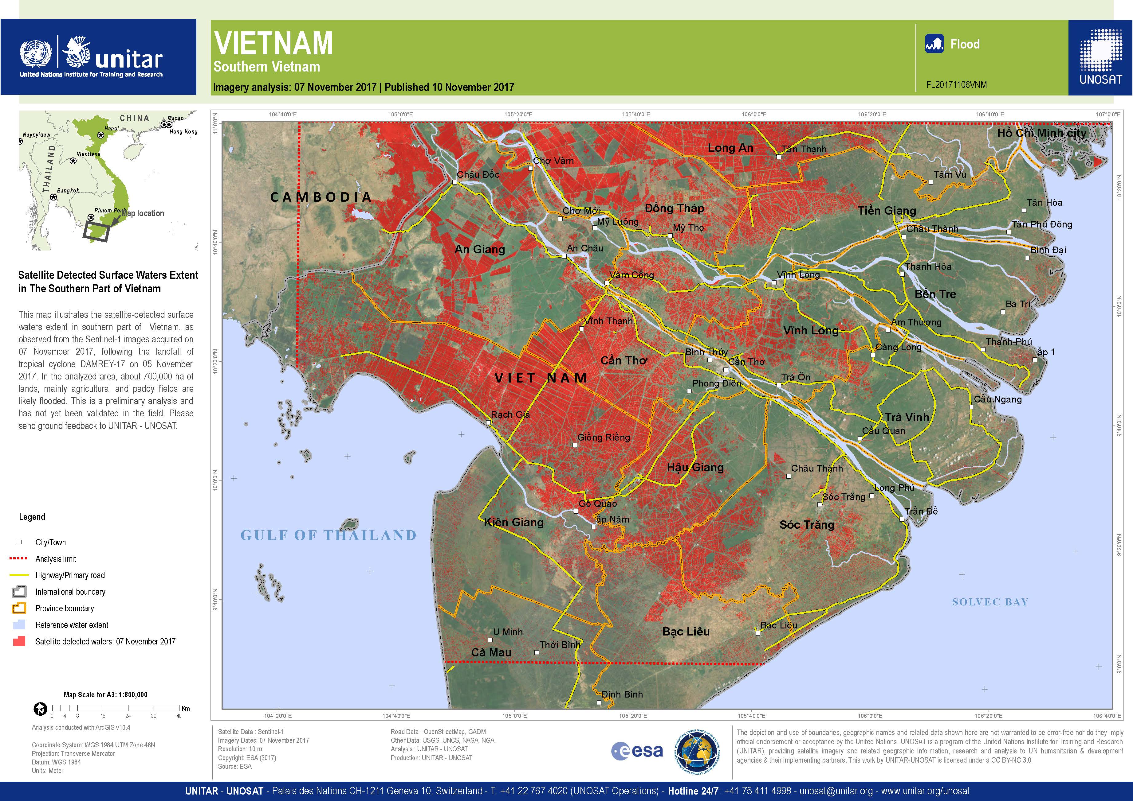
Flooding in the southern part of Vietnam
Direitos autorais: Sentinel-1© Contains modified Copernicus Sentinel data (2017)
Map produced by UNITAR / UNOSAT
Information about the Product
Adquirida: 07/11/2017
Fonte: Sentinel-1
Preliminary rapid flood assessment in Quang Binh Province
Download the full report
Direitos autorais: RADARSAT-2 Data and Products © MacDonald, Dettwiler and Associates Ltd. (2017) - All Rights Reserved. RADARSAT is an official trademark of the Canadian Space Agency.
Sentinel-1 © Copernicus Sentinel data (2017)
Report produced by UNITAR/UNOSAT
Information about the Product
Adquirida: RADARSAT-2: 07/11/2017
Sentinel-1: 03/11/2017
Fonte: RADARSAT-2 / Sentinel-1
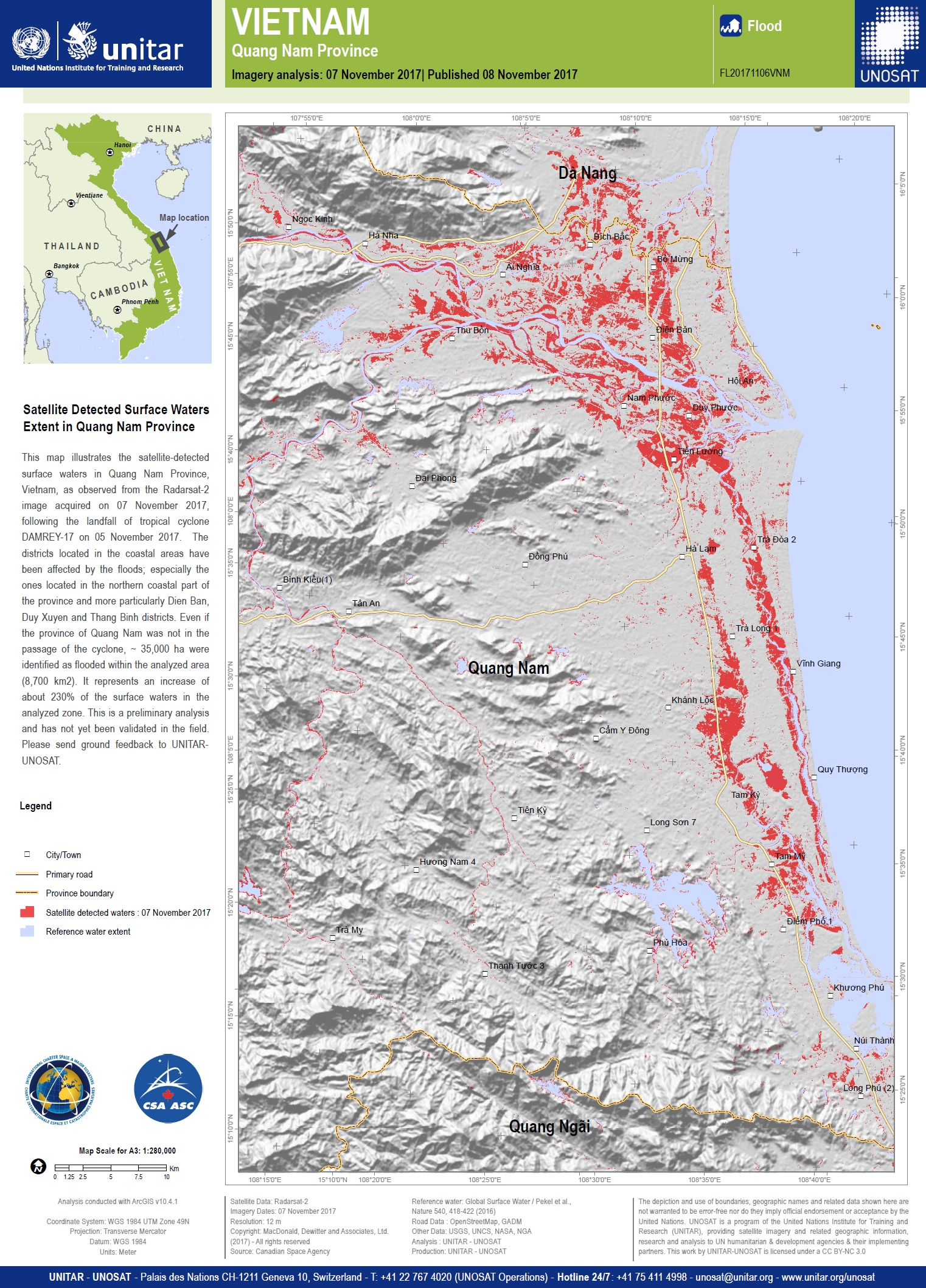
Satellite detected surface water extent in Quang Nam Province
Direitos autorais: RADARSAT-2 Data and Products © MacDonald, Dettwiler and Associates Ltd. (2017) - All Rights Reserved. RADARSAT is an official trademark of the Canadian Space Agency.
Map produced by UNITAR-UNOSAT
Information about the Product
Adquirida: 07/11/2017
Fonte: RADARSAT-2
 Voltar ao arquivo completo da Ativação

