Charter activations
Flood in Sri Lanka
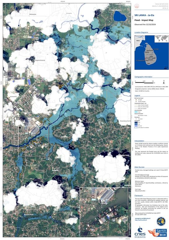
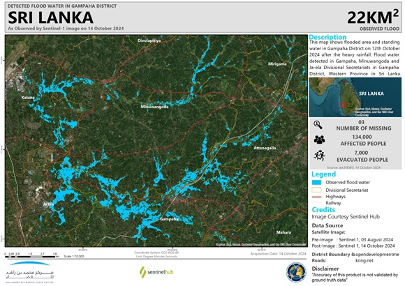
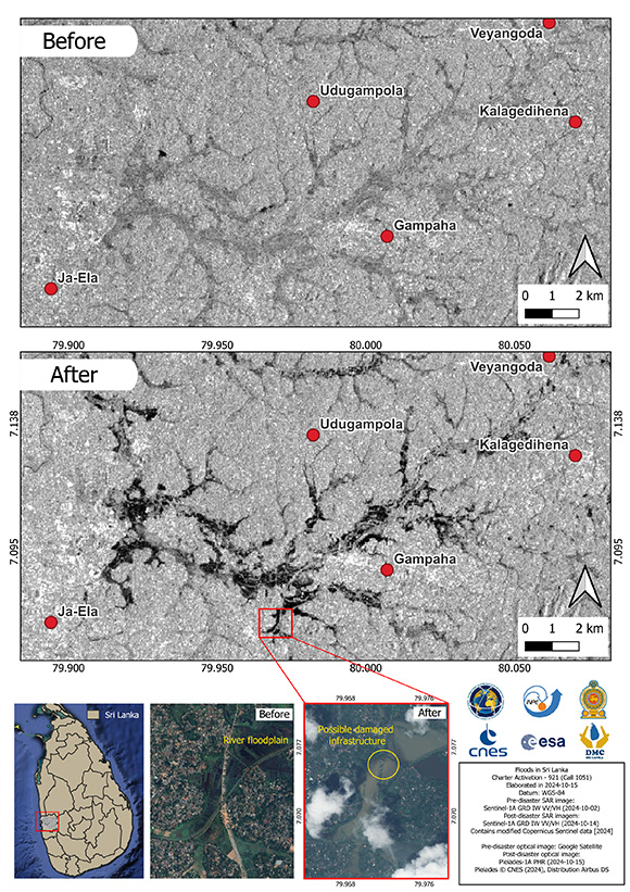
Heavy rainfall caused by adverse weather conditions started on 11 October and continued over the following days. Several areas in the Western Province of Sri Lanka experienced flooding.
Navy flood relief teams were dispatched to the Gampaha and Colombo districts, working in coordination with the Disaster Management Center (DMC). The Kalu Ganga, Kelani Ganga, and Aththanagalu Oya rivers overflowed, causing flooding in Kaduwela, Biyagama, Ihalagama, and Ja-Ela. Schools were closed on the following Monday in the capital city Colombo and its suburbs. Flooding impacted homes, fields, and roads.
The DMC reported three people had drowned, and 134,000 people had been affected by the floods.
Related Resources
| Type of Event: | Flood |
| Location of Event: | Sri Lanka |
| Date of Charter Activation: | 2024-10-12 |
| Time of Charter Activation: | 12:20 |
| Time zone of Charter Activation: | UTC+05:30 |
| Charter Requestor: | Disaster Management Centre on behalf of Disaster Management Centre |
| Activation ID: | 921 |
| Project Management: | Samanmali Matharaarachchi (Disaster Management Centre) |
| act-value-adders: | INPE Camila Gonçalves dos Santos (UFRRJ) SERTIT Rapid Mapping Service (SERTIT Rapid Mapping Service) Shaikha Ahmed Albesher (Mohammed Bin Rashid Space Centre) Disaster Management Centre - DMC |
Products
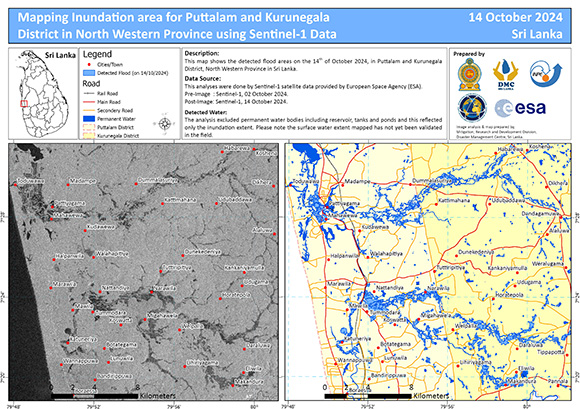
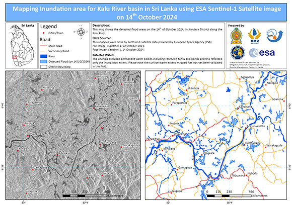
Mapping Inundation area for Puttalam and Kurunegala District in North Western Province, Sri Lanka
Copyright: Contains modified Copernicus Sentinel data (2024)
Map produced by Disaster Management Centre of Sri Lanka
Information about the Product
Acquired: 14/10/2024
02/10/2024
Source: Sentinel-1
Category: Delineation Map
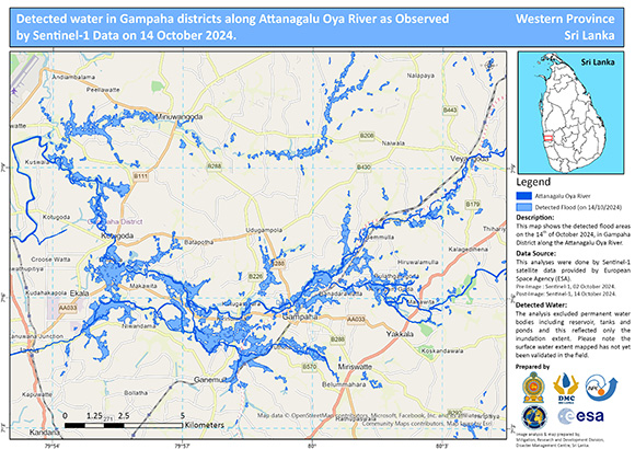
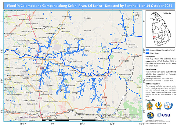
Detected water in Gampaha districts along Attanagalu Oya River, Western Province, Sri Lanka.
Copyright: Contains modified Copernicus Sentinel data (2024)
Map produced by Disaster Management Centre of Sri Lanka
Information about the Product
Acquired: 14/10/2024 / 02/10/2024
Source: Sentinel-1
Category: Delineation Map
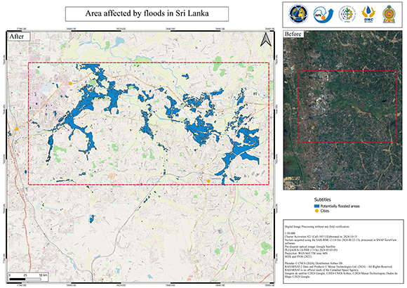
Area affected by floods in Sri Lanka
Copyright: RADARSAT Constellation Mission Imagery © Government of Canada (2024) - RADARSAT is an official mark of the Canadian Space Agency
Includes Pleiades material © CNES (2024), Distribution Airbus DS.
Imagem de satélite ©2024 Google, ©2024 CNES/Airbus, ©2024 Maxar Technologies, Dados do Mapa ©2024 Google.
Map produced by Disaster Management Centre of Sri Lanka
Information about the Product
Acquired: RCM: 14/10/2024
Pleiades : 15/10/2024
RADARSAT : 17/10/2024
Source: RCM / Pleiades / RADARSAT
Category: Delineation Map
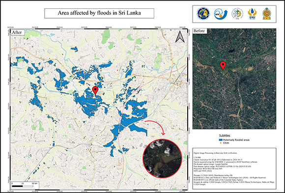
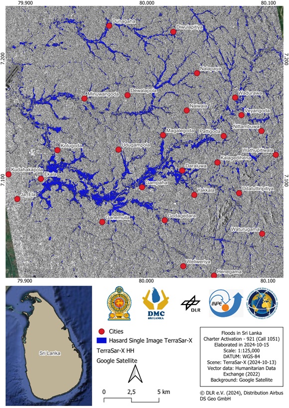
Area affected by floods in Sri Lanka
Copyright: Imagem de satélite ©2024 Google, ©2024 CNES/Airbus, ©2024 Maxar Technologies, Dados do Mapa ©2024 Google
RADARSAT Constellation Mission Imagery © Government of Canada (2024) - RADARSAT is an official mark of the Canadian Space Agency
Includes Pleiades material © CNES (2024), Distribution Airbus DS.
Map produced by Disaster Management Centre of Sri Lanka
Information about the Product
Acquired: RADARSAT: 17/10/2024
RCM: 14/10/2024
Pleiades: 15/10/2024
Source: RADARSAT / RCM / Pleiades
Category: Delineation Map
 Back to the full activation archive

 English
 Spanish
 French
 Chinese
 Russian
 Portuguese
