 English
 Spanish
 French
 Chinese
 Russian
 Portuguese
 Dernière activation
Charter activations
Hurricane Milton in the United States
Hurricane Milton has made landfall as a Category 3 storm in western Florida early on Thursday, 10 October. The eye of the storm is expected to hit Florida's Gulf Coast and densely populated areas such as Tampa, St. Petersburg, Sarasota, and Fort Myers. However, Milton's winds weakened to 90 mph overnight, making it a lower Category 1 storm.
Hurricane Milton hit Florida with winds of 120 mph before battering the coast and producing a series of tornadoes around the state. The storm has brought lightning, persistent rainfall, and winds shaking palm trees. More than 1.5 million homes and businesses were without power in Sarasota County and neighbouring Manatee County, according to poweroutage.us, which tracks utility reports.
Residents in "evacuation zones," which are situated in Milton's expected pathway, were warned to evacuate and find alternative accommodation. Search and recovery teams are on standby until Hurricane Milton has passed through, as there is nothing they can do during the storm.
| Type of Event: | Flood |
| Location of Event: | United States |
| Date of Charter Activation: | 2024-10-09 |
| Time of Charter Activation: | 12:42 |
| Time zone of Charter Activation: | UTC-05:00 |
| Charter Requestor: | USGS |
| Activation ID: | 920 |
| Project Management: | Brent Yantis (University of Louisiana at Lafayette) |
| act-value-adders: | NOAA Konstantin Homenkov (Geoniformation systems) Ramesh Sivanpillai (University of Wyoming) Mathias Studer (SERTIT) |
Products
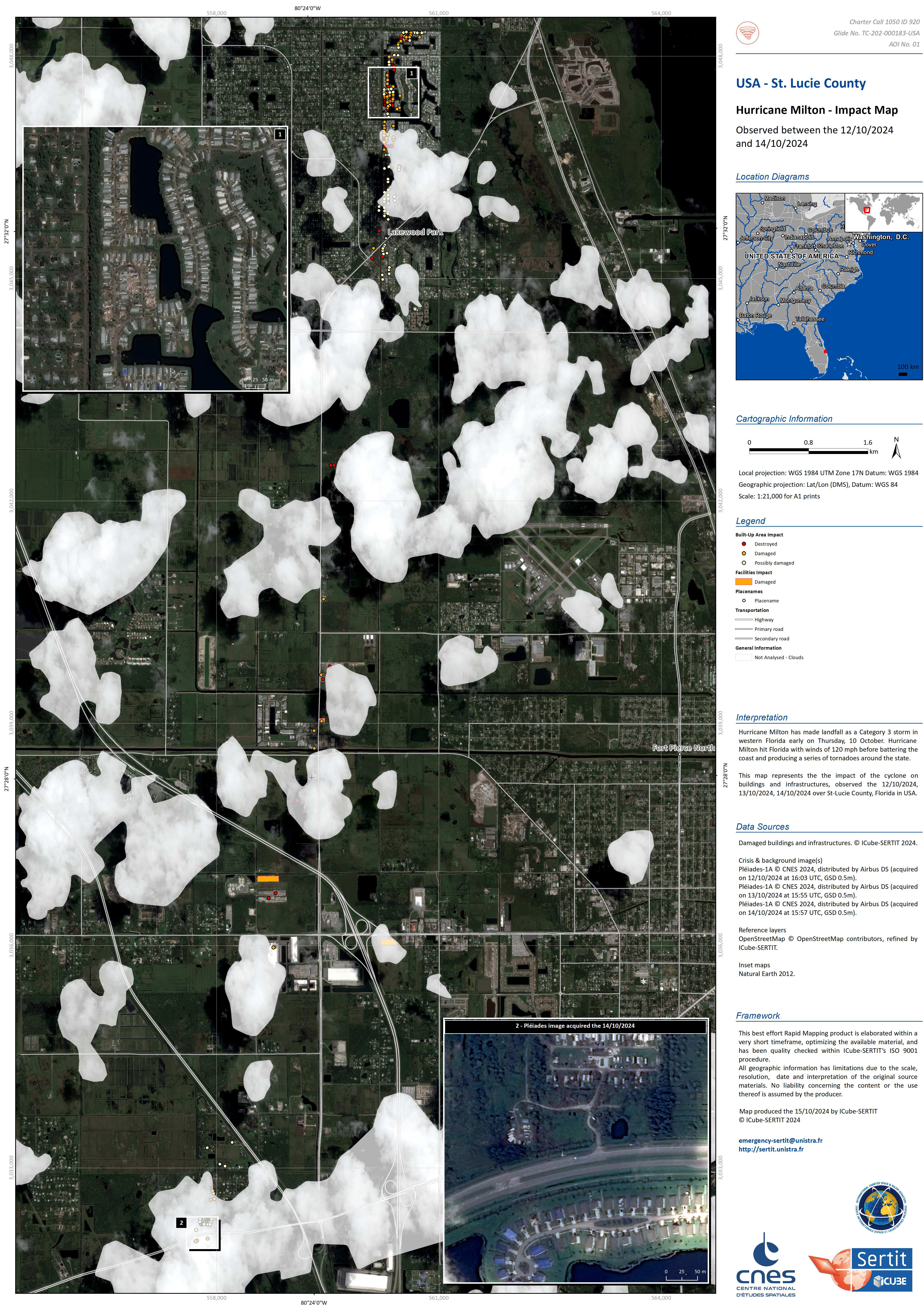
Impact Map for St Lucie County, USA
Copyright: Includes Pleiades material © CNES (2024), Distribution Airbus DS.
Includes Pleiades material © CNES (2024), Distribution Airbus DS.
Includes Pleiades material © CNES (2024), Distribution Airbus DS.
Information about the Product
Acquired: 13/10/2024
12/10/2024
14/10/2024
Source: Pleiades
Category: Grading Map
 Back to the full activation archive

