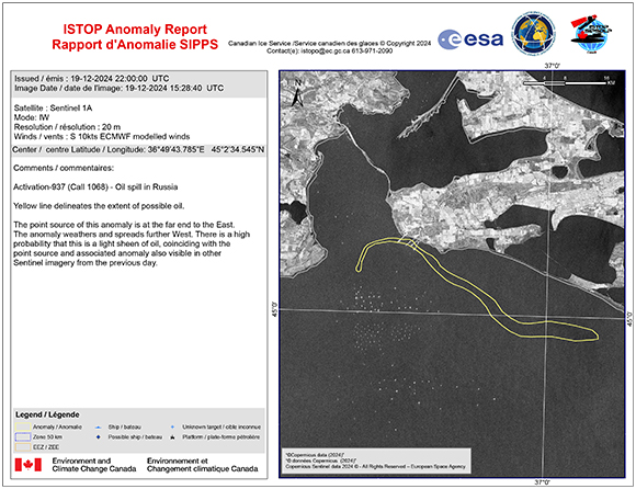
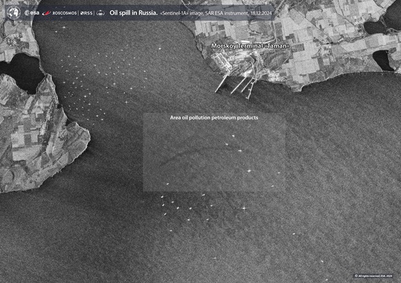
Charter activations
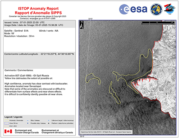
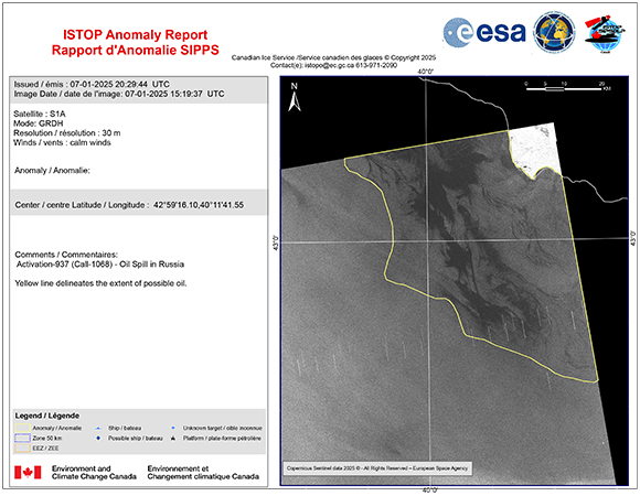
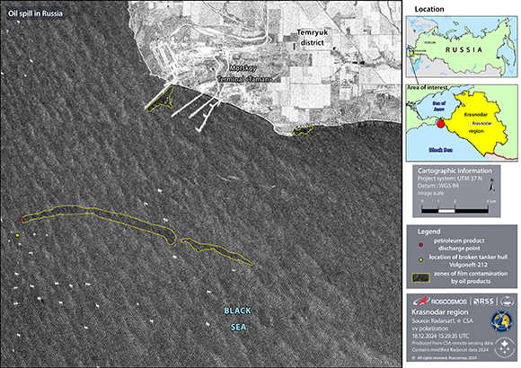
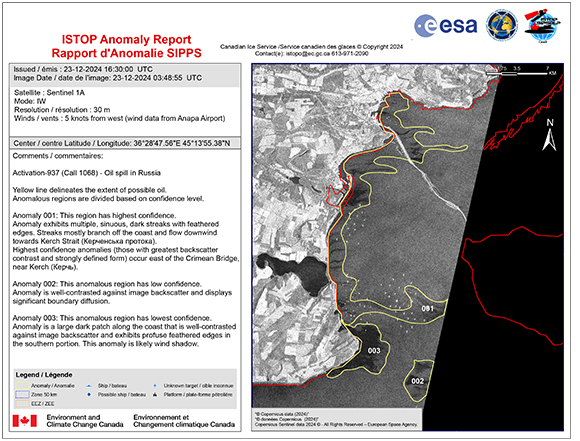
Oil spill in Russia
On the morning of 15 December, rough waves in the Black Sea damaged two tankers 8 km from the shore of the Kerch Strait.
The cargo ship Volgoneft-212 was reported to have had difficulties off the east coast of Crimea. The carrier snapped in half after being hit by a large wave and sank into the ocean.
One person was killed when the 136-metre tanker was impacted, and 12 other people were evacuated, two of whom were in serious condition. The Volgoneft-212 was carrying 4,300 tonnes of low-grade heavy fuel oil, which spilled into the ocean.
Shortly afterwards, another cargo ship, the Volgoneft-239, encountered the same harsh sea conditions and was damaged. The second tanker was carrying 4 tonnes of fuel oil and 14 crew aboard. Reports suggested that the second ship also began to sink.
Two tugboats and two helicopters were dispatched to aid in the rescue operations.
| Type of Event: | Oil spill |
| Location of Event: | Russian Federation |
| Date of Charter Activation: | 2024-12-16 |
| Time of Charter Activation: | 11:31 |
| Time zone of Charter Activation: | UTC+03:00 |
| Charter Requestor: | Ministry of the Russian Federation for Civil Defense, Emergencies and Elimination of Natural Disasters (EMERCOM) |
| Activation ID: | 937 |
| Project Management: | Andrey Kuklin (ROSCOSMOS) |
| act-value-adders: | NTs OMZ David Robertson (Meteorological Service of Canada) Environment and Climate Change Canada Russell Hanright (ISTOP) Georgy Korolyov (EMERCOM of Russia) |
Products
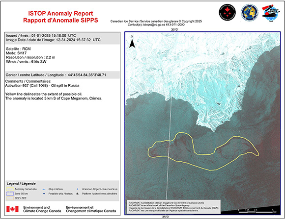
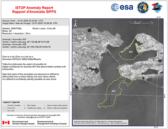
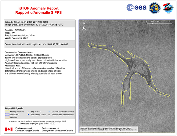
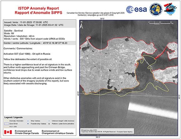
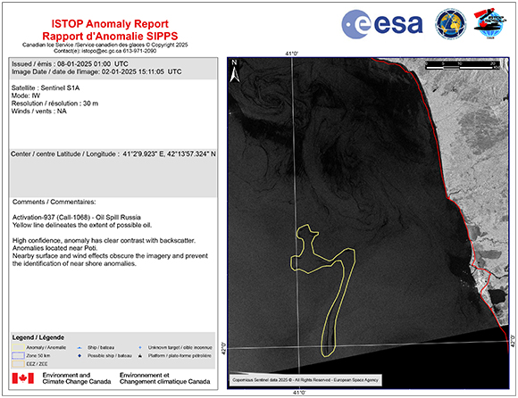
Marine pollution surveillance report of oil spill in Russia
Copyright: RADARSAT Constellation Mission Imagery © Government of Canada (2024) - RADARSAT is an official mark of the Canadian Space Agency
Map produced by ISTOP
Information about the Product
Acquired: 31/12/2024
Source: RCM
Category: Delineation Map
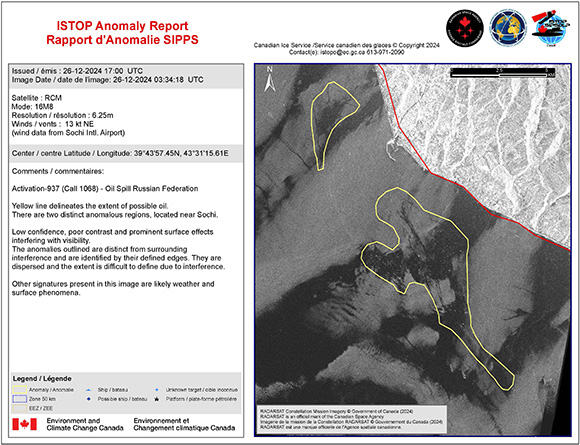
Marine pollution surveillance report of oil spill in Russia
Copyright: RADARSAT Constellation Mission Imagery © Government of Canada (2024) - RADARSAT is an official mark of the Canadian Space Agency
Map produced by ISTOP
Information about the Product
Acquired: 26/12/2024
Source: RCM
Category: Delineation Map
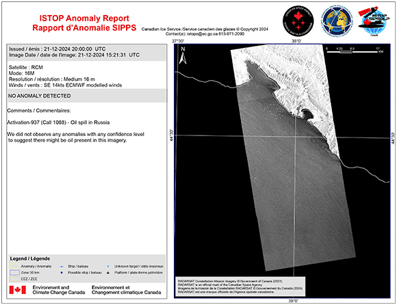
Marine pollution surveillance report of oil spill in Russia
Copyright: RADARSAT Constellation Mission Imagery © Government of Canada (2024) - RADARSAT is an official mark of the Canadian Space Agency
Map produced by ISTOP
Information about the Product
Acquired: 21/12/2024
Source: RCM
Category: Delineation Map
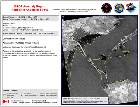
Marine pollution surveillance report of oil spill in Russia
Copyright: RADARSAT Constellation Mission Imagery © Government of Canada (2024) - RADARSAT is an official mark of the Canadian Space Agency
Map produced by ISTOP
Information about the Product
Acquired: 21/12/2024
Source: RCM
Category: Delineation Map
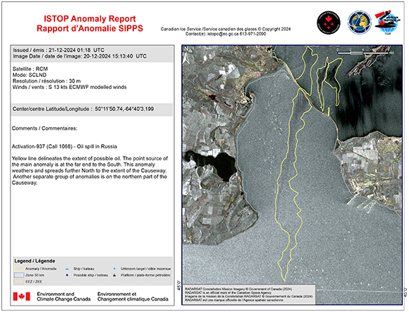
Marine pollution surveillance report of oil spill in Russia
Copyright: RADARSAT Constellation Mission Imagery © Government of Canada (2024) - RADARSAT is an official mark of the Canadian Space Agency
Map produced by ISTOP
Information about the Product
Acquired: 20/12/2024
Source: RCM
Category: Delineation Map
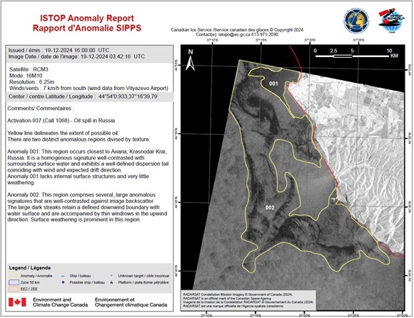
ISTOP anomaly report - Marine pollution surveillance report of oil spill in Russia
Copyright: RADARSAT Constellation Mission Imagery © Government of Canada (2024) - RADARSAT is an official mark of the Canadian Space Agency
Map produced by ISTOP
Information about the Product
Acquired: 19/12/2024
Source: RCM
Category: Delineation Map
 Back to the full activation archive

 English
 Spanish
 French
 Chinese
 Russian
 Portuguese
