Charter activations
Oil spill in Peru
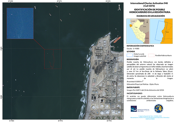
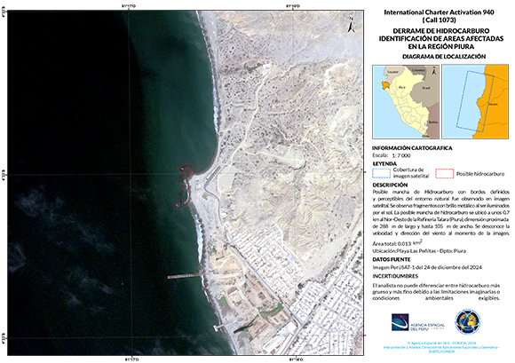
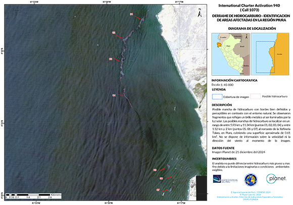
An oil spill occurred at Talara in the Piura region of Peru on 21 December.
The oil firm Petroperu spilled a crude oil shipment into the surrounding waters of the Pacific Ocean, causing serious environmental consequences. This accident puts the lives of various marine and economic species in the country at risk. It has not been confirmed how much crude was spilled into the sea, but Peru's environmental watchdog OEFA reports that the oil has affected approximately 10,000 square meters of surface seawater.
The environment ministry said it has affected at least seven beaches, as well as local wildlife. It has been reported that the oil spill has damaged coastal plants and animals, such as crabs, affecting local trade as fishermen are unable to work.
Petroperu has deployed clean-up brigades working together with the fishermen's union and local authorities.
| Type of Event: | Oil spill |
| Location of Event: | Peru |
| Date of Charter Activation: | 2024-12-23 |
| Time of Charter Activation: | 17:37 |
| Time zone of Charter Activation: | UTC+01:00 |
| Charter Requestor: | INDECI on behalf of National Commission for Aerospace Research and Development(CONIDA) |
| Activation ID: | 940 |
| Project Management: | José Pasapera (CONIDA) |
Products

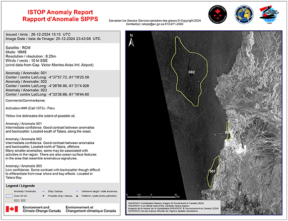
Oil Spill Identification of Affected Areas in the Piura Region
Copyright: RADARSAT Constellation Mission Imagery © Government of Canada (2024) - RADARSAT is an official mark of the Canadian Space Agency
Map produced by the Canadian Space Agency
Information about the Product
Acquired: 25/12/2024
Source: RCM
Category: Reference Map
 Back to the full activation archive

 English
 Spanish
 French
 Chinese
 Russian
 Portuguese


