Minimiser Dernière activation

Charter activations

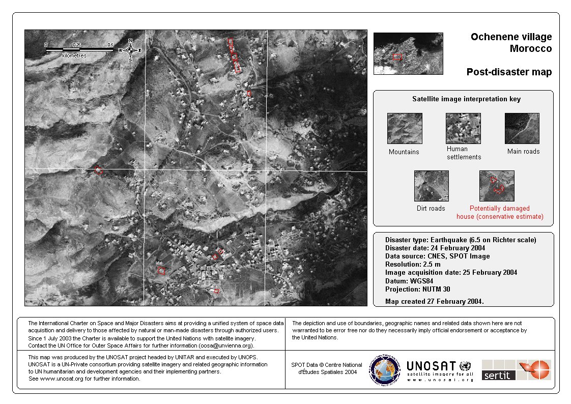
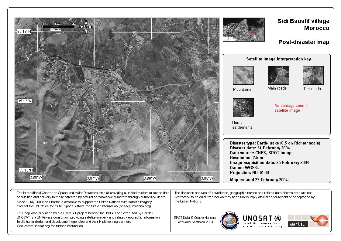
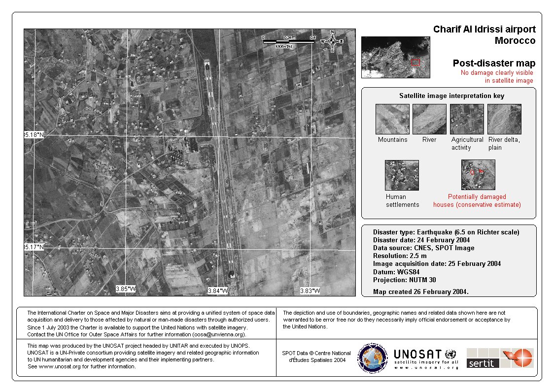
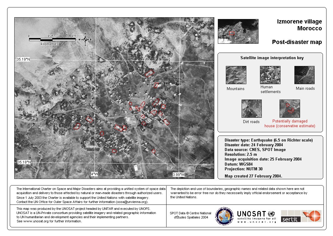
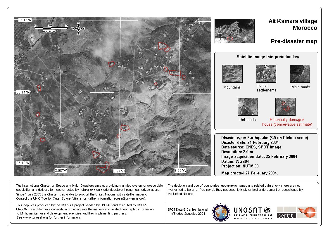
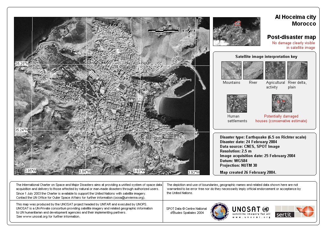
Tremblement de terre en Maroc

Un tremblement de terre mésurant 6,5 sur l'échelle de Richter s'est produit dans la mer méditerranée près du port marocain d'Al-Hoceima, le mardi 24 février. L'épicentre a été localisé à environ 295 km à l'est-nord-est de Rabat.

Des répliques sismiques importantes ont continué à se produire dans les premières heures de la journée de mercredi 25 février

Type of Event:Tremblement de terre
Location of Event:(Al Hoceima), Maroc
Date of Charter Activation:24 février 2004
Charter Requestor:UNOOSA pour UNOCHA
Project Management:UNOSAT

Products

Ochenene village, 25 février 2004 [261 KB]

Copyright: Centre National d'Études Spatiales 2002 Carte par SERTIT

Information about the Product

Source: Données SPOT

Sidi bauafif village, 25 février 2004 [261 KB]

Copyright: Centre National d'Études Spatiales 2002
Carte par SERTIT

Information about the Product

Source: Données SPOT

Aéroport, 25 février 2004 [273]

Copyright: Centre National d'Études Spatiales 2002
Carte par SERTIT

Information about the Product

Source: Données SPOT

Izmorene village, 25 février 2004 [260 KB]

Copyright: Centre National d'Études Spatiales 2002 Carte par SERTIT

Information about the Product

Source: Données SPOT

Ait Kamara village, 25 février 2004 [257 KB]

Copyright: Centre National d'Études Spatiales 2002
Carte par SERTIT

Information about the Product

Source: Données SPOT

Al Hoceima ville, 25 février 2004 [297 KB]

Copyright: Centre National d'Études Spatiales 2002
Carte par SERTIT

Information about the Product

Source: Données SPOT

Al Hoceima vue d'ensemble, 25 février 2004

Copyright: Centre National d'Études Spatiales 2002
Carte par SERTIT

Information about the Product

Acquired: 25/02/2004

Source: SPOT données

Back to the full activation archive