Spotlight on International Charter Data Contributors: Satellogic
News
17 décembre 2024
Spotlight on International Charter Data Contributors: Satellogic
A brief introduction of Satellogic
Founded in 2010, Satellogic (NASDAQ: SATL) is the first vertically integrated geospatial company, driving real outcomes with planetary-scale insights. Satellogic is creating and continuously enhancing the first scalable, fully automated Earth Observation (EO) platform with the ability to remap the entire planet at both high-frequency and high-resolution, providing accessible and affordable solutions for customers. Using its patented Earth imaging technology, Satellogic unlocks the power of EO to deliver high-quality, planetary insights at a low cost. With more than a decade of experience in space, Satellogic has proven technology and a strong track record of delivering satellites to orbit and high-resolution data to customers at the right price point.
Motivation for participating in the Charter
Satellogic is on a mission to democratize access to critical geospatial information, enabling more organizations to develop new solutions that help solve humanity's toughest challenges. To drive adoption and amplify the impact of geospatial data, Satellogic collaborates with researchers, academic institutions, and organizations working to advance our understanding of the planet and improve life on Earth. Partnering with the Charter allows Satellogic to deliver high-quality satellite data to support coordinated efforts in disaster management, resource planning, and environmental monitoring, ensuring that their technology contributes to impactful, solution-oriented initiatives.
The specific types of data Satellogic provides
Satellogic designs, builds, and operates its own fleet of Earth Observation satellites, the Aleph-1 constellation. The satellites are engineered to collect high-resolution imagery for a broad range of industrial and government applications. Satellites operate at an altitude of around 475 km ewquipped with multispectral cameras capable of capturing sub-meter resolution imagery. Satellogic has developed a proprietary Super Resolution algorithm that further enhances the spatial resolution of its multispectral imagery to 70 cm for Mark IV satellites and 50 cm for Mark V satellites. This improves the clarity of the original image without compromising the integrity of radiometric values —creating a product optimized for machine learning and AI applications. High resolution imagery serves as vital governmental and commercial intelligence for monitoring critical infrastructure, remote areas, and environmental changes, delivering high frequency and detailed insights that drive decision making.
| Imagery Product | L1 Basic | L1 Ortho | L1 Ortho SR |
| Pixel Resolution Mark IV/Mark V |
Native ~99 cm GSD at nadir ~70 cm GSD at nadir ~70 cm GSD at nadir |
Native |
70 cm GSD SuperResolution 50 cm GSD SuperResolution |
| Wavelengths | Blue: 450 - 510 nm Green: 510 - 580 nm Red: 590 - 690 nm NIR: 750 - 900 nm | ||
| Geolocation Accuracy |
Terrestrial - 20 m CE90
Maritime - 300 m CE90
|
10 m CE90 | |
| Image Delivery bits/pixel |
TOA 16 bits
VISUAL 8 bits |
||
| File Format | GeoTiff | ||
| Image Metadata | ISO and STAC | ||
| Projection | UTM/WGS84 | ||
| Swath Width | 5 km / 6.5 km at nadir | ||
| Coverage | Maritime, Terrestrial | Terrestrial | |
Satellites and Offerings
Examples of activations
Oil Spill in Trinidad and Tobago (Activation 861)
On February 7, the Tobago Emergency Management Agency reported an abandoned capsized cargo ship, the "Gulfstream," near Cove, Tobago, which led to a significant oil spill affecting 15 km of coastline, prompting a large cleanup effort and considerations for escalating the emergency response level due to overwhelmed local resources.
List of contributions
As of December 2024, Satellogic has contributed data across 27 activations in the following countries:
- Earthquake in Afghanistan (Activation 763)
- Flooding in India (Activation 764)
- Wildfire in Tunisia (Activation 766)
- Flooding in Russian Federation (Activation 767)
- Flooding in Gambia (Activation 768)
- Flooding in Sudan (Activation 769)
- Flooding in Pakistan (Activation 772)
- Typhoon in Russian Federation (Activation 774)
- Flooding in South Africa (Activation 776)
- Landslide in Honduras (Activation 778)
- Typhoon Noru in Thailand (Activation 784)
- Flooding Venezuela (Activation 785)
- Hurricane Julia in Honduras (Activation 786)
- Tropical storm Nalgae in Philippines (Activation 789)
- Earthquake in Indonesia (Activation 791)
- Oil spill in Mauritius (Activation 793)
- Flooding in Zambia (Activation 796)
- Tropical storm Cheneso in Madagascar (Activation 795)
- Landslide Colombia (Activation 794)
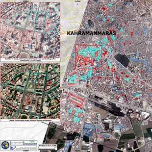
- Earthquake in Turkey (Activation 797)
- Earthquake in Syrian Arab Republic (Activation 798)
- Wildfires in Chile (Activation 799)
- Flooding in Eswatini (Activation 800)
- Flooding in South Africa (Activation 840)
- Flood in the Marshall Islands (Activation 858)
- Oil spill in Trinidad and Tobago (Activation 861)
- Flooding in Brazil (Activation 875)

 English
 Spanish
 French
 Chinese
 Russian
 Portuguese


