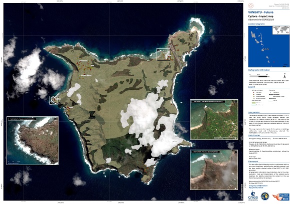
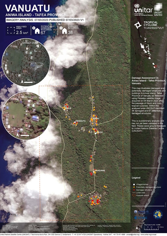
Charter activations
Tropical Cyclone Kevin in Vanuatu
The nation of Vanuatu which is spread across 13 principal islands in the south-western Pacific, has been under a state of emergency as category 4 Cyclone Kevin brought gale-force winds and torrential rain to the Pacific nation battling its second major cyclone in a week after Cyclone Judy battered Port Vila on 1 March, cutting power and forcing some residents to evacuate.
Hundreds of people remained in emergency evacuation centres in the capital Port Vila as Kevin brought destructive winds and heavy rainfall.
No casualties were reported but a number of properties have been flattened and many homes and businesses reported power outages.
Cyclone Kevin passed over Port Vila late on 3 March and was moving across the southern island province of Tafea on 4 March, bringing wind gusts in excess of 230km/h, according to the country's meteorology department.
Disaster response agencies are preparing for further damage from Cyclone Kevin and are braced for a long recovery ahead.
Related News and Resources:
| Type of Event: | Ocean Storm - Cyclone |
| Location of Event: | Vanuatu |
| Date of Charter Activation: | 2023-03-03 |
| Time of Charter Activation: | 13:46 |
| Time zone of Charter Activation: | UTC+01:00 |
| Charter Requestor: | UNITAR on behalf of United Nations Office for the Coordination of Humanitarian Affairs (OCHA) | Regional Office for Asia and the Pacific |
| Activation ID: | 808 |
| Project Management: | Samir Belabbes (UNITAR) |
Products
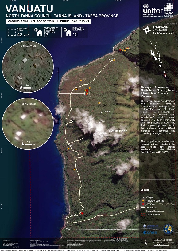
Damage Assessment in North Tanna Council, Tanna Island - Tafea Province, Vanuatu
Copyright: © (2023) DigitalGlobe, Inc., Longmont CO USA 80503. DigitalGlobe and the DigitalGlobe logos are trademarks of DigitalGlobe, Inc. The use and/or dissemination of this data and/or of any product in any way derived there from are restricted. Unauthorized use and/or dissemination is prohibited.
Map produced by UNITAR/UNOSAT
Information about the Product
Acquired: 04/03/2023, 07/03/2023
Source: WorldView-2
Category: Grading Map
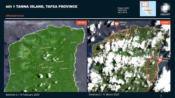
Tropical Cyclones Judy And Kevin, Preliminary Satellite-derived Assessment in Vanuatu-Penama, Malampa, Shefa, and Tefea Provinces
Download the full report
Copyright: Contains modified Copernicus Sentinel data (2023)
WorldView-2 and WorldView-3 © (2023) DigitalGlobe, Inc., Longmont CO USA 80503. DigitalGlobe and the DigitalGlobe logos are trademarks of DigitalGlobe, Inc. The use and/or dissemination of this data and/or of any product in any way derived there from are restricted. Unauthorized use and/or dissemination is prohibited.
Map produced by UNITAR/UNOSAT
Information about the Product
Acquired: Sentinel-2: 02/02/2023, 08/03/2023
WorldView-2: 06/05/2022
WorldView-3: 04/03/2023
Source: Sentinel-2 / WorldView-2 / WorldView-3
Category: Gradient Monitoring Maps
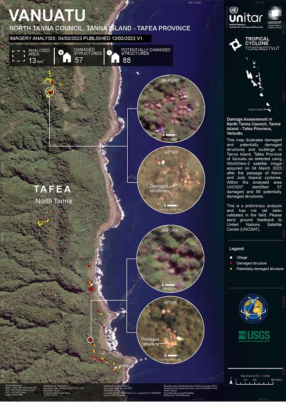
Damage Assessment in North Tanna Council, Tanna Island - Tafea Province, Vanuatu
Copyright: © (2023) DigitalGlobe, Inc., Longmont CO USA 80503. DigitalGlobe and the DigitalGlobe logos are trademarks of DigitalGlobe, Inc. The use and/or dissemination of this data and/or of any product in any way derived there from are restricted. Unauthorized use and/or dissemination is prohibited.
Map produced by UNITAR/UNOSAT
Information about the Product
Acquired: 15/06/2022, 04/03/2023
Source: WorldView-2
Category: Grading Map
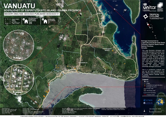
Damage Assessment in Luganville and South East Santo Councils, Espiritu Santo Island - Sanma Province
Copyright: Includes Pleiades material © CNES (2023), Distribution Airbus DS.
Map produced by UNITAR / UNOSAT
Information about the Product
Acquired: 04/03/2023, 06/03/2023
Source: Pleiades
Category: Grading Map
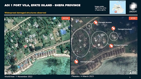
Tropical Cyclones Judy and Kevin preliminary satellite derived assessment in Vanuatu
Download full report
Copyright: WorldView-2 © (2022) DigitalGlobe, Inc., Longmont CO USA 80503. DigitalGlobe and the DigitalGlobe logos are trademarks of DigitalGlobe, Inc. The use and/or dissemination of this data and/or of any product in any way derived there from are restricted. Unauthorized use and/or dissemination is prohibited.
Includes Pleiades material © CNES (2023), Distribution Airbus DS.
Report produced by UNITAR / UNOSAT
Information about the Product
Acquired: WorldView-2: 11/07/2022
Pleiades: 05/03/2023
Source: WorldView-2 / Pleiades
Category: Delineation Map
 Back to the full activation archive

 English
 Spanish
 French
 Chinese
 Russian
 Portuguese
