Charter activations
Landslides and flooding in Brazil
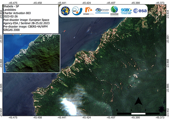
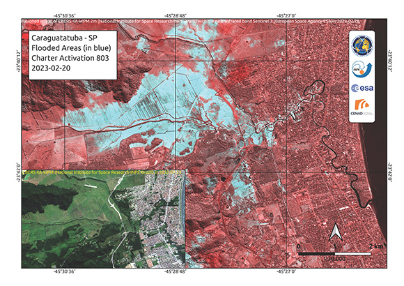
Heavy rains triggered floods and landslides in Brazil, killing at least 36 people. The hardest-hit regions have been Sao Sebastiao, Ubatuba, Ilhabela and Bertioga.
Entire neighbourhoods have been inundated in water with only roofs visible of some houses, while highways and roads remained cut off with fallen trees. Rescue workers are bracing for more heavy rains that will continue to lash Sao Paulo's coastal area, leading to difficult conditions for evacuations and rescue and relief work.
| Type of Event: | Landslide |
| Location of Event: | Brazil |
| Date of Charter Activation: | 2023-02-20 |
| Time of Charter Activation: | 17:06 |
| Time zone of Charter Activation: | UTC-03:00 |
| Charter Requestor: | CENAD |
| Activation ID: | 803 |
| Project Management: | Pedro Youssef (CENAD) |
| act-value-adders: | Laercio Massaru Namikawa (INPE) Tehrrie Konig (INPE) Renato Mendonca (SGB) Diogo Rodrigues Andrade Silva (SGB) Rodrigo Augusto Stabile (CEMADEN) Irving Rodrigues Souza (CEMADEN) |
Products
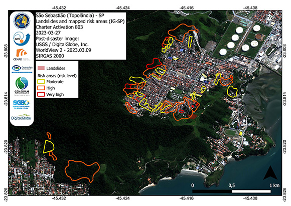
Landslides polygons and risk areas in Topolândia mapped by IG-SP
Copyright: © (2023) DigitalGlobe, Inc., Longmont CO USA 80503. DigitalGlobe and the DigitalGlobe logos are trademarks of DigitalGlobe, Inc. The use and/or dissemination of this data and/or of any product in any way derived there from are restricted. Unauthorized use and/or dissemination is prohibited.
Map produced by CENAD
Information about the Product
Acquired: 09/03/2023
Source: WorldView-2
Category: Reference Map
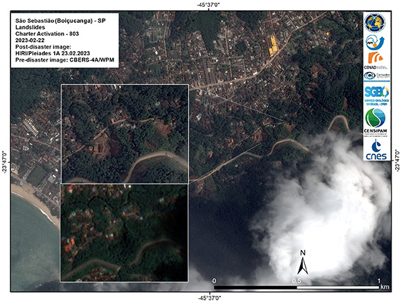
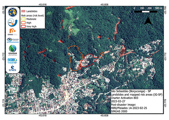
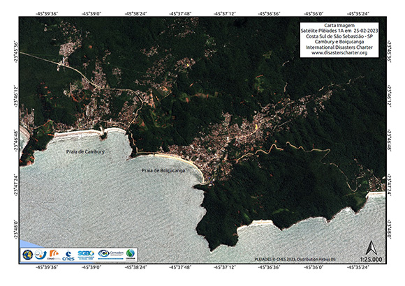
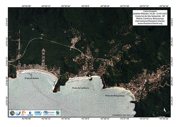
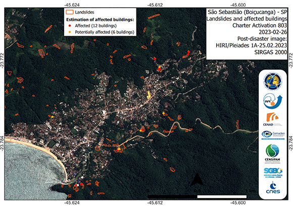
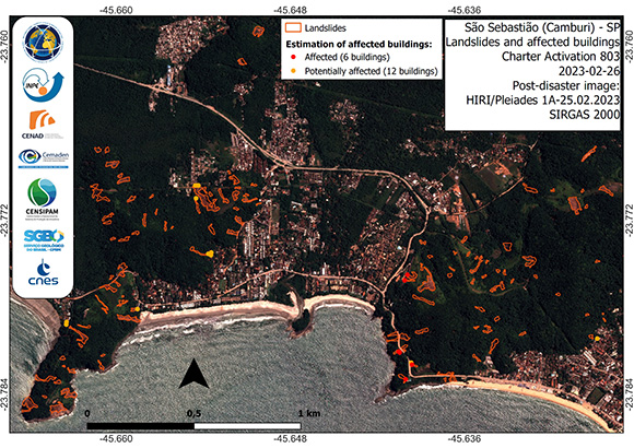
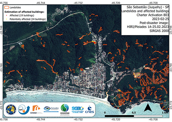
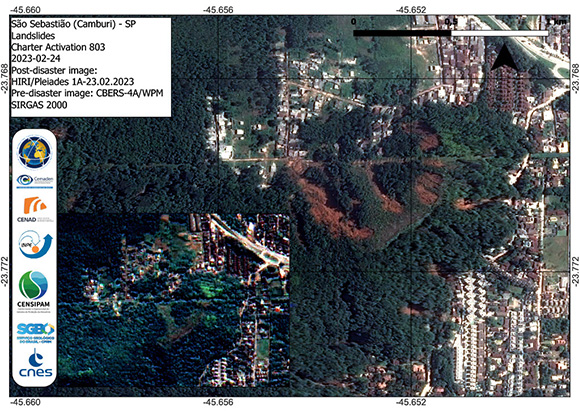
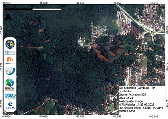
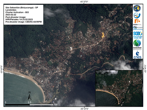
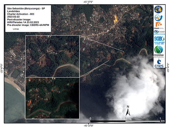
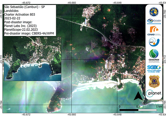
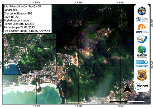
Landslides in São Sebastião (Boiçucanga/Camburi)
Copyright: ALOS-2 © JAXA (2011)
Includes Pleiades material © CNES (2023), Distribution Airbus DS.
Map produced by CENAD
Information about the Product
Acquired: ALOS-2: 08/02/2011
Pleiades: 25/02/2023
Source: ALOS-2 / Pleiades
Category: Delineation Map
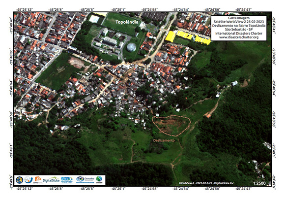
Landslide in Topolândia - São Sebastião
Copyright: © (2023) DigitalGlobe, Inc., Longmont CO USA 80503. DigitalGlobe and the DigitalGlobe logos are trademarks of DigitalGlobe, Inc. The use and/or dissemination of this data and/or of any product in any way derived there from are restricted. Unauthorized use and/or dissemination is prohibited.
Map produced by CENAD
Information about the Product
Acquired: 25/02/2023
Source: WorldView-3
Category: Delineation Map
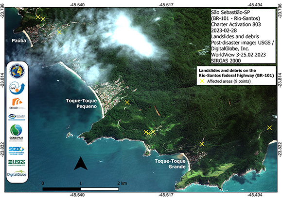
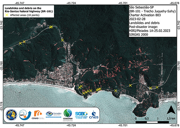
Landslides and debris on the Rio-Santos federal highway - Paúba and Toque-Toque Grande
Copyright: © (2023) DigitalGlobe, Inc., Longmont CO USA 80503. DigitalGlobe and the DigitalGlobe logos are trademarks of DigitalGlobe, Inc. The use and/or dissemination of this data and/or of any product in any way derived there from are restricted. Unauthorized use and/or dissemination is prohibited .
Map produced by CENAD
Information about the Product
Acquired: 25/02/2023
Source: WorldView-3
Category: Delineation Map
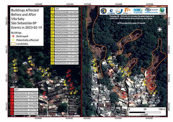
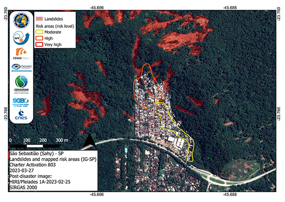
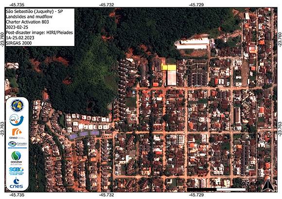
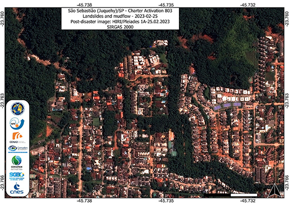
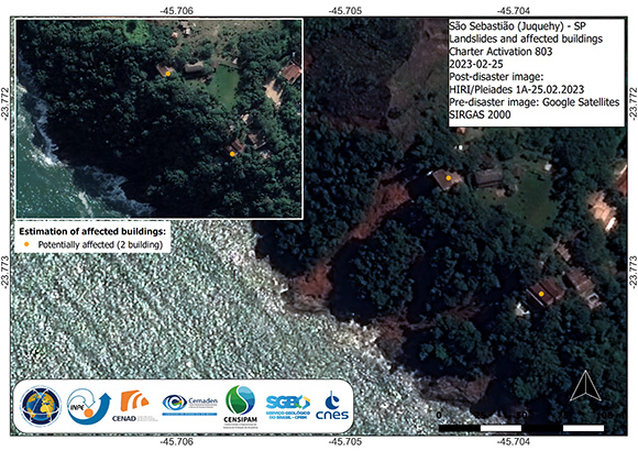
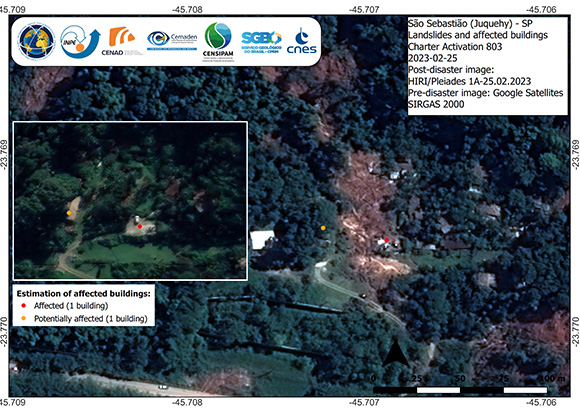
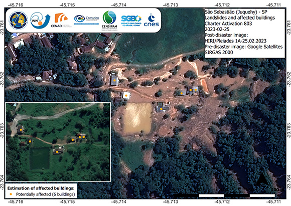
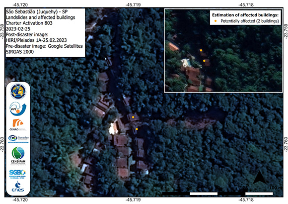
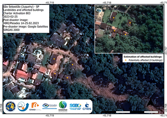
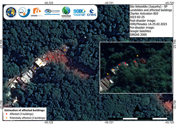
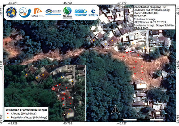
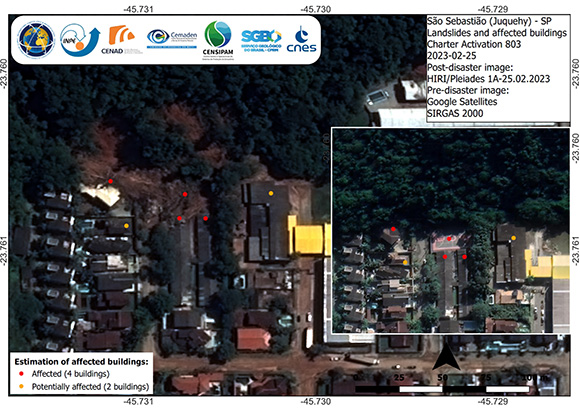
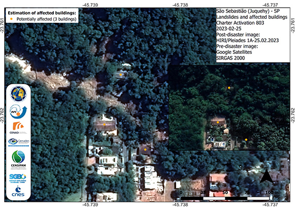
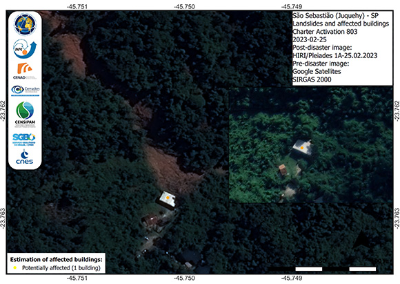
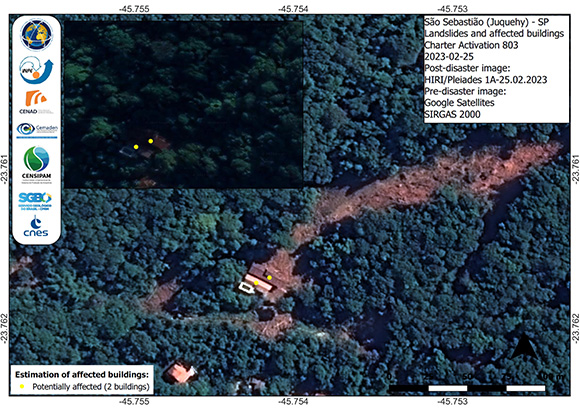
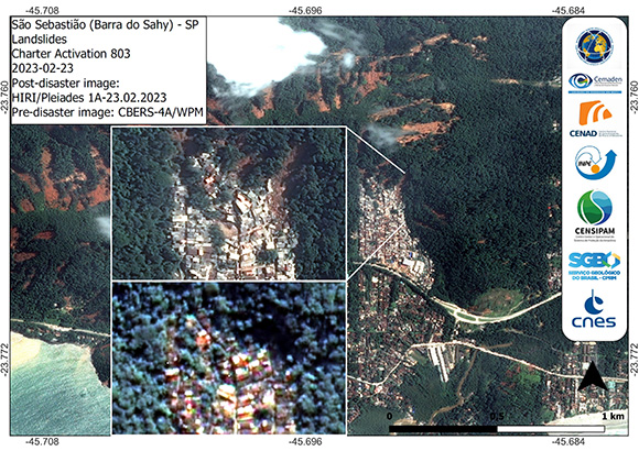
Buildings Affected Before and After Vila Sahy São Sebastião-São Paulo Events
Copyright: Google Satelite - Maxar Technologies
Includes Pleiades material © CNES (2023), Distribution Airbus DS.
Map produced by CENAD
Information about the Product
Acquired: 25/02/2023
Source: Pleiades
Category: Reference Map
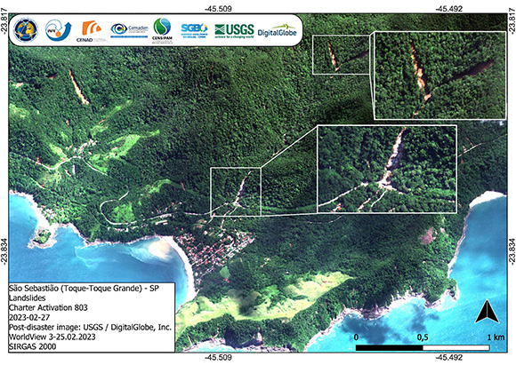
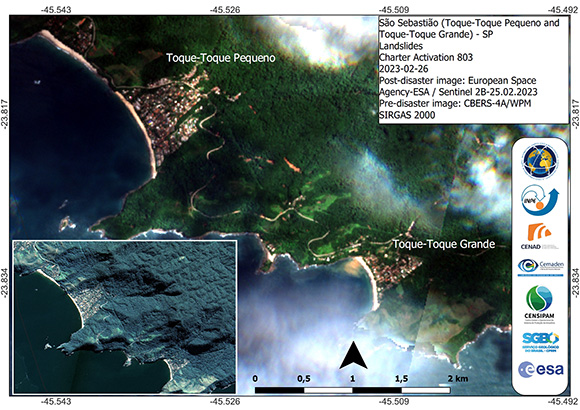
Landslides in Toque-Toque Grande - São Sebastião - São Paulo, Brazil
Copyright: © (2023) DigitalGlobe, Inc., Longmont CO USA 80503. DigitalGlobe and the DigitalGlobe logos are trademarks of DigitalGlobe, Inc. The use and/or dissemination of this data and/or of any product in any way derived there from are restricted. Unauthorized use and/or dissemination is prohibited.
Map produced by CENAD
Information about the Product
Acquired: 25/02/2023
Source: WorldView-3
Category: Delineation Map
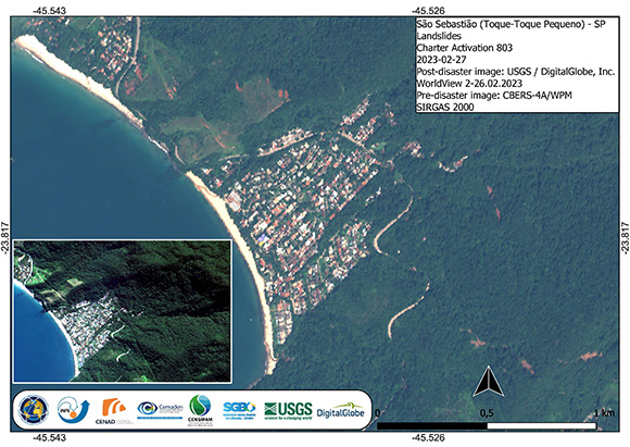
Landslides in Toque-Toque Pequeno - São Sebastião - São Paulo, Brazil
Copyright: WorldView-2 © (2023) DigitalGlobe, Inc., Longmont CO USA 80503. DigitalGlobe and the DigitalGlobe logos are trademarks of DigitalGlobe, Inc. The use and/or dissemination of this data and/or of any product in any way derived there from are restricted. Unauthorized use and/or dissemination is prohibited.
CBERS-4 © INPE (2023)
Map produced by CENAD
Information about the Product
Acquired: Post-disaster: 26/02/2023
Source: WorldView-2 / CBERS-4
Category: Reference Map
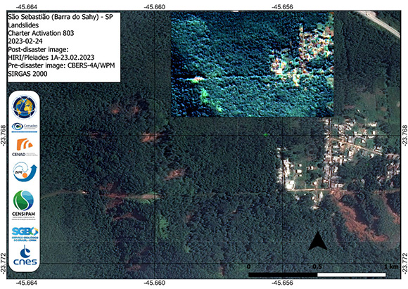
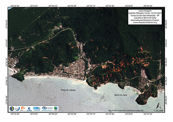
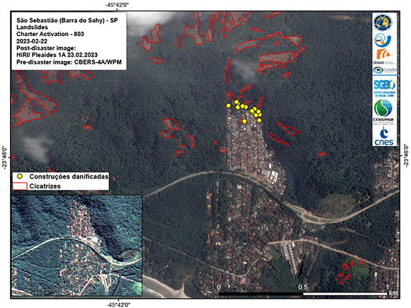
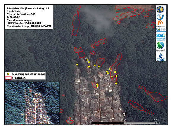
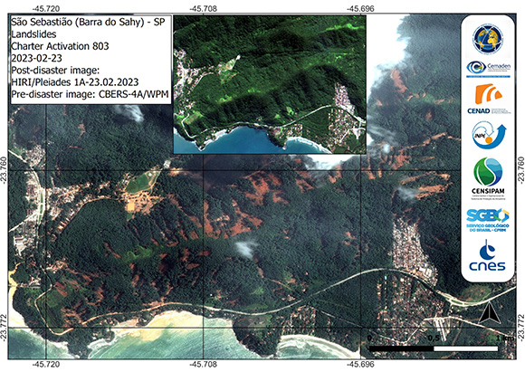
Area affected by landslides on the eastern side of Barra do Sahy - São Sebastião
Copyright: Includes Pleiades material © CNES (2023), Distribution Airbus DS.
CBERS-4 © INPE (2023)
Map produced by INPE
Information about the Product
Acquired: 23/02/2023
Source: Pleiades / CBERS-4
Category: Reference Map
 Back to the full activation archive

 English
 Spanish
 French
 Chinese
 Russian
 Portuguese

