Charter activations
Earthquake in Afghanistan
A magnitude 6.3 earthquake struck Afghanistan on 7 October forty kilometres west of Herat city, in the western Herat province - the third largest region in the country.
At least 2,400 casualties were reported with many more injured. Thousands of buildings were destroyed and heaps of rubble and debris can be found in place of where villages used to be. International aid groups are doing all they can to provide survivors with medical care, food, water and shelter.
The country was later hit with two more earthquakes, north of Herat, on 11 and 16 October, both of which also had a magnitude of 6.3. More than 100 people were injured and more buildings destroyed.
The closest hospital in the area is running at full capacity therefore some patients are having to be moved to other private healthcare facilities within the city. Unicef has reported that 90% of fatalities from the earthquakes were women and children. Afghanisation, one of Asia's poorest countries, is a war-ravaged nation already striken by an economic crisis thus these earthquakes have been devastating. The true extent of damage is still not fully known.
Related News and Resources
| Type of Event: | Earthquake |
| Location of Event: | Afghanistan |
| Date of Charter Activation: | 2023-10-08 |
| Time of Charter Activation: | 19:12 |
| Time zone of Charter Activation: | UTC+07:00 |
| Charter Requestor: | UNITAR on behalf of United Nations Office for the Coordination of Humanitarian Affairs (OCHA) |
| Activation ID: | 843 |
| Project Management: | Suwanan Sateiandee (UNOSAT) |
| act-value-adders: | Angsana Chaksan (Geoinformatics Center – Asian Institute of Technology (GIC-AIT)) |
Products
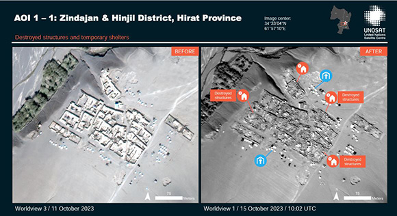
Preliminary satellite-derived damage assessment of the Zindajan and Hinjil Districts, Herat Province, Afghanistan
Download the Full Report
Copyright: WorldView-1 © (2023) DigitalGlobe, Inc., Longmont CO USA 80503.
DigitalGlobe and the DigitalGlobe logos are trademarks of DigitalGlobe, Inc. The use and/or dissemination of this data and/or of any product in any way derived there from are restricted. Unauthorized use and/or dissemination is prohibited.
Includes Pleiades material © Airbus DS (2023).
JILIN-1 © Chang Guang Satellite Technology Co., Ltd.
Report produced by UNITAR/UNOSAT.
Information about the Product
Acquired: WorldView-1: 11/10/2023 and 15/10/2023
Pleiades: 09/10/2023
JILIN-1: 09/10/2023
Source: WorldView-1, Pleiades and JILIN-1
Category: Reference Map
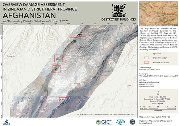
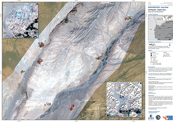
Damage Assessment in Zindajan District, Herat Province
Download the Full Report
Copyright: © 2004 GeoEye NextView License
Includes Pleiades material © CNES (2023), Distribution Airbus DS.
Map produced by the Asian Institute of Technology (GIC-AIT).
Information about the Product
Acquired: GeoEye-1: 15/08/2021
Pleiades: 09/10/2023
Source: GeoEye-1 and Pleiades
Category: Reference Map
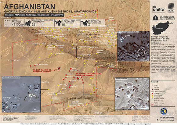
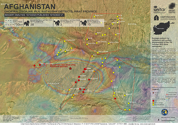
Damage analysis of settlements in Ghoryan, Zindajan, Injil and Kushk district, following the Herat earthquake
Copyright: WorldView © (2023) DigitalGlobe, Inc., Longmont CO USA 80503.
DigitalGlobe and the DigitalGlobe logos are trademarks of DigitalGlobe, Inc. The use and/or dissemination of this data and/or of any product in any way derived there from are restricted. Unauthorized use and/or dissemination is prohibited.
Map produced by UNITAR/UNOSAT.
Information about the Product
Acquired: 11/10/2023
Source: WorldView-1 and WorldView-3
Category: Reference Map
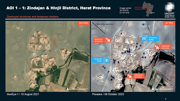
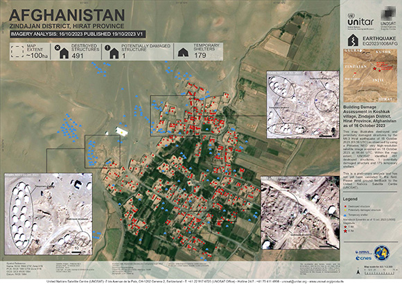
Preliminary satellite-derived damage assessment for the earthquake in the Zindajan and Injil Districts, Herat Province, Afghanistan
Download the Full Report
Copyright: Includes Pleiades material © CNES (2023), Distribution Airbus DS.
Report produced by UNOSAT/UNITAR.
Information about the Product
Acquired: 09/10/2023
Source: Pleiades
Category: Reference Map
 Back to the full activation archive

 English
 Spanish
 French
 Chinese
 Russian
 Portuguese
