 English
 Spanish
 French
 Chinese
 Russian
 Portuguese
 Latest Activation
Charter activations
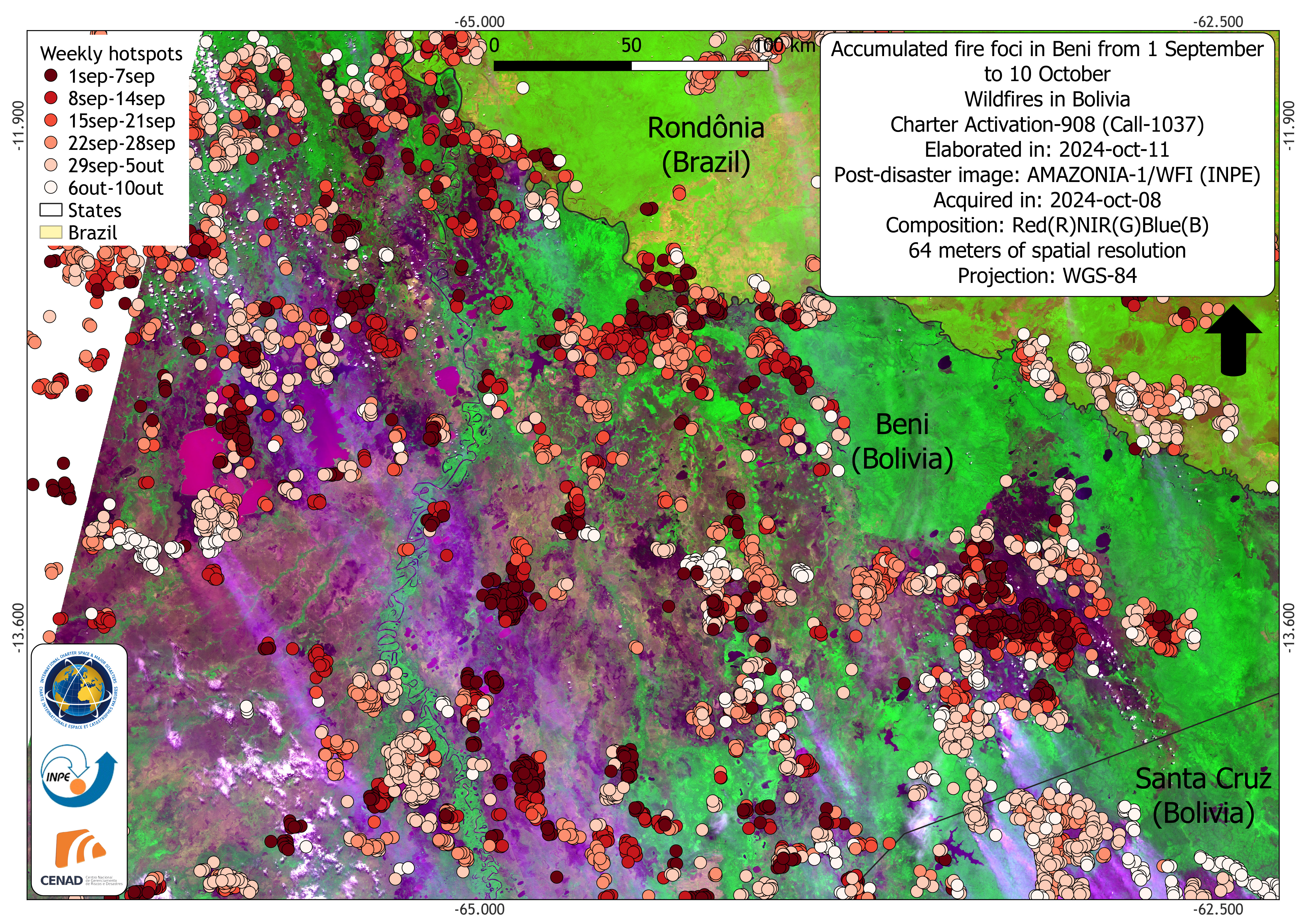
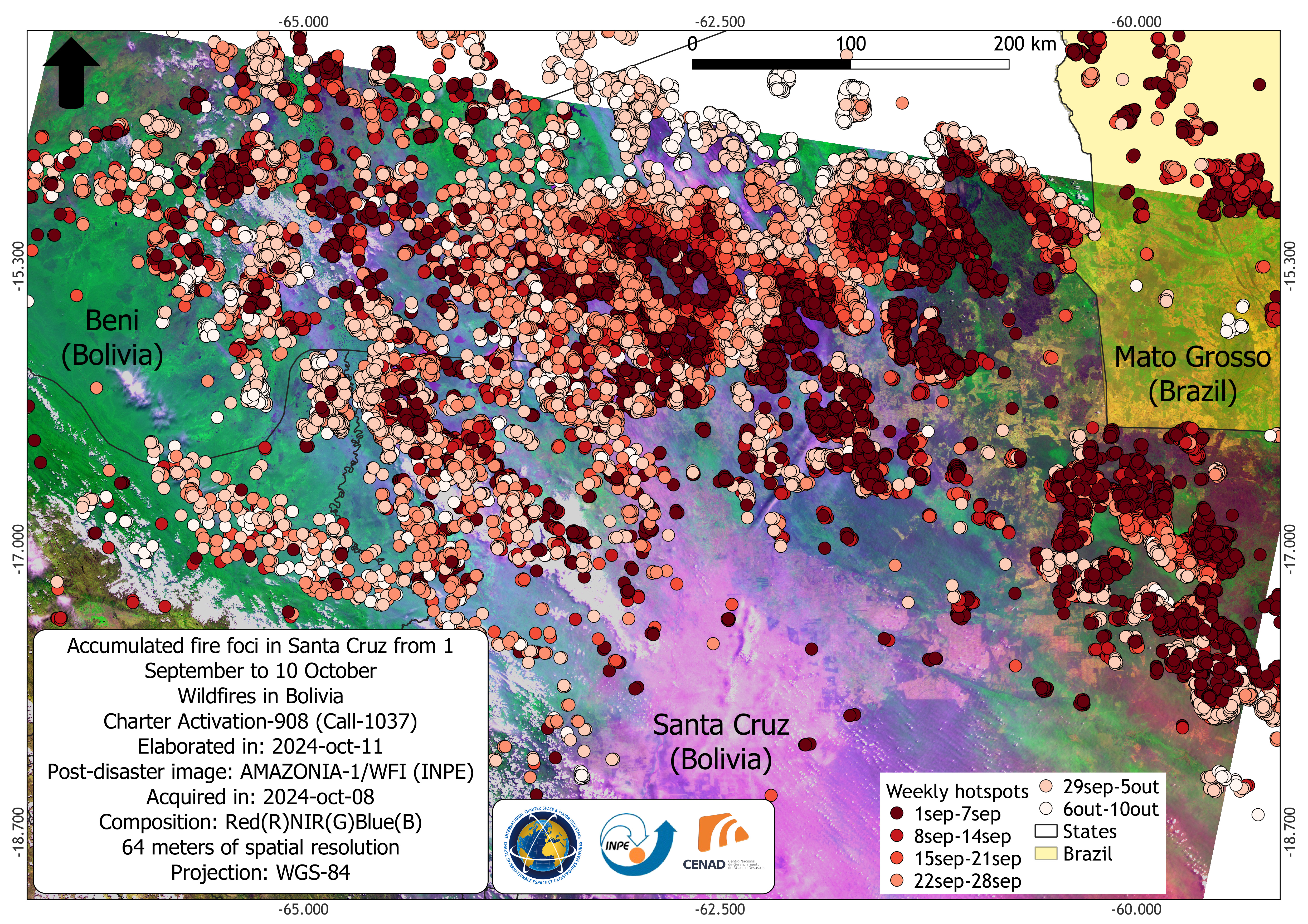
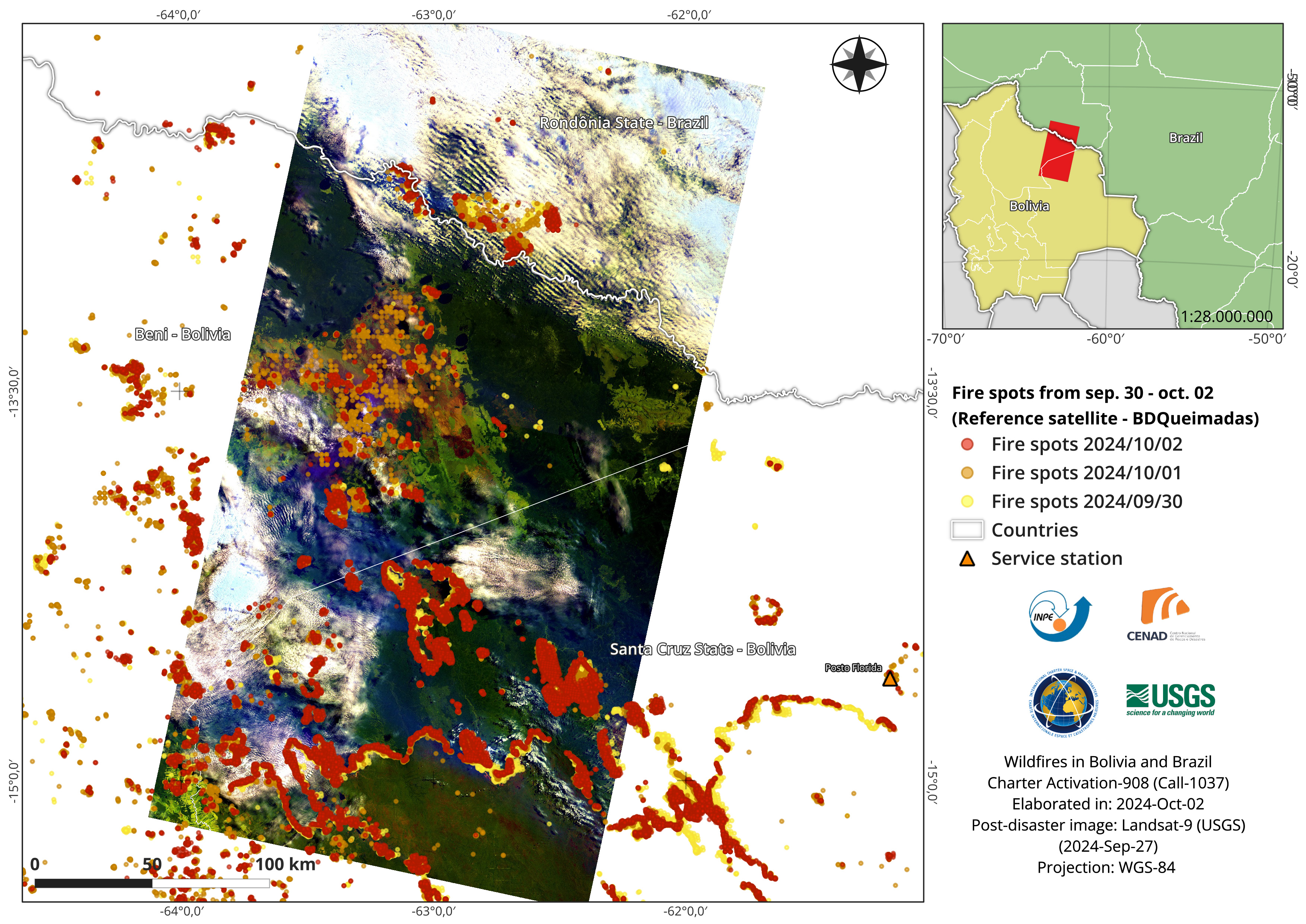
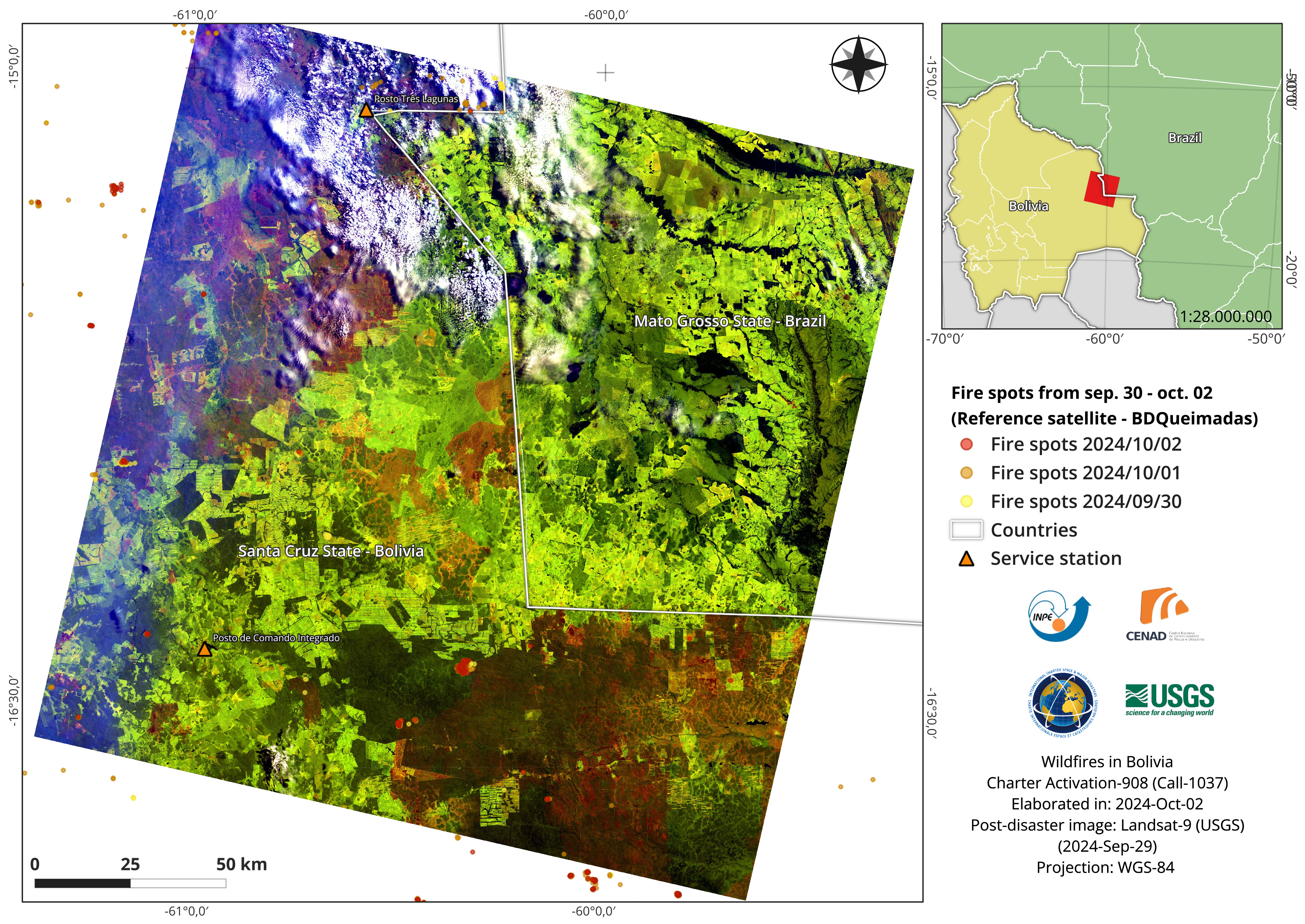
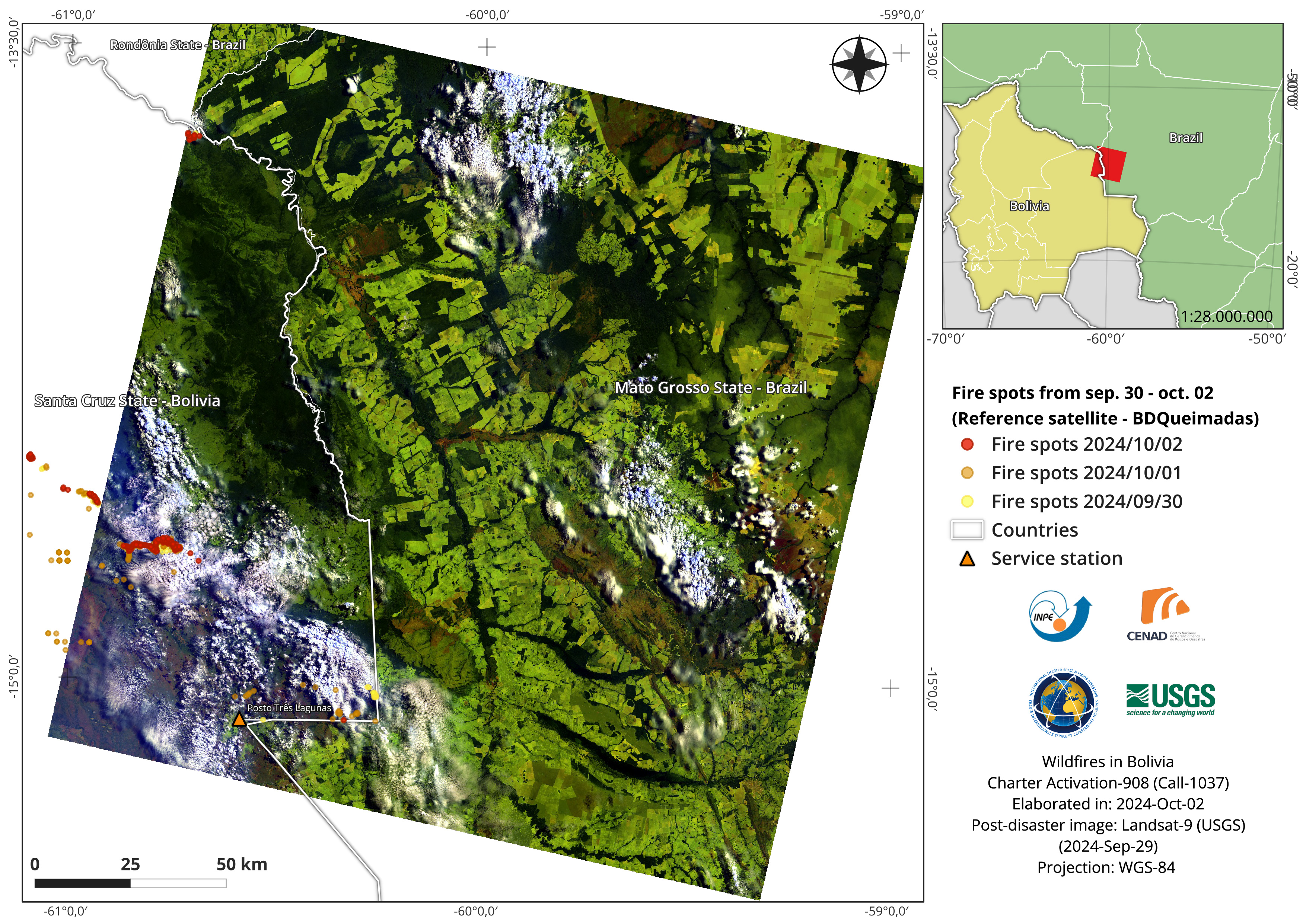
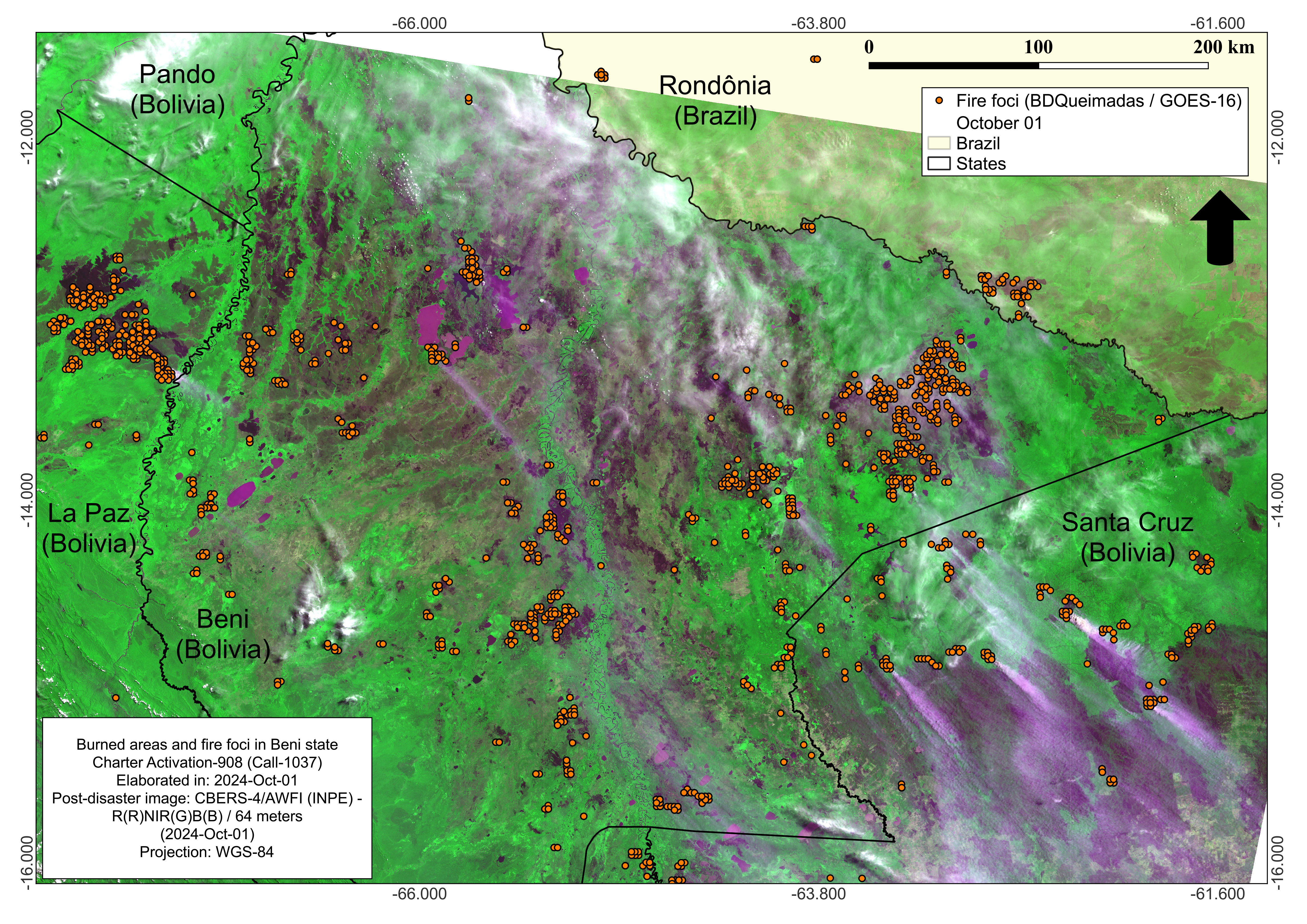
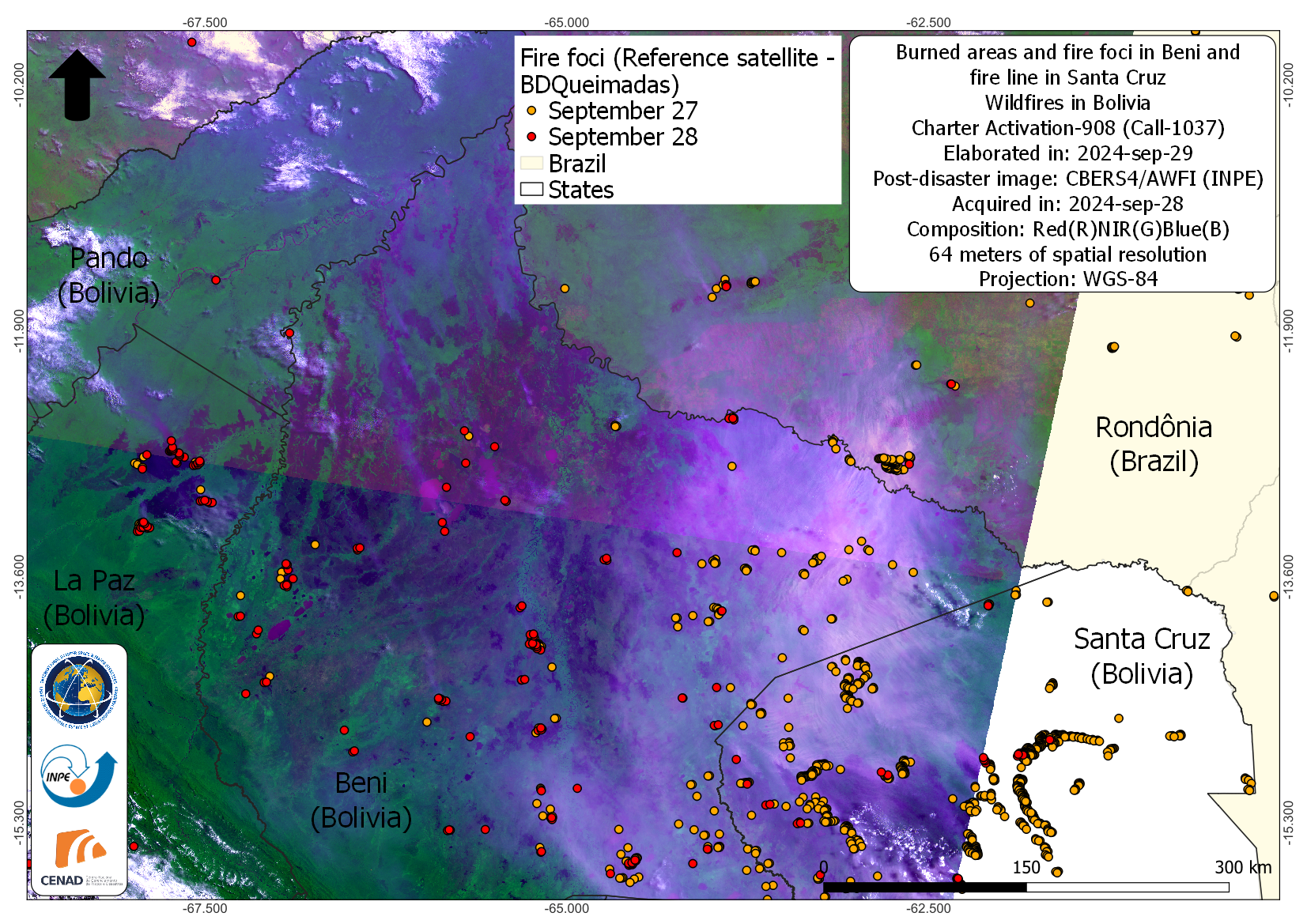
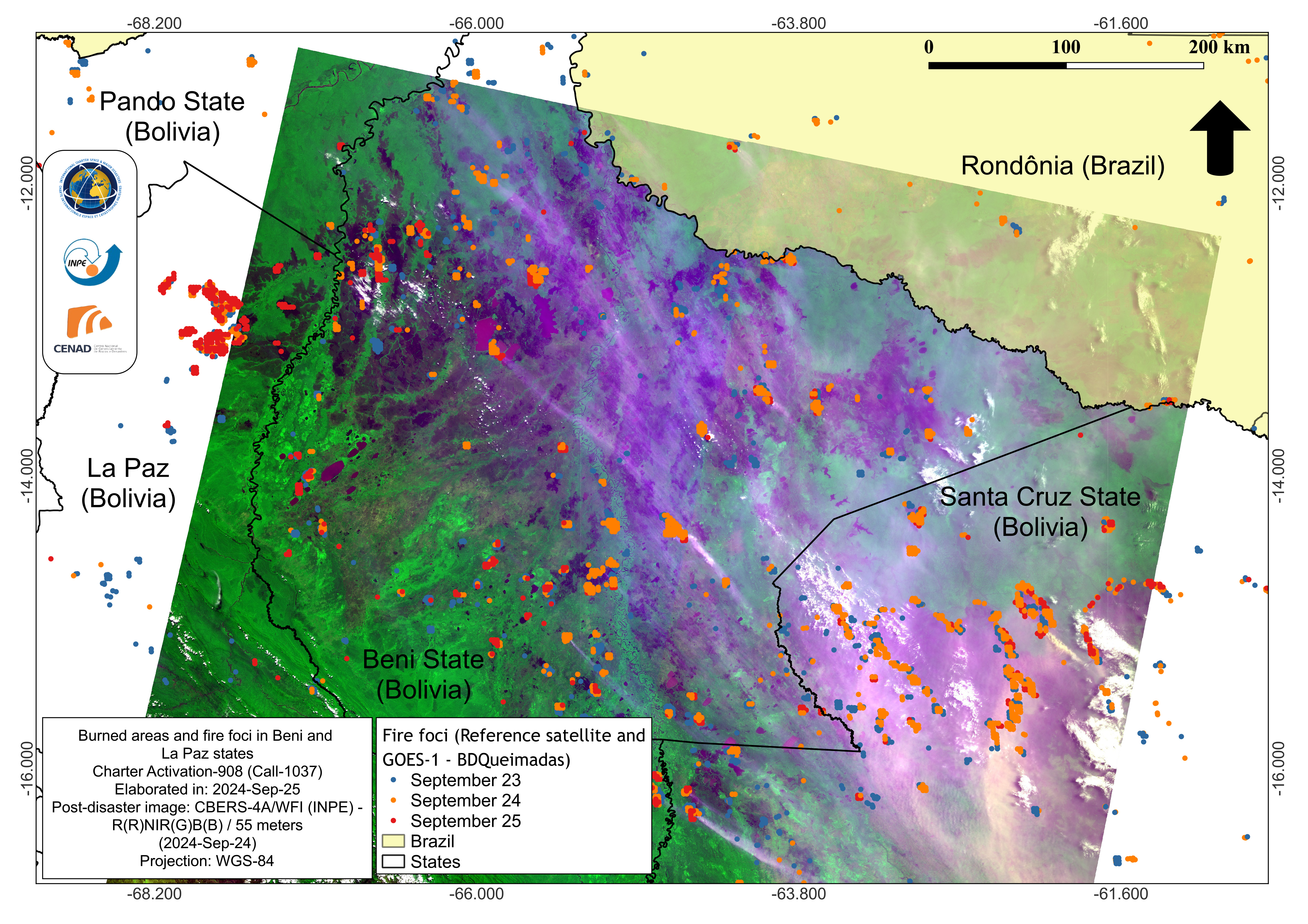
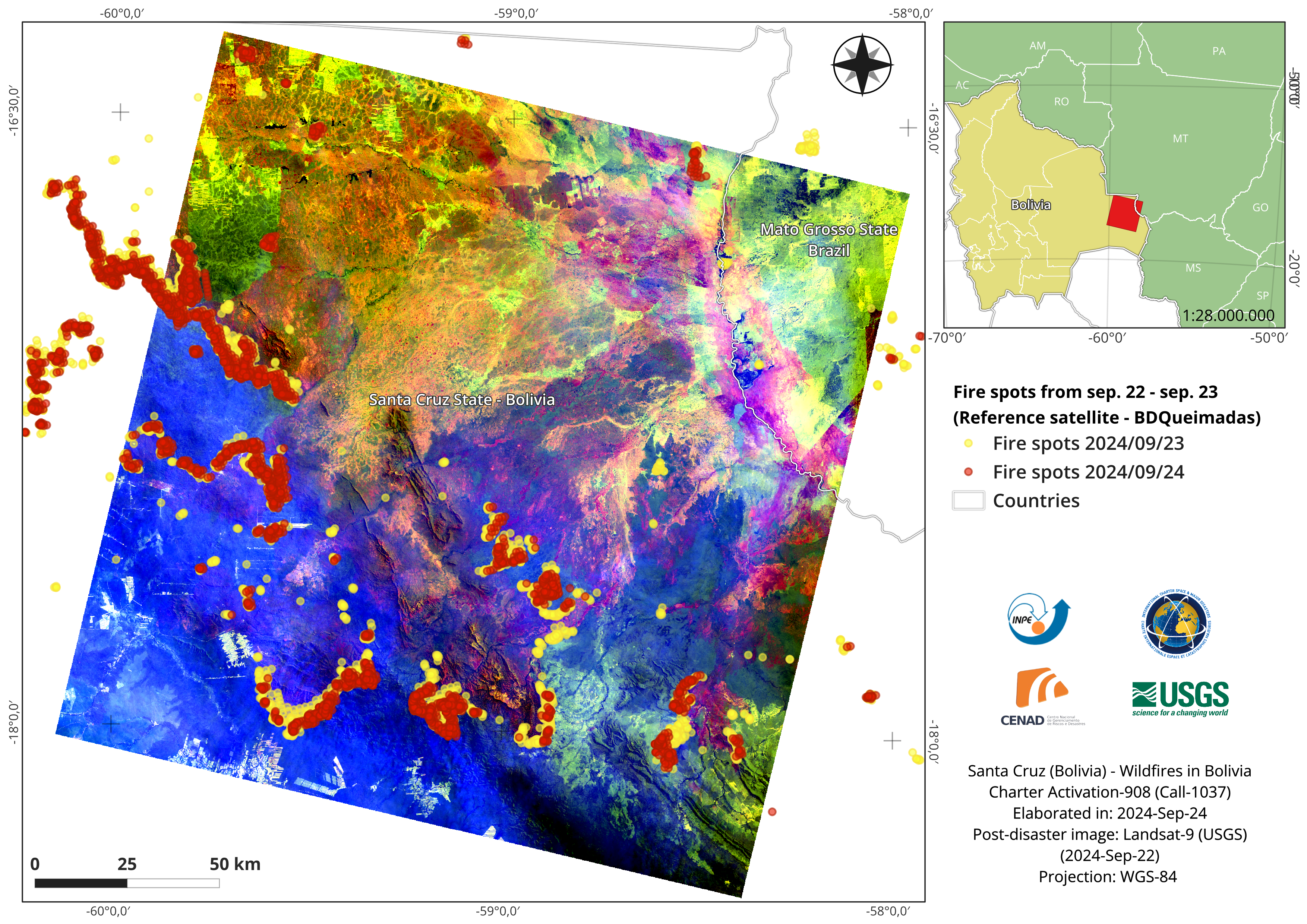
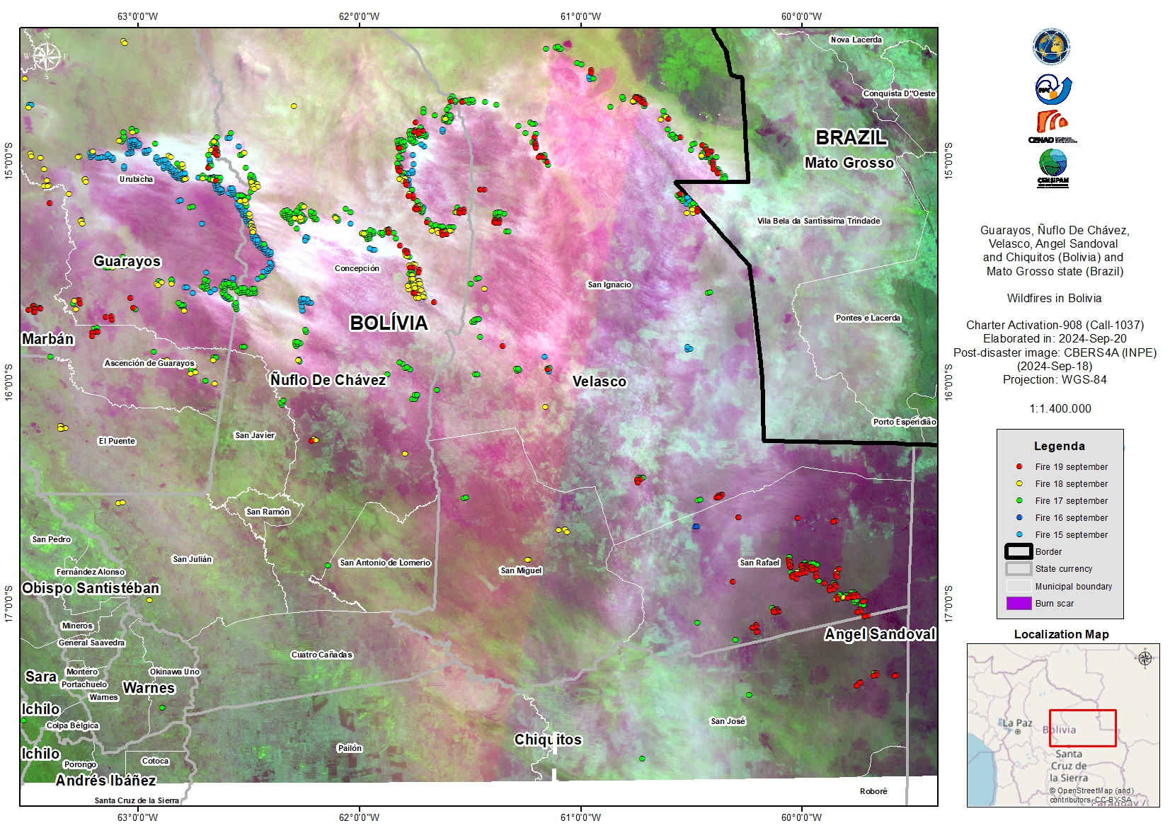
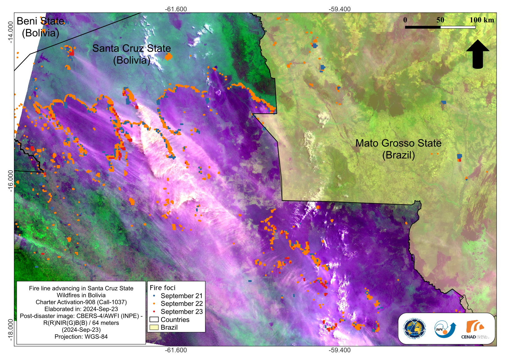
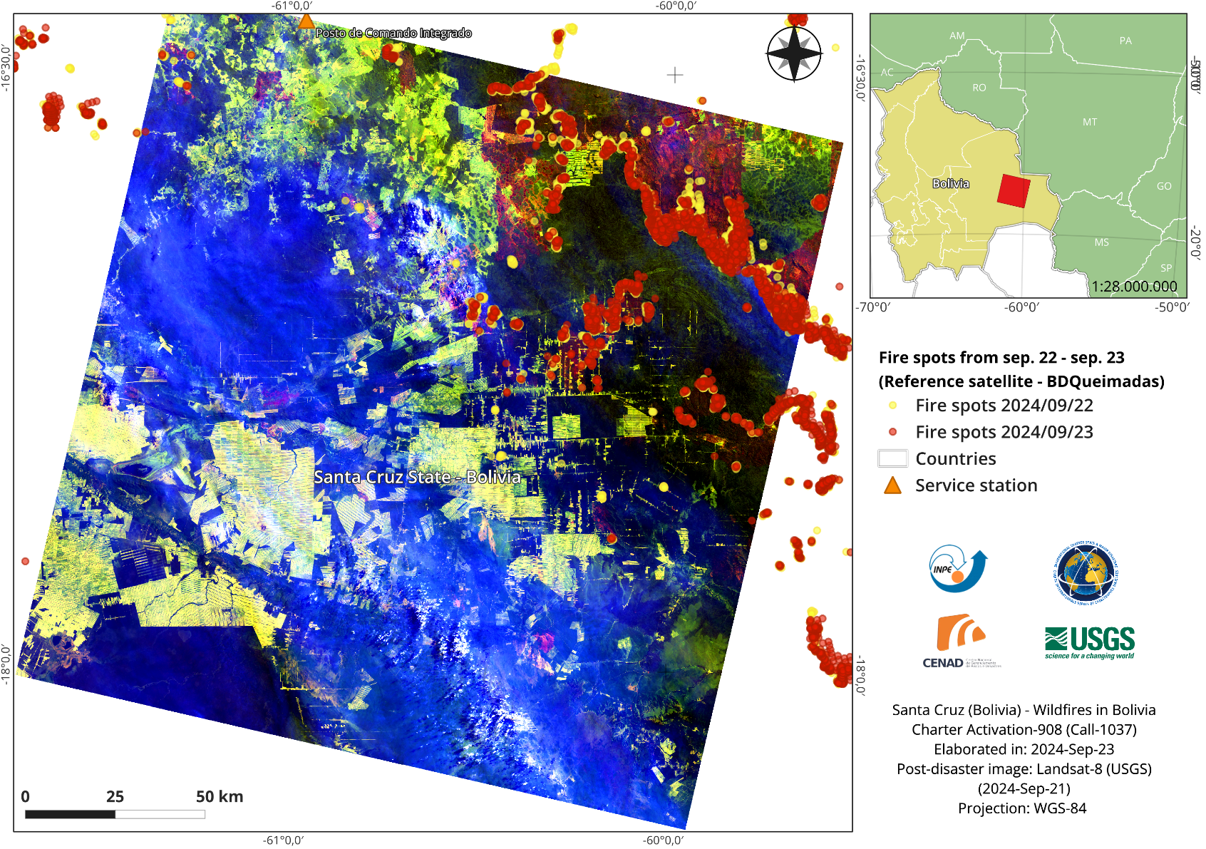
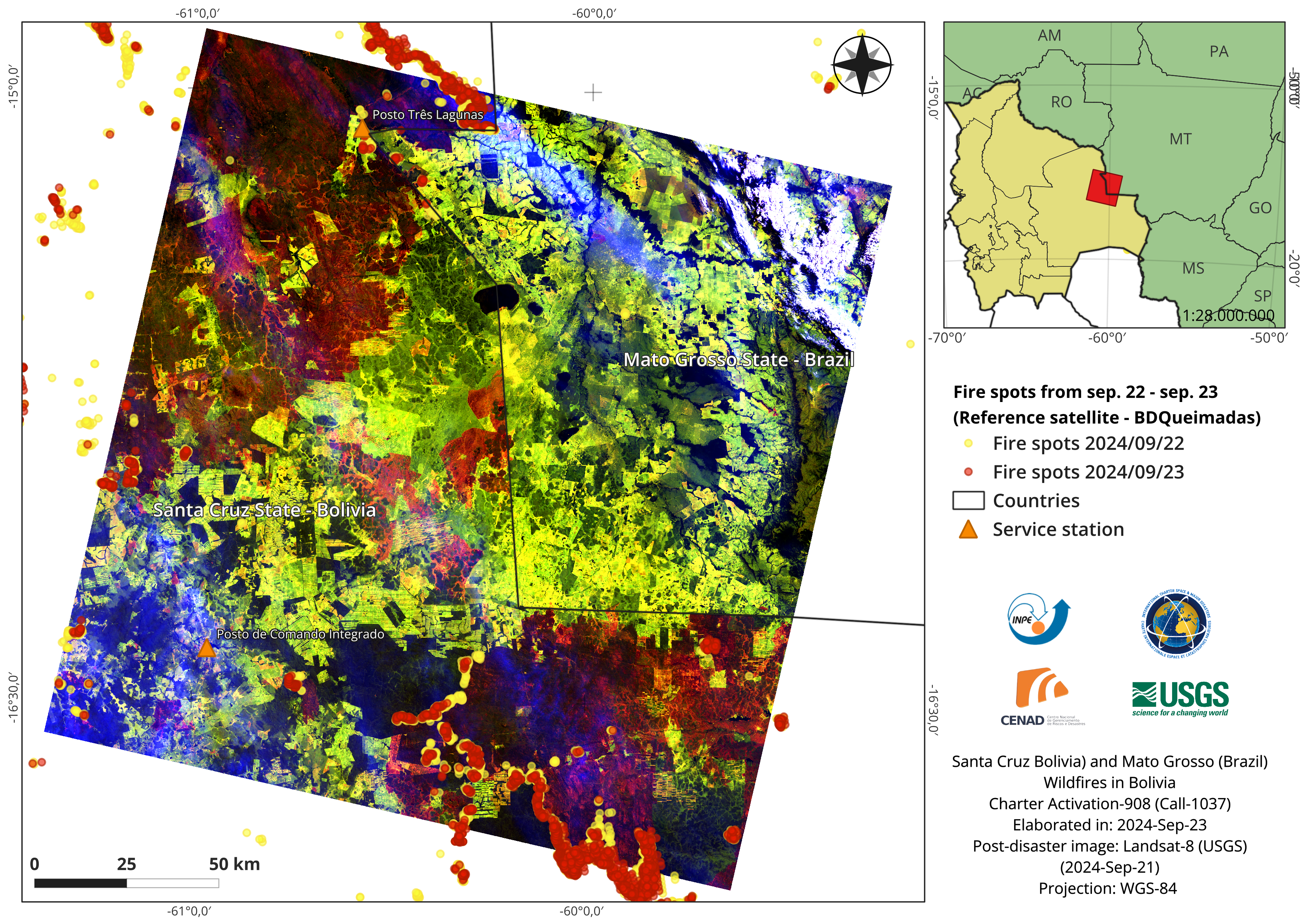
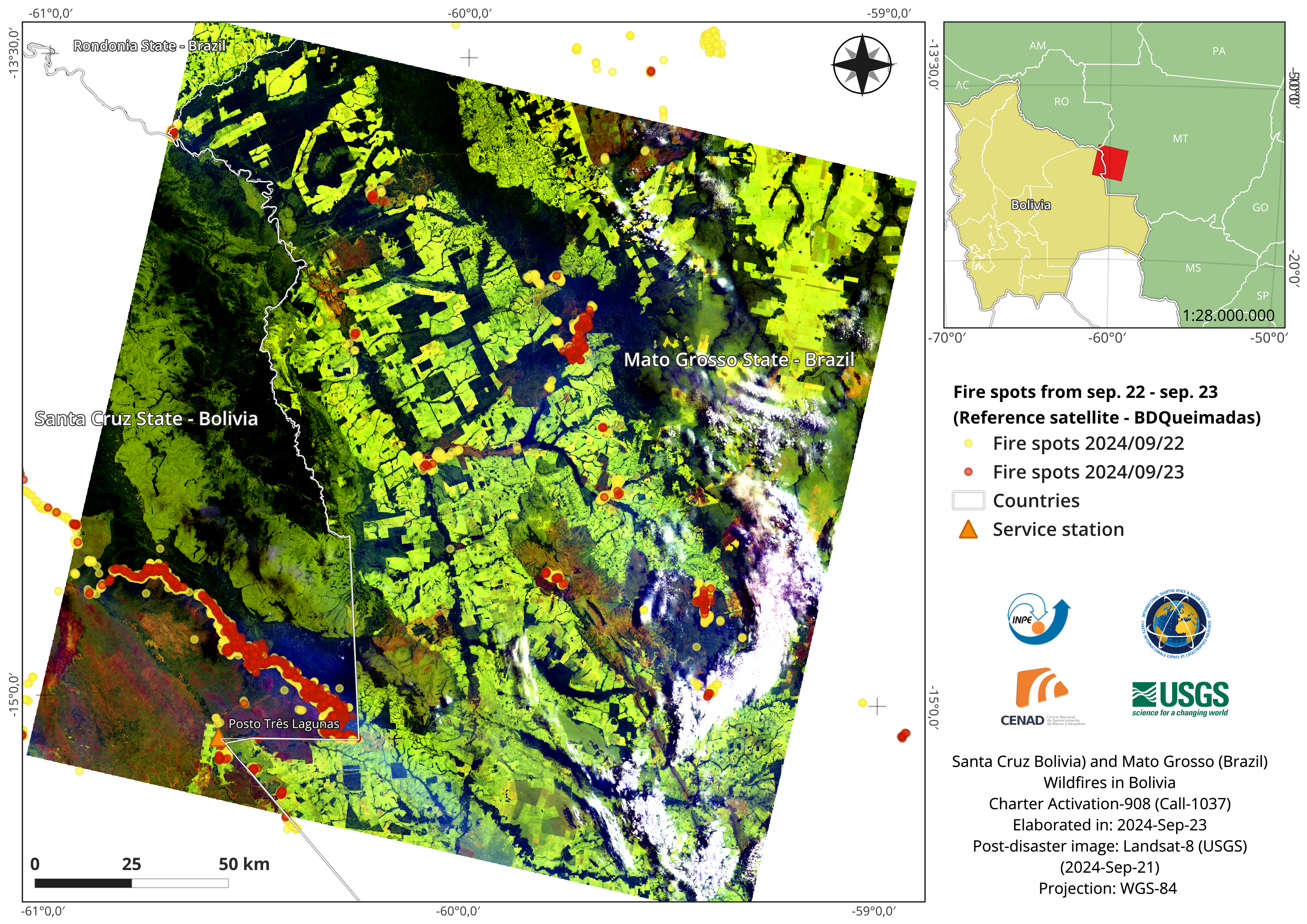
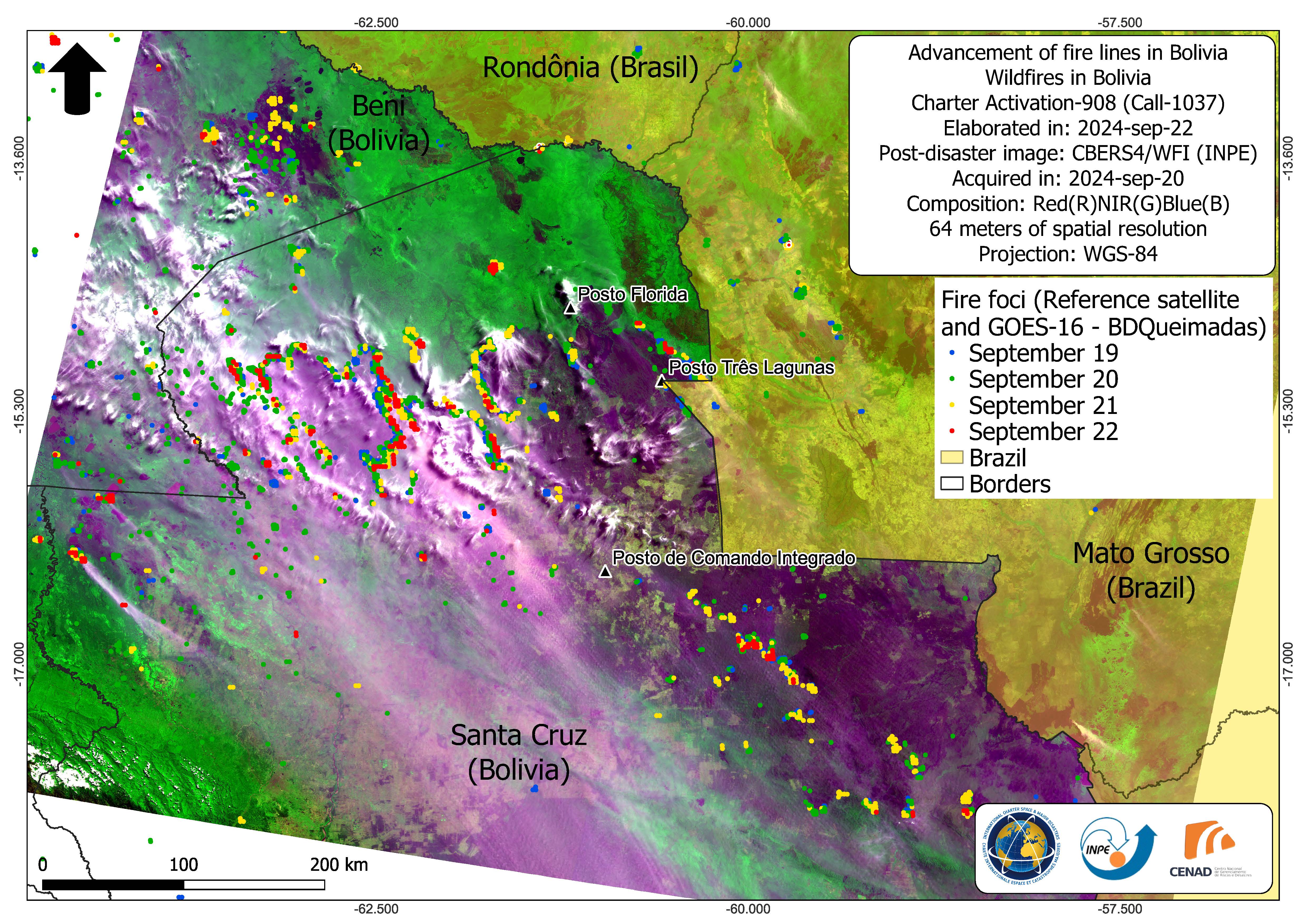
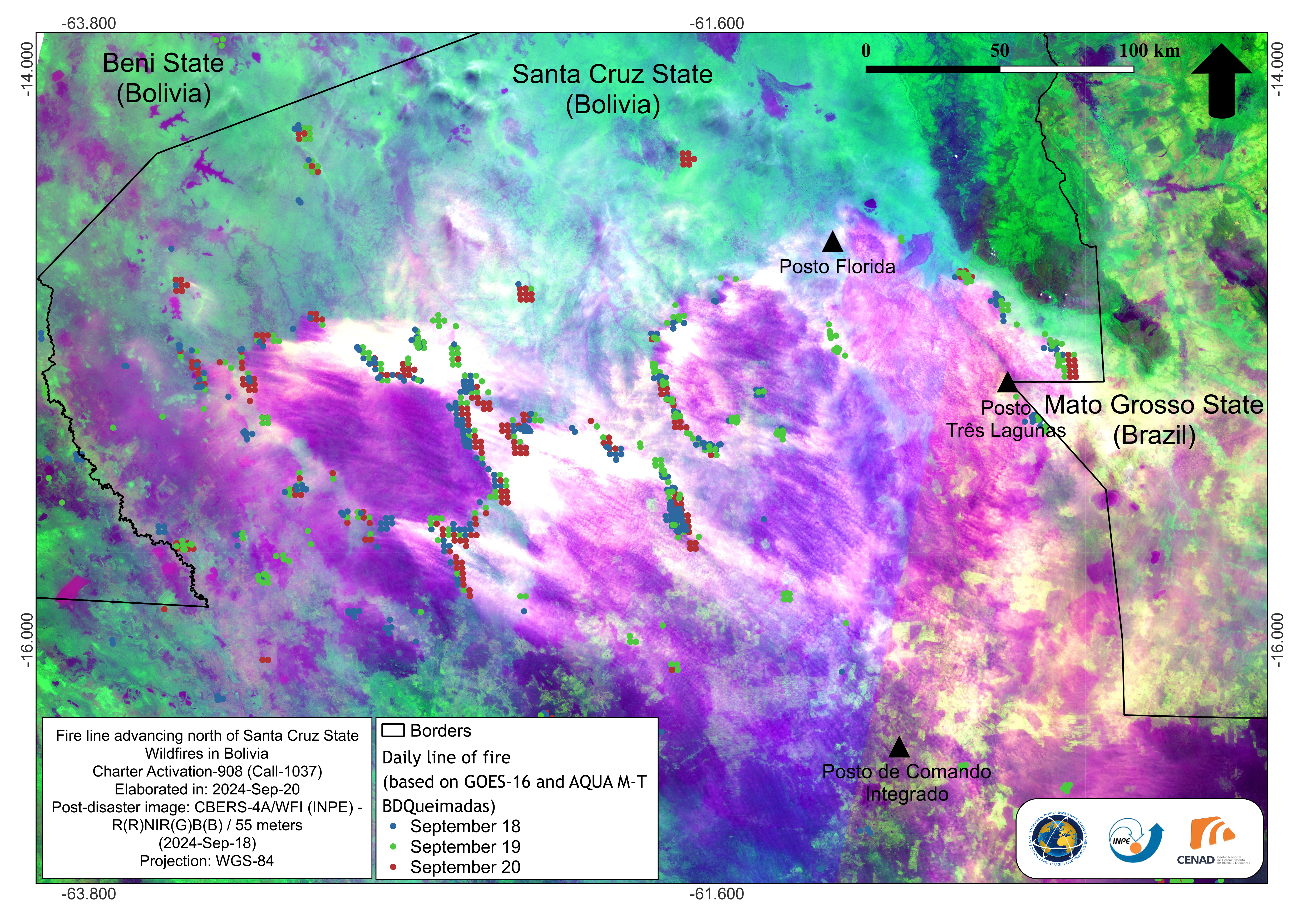
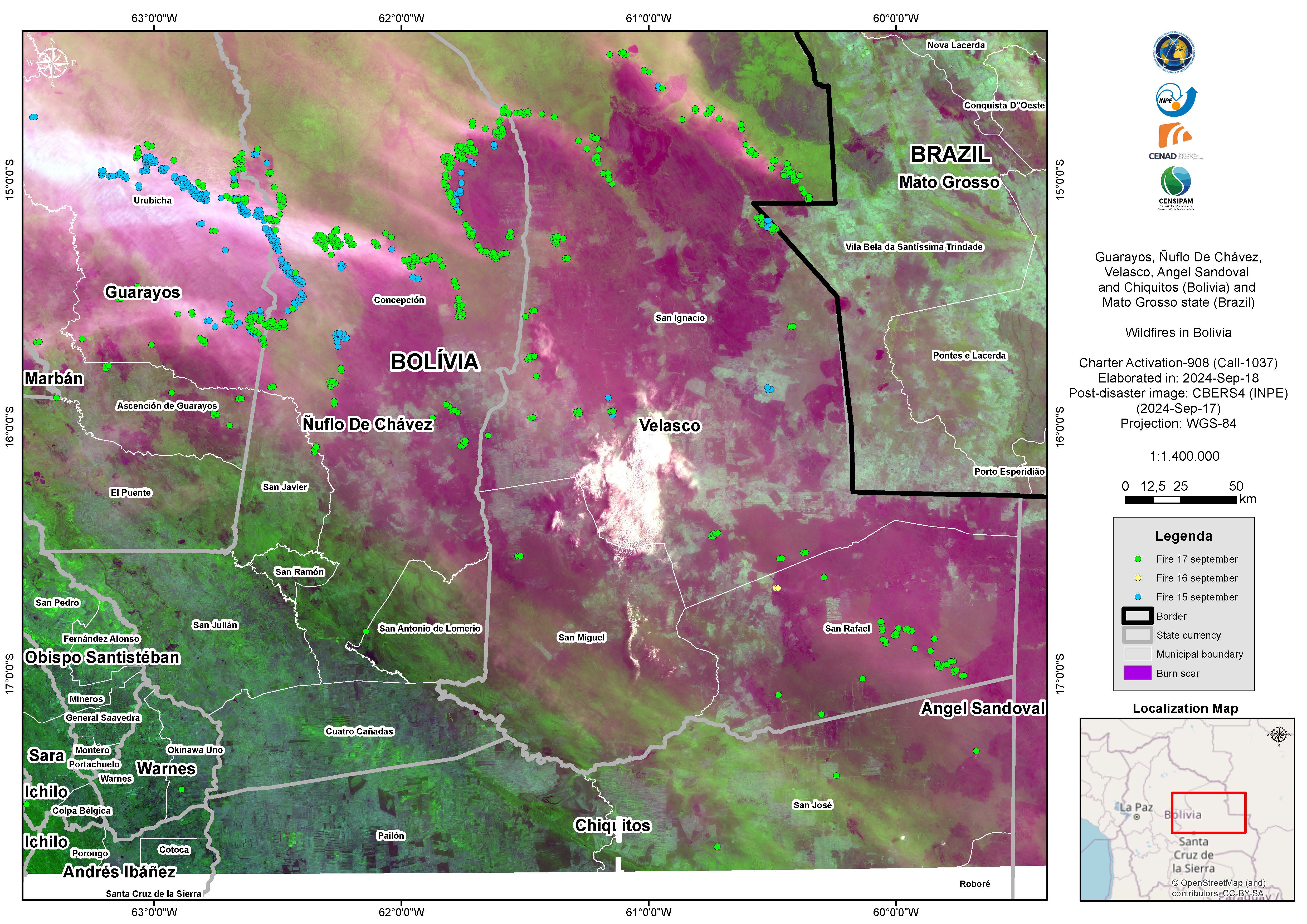
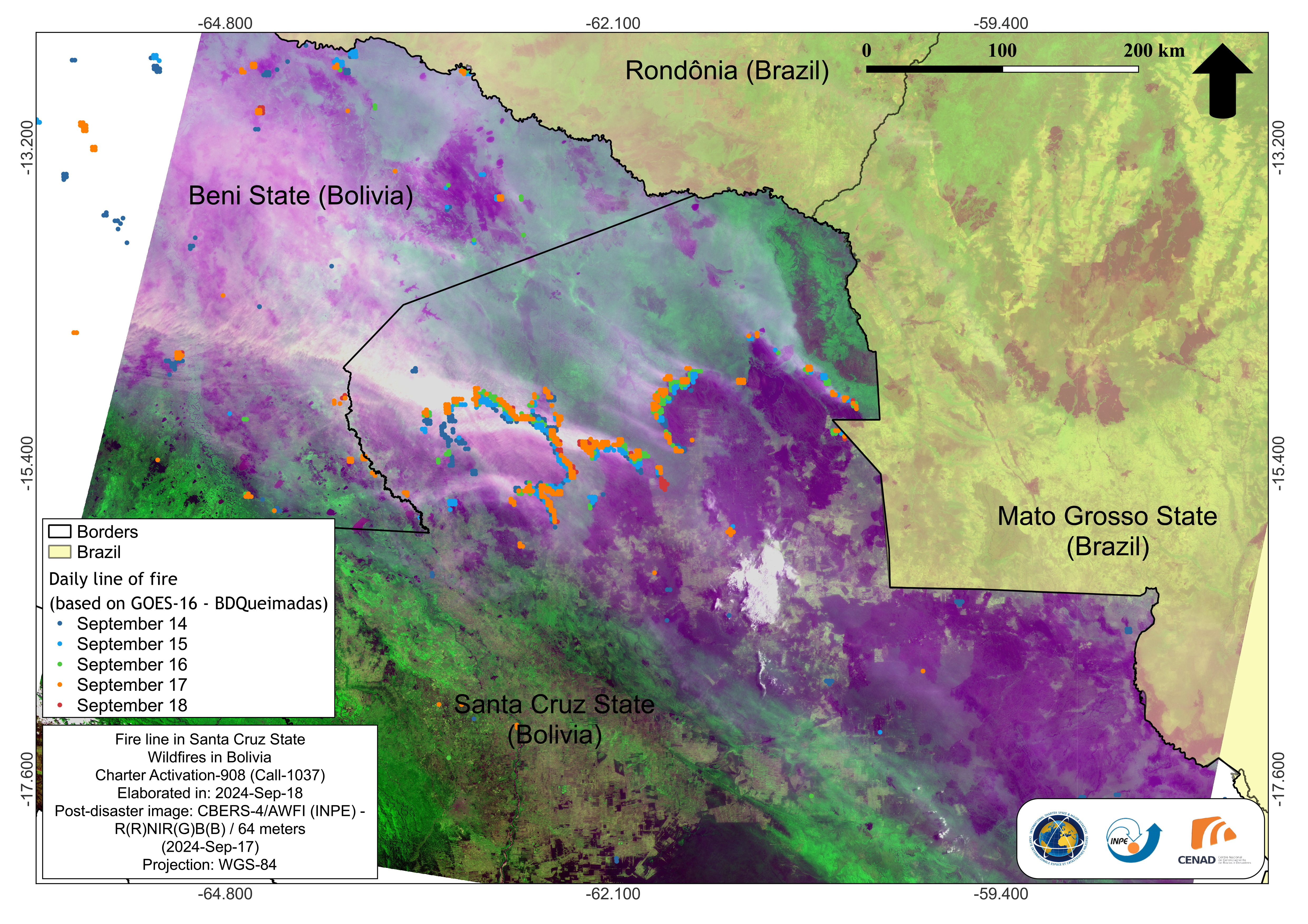
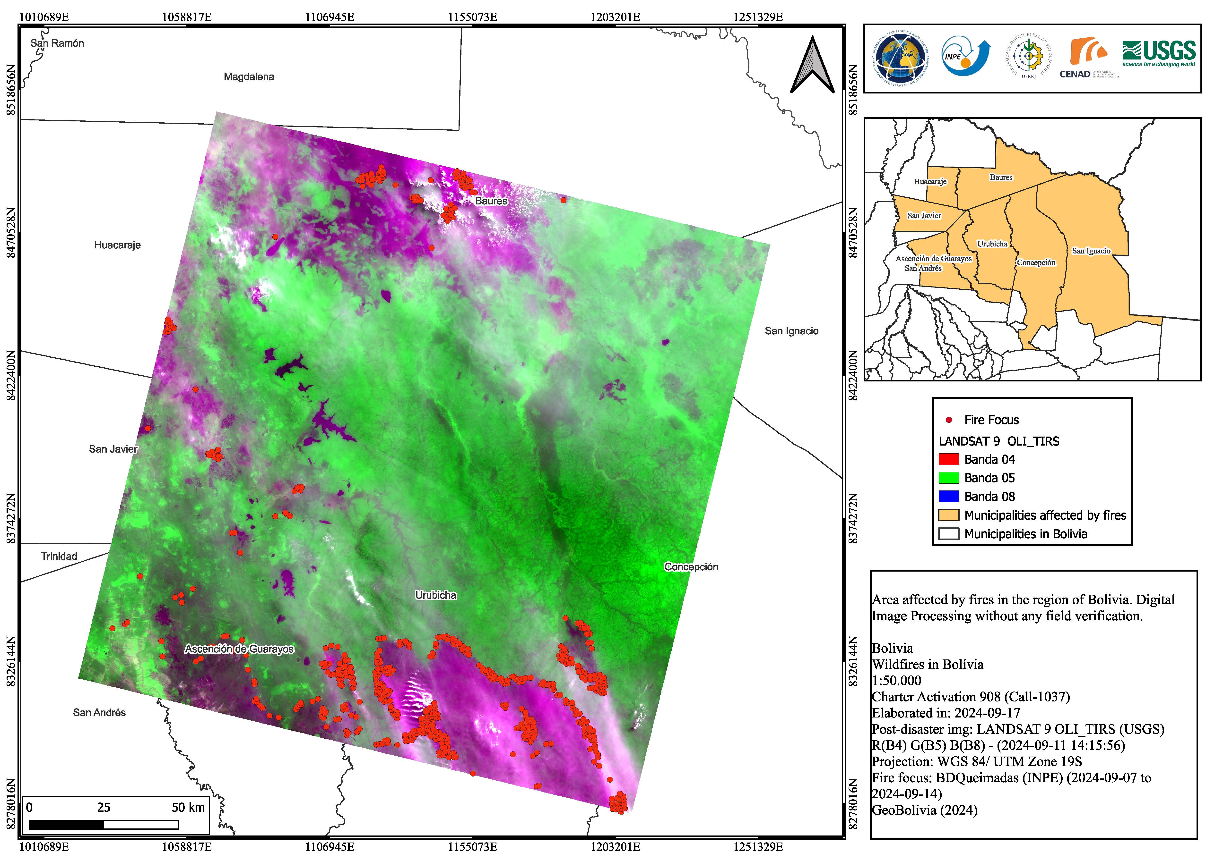
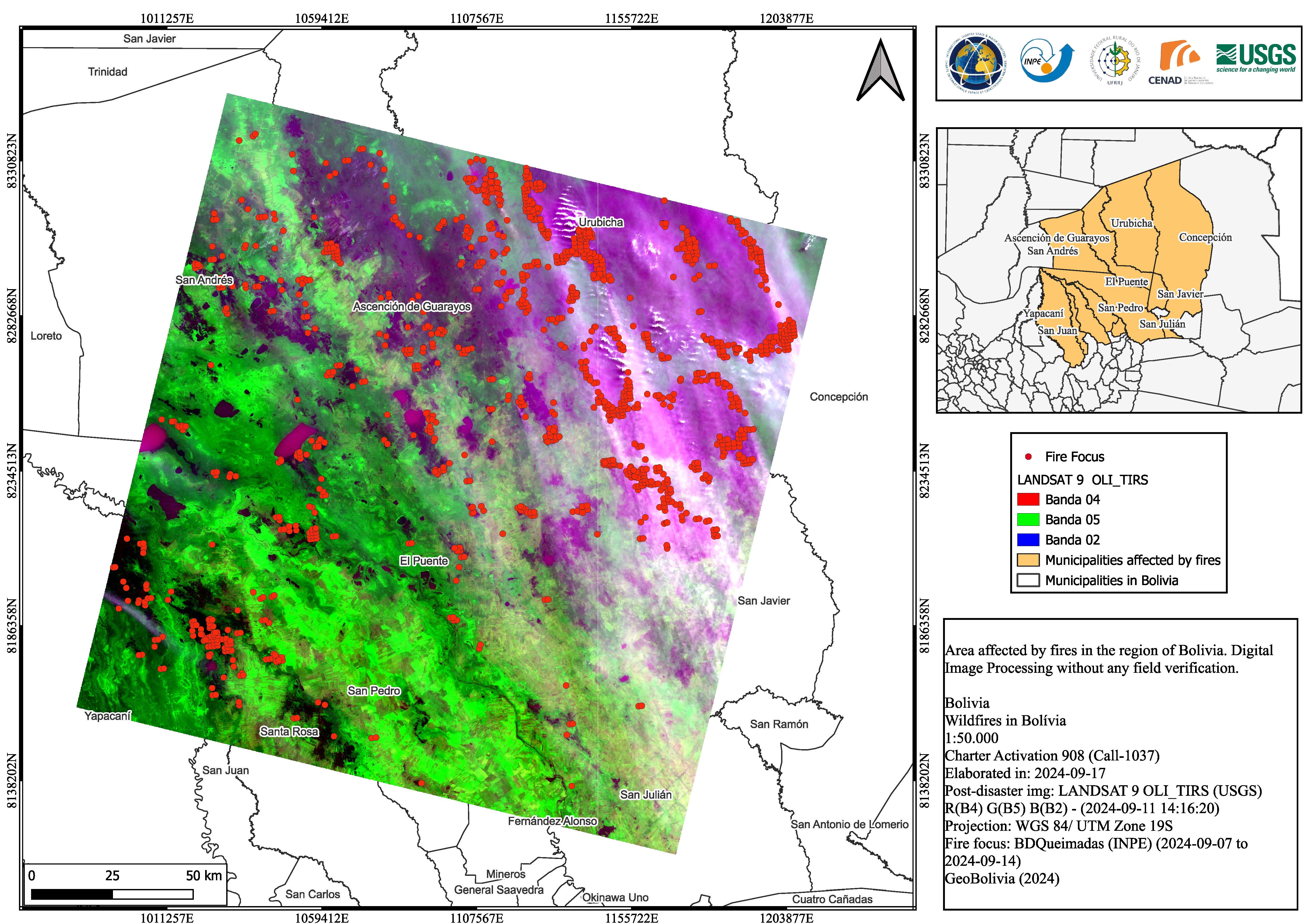
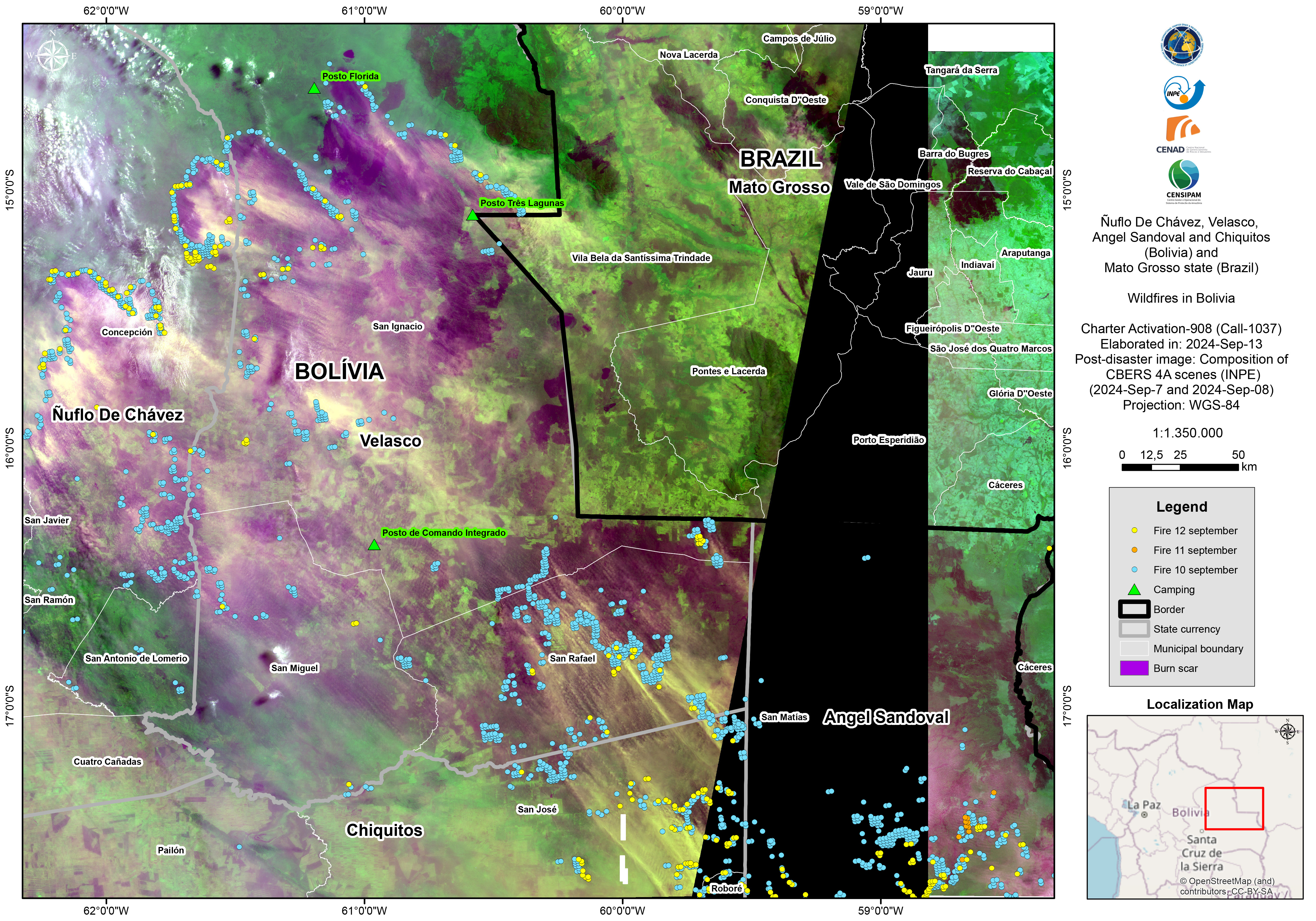
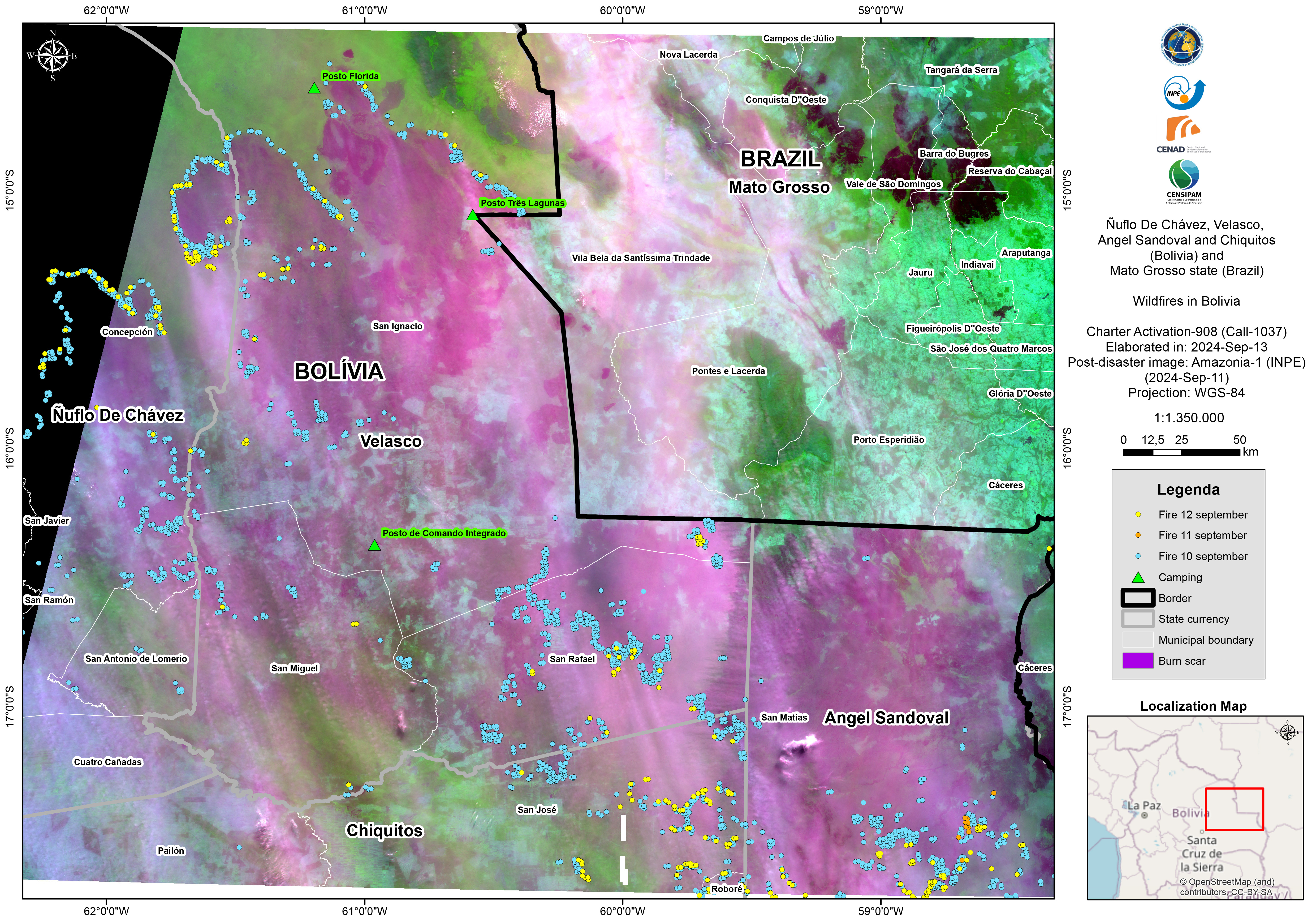
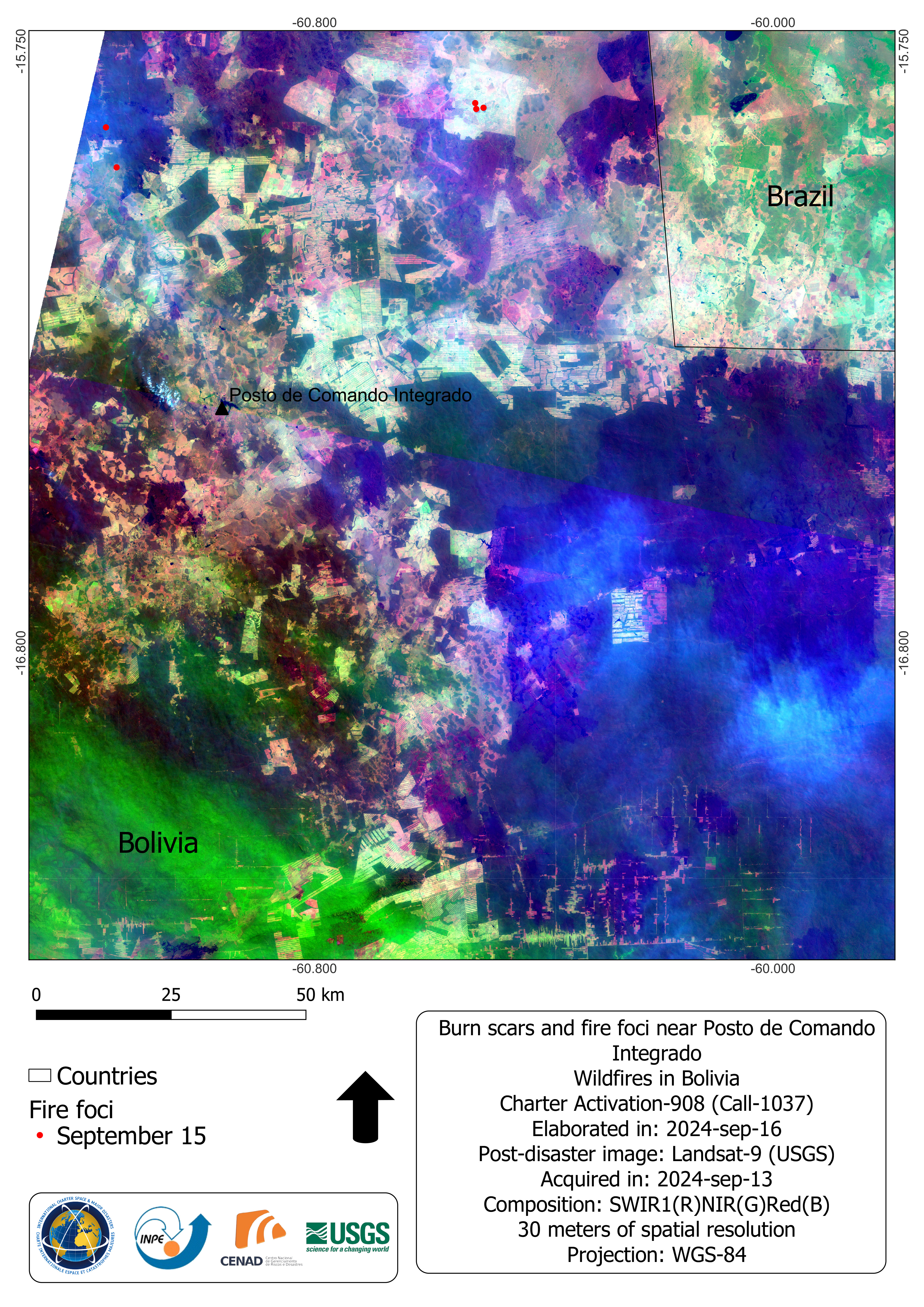
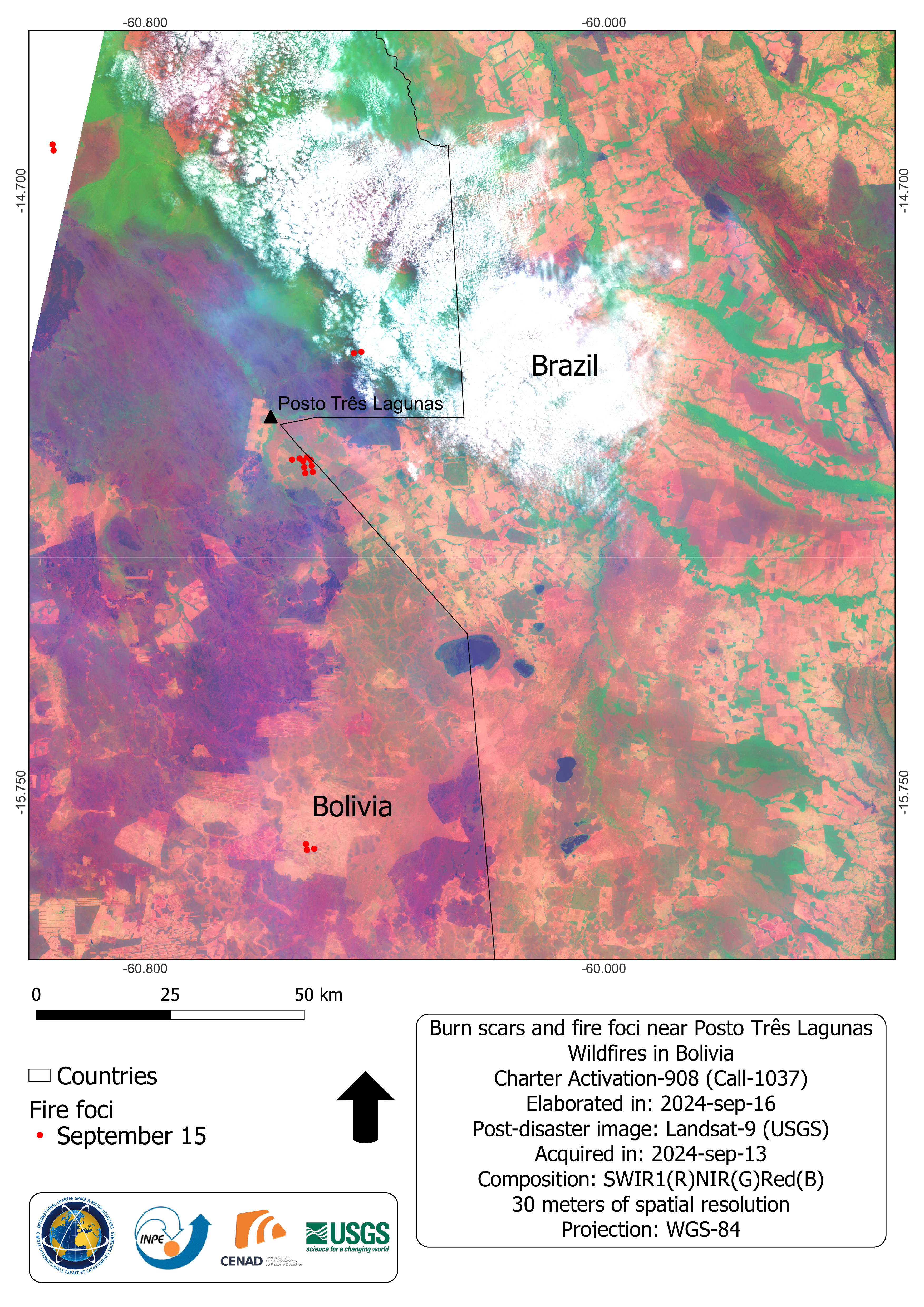
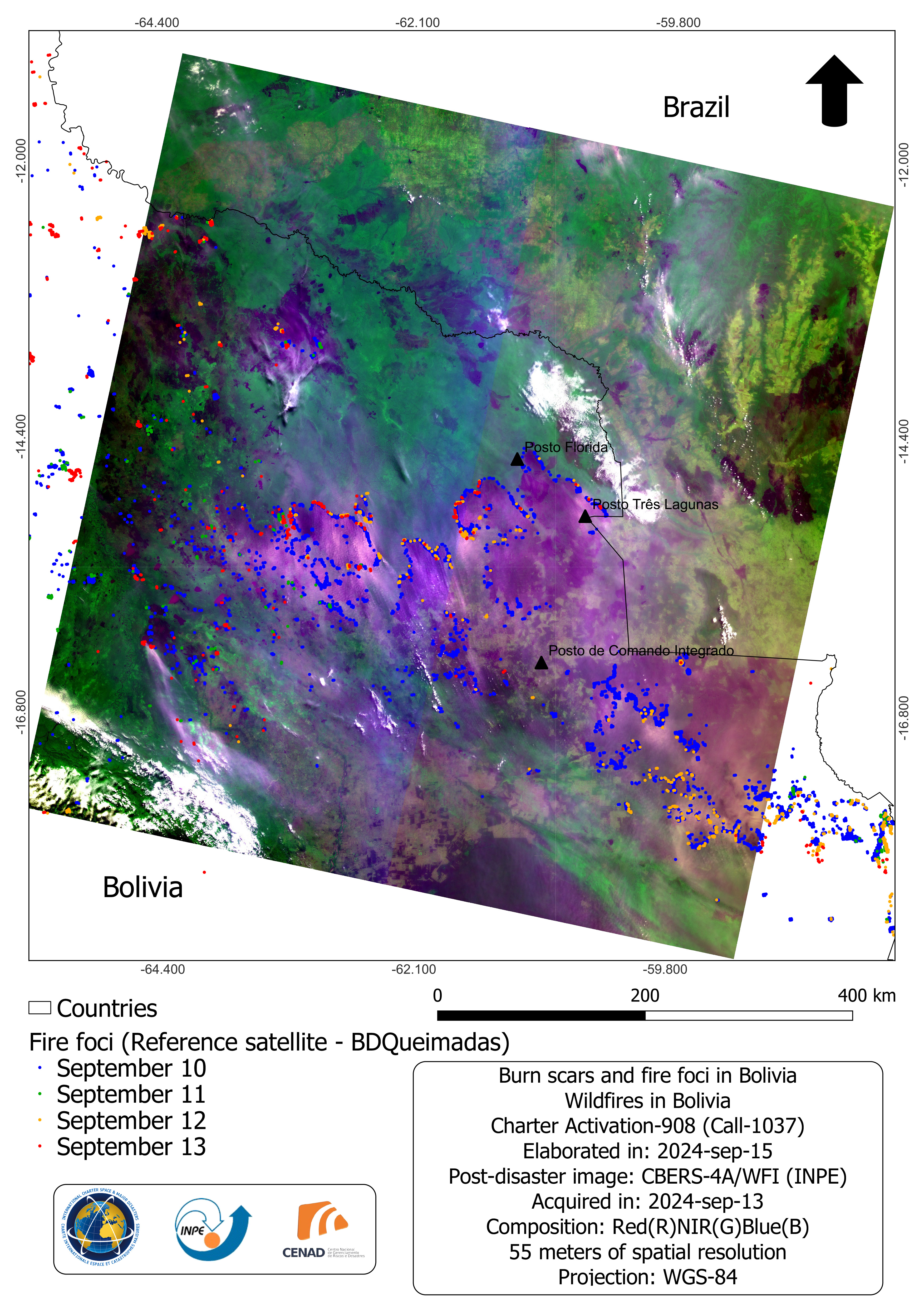
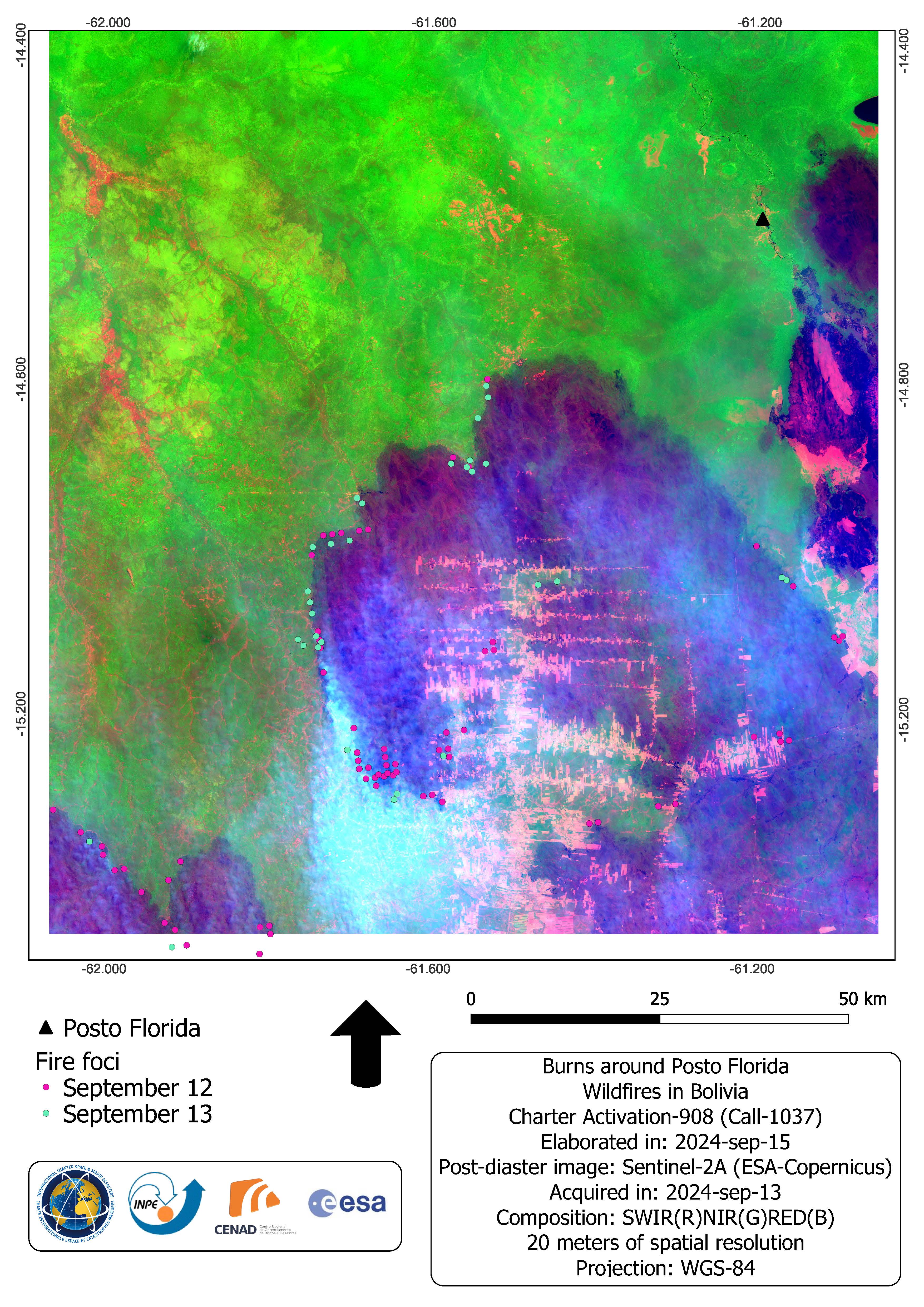
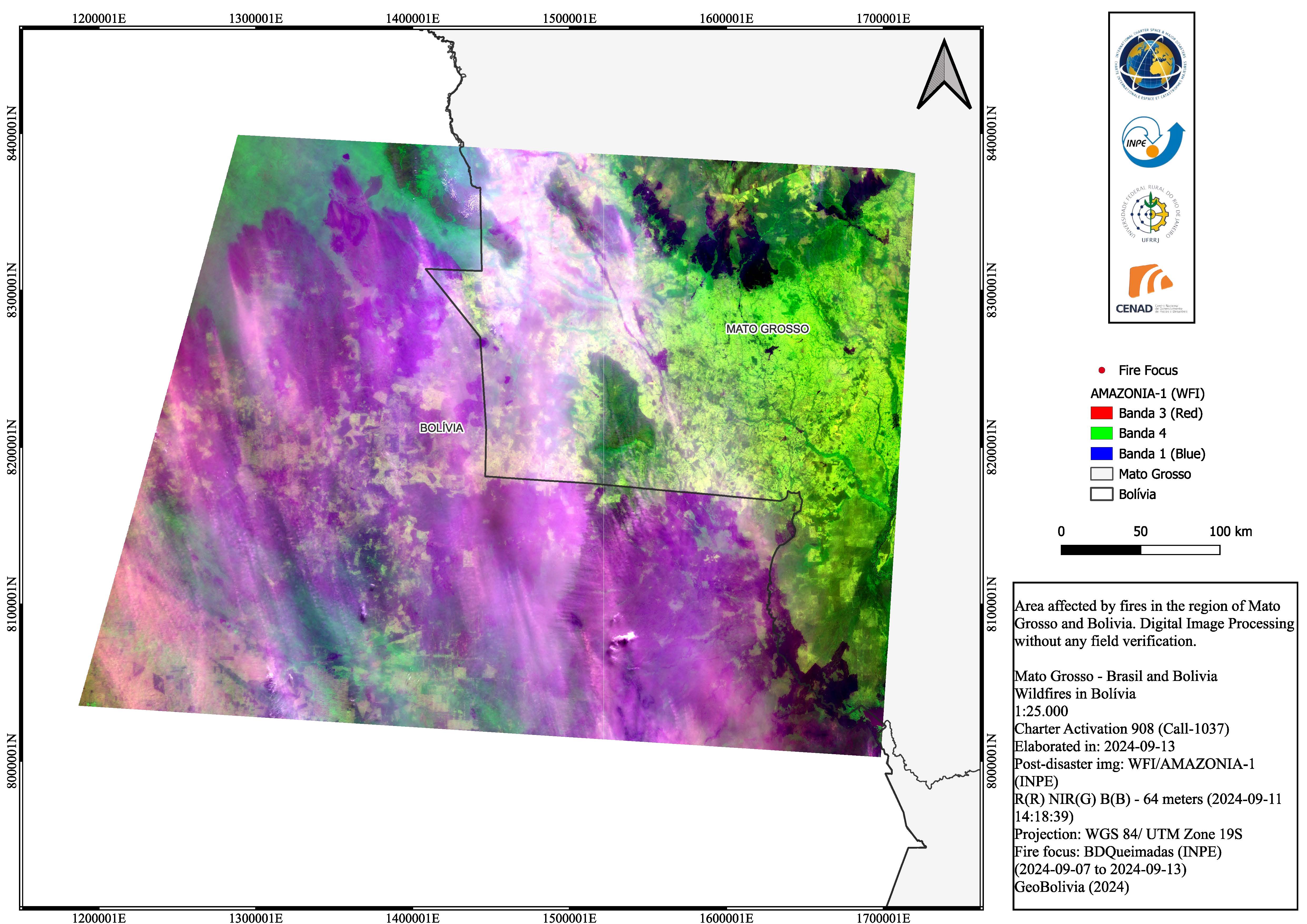
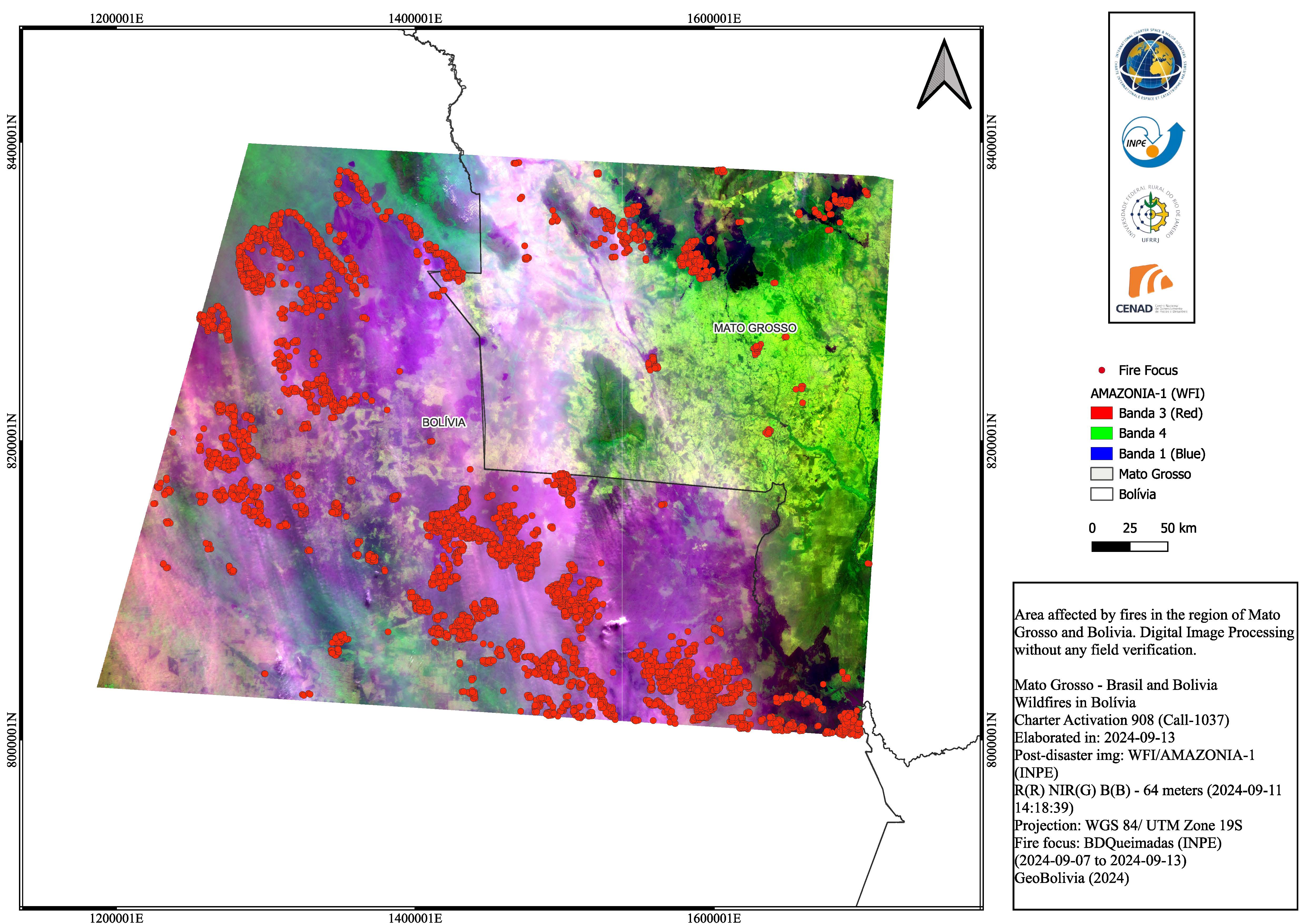
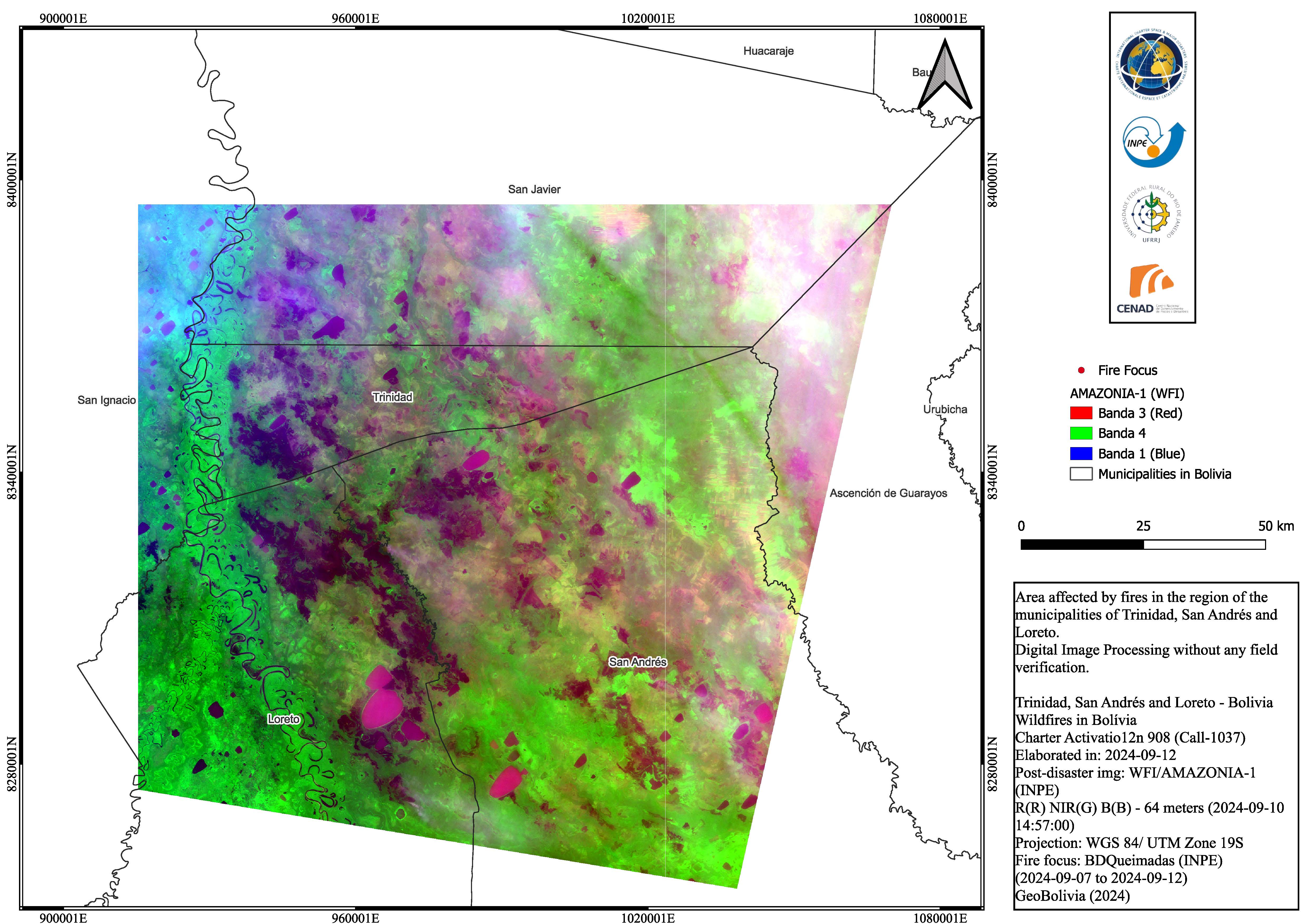
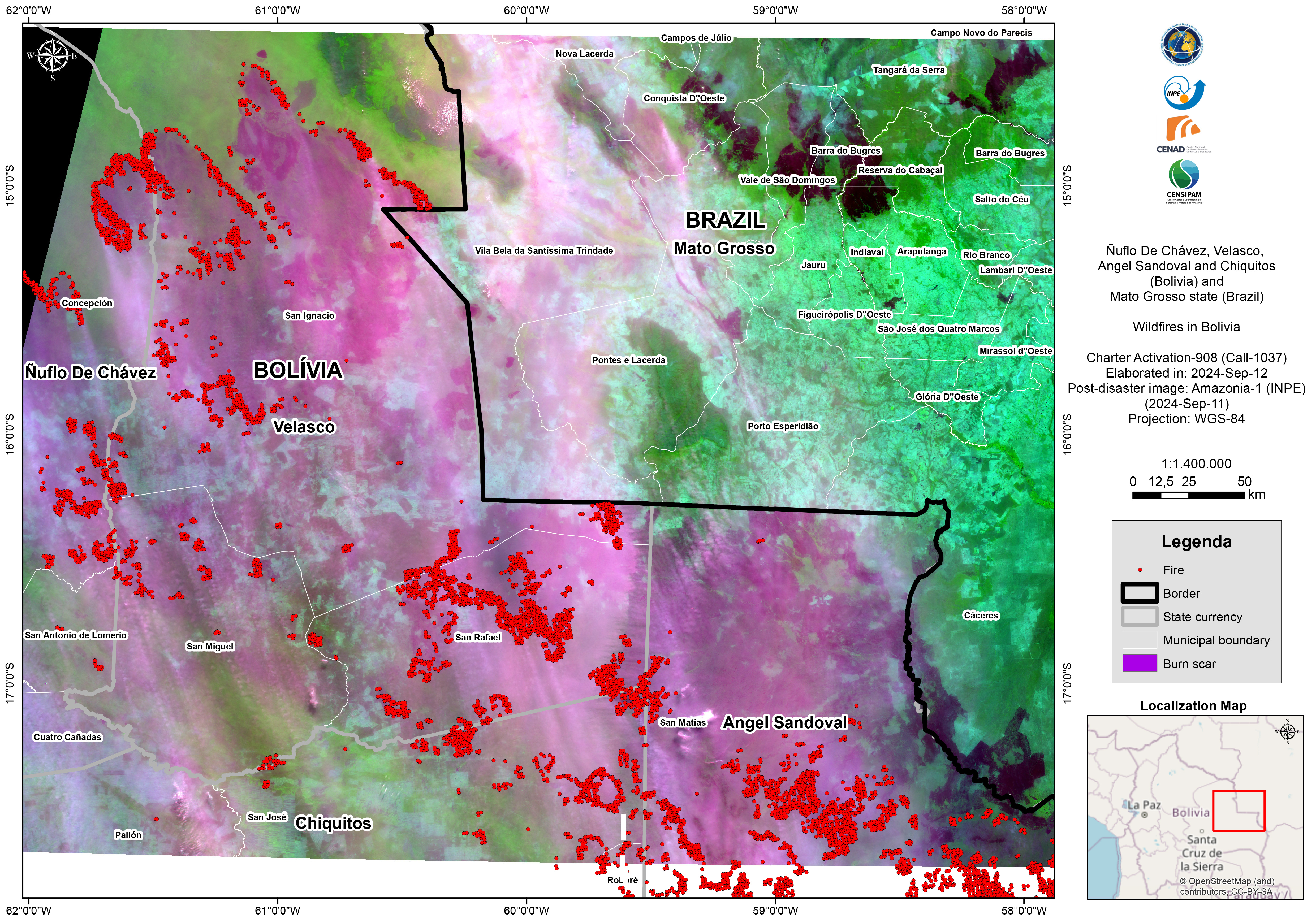
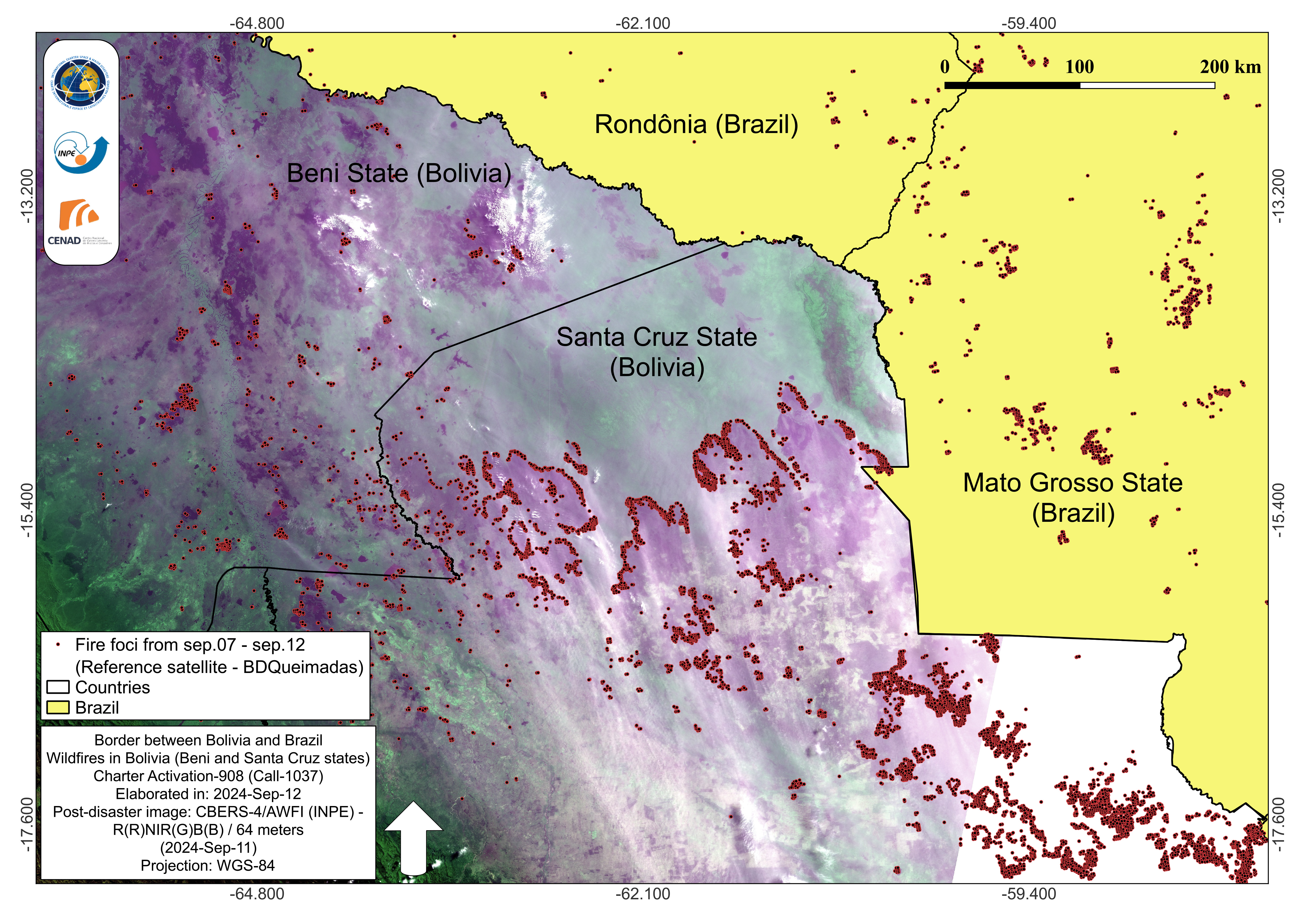
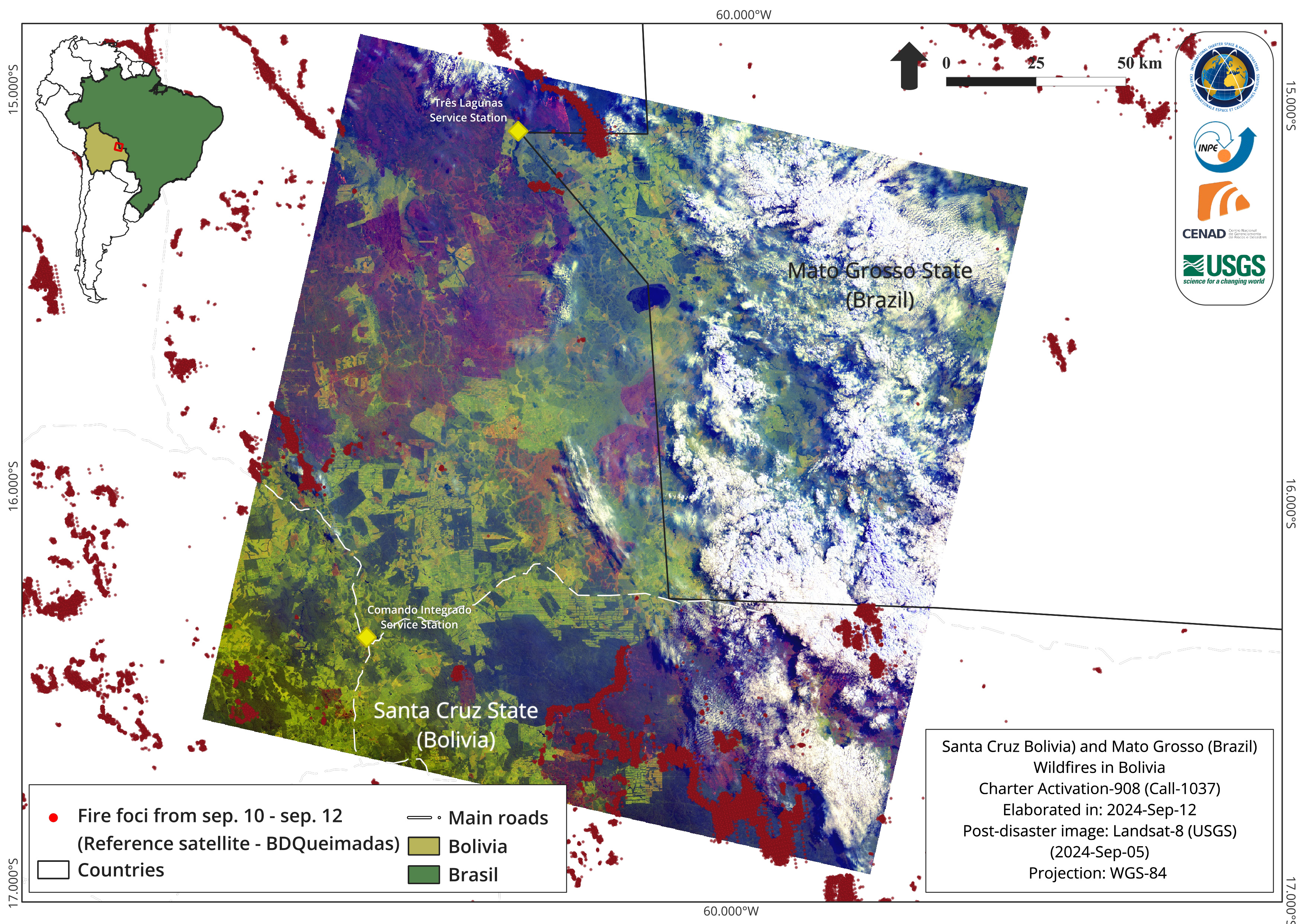
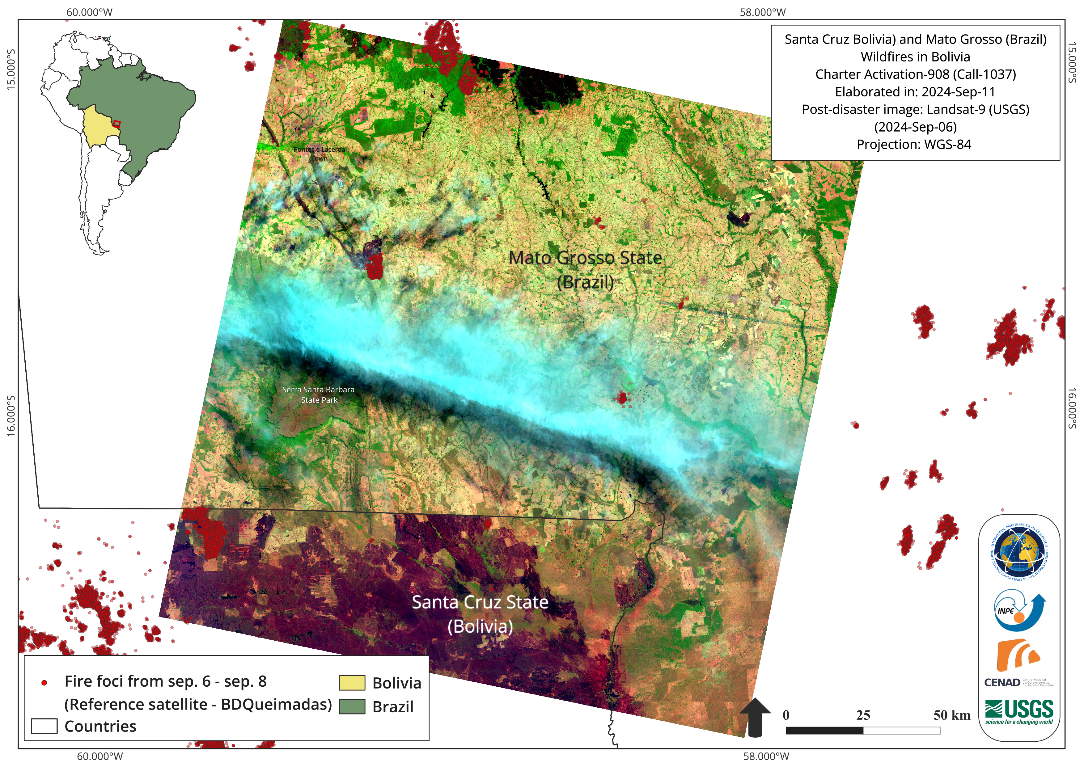
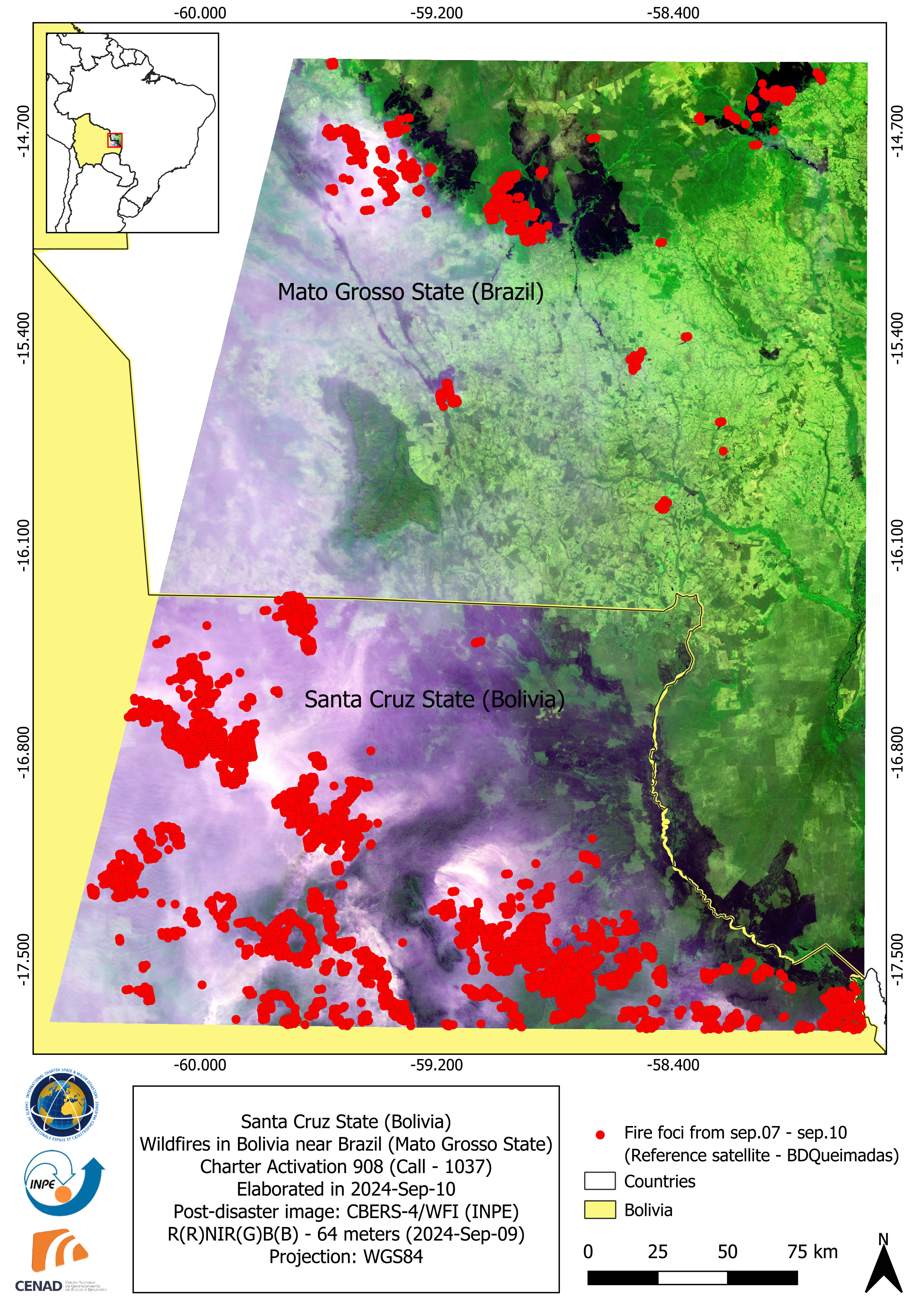
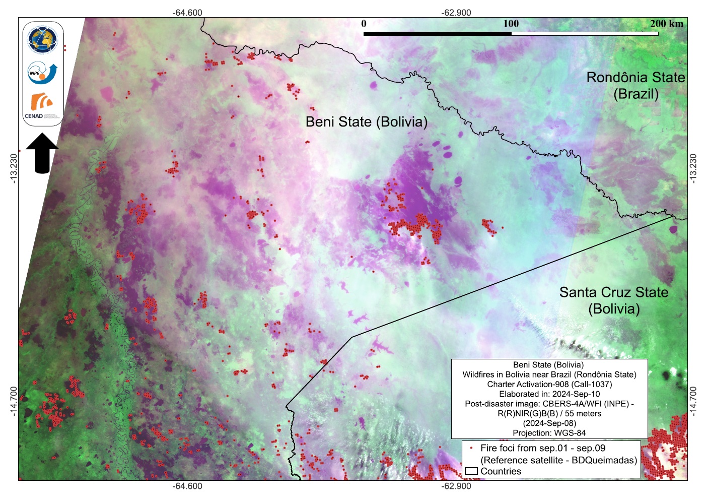
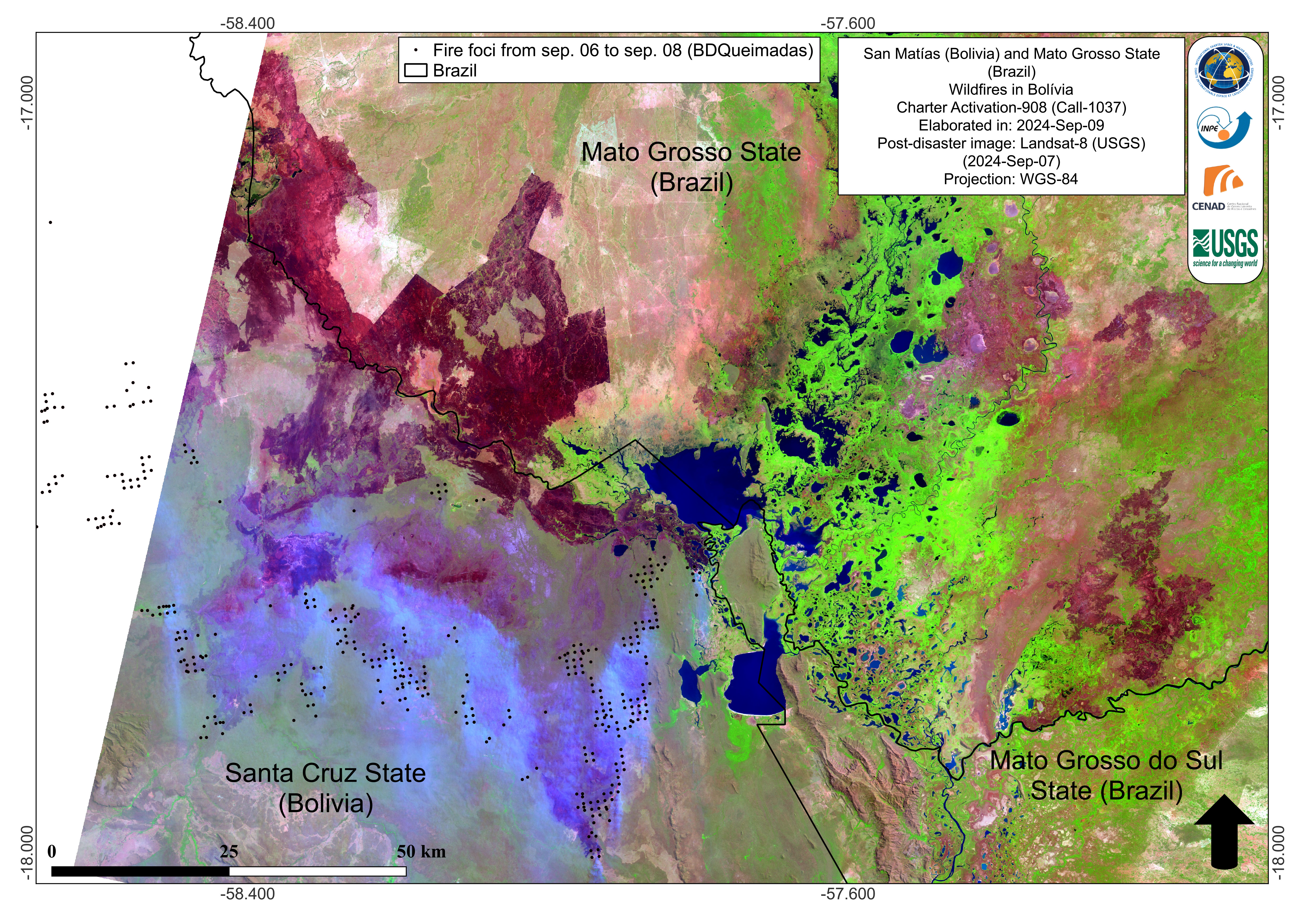
Fire in Bolivia
The Bolivian government declared a national emergency on 9 September due to wildfires that have destroyed more than 3.8 million hectares of forests and grasslands nationwide.
Currently, 72 active fires are burning across the country, with Santa Cruz in the east the worst affected, reporting 64 major hotspots. Beni in the north-central part of the country has six active fires, while La Paz in the west and Pando in the north each have one.
The fires have put key ecological regions at risk, including Noel Kempff Mercado National Park and protected areas in San Ignacio de Velasco and Concepcion in Santa Cruz.
The country's firefighting forces are stretched thin and the government has called for international aid. Indigenous volunteers tried to protect land they use to grow crops and feed livestock near the Chiquitano forest north of Concepcion that extends towards Brazil and Paraguay, but some have been forced to evacuate.
South America is in the throes of its peak fire season, that spans August and September, after an unusually early fire season started devastating the country in July following a drought.
Related Resources:
Web Map for fire in Bolivia
| Type of Event: | Fire |
| Location of Event: | Bolivia, Plurinational State Of |
| Date of Charter Activation: | 2024-09-07 |
| Time of Charter Activation: | 19:54 |
| Time zone of Charter Activation: | UTC-03:00 |
| Charter Requestor: | CENAD on behalf of INPE |
| Activation ID: | 908 |
| Project Management: | Alisson Cleiton Oliveira (INPE) |
| Value Adding: | CENAD Jose BisinotiNeto (CENAD) Brenda Rocha (INPE) Teodoro Hunger (UNITAR/UNOSAT) Camila Gonçalves dos Santos (UFRRJ) Igor Lisboa (CENSIPAM) |
Products


 Back to the full activation archive

